Bioregionalism in these islands
•Télécharger en tant que PPTX, PDF•
2 j'aime•434 vues

Workshop slides from 2018 National Permaculture Convergence in Manchester. What is bioregionalism? Why is it relevant now? What does it look like in the context of these islands?

Recommandé
Contenu connexe
Tendances
Tendances (20)
Similaire à Bioregionalism in these islands
Similaire à Bioregionalism in these islands (20)
Dernier
Dernier (20)
Bioregionalism in these islands
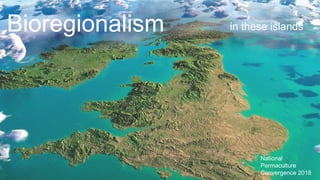
- 1. Bioregionalism in these islands National Permaculture Convergence 2018
- 2. Changing Our Perspective On the land Map by Helen Mcdonald From Robert Mcfarlane’s The Wild Places
- 3. A bioregion is defined in terms of the unique overall pattern of natural characteristics that are found in a specific place. The main features are generally found throughout a continuous geographic terrain and include a particular climate, local aspects of seasons, landforms, watersheds, soils, and native plants and animals. People are also counted as an integral aspect of a place’s life, as can be seen in the ecologically adaptive cultures of early inhabitants, and in the activities of present day re-inhabitants who attempt to harmonize in a sustainable way with the place where they live. Peter Berg, ‘Bioregionalism An Introduction’ (2002) A bioregion can be determined initially by use of climatology, physiography, animal and plant geography, natural history and other descriptive natural sciences. The final boundaries of a bioregion, however, are best described by the people who have lived within it, through human recognition of the realities of living-in-place. Peter Berg & Raymond Dasmann, ‘Re-inhabiting California’, The Ecologist (1977) What is a Bioregion?
- 4. ‘Permaculture Zones and Sectors’ Zones of influence & direct power start with the personal & extend to the global. The zones, like the Permaculture site design zones, are partly physical & geographic & partly conceptual. They work from a core of integration & strength to a wider domain of uncertainty & flexibility. The particular strategies & methods that work in one zone will not necessarily be effective in another. David Holmgren, Permaculture: Principles & Pathways Beyond Sustainability,
- 5. Principle s Design Strategies Techniques • Work with Nature • Apply self-regulation & accept feedback • Design from patterns to details • Creatively use and respond to change Bioregionalism • 100 mile diet • Parish mapping • REconomy • Local currencies • Wildlife corridors • Habitat restoration • Emergency Preparedness plans • Community fridges • ‘Preston Model’ Ethics Patterns • Independent Regions • Mosaic of subcultures • Identifiable neighbourhood
- 8. British Isles ‘These Islands’ WI(I)SE Isles The Atlantic Archipelago –
- 12. Jay Springett & Andrew Brown, resiliencemaps.org Bart Anderson, ‘Zones and Sectors in the City’, Permaculture Activist John Barrell, The Idea of Landscape and the Sense of Place 1730–1840, (1972)
- 17. 1 2 3 4
- 18. Kintyre Dengie
- 21. The Place that sustains me ●Bioregioning – process involving all our senses ●Intuitive as well as rational ●Nature connection. Re-connection ●Regenerative: clean unpolluted water, ecosystem restoration (inc. beaver), biodiversity, observe adaptive behaviour ●Water as defining fractal/nested pattern: water catchments - tributaries, firths (estuaries) - lochs, water surrounding islands & peninsulas, water cycle, source to
- 23. McCloskey map of Cascadia (2015)
- 24. Kenneth White and Scottish Centre for Geopoetics ● “World” for geopoetics is open world. Open world begins with place, not with simple piety of place (from homely couthiness to spooky animism via racial rootedness), but with knowledge (informed, sentient, intelligent) of place. From the smallest rivulet, via a network of rivers, one arrives at the ocean. A little geology allows one to know that not all the stones on the local beach are necessarily of local origin, that glaciers may have brought them in from elsewhere. Likewise, from a layer of local rock one can move across nations and continents. An informed look at the sky will see not only wind-driven cloud, but the tracks of migratory birds. To all of which must be added the movements of population and language. ● Kenneth White: The Re-mapping of Scotland, 2001
- 25. Center for the Force Majeure. “On the Deep Wealth of this Nation” - Newton Harrison
- 30. Patrick Geddes (1854-1932) ‘The environment acts, through function, upon the organism and conversely the organism acts, through function upon the environment’ Cities in Evolution (1915)
- 31. 'The counties being thus too numerous, while the three ancient political divisions (England, Wales, Scotland) are too few and unequal for the objects of this work, an intermediate set of sections became necessary, — larger than counties, smaller than kingdoms. In fixing upon such intermediate sections, it has appeared most convenient to make them in conformity with the old established divisions into kingdoms and counties; as much regard being still given to the physical geography of Britain, as is consistent with the prescribed rule. In forming these sections, a mesial line was first traced from the south coast of England, northwards into the Highlands of Scotland; the line corresponding with the boundaries of counties, and being traced in that course which would best divide the counties whose rivers flow to the east coast, from those whose waters are emptied into the western ocean.’ Hewett Cottrell Watson, Cybele Britannica: or British Plants and their geographical relations (1847)
- 32. 'Suggestions for Dividing England and Wales into Watershed Distri Frederick Toplis Journal for the Society of the Arts, No. 1369, Vol. XXVII (July 4 187
- 33. C. B. Fawcett, 'Natural Divisions of England' in The Geographical Journal, Vol. 49, No. 2. New Heptarchy
- 34. Freddy Heineken, The United States of Europe, A Eurotopia? (1992) A Europe of the Regions
- 35. 'The political map of Britain and Ireland needs to be redrawn at various provincial and regional levels in order to establish bioregions and biolocalities based on communities that understand humanity's organic dependency on the land, water and resources of those regions.’ George Williamson, Britain and Ireland Constitutional Change and Bioregionalism, The Campaign for Political Ecology, (1996)
- 36. Christopher Alexander, A Pattern Language (1977)
- 37. Environment EconomyPolitics Culture EconomyPolitics SOCIETY BIOREGION Conventional planning transforms nature Bioregional planning transforms society Adapted from Janis Birkeland & Cam Walker, ‘Bioregional Planning’ (2002)
- 39. facebook group: Confederation of Soviets of the Atlantic Archipelago (CSAA)
- 40. James Taylor @LondonPrmcultr https://dengiebioregion.wordpress.c om FB: Confederation of Soviets of the Atlantic Archipelago Ed Tyler https://bioregioning.com tyleward@gmail.com • CTRLshift – Join Slack channel – (bio)region theme • Help Permaculture Association structure around bioregions (designated staff member? working group? task-&-finish group?) • Help create Bioregional atlas for Archipelago using GIS – email Ed • Join Community of Practice coordinated by Bioregional Learning Centre (Dart valley) – email Ed Get Involved!
Notes de l'éditeur
- The concept of Bioregionalism emerged about the same time as Permaculture in the early 1970s and we can see both as responses in the environmental movement of the time to the message of Limits to Growth. It sought a harmony between human culture and the natural environment through methods including: Ensuring that political boundaries matched ecological boundaries Highlighting unique ecologies Encouraging local consumption Bioregionalism was developed by two Americans, the writer Peter Berg and the ecologist Raymond Dasmann, with inspiration from the poet Gary Snyder and quickly attracted the attention of others who developed their ideas further. Those ideas gained most traction on the West Coast of North America with the description of Cascadia – a bioregion that encompassed parts of the US states of Oregon and Washington as well as the Canadian province of British Columbia.
- Why might bioregional thought and action be valuable in a permaculture context? In the diagram on the slide we can see David Holmgren’s application of a zone and sector model to ‘Permaculture’ itself showing zones of activity where we might have different degrees of influence. Out in zones 4 and 5 exist: climate change, ocean acidification, biodiversity crash, conflict in the middle east, the rise of the far-right across Europe, the final Brexit deal etc. – things we may be concerned about, but over which we as individuals have little influence. Down in zones 1 and 2 are where I see most permaculture activity happening in these islands; where most design and implementation work is taking place – work on ourselves, our homes and gardens, on livelihoods, in community enterprises and spaces. Between those is a fruitful edge for scaling up our permaculture thinking and activity, and a context for our work in zones 1 and 2 [examples? – Transition, Woodborough Wetland, Treesponsibility]
- Another use of the zoning model here: one which I find useful for describing permaculture. At the heart are the ethics– if a design or action does not respect the ethics it’s not permaculture – its something else. Beyond that are principles – attitudinal, ecological, design etc. – and patterns: thinking tools and heuristics to guide application of those ethics. Building on those we have design strategies – frameworks for holding the process of design, and broad approaches to implementation which have proven successful (e.g. zone/sector/elevation planning; element/function design; etc.) Those strategies lead us towards techniques – the particular methods we determine appropriate to achieving our goals in a given situation. In this model, I highlight a few principles that might lead us towards bioregionalism as a design strategy – and I’ve indicated a few techniques that might suggest themselves in the implementation of such a strategy (some of these techniques might also be strategies in their own right!). No doubt we could come up with many others, eg. credit unions, re-commoning assets, repair cafes, citizen science etc.
- So in terms of Holmgren’s Permaculture Flower we’re considering activity that perhaps largely happens in the ‘Land & Nature Stewardship’ and ‘Land Tenure & Community Governance’ petals.
- Why is this relevant now? I see 4 main drivers towards why this is relevant right now – pushes and pulls towards bioregionalism: Earth Overshoot – as no doubt you are all aware, humanity’s resource use is currently exceeding the planet’s bio-capacity (roughly - the conversion of solar energy entering the Earth system into productive output by natural processes over a given period of time). Q. Who knows on what day this year it’s been predicted that we will have used up 365 days of the planet’s bio-capacity? A. It’s already happened – August 1st (the earliest on record) – ever since then humanity has been eating natural capital to meet current needs: decreasing the planet’s future bio-capacity, stealing from the unborn. Of course, I’ve said humanity here – but the use of the planet’s resources is unevenly distributed. Q2. Does anyone know what Earth overshoot for the UK was this year? A. May 8th – so not only are our consumption patterns destroying natural systems and stealing from the unborn, we are also stealing from the poorest in the world. We are not caring for the Earth, caring for People and we are taking more than our fair share. Raymond Dasmann wrote that we were once ‘ecosystem people’ like every other lifeform we sustained ourselves solely from the resources of the place we inhabited. At some point however we became ‘biosphere people’ sustaining ourselves on resources drawn from the entire globe. By becoming bioregional and re-inhabiting the places where we live, we might address our ethical deficit and live like we only have one planet. Energy Descent – part of our ability to exceed planetary bio-capacity has been afforded by our access to the stored wealth of fossil fuels – dense accumulations of solar energy that fell on Earth millions of years before humanity. With this we have carved the face of the Earth, taken the tops off mountains, transported the product of distant lands through the air at hundreds of miles an hour to serve our desire. But the resources that afforded this are finite and now appear to be declining (‘peak oil’). It’s uncertain for how long we will be able to continue to sustain ourselves with the produce of other places and service our desires with the doodads of distant lands. But there are also pulls – our love of places – topophilia in the language of the academy. While we care about the whole Earth, our love for the natural world is often bound to particular places – and our agency to care for the Earth, and to encourage others to do do also, is strongest in those places closest to us. Agency in the places we live and love: our ability to protect and preserve, enhance and improve, restore and regenerate those places is also a matter of how those places are governed. So when I heard the desire to take back control in the Brexit debate, I didn’t hear an unmet need for decisions made by faceless bureaucrats in Brussels to instead be made my faceless bureaucrats in Westminster – I heard libraries and community centres closing, fracking happening where nobody wants it, public transport firms owned by overseas companies… So for me it’s about sustenance, governance and romance…
- So I’ve begun thinking about bioregionalism here, in this cluster of over 6000 islands off the northwest coast of the European mainland. For over 2000 years these have been called something resembling the ‘British Isles’, but the centuries of empire have coloured what was once simply a geographic naming with political overtones – the Government of Ireland does not recognise the term so in the interests of decolonising our imaginations, there are other names we might use. The Good Friday agreement speaks of ‘these islands’ Lately I’ve been introduced to the acronymic ‘WISE isles’ – the name spelling out the initials of Wales, Ireland, Scotland and England. Some Manx commentators have felt excluded by this however, so perhaps another I is necessary. My preference is ‘the Atlantic Archipelago’ a term with some traction in academic circles, though little beyond, which is evocative, descriptive and place based * I propose the abbreviated form AtlanticA.
- Common to most description of bioregional thinking is the watershed unit, it’s in Berg and Dasmann’s descriptions – ensure there’s an understanding of watersheds in the group – get participant(s) to describe. On the continental scale of North America it makes sense In these islands, perhaps need to pay more attention other defining factors Perhaps not full enough for AtlanticA – need ‘more than watershed’ thinking Landforms Coastal features Vegetation distribution Human/cultural elements
- Shitty photos of ‘Environmental zone map’ (used in the GROW workshop on Friday) Atlantic Central, Atlantic North
- Sheds – miles from… with Burnham-on-Crouch as central point Coastal areas, mobility restrictions Importance of sea as a resource – Living Seas
- Here’s a confusing mash-up of models, all using the zoning idea again – here thinking some about those Human/cultural elements John Barrell’s diagrammatic representation of events in Mary Mitford’s book Our Village (mention Holmgren sourcing zoning model from Sardinian villages) Bart Anderson re-working of the original permaculture zoning model for an urban context – the pedosphere, cyclosphere, ?sphere, autosphere, aerosphere A simple diagram about food sourcing Jay Springett and Andrew Brown’s work on resilience mapping aka ’simple critical infrastructure maps’- SCIM - here within the ‘6 ways to die’ framework
- On the right another zoning model – an isochronic map of Manchester from 1914 On the left a more poetic map of West Lancashire – link to parish mapping
- Familiar territory to Sarah Pugh – parish map of Easton in Bristol
- Parish map of Oterton, Devon. Importance of artistic/creative engagement with bioregionalism and mapping
- Mention Robert Thayer’s breakdown of bio-region as Life-Place. Living Landscapes. The places that give us life – the places that sustain us (literal substance) and the places that make us come alive. Participants draw their life-place(s) on the A4 maps on their seats. Then get them to think about something from the natural world that is indicative of that place – an animal, a plant, a fungi, a landscape feature – make a flag for your bioregion using that.
- Split group into 4 4 tables – each with large scale Archipelago map and clear acetate & pens (sharpie style) Folk go into group where their self-created region, largely, exists – or if more than one area – whichever one they choose. Folk with region elsewhere in world go in group 3 The areas on the A4 maps are transposed on to the acetate. Groups report back on maps and flags All 4 transparencies are layered on top of each other - group give observations on the patchwork formed.
- Ed and my bioregions Two peninsulas surrounded by coastal waters Isostatic rebound – Scotland rising, SE England sinking
- 19
- 20
- Ed’s slide 2b
- 22
- 23
- 24
- 25
- European continental shelf
- Doggerland – before the isles cut loose
- Post-Rome Anglo-Saxon heptarchy English shires
- Great Britain’s historic counties
- Patrick Geddes – the Valley section, city regions, regional geography The pre-history of permaculture, bioregionalism etc. in these islands
- Watsonian division of Great Britain – also refer to paper map of sub-counties and equivalent in Ireland.
- Development of water authorities – national and private ownership regimes Benefits and dis-benefits of ownership structures
- Fabian socialist thought about regionalisation. HG Wells – appendix to The New Machiavelli Sidney and Beatrice Webb – The New Heptarchy series of books Local government pioneer writers like Fawcett. Ongoing trend of this thought with Labour – e.g. devolution in England plans, devo manc, mayors, municipal socialism etc. Successes and failures
- Different visions of European unity
- Bioregional thought in UK: Williamson’s vision BioRegional – Sue Riddlestone and Pooran Desai Schumacher College Molly Scott Cato – bioregional economy Lea Valley bioregion River Dart bioregion Harrison Studio work in UK English Heathen Front – the darkside Mark Burton’s Manchester bioregion work Etc.
- Christopher Alexander’s relevant patterns
- Conventional versus bioregional planning
- The real TBC
- Governance - Confederation of Soviets of the Atlantic Archipelago
- Keep in touch with us! – Slideshow shared on James’s website