Aurh-geo weastflows-Angl
•
0 likes•573 views

The open data mapping platform dedicated to transport and logistics in North-Western Europe

Recommended
Recommended
More Related Content
What's hot
What's hot (20)
Viewers also liked
Viewers also liked (20)
Similar to Aurh-geo weastflows-Angl
Similar to Aurh-geo weastflows-Angl (20)
More from AURH - Agence d'urbanisme Le Havre - Estuaire de la Seine
More from AURH - Agence d'urbanisme Le Havre - Estuaire de la Seine (20)
Recently uploaded
Recently uploaded (20)
Aurh-geo weastflows-Angl
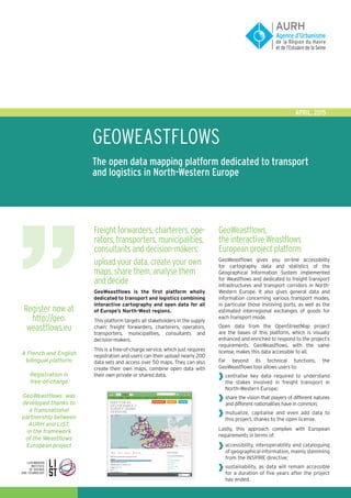
- 1. GEOWEAStflows The open data mapping platform dedicated to transport and logistics in North-Western Europe APRIL, 2015 Freight forwarders, charterers, ope- rators, transporters, municipalities, consultants and decision-makers: upload your data, create your own maps, share them, analyse them and decide GeoWeastflows is the first platform wholly dedicated to transport and logistics combining interactive cartography and open data for all of Europe’s North-West regions. This platform targets all stakeholders in the supply chain: freight forwarders, charterers, operators, transporters, municipalities, consultants and decision-makers. This is a free-of-charge service, which just requires registration and users can then upload nearly 200 data sets and access over 50 maps. They can also create their own maps, combine open data with their own private or shared data. GeoWeastflows, the interactive Weastflows European project platform GeoWeastflows gives you on-line accessibility for cartography data and statistics of the Geographical Information System implemented for Weastflows and dedicated to freight transport infrastructures and transport corridors in North- Western Europe. It also gives general data and information concerning various transport modes, in particular those involving ports, as well as the estimated interregional exchanges of goods for each transport mode. Open data from the OpenStreetMap project are the bases of this platform, which is visually enhanced and enriched to respond to the project’s requirements. GeoWeastflows, with the same license, makes this data accessible to all. Far beyond its technical functions, the GeoWeastflows tool allows users to: centralise key data required to understand the stakes involved in freight transport in North-Western Europe; share the vision that players of different natures and different nationalities have in common; mutualize, capitalise and even add data to this project, thanks to the open license. Lastly, this approach complies with European requirements in terms of: accessibility, interoperability and cataloguing of geographical information, mainly stemming from the INSPIRE directive; sustainability, as data will remain accessible for a duration of five years after the project has ended. Register now at http://geo. weastflows.eu A French and English bilingual platform Registration is free-of-charge GeoWeastflows was developed thanks to a transnational partnership between AURH and LIST, in the framework of the Weastflows European project
- 2. Over 50 maps are already online and nearly 200 data sets are in use. Internet users can either display or hide different layers of information; selection is user-friendly and just requires ticking boxes: infrastructures (either existing or planned); European corridors; Data on traffic and in particular port traffic (modal changes, breakdown of inland waterway transport according to type of ships, etc.); administrative borders (country, NWE, NUTS); demographic and economic data (GDP, population, etc.). From global to local Start off on the European level, zoom onto the country of your choice, and then zoom in again on you region. This makes it easy to understand how your region ranks and the potential that it has. It’s easy to pinpoint new supply chain routes, whatever the scale you are looking at. Consult THEMATIC maps, create your own maps, add your own data, contribute Create your own maps using our models You can use your personal space to duplicate any of the 50 theme-based maps we have, then change them by adding or deleting layers of information, the page layout, or by putting your town or region in the middle. Become a contributor: you can upload your own data, either for the general public or for private use, and work with your data with our open license You can upload your data and share this with the open license with the community of users. You can also create maps by combining data that is already present on the site with data you have uploaded. Example of a theme-based map Your personal map created using this model Europe Ireland Dublin
- 3. The research module allows you to quickly find in all North-Western Europe: existing or planned infrastructures and their details: airports, maritime connections, railways, roads, navigable inland waterways, European transport corridors, intermodal hubs, administrative borders for Europe, countries, regions and departments; Statistics on infrastructures and their use: traffic on all these transport modes and in particular, a description of port traffic (modal change, breakdown of maritime traffic according to the type of navigation, etc.,) population density, GDP. This information and data is documented, thus easy to use and understand. Upload nearly 200 data setS with an Open Data license Linked to transport and logistics Uploading formats Home office formats that you can easily analyse and use in your own reports, graphs or presentations: PDF, Excel, simple text, JPG or PNG images. Map formats: KML for Google, GeoJson, Shapefile. Become a part of this new community when you share data using Open Data Following the revision of the European Directive to open public data, in June, 2013, many local administrations and municipalities are now giving public access to information concerning transport and the supply chain, usually with an open license. Do you have an interesting source you would like to share with the GeoWeastflows community? It is easy to import this data into GeoWeastflows, thus allowing everyone to make better decisions. Write down your favourite maps and share them on social networking sites Whether you prefer LinkedIn, Facebook, Google+ or Twitter, one simple click is all it takes to share your maps on these sites. Share with other contributors or users in the Open Data transport and logistics community GeoWeastflows includes an internal messaging service. This means that you won’t have any spam in your inbox, as all correspondence takes place within the community platform. You can request assistance in interpreting the data or how to use the platform from anyone of the 300 members of the community, from all over Europe. The platform has a FAQ section. It also includes a structured help group that you can access via Google Groups. Share your creations on the social networking sites Discuss with the community of users Example of information shared on LinkedIn Example of geographical information (Open Data) on the Île-de-France Region Information shared with the GeoWeastflows community
- 4. Document created with the support of the INTERREG IV B European programme in the framework of the Weastflows European project AURH - Town Planning Agency of Le Havre and Seine Estuary Area 4 quai Guillaume Le Testu 76063 LE HAVRE cedex Tél: +33 (0)2 35 42 17 88 / Fax: +33 (0)2 35 21 51 57aurh.fr @aurh_officiel Publishedby:AURH(LA,JD,JFM,AGa)–NA5800–April2015–Design:Pixell,www.pixell.fr-Writtenby:AURH-Printedby:LaPetitePresse,LeHavre Any questions or comments: geoweastflows@aurh.fr Register on http://geo.weastflows.eu GeoWeastflows is currently available in English and French. To access the maps, you will be required to set up a free account. GeoWeastflows was developed through a transnational AURH-LIST partnership, in the framework of the European project, Weastflows Published with financial support from: