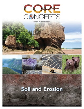
Core Concepts Soil and Erosion

Mining Matters Core Concepts are standalone classroom ready activities that reflect key foundational ideas in Earth science. Sourced from our archives of curriculum-linked teacher resources, each activity reflects an integral part of many important concepts and theories in the various disciplines that comprise the Geosciences. In an effort to be of service to all of our teacher-partners, these activities have been assembled as a way to support individual teachers without the need to attend a pre-requisite teacher training workshop. All the contents of the Core Concepts resource support current teaching practices that values hands-on experience where students take an active role in learning. Any rocks and minerals samples as well as print resources required for successful classroom delivery can be sourced through Mining Matters.

Recommandé
Contenu connexe
Tendances
Tendances (20)
Similaire à Core Concepts Soil and Erosion
Similaire à Core Concepts Soil and Erosion (20)
Plus de Mining Matters
Plus de Mining Matters (20)
Dernier
Dernier (20)
Core Concepts Soil and Erosion
- 2. © 2016 Prospectors and Developers Association of Canada Mining Matters MiningMatters.ca
- 3. CORE CONCEPTS SOIL AND EROSION 3 TABLE OF CONTENTS 1 Weathering and Erosion 4 Information Bulletin 7 Activities 9 Activity Questions 10 2 Soil Formation 11 Information Bulletin 12 3 Characteristics of Soil 13 Activity Instructions 15 4 Types and Uses of Soil 17 Information Bulletin 19 5 Importance of Soil Conservation 20 Activities - Mulching and Wind Erosion Demonstrations 22 6 Glaciers and Landforms 23 Information Bulletin 25 Activity A - Questions Based on Reading 27 Activity B - Investigating Glacial Landforms 29 Concept Chart Overview 30 Activity C - Crossword Puzzle 31 Did you know that there are complementary and additional resources that will assist with the delivery of this topic? Please contact Mining Matters and we’d be happy to assist. Be sure to state, “Core Concepts order request” in the subject line of the email and/or the fax cover sheet. Mining Matters: T: (416) 863-6463 F: (416) 863-9900 E: schoolprograms@miningmatters.ca
- 4. CORE CONCEPTS SOIL AND EROSION4 WEATHERING AND EROSION1 MATERIALS • Handout: Weathering and Erosion Information Bulletin • Handout: Weathering and Erosion Activity • Rubber Gloves • Small transparent plastic glass • Small plastic plate • Mason jar with tight fitting lid • Plastic container • Freezer Consumables: • Steel wool (without soap) • Water • Vinegar • Chalk • Writing paper • Pencil • Eraser • Water • Balloon • Plaster of Paris SUMMARY OF TASK Students will: • Investigate the effect of weathering on rocks and minerals. EARTH SCIENCE LITERACY PRINCIPLE(S) BIG IDEA 3 Earth is a complex system of interacting rock, water, air, and life. OBJECTIVES 1. Understand the effects of weathering on rocks and minerals. INSTRUCTIONS Engage 1. With students, set-up the three demonstrations of weathering (see Preparation and Set-up). These experiments take up to 3 days to produce results. 2. Have students make predictions about what will happen in each experiment. Explore 3. Have students complete the two experiments on Weathering and Erosion Activities. Explain 4. Read and review the main points of weathering as discussed in the handout: Weathering and Erosion Information Bulletin. 5. Have students complete the question on the handout Weathering and Erosion Activities, identifying the weathering process in each demonstration and activity. Elaborate 6. Have students answer the questions on the handout: Weathering and Erosion Questions. Evaluate 7. Have students design an experiment to investigate what factors may increase or decrease the amount of one type of weathering. If appropriate, have them carry out their investigation.
- 5. CORE CONCEPTS SOIL AND EROSION 5 SUPPORTING INFORMATION Explanation for Demonstration 1: Chemical Weathering by Oxidation Oxygen combines with the iron in the steel wool pad forming iron oxide or rust. Rocks with streaks of yellow, orange or reddish-brown contain iron. The iron at the surface of the rock forms iron oxide when exposed to moist air and eventually crumbles away as did the steel wool. Explanation for Demonstration 2: Mechanical Weathering through Crushing by Ice The water in the jar expands as it freezes, crushing the piece of chalk. Explanation for Demonstration 3: Mechanical Weathering by Freezing Water in the balloon expands when it freezes, cracking the plaster around it. If the container is allowed to thaw and is re-frozen, the plaster should crack even more. Preparation and Set-up Demonstration 1: Effects of Water and Air on Rock 1. Use a piece of steel wool about the size of a lemon. 2. Moisten the steel wool with water and place on a small plate. 3. Allow steel wool to sit for three days. 4. Put on the rubber gloves and rub the steel wool between your fingers. Demonstration 2: Effects of Ice on Rock 1. Place a piece of blackboard chalk in a rigid jar with a tight fitting lid. 2. Completely fill the jar with water so there is no air space. 3. Freeze the jar until the water is solid, at least overnight depending on the size of the jar. 4. Remove from the freezer and observe the piece of chalk. Demonstration 3: Effects of Freezing on Rock 1. Put water into a balloon, just enough to fill the balloon slightly beyond flat. Squeeze out any air and seal the balloon. 2. Mix plaster of Paris and put approximately 2.5 cm in the bottom of a plastic container. 3. Place the balloon on the plaster and then cover the balloon with another 2.5 cm layer of plaster. 4. When the plaster has completely set, place the container in the freezer, at least overnight, preferably 48 hours. 5. Remove the container from the freezer and observe the plaster.
- 6. CORE CONCEPTS SOIL AND EROSION6 • The jar for Demonstration 2 must very solid (can use glass, but be careful since the glass may break). • Exercise caution when using plaster of Paris in Demonstration 3. There is the potential for burns since it gives off heat while setting. SAFETY Key Words: Basic Terms: weathering, mechanical weathering, chemical weathering, erosion Explanation for Activity 1: Chemical Weathering by Acids Vinegar is an acid and acids slowly react chemically with the chalk. The piece of chalk is made of a type of limestone, a mineral that quickly changes into new substances when touched by an acid. One of the new substances is the gas seen rising in the vinegar, which is carbon dioxide. Acids affect all minerals – but very slowly. The slow deterioration of statues and buildings is caused by weak acid rain falling on the statue or building. If the building or statue is made of a type of limestone it will deteriorate quickly. Other rocks are more resistant. Explanation for Activity 2: Mechanical Weathering by Wind Pencils are made of graphite. Graphite is a mineral found in many rocks. Pencil erasers are made of high-friction materials. Pushing the eraser across the pencil markings rubs the particles of graphite and some of the paper off. When wind blows sand particles against rocks, the grinding of the sand against the rock acts like the eraser and removes small pieces of the rock. Over a period of time, more and more of the rock is rubbed away, and instead of a solid rock, only sediment is left behind.
- 7. CORE CONCEPTS SOIL AND EROSION 7 INFORMATION BULLETIN1 WEATHERING AND EROSION We have now seen how the landscape of the Earth is continually being shaped by natural forces that began millions of years ago and still continue today. Many geological processes have created new landforms or acted on existing ones, like mountains, canyons, caves and lakes. Rocks may seem solid and unchanging but in reality they are always changing. Rocks on the Earth’s surface are exposed to the air, sun, rain and ice and gradually they will start to change. This process of change is called weathering. Weathering is the breaking down of rocks into smaller particles. Weathering is a slow, continuous process that affects all substances exposed to the Earth’s atmosphere. There are two major types of weathering, mechanical and chemical. Mechanical weathering causes the rock to break into smaller pieces without changing the composition of the rock. Chemical weathering is the process of changing the composition of the rock through chemical reactions. Most landscapes we see are the result of a combination of both mechanical and chemical weathering processes. Mechanical weathering is caused by changes in temperature, frost action, the growth of crystals, plant activity, and grinding. Temperature variations over a period of time can cause rock to expand and contract repeatedly resulting in pieces breaking off. Frost action occurs as water seeps into cracks in the rock. The water expands upon freezing and breaks the rock. This process also happens when salts dissolved in water crystallize. Organic activity occurs as plant roots slowly pry apart the rock as the plant grows. Grinding occurs when rock surfaces come together. Collision between rock surfaces normally occurs through the movement of material by wind, water, or ice. Most chemical weathering is caused by water. Water can dissolve most minerals that hold rocks together. Minerals such as halite (salt) and gypsum dissolve very easily in water. Over time, water can also break down most minerals, except quartz and a few others, to form clay. Oxygen in the atmosphere will react with rocks which contain iron (basalt and gabbro) to form rusty coatings. Human industrial activity can result in increased chemical weathering from acid rain. Acid rain breaks down rocks, metal, and other materials. How would granite break down? The following shows the simplified weathering process of granite and the end result. Granite breaks down by both mechanical and chemical processes. Quartz is resistant to chemical weathering but will break down physically to form tiny quartz grains. Orthoclase feldspar and biotite both break down chemically in the presence of water to form clay. Once the weathering process has broken down a rock into smaller particles, these particles are transported from one place to another by wind, water or ice. Erosion is the general term that describes the physical breakdown and chemical dissolution of rock and the simultaneous movement of material from one place to another on the Earth’s surface. Granite Orthoclase feldspar (pink) Quartz (clear to white) Biotite (black) Weathering Water Grinding Water Result Clay Quartz grains Clay
- 8. CORE CONCEPTS SOIL AND EROSION8 One of the most spectacular landscapes resulting from erosion is Niagara Falls. When a river flows over a rock ledge, the increased speed of the falling water sets up strong turbulence at the base of the falls. The lip of Niagara Falls consists of strong, resistant dolostone (sedimentary rock) on top of weak, easily eroded shale (sedimentary rock). As the shale is eroded back by the turbulent water, the dolostone lip is undermined and collapses, resulting in the retreat of the falls upstream. The long deep gorge downstream from the falls was created by this retreat over thousands of years at the rate of about 1.2 metres/year. Weathering and erosion are processes that shape the Earth’s landscape, creating dramatic features such as canyons, flood plains and caves. These two processes are also involved in soil formation. Erosion is sometimes detrimental to human needs, but can also be beneficial to us, such as when its products are deposited on rich flood plains. We can clearly say that both weathering and erosion play a part in the processes that sustain human, animal and plant life on Earth.
- 9. CORE CONCEPTS SOIL AND EROSION 9 ACTIVITIES1 Activity 1: Effect of Acid on Rock PROCEDURE: 1. Fill a glass one quarter full with vinegar. 2. Add a piece of chalk to the glass. 3. Observe the piece of chalk and the vinegar. Activity 2: Effect of Wind on Rock PROCEDURE: 1. Write your name on the paper with the pencil. 2. Rub the eraser back and forth over the writing. 2. Observe the pencil lines and the paper. MATERIALS • Chalk • Vinegar • Small transparent plastic glass MATERIALS • Writing paper • Pencil with eraser After reading the Weathering and Erosion Information Bulletin, identify which type of weathering is represented in each of the demonstrations and activities. Demonstration 1: Effects of Water and Air on Rock Demonstration 2: Effects of Ice on Rock Demonstration 3: Effects of Freezing on Rock Activity 1: Effect of Acid on Rock Activity 2: Effect of Wind on Rock
- 10. CORE CONCEPTS SOIL AND EROSION10 ACTIVITY QUESTIONS1 1. Describe the process of weathering and erosion in your own words. 2. How is weathered rock transported from one place to another? Give two examples. 3. Given the example in the Information Bulletin of how granite would weather, describe how you would expect the following rocks to weather and what the end result would be? Sandstone Gabbro 4. Describe another example of a spectacular landscape created by erosion like Niagara Falls. Be sure to explain how the erosional processes have worked to shape the feature.
- 11. CORE CONCEPTS SOIL AND EROSION 11 SOIL FORMATION2 MATERIALS • Handout: Soil Formation Information Bulletin • Rubber Gloves • Small transparent plastic glass • Small plastic plate • Mason jar with tight fitting lid • Plastic container • Freezer Consumables: • Steel wool (without soap) • Chalk • Water • Balloon • Plaster of Paris SUMMARY OF TASK Students will: • Describe the process of soil formation by relating the various meteorological, geological and biological processes involved. • Recognise that soil is a natural resource. EARTH SCIENCE LITERACY PRINCIPLE(S) BIG IDEA 3 Earth is a complex system of interacting rock, water, air, and life. OBJECTIVES 1. Understand the processes related to soil formation. INSTRUCTIONS Engage 1. Have students observe the results of the three demonstrations set-up in Activity 3 Weathering and Erosion. Explore 2. Alongside students predictions they made for the demonstrations, record their observations. 3. Review the types of weathering represented by each demonstration. Explain 4. Read and discuss the handout: Soil Formation Information Bulletin. Elaborate 5. Have students write an explanation of how each demonstration relates to soil formation. Evaluate 6. Lead a group discussion to respond to the question: “What would happen if we could stop all erosion?” Use a three column format to prompt their thinking: plus points, minus points, and interesting comments. SUPPORTING INFORMATION Key Words: Basic Terms: soil, humus, gravel, sand, silt, clay, soil profile, A horizon, B horizon, C horizon, topsoil, parent material, loam, weathering, mechanical weathering, chemical weathering, erosion Secondary Terms: pedology, regolith, pedologist, leaching, bedrock, mixture
- 12. CORE CONCEPTS SOIL AND EROSION12 INFORMATION BULLETIN2 SOIL FORMATION One of the significant results of weathering is the creation of soil. Soil is the material that is the bridge between the non-living and the living. Soil is a complex mixture of mineral matter (gravel, sand, silt and clay), organic matter (like humus – that, incidentally gives the name to our species as being “human”, or “from the soil”), water, air and living organisms. Mineral matter can be divided into separate components based on grain size. These components include: Gravel - particle sizes (2.0 - 10.0 mm) - visible with naked eye Sand - particle sizes (2.0 - 0.02 mm) - visible with the naked eye or hand lens Silt - particle sizes (0.02 - 0.002 mm) - visible with a light microscope Clay - particle sizes (less than 0.002 mm) - need electron microscope An “average” soil consists of about 45% mineral matter, 25% air, 25% water and 1-5% organic matter. A common soil texture is loam, which is a rich soil composed of a mixture of sand, silt and clay in more or less equal proportions and usually containing humus. Soil is a product of the environment - constantly changing, constantly evolving and developing over a long period of time. Soil is different from “powdered rock” or “dirt” in that it supports life - in particular, the growth of plants. Pedology is the study of the origin, use and protection of soils. The word comes from the Greek “pedos” meaning “feet”, or “under foot” (think of the word ‘pedicure’). Regolith is the term used to describe the uncemented rock fragments and mineral grains derived from rocks by the weathering processes which overlie solid rock (bedrock) in most places. The action of weathering and biological activity on regolith eventually leads to the formation of a soil profile. The kind of soil profile that develops depends upon many factors including parent material, climate, vegetation, topography, time and organisms. It is the characteristics of this soil profile that are used to classify soil types. Why are soils classified? The main reason is to allow pedologists to predict the behavior of soils. This knowledge would help people to understand which soils are susceptible to flooding or wind erosion, which soils are best suited for a landfill, or which soils are best for specialty crops. An idealized soil profile can be thought of as having three horizons. From the surface downwards they are called A, B and C horizons. These horizons can usually be distinguished by colour differences, but there are also differences in chemical and physical properties. A horizon is the top layer of the soil. The A horizon varies in thickness and is usually dark in colour because it contains organic matter. The organic matter is present because of the biological activity of soil organisms and the accumulation of plant materials. Organic matter makes this horizon fertile, meaning that it contains nutrients that make it suitable for plant growth. Leaching of materials can also occur in the A horizon. B horizon is the soil layer underneath the A horizon. It is usually lighter in colour than the A horizon because it does not contain as much organic matter, making it less fertile. This layer can vary in thickness from a few centimetres to more than a metre. The B horizon shows accumulations of mineral particles such as clay, iron and salts due to leaching or movement from the A horizon. C horizon is the soil layer which lies under the B horizon. It remains largely unchanged by soil forming processes. It may still resemble the sand, gravel, pebbles, boulders and rock from which the soil was originally derived. Underlying the C horizon is the original material, also called the parent material, from which the soil developed. The original parent material could be sediments like till, gravel, sand and silt deposits or bedrock (solid rock).
- 13. CORE CONCEPTS SOIL AND EROSION 13 CHARACTERISTICS OF SOIL3 MATERIALS • Handout: Activity A – Components of Soil • Handout: Activity B – Water Holding Capacity of Soil • Handout: Activity C – Presence of Air in Soil • Handout: Activity D – Capillary Action in Soil: How Water Rises • 2 Magnifying glasses • 3 Glass cylinders • 3 Graduated beakers • 5 Graduated cylinders • 3 Elastic bands for coffee filters • 3 Funnels • 1 Large clear glass jar • 1 Large flat pan (33cm x 23cm or 13”x9”) • 2 Rulers • 1 Tube for siphon Consumables: • 1 Small bag of sand • 1 Small bag of clay • 1 Small bag of potting soil • Water • 3 Small coffee filters • Coarse filter paper SUMMARY OF TASK Students will: • Investigate the characteristics of soil (e.g. water-holding capacity, size of particles, texture). EARTH SCIENCE LITERACY PRINCIPLE(S) BIG IDEA 3 Earth is a complex system of interacting rock, water, air, and life. BIG IDEA 5 Earth is the water planet. BIG IDEA 7 Humans depend on Earth for resources. OBJECTIVES 1. Understand that soil is primarily made up of fine rock and mineral particles plus some organic material or humus. 2. Understand that different soil types and textures exist. 3. Understand that different soils have different characteristics. INSTRUCTIONS Engage 1. Discuss the components of soil – gravel, sand, silt, clay, organic matter or humus. 2. Provide basic definitions of the basic soil textures. 3. Discuss how to create a table to chart observations. (This can be provided or have the students create some or all of them on their own). Explore, Explain, Elaborate 4. Review the handouts for all 4 activities. Give particular attention to how to use a siphon in Activity A (see the Safety section). and have students complete these activities and record their observations. Evaluate 5. Have students create a chart that ranks each soil type (sand, clay and potting soil) for the three characteristics: water holding capacity, air content, and capillary action.
- 14. CORE CONCEPTS SOIL AND EROSION14 SUPPORTING INFORMATION There are several ways to classify soil types or textures for soils that are made primarily of mineral matter. One of the most common is based on particle size. Each type of particle is called a soil separate. Any soil composed mainly of mineral matter can be divided into soil separates such as gravel, sand, silt or clay. A common type of soil texture is loam, a soil composed of a mixture of sand, silt and clay in more or less equal proportions. The stickiness of wet clay and silt is balanced by the gritty nature of the sand. Depending upon the dominant component of loam, various terms are used to describe a loam soil. These terms include sandy loam, silty loam, clay loam and variations like silty-clay loam and sandy-clay loam. Key Words: Basic Terms: capillary action, composition, soil separate • Make sure that students wash their hands after handling soil and sand. • Make sure that any water that is spilled is cleaned up immediately to avoid slips. • Activity A uses a siphon. The siphon should NOT be started by sucking on the end of the tube. To correctly siphon, fill the tube completely with water and close both ends with thumbs. Insert one end into the water in the jar while holding the other end lower into a container to catch the water. Remove thumbs from the ends of the tube to start the siphon. • Handle all glass jars, beakers and cylinders with care to avoid breakage. SAFETY
- 15. CORE CONCEPTS SOIL AND EROSION 15 ACTIVITY INSTRUCTIONS3 Activity A: Components of Soil Question: Is a soil sample a mixture of more than one component? Hypothesis: Write a hypothesis for this activity. PROCEDURE: 1. Examine the dry soil sample under the magnifying glass. Describe its colour. 2. Describe the different particles in the soil. 3. Pick up sample, rub the sample in your fingers and feel its texture. Record your observations. 4. Put approximately three-quarters of your soil in the glass jar and slowly add enough water to cover it. Keep one quarter dry for later comparison. 5. Watch carefully for bubbles to rise from the soil. Record your observations. 6. Fill the jar so that you have approximately half soil and half water. Add jar lid. 7. Shake thoroughly and set aside to settle. Allow at least 20 to 30 minutes. 8. Observe carefully to determine which layers contain the largest and smallest particles. Draw and label the jar and contents after settling is completed. 9. Siphon out all of the water being careful not to disturb the soil. See Safety Note. 10. Carefully remove the top layer with a spoon or spatula. Examine a small sample under the magnifying glass. Take another small sample and rub it in your fingers. Record your observations. Repeat this process for each layer. 11. Compare the wet and dry soil samples and record your observations. 12. Was your hypothesis correct? Explain your results. Activity B: Water Holding Capacity of Soil Question: Are all soils capable of holding the same amount of water? Hypothesis: Write a hypothesis for this activity. PROCEDURE: 1. Examine each soil sample under the magnifying glass. Describe the colour. 2. Describe the different particles in the sample. 3. Pick up sample, rub the sample in your fingers and feel its texture. Record your observations. 4. Describe the differences between the samples. 5. Predict which sample will hold the most water. 6. Place coarse filter paper over the bottom of each funnel to stop the soil sample from moving out of the funnel. 7. Measure 50 mL of each sample and place into separate funnels without packing. 8. Place the graduated beaker under the funnel. 9. Put 50 mL of water in a graduated cylinder and slowly pour the water into the funnel and through the soil sample. Repeat for each sample. 10. Record the amount of water in the graduated beaker. 11. Was your hypothesis correct? Explain the results. MATERIALS • Soil sample • Large glass jar • Water • Ruler • Tube for siphon • Spoon or spatula • Magnifying glass MATERIALS • Soil samples (sand, clay, potting soil) • 3 Funnels (or 3 foam cups with small holes punched in the bottom) • 3 Graduated beakers • Graduated cylinder • Coarse filter paper • Ruler • Magnifying glass
- 16. CORE CONCEPTS SOIL AND EROSION16 Activity C: Presence of Air in Soil Question: Is air present in soil? Do all soils have the same amount of air? Hypothesis: Write a hypothesis for this activity. PROCEDURE: 1. Put 50 mL of each soil sample into a graduated cylinder without packing. 2. Using the fourth graduated cylinder, slowly pour 50 mL of water into each of the graduated cylinders containing the soil samples. 3. Watch carefully for bubbles to rise from the soil. Record your observations. 4. Record the final volume of the soil and water. 5. Calculate the change in volume of the water and soil for each sample. Soil = 50 mL Water = 50 mL Initial volume = 100 mL Final volume = X mL Change in volume = Y mL 6. Was your prediction correct? Was your hypothesis correct? Explain your results. Which sample had the highest volume of air between the soil particles? Activity D: Capillary Action in Soil: How Water Rises Question: Will soil samples draw water up the glass cylinder? Why? Hypothesis: Write a hypothesis for this activity. PROCEDURE: 1. Fill each cylinder with dry soil to the same height (at least 15 cm). 2. With elastic bands, cover the end of each glass cylinder with a coffee filter. 3. Predict the height to which water will rise in each cylinder after it is placed in water. 4. Stand the cylinders, filter side, down in a pan containing at least 3 cm of water. 5. Allow to stand in the pan for at least 5 minutes. 6. Note carefully if the different soils become wet. 7. Record the height to which each sample absorbs water. 8. Was your hypothesis correct? Explain your results. MATERIALS • Soil samples (sand, clay, potting soil) • 4 Graduated cylinders • Water MATERIALS • Soil samples (sand, clay, potting soil) • 3 Tall glass cylinders • Large pan • 3 Small coffee filters • Elastic bands • Water
- 17. CORE CONCEPTS SOIL AND EROSION 17 TYPES AND USES OF SOIL4 MATERIALS • Handout: Types and Uses of Soils Information Bulletin Additional teaching tools: “Teaching soil science” learning resource developed by Soil Science British Columbia www.soilsofcanada.ca This site provides and excellent overview of all aspects of soil in Canada and includes numerous pictures of various soil types. SUMMARY OF TASK Students will: • Recognize that soil is a natural resource, and explain how the characteristics of soil determine its use. EARTH SCIENCE LITERACY PRINCIPLE(S) BIG IDEA 3 Earth is a complex system of interacting rock, water, air, and life. OBJECTIVES 1. Understand that different soil types have the potential for different uses. 2. Understand that different agricultural products use different types of soils. INSTRUCTIONS Engage 1. Ask the class for the properties of soil. 2. Brainstorm ideas about why different soil types are used for different purposes. Make sure the idea of water holding potential is brought up. Explore 3. Read and discuss the handout: Types and Uses of Soils Information Bulletin. Explain, Elaborate 4. Have students research the types of soils in their region and their uses. Evaluate 5. Put the following question to the students: What type of soils would one consider best for: a. Hazardous Waste Storage b. Landfills c. Conservation Projects (reforestation) d. Recreation (soccer pitch, baseball diamond) e. Vegetable Crops f. Cattle 6. In groups of two or three have students provide reasons for their answers. Have one student record the suggestions in point form. 7. Have students debate the pros and cons of the various uses.
- 18. CORE CONCEPTS SOIL AND EROSION18 SUPPORTING INFORMATION What type of soil is best answer key: a. Hazardous Waste Storage: Answer - clay soils or rock without fissures because the material would be less likely to leach into the groundwater or beyond its storage area. b. Landfills: Answer - clay soils because the waste material would be less likely to leach into the groundwater. c. Conservation Projects (reforestation): Answer - less productive soils, sandy, gravelly soils. d. Recreation (soccer, baseball): Answer - less productive soils, old pits and quarries, soils with high sand content, because they would be well drained. e. Vegetable Crops: Answer - organic soils because of the higher nutrient content. f. Cattle (grazing/pasture): Answer - shallow, stony soils which are not useful for much else. Key Words: Basic Terms: texture, organic matter, forest soils, organic soils, mineral soils
- 19. CORE CONCEPTS SOIL AND EROSION 19 INFORMATION BULLETIN4 TYPES AND USES OF SOILS Like water, soil is a valuable resource for life forms. Green plants derive their energy from sunlight. Water, gases, mineral nutrients are absorbed by plant organs and are incorporated into plant bodies. Plants that are consumed by animals or humans are eventually converted into animal tissue. Decomposition of plant and animal bodies and their waste products in soil allows matter to be reused by living organisms. In this way, soil serves as an important interface or link between the living and non-living worlds. Soils are made up of different things. Rocks are eroded by water, wind and ice. They are broken down by physical or chemical processes to form tiny mineral particles. The sizes of the mineral particles are important in determining the characteristics, especially texture, and classifications of soils: • Clays have the finest particles, the largest total air space but the ability to soak up and hold much water. • Sands and gravels have the largest particles and large pores but less total air space. They hold little water and allow water to pass through easily. • Loams have particles of intermediate size and space. They have the ability to hold water more easily than sands and gravels. Irregular spaces between the mineral particles (pores) allow water, and water vapour, and atmospheric gases, including oxygen, carbon dioxide, and nitrogen, to enter soils. Decaying organic matter, derived from vegetation and soil organisms, is added to soil over time. Organic matter is an important component of soils in that it provides nutrients, and influences soil structure and water holding capacity. Soil also contains living organisms, including microorganisms like bacteria, fungi, and protozoa, and macro organisms like insects. Organisms are an important soil forming factor. The Canadian System of Soil Classification organizes soils into numerous types. These soil types can be grouped into three main categories that include forest soils, organic soils and mineral soils. Forest soils are usually brownish in colour and contain a well developed B horizon. There are three categories of forest soils - luvisolic, brunisolic and podzolic which are differentiated based on the degree of soil development and characteristic soil horizons. Mineral soils are usually gray in colour and are typically rich in mineral matter (sand, silt and clay) and contain little humus. These soils are generally wet and develop in low lying areas which are subject to periodic flooding and water saturation. The main category of mineral soil is gleysolic. Organic soils are usually black in colour and composed mainly of organic matter making them very fertile. These soils are typically found in bogs, swamps and wetlands. There are three major categories of organic soils - fibrisol, mesisol and humisol which are differentiated by the amount of decomposed organic material. Because soils have different characteristics from one place to another, the agricultural use and type of crop that the soil can support also differ. Shallow soil over bedrock is commonly used for extensive pasture and forest management. These soils are too shallow for cultivation of high-value crops. Organic soils are used for intensive production of high-value crops such as vegetables. Sand plains are generally used for specialty crops such fruits, vegetables, and tobacco. These plains have clay enriched layers which improve moisture availability. Many soils in Canada are under stress due to of intense cultivation and loss of productive land due to urbanization. Large areas have low levels of organic matter and soil health will decline in the future if conservation practices are not adopted.
- 20. CORE CONCEPTS SOIL AND EROSION20 THE IMPORTANCE OF SOIL CONSERVATION5 MATERIALS • Handout: Concept Overview Chart • 2 Flower pots (10cm or larger) • Electronic balance or scale • 4 Plastic garden flats/ seedling trays (approx. 22 x 45 x 6cm, no drainage holes) • Hair dryer • Large cardboard box (big enough to put the gardening flats into) • Safety goggles Consumables: • Soil • Peat moss • Sand • Quick growing grass seed SUMMARY OF TASK Students will: • Assess the importance of soil conservation (e.g. economically important to agri-food industry, important for controlling the flow of water, necessary for plant growth). EARTH SCIENCE LITERACY PRINCIPLE(S) BIG IDEA 3 Earth is a complex system of interacting rock, water, air, and life. BIG IDEA 7 Humans depend on Earth for resources. BIG IDEA 9 Humans significantly alter the Earth. OBJECTIVES 1. Observe two demonstrations that illustrate the importance of soil conservation, soil erosion and methods of soil conservation. INSTRUCTIONS NOTE: Mulch demonstration should be started three days prior. Wind Erosion demonstration should be started 14 to 20 days prior. Engage 1. Review the uses of soil. 2. Review the concept of erosion. Explore, Explain, Elaborate 3. Have students write a hypothesis about the following: What is the effect of putting a layer of peat moss on top of soil? 4. Conduct the Mulch Demonstration and have the students record observations and identify if their initial hypothesis was correct. 5. Have the students write a hypothesis for the following: How do different soils react to different wind speeds? 6. Conduct the Wind Erosion Demonstration and have the students record observations and identify if their initial hypothesis was correct. Evaluate 7. Have students create a public service announcement to convince people what they can do to prevent soil erosion, and why it is important. Products may be a web page, animation, poster or brochure. The Canadian Soil Information Service (CanSIS) The Soil Landscapes of Canada (SLCs) are a series of GIS coverages that show the major characteristics of soil and land for the whole country. You will also find a photo gallery of SLC. http://sis.agr.gc.ca/cansis/index.html
- 21. CORE CONCEPTS SOIL AND EROSION 21 SUPPORTING INFORMATION Mulch Demonstration: The act of covering the soil with a loose porous material such as peat moss is called mulching. Good mulch slows the process of evaporation of water from the soil by shielding the surface of the soil from the heat of the sun’s rays. This is important for crop growth and for slowing erosion. Wind Erosion Demonstration: The dry sand should blow easily at low speed. Sand is easily eroded by both wind and water. The wet sand is more difficult to move because the water creates tension between the particles and holds them together. The sand and peat moss should also be more difficult to blow because of the water holding capacity of the peat moss and the surface area of the peat moss. This example should be compared to the Mulch Demonstration where the peat moss kept the soil damp. The grass and sand combination should remain in the pan even at high speed because the roots hold the sand particles in place. If the grass is well developed, pulling a small clump out should demonstrate the holding capacity of roots. Key Words: Basic Terms: erosion, mulching • Caution: Dry sand blows easily, wear safety goggles. SAFETY
- 22. CORE CONCEPTS SOIL AND EROSION22 ACTIVITIES - MULCHING AND WIND EROSION DEMONSTRATIONS5 Mulch Demonstration Question What is the effect of putting a layer of peat moss on top of soil? Hypothesis Have students write a hypothesis. Equipment 2 Flower pots, soil, peat moss, balance/scale. Procedure 1. Divide a sample of moist soil into two equal parts. 2. Put each sample into a flower pot. 3. Cover the top of one sample with moist peat moss (moisten by soaking in water for approx. 10 minutes), but leave the top off the other. 4. Measure the mass of each pot with its contents. 5. Predict the outcome. 6. Set both pots in the same sunny place for 3 days. 7. Again carefully measure the mass of each pot with its contents. 8. After the mass has been recorded, carefully remove the peat moss from the one pot and compare the appearance (the degree of dryness or wetness) of the surface of the soil in each pot. 9. From the mass of the pots and their contents before and after exposure to the sun, find by subtraction the loss in mass of the contents of each pot. 10. Was your prediction correct? Wind Erosion Demonstration Question How do different soils react to different wind speeds? Hypothesis Have students write a hypothesis. Equipment Sand, peat moss, quick growing grass seed, four garden flats (no holes), hair dryer, large cardboard box (to put garden flats into) Procedure Four samples: (1) dry sand, (2) wet sand, (3) sand and damp peat moss in equal proportions, and (4) sand with grass growing. Plant the grass seed in the sand 14 to 20 days before the demonstration. 1. Place enough sand into each of the four garden flats to cover the bottom to a depth of approximately 2.5 cm. 2. The first flat of sand should remain completely dry. 3. Soak the sand in the second garden flat. 4. Mix an equal amount of wet peat moss into the second pan of sand. 5. Mix grass seed into the fourth flat of sand and gently water. Allow seed to germinate and begin to grow. Continue to add water as necessary. Try to have the sand reasonably dry by the time of this demonstration. 6. Before applying the hair dryer, (representing wind erosion) place each garden flat into a large cardboard box in order to control the blowing sand. Note of Caution: Dry sand blows easily. Use safety goggles. 7. Use hair dryer on low for each condition to demonstrate the effect of wind. 8. Use medium speed on any soil condition that does not react to the low. 9. Use the high speed if necessary.
- 23. CORE CONCEPTS SOIL AND EROSION 23 GLACIERS AND LANDFORMS6 MATERIALS • Handout: Glaciers and Landforms Information Bulletin • Handout: Glaciers and Landforms Activity A – Questions Based on Reading • Handout: Glaciers and Landforms Activity B – Investigating Glacial Landforms • Handout: Concept Overview Chart (2 per student) • Handout: Activity C – Crossword Puzzle Consumables: • Ice cube • Sand • Softwood board SUMMARY OF TASK Students will: • Investigate the effects of weather on rocks and minerals EARTH SCIENCE LITERACY PRINCIPLE(S) BIG IDEA 3 Earth is a complex system of interacting rock, water, air, and life. BIG IDEA 4 Earth is continuously changing. OBJECTIVES 1. Participate in a teacher led discussion about glaciers. 2. Complete handout: Glaciers and Landforms Activity A – Questions Based on Reading. 3. Complete handout: Glaciers and Landforms Activity B – Investigating Glacial Landforms. INSTRUCTIONS Engage 1. Review weathering and erosion from activity 1. Explore 2. Conduct the following demonstration: • Take an ice cube out of the freezer. Wait until it is just starting to melt, and then dip it in the sand. • Moving your hand in a circle, rub the sandy side of the ice cube on the wooden board. Keep dipping the cube in sand so that it stays sandy as you rub. • Look at the board surface after a few minutes have passed. The ice will have scraped the sand against the wood – just as a glacier scrapes against bedrock. Explain 3. Read and discuss the handout: Glaciers and Landforms Information Bulletin. Elaborate 4. Have students complete Activity A: Questions Based on Reading. 5. Have students complete Activity C: Crossword Puzzle. Evaluate 6. Have students research glacial features and complete Activity B and Concept Overview Chart.
- 24. CORE CONCEPTS SOIL AND EROSION24 SUPPORTING INFORMATION Demonstration highlights: Glacier ice collects rock by picking up rock fragments loosened by the process of weathering. These pieces of rock can range from large boulders with jagged edges to tiny fragments of sand. The glacier scrapes this material across the bedrock, wearing it away and often leaving gouges on the surface of the land. In this way glaciers can cause a lot of erosion. Crossword Solution Across: 5 - winderosion 6 - erosion 7 - humus 11 - zoneofaccumulation 12 - glacier 13 - plasticflow Key Words: Basic Terms: glacier, glaciation, firn, basal sliding, gravity, plastic flow, zone of accumulation, zone ablation, till, moraine, drumlin, esker, kettle Secondary Terms: continental ice sheets, alpine glacier • Make sure to clean up any excess water that may fall on the floor from the ice cube to prevent slipping. SAFETY Down: 1 - drumlin 2 - gravity 3 - basalsliding 4 - zoneofablation 8 - moraine 9 - weathering 10 - kettle
- 25. CORE CONCEPTS SOIL AND EROSION 25 INFORMATION BULLETIN6 GLACIERS AND LANDFORMS As we have learned in earlier lessons, tectonic activity deep within the Earth plays a major role in shaping the landscape (think back to folding and faulting). However, other processes have also formed the landscape we see around us. Throughout history, glaciers have changed the surface of the Earth. In some locations, this process continues at present. The term glaciation refers to the formation and movement of glaciers. This includes the accumulation of snow that leads to the eventual formation of the ice mass, and to the advance and retreat of the glacier that forms different erosional and depositional landforms. Sharp mountain peaks, grooved rocks, and vast till sheets and are all examples of the impact of glaciers. Glaciers are enormous, thick blocks of ice which cover about 10% of the Earth’s land surface. They are found on every continent except Australia. The biggest glaciers are called continental ice sheets which consist of huge slabs of ice several kilometres thick which cover very large areas. Continental ice sheets cover Antarctica and parts of Greenland, Iceland, Russia, Alaska and Canada. The ice sheet on Greenland is approximately 3 kilometres thick! A smaller but more common type of glacier is called a mountain or alpine glacier. There are more than 100,000 examples of this type of glacier worldwide. Glaciers hold almost 75% of the world’s fresh water supply. If all of the existing glaciers in the world were to melt, world sea levels would rise more than 55 metres. To get a better idea of what this would actually mean, imagine coastal cities, like Vancouver, New York, Halifax and London under water. Glaciers form in places where the air temperature never gets warm enough to completely melt the snow in the summer. Over the years, snow accumulates and becomes deeper and deeper. As new snow falls its weight compacts the snow beneath, slowly changing it to firn – which is a dense, tightly packed snow. Repeated melting and freezing, combined with increased pressure from the overlying snow turns the firn into clear, hard glacial ice. Glaciers are not stationary chunks of ice, but rather, are constantly on the move, and this movement affects the surface of the Earth. Glaciers usually move quite slowly – perhaps only 2.5 to 5 centimetres a day, but some have been known to move up to several metres per day. There are two basic ways that glaciers move. The first is called basal sliding which occurs when the force of gravity pulls the glacier down a hill. The glacier slides on a thin layer of water at the base of the glacier which allows it to slide over the rock surface below. The water beneath a glacier forms when the ice is melted by the heat produced from friction. (Friction is created when two objects rub against each other). In addition to producing heat, friction also slows the movement of the glacier. Basal sliding occurs along the bottom of a glacier – we can see evidence of this movement in the scratches and grooves left in rocks after the ice has melted away. Plastic flow is the second way that a glacier moves. This movement occurs inside a glacier and results from great pressure. The enormous weight of the ice forces individual ice crystals to line up in such a way that they slide along each other. This constant movement causes the ice to bend and flow. You see an example of the process of plastic flow when you squeeze a tube of toothpaste. When you apply pressure to the tube you cause the paste inside to bend and flow. But, the moment you stop squeezing, the paste remains in its new shape, until you squeeze it again. Just like the toothpaste, the glacial ice also acts as a plastic material. All glaciers move by one of these two methods. However, glaciers in very cold areas, like Antarctica, tend to move by plastic flow rather than basal sliding because it is so cold there is no water at the base of the glacier to slide on, the glacier is frozen to the ground.
- 26. CORE CONCEPTS SOIL AND EROSION26 It is also important to remember that glaciers are constantly losing and gaining ice, (like all parts of nature, they are constantly changing – though we may not easily notice these changes). New snow is added to a glacier in an area called the zone of accumulation, which is at the highest part of the mountain where it is the coldest. As new snow falls, a glacier continues to grow and move forward. The area where glaciers lose snow and ice is called the zone of ablation, which is at the leading edge of the glacier. Melting or evaporation causes the loss of a glacier’s ice and snow. A glacier has a scouring effect (like a steel cleaning pad on a kitchen counter) as it moves across the Earth’s surface, dramatically changing and shaping the landscape. The shape of mountain peaks, valleys and other amazing landforms are some of the effects of glacier movement. There are several glacial landforms that can be found throughout Canada. The types of glacial landforms in an area result from different processes, influenced by the local and regional geology at the time of glaciation. The sediment that glaciers carry and deposit is a mixture of sediment and rock called till. Glaciers, acting like enormous bulldozers, push the till into ridge-like deposits called moraines. Moraines form along the outside, inside and front of a glacier. Another landform created by glaciers is a rounded upside-down spoon shaped hill of glacial sediment called a drumlin, examples of which can be seen throughout Canada. Eskers are long winding ridges of sediment deposited by streams (made by melt water from glaciers) that flowed in tunnels inside and under glaciers. Kettles are bowl shaped areas in the ground that form after blocks of ice that had been buried in sediment, later melt. Some kettles later fill with water and become small round lakes. We can see that the movement of glaciers thousands of years ago, have shaped and continue to shape our landscape, as they, scour and groove the surface of the Earth and move sediment and rocks.
- 27. CORE CONCEPTS SOIL AND EROSION 27 ACTIVITY A - QUESTIONS BASED ON READING6 1. Explain in your own words the statement “glaciers have had (and still have) an important impact on the Earth’s landscape”. 2. Define the terms glacier and glaciation in your own words. 3. Explain how a glacier is formed and how it moves.
- 28. CORE CONCEPTS SOIL AND EROSION28 4. Discuss the terms basal sliding and plastic flow. 5. Describe three of the landforms created by glaciation. 6. Define the following: firn zone of accumulation zone of ablation
- 29. CORE CONCEPTS SOIL AND EROSION 29 ACTIVITY B - INVESTIGATING GLACIAL LANDFORMS6 Glacial landforms are related to the movement of glaciers. Some landforms caused by glaciation are eskers, drumlins, moraines, kettles and tills. Though we reviewed these landforms in the lesson, your job is to investigate TWO of the landforms in detail. A. You will complete two “Concept Overview Charts” – one on each type of glacial landform that you choose. B. Your investigation should include information on where your chosen landforms are found, especially if they are in your region. C. You should use at least two resources. Make sure you reference your source.
- 30. CORE CONCEPTS SOIL AND EROSION30 CONCEPT OVERVIEW CHART6 Concept Examples Characteristics What is it like? What is it unlike? Can you illustrate it? Definition
- 31. CORE CONCEPTS SOIL AND EROSION 31 ACTIVITY C – CROSSWORD PUZZLE6 ACROSS 5. A type of erosion that can blow you away 6. The physical breakdown of rock. 7. Organic material that is needed in soil formation. 11. A part of a glacier where the amount of snow added is more than the amount of snow melted. 12. An enormous block of ice found on every continent except the one down under. 13. A way that a glacier moves – it also describes how toothpaste moves in it’s tube. DOWN 1. Spoon shaped domed hills of glacial sediment. 2. A force that is involved in the creation of glaciers and also keeps your feet on the ground. 3. A way a glacier moves – the bottom line. 4. Part of a glacier where melting takes place. 8. Ridge-like till deposits created by glaciers. 9. This process breaks rock down into small pieces. 10. Glacial landform that is bowl-shaped – add water and they becomes lakes 1. 2. 3. 4. 5. 6. 7. 8. 9. 10. 11. 12. 13.