
Recommandé
Recommandé
Contenu connexe
Tendances
Tendances (20)
Similaire à Trinity River Corridor Project 2011
Similaire à Trinity River Corridor Project 2011 (20)
Dernier
Dernier (20)
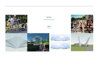
Trinity River Corridor Project 2011
- 2. The project covers 20 miles of the Trinity River, approx. 10,000 acres
- 5. Flood Protection Components Elm Fork Flood Improvements; berms and wetlands for flood conveyance Dallas Floodway Extension (DFE) levees and wetlands for flood conveyance Dallas Floodway levee raise and flood conveyance (lakes)
- 6. Flood Protection - Construction Lower Chain of Wetlands Cells D, E, F & G are complete, and doing their job!
- 9. Levee Section at Commerce Water Surface Elevations vs Parkway Existing Levee Elevation 429.40 Future 2-Foot Raised Levee Elevation 431.40 Ground Elevation about 400.00 Average low flow conditions that stay within the river channel of the Dallas Floodway Elevation 382.00 800-year Flood Elevation 428.97 100-year Elevation 417.06 Same as 1908 flood of record May 1990 35-year Flood Elevation 415.24 June 2007 5-year Flood Elevation 408.38 Trinity Parkway Flood Protected Elevation 419.06
- 10. Dallas Floodway System Components Dry Side Sump Interior Drainage refers to the system of sump & pump stations – note that both dry sides of levees have interior drainage and vegetation free zones Pump Station Levee Toe of Levee River Channel Levee Slope 15’ Vegetation Free Zone Trinity River
- 16. Recreation
- 21. Recreation: View from West Dallas
- 26. Recreation: Trinity River Audubon Center Trinity River Audubon Center
- 27. Trinity River Audubon Center Note the many trails and wetlands surrounding the Audubon Center!
- 28. Recreation: Standing Wave & Santa Fe Trestle Trail Standing Wave Whitewater Course Santa Fe Trestle Trail
- 30. Recreation: Standing Wave & Santa Fe Trestle Trail Watch videos of these kayakers on YouTube!
- 31. Recreation: Existing Trails in Rochester Park
- 32. Recreation: Future Trails Network Trinity Trails Phase I Trinity Trails Phase II Moore Gateway Park and Standing Wave IH-20 Gateway Park Rochester Gateway MLK Jr. Gateway Loop 12 Gateway Joppa Gateway Park
- 33. Transportation: Trinity Parkway Toll Road
- 35. Transportation: Trinity Parkway Toll Road Looking South from Hampton Rd.
- 36. Transportation: S.M. Wright Parkway
- 37. Trinity Parkway & S.M. Wright IH 45 US 175 Today’s Commuter Flow Future Commuter Flow N SM Wright Freeway Proposed Trinity Parkway Ideal Neighborhood Rochester Park 45 Lamar
- 39. Transportation: Sylvan Ave. Bridge
- 41. Transportation: Signature Bridges
- 42. Transportation: Margaret Hunt Hill Bridge Visit the webcam at www.trinityrivercorridor.org to view construction progress Margaret Hunt Hill Bridge under construction complete in 2011
- 43. Continental Ave. Riverfront Boulevard Spur 366 (Woodall Rodgers) IH 35E Singleton Blvd.
- 44. Continental Ave. Pedestrian/Bicycle Bridge
- 49. Trinity River Project Office (214) 671-9500 www.trinityrivercorridor.org
Notes de l'éditeur
- 20 mile stretch of the Trinity River From Royal Lane, along the Elm Fork, through downtown, down to Interstate 20 10,000 acres, one of the largest urban parks in the country Compare to other “famous” urban park…Central Park is 840 acres
- Flood Protection Strengthen our levees Raise our levees Extend our levees (through Dallas Floodway Extension) Wetland Cells for better floodwater conveyance Dallas Floodway Extension, working with the Corps of Engineers, the DFE project: Extends existing levees 5-1/2 miles to protect Cadillac Heights and Lamar Neighborhoods Provides 3-1/2 miles of wetlands for flood conveyance (restores downtown flood protection to 800 year, increases flood protection for wastewater plant from 140 year to 500 year) Wetlands also provide wildlife habitat This work is already underway!! Elm Fork Flood Improvements Interior drainage improvements (sumps), wetlands, a smaller 100 year flood protection berm to protect this largely industrial area Dallas Floodway Also being done with Corps of Engineers Besides recreation, lakes provide flood conveyance Levees will be raised 2 ft. to provide additional “buffer” above 800 year flood protection
- Lower Chain of Wetlands is already complete, and has reduced flood levels upstream by about 1 ft. The purpose of the chain of wetlands is to provide flood conveyance through the Great Trinity Forest. When the Trinity River floods, it does not flow very fast through the forest because of the density of the trees. We are creating open space for the floodwaters to flow, thereby reducing flood levels upstream. There will be 7 wetland cells in all, ranging from 10 acres to 20 acres each, shallow on the edges and deeper in the middle. These wetlands cells also provide wildlife habitat. Waterfowl like herons and egrets, turtles, beaver and other forest animals like to come to the wetlands for food and water. Flood levels upstream are estimated to be lowered by as much as 1 foot due to excavation that has taken place The upper chain of wetlands could begin construction this year, and will extend from IH-45 upwards to the DART bridge crossing of the Trinity River.
- NOTE: IDENTIFIERS POP UP ON MOUSE CLICK The future flood protection work includes 800 year flood protection for Lamar and Cadillac Heights and the upper chain of wetlands
- The Dallas Floodway project includes both the recreational features of the Balanced Vision Plan, along with the raising of our existing levees to provide additional protection from the 800 year flood event.
- Levees were originally built in the 1920’s and raised to their current height in 1960’s 26 mile system, levees are on average 30 ft. tall Back in June 2007, we had about a 5-year flood event, water reached about 8 ft. on the levees Largest flood Dallas has ever experienced, since the levees were built, was in 1990. Approximately 35-40 year flood event, got about halfway up on the levees Flood of Record, largest flood event in Dallas (before the levees), occurred in 1908. It was a 100-year levee event (which has a 1% change of occurrin in any given year). Levees will be raised and fattened to provide protection from the Standard Project Flood, which is the 800 year flood event in this area (has a 0.125% chance of occurring in any given year)
- Rain is animated for a brief period. Visual description of the floodway system The pumps and sumps move water from the dry side of the levees to the river Additional improvements on Pump Stations and Sumps are necessary – we anticipate additional flood protection bond propositions in 2012
- Flooding outside the levees occurs when our stormwater sumps and pump stations do not have enough capacity to either store the stormwater in the sump areas, or pump the stormwater through the levees into the Trinity River From the 2006 Bond Program, approximately $171 million was allocated to improving our stormwater sumps and pump stations
- Note: animated slide. Baker and Pavaho will pop up first. Pavaho Pump Station is under construction, and will be complete in Summer 2012. Baker Pump Station should begin construction later this year. Able and Charlie pop up next, then Hampton and Trinity Portland. These designs have just begun (are at 35% design level). Construction funds will be needed from the 2012 bond program.
- Next slides will take you geographically down the Trinity River, from the confluence of the Elm and West Fork down to the DART bridge
- Note: Animated slide! Graphic comes up on mouse click. Soccer complex under design now; should begin construction of Phase 1 (11 ball fields, parking, concessions, restrooms, irrigation, lighting) this year Phase 2 will include an additional 11 fields, trails and other park amenities
- Click once to move to the left side of this slide. Click again to zoom in. Point out features of interest. Click a second time to move to the right side of this slide. Again, point out features. Water for the Urban and Natural Lakes will be provided from the Central Wastewater Treatment Plant effluent. It will flow counter to the Trinity River flow, creating the opportunity for a 4 mile canoe loop (Natural Lake, to Urban Lake, to Trinity River, back down to Natural Lake)
- Note: Animated slide. Starts out with existing view under Westmoreland -West Dallas Lake is 120 acres and 2,000 meters long, which will enable us to host competitive rowing (or crew) competitions. The lake will also be available for casual boating. -Submerged wetlands will act as lane markers
- An amphitheater will be located on the north side of the West Dallas Lake for concerts, rowing competition viewing and other venues
- West Dallas Ball Fields
- Shade structures will be illuminated at night Potential concession opportunity for a water taxi to provide transportation to various points on the lake Center Island (separating the river from the lake) will provide 2 year flood protection for the lake. On average, every 2 years, the river will get high enough to inundate the lakes. When that happens, we will let the waters recede, wash down and clean up any areas, then resume operations. During dry periods, tent festivals or rubber-tired concessions could be in the floodplain without danger of flooding.
- A place where visitors can sit on the levee and watch the project be constructed over the next 4-5 years. Located at Beckley & Commerce on the levee. Funded in part by a grant from Metlife Foundation, through the Trust for Public Land.
- Animated slide: floodplain transforms into scene of boardwalk and pedestrians Boardwalks across the wetlands will allow visitors to get closer to the wildlife and their habitat
- Next slides will take you geographically down the Trinity River, from the confluence of the Elm and West Fork down to the DART bridge
- City is partnering with the National Audubon Society to build their “flagship” facility in this area. 20,000 sq. ft. facility Located on 120 acres, off loop 12, east of IH-45 Designed by Antoine Predock
- Will be eligible for Gold LEED certification “ green” features include a grass roof, insulation made out of shredded blue jeans, use of ambient light, rainwater collection system, solar energy
- Note: Animated slide! Standing Wave and Santa Fe Trestle Trail each come up on mouse click Standing Wave – under construction, to be opening in Spring 2011 Santa Fe Trestle Trail – under construction, to be opening in October 2011 Center trestle will remain and be restored to accommodate pedestrian and bicycle traffic Wooden pilings will be torn down and replaced with ramps going up to the trestle
- Two whitewater areas will be constructed, but will have a bypass channel for a more gentle ride Trail and access road to parking lot will connect back to Moore Park
- Student conservation Association created 8 miles of soft surface trails in the Great Trinity Forest (blue line). We added an ADA-accessible hard surface trail to the Texas Buckeye Trail (green line) Trailhead and trail over the levee has been awarded for construction (red line)
- Note: Animated slide – phase I comes up first, then phase II, then gateway parks on mouse clicks Trinity Trails Phase I is nearing completion. It extends 1.7 miles from Loop 12 (near Joppa) down to Simpson Stuart. Trinity Trails Phase II is under construction. It will extend from Simpson Stuart across the Trinity River and into the Trinity River Audubon Center. Future phases are shown in black, river crossings are in blue. Gateway parks are in various stages of master planning, design and construction
- Trinity Parkway 8.5 mile roadway, extending from 183 in the north to 175 in the south Reliever route will carry 100,000 vehicle trips per day Context sensitive design, due to its proximity to the park. It is being designed to blend in, not have visual intrusion or excessive noise Road will be built at an elevation above the 100 year flood in some areas; in other areas where it must dip down below the bridges in the downtown area, it will have a floodwall to protect from flooding. This will also help with visual intrusion and noise. The wall will be landscaped, terraced in some areas, to compliment the park area Construction cannot begin until Corps completes its EIS in 2014.
- View from Trinity Parkway at Hampton, looking down stream,
- Proposed improvements to SM Wright Currently, folks traveling from the south on 175 into downtown must make a dangerous traffic movement at SM Wright. It is almost a 90 degree turn, at 55 mph. The SM Wright Freeway is an elevated freeway which divides a residential neighborhood. The Trinity Parkway will allow travelers to take IH-45 into downtown, instead of using SM Wright. That means we can eliminate this high speed traffic movement, and make SM Wright a low speed, pedestrian friendly boulevard with landscaping and sidewalks. Will greatly benefit the neighborhood.
- Rendering of meandering lower speed roadway Will greatly benefit the neighborhood.
- Bridge will have 6 lanes (3 each direction) with 6 ft. sidewalks on either side, and a vehicular/pedestrian ramp going down into the park Construction will start Summer 2011; Sylvan Ave. will be shut down to traffic (saves time and money on construction) Construction should take one year
- MHH Bridge designed by Santiago Calatrava Expected to be complete in October 2011 Cable stayed bridge with center arch 400 ft. tall Cables to be hung in May 2011 Six lanes, 3 in each direction Check out the progress on our web site
- This is the route of the Margaret Hunt Hill Bridge – it extends Woodall Rodgers from where it ends today, at Riverfront Blvd., goes across the river and ties into Singleton Blvd. This route provides better mobility for residents of West Dallas and Oak Cliff, to access all the major freeways and downtown. Once this roadway is in place, the Continental Ave. Bridge will be shut down to pedestrian/bicycle only. Park amenities are being designed now, and construction can begin as soon as the MHH bridge is complete.
- Continental Bridge conversion is made possible by an anonymous donation of $10 million
- IH-30 Bridge Design is underway Will double the size of the existing bridge to Ft. Worth, from 6 lanes to 11 main lanes To begin construction in 2012
- This page signifies just how much work is underway for the Trinity Project!
- This page signifies just how much work is underway for the Trinity Project!
- - Look for the logo!! - Go to our website, sign up for the e-newsletter