5. Section 106 Consultation
• 7 consulting
parties, including
SHPO
• Controversial
corridor
• Rock fall
structures create
adverse effect
based on visual
change
• Programmatic
6.
7. The Takeaway
• Mitigation doesn’t
have a specific
price tag
• Mitigation doesn’t
have to sit on a
library shelf
• Mitigation should
have a
preservation
benefit
• It doesn’t hurt to
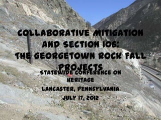
IntroductionBriefly introduce a short documentary funded by CDOT as part of Sectoin 106 mitigation for our rock fall projects at Georgetown Hill
This is where the story begins—high up on this mountain, well out of view of the highway below, where rockfal is generatedThis is an aerial view of the chutes and pathways identified as areas of rockfall activitythat CDOT rockfall experts address each yearGeorgetown is located in the upper right corner—Silver Plume is outside of this photoInterstate 70 is one of Colorado’s main east-west highways that extends over the Continental Divide to the western slope
CDOT data indicates that since 1976, 100 accidents, 17 injuries, and 3 fatalities in this stretch of roadway due to rock fallCDOT performs rock scaling and installs netting, fencing, attenuators to mitigate rock fall hazards
These are then and now shots of Georgetown, taken from different directions—showing that the community still largely fits within its original footprint—also how the it fits into the surrounding mountain landscapeThe rockfall projects take place within a 2-mile stretch of I-70 that extends through the Georgetown-Silver Plume NHL districtThe Georgetown-Silver Plume National Historic Landmark District (GSPNHLD; 5CC3) was listed on the National Register of Historic Places and was designated a National Historic Landmark in 1966. The district includes the entire commercial and residential areas of Georgetown and Silver Plume, and the Georgetown Loop Railroad that connects them. The boundary also encompasses the nearby mountainsides that contribute to a larger mining landscape. The district is significant for its intact examples of Victorian architecture in Georgetown and the simpler wood frame architecture of Silver Plume. Both communities are associated with the development of gold and silver mining in the region and have retained much of their mid-19th century boom-town atmosphere.
Rock fall projects take place within NHL boundary—the slopes are considered part of the mining landscapeFor years, SHPO and consulting parties agree to no effect or no adverse effectIn 2008, Clear Creek County writes back, stating that they believe there is a cumulative visual adverse effect to NHL as more rockfall fencing and structures are installedCDOT develops a programmatic agreement to streamline consultation and identified mitigation applicable to the all projectsConsulting partiesForest Service, Arapaho-Roosevelt National ForestColorado Historical SocietyClear Creek CountyGeorgetownSilver PlumeGeorgetown Public Lands CommissionSHPO
Mitigation includes a color selection process, where the fence materials are matched to surrounding landscapeEngineers came up with idea and local community loves itThis is a great photo of how the color selection process works—more about this in the filmMitigation also includes interpretive mitigation—initially considered a sign about geology of mining but then we decided to complete a short filmWorked with consulting parties—came up with idea to address challenges of transportation between Georgetown and Silver Plume, but also talk about historic rockfall and current efforts to mitigate rockfallWorked with Jim Havey, well-known film maker in ColoradoFilm is shown at Georgetown Visitor Center
The takeaway?Mitigation doesn’t have to be archival photos or a historic contextMitigation should be determined in consultation and should be appropriate for the scope and effect of the projectMitigation doesn’t have a specific price tagIt doesn’t hurt to ask—CDOT Region 1 was open to the idea and since the mitigation applied to all projects, the cost was apporopriateMitigation should have a preservation benefit!