

Recommandé
Contenu connexe
Tendances
Tendances (20)
En vedette
En vedette (20)
Similaire à Town planning (4)
Similaire à Town planning (4) (20)
Plus de Dhruv Seth
Plus de Dhruv Seth (20)
Dernier
Dernier (20)
Town planning (4)
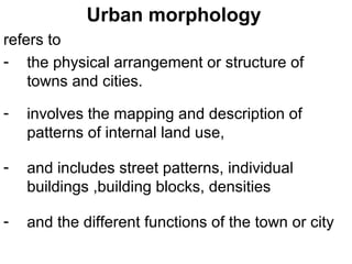
- 1. Urban morphology refers to - the physical arrangement or structure of towns and cities. - involves the mapping and description of patterns of internal land use, - and includes street patterns, individual buildings ,building blocks, densities - and the different functions of the town or city
- 2. Urban morphology Factors Influencing Urban Morphology - Site factors - Historical and cultural factors - Functional factors - Government influence - Social values - Economic forces *economic circulation *economic accessibility / urban land rents
- 3. Urban morphology The Urban Land Rent Concept and Distance Decay Mechanism 1. Areas of high accessibility ~ centre of the city ~ Major traffic routes ~ major traffic intersections 2. Land values and uses in a city ~ The central Business district ~ Industrial land use ~ residential land use
- 4. Models of urban structure Introduction Most western cities exhibit area specialization in their internal land use patterns. That means “ functional areas” or “ functional zones”
- 5. Models of urban structure Stages of urban growth - Infantile stage - Juvenile stage - Adolescent stage - Early mature stage - Fully mature stage
- 6. Models of urban structure Land-use models have been put forward on the basis of the idea - that towns and cities do not grow in a haphazard fashion, rather they tend to develop distinctive patterns of land-use as they grow and develop. - Land-use models are simplified diagrams which are used to represent the pattern of land-use functions within a town or city. - It should however be remembered that these are simplifications of reality and it is unlikely that any model will fit every town and city perfectly.
- 7. CONCENTRIC GROWTH CONCEPT E W BURGESS; EARLY 1925
- 8. CONCENTRIC GROWTH CONCEPT E W BURGESS; EARLY 1920 Zone I: Central Business District (CBD) where most of the tertiary employment is located and where the urban transport infrastructure is converging, making this zone the most accessible. Zone II: Immediately adjacent to the CBD a zone where many industrial activities locate to take advantage of nearby labor and markets. Further, most transport terminals, namely port sites and railyards, are located adjacent to the central area. Zone III: This zone is gradually been reconverted to other uses by expanding manufacturing / industrial activities. It contains the poorest segment of the urban population, notably first generation immigrants living, in the lowest housing conditions. Zone IV: Residential zone dominated by the working class and those who were able to move away from the previous zone (often second generation immigrants). This zone has the advantage of being located near the major zones of employment (I and II) and thus represents a low cost location for the working class. Zone V: Represents higher quality housing linked with longer commuting costs. Zone Va: Mainly high class and expensive housing in a rural, suburbanized, setting. The commuting costs are the highest. Prior to mass diffusion of the automobile (1930s), most of these settlements were located next to rail stations.
- 9. CONCENTRIC GROWTH CONCEPT E W BURGESS; EARLY 1920
- 10. CONCENTRIC GROWTH CONCEPT E W BURGESS; EARLY 1920 ASSUMPTIONS
- 11. CONCENTRIC GROWTH CONCEPT E W BURGESS; EARLY 1920 CRITICISM
- 12. CONCENTRIC GROWTH CONCEPT E W BURGESS; EARLY 1920 CRITICISM
- 13. SECTORAL MODEL HOMER HOYT; 1939 Major transport routes
- 14. SECTORAL MODEL HOMER HOYT; 1939 There are three explanations for these land use patterns. 1 Historical The urban area expanded outwards from the original site which is where the city centre is found today. 2 Economic Rents and rates in the CBD became too expensive for people. In the suburbs there was more land and it was cheaper. Only businesses could afford to stay in the CBD, but even they needed to make the most of expensive land by building upwards. 3 Concentrations of similar land uses One part of the urban area may have all the advantages for industrial location so that a lot of factories want to locate there; but few people want to live next door to a factory, so the residential areas are located elsewhere. Planners also prefer this segregation of land uses into definite zones.
- 15. SECTORAL MODEL HOMER HOYT; 1939 ASSUMPTIONS
- 16. SECTORAL MODEL HOMER HOYT; 1939 ASSUMPTIONS
- 17. SECTORAL MODEL HOMER HOYT; 1939 CONCLUSSIONS
- 18. SECTORAL MODEL HOMER HOYT; 1939 CONCLUSSIONS
- 19. SECTORAL MODEL HOMER HOYT; 1939 CRITICISM
- 20. MULTIPLE NUCLEI CONCEPT HARRIS & ULLMAN; 1945
- 21. MULTIPLE NUCLEI CONCEPT HARRIS & ULLMAN; 1945 - land use patterns do not grow from a single central point in a city but from multiple points or nuclei. - Some of these points existed before the city began to grow, while others develop as the city grows. - Nuclei may include the original retail or market area of the city and important transport links such as railway stations, ports or the airport.
- 22. MULTIPLE NUCLEI CONCEPT HARRIS & ULLMAN; 1945 - The areas of the city that they recognise are similar to the ones noted by Hoyt and Burgess but the location of these areas will be different in different cities. - The central business district will often be found near the original retail area of the city. - Warehousing and light industrial areas will develop adjacent to the CBD and along transport links such as railways and roads.
- 23. MULTIPLE NUCLEI CONCEPT HARRIS & ULLMAN; 1945 - Heavy industry will locate on the outskirts of towns or where the outskirts were when the development took place, since growth of the urban area may have overrun this area by now. - Residential areas will be found in the remaining space, with high-class housing situated in the better areas with good drainage, often on high ground and away from nuisances such as noise and poor air quality. - Lower quality housing will be forced to occupy the less attractive areas of the city.
- 24. MULTIPLE NUCLEI CONCEPT HARRIS & ULLMAN; 1945
- 25. STUDENTS’ PROJECT Study of Cities – Past, Present & Future growth pattern in terms of – a. Transport Network b. Commercial Land Use c. Industrial Land Use d. Residential Land Use Study Period: 1980 to 2020. Study Method: For every decade mark on the maps a to d mentioned above
- 26. STUDENTS’ PROJECT Cities GROUP 1 DELHI & NCR GROUP 2 MUMBAI & MMR GROUP 3 CHANDIGARH GROUP 4 BANGALORE