Climate Change & Africa
•
2 j'aime•460 vues

CCAPS and AidData built an interactive app with the ArcGIS API for Microsoft Silverlight/WPF to map effects of aid, climate change, and conflict in Africa.

Recommandé
Recommandé
Contenu connexe
Tendances
Tendances (20)
En vedette
Similaire à Climate Change & Africa
Similaire à Climate Change & Africa (20)
Plus de Esri
Plus de Esri (20)
Dernier
Dernier (20)
Climate Change & Africa
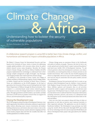
- 1. Climate Change Understanding how to bolster the security & Africa of vulnerable populations By Karen Richardson, Esri Writer A collaborative research program is using GIS to better learn how climate change, conflict, and humanitarian aid intersect to impact vulnerable populations in Africa. The Robert S. Strauss Center for International Security and Law, Climate change poses an enormous threat to the livelihoods based at the University of Texas, Austin, is known for addressing and safety of millions of people. “However, the level of risk is not complex global problems with innovative ideas driven by policy- evenly spread and certainly doesn’t respect national boundaries,” related research across many disciplines. Recently, the Strauss said Jean-Louis Sarbib, CEO of Development Gateway. “To ask Center’s Climate Change and African Political Stability (CCAPS) critical questions about how development assistance can reduce program implemented Esri technology to understand how to best vulnerability, you need hyperlocal data on climate and also on aid- manage complex emergencies in light of drought, crop shortages, funded interventions. Th is is what the new CCAPS mapping tool and changing weather that could result from climate change. shows in a digestible, interactive way. It will no doubt be a valuable In addition to the University of Texas, Austin, the College of new tool not only for researchers but also policy makers, journal- William and Mary in Williamsburg, Virginia; Trinity College Dublin ists, and citizens.” in Dublin, Ireland; and the University of North Texas in Denton, Development Gateway fi rst partnered with Esri to create an ap- Texas, are collaborators on the CCAPS program. As the lead or- plication called Development Loop for AidData. A joint initiative ganization, the University of Texas receives funding from the United with Brigham Young University and the College of William and States Department of Defense through the Minerva Initiative. Th is Mary, AidData captures and interprets data on aid activities initiative is a university-based, social science research program around the world to support aid transparency and decision-mak- that focuses on areas of strategic importance to national security ing processes. Development Loop is a simple, easy-to-use applica- policy. Th rough quantitative and GIS analysis, case studies, and field tion that allows users to add and edit their own project information, interviews, CCAPS strives to produce research that can support US, including comments, pictures, and stories, at a subnational level. African, and international policy responses. Th is information can be viewed and shared with others both on the web and offl ine. Closing the Development Loop Users can view their own projects along with those of other or- The CCAPS program enlisted the help of Development Gateway, a non- ganizations or with data on poverty rates, maternal mortality, or profit organization that delivers information solutions to government other important indicators. The application can also be linked to policy workers allocating scarce resource investments, aid workers beneficiary feedback. The Development Loop prototype was built building infrastructure, and citizens who want to have a voice in the using the ArcGIS API for Microsoft Silverlight/WPF and ArcGIS process. Development Gateway created a dynamic mapping tool that for Server technology from Esri and incorporated World Bank and could visualize program data and show the variables that affect vul- African Development Bank project data geocoded by the AidData nerable populations in a holistic manner. partners. 30 au Summer 2012 esri.com
- 2. Feature Africa faces unique challenges in coping with climate change caused by its dependence on rain-fed agriculture and the fragile social and political infrastructure of many of its countries. (Photo credit: Anustubh Agnihotri, CCAPS Program) Understandable and Actionable Data When Development Gateway staff members began working on the Viewing the CCAPS data on a map is very intuitive to users. “My CCAPS program, they felt that the same technology and workflows experience is that once we sit down and show people what they are created for Development Loop could be applied to this project. The getting as part of the system, they get even more excited. The users CCAPS program had produced data in many research areas and are able to shift their thinking and understanding using what we needed a way to layer the data to analyze how various factors work to- consider to be simple tools by putting their projects on a map. By gether to compound or reduce vulnerabilities to climate change. “The doing this, in return, they get powerful visualization that shows best way to get a really clear picture of what is going on is by looking at them where they are doing what. You can’t get this out of a table or it on a map,” said Joshua Powell, GIS analyst at Development Gateway. spreadsheet.” esri.com Summer 2012 au 31
- 3. The mapping tool allows users to select and layer any combination Being able to look at this data over time and space greatly en- of CCAPS data onto one map to assess how multiple climate change hanced analytical capabilities of CCAPS. “The mapping tool allows impacts and responses intersect. For example, mapping conflict data users to get a snapshot of trends across these issues or drill down to over climate vulnerability data can help one assess how local conflict get the details on particular issues or locations where they have an patterns could exacerbate climate-induced insecurity in a region. interest,” said Ashley Moran, CCAPS program manager. “We’re able Mapping aid and climate data together helps explore whether aid to make large volumes of data available to a wider audience of policy interventions are targeting areas of greatest climate security risk. makers, researchers, and citizens in a format they can use for day-to- day analysis.” Democratization of Data The tool is already being used in the country of Malawi for a solu- By integrating CCAPS research on climate change and real-time con- tion that tracks and reports on the country’s external funding. Aid flict tracking with existing datasets, such as topographic maps and information is mapped along with data on climate change vulner- imagery, the goal of the CCAPS mapping tool is to provide the most ability and incidents of conflict. This sheds light on whether aid is comprehensive view possible of climate change and security in Africa. effectively targeting regions where climate change or conflict pose “The complex pathways from climate change to security impacts the most significant risk to the sustainable development and po- have demanded new datasets to fill knowledge gaps but also new litical stability of the country. The mapping tool is also a significant ways of presenting the data to be of most use in policy planning,” innovation in the context of the global aid transparency movement. said Francis J. Gavin, director of the Strauss Center. “This mapping It represents the first effort of the sort envisioned by the Open Aid tool allows policy makers to analyze data from multiple sources at Partnership, an initiative spearheaded by the World Bank to in- once, providing integrated analysis of the drivers and responses re- crease the openness and effectiveness of development assistance at lated to security risks stemming from climate change.” the subnational level. Wind turbines located in southern Kenya create electricity to Graduate students working with CCAPS used GIS to identify the offset losses in hydroelectric production caused by decreased regions in Africa at greatest risk from climate change, particularly rainfall. CCAPS helped produce a wind energy atlas the Kenyan as related to water resources. (Photo credit: Todd Smith, CCAPS government uses to promote investment in this technology. (Photo Program) credit: Todd Smith, CCAPS Program) 32 au Summer 2012 esri.com
- 4. Feature 1996–2000 2001–2005 2006–2010 An examination of conflict and climate vulnerability data shows that conflict events involving the Lord's Resistance Army (red areas) have gradually diffused from Uganda into areas with less stability and more climate security vulnerability such as South Sudan and the northern portion of Democratic Republic of the Congo. (Source: CCAPS Vulnerability Model, ACLED data, CCAPS mapping tool) CCAPS and AidData will continue to release upgrades to the map- ping tool throughout 2012. The current mapping tool is available to use now at strausscenter.org/ccaps/mappingtool. For more information on AidData, go to aiddata.org. For more information on Development Gateway, go to developmentgateway.org. Learn more about GIS solutions for climate change from Esri at esri.com/climate. Pen n State | On li n e Geospatial Education Portfolio Enroll in one of our high-quality online education programs to help you achieve your career goals: Master of Geographic Information Systems Master of GIS—Geospatial Intelligence Option Postbaccalaureate Certificate in GIS Graduate Certificate in Geospatial Intelligence U.Ed.OUT 12-0171/12-WC-0112ajw/jms/smb w w w.worldc ampu s . p su .e du/A r cU s er1 2 esri.com Summer 2012 au 33