SlideShare une entreprise Scribd logo
1  sur  60
S.K. SINGH
Director
ICAR-NBSS&LUP, NAGPUR
ICAR-National Bureau of Soil Survey and Land Use Planning
Amravati Road, Nagpur
 NBSS&LUP- In the service of
nation since 1976
 Five regional canters:
RC Kolkata, eastern region
RC Jorhat, north eastern
region
RC Delhi, northern region
RC Bangalore, southern
region
RC Udaipur, Western region
2
Mandate
 To conduct soil survey and mapping of the soils of the country to promote
scientific and optimal land use programmes in collaboration with relevant
institutions and agencies.
 To conduct and promote research in the National Agricultural Research
System in the areas of Pedology, Soil survey, Remote sensing applications,
Land degradation, Land evaluation and Land use planning.
 To impart training and education to create awareness on soil and land
resources and their state of health.
3
Landmark Achievement
Soil Resource map of the country on 1:1 million scale and for the states on 1:250000 scale
 Food security
 Ecosystem services
 Facility of Infrastructure
 Industrialization
Mountains 10.3%
Hills 12.8%
Plateaus 30.6%
Desert 6.3%
Coastal
plains
4.8%
Island 0.3%
Eco-sensitive area
o Food and water
supply
o Flood and disease
control
o Cultural services
o Nutrient cycling
Food Security Act, Land Acquisition Act, NREGA
Pushing Agriculture on
the back end
LD: Harmonized data-120 mha; 64 mha arable
land
Estimating degradation
Completed the Assessment of Soil
Loss in India under Collaborative
Project between NBSS&LUP and
CSWCR &TI
Soil Loss/Erosion Assessment in India
5
Class (t/ha/yr) % Area
Very Slight (< 5) 30.16
Slight (5 – 10) 19.84
Moderate (10 – 15) 12.82
Mod.Severe (15 – 20) 6.97
Severe (20 – 40) 11.28
Very Severe (40 – 80) 6.76
Extr.Severe (> 80) 4.04
Others* 8.12
15 States reports have been printed
Salt Affected Area
2017
Monitoring degradation :
Wind erosion : Increasing sand load in the desert
command area
Extent of
Degradation
Slight: 29%
Moderate: 30%
Severe: 15%
Very severe: <1%
Monitoring environmental degradation
Shifting River Case study- Bihar
Heavy siltation and erosion
Monitoring degradation
Monitoring degradation:
short and long term consequences on estuarine and coastal waves
Monitoring degradation:
Arsenic and fluoride contamination in West Bengal
o Acidity is increasing in the flood plains of Bengal
o Area under Multi-nutrient deficiency is increasing due
to the intensification of agriculture
Monitoring degradation: Multi-nutrient deficiency
Monitoring climate change: Aridity Index
1992 2018
14
20 Agro-Ecological Regions (1992) 60 Agro-Ecological Sub-Regions (1999)
Sub-humid moist,
Humid
Per-humid
Aridity
Revision of Agro-ecological Region Map
 Reduced number of
rainy days
 Increased frequency
of dry spells
 Increased extreme
events of rain, cold,
storms……..
Degradation
Vulnerability
increased
Agro-ecological Sub-region
Assigning the reasons:
Defined sustainable area for major crops and cropping sequences in India
Wheat Rice Cotton
18
Current area Vs. Sustainable Area, Wheat
Current area Vs. Sustainable Area, Rice
Market based Land Use- The driver
Lack of Land use based market
Telangana, Andhra Pradesh and Tamilnadu- Maize area with
support of poultry industry; cotton is being replaced
Groundnut- Gujarat; Sugarcane- Maharashtra and U.P
Bihar- Potential area for maize, lack of processing unit; farmers do
not have interest
Assigning the reasons for degradation
Poverty and Degradation
Schedule caste maximum in high productive soils and schedule tribe on
Challenges
 Sustainable agriculture includes sustainable area with the area specific best
management practices (BMP) covering soil conservation measures for water
harvesting in the rain-fed areas, the best water management in the irrigated areas
and nutrient management in site specific mode.
 Sustainable area (SA) is an uniform piece of land, potentially suitable for a crop
and cropping sequence in terms of soil, water and climate, presently available for
the defined use.
Scale: National, Regional, State, district, village and farm
Conceptualizing Sustainable
Agriculture
Total
Food grains
Agriculture can share the land for Infrastructure and Industry
Attaining State of Degradation Neutral
Sustainable Area with BMP
Land Resource Inventory (LRI) at 1:10000 scales
( SA at Farm level)
Integration of traditional soil survey and
advancing remote sensing technology
involving high resolution remote sensing
data (RS), digital terrain model
Assumption if landform, slope and land use are
identical in a given geographic setting, there is
high possibility for setting similar kinds of soils
Attaching cadastral is optional
Landscape Ecological Unit - A base map
Base Map- Landscape Ecological Unit
o New : Degree, length and curvature of slope together with contour
and drainage
o New information links LRI with soil water conservation planning,
irrigation, water harvesting potentials and precision agriculture
(IRS LISSS IV, Cartosat DEM, Geo Eye)
Phases of soil series -mapped
Soil Map
Manipur Sikkim
Characterization - degradation prone and Climate change vulnerable area- Hot spot
Nagaland
Characterization of Jhum land in north eastern region
North Eastern Region-Tripura
West Coast -
Goa
o State
o District
o Taluka
o Panchayat wise map
West Coast - Gujarat
Districts Nos. of blocks
covered
Surat 10
Kutch 10
Junagadh 10
Valsad 6
Navsari 6
Bharuch 9
Ahmedabad 1
Banaskantha 1
Porbandar 3
Soils of Kultuli block, 24 Paragana South,
West Bengal
Soil map of Basudevpur block, Bhadrak district, Odisha
East Coast – West Bengal & Odisha
Desert Ecosystem – Rajasthan
Chhotanagpur Plateau
District State Block
Hazaribag Jharkhand 16
Sahibganj Jharkhand 9
Dumka Jharkhand 10
 Leh
 Lahul
 Pangi
The Cold Desert- Lahaul Block, Himachal Pradesh
Tamil Nadu
Annur Block, Coimbatore
Veerapandi Block, Salem
Rasipuram Block, Namakkal
Gingee Block, Villupuram
Thirumannur Block, Ariyalur
R.S. Mangalam Block, Ramanathapuram
Perambalur Block, Perambalur
Uthanagarai Block, Krishnagirai
Sarkar Samakulam Block, Coimbatore
Valapadi Block, Salem
Southern India
Telangana
Gajwel mandal, Medak
Thimmajipet mandal, Mehboobnagar
Indravelle mandal, Adilabad
Garedapally mandal, Nalgonda
Huzur Nagar mandal, Nalgonda
Chilkur mandal, Nalgonda
Andhra Pradesh
Bukkarayasamudram mandal, Anantpur
Kerala
Iddukki block
Soil map of Indervalle mandal, Adilabad district, Telangana
Chronically waterlogged area- Bihar
LMU Description Present
land use
Suggested land
use options
Suggested management
practices
1 Very deep, extremely
acidic, fine soils on very
steeply sloping high hills
Rainfed
upland
paddy
Forestry and
natural vegetation
Contour bunding, grassed
waterways and allocation of
land for natural vegetation
2 Very deep, extremely
acidic, fine soils on steeply
sloping high hills
Rainfed
upland
paddy
Rubber / tea /
pineapple
Land shaping, contour bunding,
graded bunding and liming at
every alternate year
3 Very deep, extremely
acidic, fine soils on very
steeply sloping medium
hills
Rainfed
upland
paddy
Forestry and silvi-
pastoral system
Contour bunding, afforestation
and silvi-pastoral system with
multipurpose tree species
4 Very deep, extremely
acidic, fine soils on strongly
to steeply sloping medium
hills
Rainfed
upland
paddy
Rubber / tea /
pineapple
Bench terracing, contour
bunding and liming at every
alternate year
5 Very deep, extremely
acidic, very fine soils on
moderately steeply sloping
low hills
Rainfed
upland
paddy
Rubber / tea /
pineapple
Bench terracing, contour
bunding, contour farming and
liming at every alternate year
6 Very deep, very strongly
acidic, fine loamy soils on
moderately to strongly
sloping low hills
Rainfed
upland
paddy
Upland paddy
/Rubber / tea /
pineapple / coffee
Bench terracing and liming at
every alternate year
Mokokchaung district, Nagaland
LUP: Intensification of jhum land through
rubber plantations
Area Specific Best Management Practices
LMU Description Present land use Suggested land use options
1 Very deep, excessive to
well drained, very
strongly acidic, sandy
loam to silty clay loam
soils, moderate to
severe erosion
Rubber
plantation
 Rubber plantation
 Inter-cropping with
pineapple, ginger and
turmeric for first three
years.
2 Very deep, moderate to
well drained, very
strongly acidic, silty clay
loam soils, slight erosion
Kharif paddy /
fallow
 Paddy / maize –
mustard / lentil / pea /
groundnut
 Summer green gram in
water scarcity.
3 Deep, somewhat to
poorly drained, strongly
acidic, sandy clay loam
to sandy clay soils,
slight to moderate
erosion
Paddy –
mustard / pea
/ lentil / winter
vegetables /
groundnut /
paddy / fallow
 No change, prefer
medium duration HYV
paddy varieties.
4 Deep to very deep,
somewhat to poorly
drained, strongly acidic,
Paddy – lentil /
pea / fallow
 No change. Preference
should be given to
medium duration paddy
varieties.
Bishalgarh block, Sipahijila district, Tripura
Ginger based processing
units
LMU Landform Crops and cropping systems
10 Restricted
Summits/ High
Hills
Cashew +pineapple/ Kokum /Oil palm(Rainfed)
Coconut+ Nut mug +Mango+ Areca nut+ Lemon+ Sapota+/ Turmeric (Rainfed)
Vegetables like Chiili, Cluster bean, Brinjal, Tomato, Potato, Onion, Radish, Sweet potato
(irrigated)
6 Undulating Lands  Rice (Kharif)- Vegetables like Chilli, Cluster bean, Guava, Brinjal, Tomato, potato,
Onion, Radish, Sweet potato(rabi/ summer with irrigation)
 Sugarcane, Oil palm,
 Coconut + Areca nut +Pepper + Turmeric +Ginger + Pineapple ,
 Coconut+ Banana+ Vegetables
 Coconut+ Kokum+ Nut mug+ Sapota + Lemon
14 Inter-Hilly
Basin/Valleys /
Narrow valleys
Rice- Rice-Rice
Rice-Rice –Vegetables (in summer with protective irrigation)
Rice – Vegetables on raised beds (brinjal, chilli, tomato, potato, cluster bean, okra,
green leafy vegetables on raised beds in rabi/ summer with irrigation)
Coconut + Areca nut + Pepper
Coconut + turmeric/ginger
Coconut + banana
Cashew + pine apple/ Napier grasess (on bunds)
Cashew, guava, mango, sapota
 Protective cultivation of cut flower and archids and high value vegetables
19 Plains
23 Mudflats Rice, Coconut, Bajje (Acorus calamus)
25 Salt pans Coconut
26 Swamps and
Marshes
Rice and Bajje
27 Acid sulphate
Plains
Rice, Coconut and Kokum
1 Beach and Beach
Ridges
Coconut, Cashew, Areca nut
Site Specific Information and Situation
Specific Recommendations- Goa State
Gajwel mandal : Medak district Telangana
http://www.bhoomige
oportal-nbsslup.in/
Digitalized soil and
site information
Our Visitors from India, China, USA, Canada, Europe, Australia and
 LRIS Goa
 Potential Crop Zone
Mapper
 Smart mobile phone
for collecting Geo-
referenced samples
 Automated Land
Evaluation system
 Rubber information
system
 Digital soil library
Monitoring of resources periodically using RS data
Constant low values of NDVI as
Proxy Indicator
 Erosion
 Organic carbon decline
 Salinization
 Compaction and land
slides
 Contamination
 Sealing
 Nutrient dynamics
 Land use changes
 Other threats
Periodic monitoring of Prime Agricultural Land using MODIS data
High constant value of NDVI as Proxy indicator- Prime land
o Soil Health card
o NAREGA
o PMSKY
o Neeranchal
o PFBM
o RKVY
o Sujala
o Jalyukt sivar
o POCRA
o Crop colony
o Desiltation
o Mera Goan mera Gauron
o TSP
o Kishan Portal
o Soil Health card portal
o National Agri-Market portal
o Seednet India portal
o Ensuring state funding for soil and water conservation plans
through different Govt. Scheme enabling employment for
landless, small and marginal farmers
o Regulating subsidy on seeds, fertilizers- Diversification of
agriculture with middle group farmers
o Value added crops with large farmers
Policy interventions
Ensuring knowledge based agriculture
Single window
information
India < Sri Lanka, China, Bangladesh, Afghanistan; Desert India < Desert of China, Africa; USA, Russia
and Europe > Asian Countries
Soil misuse or over exploitation- nutrient recycling
Challenges
Land Use Options for Basaltic terrain
of Maharashtra – Warud model
Soil water conservation together with Bt cotton in
deep black soils; sorghum or deshi cotton on
shallow soils
Rice cultivation with community nursery - Gondia, Bhandara, Gadchiroli, Chandrapur
(Community Nursery)
Land Use Model – Mysore Plateau (Sujala)
Land Use Model – Desert Command Area
 Bajra- wheat
 Bajra-mustard
 Cotton-mustard
 Bajra-gram
Managing Coast of West Bengal with Land Shaping Technology
Farm size Income Total man days
created
Before
management
After Management
0.20 ha Rs. 2300 Rs.34400.00 285
0.266 ha Rs. 3100 Rs. 47800.00 405
0.39 ha Rs. 4500 Rs. 68900,00 600
Reduced soil degradation, increased employment for the landless and
improved social status of the farmers
Up-scaling of site-specific soil-land use plan in
the benchmark sites of National Land use
Planning
Land Use Plan for Coastal Region
Land Use Model – Brahmaputra Plain
1. National Remote Sensing Centre, Hyderabad
2. BISAG, Gandhinagar, Gujarat
3. Department of Agriculture, Govt. of Telangana
4. Department of Agriculture, Govt. of Karnataka
5. Meghalaya Basin Development Authority, Meghalaya
6. Department of Agriculture, Govt. of Goa
7. Land Use Board, Agartala, Govt. of Tripura
8. Department of Agriculture, Govt. of Arunachal Pradesh
9. Neeranchal Project by DoLR – Maharashtra, Andhra Pradesh, Telangana, Jharkhand,
Odisha, Chattisgarh, Madhya Pradesh, Gujarat, Rajasthan, Goa
Collaborations (Land Resource Inventory)
TECHNOLOGY USERS
 KEC International Limited, Maharashtra for foundation of towers
 Sterlite Tech. Ltd., Mumbai, Maharashtra for spreading optical fibers in India
 Nagarjun Sagar Left Canal Command Area for division of Krishna river water between Andhra
Pradesh and Telangana
 AFRO for enhancing livelihood in Kelapur block, Yevatmal district
 APMC precision agriculture for Nagpur block, Maharashtra
 National Innovations on Climate Resilient Agriculture (NICRA)
 Watershed Development Department, Karnataka (World bank Funded Project – Sujala)
 Kerala State Land Use Board
POTENTIAL USER
 Govt. of Maharashtra for watershed development under Neeranchal Project
 Govt. of Rajasthan for watershed development under Neeranchal project
 National Dairy Development Board for fodder production in Vidarbha Region of Maharashtra
 Project on Climate Resilient Agriculture in Maharashtra

Contenu connexe

Tendances

Watershed management Programs and Policies in India
Watershed management Programs and Policies in IndiaWatershed management Programs and Policies in India
Watershed management Programs and Policies in IndiaGeeva Chandana
 
Land Suitability Classification
Land Suitability ClassificationLand Suitability Classification
Land Suitability ClassificationRisikesh Thakur
 
Remote Sensing and GIS Techniques
Remote Sensing and GIS TechniquesRemote Sensing and GIS Techniques
Remote Sensing and GIS TechniquesRisikesh Thakur
 
Watershed concept, objectives and approach
Watershed concept, objectives and approachWatershed concept, objectives and approach
Watershed concept, objectives and approachAkshay Bhorkade
 
Groundwater and watershed management
Groundwater and watershed managementGroundwater and watershed management
Groundwater and watershed managementHaroon khan
 
Wasteland assessment using remotesensing and gis
Wasteland assessment using remotesensing and gisWasteland assessment using remotesensing and gis
Wasteland assessment using remotesensing and gisaakvd
 
Recent Advances in Dryland Agriculture
Recent Advances in Dryland AgricultureRecent Advances in Dryland Agriculture
Recent Advances in Dryland AgricultureGurunathReddy20
 
Soil water plant relationship
Soil water  plant relationshipSoil water  plant relationship
Soil water plant relationshipMOHIT MAYOOR
 
drought management strategies
drought management strategiesdrought management strategies
drought management strategiesjaya47
 
RAINFED AGRICULTURE & WATERSHED MANAGEMENT
RAINFED AGRICULTURE & WATERSHED MANAGEMENTRAINFED AGRICULTURE & WATERSHED MANAGEMENT
RAINFED AGRICULTURE & WATERSHED MANAGEMENTSHIVAJI SURYAVANSHI
 
soil,water & plant relationships
soil,water & plant relationshipssoil,water & plant relationships
soil,water & plant relationshipsShaik Asif Ahmed
 
Drought and drought management strategies
Drought and drought management strategiesDrought and drought management strategies
Drought and drought management strategiesO.P PARIHAR
 

Tendances (20)

Watershed management
Watershed managementWatershed management
Watershed management
 
Watershed management Programs and Policies in India
Watershed management Programs and Policies in IndiaWatershed management Programs and Policies in India
Watershed management Programs and Policies in India
 
Soil Water Plant Relationships
Soil Water Plant RelationshipsSoil Water Plant Relationships
Soil Water Plant Relationships
 
DRYLAND FARMING
DRYLAND FARMING DRYLAND FARMING
DRYLAND FARMING
 
Land Suitability Classification
Land Suitability ClassificationLand Suitability Classification
Land Suitability Classification
 
Remote Sensing and GIS Techniques
Remote Sensing and GIS TechniquesRemote Sensing and GIS Techniques
Remote Sensing and GIS Techniques
 
Watershed concept, objectives and approach
Watershed concept, objectives and approachWatershed concept, objectives and approach
Watershed concept, objectives and approach
 
Groundwater and watershed management
Groundwater and watershed managementGroundwater and watershed management
Groundwater and watershed management
 
lysimeters
 lysimeters lysimeters
lysimeters
 
Wasteland assessment using remotesensing and gis
Wasteland assessment using remotesensing and gisWasteland assessment using remotesensing and gis
Wasteland assessment using remotesensing and gis
 
Recent Advances in Dryland Agriculture
Recent Advances in Dryland AgricultureRecent Advances in Dryland Agriculture
Recent Advances in Dryland Agriculture
 
Soil water plant relationship
Soil water  plant relationshipSoil water  plant relationship
Soil water plant relationship
 
drought management strategies
drought management strategiesdrought management strategies
drought management strategies
 
RAINFED AGRICULTURE & WATERSHED MANAGEMENT
RAINFED AGRICULTURE & WATERSHED MANAGEMENTRAINFED AGRICULTURE & WATERSHED MANAGEMENT
RAINFED AGRICULTURE & WATERSHED MANAGEMENT
 
Classification of soil water
Classification of soil waterClassification of soil water
Classification of soil water
 
soil,water & plant relationships
soil,water & plant relationshipssoil,water & plant relationships
soil,water & plant relationships
 
Watershed management
Watershed managementWatershed management
Watershed management
 
Puddling
PuddlingPuddling
Puddling
 
Drought and drought management strategies
Drought and drought management strategiesDrought and drought management strategies
Drought and drought management strategies
 
Irrigation methods in wheat
Irrigation methods in wheatIrrigation methods in wheat
Irrigation methods in wheat
 

Similaire à ICAR-NBSS&LUP: Soil Survey and Land Use Planning in India

DESERT PLANNING
DESERT PLANNINGDESERT PLANNING
DESERT PLANNINGshnwz c
 
Cropping Pattern and Agricultural Productivity of Pindar Basin, Garhwal Himalaya
Cropping Pattern and Agricultural Productivity of Pindar Basin, Garhwal HimalayaCropping Pattern and Agricultural Productivity of Pindar Basin, Garhwal Himalaya
Cropping Pattern and Agricultural Productivity of Pindar Basin, Garhwal HimalayaIRJET Journal
 
The Status of Soils resources, Needs and Priorities for sustainable managemen...
The Status of Soils resources, Needs and Priorities for sustainable managemen...The Status of Soils resources, Needs and Priorities for sustainable managemen...
The Status of Soils resources, Needs and Priorities for sustainable managemen...FAO
 
Asian Soil Partnership
Asian Soil PartnershipAsian Soil Partnership
Asian Soil PartnershipFAO
 
Bari khulna 23 may 2012 proshanta
Bari khulna 23 may 2012 proshantaBari khulna 23 may 2012 proshanta
Bari khulna 23 may 2012 proshantaAASBD
 
Land resource inventory of India for development of sustainable agricultural ...
Land resource inventory of India for development of sustainable agricultural ...Land resource inventory of India for development of sustainable agricultural ...
Land resource inventory of India for development of sustainable agricultural ...GCARD Conferences
 
Alkaline Soils and it’s Improvement in Panchganga Basin (Maharashtra): A Geog...
Alkaline Soils and it’s Improvement in Panchganga Basin (Maharashtra): A Geog...Alkaline Soils and it’s Improvement in Panchganga Basin (Maharashtra): A Geog...
Alkaline Soils and it’s Improvement in Panchganga Basin (Maharashtra): A Geog...Malhari Survase
 
Potential of Medicinal and Aromatic Plants Cultivation in Jharkhand (Experien...
Potential of Medicinal and Aromatic Plants Cultivation in Jharkhand (Experien...Potential of Medicinal and Aromatic Plants Cultivation in Jharkhand (Experien...
Potential of Medicinal and Aromatic Plants Cultivation in Jharkhand (Experien...MalothSuresh2
 
Supporting the mission of ICRISAT using Geospatial tools
Supporting the mission of ICRISAT using Geospatial tools Supporting the mission of ICRISAT using Geospatial tools
Supporting the mission of ICRISAT using Geospatial tools ICRISAT
 
Ch 2 Land, Soil, Water, Natural Vegetation and Wildlife Resources 1.pptx
Ch 2 Land, Soil, Water, Natural Vegetation and Wildlife Resources 1.pptxCh 2 Land, Soil, Water, Natural Vegetation and Wildlife Resources 1.pptx
Ch 2 Land, Soil, Water, Natural Vegetation and Wildlife Resources 1.pptxIndra Shekar
 
Agro-Ecological Regions of India
Agro-Ecological Regions of IndiaAgro-Ecological Regions of India
Agro-Ecological Regions of IndiaCalcutta University
 
Soils of telangana and water management
Soils  of telangana and water managementSoils  of telangana and water management
Soils of telangana and water managementsireesha sudharani
 
Nechisar park gis based conservation assesment
Nechisar park gis based conservation assesmentNechisar park gis based conservation assesment
Nechisar park gis based conservation assesmentAsaye Nigussie
 

Similaire à ICAR-NBSS&LUP: Soil Survey and Land Use Planning in India (20)

Aesr 9.2
Aesr 9.2Aesr 9.2
Aesr 9.2
 
Agro climatic zones
Agro climatic zonesAgro climatic zones
Agro climatic zones
 
DESERT PLANNING
DESERT PLANNINGDESERT PLANNING
DESERT PLANNING
 
Lecture No. 3 Agroclimatic zones of india
Lecture No. 3 Agroclimatic zones of indiaLecture No. 3 Agroclimatic zones of india
Lecture No. 3 Agroclimatic zones of india
 
Cropping Pattern and Agricultural Productivity of Pindar Basin, Garhwal Himalaya
Cropping Pattern and Agricultural Productivity of Pindar Basin, Garhwal HimalayaCropping Pattern and Agricultural Productivity of Pindar Basin, Garhwal Himalaya
Cropping Pattern and Agricultural Productivity of Pindar Basin, Garhwal Himalaya
 
The Status of Soils resources, Needs and Priorities for sustainable managemen...
The Status of Soils resources, Needs and Priorities for sustainable managemen...The Status of Soils resources, Needs and Priorities for sustainable managemen...
The Status of Soils resources, Needs and Priorities for sustainable managemen...
 
Agro Ecoregion 4
Agro Ecoregion 4Agro Ecoregion 4
Agro Ecoregion 4
 
Landuse in India
Landuse in IndiaLanduse in India
Landuse in India
 
Asian Soil Partnership
Asian Soil PartnershipAsian Soil Partnership
Asian Soil Partnership
 
Bari khulna 23 may 2012 proshanta
Bari khulna 23 may 2012 proshantaBari khulna 23 may 2012 proshanta
Bari khulna 23 may 2012 proshanta
 
IFPRI-TAAS-ICAR- Land Degradation in India - Nature, Extent and Severity-S K ...
IFPRI-TAAS-ICAR- Land Degradation in India - Nature, Extent and Severity-S K ...IFPRI-TAAS-ICAR- Land Degradation in India - Nature, Extent and Severity-S K ...
IFPRI-TAAS-ICAR- Land Degradation in India - Nature, Extent and Severity-S K ...
 
Land resource inventory of India for development of sustainable agricultural ...
Land resource inventory of India for development of sustainable agricultural ...Land resource inventory of India for development of sustainable agricultural ...
Land resource inventory of India for development of sustainable agricultural ...
 
Alkaline Soils and it’s Improvement in Panchganga Basin (Maharashtra): A Geog...
Alkaline Soils and it’s Improvement in Panchganga Basin (Maharashtra): A Geog...Alkaline Soils and it’s Improvement in Panchganga Basin (Maharashtra): A Geog...
Alkaline Soils and it’s Improvement in Panchganga Basin (Maharashtra): A Geog...
 
Potential of Medicinal and Aromatic Plants Cultivation in Jharkhand (Experien...
Potential of Medicinal and Aromatic Plants Cultivation in Jharkhand (Experien...Potential of Medicinal and Aromatic Plants Cultivation in Jharkhand (Experien...
Potential of Medicinal and Aromatic Plants Cultivation in Jharkhand (Experien...
 
Supporting the mission of ICRISAT using Geospatial tools
Supporting the mission of ICRISAT using Geospatial tools Supporting the mission of ICRISAT using Geospatial tools
Supporting the mission of ICRISAT using Geospatial tools
 
Ch 2 Land, Soil, Water, Natural Vegetation and Wildlife Resources 1.pptx
Ch 2 Land, Soil, Water, Natural Vegetation and Wildlife Resources 1.pptxCh 2 Land, Soil, Water, Natural Vegetation and Wildlife Resources 1.pptx
Ch 2 Land, Soil, Water, Natural Vegetation and Wildlife Resources 1.pptx
 
Agro-Ecological Regions of India
Agro-Ecological Regions of IndiaAgro-Ecological Regions of India
Agro-Ecological Regions of India
 
climatology
climatologyclimatology
climatology
 
Soils of telangana and water management
Soils  of telangana and water managementSoils  of telangana and water management
Soils of telangana and water management
 
Nechisar park gis based conservation assesment
Nechisar park gis based conservation assesmentNechisar park gis based conservation assesment
Nechisar park gis based conservation assesment
 

Plus de ExternalEvents (20)

Mauritania
Mauritania Mauritania
Mauritania
 
Malawi - M. Munthali
Malawi - M. MunthaliMalawi - M. Munthali
Malawi - M. Munthali
 
Malawi (Mbewe)
Malawi (Mbewe)Malawi (Mbewe)
Malawi (Mbewe)
 
Malawi (Desideri)
Malawi (Desideri)Malawi (Desideri)
Malawi (Desideri)
 
Lesotho
LesothoLesotho
Lesotho
 
Kenya
KenyaKenya
Kenya
 
ICRAF: Soil-plant spectral diagnostics laboratory
ICRAF: Soil-plant spectral diagnostics laboratoryICRAF: Soil-plant spectral diagnostics laboratory
ICRAF: Soil-plant spectral diagnostics laboratory
 
Ghana
GhanaGhana
Ghana
 
Ethiopia
EthiopiaEthiopia
Ethiopia
 
Item 15
Item 15Item 15
Item 15
 
Item 14
Item 14Item 14
Item 14
 
Item 13
Item 13Item 13
Item 13
 
Item 7
Item 7Item 7
Item 7
 
Item 6
Item 6Item 6
Item 6
 
Item 3
Item 3Item 3
Item 3
 
Item 16
Item 16Item 16
Item 16
 
Item 9: Soil mapping to support sustainable agriculture
Item 9: Soil mapping to support sustainable agricultureItem 9: Soil mapping to support sustainable agriculture
Item 9: Soil mapping to support sustainable agriculture
 
Item 8: WRB, World Reference Base for Soil Resouces
Item 8: WRB, World Reference Base for Soil ResoucesItem 8: WRB, World Reference Base for Soil Resouces
Item 8: WRB, World Reference Base for Soil Resouces
 
Item 7: Progress made in Nepal
Item 7: Progress made in NepalItem 7: Progress made in Nepal
Item 7: Progress made in Nepal
 
Item 6: International Center for Biosaline Agriculture
Item 6: International Center for Biosaline AgricultureItem 6: International Center for Biosaline Agriculture
Item 6: International Center for Biosaline Agriculture
 

Dernier

Arihant handbook biology for class 11 .pdf
Arihant handbook biology for class 11 .pdfArihant handbook biology for class 11 .pdf
Arihant handbook biology for class 11 .pdfchloefrazer622
 
Presiding Officer Training module 2024 lok sabha elections
Presiding Officer Training module 2024 lok sabha electionsPresiding Officer Training module 2024 lok sabha elections
Presiding Officer Training module 2024 lok sabha electionsanshu789521
 
PSYCHIATRIC History collection FORMAT.pptx
PSYCHIATRIC   History collection FORMAT.pptxPSYCHIATRIC   History collection FORMAT.pptx
PSYCHIATRIC History collection FORMAT.pptxPoojaSen20
 
Contemporary philippine arts from the regions_PPT_Module_12 [Autosaved] (1).pptx
Contemporary philippine arts from the regions_PPT_Module_12 [Autosaved] (1).pptxContemporary philippine arts from the regions_PPT_Module_12 [Autosaved] (1).pptx
Contemporary philippine arts from the regions_PPT_Module_12 [Autosaved] (1).pptxRoyAbrique
 
Crayon Activity Handout For the Crayon A
Crayon Activity Handout For the Crayon ACrayon Activity Handout For the Crayon A
Crayon Activity Handout For the Crayon AUnboundStockton
 
microwave assisted reaction. General introduction
microwave assisted reaction. General introductionmicrowave assisted reaction. General introduction
microwave assisted reaction. General introductionMaksud Ahmed
 
Industrial Policy - 1948, 1956, 1973, 1977, 1980, 1991
Industrial Policy - 1948, 1956, 1973, 1977, 1980, 1991Industrial Policy - 1948, 1956, 1973, 1977, 1980, 1991
Industrial Policy - 1948, 1956, 1973, 1977, 1980, 1991RKavithamani
 
Solving Puzzles Benefits Everyone (English).pptx
Solving Puzzles Benefits Everyone (English).pptxSolving Puzzles Benefits Everyone (English).pptx
Solving Puzzles Benefits Everyone (English).pptxOH TEIK BIN
 
Sanyam Choudhary Chemistry practical.pdf
Sanyam Choudhary Chemistry practical.pdfSanyam Choudhary Chemistry practical.pdf
Sanyam Choudhary Chemistry practical.pdfsanyamsingh5019
 
“Oh GOSH! Reflecting on Hackteria's Collaborative Practices in a Global Do-It...
“Oh GOSH! Reflecting on Hackteria's Collaborative Practices in a Global Do-It...“Oh GOSH! Reflecting on Hackteria's Collaborative Practices in a Global Do-It...
“Oh GOSH! Reflecting on Hackteria's Collaborative Practices in a Global Do-It...Marc Dusseiller Dusjagr
 
Presentation by Andreas Schleicher Tackling the School Absenteeism Crisis 30 ...
Presentation by Andreas Schleicher Tackling the School Absenteeism Crisis 30 ...Presentation by Andreas Schleicher Tackling the School Absenteeism Crisis 30 ...
Presentation by Andreas Schleicher Tackling the School Absenteeism Crisis 30 ...EduSkills OECD
 
Introduction to AI in Higher Education_draft.pptx
Introduction to AI in Higher Education_draft.pptxIntroduction to AI in Higher Education_draft.pptx
Introduction to AI in Higher Education_draft.pptxpboyjonauth
 
Alper Gobel In Media Res Media Component
Alper Gobel In Media Res Media ComponentAlper Gobel In Media Res Media Component
Alper Gobel In Media Res Media ComponentInMediaRes1
 
Organic Name Reactions for the students and aspirants of Chemistry12th.pptx
Organic Name Reactions  for the students and aspirants of Chemistry12th.pptxOrganic Name Reactions  for the students and aspirants of Chemistry12th.pptx
Organic Name Reactions for the students and aspirants of Chemistry12th.pptxVS Mahajan Coaching Centre
 
mini mental status format.docx
mini    mental       status     format.docxmini    mental       status     format.docx
mini mental status format.docxPoojaSen20
 
The basics of sentences session 2pptx copy.pptx
The basics of sentences session 2pptx copy.pptxThe basics of sentences session 2pptx copy.pptx
The basics of sentences session 2pptx copy.pptxheathfieldcps1
 
_Math 4-Q4 Week 5.pptx Steps in Collecting Data
_Math 4-Q4 Week 5.pptx Steps in Collecting Data_Math 4-Q4 Week 5.pptx Steps in Collecting Data
_Math 4-Q4 Week 5.pptx Steps in Collecting DataJhengPantaleon
 
The Most Excellent Way | 1 Corinthians 13
The Most Excellent Way | 1 Corinthians 13The Most Excellent Way | 1 Corinthians 13
The Most Excellent Way | 1 Corinthians 13Steve Thomason
 

Dernier (20)

Staff of Color (SOC) Retention Efforts DDSD
Staff of Color (SOC) Retention Efforts DDSDStaff of Color (SOC) Retention Efforts DDSD
Staff of Color (SOC) Retention Efforts DDSD
 
Arihant handbook biology for class 11 .pdf
Arihant handbook biology for class 11 .pdfArihant handbook biology for class 11 .pdf
Arihant handbook biology for class 11 .pdf
 
Presiding Officer Training module 2024 lok sabha elections
Presiding Officer Training module 2024 lok sabha electionsPresiding Officer Training module 2024 lok sabha elections
Presiding Officer Training module 2024 lok sabha elections
 
PSYCHIATRIC History collection FORMAT.pptx
PSYCHIATRIC   History collection FORMAT.pptxPSYCHIATRIC   History collection FORMAT.pptx
PSYCHIATRIC History collection FORMAT.pptx
 
Contemporary philippine arts from the regions_PPT_Module_12 [Autosaved] (1).pptx
Contemporary philippine arts from the regions_PPT_Module_12 [Autosaved] (1).pptxContemporary philippine arts from the regions_PPT_Module_12 [Autosaved] (1).pptx
Contemporary philippine arts from the regions_PPT_Module_12 [Autosaved] (1).pptx
 
Crayon Activity Handout For the Crayon A
Crayon Activity Handout For the Crayon ACrayon Activity Handout For the Crayon A
Crayon Activity Handout For the Crayon A
 
microwave assisted reaction. General introduction
microwave assisted reaction. General introductionmicrowave assisted reaction. General introduction
microwave assisted reaction. General introduction
 
Industrial Policy - 1948, 1956, 1973, 1977, 1980, 1991
Industrial Policy - 1948, 1956, 1973, 1977, 1980, 1991Industrial Policy - 1948, 1956, 1973, 1977, 1980, 1991
Industrial Policy - 1948, 1956, 1973, 1977, 1980, 1991
 
Solving Puzzles Benefits Everyone (English).pptx
Solving Puzzles Benefits Everyone (English).pptxSolving Puzzles Benefits Everyone (English).pptx
Solving Puzzles Benefits Everyone (English).pptx
 
Sanyam Choudhary Chemistry practical.pdf
Sanyam Choudhary Chemistry practical.pdfSanyam Choudhary Chemistry practical.pdf
Sanyam Choudhary Chemistry practical.pdf
 
“Oh GOSH! Reflecting on Hackteria's Collaborative Practices in a Global Do-It...
“Oh GOSH! Reflecting on Hackteria's Collaborative Practices in a Global Do-It...“Oh GOSH! Reflecting on Hackteria's Collaborative Practices in a Global Do-It...
“Oh GOSH! Reflecting on Hackteria's Collaborative Practices in a Global Do-It...
 
Presentation by Andreas Schleicher Tackling the School Absenteeism Crisis 30 ...
Presentation by Andreas Schleicher Tackling the School Absenteeism Crisis 30 ...Presentation by Andreas Schleicher Tackling the School Absenteeism Crisis 30 ...
Presentation by Andreas Schleicher Tackling the School Absenteeism Crisis 30 ...
 
Introduction to AI in Higher Education_draft.pptx
Introduction to AI in Higher Education_draft.pptxIntroduction to AI in Higher Education_draft.pptx
Introduction to AI in Higher Education_draft.pptx
 
Alper Gobel In Media Res Media Component
Alper Gobel In Media Res Media ComponentAlper Gobel In Media Res Media Component
Alper Gobel In Media Res Media Component
 
Organic Name Reactions for the students and aspirants of Chemistry12th.pptx
Organic Name Reactions  for the students and aspirants of Chemistry12th.pptxOrganic Name Reactions  for the students and aspirants of Chemistry12th.pptx
Organic Name Reactions for the students and aspirants of Chemistry12th.pptx
 
mini mental status format.docx
mini    mental       status     format.docxmini    mental       status     format.docx
mini mental status format.docx
 
The basics of sentences session 2pptx copy.pptx
The basics of sentences session 2pptx copy.pptxThe basics of sentences session 2pptx copy.pptx
The basics of sentences session 2pptx copy.pptx
 
_Math 4-Q4 Week 5.pptx Steps in Collecting Data
_Math 4-Q4 Week 5.pptx Steps in Collecting Data_Math 4-Q4 Week 5.pptx Steps in Collecting Data
_Math 4-Q4 Week 5.pptx Steps in Collecting Data
 
Model Call Girl in Tilak Nagar Delhi reach out to us at 🔝9953056974🔝
Model Call Girl in Tilak Nagar Delhi reach out to us at 🔝9953056974🔝Model Call Girl in Tilak Nagar Delhi reach out to us at 🔝9953056974🔝
Model Call Girl in Tilak Nagar Delhi reach out to us at 🔝9953056974🔝
 
The Most Excellent Way | 1 Corinthians 13
The Most Excellent Way | 1 Corinthians 13The Most Excellent Way | 1 Corinthians 13
The Most Excellent Way | 1 Corinthians 13
 

ICAR-NBSS&LUP: Soil Survey and Land Use Planning in India

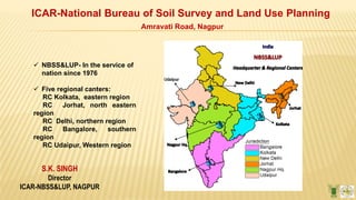
  • 1. S.K. SINGH Director ICAR-NBSS&LUP, NAGPUR ICAR-National Bureau of Soil Survey and Land Use Planning Amravati Road, Nagpur  NBSS&LUP- In the service of nation since 1976  Five regional canters: RC Kolkata, eastern region RC Jorhat, north eastern region RC Delhi, northern region RC Bangalore, southern region RC Udaipur, Western region
  • 2. 2 Mandate  To conduct soil survey and mapping of the soils of the country to promote scientific and optimal land use programmes in collaboration with relevant institutions and agencies.  To conduct and promote research in the National Agricultural Research System in the areas of Pedology, Soil survey, Remote sensing applications, Land degradation, Land evaluation and Land use planning.  To impart training and education to create awareness on soil and land resources and their state of health.
  • 3. 3 Landmark Achievement Soil Resource map of the country on 1:1 million scale and for the states on 1:250000 scale
  • 4.  Food security  Ecosystem services  Facility of Infrastructure  Industrialization Mountains 10.3% Hills 12.8% Plateaus 30.6% Desert 6.3% Coastal plains 4.8% Island 0.3% Eco-sensitive area o Food and water supply o Flood and disease control o Cultural services o Nutrient cycling Food Security Act, Land Acquisition Act, NREGA Pushing Agriculture on the back end LD: Harmonized data-120 mha; 64 mha arable land Estimating degradation
  • 5. Completed the Assessment of Soil Loss in India under Collaborative Project between NBSS&LUP and CSWCR &TI Soil Loss/Erosion Assessment in India 5 Class (t/ha/yr) % Area Very Slight (< 5) 30.16 Slight (5 – 10) 19.84 Moderate (10 – 15) 12.82 Mod.Severe (15 – 20) 6.97 Severe (20 – 40) 11.28 Very Severe (40 – 80) 6.76 Extr.Severe (> 80) 4.04 Others* 8.12 15 States reports have been printed
  • 7. 2017 Monitoring degradation : Wind erosion : Increasing sand load in the desert command area
  • 8. Extent of Degradation Slight: 29% Moderate: 30% Severe: 15% Very severe: <1% Monitoring environmental degradation
  • 9. Shifting River Case study- Bihar Heavy siltation and erosion Monitoring degradation
  • 10. Monitoring degradation: short and long term consequences on estuarine and coastal waves
  • 11. Monitoring degradation: Arsenic and fluoride contamination in West Bengal
  • 12. o Acidity is increasing in the flood plains of Bengal o Area under Multi-nutrient deficiency is increasing due to the intensification of agriculture Monitoring degradation: Multi-nutrient deficiency
  • 13. Monitoring climate change: Aridity Index 1992 2018
  • 14. 14 20 Agro-Ecological Regions (1992) 60 Agro-Ecological Sub-Regions (1999)
  • 15. Sub-humid moist, Humid Per-humid Aridity Revision of Agro-ecological Region Map  Reduced number of rainy days  Increased frequency of dry spells  Increased extreme events of rain, cold, storms…….. Degradation Vulnerability increased
  • 17. Assigning the reasons: Defined sustainable area for major crops and cropping sequences in India Wheat Rice Cotton
  • 18. 18 Current area Vs. Sustainable Area, Wheat
  • 19. Current area Vs. Sustainable Area, Rice
  • 20. Current area Vs. Sustainable Area, Rice
  • 21. Market based Land Use- The driver Lack of Land use based market Telangana, Andhra Pradesh and Tamilnadu- Maize area with support of poultry industry; cotton is being replaced Groundnut- Gujarat; Sugarcane- Maharashtra and U.P Bihar- Potential area for maize, lack of processing unit; farmers do not have interest Assigning the reasons for degradation
  • 22. Poverty and Degradation Schedule caste maximum in high productive soils and schedule tribe on Challenges
  • 23.  Sustainable agriculture includes sustainable area with the area specific best management practices (BMP) covering soil conservation measures for water harvesting in the rain-fed areas, the best water management in the irrigated areas and nutrient management in site specific mode.  Sustainable area (SA) is an uniform piece of land, potentially suitable for a crop and cropping sequence in terms of soil, water and climate, presently available for the defined use. Scale: National, Regional, State, district, village and farm Conceptualizing Sustainable Agriculture
  • 24. Total Food grains Agriculture can share the land for Infrastructure and Industry
  • 25. Attaining State of Degradation Neutral Sustainable Area with BMP
  • 26. Land Resource Inventory (LRI) at 1:10000 scales ( SA at Farm level) Integration of traditional soil survey and advancing remote sensing technology involving high resolution remote sensing data (RS), digital terrain model
  • 27. Assumption if landform, slope and land use are identical in a given geographic setting, there is high possibility for setting similar kinds of soils Attaching cadastral is optional Landscape Ecological Unit - A base map
  • 28. Base Map- Landscape Ecological Unit o New : Degree, length and curvature of slope together with contour and drainage o New information links LRI with soil water conservation planning, irrigation, water harvesting potentials and precision agriculture (IRS LISSS IV, Cartosat DEM, Geo Eye)
  • 29. Phases of soil series -mapped Soil Map
  • 30. Manipur Sikkim Characterization - degradation prone and Climate change vulnerable area- Hot spot Nagaland
  • 31. Characterization of Jhum land in north eastern region
  • 33. West Coast - Goa o State o District o Taluka o Panchayat wise map
  • 34. West Coast - Gujarat Districts Nos. of blocks covered Surat 10 Kutch 10 Junagadh 10 Valsad 6 Navsari 6 Bharuch 9 Ahmedabad 1 Banaskantha 1 Porbandar 3
  • 35. Soils of Kultuli block, 24 Paragana South, West Bengal Soil map of Basudevpur block, Bhadrak district, Odisha East Coast – West Bengal & Odisha
  • 36. Desert Ecosystem – Rajasthan
  • 37. Chhotanagpur Plateau District State Block Hazaribag Jharkhand 16 Sahibganj Jharkhand 9 Dumka Jharkhand 10
  • 38.  Leh  Lahul  Pangi The Cold Desert- Lahaul Block, Himachal Pradesh
  • 39. Tamil Nadu Annur Block, Coimbatore Veerapandi Block, Salem Rasipuram Block, Namakkal Gingee Block, Villupuram Thirumannur Block, Ariyalur R.S. Mangalam Block, Ramanathapuram Perambalur Block, Perambalur Uthanagarai Block, Krishnagirai Sarkar Samakulam Block, Coimbatore Valapadi Block, Salem Southern India Telangana Gajwel mandal, Medak Thimmajipet mandal, Mehboobnagar Indravelle mandal, Adilabad Garedapally mandal, Nalgonda Huzur Nagar mandal, Nalgonda Chilkur mandal, Nalgonda Andhra Pradesh Bukkarayasamudram mandal, Anantpur Kerala Iddukki block Soil map of Indervalle mandal, Adilabad district, Telangana
  • 41. LMU Description Present land use Suggested land use options Suggested management practices 1 Very deep, extremely acidic, fine soils on very steeply sloping high hills Rainfed upland paddy Forestry and natural vegetation Contour bunding, grassed waterways and allocation of land for natural vegetation 2 Very deep, extremely acidic, fine soils on steeply sloping high hills Rainfed upland paddy Rubber / tea / pineapple Land shaping, contour bunding, graded bunding and liming at every alternate year 3 Very deep, extremely acidic, fine soils on very steeply sloping medium hills Rainfed upland paddy Forestry and silvi- pastoral system Contour bunding, afforestation and silvi-pastoral system with multipurpose tree species 4 Very deep, extremely acidic, fine soils on strongly to steeply sloping medium hills Rainfed upland paddy Rubber / tea / pineapple Bench terracing, contour bunding and liming at every alternate year 5 Very deep, extremely acidic, very fine soils on moderately steeply sloping low hills Rainfed upland paddy Rubber / tea / pineapple Bench terracing, contour bunding, contour farming and liming at every alternate year 6 Very deep, very strongly acidic, fine loamy soils on moderately to strongly sloping low hills Rainfed upland paddy Upland paddy /Rubber / tea / pineapple / coffee Bench terracing and liming at every alternate year Mokokchaung district, Nagaland LUP: Intensification of jhum land through rubber plantations Area Specific Best Management Practices
  • 42. LMU Description Present land use Suggested land use options 1 Very deep, excessive to well drained, very strongly acidic, sandy loam to silty clay loam soils, moderate to severe erosion Rubber plantation  Rubber plantation  Inter-cropping with pineapple, ginger and turmeric for first three years. 2 Very deep, moderate to well drained, very strongly acidic, silty clay loam soils, slight erosion Kharif paddy / fallow  Paddy / maize – mustard / lentil / pea / groundnut  Summer green gram in water scarcity. 3 Deep, somewhat to poorly drained, strongly acidic, sandy clay loam to sandy clay soils, slight to moderate erosion Paddy – mustard / pea / lentil / winter vegetables / groundnut / paddy / fallow  No change, prefer medium duration HYV paddy varieties. 4 Deep to very deep, somewhat to poorly drained, strongly acidic, Paddy – lentil / pea / fallow  No change. Preference should be given to medium duration paddy varieties. Bishalgarh block, Sipahijila district, Tripura Ginger based processing units
  • 43. LMU Landform Crops and cropping systems 10 Restricted Summits/ High Hills Cashew +pineapple/ Kokum /Oil palm(Rainfed) Coconut+ Nut mug +Mango+ Areca nut+ Lemon+ Sapota+/ Turmeric (Rainfed) Vegetables like Chiili, Cluster bean, Brinjal, Tomato, Potato, Onion, Radish, Sweet potato (irrigated) 6 Undulating Lands  Rice (Kharif)- Vegetables like Chilli, Cluster bean, Guava, Brinjal, Tomato, potato, Onion, Radish, Sweet potato(rabi/ summer with irrigation)  Sugarcane, Oil palm,  Coconut + Areca nut +Pepper + Turmeric +Ginger + Pineapple ,  Coconut+ Banana+ Vegetables  Coconut+ Kokum+ Nut mug+ Sapota + Lemon 14 Inter-Hilly Basin/Valleys / Narrow valleys Rice- Rice-Rice Rice-Rice –Vegetables (in summer with protective irrigation) Rice – Vegetables on raised beds (brinjal, chilli, tomato, potato, cluster bean, okra, green leafy vegetables on raised beds in rabi/ summer with irrigation) Coconut + Areca nut + Pepper Coconut + turmeric/ginger Coconut + banana Cashew + pine apple/ Napier grasess (on bunds) Cashew, guava, mango, sapota  Protective cultivation of cut flower and archids and high value vegetables 19 Plains 23 Mudflats Rice, Coconut, Bajje (Acorus calamus) 25 Salt pans Coconut 26 Swamps and Marshes Rice and Bajje 27 Acid sulphate Plains Rice, Coconut and Kokum 1 Beach and Beach Ridges Coconut, Cashew, Areca nut Site Specific Information and Situation Specific Recommendations- Goa State
  • 44. Gajwel mandal : Medak district Telangana
  • 45. http://www.bhoomige oportal-nbsslup.in/ Digitalized soil and site information Our Visitors from India, China, USA, Canada, Europe, Australia and  LRIS Goa  Potential Crop Zone Mapper  Smart mobile phone for collecting Geo- referenced samples  Automated Land Evaluation system  Rubber information system  Digital soil library
  • 46. Monitoring of resources periodically using RS data Constant low values of NDVI as Proxy Indicator  Erosion  Organic carbon decline  Salinization  Compaction and land slides  Contamination  Sealing  Nutrient dynamics  Land use changes  Other threats
  • 47. Periodic monitoring of Prime Agricultural Land using MODIS data High constant value of NDVI as Proxy indicator- Prime land
  • 48. o Soil Health card o NAREGA o PMSKY o Neeranchal o PFBM o RKVY o Sujala o Jalyukt sivar o POCRA o Crop colony o Desiltation o Mera Goan mera Gauron o TSP o Kishan Portal o Soil Health card portal o National Agri-Market portal o Seednet India portal o Ensuring state funding for soil and water conservation plans through different Govt. Scheme enabling employment for landless, small and marginal farmers o Regulating subsidy on seeds, fertilizers- Diversification of agriculture with middle group farmers o Value added crops with large farmers Policy interventions Ensuring knowledge based agriculture Single window information
  • 49.
  • 50. India < Sri Lanka, China, Bangladesh, Afghanistan; Desert India < Desert of China, Africa; USA, Russia and Europe > Asian Countries Soil misuse or over exploitation- nutrient recycling Challenges
  • 51. Land Use Options for Basaltic terrain of Maharashtra – Warud model Soil water conservation together with Bt cotton in deep black soils; sorghum or deshi cotton on shallow soils
  • 52. Rice cultivation with community nursery - Gondia, Bhandara, Gadchiroli, Chandrapur (Community Nursery)
  • 53. Land Use Model – Mysore Plateau (Sujala)
  • 54. Land Use Model – Desert Command Area  Bajra- wheat  Bajra-mustard  Cotton-mustard  Bajra-gram
  • 55. Managing Coast of West Bengal with Land Shaping Technology
  • 56. Farm size Income Total man days created Before management After Management 0.20 ha Rs. 2300 Rs.34400.00 285 0.266 ha Rs. 3100 Rs. 47800.00 405 0.39 ha Rs. 4500 Rs. 68900,00 600 Reduced soil degradation, increased employment for the landless and improved social status of the farmers Up-scaling of site-specific soil-land use plan in the benchmark sites of National Land use Planning Land Use Plan for Coastal Region
  • 57. Land Use Model – Brahmaputra Plain
  • 58. 1. National Remote Sensing Centre, Hyderabad 2. BISAG, Gandhinagar, Gujarat 3. Department of Agriculture, Govt. of Telangana 4. Department of Agriculture, Govt. of Karnataka 5. Meghalaya Basin Development Authority, Meghalaya 6. Department of Agriculture, Govt. of Goa 7. Land Use Board, Agartala, Govt. of Tripura 8. Department of Agriculture, Govt. of Arunachal Pradesh 9. Neeranchal Project by DoLR – Maharashtra, Andhra Pradesh, Telangana, Jharkhand, Odisha, Chattisgarh, Madhya Pradesh, Gujarat, Rajasthan, Goa Collaborations (Land Resource Inventory)
  • 59. TECHNOLOGY USERS  KEC International Limited, Maharashtra for foundation of towers  Sterlite Tech. Ltd., Mumbai, Maharashtra for spreading optical fibers in India  Nagarjun Sagar Left Canal Command Area for division of Krishna river water between Andhra Pradesh and Telangana  AFRO for enhancing livelihood in Kelapur block, Yevatmal district  APMC precision agriculture for Nagpur block, Maharashtra  National Innovations on Climate Resilient Agriculture (NICRA)  Watershed Development Department, Karnataka (World bank Funded Project – Sujala)  Kerala State Land Use Board
  • 60. POTENTIAL USER  Govt. of Maharashtra for watershed development under Neeranchal Project  Govt. of Rajasthan for watershed development under Neeranchal project  National Dairy Development Board for fodder production in Vidarbha Region of Maharashtra  Project on Climate Resilient Agriculture in Maharashtra