LiDAR Market Set Explosive Growth to 2025
•
0 j'aime•37 vues

LiDAR or LADAR stands for ’Light Imaging, Detection, And Ranging’ or ’Light Detection And Ranging’. It is a surveying technique that calculates the distance to targeted objects by illuminating them using laser light. It is commonly used for making high-resolution maps and has several applications in geomatics, geodesy, archaeology, geology, and geography.

Recommandé
Recommandé
Contenu connexe
Similaire à LiDAR Market Set Explosive Growth to 2025
Similaire à LiDAR Market Set Explosive Growth to 2025 (20)
Dernier
Dernier (20)
LiDAR Market Set Explosive Growth to 2025
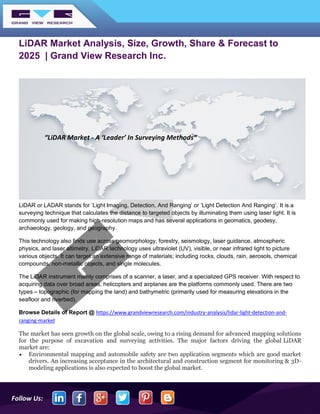
- 1. Follow Us: LiDAR Market Analysis, Size, Growth, Share & Forecast to 2025 | Grand View Research Inc. LiDAR or LADAR stands for ’Light Imaging, Detection, And Ranging’ or ’Light Detection And Ranging’. It is a surveying technique that calculates the distance to targeted objects by illuminating them using laser light. It is commonly used for making high-resolution maps and has several applications in geomatics, geodesy, archaeology, geology, and geography. This technology also finds use across geomorphology, forestry, seismology, laser guidance, atmospheric physics, and laser altimetry. LiDAR technology uses ultraviolet (UV), visible, or near infrared light to picture various objects. It can target an extensive range of materials; including rocks, clouds, rain, aerosols, chemical compounds, non-metallic objects, and single molecules. The LiDAR instrument mainly comprises of a scanner, a laser, and a specialized GPS receiver. With respect to acquiring data over broad areas, helicopters and airplanes are the platforms commonly used. There are two types – topographic (for mapping the land) and bathymetric (primarily used for measuring elevations in the seafloor and riverbed). Browse Details of Report @ https://www.grandviewresearch.com/industry-analysis/lidar-light-detection-and- ranging-market The market has seen growth on the global scale, owing to a rising demand for advanced mapping solutions for the purpose of excavation and surveying activities. The major factors driving the global LiDAR market are: • Environmental mapping and automobile safety are two application segments which are good market drivers. An increasing acceptance in the architectural and construction segment for monitoring & 3D- modeling applications is also expected to boost the global market. “LiDAR Market - A ‘Leader’ In Surveying Methods”
- 2. Follow Us: • Maintenance and inspection of power lines is also expected to drive the market, as the LiDAR technology helps in identifying issues with them through use of UAVs, which ensures timely assessment of the problems. • LiDAR finds an important usage in agriculture and forestry, as surveys through their use can help determine the best ways to increase crop productivity, along with helping officials determine the impact of human activities on forests. This again is a major factor driving growth of the market. • LiDAR finds usage in mining applications, as it can determine material volumes in open pit mines, thus cutting down on time, cost, as well as exposure to risks. • Future transportation infrastructural plans can also be generated using LiDAR technology, as drones can provide scans of different areas to assist city planners with the blueprint of mass transit systems. With the developing and developed economies looking towards creating smart cities, the market is expected to receive a huge boost. Some of the major products to have come out in the past few years include HYPACK’s NEXUS 800 UAV, which offers data acquisition solutions, LiDAR survey planning, post-processing, and analysis & product creation; as well as the ‘Leddar’ system, developed by ‘LeddarTech’ for the automobiles industry. The global market has some very important players such as: • Velodyne LiDAR, Inc. • Leica Geosystems Holdings AG • Faro Technologies Inc. • Trimble Navigation Limited, and • RIEGL USA Inc. Some of the most recent developments to have taken place in the market include: • In October 2019, SAM, LLC. announced that it would be the first North American company to acquire and deploy the RIEGL VQ-1560 II dual channel waveform processing airborne LiDAR scanning system. The sensor would be installed in the 2019 Cessna Grand Caravan EX, the new fixed-wing aircraft by SAM, thus enhancing its national aerial mapping capabilities. While the system was introduced in September 2019, SAM is targeting the first quarter of 2020 for its deployment in the Cessna. • In September 2019, VSI Labs, the autonomous vehicle research firm, took a three-member team on a thousand-mile journey, from Minneapolis to Washington D.C. The adventure, known as the ‘Automated Drive East’, made use of the Trimble RTX, which is Trimble’s precise point positioning (PPP) technology. The members departed for the journey in an automated 2018 Ford Fusion. • In September 2019, Leica Geosystems announced a huge improvement in the efficiency of their airborne urban mapping solution by introducing the Leica CityMapper-2, which provides efficient and fast city digitization. The system is available in 2 configurations for standard and high-altitude flights, in order to cater to customer needs as well as local flight regulations. • In October 2018, Faro Technologies joined hands with STORMBEE®, which champions Mobile UAV technology, to develop a cost-effective, integrated airborne 3D scanning solution for gathering data from large areas for the purpose of crash scene documentation, security pre-planning and military applications. The system comprises of FARO Focus laser scanner, STORMBEE S series UAV and BEEFLEX software suite.
- 3. Follow Us: About Grand View Research, Inc.: Grand View Research, Inc. is a U.S. based market research and consulting company, registered in the State of California and headquartered in San Francisco. The company provides syndicated research reports, customized research reports, and consulting services. To help clients make informed business decisions, the company offers market intelligence studies ensuring relevant and fact-based research across a range of industries including technology, chemicals, materials, healthcare and energy. Contact: Sherry James Corporate Sales Specialist, USA Grand View Research, Inc Phone: 1-415- 349-0058 Toll Free: 1-888- 202-9519 Email: sales@grandviewresearch.com For More Information: http://www.grandviewresearch.com