1. ORIGINAL PAPER
Projected impacts of land use and road network changes
on increasing flood hazards using a 4D GIS: A case study
in Makkah metropolitan area, Saudi Arabia
Gomaa M. Dawod & Meraj N. Mirza &
Khaled A. Al-Ghamdi & Ramze A. Elzahrany
Received: 28 November 2012 /Accepted: 25 January 2013 /Published online: 14 February 2013
# Saudi Society for Geosciences 2013
Abstract Makkah City, west of the Kingdom of Saudi Arabia,
is considered the third main highly populated metropolitan area
in the Kingdom of Saudi Arabia. It exhibits two unique features
that increase the hazardous flood consequences: (1) its topog-
raphy is very complex and (2) about three million Muslims are
gathered annually in Makkah to perform Hajj over a 2-week
period. Floods are natural returning hydrological phenomena
that have been affecting human lives. The objectives of the
current study are: (1) identification of land use types and road
networks in Makkah, (2) hydrological modeling of flood char-
acteristics in Makkah based on precise up-to-date databases, (3)
examination of the relationship between land use, land cover
changes, transportation network expansion, and the floods'
prosperities and hazards, and (4) development of digital hydro-
logical maps for present and near future flood hazards in
Makkah. The attained results show that the mean runoff depth
and the total flood volume are significantly increased from
2010 to 2030. Additionally, it has been found that a great part
of the road network in Makkah City is subjected to high
dangerous flood impacts. The overall length of flood danger-
factor roads is increased from 481 km (with almost 37 %) to
1,398 km (with 74 % approximately) between 2010 and 2030.
Thus, it is concluded that urbanization has a direct strong
relationship with flood hazards. Consequently, it is recommen-
ded that the attained results should be taken into account by
decision makers in implementing new development planning
of the Makkah metropolitan area.
Keywords Flood management . Road networks .
Urbanization . GIS . Makkah
Introduction
Flash floods occur periodically in Makkah City, Saudi Arabia,
due to several factors including its rugged topography and
geological structures. Hazards of flash floods are vital in terms
of human lives lost and economical damages. Hence, precise
assessment of floods becomes a more vital demand in devel-
opment planning (e.g., Subyani et al. 2010; Fred and Mostafa
2008). A Geographic Information System (GIS)-based meth-
odology has been already developed to quantify and spatially
map the flood characteristics (Dawod et al. 2011a). Utilization
of a precise Digital Elevation Model (DEM) enables precise
flood modeling in Makkah (Mirza et al. 2011a, b, c). Simple
rainfall-runoff models (e.g., Snyder and regression models)
did not take into account important parameters particularly the
land use and land cover of the catchment area. Land use plays
a central role in flood runoff and, consequently, in flood
hazardous impacts. Generally, flood runoff reacts differently
with respect to land covers and road network locations. Global
and national flood modeling methodologies implicitly take
into account the types of land use in the catchment area. One
of the most popular flood model is the US National Resources
Conservation Services (NRCS) curve number (CN), which
has been applied globally for flood modeling (e.g., Chen et al.
2010; Mojaddadi et al. 2009).
The relationship between land use changes, road network
expansion, and the increase of flood hazards has been inves-
tigated by a number of researchers. This issue may not have
acquired the necessary awareness in Saudi Arabia although it
is considered a major subject in hydrological and environmen-
tal planning, and many governmental organizations, in several
countries, have focused on that dilemma. For example, re-
search studies and practical projects have been carried out in:
the USA (e.g., Wang et al. 2010; Sheng and Wilson 2009),
France (e.g., Paquier 2010), and New Zeeland (e.g., Hansford
2010). Consequently, land use and road networks are
G. M. Dawod (*) :M. N. Mirza :K. A. Al-Ghamdi :
R. A. Elzahrany
Technology Innovation Center on Geographic Information
Systems, Umm Al-Qura University, Makkah, Saudi Arabia
e-mail: dawod_gomaa@yahoo.com
Arab J Geosci (2014) 7:1139–1156
DOI 10.1007/s12517-013-0876-7
2. key factors affecting flood runoff volume and path (e.g.,
Sherief 2008).
Regarding the influences of land cover changes on flood
peak discharge, Olang and Furst (2011) have studied the
impacts of historical land cover changes witnessed between
1973 and 2000 on the hydrologic response of the Nyando
river basin in Kenya. Physically based parameters of the
models were estimated from the land cover change maps
together with a digital elevation model and soil datasets of
the basin. Results revealed significant and varying increases
in the runoff peak discharges and volumes within the basin.
A similar study has investigated the land use/flood dilemma
in India, but from a different perspective (Kar et al. 2009).
That research aimed to study the morphometric and hydro-
logical properties of a watershed and tried to get benefits of
those properties in enhancing land use sustainable planning.
Other investigations have focused on the assessment of land
uses and also population distribution on hydrological sec-
tion properties. An approach was developed to quantify the
landscape alterations resulting from human disturbances
(e.g., urbanization, agriculture, roads, and population) on
lake conditions in Michigan state, USA (Wang et al.
2010). More recently, the relationship between urbanization
and flood hazards has been investigated extensively utiliz-
ing geomatics technologies particularly the GIS. Amini et al.
(2011) concluded that land cover deterioration has increased
the flood peak by up to 26.7 % in the Damansara water-
sheds, Malaysia. Similar results reveal that increasing de-
velopment (in Los Angeles, CA, USA) increases total
annual runoff and decreases groundwater recharge during
both dry and wet seasons (He and Hogue 2011). Also, a
special flood warning system is proposed for road networks
in particular (e.g., Versini et al. 2010).
Based on results of related investigations worldwide, it can
be concluded that inspecting the impacts of land use changes
and road network expansion on flood hazards in Makkah
metropolitan area becomes an obligation. It is worth mention-
ing that the metropolitan extent of Makkah City has been
increased from 4,800 ha in 1983 to 9,457 ha in 2004 (Mirza
2009). Also, new circular highways and metro lines are
planned in Makkah. Hence, the growing urbanization rate in
Makkah nowadays emphasizes the necessity for conducting a
scientific project, utilizing recent technical tools and models,
to quantify the expected flood hazard increase in the present
and near future, particularly in the holy shrines. This study
will be the first of its kind to be carried out not just in Makkah
City, but in the entire Saudi Arabia.
Study area
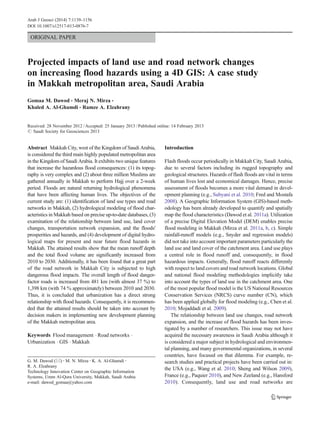
Makkah City is located in the southwest part of the Kingdom
of Saudi Arabia, about 80 km east of the Red Sea (Fig. 1). The
current area of the metropolitan region (the study area)
extends about 37 km in the north and 43 km in the east; thus,
it equals approximately 1,600 km2
. It extends from longitudes
39°35′E to 40°0′E, and from latitudes 21°15′N to 21°35′N.
Makkah City is a unique city for Muslims all over the world,
since it contains the holy mosque. From a religious point of
view, a Muslim should perform pilgrimage (called Hajj, which
means visiting Makkah in specific days in the year) once in
his/her life. Thus, hundreds of thousands of Muslims are
gathered in Makkah yearly. Moreover, the topography of
Makkah is complex in nature, and several mountainous areas
exist inside its metropolitan area. That is also a vital element in
investigating the spatial pattern of Makkah sprawl.
Fig. 1 Makkah City
1140 Arab J Geosci (2014) 7:1139–1156
3. Makkah's hydrology
It is worth mentioning that the southwest part of the Kingdom
of Saudi Arabia contains almost 60 % of the volume of wadi
flow, particularly in the terrain situated between the Red Sea
coast and the adjacent mountains. The annual rain over
Makkah City, for a period extending from 1966 to 2010,
varies from 3.8 to 318.5 mm, with the average rainfall equal
to 102.6 mm (Fig. 2). Due to the complexity of Makkah's
topography, flash floods occur periodically with significant
variations in magnitude. Mirza and Ahmed (2001) have
reported that the extreme flood type is repeated with a return
period of 46 years, while a second-order flood takes place
occasionally with a return period of 33 years, and a low-
dangerous flood comes about every 13 years.
Makkah's topography
The topography of the Makkah metropolitan area is com-
plex, where several mountainous regions exist within the
urban boundaries of the city. Terrain heights in Makkah
(Fig. 3) range from 82 to 982 m above sea level (Mirza et
al. 2011a, b, c). The highest mountains in Makkah City are:
Al-Tarki (987 m), Ahdaab (919 m), Thabeer (814 m), Thour
(719 m), and Al-Noor mountain (620 m). Dividing
Makkah's heights in groups (Table 1), it can be realized that
81.8 % of the heights are less than 400 m. In the second
group, heights range from 400 to 600 m and occupy 17 % of
Makkah's area, while 1.1 % has heights ranging from 600 to
800 m. The highest area, with values greater than 800 m,
only occupies 0.1 % of Makkah City. Distributions of the
topography slopes in Makkah City are also depicted in
Fig. 4 and tabulated in Table 2. It can be noticed that about
80 % of Makkah territories have smart slopes of less than
10°, while 0.9 % of the study area represents hilly regions of
slopes greater than 30°.
It is known that the growth in Makkah City spreads out
along the valleys and stays away from the mountainous
areas for economical reasons. It is worth mentioning that
almost 50 % of Makkah's geology contains igneous rocks,
mainly granite, that massively increase the development
costs in mountainous areas.
Fig. 2 Annual rains in Makkah City from 1966 to 2010
Fig. 3 Topography of Makkah
City
Arab J Geosci (2014) 7:1139–1156 1141
4. Makkah's geology
The geology of Makkah metropolitan area consists mainly
of three geological structures (Fig. 5 and Table 3). The
Precambrian igneous rocks occupy about 809 km2
(with
51 % approximately of the total area). Those rocks implic-
itly imply a low-permeability property that increases the
ability of rainfall to be converted into dangerous surface
runoff. The deposits, or wadi alluvium, exist mainly along
the wadi streams and constitute about 48 %, with an area
equal to 770 km2
approximately. The rest of Makkah area,
about 12 km2
only, represents the tripartite rocks.
Available data
The collected databases consist of several data sets of dif-
ferent types, sources, and dates. They include:
& The spatial urban compiled datasets constituting two
categories:
– The first element consists of 105 cadastral maps in
AutoCAD files for 1990.
– The second constituent consists of a land use map
developed by the Saudi Geological Survey Authority
dated 2010.
– The third category contains detailed cadastral maps
that describe the future Makkah land use and road
network in 1,450 H (HAMDD 2004).
& A national 5-m-resolution DEM for the study area has
been obtained from the King Abdulaziz City of Sciences
and Technology.
& A set of 1:50,000 topographic maps, produced by the
Military Survey Department, Ministry of Defense and
Aviation.
& A set of 1:50,000 geological maps, produced by the
Saudi Geological Survey Authority.
& A set of Ikonos and Quick-Bird high-resolution satellite
images.
& A hydrological database obtained from Institute of Hajj
and Omrah, Umm Al-Qura University.
Fig. 4 Terrain slopes of
Makkah City
Table 2 Makkah slope
categories Slope (°) Area (%)
Less than 10° 79.7
From 10 to 20° 15.7
From 20 to 30° 3.7
Greater than 30° 0.9
Table 1 Makkah height
categories Heights in meters
(above mean sea level)
Area (%)
Less than 400 m 81.8
From 400 to 600 m 17.0
From 600 to 800 m 1.1
Greater than 800 m 0.1
1142 Arab J Geosci (2014) 7:1139–1156
5. Methodology and data processing
Accurate estimation of flood characteristics in Makkah metro-
politan area is a vital demand in planning and resources man-
agement. The different collected datasets have been manipulated
and stored in a digital form after unifying their geographic
datums and coordinate systems. In order to extract the hydro-
logical catchments in Makkah City, a morphometric analysis has
been performed and utilized as an input step for flood estima-
tion. Then, a unique GIS system has been built for quantifying
and spatial mapping of flood hazards in Makkah in past, present,
and future scenarios. Impacts of urban growth and flood hazard
increase on the road networks in Makkah have been determined.
The following sections describe, in detail, the utilized method-
ology and the procedures applied in data processing.
Building a unique 4D GIS
The developed GIS-based flood assessment methodology con-
sists of several stages. The Arc GIS software (v. 10), along with
the Arc Hydro extension, has been used in the present study to
combine all obtainable data in a unique environment. The
processing phase includes (Fig. 6): rectifying the printed maps,
digitizing two shapefiles for residential areas and roads for each
dataset, converting AutoCAD files to GIS shapefiles, unifying
the spatial reference frames for all datasets, performing statis-
tical and spatial analyses, and flood computations (Al-Ghamdi
et al. 2012b). The Arc GIS software has been used to obtain
several shapefiles describing the geomorphology of the study
area. These shapefiles include: the main basins and the sub-
basins of each main catchment, along with drainage network
using the Strahler method (a simple widely utilized network
order method), and the longest stream path in each catchment.
The second stage of the developed methodology is based on the
flood assessment method developed by the NRCS, formerly
known as the Soil Conservation Service. Processing steps, and
hence attained results, have been performed for past (1990),
present (2010), and future (2030) scenarios.
Urban growth data processing
Shapefiles of residential areas, within Makkah City, for 1990,
2010, and 2030 have been developed and integrated in a GIS
project. Surface areas have been computed and compared for
the three dates, and growth rates have been obtained. Spatial
statistics tools, in the Arc Tool Box component of the Arc GIS
software, have been performed in order to investigate the spatial
pattern of Makkah sprawl. Applying GIS spatial analysis tools
produces more valuable pieces of information. Measuring the
compactness of a distribution provides a single value represent-
ing the dispersion of features around the center (Al-Ghamdi et
al. 2012a). The available national 5-m-resolution DEM
describes the rigid topography of Makkah metropolitan area.
Several mountainous areas exist within Makkah City and affect
the spatial urban growth location and direction. Thus, the resi-
dential areas' layers have been compared against the DEM layer
Fig. 5 Geology of Makkah
City
Table 3 Makkah geological categories
Geological structure Area (km2
) Area (%)
Precambrian igneous rocks 809 50.8
Wadi alluvium 770 48.4
Tripartite rocks 12 0.8
Arab J Geosci (2014) 7:1139–1156 1143
6. in order to investigate the topography–urban development rela-
tionship. Additionally, residential areas' layers have been com-
pared against the road network's layer in order to determine the
relationship between urban growth and roads in the three sce-
narios under investigation. A similar task has been carried out,
also, to define the relationship between urban expansion and the
geology structures of the study area.
Flood data processing
First, analyzing the flood series frequency, the return period
or recurrence interval can be computed. That period defines
the average number of years during which a flood of a given
magnitude will be equalled or exceeded once. The Welbull
method, among several other formulas, computes the return
period T as (Raghunath 2006):
T ¼ n þ 1
ð Þ m
= ð1Þ
where n is the number of events or number of records, and m
is the order or rank of the event (flood item) when flood
magnitudes are ranked in descending order.
The computed return period of the 1969 flood has been
estimated to be 45 years. That piece of information is quite
helpful in flood assessment studies, as it means that: (a) flood
magnitude is expected to occur by about 2014, and (b) the
selected return period value for flood management projects
should be equal or greater than 44 years. The rainfall intensity
for a 50-year return period has been estimated, through the log
Pearson II statistical method, as 200 mm/h.
The CN has been determined for each sub-basin in each
scenario (1990, 2010, and 2030) based on the available soil
and geological digital databases of Makkah metropolitan
area. Dawod et al. (2011b) has performed a comparison
study of several flood estimation techniques and concluded
that the CN is the optimum one. Then, flood characteristics
have been computed through Eq. 2, using VBA in the GIS
environment. Additionally, the total flood volume of a basin
is computed as:
QT ¼ QA ð2Þ
where Q is the depth of direct runoff (in millimeter), QT is
the volume of runoff (in cubic millimeter), and A is the area
of the basin (in square kilometer).
Road network data processing
Regarding flood impacts on roads, some researchers have
investigated this aspect in several countries. Blanton and
Fig. 6 The developed GIS-
based flood assessment
approach
1144 Arab J Geosci (2014) 7:1139–1156
7. Marcus (2009) have documented the geographic distribution
of roads and railroads in the alluvial floodplains of the
continental USA and the regional variability of their poten-
tial impacts on lateral connectivity and resultant channel and
floodplain structure and function. Youssef et al. (2010) have
presented the utilization of remote sensing data, Shuttle
Radar Topography Mission, coupled with geological, geo-
morphological, and field data in a GIS environment for the
estimation of the flash flood risk along the Feiran–Katherine
road, southern Sinai, Egypt. However, those two studies are
based on flood hazard estimation by analyzing morphomet-
ric characteristics of basins in which roads exist. That means
that the flash floods themselves have not been estimated. In
the current paper, a GIS has been developed to quantify
flood characteristics in Makkah City and then estimate dan-
gerous impacts on the road network.
Next, an estimation has been developed to quantify flood
impacts on roads. It is implicitly based on an idea that the
higher the runoff depth in a sub-basin, the more hazards on
roads within that sub-basin. Since the flood computations
have been performed on a sub-basin level, the runoff depth
of each sub-basin may be considered as the most effectual
factor that affects the flood impact. Hence, the spatial anal-
ysis tools of the Arc GIS software are utilized to re-classify
runoff depths in ten categories, and each category is
assigned a unique number. That number, called the hazard,
or danger, factor, will be assigned to the road existing in a
particular sub-basin. By this approach, each road in the
transportation network gets a unique hazard factor (in each
scenario) that represents the flood hazard level.
Results and discussion
Several datasets have been compiled, processed, and analyzed
in the current research study dealing with urban growth and
flood hazard increase in Makkah City. The attained results can
be divided in three main groups: (1) results of urbanization,
(2) results of flood hazards, and (3) results of flood impacts on
the road network. The results are presented in the next sections
according to this classification.
Results of urban growth
For the first results' category, shapefiles of Makkah metro-
politan area for 1990, 2010, and 2030 have been integrated
in a GIS project (Fig. 7). Table 4 shows that the total
residential area has been computed and found to be
80.012, 158.583, and 690.007 km2
for 1990, 2010, and
2030, respectively. Thus, the residential areas in Makkah
City have grown by about 98 % from 1990 to 2010 (with
4.9 % annual rate) and are expected to have grown by about
335 % from 2010 to 2030.
Table 4 Urban growth of Makkah City between 1990 and 2030
Year Area (km2
) Difference (km2
) Difference (%) Annual
growth (%)
1990 80.012
2010 158.583 78.571 98 4.9
2030 690.007 531.424 335 16.8
Fig. 7 Urban growth of
Makkah City between 1990 and
2030
Arab J Geosci (2014) 7:1139–1156 1145
8. It can be realized from Fig. 7 that the urban growth in
Makkah City takes a radial (or spoke) pattern. That is
logically understood knowing that the holy mosque is con-
sidered the center of the city, and the central area around it
Fig. 9 Main roads in Makkah City
Fig. 8 Topography of
residential areas in Makkah
City
1146 Arab J Geosci (2014) 7:1139–1156
9. has the highest population density since residents and pil-
grims prefer to stay close to this holy mosque.
The available national 5-m-resolution DEM describes the
rigid topography of Makkah metropolitan area. Several moun-
tainous areas exist within Makkah City and affect the spatial
urban growth location and direction. Figure 8 depicts the to-
pography of Makkah as divided into four categories. It can be
seen that the urban sprawl mainly exists in low- and moderate-
elevation regions. The growth spreads out along the valleys and
stays away from the mountainous areas for economical reasons.
It is worth mentioning that almost 50 % of Makkah's geology
contains igneous rocks, mainly granite, that massively increase
the development costs in mountainous areas.
Concerning the road network, it is worth mentioning that
Makkah has six regional highways that connect it to a major
Saudi city (Fig. 9). These roads are: Makkah–Madinah road
(427 km), Makkah–Riyadh road (880 km), Makkah–Taif road
(88 km), Makkah–Laith road (180 km), and two Makkah–
Jeddah roads (78 km). Inspecting both Figs. 7 and 9, it can
be concluded that the urban sprawl of Makkah City follows
those regional roads. In the first phase (1990–210), urban
development has been intensive mostly along Makkah–
Riyadh and Makkah–Madinah roads. That growth leads to
the creation of new districts in Makkah City, such as:
Sharee'h, Sharee'h Al Mojahdeen, Al Rashdia, and Al-
Khadraa at the northeast corner, and Omraa, Nowaria, and Al
Bohayrat at the north corner of Makkah (Fig. 10). That con-
clusion consents with the values of the rotation angles of the
standard deviational ellipses as argued earlier.
Results of flood hazard increase
The second results' group concerns the estimation of flood
hazards in Makkah City. Six main hydrological basins have
been identified in the study area, with areas ranging from 74.3
to 360.6 km2
and lengths of their main streams varying from
16.50 to 48.55 km (Fig. 11). Table 5 presents the statistics of
hydrological parameters of these basins (Koshak and Dawod
2011). Sixty sub-basins have been recognized within these six
basins (Fig. 12). The NRCS method has been performed for
the available data of Makkah metropolitan area to compute the
peak discharge value for the six basins for the 1990, 2010, and
Fig. 10 New districts within Makkah City
Arab J Geosci (2014) 7:1139–1156 1147
10. 2030 datasets. The return period has been chosen, herein, as
50 years, for which the rainfall intensity has been estimated,
by applying the log Pearson III statistical analysis, as
200 mm/h. The total flood volumes have been computed on
the sub-basin scale, only for those sub-basins which contain
residential areas. A total of 76 sub-basins, which include
residential areas in 1990, have been identified within the study
area. These sub-basins extended over an area of 194.726 km2
,
which constitutes 17.5 % of the total area of the main hydro-
logical basins in the study area. In 2010, the urban areas have
been extended to cover 136 sub-basins, whose total areas
equal 400.551 km2
. In 2030, it is expected that the urban
extent of Makkah City will cover 264 sub-basins with an
overall area of 780.388 km2
.
Regarding the runoff depth over the urban sub-basins, it
has been found that its mean value has been increased from
165.3 mm in 1990 to 185.7 mm in 2030 (Figs. 13, 14, and 15).
However, the most dangerous flood impact is the total flood
volume (Figs. 16, 17, and 18). It has been found that the total
flood volume (for urban sub-basins) equals 31.6, 64.6, and
141.9 millionm3
for 1990, 2010, and 2030, respectively.
Hence, it is concluded that the augmentation of the total flood
volume has been increased by almost 104 % from 1990 to
2010, and by almost 120 % from 2010 to 2030.
Table 5 Statistics of floods over
residential areas in 1990 and
2010
Item 1990 2010 2030
Number of sub-basins containing residential areas 76 136 264
Total area of sub-basins of residential areas (km2
) 194.725 400.551 780.388
Percentage of these sub-basins' area to main basins' area 17.5 % 36.0 % 70.2 %
Minimum CN of these sub-basins 76 76 76
Maximum CN of these sub-basins 98 98 98
Mean CN of these sub-basins 88.5 88.5 95.3
Minimum runoff depth of these sub-basins (mm) 122.3 128.1 128.1
Maximum runoff depth of these sub-basins (mm) 193.9 193.9 193.9
Mean runoff depth of these sub-basins (mm) 165.3 165.3 185.7
Total flood volumes in these sub-basins (million m3
) 31.632 64.620 141.945
Fig. 11 The main basins in the Makkah metropolitan area
1148 Arab J Geosci (2014) 7:1139–1156
11. Fig. 12 The sub-basins in the Makkah metropolitan area
Fig. 13 Runoff depth in 1990
Arab J Geosci (2014) 7:1139–1156 1149
12. Fig. 14 Runoff depth in 2010
Fig. 15 Runoff depth in 2030
1150 Arab J Geosci (2014) 7:1139–1156
13. Fig. 16 Flood volume in 1990
Fig. 17 Flood volume in 2010
Arab J Geosci (2014) 7:1139–1156 1151
14. Results of flood impacts on road network
Regarding the flood impacts on roads, two shapefiles have
been constructed containing the road network of Makkah
City in 2010 and 2030. It was decided to work with main roads
only, whose lengths are greater than 1,000 m, just for simplicity
in the current research. So, that road network, in 2010, consists
of 566 roads whose lengths range from 1.004 to 20.531 km,
with a mean of 2.311 km. The Arc GIS spatial analysis tools
have been utilized to: (a) divide the sub-basins' runoff depth
into ten groups using the equal-interval classification method;
(b) re-classify those flood depth groups to unique label values
ranging from 1 to 10, just for simplicity, which will be consid-
ered as the hazard factor; (c) convert that shapefile into a raster
format; and (d) project that raster onto the road network in order
to assign each road with the corresponding unique hazard
factor. By this approach, the flood hazard impact on each road
is assigned on a scale from 1 to 10 (based on the runoff depth
for the corresponding sub-basin), which is a simple scale to be
interpreted. This quantitative classification is presented in
Table 6 and depicted in Fig. 19. Next, the flood hazards on
roads have been classified into three groups, just for simplicity
too, as seen in Table 6 and Fig. 20. Obviously, a great part of the
road network in Makkah City is subjected to high dangerous
flood impacts. That category constitutes 211 roads, represent-
ing 37 % of the network, with a total length of 481 km. It is
worth noticing that roads of high flood impacts exist in the holy
shrines particularly in the Arafat area. That finding is quite
important and strongly necessitates the development of a spe-
cific surface water drainage network in this area to avoid flood
hazards during the Hajj season.
Secondly, the same procedures have been performed on the
future road networks of Makkah City in 2030. Again, it was
Fig. 18 Flood volume in 2030
Table 6 Categories of flood hazard on road network in Makkah City
in 2010
Hazard
category
Hazard
factor
No. of
roads
Total length
of roads (km)
Percentage
of road length
Low 1–4 171 429.242 32.8 %
Medium 5–7 184 397.79 30.4 %
High 8–10 211 481.226 36.8 %
Fig. 19 Flood hazard categories on road network in Makkah City in 2010
1152 Arab J Geosci (2014) 7:1139–1156
15. decided to work with main roads only, whose lengths are
greater than 1,000 m, just for simplicity in the current re-
search. That road network consists of 705 roads whose lengths
range from 1.004 to 23.70 km, with a mean of 2.691 km. The
attained quantities of danger factor on roads are presented in
Table 7 and depicted in Fig. 21. Additionally, the flood haz-
ards on roads have been classified into three groups, as seen in
Table 7 and Fig. 22. It is concluded that a major part of the
road network in Makkah City, in 2030, is subjected to high
dangerous flood impacts. That category constitutes 563 roads,
representing 74 % of the network, with a total length of
1,398 km. Again, it is noticed that roads of high flood impacts
exist in the holy shrines particularly in the Arafat area. That
finding is quite important and strongly necessitates the devel-
opment of a specific surface water drainage network in this
area to avoid flood hazards during the Hajj season.
Comparing Tables 6 and 7, it can be noticed that there is a
significant increase in the flood impacts on Makkah's road
networks between 2010 and 2030. The overall length of flood
danger-factor roads is increased from 481 km (with almost
37 %) to 1,398 km (with 74 % approximately). The main
reason is the huge expected urban development of the city from
2010 to 2030, where the urban boundaries of Makkah will
increase from 158 to 690 km2
. As a matter of fact, urbanization
has a direct strong relationship with the flood hazards (Fig. 23).
Urbanization leads to changing the land use of a region,
changes its geological characteristics, and decreases its ability
to absorb surface water which, in turn, increases the surface
water runoff. Hence, it is concluded that the current surface
water drainage network in Makkah City should be re-
evaluated, in terms of its capacity and spatial distribution, in
order to cope with the expected flood hazards in 2030.
Conclusions and recommendations
The current research study aims to: (1) identify land use types
and road networks in Makkah, through recent high-resolution
multi-band satellite images, and prepare corresponding digital
maps; (2) perform hydrological modeling of flood character-
istics in Makkah based on precise up-to-date metrological,
geological, and topographic datasets; (3) build 4D geographic,
topographic, geological, metrological, and hydrological digi-
tal databases for Makkah; (4) examine the relationship be-
tween land use, land cover changes, transportation network
expansion, and the floods' prosperities and hazards, and (5)
Fig. 20 Flood hazards on road
network in Makkah City in
2010
Table 7 Categories of flood hazard on road network in Makkah City
in 2030
Hazard
category
Hazard
factor
No. of
roads
Total length
of roads (km)
Percentage
of road length
Low 1–4 71 271.355 14.3 %
Medium 5–7 69 228.329 12.0 %
High 8–10 563 1,397.964 73.7 %
Fig. 21 Flood hazard categories on road network in Makkah City in 2030
Arab J Geosci (2014) 7:1139–1156 1153
16. develop digital hydrological maps for present and near future
flood hazards in Makkah.
The main findings of the study are:
& The urban sprawl mainly exists in low- and moderate-
elevation regions. The growth spreads out along the
valleys and stays away from the mountainous areas for
economical reasons. Almost 50 % of Makkah's geology
contains igneous rocks, mainly granite, that massively
increase the development costs in mountainous areas.
& Six main hydrological basins have been identified in the
study area, with areas ranging from 74.3 to 360.6 km2
and
lengths of their main streams varying from 16.50 to
48.55 km. A number of 60 sub-basins have been recog-
nized within these six basins. A total of 76 sub-basins,
which include residential areas in 1990, have been identi-
fied within the study area. These sub-basins extended over
an area of 194.726 km2
, which constitute 17.5 % of the
total area of the main hydrological basins in the study area.
In 2010, the urban areas have been extended to cover 136
sub-basins, whose total areas equal 400.551 km2
. In 2030,
it is expected that the urban extent of Makkah City will
cover 264 sub-basins with an overall area of 780.388 km2
.
& The mean runoff depth has been increased from 165.3 mm
in 1990 to 185.7 mm in 2030. The total flood volume (for
urban sub-basins) equals 31.6, 64.6, and 141.9 millionm3
for 1990, 2010, and 2030, respectively. The augmentation
of the total flood volume has been increased by almost
104 % from 1990 to 2010, and by almost 120 % from
2010 to 2030.
& A great part of the road network in Makkah City is
subjected to high dangerous flood impacts. That catego-
ry constitutes 211 roads, representing 37 % of the net-
work, with a total length of 481 km. Those roads of high
flood impacts exist in the holy shrines particularly in the
Arafat area. The future road network of Makkah City in
2030 consists of 705 roads whose lengths range from
1.004 to 23.70 km, with a mean of 2.691 km. A major
part of the road network in Makkah City, in 2030, is
subjected to high dangerous flood impacts. That catego-
ry constitutes 563 roads, representing 74 % of the net-
work, with a total length of 1,398 km.
& There is a significant increase in the flood impacts on
Makkah's road networks between 2010 and 2030. The
overall length of flood danger-factor roads is increased
from 481 km (with almost 37 %) to 1,398 km (with
74 % approximately).
& Urbanization has a direct strong relationship with the
flood hazards. Urbanization leads to change in the land
use of a region, changes its geological characteristics,
and decreases its ability to absorb surface water which,
in turn, increases the surface water runoff.
Based on the attained results, the following concluding
remarks can be drawn:
– It is recommended that the attained results should be
taken into account by decision makers in implementing
new development planning of Makkah metropolitan area.
Fig. 22 Flood hazards on road
network in Makkah City in
2030
Fig. 23 Relationship between urbanization and flood impacts on roads
in Makkah City
1154 Arab J Geosci (2014) 7:1139–1156
17. – The utilization of GIS in urban growth and flood hazard
estimation researches is quit powerful and provides an
effective technical tool which should be utilized in
analyzing and understanding such phenomena.
– It is recommended that the developed flood hazard
maps should be considered a chief aspect in allocating
new residential areas within Makkah City.
– The current surface and flood drainage network in
Makkah City should be continuously maintained and
periodically cleaned, in order for them to work at max-
imum capacity when surface runoff starts.
– The current surface water drainage network in Makkah
City should be re-evaluated, in terms of its capacity and
spatial distribution, in order to cope with the expected
flood hazards in 2030.
– The process of cutting mountainous portions for urbani-
zation should be strongly controlled by decision makers,
particularly during the execution stage, since some falling
rocks may block the surface water drainage inlets.
– The integrated water resources management should be
considered in order to optimally utilize surface and
underground water resources in Makkah.
– A number of flood measurement metrological stations
should be established in Makkah to measure, record,
and analyze the flood characteristics more precisely.
– An on-line flood warning system should be developed
in Makkah in order to issue warnings for the residents
before the start of a real flood scenario.
Acknowledgments The authors would like to acknowledge the
financial support offered by the Technology Innovation Center on
Geographic Information System (TIC-GIS), Umm Al-Qura University,
Saudi Arabia.
References
Al-Ghamdi K, Elzahrany R, Mirza M, Dawod G (2012a) Impacts of
urban growth on flood hazards in Makkah City, Saudi Arabia. Int
J Water Resour Environ Eng 4(2):23–34
Al-Ghamdi K, Mirza M, Elzahrany R, Dawod G (2012b) GIS evalu-
ation of urban growth and flood hazards: a case study of Makkah
City, Saudi Arabia. The International FIG Working Week 2012,
Rome, Italy, May 6–10
Amini A, Ali T, Ghazali A, Aziz A, Akib S (2011) Impacts of land-use
change on stream flows in the Damansara watershed. Malays
Arab J Sci Eng 36:713–720
Blanton P, Marcus A (2009) Railroads, roads and lateral disconnection
in the river landscapes of the continental. US Geomorphol
112:12–227
Chen J, Hill A, Urbano L (2010) A GIS-based model for urban flood
inundation. J Hydrol 373:184–192
Dawod G, Mirza M, Al-Ghamdi K (2011a) GIS-based spatial mapping
of flash flood hazards in Makkah City, Saudi Arabia. J Geogr Inf
Syst 3(3):217–223
Dawod G, Mirza M, Al-Ghamdi K (2011b) Assessment of several
flood estimation methodologies in Makkah metropolitan area,
Saudi Arabia. Arab J Geosci. doi:10.1007/s12517-011-0405-5,
Published online October, 6
Fred E, Mostafa B (2008) Flood risk modeling for holy sites in
Makkah. Third National Conference of GIS Applications in Saudi
Arabia, April 7–9, Al Khober City, Saudi Arabia
Hansford J (2010) Impact of land use changes on floods in the
Upper Waikato, New Zeeland, Final Report, January 19,
16 pp
HAMDD (Higher Authority for Makkah District Development) (2004)
Master planning of Makkah City till 2030. Technical report (in
Arabic), Makkah. Saudi Arabia
He M, Hogue T (2011) Integrating hydrologic modeling and land use
projections for evaluation of hydrologic response and regional
water supply impacts in semi-arid environments. Environ Earth
Sci. doi:10.1007/s12665-011-1144-3
Kar G, Kumar A, Singh R (2009) Spatial distribution of soil hydro-
physical properties and morphometric analysis of a rainfed water-
shed as a tool for sustainable land use planning. Agr Water
Manage 96:1449–1459
Koshak N, Dawod G (2011) A GIS morphometric analysis of hydro-
logical basins for flood management within Makkah Metropolitan
Area, Saudi Arabia, under review. Int J Geomatics Geosci 2
(2):544–554
Paquier A (2010) Flood studies and effects of climate changes: two
examples. Presented in the International Workshop on Impacts of
Global Warming from Hydrological and Hydraulics Issues,
Kyoto, Japan
Mirza M, Ahmed B (2001) Winter weather and climate conditions in
Makkah (in Arabic), Geographic Messages, 253, Kuwait Geo-
graphic Association, Kuwait
Mirza M (2009) Impacts of development on spatial variations in
Makkah City, Saudi Arabia (in Arabic). Presented in the Fourth
Arab Geographers Meeting, Rebate, Morocco
Mirza M, Dawod G, Al-Ghamdi K (2011a) Assessment of flood
hazards on road network in Makkah City and holy areas using a
3D GIS (in Arabic). Unpublished technical report, Center of
Research Excellence in Hajj and Omrah, Umm Al-Qura Univer-
sity, Makkah, Saudi Arabia
Mirza M, Dawod G, Al-Ghamdi K (2011b) Accuracy and relevance of
digital elevation models for geomatics applications—a case study
of Makkah municipality, Saudi Arabia. Int J Geomatics Geosci 1
(4):803–812
Mirza M, Dawod G, Al-Ghamdi K, Elzahrany R, Al-Harbi K,
Shehata A (2011) Assessment of flood hazards on road
network in Makkah City and holy areas using a 3D GIS.
Unpublished technical report, Center of Research Excellence
in Hajj and Omrah, Umm Al-Qura University, Makkah, Saudi
Arabia
Mojaddadi H, Habibnejad M, Solaimani K, Abmadi M, Hadian-
Amri M (2009) An investigation of efficiency of outlet
runoff assessment models: Navroud watershed, Iran. J Appl
Sci 9(1):105–112
Olang L, Furst J (2011) Effects of land cover change on flood peak
discharges and runoff volumes: model estimates for the Nyando
river basin, Kenya. Hydrol Process 25:80–89
Ragunath H (2006) Hydrology: principles, analysis, and design, 2nd
edn. New Age International Limited Publications, New Delhi,
India
Sheng J, Wilson J (2009) Watershed urbanization and changing flood
behavior across the Los Angeles metropolitan region. Nat Hazards
48:41–57
Sherief Y (2008) Flash floods and their effects on the development in
El-Qaa plain area in south Sinai, Egypt. PhD dissertation, Uni-
versity of Mainz, Germany
Arab J Geosci (2014) 7:1139–1156 1155
18. Subyani A, Qari M, Matsah M (2012) Digital elevation model and
multivariate statistical analysis of morphometric parameters of
some wadis, western Saudi Arabia. Arab J Geosci 5:147–157
Versini P, Gaume E, Andrieu H (2010) Application of a distributed hydro-
logical model to the design of a road inundation warning system for
flash flood prone areas. Nat Hazard Earth Syst Sci 10:805–817
Youssef A, Pradhan B, Hassan A (2010) Flash flood risk estimation
along the St. Katherine road, southern Sinai, Egypt using GIS
based morphometry and satellite imagery. Environ Earth Sci.
doi:10.1007/s12665-010-0551-1
Wang L, Wehrly K, Breck J, Kraft L (2010) Landscape-based assessment of
human disturbance for Michigan lakes. J Environ Manag 46:471–483
1156 Arab J Geosci (2014) 7:1139–1156