SlideShare une entreprise Scribd logo
1  sur  5
Télécharger pour lire hors ligne
9
MontBlancFreeride
9
€ 25,00
ideaMontagna
editoria e alpinismo
collanaskialp
Mont Blanc
Freeride
ideaMontagna
editoriaealpinismo
“Non importa su che pendenze stai sciando…
Basta che tu sia al tuo limite.
Fondamentalmente provi le mie stesse emozioni.”
“Les pentes sur lesquelles tu ski n’ont pas d’importance…
L’important c’est que tu sois toujours à la limite.
Ainsi, tu éprouves mes même émotions.”
“No matter which slope you are skiing…
You just have to be at your limit.
Then, you are feeling my same emotions.”
Stefano De Benedetti
VIALE MONTE BIANCO, 21
COURMAYEUR • MONT BLANC
TEL.: 0165 841925
www. ulissesport.com
STRADA REGIONALE
COURMAYEUR • MONT BLANC
TEL.: 0165 842516
SECONDA EDIZIONE
12 13
Skialp l Mont Blanc Freeride l Sommario
• Prefazione / Préface / Preface	5
• Introduzione / Introduction	6
• Inquadramento generale / Géographie /
Geographical situation	14
• Indirizzi utili / Contacts utiles /
Useful addresses		 16
• Legenda	 20
• Equipaggiamento / Matériel / Equipment	22
• Scala difficoltà tecnica / Cotation technique /
Technical grade	24
• Scala pericolo / Exposition ski / Ski exposure 25
• Disclaimer	 26
• Autori / Auteurs / Authors	 27
1. COURMAYEUR CHECROUIT	 31
001. Arp – La Balme	 33
002. Youla Nera	 39
003. Canale delle Capre	 43
004. Canale di Dolonne (da Youla)	 47
005. Canale di Dolonne (da LeGreye)	 53
006. Arp – Dolonne	 59
007. Arp – Dolonne - Finestre	 65
008. Canale dello Spagnolo	 71
009. Vesses - Canale Classico	 77
010. Vesses - Canale di Sinistra	 85
011. Vesses - Spalla	 93
012. Canale del Vescovo	 99
013. Arp Vieille	 105
014. Cresta del Mont Favre	 111
015. Traversata Arp – Mont Fortin	 117
2. COURMAYEUR MONT BLANC	 123
016. Ghiacciaio del Toula	 125
017. Col d’Entreves	 133
018. Aiguille d’Entreves	 139
019. Aiguille du Toula - Parete NW	 145
020. Ghiacciaio della Brenva	 149
021. Ghiacciaio della Brenva - Traverso	 155
022. Tour Ronde - Canale Gervasutti	 161
023. Col du Diable: Couloir Macho	 167
024. Marbrée - Classico	 173
025. Marbrée - Ingresso dei Biellesi	 179
3. VALLÉE BLANCHE	 185
026. Vallée Blanche Courmayeur - Classica	 187
027. Vallée Blanche Courmayeur - Vierge	 193
028. Vallée Blanche Courmayeur - Noire	 195
029. Vallée Blanche Chamonix - Classique	 199
030. Vallée Blanche Chamonix - Vraie	 205
031. Vallée Blanche Chamonix -
Grand Envers du Plan	 209
4. CHAMONIX ARGENTIÈRE	 215
032. Aig. Grands Montets - Pas de Chèvre	 217
033. Aig. Grands Montets - Coul. Rectiligne	 223
034. Col d’Argentière - Sur La Fouly	 229
035. Col d’Argentière - Glacier du Tour Noir	 235
036. Col du Chardonnet	 239
037. Col du Passon	 245
038. Col des Cristaux	 251
5. CHAMONIX AIGUILLE DU MIDI	 257
039. Couloir des Cosmiques	 259
040. Glacier Rond	 265
041. Brèche Puiseux - Tour des Périades	 271
042. Aig. de l’M - Traverse du Col de la Bûche	 279
6. CHAMONIX FLÉGÈRE	 285
043. Aiguille de Bérard - Traversée Crochues - 	
Brèche de Bérard	 287
044. Col du Belvedère - Traverse SE-NW	 293
045. Pointe Alphonse Favre par le col des
Aiguilles Crochues, Glacier du Mort	 299
046. Col de Beugeant	 305
047. Aiguille Pourrie - NE Couloir	 311
048. Couloir de l’ENSA	 315
• Ringraziamenti / Remerciements / Credits	 318
SOMMARIO / SOMMAIRE / CONTENTS
166
Skialp l Mont Blanc Freeride
Aspect: NE
Elevation gain: 950 m
Elevation loss: 950 m
Max/min altitude:
3955 m → 3470 m
Technical grade: 5.2
Ski exposure grade: E3
Check-Point Artva: √
Orientation: NE
Dénivelé (+): 950 m
Dénivelé (-): 950 m
Altitude max/min:
3955 m → 3470 m
Cotation tecnique: 5.2
Exposition ski: E3
Check-Point Artva: √
Esposizione: NE
Dislivello salita: 950 m
Dislivello discesa: 950 m
Altitudine max/min:
3955 m → 3470 m
Difficoltà tecnica: 5.2
Scala pericolo: E3
Check-Point Artva: √
COL DU DIABLE
Couloir Macho
023
Courmayeur - Mont Blanc l Col du Diable - Couloir Macho
168 169
Skialp l Mont Blanc Freeride
Moruga Scorpion Chili: handle with care!
EQUIPMENT
Freeride – Skitouring – Glacier.
ACCESS
• Skyway Monte Bianco. Take both sections of
the cable up to Punta Hellbronner.
ROUTE
1. From the exit of the Punta Hellbronner station,
walk left towards the Col Flambeau: this section is
slightly uphill, but also groomed by the snowcat,
making it easy to walk with skis on your shoulder.
2. From the Col Flambeau, put your skis on and
start descending heading left. Stop on the first
plateau below the North Face of the Aiguille du
Toula: from there, you will be able to identify the
couloir that runs between the Petit and the Grand
Capucin (Brêche du Carabinier). Reach and climb
it entirely with skis strapped to the backpack (ice
axe and crampons necessary), until reaching a
pass from where the NE face of the Col du Diable
(Couloir Macho) is visible.
3. Pass the crevasse at the end of the couloir and
start climbing up to a bottleneck, usually with a
poor snow cover. Pass it on the right hand side
and continue climbing on the spur until reaching
the summit: this last section is very exposed.
4. At the top, put skis on and start the descent
along the same line as the ascent.
NOTES
This is a technical steep skiing line: only attempt
it if you have extensive experience in skiing such
terrain and if you are in very good physical and
psychological condition.
In late winter days, it is possible to complete the
Piment Moruga Scorpion : assaisonnez avec déli-
catesse !
MATÉRIEL
Freeride – Ski de Randonnée – Glacier.
ACCÈS
• Skyway Monte Bianco. Prendre les deux tron-
çons du téléphérique jusqu’à Punta Hellbronner.
• Aussi possible depuis l’Aiguille du Midi mais plus
long.
ITINÉRAIRE
1. Depuis la sortie de la station amont de Punta
Hellbronner, se diriger sur la gauche en direction
du Col des Flambeaux : en légère montée mais
souvent commode en escalier ou à pied.
2. Au Col des Flambeaux, chausser les skis et de-
scendre sur la gauche (suivre les traces qui partent
vers la Vallée Blanche en direction de l’Aiguille du
Midi) jusqu’au plateau situé sous la face N de
l’Aiguille de Toule. Repérer alors de l’autre côté de
la Combe Maudite un couloir qui remonte entre le
Petit et le Grand Capucin (Brèche du Carabinier).
Le rejoindre et le remonter entièrement, skis sur
le sac (piolets et crampons nécessaires) jusqu’au
col de sortie. La face NE du Col du Diable (Couloir
Macho) est alors visible sur la gauche.
3. Traverser vers la droite puis franchir la rimaye.
Remonter dans la face jusqu’à un goulet, souvent
mal enneigé. Le contourner par la droite et con-
tinuer le long de l’éperon rocheux jusqu’au som-
met (exposé).
4. Chausser les skis et redescendre par le même
itinéraire.
NOTES
Itinéraire technique qui nécessite un niveau et
Courmayeur - Mont Blanc l Col du Diable - Couloir Macho
Peperoncino Moruga Scorpion: maneggiare
con cura!
MATERIALE
Freeride – Scialpinismo – Ghiacciaio.
ACCESSO
• Skyway Monte Bianco. Prendere entrambi i
tronconi della funivia fino a Punta Hellbronner.
• È anche possibile dall’Aiguille du Midi ma con
percorso più lungo.
ITINERARIO
1. Dall’uscita della Stazione di Punta Hellbronner
seguire a piedi in direzione del Col Flambeau: il
percorso è in leggera salita, ma generalmente bat-
tuto dai gatti delle nevi, quindi facilmente percor-
ribile sci in spalla.
2. Giunti al Col Flambeau, calzare gli sci e iniziare
la discesa lungo il pendio sottostante verso sini-
stra, in direzione dell’Aiguille du Midi. Giunti al
pianoro alla base della parete Nord dell’Aiguille
du Toula, sarà possibile identificare un canale che
risale tra il Petit e il Grand Capucin (Brêche du
Carabinier): raggiungerlo e risalirlo sci sullo zaino
(piccozza e ramponi necessari) nella sua interez-
za, fino a giungere su un colle da cui sarà chiara-
mente visibile il pendio nord-est del Col du Diable
(Couloir Macho).
3. Superare la crepacciata terminale e risalire il
pendio fino a raggiungere una strettoia spesso
poco innevata. Aggirarla a destra e proseguire lun-
go lo sperone, fino a raggiungere il pendio som-
mitale: l’esposizione in questo punto è notevole.
3
170 171
Skialp l Mont Blanc Freeride
ascent and the descent in the same day. In spring,
when it gets warmer, it is extremely important
to watch out for the temperatures and consider
spending the night before at the Torino Hut, start-
ing the ascent before the cable car opens.
The vertical in the technical chart does not consid-
er the descent from the Col Flambeau to Combe
Maudit and retourn (150 m).
une expérience adéquate en ski de pente raide,
une bonne expérience en alpinisme (progression
sur glacier et en piolet-traction) ainsi qu’une très
bonne préparation physique et psychologique.
A la fin de l’hiver, il est possible d’effectuer la des-
cente à la journée ; au printemps, lorsqu’il fait plus
chaud, il faut tenir compte des températures et
passer la nuit au Rifugio Torino ou au Refuge des
Cosmiques afin de partir tôt.
Le dénivelé indiqué ne prend pas en compte la
section entre le Col des Flambeaux (ou depuis
l’Aiguille du Midi) et la Combe Maudite (150m à
l’aller comme au retour).
Courmayeur - Mont Blanc l Col du Diable - Couloir Macho
6
4. Iniziare quindi la discesa, che avviene lungo lo
stesso itinerario di salita.
NOTE
Itinerario tecnico di sci ripido da affrontare solo
se in possesso di adeguate competenze sciistiche
e alpinistiche, oltre che in ottima forma fisica e
psicologica.
Nelle giornate di fine inverno è possibile effettuare
la discesa in giornata; invece nelle giornate prima-
verili, più calde, occorre osservare attentamente le
temperature del periodo e prevedere di passare
la notte prima al Rifugio Torino, iniziando la salita
prima dell’apertura di Skyway Monte Bianco.
Il dislivello della scheda tecnica non considera la
discesa dal Col Flambeau alla Combe Maudit e
ritorno (ca. 150 m).
4

Contenu connexe

Plus de Idea Montagna Editoria e Alpinismo

Plus de Idea Montagna Editoria e Alpinismo (20)

Catalogo libri Idea Montagna 2021
Catalogo libri Idea Montagna 2021Catalogo libri Idea Montagna 2021
Catalogo libri Idea Montagna 2021
 
Cervino
CervinoCervino
Cervino
 
Escursionismo consapevole attorno al Lago di Como
Escursionismo consapevole attorno al Lago di ComoEscursionismo consapevole attorno al Lago di Como
Escursionismo consapevole attorno al Lago di Como
 
Wanderungen am Gardasee
Wanderungen am GardaseeWanderungen am Gardasee
Wanderungen am Gardasee
 
Escursioni in Cadore
Escursioni in CadoreEscursioni in Cadore
Escursioni in Cadore
 
Escursioni in Brenta e Paganella
Escursioni in Brenta e PaganellaEscursioni in Brenta e Paganella
Escursioni in Brenta e Paganella
 
Escursioni ad anello nelle Dolomiti Orientali
Escursioni ad anello nelle Dolomiti OrientaliEscursioni ad anello nelle Dolomiti Orientali
Escursioni ad anello nelle Dolomiti Orientali
 
Escursioni a Chamonix
Escursioni a ChamonixEscursioni a Chamonix
Escursioni a Chamonix
 
Cime attorno a Cortina
Cime attorno a CortinaCime attorno a Cortina
Cime attorno a Cortina
 
Catalogo libri Idea Montagna - Inverno 2019
Catalogo libri Idea Montagna - Inverno 2019Catalogo libri Idea Montagna - Inverno 2019
Catalogo libri Idea Montagna - Inverno 2019
 
Medicina e Montagna
Medicina e MontagnaMedicina e Montagna
Medicina e Montagna
 
Scialpinismo nelle Orobie Valtellinesi
Scialpinismo nelle Orobie ValtellinesiScialpinismo nelle Orobie Valtellinesi
Scialpinismo nelle Orobie Valtellinesi
 
Escursioni in Valle Aurina
Escursioni in Valle AurinaEscursioni in Valle Aurina
Escursioni in Valle Aurina
 
3000 der Dolomiten - TED
3000 der Dolomiten - TED3000 der Dolomiten - TED
3000 der Dolomiten - TED
 
3000 delle Dolomiti - 3° ed. ITA
3000 delle Dolomiti - 3° ed. ITA3000 delle Dolomiti - 3° ed. ITA
3000 delle Dolomiti - 3° ed. ITA
 
Sentieri dello Stelvio
Sentieri dello StelvioSentieri dello Stelvio
Sentieri dello Stelvio
 
Camminate per tutti in Appennino
Camminate per tutti in AppenninoCamminate per tutti in Appennino
Camminate per tutti in Appennino
 
Rocca Pendice - ed. 2
Rocca Pendice - ed. 2Rocca Pendice - ed. 2
Rocca Pendice - ed. 2
 
Mountain bike nei Colli Euganei
Mountain bike nei Colli EuganeiMountain bike nei Colli Euganei
Mountain bike nei Colli Euganei
 
Escursionismo consapevole in Valle d'Aosta
Escursionismo consapevole in Valle d'AostaEscursionismo consapevole in Valle d'Aosta
Escursionismo consapevole in Valle d'Aosta
 

Anteprima Mont Blanc Freeride

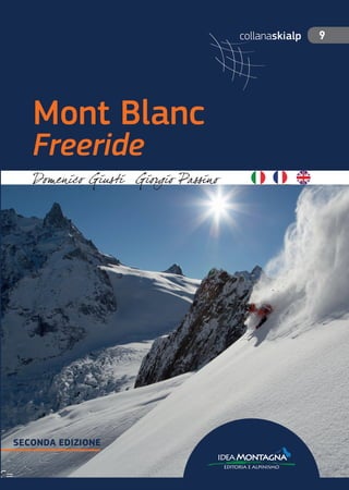
  • 1. 9 MontBlancFreeride 9 € 25,00 ideaMontagna editoria e alpinismo collanaskialp Mont Blanc Freeride ideaMontagna editoriaealpinismo “Non importa su che pendenze stai sciando… Basta che tu sia al tuo limite. Fondamentalmente provi le mie stesse emozioni.” “Les pentes sur lesquelles tu ski n’ont pas d’importance… L’important c’est que tu sois toujours à la limite. Ainsi, tu éprouves mes même émotions.” “No matter which slope you are skiing… You just have to be at your limit. Then, you are feeling my same emotions.” Stefano De Benedetti VIALE MONTE BIANCO, 21 COURMAYEUR • MONT BLANC TEL.: 0165 841925 www. ulissesport.com STRADA REGIONALE COURMAYEUR • MONT BLANC TEL.: 0165 842516 SECONDA EDIZIONE
  • 2. 12 13 Skialp l Mont Blanc Freeride l Sommario • Prefazione / Préface / Preface 5 • Introduzione / Introduction 6 • Inquadramento generale / Géographie / Geographical situation 14 • Indirizzi utili / Contacts utiles / Useful addresses 16 • Legenda 20 • Equipaggiamento / Matériel / Equipment 22 • Scala difficoltà tecnica / Cotation technique / Technical grade 24 • Scala pericolo / Exposition ski / Ski exposure 25 • Disclaimer 26 • Autori / Auteurs / Authors 27 1. COURMAYEUR CHECROUIT 31 001. Arp – La Balme 33 002. Youla Nera 39 003. Canale delle Capre 43 004. Canale di Dolonne (da Youla) 47 005. Canale di Dolonne (da LeGreye) 53 006. Arp – Dolonne 59 007. Arp – Dolonne - Finestre 65 008. Canale dello Spagnolo 71 009. Vesses - Canale Classico 77 010. Vesses - Canale di Sinistra 85 011. Vesses - Spalla 93 012. Canale del Vescovo 99 013. Arp Vieille 105 014. Cresta del Mont Favre 111 015. Traversata Arp – Mont Fortin 117 2. COURMAYEUR MONT BLANC 123 016. Ghiacciaio del Toula 125 017. Col d’Entreves 133 018. Aiguille d’Entreves 139 019. Aiguille du Toula - Parete NW 145 020. Ghiacciaio della Brenva 149 021. Ghiacciaio della Brenva - Traverso 155 022. Tour Ronde - Canale Gervasutti 161 023. Col du Diable: Couloir Macho 167 024. Marbrée - Classico 173 025. Marbrée - Ingresso dei Biellesi 179 3. VALLÉE BLANCHE 185 026. Vallée Blanche Courmayeur - Classica 187 027. Vallée Blanche Courmayeur - Vierge 193 028. Vallée Blanche Courmayeur - Noire 195 029. Vallée Blanche Chamonix - Classique 199 030. Vallée Blanche Chamonix - Vraie 205 031. Vallée Blanche Chamonix - Grand Envers du Plan 209 4. CHAMONIX ARGENTIÈRE 215 032. Aig. Grands Montets - Pas de Chèvre 217 033. Aig. Grands Montets - Coul. Rectiligne 223 034. Col d’Argentière - Sur La Fouly 229 035. Col d’Argentière - Glacier du Tour Noir 235 036. Col du Chardonnet 239 037. Col du Passon 245 038. Col des Cristaux 251 5. CHAMONIX AIGUILLE DU MIDI 257 039. Couloir des Cosmiques 259 040. Glacier Rond 265 041. Brèche Puiseux - Tour des Périades 271 042. Aig. de l’M - Traverse du Col de la Bûche 279 6. CHAMONIX FLÉGÈRE 285 043. Aiguille de Bérard - Traversée Crochues - Brèche de Bérard 287 044. Col du Belvedère - Traverse SE-NW 293 045. Pointe Alphonse Favre par le col des Aiguilles Crochues, Glacier du Mort 299 046. Col de Beugeant 305 047. Aiguille Pourrie - NE Couloir 311 048. Couloir de l’ENSA 315 • Ringraziamenti / Remerciements / Credits 318 SOMMARIO / SOMMAIRE / CONTENTS
  • 3. 166 Skialp l Mont Blanc Freeride Aspect: NE Elevation gain: 950 m Elevation loss: 950 m Max/min altitude: 3955 m → 3470 m Technical grade: 5.2 Ski exposure grade: E3 Check-Point Artva: √ Orientation: NE Dénivelé (+): 950 m Dénivelé (-): 950 m Altitude max/min: 3955 m → 3470 m Cotation tecnique: 5.2 Exposition ski: E3 Check-Point Artva: √ Esposizione: NE Dislivello salita: 950 m Dislivello discesa: 950 m Altitudine max/min: 3955 m → 3470 m Difficoltà tecnica: 5.2 Scala pericolo: E3 Check-Point Artva: √ COL DU DIABLE Couloir Macho 023 Courmayeur - Mont Blanc l Col du Diable - Couloir Macho
  • 4. 168 169 Skialp l Mont Blanc Freeride Moruga Scorpion Chili: handle with care! EQUIPMENT Freeride – Skitouring – Glacier. ACCESS • Skyway Monte Bianco. Take both sections of the cable up to Punta Hellbronner. ROUTE 1. From the exit of the Punta Hellbronner station, walk left towards the Col Flambeau: this section is slightly uphill, but also groomed by the snowcat, making it easy to walk with skis on your shoulder. 2. From the Col Flambeau, put your skis on and start descending heading left. Stop on the first plateau below the North Face of the Aiguille du Toula: from there, you will be able to identify the couloir that runs between the Petit and the Grand Capucin (Brêche du Carabinier). Reach and climb it entirely with skis strapped to the backpack (ice axe and crampons necessary), until reaching a pass from where the NE face of the Col du Diable (Couloir Macho) is visible. 3. Pass the crevasse at the end of the couloir and start climbing up to a bottleneck, usually with a poor snow cover. Pass it on the right hand side and continue climbing on the spur until reaching the summit: this last section is very exposed. 4. At the top, put skis on and start the descent along the same line as the ascent. NOTES This is a technical steep skiing line: only attempt it if you have extensive experience in skiing such terrain and if you are in very good physical and psychological condition. In late winter days, it is possible to complete the Piment Moruga Scorpion : assaisonnez avec déli- catesse ! MATÉRIEL Freeride – Ski de Randonnée – Glacier. ACCÈS • Skyway Monte Bianco. Prendre les deux tron- çons du téléphérique jusqu’à Punta Hellbronner. • Aussi possible depuis l’Aiguille du Midi mais plus long. ITINÉRAIRE 1. Depuis la sortie de la station amont de Punta Hellbronner, se diriger sur la gauche en direction du Col des Flambeaux : en légère montée mais souvent commode en escalier ou à pied. 2. Au Col des Flambeaux, chausser les skis et de- scendre sur la gauche (suivre les traces qui partent vers la Vallée Blanche en direction de l’Aiguille du Midi) jusqu’au plateau situé sous la face N de l’Aiguille de Toule. Repérer alors de l’autre côté de la Combe Maudite un couloir qui remonte entre le Petit et le Grand Capucin (Brèche du Carabinier). Le rejoindre et le remonter entièrement, skis sur le sac (piolets et crampons nécessaires) jusqu’au col de sortie. La face NE du Col du Diable (Couloir Macho) est alors visible sur la gauche. 3. Traverser vers la droite puis franchir la rimaye. Remonter dans la face jusqu’à un goulet, souvent mal enneigé. Le contourner par la droite et con- tinuer le long de l’éperon rocheux jusqu’au som- met (exposé). 4. Chausser les skis et redescendre par le même itinéraire. NOTES Itinéraire technique qui nécessite un niveau et Courmayeur - Mont Blanc l Col du Diable - Couloir Macho Peperoncino Moruga Scorpion: maneggiare con cura! MATERIALE Freeride – Scialpinismo – Ghiacciaio. ACCESSO • Skyway Monte Bianco. Prendere entrambi i tronconi della funivia fino a Punta Hellbronner. • È anche possibile dall’Aiguille du Midi ma con percorso più lungo. ITINERARIO 1. Dall’uscita della Stazione di Punta Hellbronner seguire a piedi in direzione del Col Flambeau: il percorso è in leggera salita, ma generalmente bat- tuto dai gatti delle nevi, quindi facilmente percor- ribile sci in spalla. 2. Giunti al Col Flambeau, calzare gli sci e iniziare la discesa lungo il pendio sottostante verso sini- stra, in direzione dell’Aiguille du Midi. Giunti al pianoro alla base della parete Nord dell’Aiguille du Toula, sarà possibile identificare un canale che risale tra il Petit e il Grand Capucin (Brêche du Carabinier): raggiungerlo e risalirlo sci sullo zaino (piccozza e ramponi necessari) nella sua interez- za, fino a giungere su un colle da cui sarà chiara- mente visibile il pendio nord-est del Col du Diable (Couloir Macho). 3. Superare la crepacciata terminale e risalire il pendio fino a raggiungere una strettoia spesso poco innevata. Aggirarla a destra e proseguire lun- go lo sperone, fino a raggiungere il pendio som- mitale: l’esposizione in questo punto è notevole. 3
  • 5. 170 171 Skialp l Mont Blanc Freeride ascent and the descent in the same day. In spring, when it gets warmer, it is extremely important to watch out for the temperatures and consider spending the night before at the Torino Hut, start- ing the ascent before the cable car opens. The vertical in the technical chart does not consid- er the descent from the Col Flambeau to Combe Maudit and retourn (150 m). une expérience adéquate en ski de pente raide, une bonne expérience en alpinisme (progression sur glacier et en piolet-traction) ainsi qu’une très bonne préparation physique et psychologique. A la fin de l’hiver, il est possible d’effectuer la des- cente à la journée ; au printemps, lorsqu’il fait plus chaud, il faut tenir compte des températures et passer la nuit au Rifugio Torino ou au Refuge des Cosmiques afin de partir tôt. Le dénivelé indiqué ne prend pas en compte la section entre le Col des Flambeaux (ou depuis l’Aiguille du Midi) et la Combe Maudite (150m à l’aller comme au retour). Courmayeur - Mont Blanc l Col du Diable - Couloir Macho 6 4. Iniziare quindi la discesa, che avviene lungo lo stesso itinerario di salita. NOTE Itinerario tecnico di sci ripido da affrontare solo se in possesso di adeguate competenze sciistiche e alpinistiche, oltre che in ottima forma fisica e psicologica. Nelle giornate di fine inverno è possibile effettuare la discesa in giornata; invece nelle giornate prima- verili, più calde, occorre osservare attentamente le temperature del periodo e prevedere di passare la notte prima al Rifugio Torino, iniziando la salita prima dell’apertura di Skyway Monte Bianco. Il dislivello della scheda tecnica non considera la discesa dal Col Flambeau alla Combe Maudit e ritorno (ca. 150 m). 4