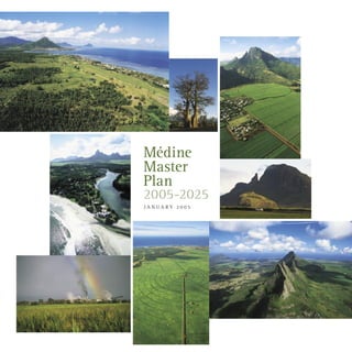
2. Médine Master Plan
2005-2025
Médine Sugar Estate LtdMaurice Giraud Architect
Maurice Giraud architect-planner
Thierry de Comarmond, architect-planner
Malenn Oodiah sociologist
Adi Teelock consultant
Mélanie Vigier de Latour Junior Consultant
Shakti Callikan Junior Consultant
Adish Maudho Research Assistant
3. Acknowledgements
A number of persons and institutions, both public and private, have been helpful in the preparation of the Médine Master Plan, by
providing information and data, and by sharing their views with us. In particular we wish to thank:
The Ministry of Housing and Lands
The Ministry of Education and Scientific Research
The Ministry of Environment
Consultants of the Halcrow Group
The Director and staff of the Statistical Office
The Management and staff at Médine S.E
and all the resource-persons with whom we have had fruitful working sessions.
4. I
Executive Summary
In 2003, the Republic of Mauritius adopted the National Development Strategy Plan 2003, for the period 2003-2023. Médine Sugar
Estate, a major land-owner in the West of the island, wishing to bring its contribution to the overall land planning process, whilst
complying with its global and sectoral strategies, has called for the preparation of the Médine Master Plan (MMP).
The proposed Médine Master Plan aims to:
present the key concepts underlying the development plan
outline the major options for urban development
explain the methodology chosen
present the zones, components and phases of the project
set out the main lines and mechanisms to achieve integrated development
list the specific proposals included in the project
identify the requirements for its implementation.
The project is spread over a period of 21 years, divided into three phases of 7 years each.
The Master Plan does not include a financial study to estimate costs. Costings will be carried out later. It is also assumed that
the authorities concerned will provide the infrastructure (water, electricity, national and regional roads) that falls under their
responsibility.
The promoter
Médine owns 10,625 hectares of land, which equals 5.5% of the total land area of Mauritius. 4,900 hectares are used to
grow sugar cane, which also equals 5.5% of the total area of cane-growing for the island. Médine, through its associate
companies, is also present in the beverages, tourism, commerce and property development sectors.
Economic transition and property development
Mauritius is going through a time of great social and economic change. Sugar is in a restructuring phase and it is estimated
that between 6,000 and 10,000 hectares of sugar cane land will be put to other uses in the next 20 years. New growth
activities have been identified to diversify the country’s economic base. The MMP takes into account this new situation
and makes recommendations accordingly.
Médine Master Plan - Executive Summary
5. II
The assets of the region
The Black River district has a high population growth. For the past 20 years its population influx has been greater than
that of any other district in Mauritius. This is mainly due to its exceptional position in respect of the coast, Plaines Wilhems
and Port Louis.
Key concepts
The Médine Master Plan has been built around three key concepts :
integrated development
sustainable development
social and spatial integration.
Land Development
From the point of view of land development, the set objectives are:
to integrate the physical parameters of the continuing agricultural and sugar restructuring process
to offer a better environment for living, working and leisure for people from all levels of Mauritian society
wishing to live in the area
to integrate the new industrial and service orientations
to ensure the development of international tourism, with respect to the potentialities of the area.
The set objectives take into account:
the need to preserve the ecological and environmental balance
the economic and financial capacities of the national and international actors.
Integration and social engineering
The integration of the present and future populations, in the development process, requires a fully-fledged plan of social
engineering. This plan aims at generating opportunities so that the populations in the zone can participate actively in, and
benefit from, the ensueing developments.
The social engineering proposed would be three-fold:
integration of social outcasts
integration of new arrivals on the labour market
conversion of those who need/wish to be redeployed.
Médine Master Plan - Executive Summary
6. III
Among the proposals contained in the MMP, is the setting up of two institutions: the “Fondation d’aide à l’intégration
citoyenne” (Foundation for the support of community integration) and the Médine Capital Venture Fund.
Partnership
Most of the initiatives and projects would be realised according to the principle of partnership between Médine and other
actors in the development process, at both national and regional level.
Implementation of the Master Plan
In order to implement the whole project, the Médine Master Plan will require means, resources, strong partnership
agreements, an implementation team and a good communication strategy. The implementation of the MMP will be
governed with a large measure of flexibility. The MMP will need to adapt to demand while ensuring, at the same time, that
the main objectives in terms of concept, norms and orientations are respected.
Médine Master Plan - Executive Summary
7. IV
BBRH Beau Bassin – Rose Hill
CSO Central Statistics Office
DBM Development Bank of Mauritius
DOPS District Outline Planning Scheme
FAIC Fondation d’Aide à l’Intégration Citoyenne
(Foundation for the support of community integration)
GRNW Grand River North-West
ICT Information and Communication Technologies
IRS Integrated Resort Scheme
MMP Médine Master Plan
MOH Ministry of Health
NDS National Development Strategy
NGO Non-governmental organisation
PM Prime Minister
S.E. Sugar Estate
SME Small and medium enterprise
SMI Small and medium industry
SMIDO Small and Medium Industries Development Organisation
UoM University of Mauritius
UTM University of Technology Mauritius
VCA Village Council Area
VRS Voluntary Retirement Scheme
Ward Administrative area in a town
WTO World Trade Organisation
WWA Waste Water Authority
HT High tension
MT Medium tension
LT Low tension
h.u. housing unit
ha hectare(s)
Abbreviations and Acronyms
Médine Master Plan - Abbreviations and Acronyms
10. 1
Introduction
In2003,theRepublicofMauritiusadoptedtheNationalDevelopmentStrategyPlan,2003fortheperiod2003-2023.TheGovernment
intends to introduce soon detailed District Outline Planning Schemes that will follow the policies defined in the overall strategy.
Médine Sugar Estate, a major land-owner in the area stretching from the north of the Black River District to the western fringes
of Beau-Bassin, Quatre Bornes and Curepipe, wishes to bring its contribution to the overall land planning process, all the while
complying with its global and sectoral strategies.
Médine S.E. thus requested a team of architect-planners and social scientists to work out a Master Plan for the development of its
lands over the next twenty years, 2005-2025.
The proposed Médine Master Plan:
describes the historical background of the project
presents the key concepts underlying the development plan
outlines the major options for urban development
sets out the time frame and phases
explains the methodology chosen
presents the zones, components and phases of the project
sets out the main lines and mechanisms to achieve integrated development
lists the specific proposals included in the project
identifies the requirements for its implementation.
TheMasterPlandoesnotincludeafinancialstudytoestimatethecosts.Thiswillbecarriedoutlater.Itisalsoassumedthattheauthorities
concerned will provide the infrastructure (water, electricity, national and regional roads) that falls under their responsibility.
Médine Master Plan - Introduction
12. 3
Médine Master Plan - The Project
1.1 The promoter
The main economic activities of Médine are sugar and its by-products, property development and tourism. Médine owns
10,625 hectares of land, which equals 5.5% of the total land area of Mauritius. 4,900 hectares are used to grow sugar cane, which
also equals 5.5% of the total area of cane-growing for the island. Of the 12 sugar factories in Mauritius, it is the only one situated in
the western part of the island. In 2003, it supplied just under 10% of the sugar produced in Mauritius from its own cane fields and
those of the other planters within its factory area. Agricultural diversification activities undertaken by the company include market
gardening, fruit growing, deer farming and poultry. In 2003, the agricultural sector (sugar and non-sugar) represented about 90% of
its activities. Diversification in non-agricultural activities has been directed over the past few years towards property development
(Integrated Resort Scheme and residential developments), tourism and eco-tourism in the Casela-Yemen area. Médine employs about
1,200 people, that is, about 6.6% of the labour force working in the sugar sector in Mauritius (18,000 employees in March 2004).
ThroughtheExcelsiorUnitedDevelopmentCompanyLimitedanditsSubsidiaries(EUDCOS),anassociatedcompany,Médineispresent
inthebeverages,tourism,commerceandpropertydevelopmentsectors.ThedistilleryplantoftheMédineDistilleryCoLtdsubsidiaryis
located within the premises of the Médine sugar factory. The United Spirit Producers Ltd has an operational management agreement
with the Médine Sugar Estate Co Ltd and a technical agreement with Société Chatel of Reunion Island. In the tourism sector, the
Médine-EUDCOS group, which runs the Concorde travel agency, has a hotel project in the pipeline. The Compagnie Mauricienne de
Commerce Ltée is a 89% subsidiary whose main product line is the sale of new and retreaded tyres. In property development, the
group has embarked on several residential projects, an Integrated Resort Scheme (IRS) and Médine Mews, an eleven-storey building
in the heart of Port Louis planned to open in 2005.
As at December 2003, Médine S.E. and EUDCOS had assets totalling Rs3.3 billion, with a turnover of Rs972 million and net profit of
Rs217 million. The two companies are quoted on the over-the-counter market at the Mauritius Stock Exchange.
1.2 The area
Most of the land belonging to Médine stretches southwards from the north to the centre of Black River District, and eastwards from
the west coast to the western limits of the Plaines Wilhems conurbation. A few hundred hectares are found in the Upper Plaines
Wilhems region at Floréal and Henrietta. The terrain is mainly flat, with some isolated peaks and, towards the southeast, part of the
Black River mountain chain. As the west of the island receives the least rainfall, the vegetation in the area is often dry. Except for
the southwest part of the area, the coastline consists mostly of rocky cliffs.
The population in the Médine area lives in the large village of Bambous and some smaller hamlets, such as Cascavelle and Beaux
Songes. Although, strictly speaking, the two main inhabited areas on the coast, Flic en Flac and Albion, lay outside the actual
boundaries of Médine, they are so much linked to the area that they have been included in the study.
13. 4
Médine Master Plan - The Project
The main economic activities are agriculture, with cane growing and market gardening, and manufacturing, which is located in the
Bambous industrial zone. The United Basalt company has a major stone-crushing operation on the outskirts of Bambous village.
Apart from the eco-tourism activities in the Casela and Yemen areas, tourism in the Médine area is still in its early stages. The IRS
project, “Tamarina Golf Estate” stretching on 200 hectares in the southwest of the zone, is due to start soon. However, no less than
eight hotels having more than 50 rooms are already in the coastal area of Flic en Flac and Wolmar.
1.3 The time frame: duration and phases
The project is spread over a period of 21 years, divided into three phases of 7 years each. The details about the implementation are
given on the development plan and in Chapter 7 of this report.
Phase 1: 2005 to 2011
Phase 2: 2012 to 2018
Phase 3: 2019 to 2025
15. 6
2.1 Economic transition and property development
Mauritius is going through a time of great social and economic change in an international context dominated by the logic
of globalisation.
Two of the leading sectors behind the economic growth of Mauritius in the 1990s are now facing major difficulties, sugar and the
manufacturing Free Zone. Tourism, another ‘traditional’ sector for the creation of wealth and employment, while being in a much
less critical position, is facing stiff competition. New growth activities have been identified to diversify the country’s economic base,
namely the IRS, ICT and the seafood hub.
It is, therefore, most opportune to think of a more intelligent use of available land to satisfy the needs of a new economic system
which will be based on growth activities outside the traditional sectors.
2.1.1 Agriculture
Agriculture, in particular the sugar industry, must take up some vital challenges to ensure its survival. The international
negotiations within the framework of the WTO and the initiatives taken to remove customs barriers and protected markets
are seriously bringing into question the competitiveness of the Mauritian sugar industry. The selling price of Mauritian sugar
is expected to drop by 37% over the next few months. The number of people employed in large agricultural establishments
has dropped from 25,000 employees in 2002 to 23,000 in 2004.
2.1.2 Small and Medium Enterprises (SMEs)
The potential for creating employment by increasing the number of SMEs can be exploited further. According to the
Central Statistical Office (CSO), in 2002 there were 75,267 SMEs employing less than 10 people, of which only 3% were
situated in the Black River district, compared to 30% in the Plaines Wilhems district. The number of people working in
SMEs totalled 176,878, that is, about 30% of the working population.
The problem in Mauritius is the tendency to keep separate the spheres of activity of the SMEs from those of the larger
enterprises. Very few links exist between the two, sub-contracting is not very common and clustering is only now being
developed with the help of Government. Diversification into activities with a high potential for economic development,
such as jam-making, agri-business and paper recycling, is being seriously envisaged. The Small and Medium Industries
Development Organisation (SMIDO) has identified several growth markets for the SMEs/SMIs.
2.1.3 The manufacturing Free Zone
After twenty years of job creation thanks to the economic incentives offered by the free zone and low salaries, the
manufacturing sector has gone into recession due to the combination of a number of external factors (economic
liberalisation linked to globalisation, competition from emerging countries) and internal factors (increase in salaries, cost
of electricity). Employment in large establishments in the sector has already dropped considerably from 84,400 employees
in the free zone factories in 2002 to 74,700 in 2004.
Médine Master Plan - National Development
16. 7
The dismantling of the Multi-Fibre Agreement is likely to cause a significant drop in prices as well as profit margins, which
will in turn have serious repercussions on the companies concerned.
2.1.4 Tourism
The tourism sector is facing a constantly changing world market and very stiff international competition. Room capacity is
increasing with the opening of several new hotels by the end of 2004 and the starting of other projects in 2005-2006. In
September 2004, 98 hotels were operating with 10,008 rooms available. However, the destination has experienced a drop
in the yearly increase in tourist arrivals from 5-10% in the 1990s to 3-4% in more recent years. The average occupancy
rate has also gone down from 66% in 2001 to 63% in 2003.
Nevertheless, the tourism sector remains a growth sector, provided that appropriate measures are taken to ensure
its continuity.
2.1.5 Integrated Resort Scheme
The Integrated Resort Scheme (IRS) is a programme introduced by the Mauritian Government for the creation of luxury
estates for foreigners and Mauritian citizens. The aim is to open up new investment and employment opportunities.
Two of the ten projects under consideration have already been approved by the Board of Investment, one presented by
the CIEL Group and the other by Médine Sugar Estate. In both cases, the programme involves offering for sale luxury villas
for a minimum price of US$500,000. Clients can also be foreign or local firms. On buying a villa, whether on plan or at
completion, the foreign buyer is granted the right of abode in Mauritius for himself and his family. The residence permit is
issued once the title deeds have been drawn up.
The CIEL project is scheduled to start in 2005 for completion in 2008, while the initial phase of the Médine project should
be ready in 2005.
2.1.6 Information and Communication Technologies (ICT)
The political will to turn Mauritius into a cyber-island has given to the information and technology industry an important
place in the economic scene of the country. A first block to house firms working in this sector has been built following a
government initiative at Ebène. A second one is planned for Rose Belle and a third one has been announced. In September
2004, 2260 people were employed in the sector, of whom the majority were working in call centres (1260 employees) and
as software developers.
2.1.7 Seafood hub
With an exclusive economic zone of 1.9 million square kilometres, Mauritius has a major asset to become a large-scale
fishing port. The creation of a seafood hub includes the logistics for handling, processing and exporting fish products.
Mauritius has some competitive advantages that can help it turn the traditional fishing sector into a fully fledged industrial
Médine Master Plan - National Development
17. 2. The Wolmar hinterland
4. Flic-en-Flac: formal & informal tourism development
3
2
1. Hotels in Wolmar
3. Hotel development towards Tamarin Bay
4
1
Tourism
development
in the area
Médine Master Plan - National Development
18. 9
activity. Countries such as Mauritius that still have large stocks of fish will be called upon to exploit their potential. The
government has taken several initiatives to get the sector moving, amongst which, the setting-up of a one-stop shop and
a proposal for a special financing programme to be run by the Development Bank of Mauritius (DBM). The Minister of
Finance stated in his Budget Speech that the seafood hub would be an integral part of the development strategy for the
fishing industry.
2.1.8 The challenges facing national development
The uncontrolled impact of globalisation in Mauritius, as elsewhere, has resulted in a very uneven pace of development with
its attendant social ills. At national level, several major challenges must be addressed to ensure an equitable development
process that does not admit the notion of exclusion. These challenges with their specific characteristics are found in the
Black River district and therefore in the Médine zone. The Master Plan for Médine addresses these issues and makes
proposals with the view of overcoming these social deficits.
2.2 Coherence and conformity
The Master Plan for Médine is in line with the present debate on land development and the national strategy for development as
described in the New Planning Framework Design Guidance and Revised Outline Scheme. These new outline schemes allow for
more flexibility in respect of the change in use of those lands that are no longer required for agricultural development, allow for
the development of coastal and rural areas and introduce planning mechanisms that will encourage public-private partnerships. A
new approach to land development is needed to take into account the profound social and economic changes that are in process
together with their effect and consequences on land use and land ownership patterns. We have strived to adopt such an approach
so as to be consistent with the overall trends in respect of economic, social and cultural development, while bearing in mind the role
and importance of the other regions in achieving a balanced national development strategy.
2.3 National Land Development and the Médine Master Plan
The preparation of the Médine Master Plan ran concurrently with the Outline Schemes being prepared by a consultancy firm,
Halcrow, on behalf of the Government of Mauritius. Fruitful discussions were held with these consultants on the main issues related
to urban development at national level, and more specifically in the west and the Médine zone.
The MMP has thus taken into account, and complied with, the broad recommendations made at national level. It has, in
addition, highlighted the strong demand for residential and tourism development within specific areas of Médine and has made
recommendations accordingly.
Médine Master Plan - National Development
20. 11
3.1 Population growth and projections
A study of the population figures for the past few years brings to light the following elements:
For the past twenty years, the Port Louis district has registered a negative population flow. As it is becoming more saturated, the
capital has, in fact, expanded beyond its administrative boundaries (Le Hochet, Terre Rouge, Riche Terre, Tombeau Bay, Les Pailles,
GRNW) whilst part of its population has moved to other areas.
The Plaines Wilhems district, where a third (30.38%) of the population of Mauritius lives, has a positive population flow, which is,
however, less than that of the Black River district.
The Black River district has the highest population flow. Between 1995 and 2000, the number of people migrating towards Black
River totalled 3500, while those migrating towards the Plaines Wilhems numbered 2050. The majority of newcomers to Black River
come from the Plaines Wilhems.
When one takes a closer look at the population movements between the Village Council Areas (VCA’s) in the Black River district,
the following trends can be seen:
The Bambous VCA has experienced a very high influx of people. Over the past 20 years, its population has practically doubled, from
6,870 to 11,235 inhabitants. Nearly half of the new inhabitants come from the Black River district, which shows the strong pull that
Bambous has over the other villages in the district and confirms its position as the “regional capital”.
Albion and Flic en Flac, which were almost inexistent twenty years ago with only about 250 inhabitants each, now have populations
of 2815 and 1739 respectively (Census 2000). These figures do not include the occupants of second homes.
Table: Number of people living in the VCA’s of the Black River District, 1983-2000
VCA
No. of residents
1983
No. of residents
1990
No. of residents
2000
% Percentage increase
between 1990 & 2000
Bambous 6 870 7774 11 285 45,16
Cascavelle 1 539 1039 2252 116,74
Flic en Flac 964 1072 1739 62,22
Albion 284 294 2815 857,48
Belle Vue 7
Camp Créole 499
Sources: Resident population by geographical location, census 1983, 1990, 2000
NB: The administrative boundaries changed several times in the period covered by the three censuses, but this does not alter the fact that Albion and Flic en Flac have
registered a very high influx of population.
Médine Master Plan - Overall Perspective
21. 12
The Black River district has known a spectacular rate of urban development compared with other districts in the country. This cannot
just be due to the development of tourism, since the north, east and south-east coasts have as many, if not more, tourist areas.
The district keeps its population and attracts inhabitants from the other districts because of:
its exceptional position with respect to the Plaines Wilhems and Port Louis
its climate that has the lowest rainfall and the highest average sunshine on the island.
Thus, many Mauritians from all levels of society choose this area to live permanently, spend their holidays or enjoy a weekly day
of leisure.
By using the figures obtained from the last three censuses, the population movements between the districts can be measured. By
projecting these trends over the twenty-year period covered by this master plan (2005-2025), a reasonable estimate of the eventual
number of inhabitants can be obtained. The following table shows the projections for the areas covered by this plan.
2000 2005 2010 2015 2020 2025
Difference
2005-2025
Mauritius 1,140,000 1,192,500 1,245,000 1,297,500 1,350,000 1,402,500 210,000
Port Louis 123,690 119,012 113,420 106,914 99,495 91,163 -27,849
Plaines Wilhems 346,332 361,864 377,360 392,818 408,240 423,625 61,761
Black River 58,596 67,257 76,443 86,154 96,390 107,151 39,894
Rest of Mauritius 611,382 644,367 677,778 711,614 745,875 780,561 136,194
The population figures for the year 2000 are those given in the census.
The figure of 1,350,000 for the year 2020 for Mauritius is an official estimate.
Thus, between 2005 and 2025, the population could increase by 40,000 in Black River and 60,000 in Plaines Wilhems.
The total population figures for Mauritius are based on official estimates, which are themselves based on strong tendencies that have
been noted over long periods. These figures will be more or less reached. However, the distribution between the different districts
has been obtained by a straight-line projection of the population trends for each district through natural growth and migrations
observed over the past twenty years. It is obvious that a favourable or unfavourable situation in any district will cause the figures
to go up or down. For example, an attractive offer in terms of quality and price of residential properties or the implementation of
dynamic and motivating projects in any one area will result in increased migrations.
Médine Master Plan - Overall Perspective
22. Médine in the national context
Médine Master Plan - Overall Perspective
23. 14
3.2 Use of land
3.2.1 At national level
The table below, based on the figures given in the NDS, shows the present land use at national level.
ha % ha %
Agriculture 84,000 45%
(of which sugar cane) 77,000 41%
(rest) 7,000 4%
Forest and Scrub 57,000 31% 31%
Built incl. roads & utilities 45,000 24% 24%
Island : 186,000 100.00% 100.00%
The Mauritius Sugar Authority, in its Sugar Sector Strategic Plan, 2001-2005, estimated that over the next 20 years,
between 14 and 19,000 hectares of land that are, at present, used for cane cultivation will be available for conversion, that
is, between 18% and 25% of the area planted with cane, as shown in the table below.
ha sugar
cane land
released for
other uses
%
2000 77,000
2020 Lowest estimate 63,000 14,000 18%
2020 Highest estimate 58,000 19,000 25%
It is estimated that over the next twenty years additional urbanisation, including housing, infrastructure, equipment and
services, will occupy between 9 and 10,000 hectares. About 90% of this land, between 8 and 9,000 hectares, is at present
used for cane cultivation. Thus remains the problem as to how to use 6,000 to 10,000 hectares of land that in twenty
years’ time will no longer be used for cane cultivation and will not be urbanised.
3.2.2 Médine
The 10,625 hectares of land at Médine are used as shown in the table below.
Use Area (ha)
Sugar Cane 4,700
Orchards & vegetables 50
Grazing land 1,100
Rivers, Dams & reservoirs 175
Hunting grounds 2,300
If the percentages used at national level, that is, 18% and 25%, are applied to the land at Médine, then between 850 and
1200 hectares of cane-fields could be done away with between now and the year 2020.
Use Area (ha)
Sylviculture 600
Mountain reserves 500
Casela Park 60
Other lands 1,140
TOTAL : 10,625
Médine Master Plan - Overall Perspective
24. 15
Médine S.E. - Existing Land Use
Médine Master Plan - Overall Perspective
26. 17
4.1 Integrated development
The starting point for the Médine Master Plan is the concept of integrated development. This development philosophy was discussed
extensively during the working sessions held to prepare the Master Plan. It is, therefore, necessary to go back to this concept which
has guided our approach and methodology while working out the proposals.
The present mode of development could bring about very serious social deficits would that become apparent through exclusion, job
insecurity, marginalisation, the disappearance of small workshops and businesses. Should this be the case, there would be no scope
for social development, and left unchecked, the dominating logic of this mode of development would only make the deficits worse.
The partners in the development process must therefore work out new modes of partnership for a development that will address
these deficits and eliminate them.
The private company can, without taking over the role of the State, contribute to the promotion of integrated development by
assuming fully its corporate social responsibility. The implementation of this Master Plan could be an excellent opportunity for
Médine to contribute in a tangible way to a development process that is based on an integrative approach.
The challenge in development today is how to integrate the social and the human aspects better in its process. At the base of the
concept of for integrated development lies a simple idea full of common sense, namely that development must benefit the whole
population on both the social and the economic levels of life.
The development process should try, through a variety of projects, to lessen social inequality and its impact on the most
vulnerable groups.
When the integrative processes that allow everyone to enjoy the fruits of economic development and to climb the social ladder
are not working, society produces outcasts. Those rejected are then increasingly being violently pushed towards the outer limits of
society, into a situation where access to education and health services is barred, work uncertain and unemployment rife. Their self-
esteem and self-confidence are diminished and their family unit weakened.
Integrateddevelopmentisthesumofmanydiverseinitiatives.Itrequiresactionatthelocallevel,butalsoaspartofaglobalapproach
to push back all forms of rejection, be they economic, political, cultural or social. These social imbalances are usually confined to
the same geographical area. The populations in these deprived areas are thus locked into a situation where the absence of mobility
blocks their social future. It is difficult, if not impossible, for the people in these poverty zones to escape from this stalemate. How
can such a zone become a place for social progress? This is the challenge that the concept of integrated development must take
up within the framework of planned land development. Nowadays it is all the more necessary to create an environment in which
individuals can fully develop their potential and lead a productive life according to their needs and interests. The role of development
is, therefore, to satisfy the basic needs of the population (clothing, food, housing, work) and give each person the chance of reaching
a better quality of life. The Médine Master Plan aims to contribute to this goal by basing its physical proposals on the principles
set out at the beginning of Chapter 7, and making policy proposals that will strive to bring into reality the concept of integrated
development (Chapter 9).
Médine Master Plan - Key Concepts
27. 18
4.2 Sustainable development
AccordingtotheBrundtlandreport(1987),sustainabledevelopmentisdevelopmentthatsatisfiespresentneedswithoutcompromising
the ability of future generations to respond to their own needs.
This definition implies:
the taking into account of long term issues in the present time
the coupling of ecological issues with social issues
the need to act before development problems arise.
The main objective of sustainable development is to reconcile the different aspects of economic, social and ecological development.
Sustainable development requires economic growth, increased productivity and equal opportunity. It is, therefore, essential to
promoteeconomicgrowththatissustainableanddurable,aswellasspecificmeasurestoeliminatepoverty,suchasthestrengthening
of programmes to create employment and generate income that avoid the exploitation of people.
Sustainable development is also concerned with the protection of the environment and the conservation of eco-systems. It is
imperative not to endanger the natural systems that allow us to live, such as the atmosphere, water, the soil and living beings.
This requires a strategy that aims to solve at the same time the problems linked to poverty, development and environment. To be
successful, it must be oriented right from the beginning on the resources, the means of production and the population. It should
cover issues concerning population, agriculture and tourism, the improvement of healthcare and education, women’s rights, the role
of youth, the status of the ‘native’ population and include a process for democratic participation in conjunction with an improved
administrative system.
The concept underlying the MMP includes the notion of continuity and concern for the medium and the long term. It is, therefore,
both logical and natural that the notion of sustainable development is at the heart of the plan. Existing parameters, such as
agriculture, have been used to define the proposed orientations, which not only respect the environment, but also aim to enhance
the natural and historical heritage in the area. The amount of space available will make possible a green urban development, which
will result in a notable improvement in the surroundings and quality of life.
Médine Master Plan - Key Concepts
28. 19
Médine Master Plan - Key Concepts
4.3 Social and spatial integration
Land development that is based on ethnic and social segregation is not inevitable, even though the settlement pattern in Mauritius,
and more particularly in the Médine area, can be explained by historical and sociological factors. Any land development project in a
society such as Mauritius must be founded on a down-to-earth philosophy of living together that is shared by the great majority of
Mauritians. The notion of social and spatial integration satisfies this philosophical consideration. It is the direct opposite of a ghetto-
type development, and it appears in the MMP in :
the linking of socio-economic areas with residential zones
the structuring of the land by means of multi-purpose areas that are places to mix in and meet people.
Thepresentre-structuringoflandareashassocialimpactsthatpresentaseriouschallengeforsocialdevelopmentwithrespecttothe
integration of populations in the same area. While living in the same geographical microcosm, the various individuals have multiple
and varied identities. One of the first challenges in social and community integration is to bring together, in a given area, a disparate
population. It is necessary to prevent dysfunctions in the integrative processes, for instance those that stop the people on the edges
from moving into the centre by blocking the access, or those that push out certain individuals or social groups towards the periphery.
This entails fighting against social and spatial polarisation which freezes positions and locks the populations of the deprived areas
into a situation where the lack of prospects of mobility block social progress. Social integration is a vital process in all societies. The
main mechanisms for social integration, that are schools, employment and the family, together with the basic services, contribute
to the building of a social identity. Social integration requires proper access to goods and basic services (education, health, roads,
public transport, communication, culture). A breakdown of these tools for socialisation leads to a dislocation of the collective social
identity. To remedy this, the physical and social distance from the labour market must be reduced. Access to the catchment areas for
employment and opening up of districts must be made easier. Public transport must be improved, local employment increased, and
neighbourhood shops and services encouraged. Support should be given to local initiatives and micro-credit schemes which reduce
social distances, and ensure proper access to education and training.
29. 5
1. An interesting garden in Cascavelle
2. A corrugated-iron house in
Beaux Songes
Villages
need to be
fully integrated
8. School children need support
9. A typical roadside scene
10. A small shop in Canot
2
3
1
3. New concrete houses in Beaux Songes
4. A focal point for the village
5. Canot: difficult living conditions
6
7
8
10
9
4
6. A typical scene: no other
place to meet
7. Canot: a football pitch
Médine Master Plan - Key Concepts
31. 22
5.1 Consultative process
The approach chosen was organised around targeted consultations with individuals and small focus groups. The aim was to identify
more clearly the concerns of the various people affected. The consultative process put the emphasis on dialogue and listening. In
our opinion, this is the only way to work out, in a flexible manner, the short, medium and long term aims of the main Plan. These
consultations enabled the different parties concerned, the State, the private sector and the civil society, to share their needs,
aspirations, expectations, and suggestions, etc.
Through this exercise it has been possible to:
collect ideas and suggestions
understand the different logics and forces at work
identify the supporters as well as the potential sources of opposition to the project
learn about projects of other actors in the area.
This consultative process will continue during the implementation of the MMP through an information and communication strategy
comprising several themes and phases that will cover all the stake holders. In fact, for most of its implementation, the MMP will
strive to participate in the sense that it will offer different types of collaboration between the various stake holders.
5.2 Profile analysis and assessment of current and future needs
To ensure that this development project is firmly rooted in the existing social environment and, therefore, viable, it was necessary
to situate the socio-economic state of the area in the national context (for example, by comparing the situation in the Black River
district with that of the other districts) and to draw up the socio-economic profile of the area. It was also important to have a
deeper knowledge of the characteristics of the population living in the Médine area and the trends for population growth in order
to make projections (based on hypotheses such as strong social heterogeneity, high growth, high migration from the urban areas to
the west coast, and the increase in built-up areas), and study their implications and consequences. Finally, it was also necessary to
research the availability of infrastructure for healthcare, leisure activities, training and, at the same time, the needs, expectations
and aspirations of the current, future and potential population.
5.3 Multi-disciplinary approach
A development plan must include an economic and sociological analysis. Given the overall aim of the study, its scope, complexity,
size, importance for national development and the issues at stake, we have adopted a multi-disciplinary approach for the socio-
economic analysis that covers the sociological, geographical, historical and psycho-sociological aspects. The feasibility study of the
different components of the Plan will be carried out by specialist economists.
Médine Master Plan - Methodology
32. 23
5.4 Desk study
A desk study was undertaken to ascertain the socio-economic context at the national, regional and local levels. The sources of
information included reports from ministries, national statistics (CSO), texts of general interest and conclusions from earlier studies.
Several issues were studied:
Population and migration trends
Housing
Economic activities: present status and development (SMEs, SMIs and agriculture)
Tourism and eco-tourism
Social issues: education, training, health, social problems
Infrastructure: equipment for general use (social centres, football pitches, etc.),
access to services (CEB, CWA, telephone).
The desk study consisted in the dissection of all documents and reports, both official and otherwise, that could be useful in
determining the current state of affairs for urban, environmental, economic, socio-demographic and cultural issues, as well as the
present and future trends. This research was essential to support the proposals for the required social engineering. The data base
that is being set up will contain full syntheses of the research carried out on the various parts and aspects of the project.
5.5 Qualitative and quantitative surveys
In addition to the desk study, a series of qualitative and quantitative studies were carried out during the period May-July 2004 by a
team of professional interviewers and a consultancy firm specialising in market surveys.
5.5.1 Qualitative analysis
Thequalitativeanalysisascertainedtheperceptionthatthepeopleintheareahaveoftheirownsocio-economicenvironment.
It also identified their needs and expectations with respect to their quality of life and to development in general.
Fifty individual interviews were carried out with the management at Médine, officials in ministries and at the Black River
District Council, leaders of associations, experts from different fields (training, education, demography), persons engaged
in economic activities, such as small planters, and inhabitants involved in social activities in the area.
Ten focus groups were organised at Cité La Ferme, Camp Créole at Albion, Mont Roches, Beaux-Songes, Flic en Flac,
Henrietta, Camp Mapou, Chébel and two at Bambous (one with social workers and the other with inhabitants who had
opted for the Voluntary Retirement Scheme (VRS). Each focus group brought together about ten people in order to gather
Médine Master Plan - Methodology
33. 24
their views on a range of topics and to gain a full picture of the reality in which the populations in the area live. The topics
included leisure activities (sporting, amusement and cultural), activities at the social and community centres, economic
activities, education, training, access to healthcare, general services, basic infrastructure (telephone, police, post offices),
social problems, social and communal relations, physical environment (assets and potentialities). From the information
gained through these focus groups, it became possible to draw up a full picture of the problems encountered by the
inhabitants, and to determine their needs and expectations.
On-site observations completed the information thus gathered.
5.5.2 Quantitative analysis
The quantitative analysis took the form of a market study on the residential and property development in the area.
The findings complemented the analysis made during the desk study. It highlighted the preferences and financial means
of the population with respect to buying land. The sample of 988 individuals was representative of the Mauritian
population as a whole, living mainly in the Plaines Wilhems and in several places in the area under study (Albion, Bambous,
Beaux-Songes, etc.).
Thus, a whole range of techniques was used over a period of six months to ascertain the current state of affairs and
identify the developing trends. The data thus collected and the subsequent analyses became the basis for the proposals
described in Chapter 9.
Médine Master Plan - Methodology
35. 26
Médine Master Plan - Current Situation
Introduction
The research and the reflection carried out as part of the setting up of the MMP have resulted in the drawing up of:
a land development map that lays down the main orientations of land use for the next 21 years
and which takes into account the agricultural project at Médine
an analysis of the current socio-economic situation in the area
proposals for an integrated development plan.
6.1 Social and economic situation
6.1.1 Socio-economic situation in the catchment area for employment
112 free zone factories are found in an area that is accessible by bus (Tour Koenig, Plaine Lauzun, Coromandel, Vacoas
Holyrood, La Marie, Beau Bassin). These are the biggest source of employment for the population living in the Médine area.
1120 firms are established in various places in the area under study (Bambous, Albion, Flic en Flac, Beaux Songes, Cascavelle,
Chébel, Mont Roches), together with Gros Cailloux. They are all registered with the Black River District Council, but only 21
SMEs in the area (including Petite Rivière) are registered with the SMIDO.
The villages with the highest number of professional and commercial activities are Bambous and Flic en Flac. The latter
owes its special position to the constant influx of local and international tourists, which makes tourism a major generator
of connected activities (restaurants, photo development, taxis, etc).
Bambous confirms its place as the regional capital. It has numerous service activities (video club, beautician, hairdressers,
bank, filling station) and is a source of employment (several industries of different sizes, shops, sale of foodstuffs). Thus a
stop in Bambous has become a necessity for the inhabitants of the nearby villages such as Cascavelle and Beaux-Songes.
Concerning existing commercial activities, the high number of self-employed persons in the area should be noted. Quite
a few of these self-employed persons sell various products (foodstuffs, textiles) on the beaches, in the streets or at the
weekly markets.
6.1.2 Evolution of traditional sectors
The most striking factor in the evolution of the agricultural and fishing sectors is the huge drop in employment in the past
ten years, from 28% to 8% in Albion, 24% to 17% in Bambous and 23% to 9% in Flic en Flac. These sectors are no longer
the main employer in the area. The manufacturing sector has now become the main employer in the area.
36. 27
Médine Master Plan - Current Situation
The manufacturing sector does not just consist of textile factories. Printers, and manufacturers of other products
(cardboard,, jewellery, plastic bags, etc), and flower growers are present in the area. Although it is now the main source of
employment for the inhabitants, this sector has witnessed a significant drop in the number of jobs. In fact, the percentage
of persons employed has gone down everywhere, except for Flic en Flac, where it has doubled in 10 years (9% in 1990
and 18% in 2000).
For census purposes, the activities linked to tourism and those linked to retailing are grouped together in the same
category. The percentage of persons living in the area who are employed in this sector (tourism and retailing) has increased
considerably in ten years (1990-2000). At Bambous, it has more than doubled, going from 6% to 14%, and at
Cascavelle also.
Flic en Flac, which has experienced another type of development directly linked to tourism, and which had started to shift
into service activities much earlier, has maintained the same percentage of employees in this sector, with just a
slight increase.
6.1.3 Impact of the crisis in the traditional professional activities
The main employers in the area are the numerous free zone factories and the sugar industry. Both sectors are at present
going through a crisis and, as a result, many inhabitants in the area find themselves in an unstable and insecure position
with respect to their employment. Official statistics show that the manufacturing sector is the main employer in the area
with 25% of persons employed. The crises that have hit it are directly affecting the employees’ households, in particular
with respect to access to transport, education and health-care.
Unemployment in the area has risen considerably between 1990 and 2000, even if the rate remains low. It has more than
doubled in Cascavelle (4% in 1990 and 9% in 2000) and Flic en Flac (4% to 8%) and almost tripled in Bambous going
from 2% to 6% of the active population.
Unemployment is affecting certain parts more than others, for instance Cité la Ferme where it is considered to be the main
problem in the locality.
6.1.4 Household income
At the national level, 84% of heads of household earn less than Rs10, 000 a month, while in the Black River district
the figure is 91%.
In the other localities in the area, the percentage of households earning less than Rs10,000 a month are Albion 50.65%,
Bambous 70.92%, Cascavelle 67.29%, Flic en Flac 44.22% and Henrietta 74.72%.
However, Albion and Flic en Flac have one peculiarity. 23.47% and 28.80% of households respectively earn more than
Rs20,000 per month. These families are the ones that have left the towns to live in the new coastal residential areas.
37. 28
Médine Master Plan - Current Situation
6.1.5 The status of women in the area and at national level
At national level, 17.5% of heads of household are women. In the Black River district this percentage goes from 12.33%
(Albion) to 17.56% (Bambous). More than 70% of the female heads of household are widows, followed by divorcees.
Thus, a woman is only head of household in the absence of a husband. Recent studies have shown that female-headed
households are more likely to be poorer than those headed by men. This state of poverty can be handed down to their
children, as part of the cycle reproducing social instability. This is particularly true for the girls who have to stop their
schooling to look after their little brothers and sisters while their mother is at work. At the national level, one out of three
employed persons is a woman (33.65%). In the area under study the rate is slightly higher (35.85%). There are also fewer
unemployed women in the district (33.78%) than at national level (35.69%).
6.1.6 Education
Education in the Black River districts shows wide disparities when compared with the state of education nationally and
that prevailing in the other districts.
40.4% of the Black River population aged more than 15 years have a level of education equivalent to primary level but have
not passed the Certificate of Primary Education (CPE), compared to a national average of 34.4%. 11.5% have not gone
beyond Form 3, compared to the national average of 9.9%. Only 15% have Form 4 and 5 levels, but no School Certificate
(SC), compared to the national figure of 17.9% and only 9.5% have obtained the SC, compared to 13.7% nationally. All of
these figures are lower than those in the other districts. 14.2% of children aged between 10 to 14 years are not enrolled
in school, compared to 8.3% at national level.
63.5% of the children in Mauritius pass the CPE, which allows them to enter secondary school. In the Black River district
the success rate is only 37.1%, which is considerably lower than that of the other districts. The number of teenagers who do
not attend school is very high in Mauritius, 48.8% of children aged 15-19 years. In the Black River district the percentage
is 62.2%, which is the highest in the country. At Bambous, 71.4% of young people aged 15-19 years do not attend school.
19.8% of the Black River population is officially counted as being illiterate, as opposed to 14.4% at the national level.
There are 13 primary schools in the Black River district, six of which are found in the area under study: one each at Flic
en Flac, Henrietta, Chébel and Cascavelle and two at Bambous. The school at Cascavelle is listed as a PEZ school (priority
education zone), as well as one of the two schools in Bambous.
The primary schools in the Médine area are overcrowded, except for the one at Flic en Flac. The average number of pupils
per class is 35 to 40, which is the same as at national level. At Flic en Flac, the average class size remains at around 15
pupils, since the children from middle-class families attend school in the Plaines Wilhems. This is also true for Albion.
As there is no school there, the poorer village children go to the school at Petite Rivière, while those coming from more
fortunate families also go to school in the Plaines Wilhems. The Government is presently undertaking a project to build a
school at Albion and another at Bambous to satisfy the needs of the population in the area for primary schools.
38. 29
The government pre-primary schools are also confronted with the problem of insufficient places. The Ministry of Education
is taking steps to address this problem. A pre-primary section will be built within the premises of the school at Cascavelle.
A project for pre-primary education in the area is being worked out.
Three out of five secondary schools (Forms 1 to 5) in the Black River district are found in the Médine area, two at Bambous
and one at Mont Roches. The average enrolment per school is 261 pupils, compared to 594 at the national level. This is the
lowest average of all the districts. All three schools are pre-vocational ones. In order to continue their schooling from Form
5 to Higher School Certificate (HSC), the pupils go mainly to schools in Plaines Wilhems. Government has undertaken a
project for a secondary school for girls at Palma and is looking for 2.5 hectares of land.
The combination of financial and psychological factors together with the limited means of the schools has oriented
our proposals along two main lines. The first concerns helping the schools in the area financially and materially. The
second concerns a more in-depth form of support in terms of training and counselling to compensate for the deficiencies
and shortcomings of the Mauritian education system. In both cases, our proposals are in line with the present
government policies.
6.1.7 Health
In 2002, the health sector in Mauritius counted 12 private clinics, 5 regional hospitals, 2 district hospitals, 20 ‘Mediclinics”
and Area Health Centres (AHC), 107 Community Health Centres (CHC) and 19 medical centres on the sugar estates. 2531
mobile dispensaries work all over the island, particularly in the schools.
In the Black River district there are two AHC, one at Black River (Dr. Cantin Hospital) and one at Bambous, 11 CHC of which
one each at Beaux Songes, Flic en Flac and Albion, and finally the health centre on the Médine sugar estate. All the estate
employees are covered and can receive treatment at the centre.
In 2002, 9.8% of the patients treated in the hospitals, mainly Victoria and Jeetoo, and in the public health centres come
from the Black River district. The average number of visits per inhabitant from this district is 4.6, compared with 2.6 at the
national level and 1.7 for the Plaines Wilhems district. The figure for Black River is again above that of the other districts
and would indicate that the population from Black River is over-represented in the public health centres. This is most likely
due to a lack of means to access private healthcare. The majority of the Black River inhabitants frequent the CHC at Petite
Rivière (21.4%) and the Dr Cantin AHC (19.8%). 13% go to the Bambous AHC where the renovation and extension works
have been continuing for several months. 6.2% go to the CHC at Pointe aux Sables and 5% to the CHCs at Albion, Beaux
Songes, Flic en Flac, Case Noyale, Chamarel, etc.
The cost of transport and the distance to the nearest hospitals make access to treatment difficult and is a heavy item in
family budget. All these factors could justify the setting up of a district or regional hospital in the Médine area and/or the
extension of one of the health centres.
Médine Master Plan - Current Situation
39. 30
The absence of a regional or district hospital in the west would explain why in 2000, 71.2% of the Black River inhabitants
needing hospital treatment were admitted to the Jeetoo hospital in Port Louis and 27.5% to the Victoria hospital
at Candos.
In October 2004, the Ministry of Health announced the construction of a regional hospital at Bambous and expressed the
wish that the project could be carried out quickly.
6.2 The agricultural issue
6.2.1 The situation of agriculture at Médine
Médine is an agricultural company. Agriculture counts for 90% of its turnover. It has 10,625 hectares, of which 4,905 are
under cane cultivation. The sugarcane crop from this area is expected to produce 39,600 tonnes of sugar in 2004. The
yield per hectare of cane at Médine is the highest on the island, 88.5 tonnes per hectare, compared to an average 81.6
tonnes per hectare for the other estates. De-rocking, levelling of land, irrigation using the pivot mechanism instead of the
old system, mechanisation and training are the main components of its agricultural strategy.
Médine SE currently employs 1,263 persons, including 133 managers. The operations count 1,130 employees, including
97 women. As part of its restructuring strategy, Médine has implemented two Voluntary Retirement Schemes (VRS). The
first one concerned 750 persons and the second 117 persons. Médine has since applied to the authorities for permission
to carry out a third scheme.
The Médine Master Plan integrates the agricultural project of Médine for the next five years and beyond. The constraints,
the suggestions for possible trade-offs in the use of certain localities, and the agricultural set-up (use of pivots, land
fertility) presented by the agricultural managers at Médine have been given all the necessary attention.
6.2.3 The agricultural project
Médine has worked out an agricultural project to face up to the crisis that the sugar industry is presently experiencing. This
project is based on the production of sugar, including organic sugar, and an ambitious plan for agricultural diversification
(food production and animal farming). At present, the agricultural diversification is taking place on the land situated at
Chébel, La Mecque, Beaux Songes and Tamarin, over a total area of 60 hectares.
In2004,outofatotalincomeofRs584,432,607,sugar,bagasseandmolassescountedforRs484,950,558,whileagricultural
diversification brought in Rs22,958,000. The sale of rocks (taken out during the derocking) and of electricity, together with
income from other sources (right of way, renting of land, etc) make up the rest of the total direct income. In 2009, on
the hypothesis of a 37% drop in the price of sugar, Médine expects a total direct income of Rs442,444,399, of which
Rs315,998,050 would come from sugar, bagasse and molasses and Rs95,860,000 from agricultural diversification.
Médine Master Plan - Current Situation
40. 9
1. Mechanised cane-cutting
2. Inside the distillery
3. At the mill
4. Manual cane-cutting
6
5. Pivot system of irrigation
6. Médine sugar factory
7. Agricultural diversification
fruit growing
8
1
4
7
3
5
8. The highest sugar yield in 2003
9. Vegetable growing on a large scale
2
Medine
has a high
agricultural
potential
Médine Master Plan - Current Situation
41. 32
6.2.3 Components and potential outcomes
The use of land for other purposes has already started at Médine and will continue. In the end, Médine plans to reduce the
area of land under cane cultivation from the present 4,900 ha to 3,600 ha. The remaining 1,300 ha would be redeployed
as follows: 320 ha as permanent vegetable gardens, 190 ha for parcelling out for agricultural use, 395 ha for residential
zones already started, 40 ha golf courses, IRS and hotels and 355 ha for possible residential areas.
For uncultivated lands, Médine has reserved 160 ha for residential areas, 340 ha for golf courses, IRS and hotels and 690
ha for other possible residential areas.
The challenge facing the Médine Master Plan is to go beyond the vision and conceptions that lay emphasis on either
residential projects or agricultural activities. The aim is to achieve a vision and a conception of development that bring
together all the identified components into one design and so respond to the different national and regional needs of the
population in terms of space that the Médine area can offer.
Itispossibletoadjustthephasing,ifnecessary,toallowforthedepreciationofinvestmentsalreadymadeontheagricultural
lands. The fact that nearly all of the land belonging to Médine is fertile is a factor that can be exploited if certain lands that
are presently being used for agricultural purposes must be converted to other uses in the light of a cost-benefit analysis.
The principle that will decide any conflicts over potential uses will be the consideration of what is the best in terms of
future interests.
6.3 Land development map and orientations
The drawing-up of the land development map required:
a preliminary assessment of the economic potential of the sub-zones in the Médine area
an in-depth analysis of present and future physical parameters (roads, infrastructure, water
and electricity resources)
a vision of what the country will or may be like in 2025
information about the recent socio-economic trends, and their impact on the space available
information about population trends and their impact on housing
information on the agricultural figures for the area.
Médine Master Plan - Current Situation
43. 34
7.1 Objectives and principles of development
7.1.1 Objectives
From the point of view of land development, the objectives to be attained are to:
integrate the physical parameters of the continuing agricultural and sugar restructuring process
offer a better environment for living, working and leisure for people from all levels of Mauritian society
wishing to live in the area
integrate the new industrial and service orientations
ensure the development of international tourism, with respect to the potentialities of the area
by taking into account:
the need to preserve the ecological and environmental balance
the economic and financial capacities of the national and international actors.
7.1.2 Principles
To reach the objectives, the principles that have guided the preparation of this development plan are:
To follow the existing population growth and migratory trends by proposing for the duration of the
project, residential areas of which the size is compatible with the population and migratory projections.
To ensure the optimal use of infrastructures in order to structure urban development around the
framework of existing infrastructures and those that are planned in the short, medium and long term in
the NDS 2003. Also to propose other major complementary lines.
To group and concentrate, rather than disperse, urban development throughout the region in order to:
- free up large areas for agriculture, forests and national and international eco-tourism.
- amortise as best as possible the present and future road and public transport networks.
To physically integrate the existing neighbourhoods and projects presently being executed with
the proposed new units.
To bring closer together the activity areas and the residential areas in order to reduce the amount of
daily travelling.
To respect as far as possible the best agricultural land, in particular that on which major investments
have been made.
Médine Master Plan - Land Development Plan
44. 35
To respect the natural spaces and exploit in the best way possible the panoramic views towards both
the ocean and the hinterland (mountain ranges and peaks).
To adopt better standards than in the past for:
- roads (width of lanes, drains, pavements, parking spaces, bus shelters, public green spaces, cycling lanes,
jogging paths, etc)
- electricity grid (low tension cables to go underground)
- reserve areas in case of future road widening.
7.2 Proposals for urban development
The main developments concern:
a natural extension towards the north-west of the town of Beau Bassin
several residential areas and a zone for secondary and tertiary education at Palma
a residential development and a shopping centre at Floréal
urban development going from Wolmar in the south to Albion in the north, and including further inland the
regional capital Bambous
the development of eco-tourism and hunting in the protected valley of Yémen/Magenta as a complementary
development to the existing Casela park.
Comment on the national highways:
ThehighwaysthattheGovernmentplanstobuildinthenextfewyearshavebeendescribedintheNationalDevelopmentStrategy2003.
These roads are partly on land belonging to Médine and partly on land belonging to other people. For the purposes of this study we have
hadtodeterminetheextentoflandtobetakenfortheseroads.Wehavedonesofromtheurbandeveloper’sstandpoint,andhavetaken
into account the various constraints that we are aware of. The routes that we have adopted should be considered as proposals to be
submittedtotheGovernment.Itisveryimportantthattheauthoritiesconcernedareinformedoftheseproposalsandthatthefinalroutes
aredecidedupontoguidedevelopers(Médineandtheothers)intheirfutureapplicationsforpermits.
7.2.1 The western outskirts of the Plaines Wilhems, from Coromandel to Floréal
Several years ago, the Government decided upon the route for a ring road linking Grand River North West to La Vigie, going
round Beau Bassin, Rose Hill, Quatre Bornes and Palma, then linking Henrietta and finally going round Curepipe as far as
La Vigie. This road is called the Western By-pass and is confirmed in the NDS.
We think that, to be completely effective, this fast road should be the boundary for the development of the conurbation,
the dividing line between the urban and rural areas, between town and country. We also recommend that, with respect to
Médine Master Plan - Land Development Plan
45. 36
Médine, the urban development does not go beyond the Western By-pass to the west.
The project proposes a major development in Beau Bassin, Palma and Floréal, some minor developments at Mont Roches,
Roches Brunes and Camp Levieux.
7.2.1.1 Beau Bassin and Chapman Hill
To the west of Royal Road, in the vicinity of Chapman Hill, a plateau of 300 hectares slopes gently towards the north-
north-west and is bounded to the west by the future light transit railway. A hill known as Petit Malabar dominates this
plateau and is an ideal space of 18 hectares for leisure and sport. The topography of the plateau, together with the
excellent bus service and the proximity of the centre of Beau Bassin and Rose Hill make these 300 hectares a perfect
extension of Beau Bassin-Rose Hill.
A clear view towards Pointe aux Sables and Albion, and a dry, sunny climate are the most attractive features.
The project proposes a new area that will be a continuation of the town of Beau Bassin and the Municipality of Beau
Bassin – Rose Hill with respect to:
the social structure
the activities
the continuity in the urban fabric and networks
the services and equipment.
What will distinguish the new quarter from old Beau Bassin will be:
the spaciousness of the public parks, leisure and fitness areas, which are presently insufficient
in the town ,
the ample space for the road system, even in the areas for low-income families.
In the past, many areas were built with narrow passages for roads. This has made any subsequent improvement of the
infrastructure and public services very difficult.
Médine is already carrying out some urban development projects and has applied for government permission for others.
These projects will be integrated into Phase 1 of the MMP. They are:
a residential development under the VRS of 4 ha divided into 85 plots of an average 300 m2 each,
next to La Confiance College and the Cité Chébel for the middle low income group
a residential development of 21 ha, of which 13.4 ha come under the VRS and the remainder is for
sale for the middle income group. The average size of the 400 plots is 350 m2 each
A residential development of 5 ha for the high income group.
Médine Master Plan - Land Development Plan
46. 37
7.2.1.1.1 The Light Transit Railway
For the past 30 years, the Government has had a project to build an efficient public urban transport system between
Curepipe and Port Louis by using the bed of the former railway line. This bed has two important advantages in that the
bends are open and the incline slight and consistent, both of which were standard features for the railways of the time.
The proposals, prepared by various traffic experts, go from the highly sophisticated: a light transit railway with engineering
works to avoid level crossings or a suspended railway, to the simplest, a lane reserved for buses, taxis and ambulances, with
an intermediate solution, the tramway.
The proposed new area will significantly increase the profitability of the light transit railway.
7.2.1.1.2 The Western By-pass
Next to the new development at Chapman Hill, the Western By-pass will have to follow the railway line on the outside. The
required land (22 metres for two double lanes and a central reservation) must be identified and reserved.
7.2.1.1.3 The A3-Sorèze Link Road
This project, which is planned by the Government, will double the link between the capital and the western region. The new
road will go along the present Chébel Branch Road, round Petit Malabar hill, cross the Royal Road at Belle Etoile, cross over
the river and join the Phoenix-Port Louis motorway at Sorèze. Two major engineering works are required: a new bridge and
a roundabout at Sorèze. On the other hand, no existing buildings will need to be demolished, provided that the authorities
do not give any building permit on the identified route in the meantime.
7.2.1.1.4 Other major roadworks
Three other major roads will go through the new area and make connections easier with the rest of the town - including
Cité Chébel, Royal Road, Cité Barkly, Hugnin Road, the Olympic swimming-pool, the covered sports stadium, and the
central square at Beau Bassin, etc.
7.2.1.1.5 Electricity
A high-tension cable going from the Fort George Power Station to the south crosses the site for 1.8 kms. This affects
Phases 2 and 3. It will have to be moved west towards the agricultural land during Phase 2.
7.2.1.1.6 Waste water treatment
The St. Martin treatment plant is within close proximity, but the rise in altitude does not allow the evacuation of waste
water from this proposed urban development to the station by gravity. It will, therefore, be necessary to make provision
for an evacuation plant towards St. Martin or a gravitational flow towards the Mont Jacquot station, depending on what
the Waste Water Authority decides.
Médine Master Plan - Land Development Plan
47. 38
7.2.1.1.7 Residential developments
In all the phases of the project, the residential developments are designed for three segments of the population, the middle
high, middle and middle low income groups, thus ensuring continuity with the current social structure in Beau Bassin.
Neighbourhood shops and residential complexes (townhouses and apartment blocks with a maximum of ground floor plus
3 floors) will also have to be provided.
7.2.1.1.8 SMEs / SMIs
The southern part of Beau Bassin and the neighbouring village of Petite Rivière already have large SME/SMI zones which,
together with the Plaine Lauzun and Bell Village make up the industrial belt around the south of the capital. The project
includes three small SME/SMI zones, where office blocks could also be built for those firms and public offices that wish to
move their service activities away from the capital.
7.2.1.1.9 Public park
A public park with three sections will be at the heart of the area. The park covers the hill and an open space that already
has many big trees and some of the Médine buildings. A railway station at one end of the park is planned to enable both
residents and workers to get to the public transport in a pleasant manner. The hill can be seen by all the area and also
from outside. The park will have cycling and jogging tracks, walks, pitches for such social sports as minifoot, basketball,
volleyball, tennis and pétanque, merry-go-rounds and other children’s games, snack bars and restaurants with covered
terraces, music kiosks and an open-air theatre. On the hill itself there will be a fitness run with little kiosks and benches
for rest and meditation.
7.2.1.1.10 Shopping centre
The new consumer habits adopted by Mauritians impose the setting up of hypermarket shopping centres that serve a
whole area. The nearest two hypermarkets are at Trianon and Ebène, but it is difficult to find a big enough piece of land in
Beau Bassin – Rose Hill. Therefore, a plot of 7 hectares has been reserved for a hypermarket shopping centre. This complex
will complete the facilities for mass retailing for Beau Bassin – Rose Hill and will also serve GRNW, the Tour Koenig, Pointe
aux Sables and Albion.
7.2.1.1.11 Regional hospital
The average number of beds for the five regional hospitals in the country is 500. At national level, the number of habitants
per hospital bed in a public general hospital is 450. If we consider the total population increase of 210,000 inhabitants
for Mauritius for the next twenty years, the number of additional beds required should be 467, that is, the equivalent of a
regional hospital. The planning department of the Ministry of Health has not made public its projections for the next twenty
years. In the absence of these figures, we do not know which option will be taken between a hospital unit with 500 beds or
two to three smaller units that together will offer 500 beds. Nor do we know where this (these) unit(s) will be situated.
Médine Master Plan - Land Development Plan
48. Residential development for middle-low income group at Chapman Hill
Médine Master Plan - Land Development Plan
49. Residential development for middle-low income group at Chapman Hill
Médine Master Plan - Land Development Plan
51. 42
In spite of this lack of information, we have decided to allocate 8 ha of land with an excellent bus service and superb
surroundings for a hospital. We have done the same for Bambous. (See Section 7.2.3)
7.2.1.1.12 Phasing
The project will be divided into three phases of 7 years each, that is, 21 years in all.
Phase 1: 2005 to 2011
59 ha for residential developments for the high, medium high, middle and middle low income
groups of which 26 ha are already being developed
28 ha for SMEs/SMIs and administrative and commercial offices.
A precast concrete factory is already operational in this area
29 ha, plus the hill, for the public parks
Phase 2: 2012 to 2018
42 ha for residential developments for the middle high, middle and middle low income groups
16 ha for SMEs/SMIs and administrative and commercial offices
7 ha for a hypermarket
8 ha for a regional hospital (eventually)
16 ha for the public parks.
Phase 3: 2019 to 2025
55 ha for residential developments for the middle high, middle and middle low income groups
15 ha for SMEs/SMIs and administrative and commercial offices
12 ha for the public parks.
7.2.1.2 Mont Roches – Roches Brunes
Two residential developments, for which the permits have been granted, totalling 15 ha divided into 340 plots.
7.2.1.3 Palma – Pierrefonds
The Western By-pass will go round Palma and Pierrefonds and then to Henrietta along the existing Bassin road.
A road linking Palma to Phoenix is one of the Government priorities. It will make access to SSR airport easier for the
western region and absorb traffic that goes at the moment via Pierrefonds and La Louise.
Médine Master Plan - Land Development Plan
52. Education Park and Campus at Palma
Médine Master Plan - Land Development Plan
53. 44
Thus, with the opening of the Western By-pass and the Palma-Phoenix road, Palma and Pierrefonds will be integrated into
the town of Quatre Bornes.
Concerning the Médine lands, the proposed developments are as follows:
An education park around the new State Secondary School:
- a second State Secondary School for girls
- a Catholic secondary school
- sports facilities
- a business school, with halls of residence for foreign students.
Residential developments, including for Phase 1, a development on 12 ha divided into 230 plots, for which
the permits have been granted. Part of this residential development will be reserved for an eventual
extension of the old people’s home, the Cheshire Home.
7.2.1.4 West Floréal
To the west of Floréal is a portion of 70 ha belonging to Médine that has the charming names of La Vanille and Robinson.
By virtue of its intrinsic characteristics, the best use this land can be put to, is to become an extension of the prestigious
residential area of Floréal.
The land is a plateau between two river valleys, overlooking the larger plateau of Henrietta. The land slopes westwards
quite steeply but not excessively. There are magnificent views towards the mountain ranges and ocean.
The biggest drawback for both the Médine land, and the other residential developments in this part of Floréal, is
its difficult access.
Going towards East Floréal, the link is made with Queen Mary Avenue via a very narrow road that joins up with the Ligne
Berthaud at a narrow and steep crossroads. In the direction of Curepipe, the Ligne Berthaud is narrow and not asphalted
all the way. Going towards Reunion, Holyrood, La Caverne and Vacoas, the roads are also very narrow, lined with houses
and without pavements.
In order to develop La Vanille it is, therefore, imperative to liaise with the national and local authorities in order to improve
the access to West Floréal.
It should also be noted that in Floréal nearly all the shops are found on the eastern side. With the continued development
of the area towards the west, it will be necessary to open, in West Floréal, neighbourhood shops, a supermarket, bookshop,
pharmacy, etc. A portion of 3 ha has been earmarked to this effect.
Concerning the development of the largest portion which spreads between the two rivers, a residential development in
three phases is proposed. The edges of the land on the banks of the two rivers will be reserved for luxury villas, while the
Médine Master Plan - Land Development Plan
54. 45
central part will be divided into plots for small housing complexes (townhouses and apartment blocks comprising ground
floor plus two floors) and public green spaces with play and leisure areas.
Another proposal earmarks a combined residential and golf complex. The golf course would be open to both the residents
of the complex and those of Floréal and Curepipe. This option would require a more detailed feasibility study which is not
within the scope of the present study.
7.2.2 Albion, Pointe Moyenne, Bambous, Flic en Flac, Wolmar
and the villages of Cascavelle and Beaux Songes
Theprojectproposesthatthepresentzonesofurbandevelopment,whichareAlbion,thefactoryandthedistillery,Bambous,
Flic en Flac and Wolmar, become in the long run a single continuous, coherent and harmonious urban area.
This area, which, at the end of twenty years, will welcome 30,000 new residents, will include:
housing for the different income groups
facilities for international tourism
facilities for local tourism
commercial facilities
SMEs, SMIs and handicraft
tertiary education and research institutions
ICT
film, television and audiovisual studios
cultural facilities: museums, entertainment areas, multi-media libraries
health facilities
education and training facilities
police stations, post offices and telecommunications
places of worship.
The details of the proposed development are as follows.
Médine Master Plan - Land Development Plan
55. 46
7.2.2.1 Current projects
Médine is already carrying out some urban development projects in the area and has applied for government permission
for others. They are:
at Albion: three residential developments (74 ha) for the middle high income group
at Bambous: three residential developments (17 ha) for the middle low and middle income groups
at Beaux Songes: one residential development (18 ha) for the middle income group
at Cascavelle: one residential development (5 ha) for the middle low income group
at Flic en Flac: two residential developments (28 ha) for the middle high income group
at Wolmar: a championship golf course under the IRS, a resort golf course plus one residential development
(108 ha) for the high income group.
The residential development projects currently being carried out as part of phase 1 (2005-2011) represent almost a third
of the whole Master Plan.
7.2.2.2 Road networks
7.2.2.2.1 The national road network
Included in the NDS 2003, is the Bambous By-pass which will rid the village centre of the nuisance and
problems caused by the A3 road
Not included in the NDS 2003, but advisable in the short or medium term, by-passes for Beaux Songes and
Petite Rivière to rid these areas of problems caused by the traffic
Not included in the NDS, and yet necessary in the short or medium term, is a national highway linking the
Yemen fork to Petite Rivière Noire by going through Yemen which would relieve the coastal road of Tamarin
and Grande Rivière Noire of all the southbound traffic, thus removing a large part of the noise pollution and
improving road safety in these two important villages.
7.2.2.2.2 The road network proposed under this project
The Coastal Drive
A continuous coastal road will link the Albion lighthouse to the Bayside Village at Wolmar.
This coastal road already exists partly. It goes along the public beach at Albion for 800 metres and along
the public beach at Flic en Flac for 1.7 kms. The part that needs to be created will extend to 2 kms along the
coast beside a public park and stop at its southernmost tip at the public park in the residential development
of Bayside Village.
The intermediate road
Running parallel to the national A3 road between Petite Rivière and the Papayes Bridge over the Rivière du
Médine Master Plan - Land Development Plan
56. 47
Rempart, this road will use part of the old railway line. It will restrict the urban development to the east and
feed a future development zone (beyond 25 years) - presently the Wolmar hunting grounds.
The land earmarked for this road should include a reserve for a clear run for a new public urban transport
system (bus or tramway).
The crossroads
- Opposite Chébel road, a link on the old railway line would connect the intermediate road at the junction
with Belle Etoile and the motorway at Sorèze
- Simonet Road, which is too narrow, must be widened
- St Martin Road must be altered to come out on the A3 opposite the road to Albion with either a
roundabout or traffic lights
- A new transverse road should go from the Bambous By-pass to the Coastal Drive
- The two existing roads (old and new) leading to the Médine factory will be extended to reach the
Coastal Drive
- The present access road to Flic en Flac will continue to function but will be less congested because of
the other main roads.
7.2.2.3 Waste water management
The Government of Mauritius has decided that the waste water from Flic en Flac and Bambous will be treated by the
present treatment plant at St. Martin and the waste water from Albion by the Mont Jacquot plant.
The treated water from St. Martin will be fed back into the existing irrigation system for agriculture.
The Coastal Drive from Wolmar to Albion would be the ideal route for the main collector pipe with its lifting stations. The
water would be sent back to St. Martin along the bottom ditches of the Albion road.
The big hotels already have their own water treatment plants and use the treated water to irrigate their grounds. They are
not concerned by the public waste water system. The same goes for the planned golf courses.
7.2.2.4 The public parks
The project proposes wide grassed spaces for the public, which will need to be properly looked after. The parks should be
properly landscaped so as to make the most of the views and rich local vegetation. They should include a network of cycling
tracks and pedestrian ways for walkers and joggers, sports pitches (minifoot, volleyball, basketball, pétanque, tennis, etc.),
snack bars and kiosks, restaurants, open-air theatres. The parking areas, public toilets, kiosks, restaurants, picnic areas, etc
should be discreet and aesthetic to respect the green and mineral character of the landscape.
The leisure parks will be situated along the sea front (2 kms wide and 100 to 200 metres across) and along the river valleys
that are already beautifully planted.
The creation and maintenance of these parks will generate both skilled and unskilled employment.
Médine Master Plan - Land Development Plan
57. 48
7.2.2.5 The residential developments
The residential developments have been designed to satisfy the requirements of all levels of the population in all the phases
of the project. They include spacious roads with pavements and trees planted along the main avenues. Zones for local
shops will also be provided. Land for sale for flats and townhouses will be included as the demand for this type of housing
is greatly increasing.
The illustrations of two developments, one for the high income group, Bayside Village, and the other for the middle high
income at Albion show the spirit in which the residential areas will be developed.
7.2.2.6 Information and Communication Technologies (ICT) –
Tertiary education and research linked to ICT
Several zones have been earmarked for ICT use.
7.2.2.7 Private university
The Government is favourable to accrediting private universities in Mauritius (Budget Speech 2004). An area large enough
to house a campus and residence halls for foreign students has been earmarked.
7.2.2.8 Audiovisual production
Film studios from India are increasingly choosing Mauritius as a location. Space has been identified within the urban
development for facilities linked to the film industry. These facilities will be available to film-makers from India, Mauritius
and the countries in the region.
7.2.2.9 Shopping centre
The new consumer habits adopted by Mauritians impose the setting up of hypermarket shopping centres that serve a
whole area. A portion of land of 21ha at the Flic en Flac–A3-Palma Quatre Bornes crossroads has been identified for this
development. It includes the ruins of an old stone tower that could be kept and used as part of the architecture for the
complex. The building of this shopping centre would be an opportunity to replace the existing dangerous junction by a
properly designed round-about.
7.2.2.10 Bambous, the factory area and the distillery
In the westward extension of Bambous, the project provides for areas dedicated to training (hotel trades, landscape
gardeners, gardeners, building trades, etc), handicraft, SMEs and SMIs, market gardening and flower nurseries. Activities
will be developed around the sugar factory and distillery for tourists and Mauritians: guided tours of the factory in
operation and the distillery, showroom and sale of their products and by-products, showroom and sale of products from
the area such as handicraft, creative arts and home-made foodstuffs, weekly markets. Cultural activities produced and
performed by the local inhabitants that would interest both tourists and Mauritians will be set up in this zone.
Chapter 9 of this report gives the details of these activities.
Médine Master Plan - Land Development Plan
58. Detail of Bayside Village
Residential Development for High Income Group
Médine Master Plan - Land Development Plan
See detail
59. Detail of Terres d’Albion
Residential Development for Middle Income Group
Médine Master Plan - Land Development Plan
New scan of
Terres d’Albion PLAN
HERE
See detail
60. Perspective of Terres d’Albion Commercial Centre
Médine Master Plan - Land Development Plan