
Recommandé
Recommandé
Contenu connexe
Tendances
Tendances (20)
Similaire à Paul Froggatt - KWR presentation
Similaire à Paul Froggatt - KWR presentation (20)
Plus de JumpingJaq
Plus de JumpingJaq (20)
Dernier
Dernier (20)
Paul Froggatt - KWR presentation
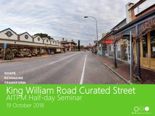
- 1. King William Road Curated Street AITPM Half-day Seminar 19 October 2018
- 2. Background Pavement Condition – requires full renewal High and increasing vacancy rates (as at 2014) Change in retail uses – concern of increase in café/ restaurant uses and loss of retail shops
- 3. 2014 Masterplan Introduced Curated Street concept Intersection Treatments Phased renewal of road pavement to minimise impact to trade Future flexibility for use of space Limited changes to parking – still seen as critical by traders
- 4. 2017 Visitor Perception Study Mission and objectives: “To explore perceptions of the King William Road precinct along with visitor demographics and visitor behaviour” Objectives • Measure business vs visitor perspectives of King William Road • Profile visitors and local residents (including a wider region target audience) • Explore issues and concerns for visitors, residents and business • Understand how best to meet the needs of visitors • Identify priority areas for improvement and how best to engage with visitors and business In depth business interviews, online visitor sample survey and follow up phone survey
- 5. Perception Study Key Findings
- 6. Detailed Design Study • Upgrade the road pavement and streetscape • Ongoing market research and background studies by Council • Three stage consultation process with landlords/traders, community and stakeholders • In depth design analysis of all project disciplines: • Streetscape, landscape and public realm amenity • Civil design • Stormwater assessment and design • Parking and pedestrian surveys, traffic signal intersection assessment • Lighting and electrical assessment • Smart technology and future proofing • DDA assessment • Public art
- 7. Design Development Development of 3 Options Beautiful Street • Most change • Fewest car parks • More outdoor areas Active Street • Modest change • Balance between greening, car parks and pedestrians Accessible Street • Retained most car parks • Less outdoor spaces and pedestrian crossings
- 8. Community Endorsement Community engagement on the 3 design options as well as surface treatment and kerb design • Strong community preference for most change; more greening elements, outdoor spaces and pedestrian crossing points, less on-street parking • Preference for lost parking to be replaced off-street • Desire to retain a roadway using paving • Preference for flush treatment across road, parking and footpath; final outcome is rollover kerb to assist with stormwater management Provided a clear direction for the design to work towards the greater level of change of the “beautiful street” with the rollover kerb and retained road paving
- 9. Design Challenges Car Parking • 2018 parking surveys reconfirmed 2014 surveys • High turnover of on-street spaces generating capacity and parking opportunities • 2018 surveys showed capacity and lower turnover in key off-street car parks • Loss of on-street parking accepted by all as parking not perceived as one of the major visitor issues
- 10. Design Challenges Car Parking Design Basis • Retained car parking in groups of 1-2 spaces to break up the dominant perception of cars within the street • Generous length of spaces (6.3m+)where feasible for ease of entry/exit • Clear width of 2.3m • Use of removable bollards to enable change of use of parking spaces to support event modes and tenant/land use changes • Council to work with landlords/tenants to encourage increased development and use of rear parking areas
- 11. Design Challenges Car Parking Design Basis
- 12. Design Challenges • Some capacity issues at peak periods, most other times spare capacity • Long cycle time for pedestrian accessibility • Desire to reduce the area designated to vehicles to assist adjacent businesses Design basis – two options • Single lane on 3 approaches, south remains as current • Retain some additional lane capacity on Park St (right turn) and King William Rd north (for left and right turn) • Preferred option retained some additional traffic capacity and was endorsed by Council Park and Mitchell Street Traffic Signal Intersection
- 13. Design Challenges Outdoor Dining and Public Realm area protection • Desire to provide a safe environment for diners and public • Limited design guidance to assist; what is available would recommend bollards, bollards, bollards!! High cost and poor streetscape outcome • Risk assessment approach based on: • Nature of use, ODA higher risk than general public realm • Vehicle encroachment risk; highest risk opposite intersections • Reflect the likely crash risk; low vehicle speeds, potential direction of encroachment • Overall, the street has a relatively low risk rating due primarily to vehicle speeds and nature of intersections • Use of energy absorbing bollards at higher risk locations, standard or no bollards at lower risk locations
- 14. Design Challenges Other considerations • Bus stop locations and format – one relocation proposed • Disabled parking – desire for on-street provision but difficult to achieve the required width mandated by the standard • Stormwater Management • Lighting upgrades, particularly for pedestrian crossings • Accommodating future smart technology
- 15. Next Steps • Completion of detailed design and documentation • Final approval processes • Construction from 2019