2. Presented By:
Mayur Patil.(J-39)
Sanket Bhatagalikar.(J-06)
Aakash Surywanshi.(J-56)
Umakant Thorat.(J-61)
Guided By:
Prof G. D. Bhutkar.
DEPARTMENT OF COMPUTER ENGINEERING
BANSILAL RAMNATH AGARWAL CHARITABLE TRUST'S
VISHWAKARMA INSTITUTE OF TECHNOLOGY
(An Autonomous Institute affiliated to University of Pune)
PUNE – 411037
2011-2012
3. AGENDA
About Spain
Geographical Structure of Spain
Economy
Government
History
Regions of Spain
Climate of Spain
Spanish Culture
Military
Satellites of Spain
Application of GIS
References
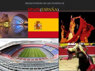
4. ABOUT SPAIN
a country and member state of the European Union
includes the Balearic Islands in the Mediterranean, the Canary Islands in the
Atlantic Ocean off the African coast, and two autonomous cities in North
Africa, Ceuta and Melilla, that border Morocco
Also include town of Llívia is a Spanish exclave situated inside French territory
emerged as a unified country in the 15th century
a developed country with the twelfth largest economy in the world by nominal
GDP
Recognized regional languages
Basque, Catalan/Valencian , Galician and Occitan
Official language(s)
Spanish
Area
504,030 square kilometres (194,610 sq mi) (51st)
Second largest country in Western Europe and the European Union
fourth largest country in Europe
Water(%) 1.04
5. Geographical Structure
LOCATION OF SPAIN
Time zone CET (UTC+1)
Summer (DST) CEST (UTC+2)
in southwestern Europe on the Iberian Peninsula
mainland is bordered to
south and east by the Mediterranean Sea except for a small land
boundary with the British Overseas Territory of Gibraltar ;
the north by France, Andorra, and the Bay of Biscay;
northwest and west by the Atlantic Ocean and Portugal
6. ECONOMY
GDP(Purchasing Power Parity)2011 estimate
Total $1.413 trillion
Per capita $30,622
GDP (nominal) 2011 estimate
Total $1.536 trillion
Per capita $33,297
HDI (2011)
0.878 (very high) (23rd)
Money Matters
Most major credit cards are accepted
Most places have ATMs that allow you
to withdraw cash with your card
1 US Dollar = .77 Euro
7. GOVERNMENT
Unitary parliamentary democracy and Constitutional monarchy
King Juan Carlos I
Prime Minister José Luis Rodríguez Zapatero (PSOE)
Legislature Cortes Generales
Upper House Senate
Lower House Congress of Deputies
Population
2010 estimate 46,030,109 (27th)
Density 93/km2 ; 231/sq m
8. HISTORY
Two major events in Spanish History
CONQUEST OF GRANADA: The CATHOLIC KING AND QUEEN: unity of the
peninsula, created a permanent state served by civil servants and diplomats with a
concept of unity. Spain was one of the first modern states
in Europe.
DISCOVERY OF AMERICA Christopher Columbus
by
under Spanish command
Formation 15th century
Traditional date 569 (ascension to
the throne of Liuvigild)
Dynastic 1479
De facto 1516
De jure 1715
Nation state 1812
Constitutional democracy 1978
9. REGIONS OF SPAIN(19)
Galicia Castilla-la Mancha
Principado de Asturias Extremadura
Cantabria Cataluña
Pais Vasco Comunidad Valenciana
Comunidad Foral de Navarra Illes Balears
La Rioja Andalucia
Aragón Región de Murcia
Comunidad de Madrid Ciudad Autónoma de Ceuta
Castilla y León Ciudad Autónoma de Melilla
Canarias
10. CLIMATE OF SPAIN
Three main climatic zones can be separated
The Mediterranean climate, characterized by dry and warm summers
The semiarid climate , located in the southeastern quarter of the country
the dry season extends beyond the summer.
The oceanic climate , located in north quarter of the country
Contrary Mediterranean climate to winter and summer temperatures are
influenced by the ocean, and have no seasonal drought
11. SPANISH CULTURE
Bullfighting
The National Sport of Spain
711 AD
24,000 bulls are killed each year
Flamenco
The Great Spanish Tradition
Cante: the song
Baile: the dance
Guitarra: guitar playing
Product of the Gypsies
Fiestas and Traditions
Each town has their own celebrations
Celebrate national holidays such as
Christmas, Easter, All Saint’s Day, ect.
Majority of festivities are religious
based
12. MILITARY
The armed forces of Spain are known as the Spanish Armed
Forces
Their Commander-in-chief is the King of Spain, Juan Carlos I
military spending was an estimated 1.2% of the country's GDP
The Spanish Armed Forces are divided into three branches:
Army (Ejército de Tierra)
Navy (Armada)
Air Force (Ejército del Aire)
14. INTASAT 1 HISPASAT 1A& 1B
the first Spanish satellite the first Spanish satellite
Gross mass: 20 kg (44 lb). Gross mass: 20 kg (44 lb).
First Launch: 15/11/1974. First Launch: 15/11/1974.
Type: Communications Type: Communications
technology satellite technology satellite
Power: Solar cells, batteries Power: Solar cells, batteries
Lifetime:2 years Lifetime:2 years
Used : to study the Used : to study the
ionosphere ionosphere
15. MINISAT 01 HISPASAT 1C , 1D
Launced date: Apr 22, 1997 Launched date: Feb 03, 2000 &
Sep 18, 2002
Type / Application: Type / Application:
Experimental Communication
Mass:200 kg Power:2 deployable solar arrays,
batteries
Lifetime: 2 years Mass:3,113 kilograms (6,860 lb)
Used : ; 3250 kg
Lifetime: 15 years
study the background radiation in
the extreme ultraviolet range Used :
study the low energy gamma
provides communications services
to Europe and the Americas
radiation from astronomic sources
digital T.V. broadcast (including
using detectors HgI2 live television),
to study the behaviour of liquid telecommunications, data and
bridges in microgravity conditions video
transmission and access to
Internet and multi media services.
16. AMAZONAS 1 NANOSAT 01
Launched date: Aug 04, 2004 Launched date: Dec 18, 2004
Type / Application: Type / Application: Science
Communication Power: Solar cells, batteries
Power:2 deployable solar Mass: 15 kilograms
arrays, batteries Used : to ensure
Mass: 4545kilograms communications with bases in
Lifetime: 15 years the Antarctica zone
Used : provides a full range
of both fixed and broadcast
communications services,
including TV broadcasting,
business services, VSAT and
data broadcasting
17. SPAINSAT 1 / XTAR-
XTAR-EUR
LANT
Launched date: Feb 12, 2005 Launched date: Mar 11, 2006
Type / Application: Type / Application:
Communication Communication
Power:2 deployable solar Power:2 deployable solar
arrays, batteries arrays, batteries
Mass: 3631 kg Mass: 3683 kg
Lifetime: 15 years Lifetime: 15 years
Used : to operate with Used : which provides
existing and planned defense dedicated communications for
communications terminals the Spanish Ministry of
around the world. Defense.
18. AMAZONAS 2 HISPASAT AG1
Launched date: july, 2007 Launched date: may, 2008
Type / Application: Type / Application:
Communication Communication
Power:2 deployable solar Power:2 deployable solar
arrays, batteries
arrays, batteries
Mass: 5465 kg
Mass: 5465 kg
Lifetime: 15 years
Lifetime: 15 years Used :
Used : provide a full range of a communication capacity of up
telecommunications services to 24 transponders in Ku-band
and three transponders in Ka-
band
a highly innovative payload,
REDSAT, led by Spanish
industry
19. HISPASAT 1E AMAZONAS 3
Launched date: July, 2008 ordered in July 2010
Type / Application: scheduled to be available for
Communication launch in 2012
Power:2 deployable solar Type / Application:
Communication
arrays, batteries
Power:2 deployable solar
Mass: 5270 kg arrays, batteries
Lifetime: 15 years Mass: ~ 5000 kg
Used : Lifetime: 15 years
to provide Fixed Satellite Used :
Services (FSS) and Broadcast will be capable of operating up to
Satellite Services (BSS) 33 simultaneous Ku-band
transponders and 19 simultaneous
C-band transponders over Europe
and North and South America
20. DEIMOS 1 INGENIO & PAZ
Launched date: 2008 Schedule date: 2013 ; 2012
Type / Application: Earth Type / Application: Earth
Observation observation
Power:solar arrays, batteries Lifetime: 7 years ; % years
Used : provide imagery for Uses :
commercial applications, for (Paz): providing images in any type of
government use and for rapid- weather conditions, day and night, and
will primarily fulfil the security and
response following disasters defence needs of the Spanish
government
(Ingenio): to provide
Full autonomy and independence in
image capture
Applications in fields such as security
Land management
Natural resource management
Prevention of natural catastrophes.
21. APPLICATIONS OF GIS
WEB GIS
Geographical Information Systems and Geo information on the Internet
increase the possibilities of learning and teaching about territory. Statistical
data, maps (cadastral, land use, geological…) and images of different places
of the world, especially aerial photographs and satellite images, are put on
the Web by a GIS program.
main aim of GIS is to solve territorial problems, but we will try to take
advantage of the Internet of GIS for spatial skills in Geography teaching
Old GIS system
22. SPAIN AIMS AT MILITARY-CIVILIAN
SATELLITES
Spain is on track to become the first European country to have a dual Earth
observation system, radar and optical, for both civilian and military use
Defense Minister Carme Chacon said radar technology installed on the
satellite, which is totally of Spanish design and manufacture, will enable up to
100 images of the Earth's surface to be taken per day at a resolution of up to 1
yard
Chacon stressed that the Paz
satellite, which will be in orbit in 2013,
will be able to detect the position of
any ship in the world that could
possibly become the victim of
hijacking through an automatic AIS
identification system
23. GEOGRAPHIC INFORMATION SYSTEMS FOR
WATER RESOURCES EVALUATION
Application of GIS-BALAN to Atlantic basins in Spain :
GIS-BALAN evaluates hydrologic components in a sequential manner
and performs a daily water balance in the upper soil, the unsaturated zone
and the underlying aquifer.
Main window of GIS-BALAN pre-processor
It requires only a few parameters and
incorporates user-friendly interfaces for
data input and post-processing of
results.
Computed groundwater levels and
stream flows can be compared to
measured data for the purpose of
model testing and calibration which
can be performed automatically by
minimizing a least squares criterion
24. USED OF GIS FOR RURAL LAND USE PLANNING
IN GALICIA (SPAIN)
Changes experienced in rural areas - depopulation, loss of agricultural
activity - or the appearance of new activities or expectations placed upon the
land require support tools for the decision-making process in terms of
connecting activities and territories
Land use planning models included the analysis and evaluation of their main
characteristics
25. GIS SYSTEM AS A DECISION SUPPORT TOOL FOR
AGRICULTURAL PLANNING IN ARID ZONES OF
SPAIN
objective of this work was to analyze the factors involved in rural
planning to enable the identification of the important agricultural
possibilities and risks related to the province of Almeria, Spain.
Main stages in the creation of this system were:
(a) Information preparation,
(b) Data integration,
(c) Construction of GIS tool (ESTIARA*SIG), and
(d) Exploitation of the information stored at the Ministry of Agriculture of
the Regional Government of Andalusia, Spain, and its updating at the
University of Almeria
A GIS was carried out in the framework of the ESTIARA project, funded by
the Ministry of Agriculture and Fishing of the Regional Government of
Andalusia
26. GIS SYSTEM AS A DECISION SUPPORT TOOL FOR
AGRICULTURAL PLANNING IN ARID ZONES OF
SPAIN(CONT……)
Example of map in ESTIARA*SIG
27. FIRE HAZARD MODELS FROM REMOTE
SENSING
Digitally processed Thematic Map data were integrated with other
layers of geographic information to derive a forest fire hazard map.
The objective of this project was to establish a reliable method for fire
hazard mapping in a mediterranean environment.
Aspect groups for the fire hazard model. Dark grey, southeast (high
hazard); medium grey, southwest (medium hazard); and white, north
(low hazard):
28. Use of Geographic Information Systems as a
Decision Support Tool for the Management of
Mediterranean Fisheries
a global approach which has been formalized in order to develop a
computerized simulation tool called FAST (Fishing Activity
Simulation Tool), distributed as an extension of ESRI ArcView GIS
Software.
FAO COPEMED Project GCP/REM/057/SPA, within the framework of
its activities aiming the enhancement of scientific knowledge for a
better management of Mediterranean Fisheries, has led a regional
training activity on the use of Geographical Information Systems (GIS)
EMA Ltd. Slovenia has been selected
by the National Fisheries Authority (NFA)
of Albania to provide an integrated Vessel
Monitoring System (VMS) for fisheries
management.
Fishing vessel with BlueTraker
29. GIS APPLICATION IMPROVES STADIUM
SECURITY OF FOOTBALL GAMES
These application allows police and emergency responders to track and view
security and safety activities digitally using a Web-enabled, spatial platform
The map displays GIS layers for incidents, rescue squad and police resources,
stadium seating location references, and interior space floor plans overlaid on top
of an aerial view of the stadium and surrounding areas
30. GIS-FOREST TREE SPECIES IN SPAIN
Four Applications
GIS of tree forest species in Spain
This application is a GIS viewer implemented in ArcGIS Server 9.3, with
information about forest tree species included in Spanish RD 289/2003
and in1999-105 European Directive
Use Recommendations of Forest Reproduction Materials
Another Gis-viewer application shows climatic suitability of tree
forest species included in Spanish RD 289/2003 and in1999-105
European Directive, and their use in reforestation
Regions of Provenance in Europe
For some important European species, you can access to the Regions of
provenance in Europe, and the national codes used in the marketing of
forest Reproductive material.
Distribution maps of forest tree species
31. GIS-FOREST TREE SPECIES IN SPAIN (CONT……)
Distribution of Plantation
Evolution of commercial timber harvests in Galicia(1996-2008)