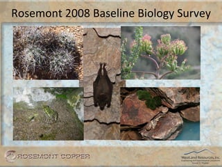
Rosemont 2008 Baseline Biological Survey
•
1 j'aime•392 vues

WestLand Resources, Inc. prepared and gave this presentation during a Technology Transfer meeting with the Forest Service and the various contractors working on the Rosemont Copper project. The presentations were given during November 2008.

Recommandé
Recommandé
Contenu connexe
Similaire à Rosemont 2008 Baseline Biological Survey
Similaire à Rosemont 2008 Baseline Biological Survey (20)
Plus de Hudbay Minerals Inc.
Plus de Hudbay Minerals Inc. (20)
Dernier
Dernier (20)
Rosemont 2008 Baseline Biological Survey
- 1. Rosemont 2008 Baseline Biology Survey
- 3. Helve7a, July 1901 (AHS 3501)
- 4. Helve7a 2004
- 5. Copper World, Schrader (1909)
- 7. Copper World, ca 1902 (AHS 3550)
- 9. Isle Royal Mine, Schrader (1909, Plate XIIb)
- 11. Heavy Weight Mine, Schrader (1909)
- 12. Heavy Weight Mine, 2004
- 13. Ridge at Coconino fault, C. Popoff (1940, VIIIb)
- 14. Ridge at Coconino fault, 2004
- 15. Rosemont smelter, Popoff (1940,VIIa )
- 17. Rosemont Hotel, ca. 1906
- 19. Close up in 2004 of Emory oak (adult in 1906)
- 20. Panoramic View of Ridgeline, Popoff (1940)
- 21. Panoramic View of Ridgeline, 2004
- 22. Pima pineapple cactus (PPC) (Coryphantha scheeri var. robus1spina)
- 23. Objec7ves of PPC survey • Survey for PPC along a 15.8-‐mile 120-‐footwide (229-‐acre) proposed route for the water line from near Sahuarita to Helve7a • Map the loca7on of each PPC plant and determine on which alluvial units this cactus was found in this survey.
- 24. Loca7on of PPC Plants
- 25. Results of PPC Survey • 35 PPC plants were located during the survey in October 2008 • 19 of these plants occurred on very old (early to middle Pleistocene) alluvial deposits near the mouth of Sycamore Canyon. About half of these were on the red clay surface; the other half were in areas incised or veneered with younger soils. • 16 plants occurred on late Pleistocene to early Holocene alluvium on the edge of the Santa Cruz floodplain.
- 26. Results of PPC Survey • No PPC were found in the intervening region along the survey route. • Based on Bureau of Reclama7on surveys for PPC on the Santa Rita Experimental Range and surveys towards Corona de Tucson, the longer alluvial surfaces have been stable (middle to early Pleistocene), generally the more PPC plants are found.
- 27. Palmer’s Agave (Agave palmeri)
- 28. Objec7ves –Agave Impact Area • Determine overall density of agave roseaes in impact area • Determine density of successful flowering stems in impact area • Determine impacts of herbivory on success of flowering stems in impact area • Determine size class structure of popula7on as representa7ve of age class structure
- 29. Objec7ves –Agave Regional Area • Es7mate density of agave roseaes in regional area • Determine density of successful flowering stems in regional area • Make comparisons with impact area
- 30. Methods – Impact Area: • Subset of 1 ha units selected at random from all ha units in impact area • Detailed count of all agaves, by size class, in 0.25 ha por7on of random unit • Count of all current flowering stems and flowering stems from previous years, including those lost to herbivory, with size measurements of flowering roseaes
- 31. Methods – Impact Area: • Count of all successful flowering stems on 1 ha sampling unit • Addi7onal informa7on on slope aspect, geological substrate, and presence of drainages
- 32. Agave Survey – Rosemont Impact Area
- 33. Methods – Regional Area: • Three scales for analysis: – Within Rosemont Property but outside of impact area – Within 5 mi circle centered in proposed project loca7on – Within 20 mile circle centered in proposed project loca7on • Randomly selected points along public access roads
- 34. Methods – Regional Area: • Count all roseaes and current, successful flowering stems within quadrant selected at random • Map coun7ng area on lap-‐pad computer with detailed aerial photography of region • Addi7onal informa7on on slope aspect, geological substrate, and presence of drainages
- 35. Agave Survey Plots – Regional Area Agave Plots 5 Mile Radius
- 36. Agave Survey Results –Impact Area • 76 one-‐hectare plots surveyed • Roseae density range from 0 to 1,088 plants/ ha • Mean roseae density is 140.2 plants/ha (standard devia7on 166.7; standard error of ±19.12) • Flowering stem density range from 0 to 13/ha
- 37. Agave Survey Results –Impact Area • Flowering stem density is 2.91/ha (std. dev. 3.76, s.e. ±0.43) • Geological substrate and slope aspect had no significant effect on agave density • Herbivory has significant impact, causing the loss of 58% of current year flowering aaempts • Long-‐term herbivory impact is about 46% of all flowering aaempts
- 39. Agave Survey Results – Regional Area • 117 plots surveyed – Total area = 500 ha • Roseae density range from 0 to 340 plants/ha • Mean roseae density is 12.3 plants/ha, (standard devia7on 37.8; standard error of ±3.49)
- 40. Agave Survey Results – Regional Area • Flowering stem density range from 0 to 57.1/ ha • Flowering stem density is 2.78/ha (std. dev. 8.56, s.e. ± 0.79)
- 41. Distribu7on of Agave Densi7es Distribution of Agave Densities 35 30 Number of Plots in Group 25 20 15 10 5 0 1 2 3 4 5 6 7 8 9 10 Density Group (n*50 plants/ha)
- 42. Agave Size Class Distribu7on Agave Size Class Distribution 400 350 Numbers of Rosettes 300 250 200 150 100 50 0 1 2 3 4 5 6 7 8 9 10 11 12 13 14 15 16 Size Class - Decimeters
- 43. Agave Density, Running Mean Running Mean and Standard Deviation 350.00 300.00 Agave Density, Plants/ha 250.00 200.00 150.00 100.00 50.00 0.00 1 5 9 13 17 21 25 29 33 37 41 45 49 53 57 61 65 69 73 Sample Number Running Mean, plants/ha Running Standard Deviation
- 44. Flowering Stem Density, Running Mean Flowering Stems, Rosemont 6.000 5.000 Flowering Stems/ha 4.000 3.000 2.000 1.000 0.000 1 5 9 13 17 21 25 29 33 37 41 45 49 53 57 61 65 69 73 Plot Number Running Mean Running Standard Deviation
- 45. Regional Flowering Stem Density, Running Mean Regional Flowering Stem Density 14.0000 12.0000 Flowering Stems/ha 10.0000 8.0000 6.0000 4.0000 2.0000 0.0000 1 9 17 25 33 41 49 57 65 73 81 89 97 105 113 Plot Number Running Mean Running Standard Deviation
- 46. Conclusions 1: • Palmer’s agaves on the Rosemont Site provide a significant foraging resource for lesser long-‐nosed bats during their late summer, post-‐maternity dispersal • Agave densi7es in impact area and in regional area are highly variable and have no obvious rela7onships with substrate or slope aspect • Rosemont Impact Area has size class distribu7on that indicates normal, healthy popula7on of agaves
- 47. Conclusions 2: • Herbivory has significant impact on flowering success • No difference in successful flowering stem density between impact area and regional area • Rosemont Impact Area provides nothing unique with regard to agave popula7ons • Sampling for agave roseae density on regional scale is not representa7ve of actual popula7ons
- 48. Lesser Long-‐Nosed Bat (Leptonycteris yerbabuenae)
- 49. LLNB Survey Objec7ves • Evaluate bat foraging on Rosemont Property • Evaluate bat foraging outside of Impact Area • Evaluate bat roos7ng on Rosemont Property • Evaluate bat roos7ng regionally
- 50. LLNB Survey Methods • Ultrasonic acous7c and infrared surveys on Rosemont Property • Ultrasonic acous7c and infrared surveys outside of Impact Area • Poten7al roost site surveys on Rosemont Property • Poten7al roost site surveys in regional area
- 51. Acous7c Survey Loca7ons • Between McCleary and Scholefield Canyons • East Side of Gunsight Pass • Box Canyon • Near Scholefield Spring • Upper McCleary Canyon
- 52. Flowering Agave
- 53. Ac7ve and Passive Sensor Loca7ons Active Sensor Passive Sensor
- 54. Ac7ve Set-‐up at Flowering Agave
- 55. Passive Set-‐up at Flowering Agave
- 56. LLNB Sonogram
- 57. Acous7c Survey Results -‐ 1: • LLNB recorded at 23 out of 27 sensor loca7ons • Mexican long-‐tongued bat (MLTB) recorded at 4 out of 27 sensor loca7ons • Intensity of foraging ac7vity increased with decrease in flower availability
- 58. Acous7c Survey Results -‐ 2: • Foraging intensity highly variable, from 0 to over 500 hits on an agave flower in 2 hours • Foraging is frequently visual, with no ultrasonic calls • At least one bat species recorded at all loca7ons
- 59. Acous7c Survey Results – 3: • 7 species iden7fied, at least 10 species recorded • Gunsight Pass appears to be corridor for several species of bats (at least 9 recorded) • Other species: big brown bat, fringed myo7s, pocketed free-‐tailed bat, western pipistrel, Brazilian free-‐tailed bat
- 60. Foraging Ac7vity • LLNB foraging on agave flower
- 61. Poten7al Roost Loca7ons – Impact Area • Gunsight Pass Vicinity • Between McCleary and Wasp Canyons • Head of Wasp Canyon
- 62. Poten7al Roost Sites Examined No Evidence of Bats Some Evidence of Bats, or Undetermined Potential Confirmed Presence of LLNB
- 64. Poten7al Roost Loca7ons – Regional Area • Empire Mountains • Mulberry Canyon • West Side of Gunsight Pass • Box Canyon Vicinity • Greaterville Vicinity
- 65. Poten7al Roost Loca7ons – Regional Area • Fish and Sawmill Canyons • Cave Canyon • Gardner Canyon • Temporal Gulch
- 66. Poten7al Regional Roost Sites Examined No Evidence of Bats Some Evidence of Bats, or Undetermined Potential Confirmed Presence of LLNB
- 67. Nec7vorous Bat Guano Splaaer
- 69. Evidence of Bats – Insect Parts
- 70. Roost Sites -‐ Rosemont No Evidence of Bats Evidence of Insectivorous Bats or Unknown Potential Evidence of Nectar Feeding Bats Confirmed Presence of LLNB
- 71. Roost Survey Summary 1 • Total of 105 sites examined • LLNB confirmed presence in 6 sites • MLTB confirmed presence in 14 sites • Evidence of nectar-‐feeding bats in 21 sites
- 72. Roost Survey Summary 2 • 43 sites have evidence of bat use • Insec7vorous bat species observed: cave myo7s, Townsend’s big-‐eared bat, fringed myo7s, and big brown bat
- 73. Regional Roost Sites No Evidence of Bats Evidence of Insectivorous Bats or Unknown Potential Evidence of Nectar Feeding Bats Confirmed Presence of LLNB
- 74. Conclusions – LLNB Foraging • Agaves on Rosemont Site and surrounding areas are heavily used by LLNB for late summer foraging • It is likely that every flowering agave will be visited by LLNB at some point during this season • Rosemont provides an important foraging resource
- 75. Conclusions – Bat Roost Sites 1 • Many abandoned mines in Rosemont Impact Area and in the surrounding vicinity appear to provide suitable roos7ng habitat for LLNB • Evidence of nectar-‐feeding bats (LLNB or MLTB) observed in 21 sites • LLNB presence confirmed in low numbers in only one adit in Rosemont Impact Area
- 76. Conclusions – Bat Roost Sites 2 • LLNB presence confirmed in low numbers in one adit on Rosemont Unpatented Claim Area • LLNB presence confirmed in good numbers in four adits in the vicinity.
- 77. Chiricahua Leopard Frog (Rana [=Lithobates] chiricahuaensis)
- 78. Objec7ves of Ranid Survey • Iden7fy poten7al suitable habitat for ranids within the Impact Area • Determine the presence or absence of ranids (par7cularly Chiricahua leopard frog) within the Impact Area and surrounding areas • Iden7fy the likely source of dispersing ranids (Chiricahua leopard frog) in the Rosemont Vicinity
- 79. Ranid Survey Methods • Survey of drainages, tanks, and springs within the Impact Area in search of suitable habitat • Visual Encounter Survey Method within features suppor7ng suitable habitat • Dip net capture and call playback for iden7fica7on purposes • Precau7ons for disease preven7on
- 81. Chiricahua Leopard Frog Findings • One Chiricahua leopard frog observed within the Impact Area – Lower Stock Tank • Frogs observed outside the Impact Area but within the Rosemont Property – Oak Tree Canyon (One Chiricahua leopard frog) – Highway Tank (One Chiricahua leopard frog)
- 82. Chiricahua Leopard Frog Findings • Frogs observed outside the Rosemont Property – East Dam (One Chiricahua leopard frog) – Box Canyon (Several Chiricahua leopard frogs) – Sycamore Spring and Sycamore Canyon (Two Chiricahua leopard frogs) – Lower Davidson Canyon above Cienega Creek (Several lowland leopard frogs)
- 83. Known Chiricahua Leopard Frog Distribu7on
- 84. Sonorella species in the Rosemont area
- 85. Sonorella rosemontensis Pilsbry • Described as a new species by Pilsbry in 1939 • Type locality “northern end of the Santa Rita Mountains near Rosemont (J. H. Ferriss), Type 166642 A.N.S.P.; Helve7a; Greaterville” • Pilsbry’s (1939) treatment of S. rosemontensis would suggest this species is a narrow endemic restricted to an area somewhere near Rosemont
- 86. Objec7ves of Field and Literature Surveys 1. Review the taxonomic literature on Sonorella rosemontensis, the descrip7ons of the type specimens used, and the concept(s) of species used by the biologists working with Sonorella.
- 87. Objec7ves of Field and Literature Surveys 2. Conduct field surveys for Sonorella (on talus slopes and scree) in the Rosemont project area and other areas of the Santa Rita Mountains.
- 88. Objec7ves of Field and Literature Surveys 3. Visit talus slopes to observe how ac7ve the slopes are in terms of the addi7on of new rock spalling from above, areas of slope failure, and areas of rela7vely stable slopes.
- 90. Sonorella rosemontensis • S. rosemontensis shell is like S. hesterna or S. walkeri shells. • S. rosemontensis verge is not spirally groved (as first described) but is nearly iden7cal to S. walkeri. • S. walkeri has been collected in Agua Caliente Canyon (Soldier Canyon), Madera Canyon, in the southwestern Santa Ritas (Josephine Canyon towards San Cayetanos), and Pajarito Mountains. S. walkeri is also closely related to S. huachucana, a species that occurs in the Huachuca, Patagonia, and Santa Rita Mountains, and as a fossil species in the Mustang Mountains.
- 91. Sonorella rosemontensis • In 1978, Miller wrote that “it is the opinion of the author [Miller] that S. rosemontensis is at least conspecific with S. walkeri and may possibly be a synonym” (p. 111).
- 92. Surveys for Sonorella rosemontensis in the Rosemont area • Walter Miller searched for this species during six field trips from Oct. 1975 to May 1976. He visited 18 locali7es (iden7fied to ¼ of ¼ sec7ons). Miller found S. rosemontensis in only two of the 18 locali7es. • WestLand searched for this species during 20 field trips from July 14 to October 1, 2008. Surveys coincided with the monsoon season. Field trips provided coverage of most of the Rosemont project area and included areas outside of the Rosemont area (Fish Canyon, Mt. Hopkins, Agua Caliente Canyon, and Gardner Canyon).
- 93. Surveys for Sonorella rosemontensis in the Rosemont area • Sonorella shells and in some cases live snails (with an AGFD permit) were collected by WestLand in 14 locali7es in or near the Rosemont project area. Snails were also observed ma7ng, with eggs, and feeding.
- 95. Rosemont Area Talus Snail Survey
- 96. Talus Slopes • Provide humid refugia for Sonorella, some protec7on from predators (mice, flies, beetles), and food (lichens, plants, fungi). • Deep extensive talus on the west slopes of the Rosemont area may provide microsites more like sites at higher eleva7ons around Mt. Wrightson.
- 97. Fungus growing on rocks buried within a humid talus slope, August 2008
- 98. Talus Slopes • Talus slopes are persistent and dynamic. • Most of the talus slopes along the ridge west of the Rosemont project area are composed of quartzite. Quartzite is resistant to weathering; erosion of this ridgeline (over the last ca 1 my) is coupled to rate of erosion of the Bolsa quartzite bed. • As such, these quartzite talus slopes are dynamic but persistent features, with par7cular talus slopes probably las7ng 100,000 years or more.
- 99. View of west slope (Schrader 1909)
- 100. Same view of west slope in 2004
- 101. Google Earth image of north ridge talus slopes
- 102. Shallow talus slope on east side of ridge
- 103. Long talus
- 104. Sonorella habitat • View along edge of talus, rela7vely stable, more lichens and shrubs
- 105. Trees along edge of talus slope • Deep quartzite talus slope, west side
- 106. Xanthoparmelia
- 107. 1909 view of Isle Royale Mine
- 108. Old road bed to Isle Royale (2004)
- 109. Retaining wall of old road bed to Isle Royale
- 110. Pleopsidium a chartreuse crustose lichen, on freshly spalled surfaces of quartzite
- 111. Freshly spalled bedrock surface of quartzite with Pleopsidium
- 112. Stable rock with Xanthoparmelia
- 113. Looking downslope, ac7ve rock slides
- 114. Ac7ve center with quiet edges
- 115. Talus slopes • Unstudied in the Southwest United States • Rock spall along the quartzite ridge appears to be ongoing, at least above the major talus slopes
- 116. Talus slopes • Not yet understood if rate of rock spall is constant between pluvial and interpluvial periods