2. Location
INDIA MADHYA PRADESH BHOPAL CITY
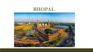
• Bhopal is the capital of the Indian state of Madhya Pradesh and the administrative
headquarters of Bhopal district and Bhopal division. Founded by Raja Bhoj.
• The city was the capital of the former Bhopal State. Bhopal is known as the City of
Lakes.
• One of the 21 Fastest Growing Cities in India. Bhopal is the 20th largest urban
agglomeration in India.
• It is 744 km south of New-Delhi and 779 km northwest of Mumbai.
3. Geography and natural resources
Municipal Land Area:
28717 Hectares
Average elevation of
427 meters (1401 ft.)
Latitude: 23 degree 16
minutes North
Longitude: 77 degree 36
minutes East
Is just north of the upper
limit of
the Vindhya mountain
ranges. Located on
the Malwa plateau
Bhopal city is divided into two
parts where one part which is
near the VIP and lake is old
Bhopal (north) and the other is
New Bhopal (South).
• City's geography has in it
two lakes namely upper
lake and lower lake.
• The catchment area of
the Upper Lake is 361
km² while that of
the Lower Lake is 9.6
km².
• The Upper Lake drains
into the Kolar River.
The Van Vihar National
Park is a national park
situated besides the
Upper Lake.
• Is just north of the upper
limit of
the Vindhya mountain
ranges. Located on
the Malwa plateau
`
The major hills in Bhopal comprise of Idgah
Hills and Shyamala Hills in the northern region
and Arera Hills in the central region.
TOURIST MAP
4. The average yearly rainfall has been observed as 1160 cm.
It is observed that 93.6% of annual rainfall takes place in
the months June to September. the average temperature
being around 30 °C (86 °F). Bhopal has a humid
subtropical climate.
Geography and resources
5. Administration
It houses the State Legislative Assembly, or the Vidhan Sabha. In 1973, the city had a 'City Improvement Trust', to assist
the Bhopal municipal body. In 1973, the Improvement Trust converted to Bhopal Development Authority (BDA) under the
Madhya Pradesh. Town and Country Planning Act, 1973. The Madhya Pradesh Nagar Tatha Gram Nivesh Niyam 1973 (the Act)
provides for formation of development authorities in the State.
"Majlis-e-intezamia" was the name of first municipal body, which
came into being in 1907 in the erstwhile Bhopal estate . Upto 1956
the area under Bhopal Municipal limit was very small , but after
that few more surrounding villages were added to it.
In 1983, Bhopal Municipal Council got the status of Municipal
Corporation, with total 56 wards.
At present total area under Bhopal municipal corporation is 285 Sq.
Kms. Initial constitution of Bhopal Municipality was a 20-member
committee, headed by a non -Governmental president.
6. Period Year Major Event Additional Details
Period
of
Unrest
and
Feudal
Wars
(1010 –
1870
AD)
1010
AD
Site Selection by Raja Bhoj –
Creation of the Upper Lake.
Construction of Earthen Dam.
The poorer section of the
society lined outside the
fort walls. This led to
division of economic and
social groups.
1151 -
1184
AD
Rani Salmali constructed the
Subha Mandal (A place of
learning & worship)
A Stone Wall with 6 major
Gates viz. Imami Gate, Peer
Gate, Jumerati Gate, Itwara
Gate, Budhwara Gate, and
Ginnori Gate was
constructed for protection
under the rule of Dost
Mohammed Khan.
1720
–
1726
AD
Dost Mohammad Khan fortified
the City and built the Fatehgarh
Fort
1828
AD
Qudsia Begum constructed Jama
Masjid. Built Shops, developed
roads.
Period
of Peace
(1871 –
1946
AD) –
East
India
Compan
y
1871
AD
Nazar Mohammad Khan executed
the 'Company Government' Pact
for Peace & Stability
City flourished under
Begum Rule. Jahangir
Mohammed Khan built s
Jehangirabad. Also, City
sprawled towards Ginnori
and Mangalwara
(Unplanned & Haphazard).
Industrial & Economic
development took place
with railway system
establishment.
1880
–
1901
AD
Begum Shahjahan built second
plan extension of
Shahajahanabad with Taj-ul-
Masjid, Taj Mahal etc.
PRACHIR
GHANTA MARG
RAJ MARG
MAHARATHYA
CHOURAHA
BRAHMA STHAN
GATES
History
Raja Bhoj plan
Evolution of
Bhopal city
Legend
7. Period Year Major Event Additional Details
Period after
Independence (1947
– Current)
1948 AD State was merged as Class 'C' in the Indian
Union
Period during which construction of residential
quarters, secretariat and other office buildings
took place. Planned Townships arose along with
better connectivity and services. Markets were
shifted from the City centre to other peripheral
locations.
1956 AD Bhopal became the Capital of New Madhya
Pradesh
1959 -1960 AD Overall Development Plan for Capital Project
Area
1962- 1963 AD Interim Development Plan for Bhopal City
Map showing intense development
of Bhopal City Core (Department,
1991).
Map showing Gates of Walled Core City Bhopal
Hamidia
Sadar manzil
History
8. Heritage and conservation
Bhopal has several mosques, including the 19th-
century Taj-ul-Masjid, the largest mosque in
India. A three-day religious pilgrimage is held at
the mosque annually, which attracts Muslim
pilgrims from all parts of India. The Jami Mosque
was erected during 1833-56 CE during Qudsia
Begum’s reign
The fortified grid iron city of Bhojapala was located towards the east of the lake. About 35 km. towards south-east of Bhojapala was its sister city
called Bhojpur. This city in King Bhoja’s kingdom, perhaps its capital, was a bustling centre of trade and commerce.
The north of the Gohar Mahal became prominent
with the construction of the Moti Mahal. Built by
Sikandar Jehan Begum in 1847 CE, this palace
became the administrative cum residential nucleus.
The ‘baoli’ (Hindi for step well) at
Bara Bagh is a beautiful example
of stepwell architecture.
10. Demographics
House hold size 5.2
No. of households 382690
Year (0-6) 206,967
Ratio male female 917-1000
Urban population 80.53%
Decadal growth rate 24%
Density per hectare 50
Sc/st population % 12/3
11. 1320675
477543
631112
1167106
720207
215961
490496
445672
600468
261582
140616
721434
0 200000 400000 600000 800000 1000000 1200000 1400000
LITERATE
ILLITRATE
WORKING POPULATION
NON WORKING
FEMALE MALE TOTAL
1798218
936168 862050
0
500000
1000000
1500000
2000000
POPULATION
TOTAL MALE FEMALE
242103
46076
125393
23863
116710
22213
0
50000
100000
150000
200000
250000
300000
SC ST
TOTAL MALE FEMALE
Demographics
caste based population division
Total population
Total literacy and employment
Employment
percentage
Household ratio of
Bhopal Literacy ratio
12. Economy
With stable political environment it serves as a hot spot for trade and
commerce. This position is also bolstered by high literacy. The major areas in
Bhopal include New City and Old City. The prominent industries in the old city
are those of cotton, electrical goods . M P Nagar is Bhopal's most prominent
commercial area. The industrial suburb of Bhopal is Mandi-deep. Bharat
Heavy Electricals Limited (BHEL), has its unit in Bhopal.
Indicator City (Municipal
corporation)
State
(Urban)
India (Urban)
Per Capita Income Rs 47214 23539 35947
Urban Poverty Ratio (%
of urban population)
9.72 21 13.7
Major industries Automobile,
Machinery, Textile,
Wood
30%
10%
9%15%
7%
0%
9%
3%
17%
Legislators Professionals Technicians
Clerks Service/sales workers Skilled workers
Craftmens Machine operators Elementry operations
% of work distribution
33%
53%
14%
Primary sector Secondry sector Tertiary sector
Sector wise distribution
BHEL M.P NAGARNEW MARKET
13. Physical Infrastructure
97%
3%
% Access to Electricity
Access to electricity No access
82.12
17.88
% Access to Public toilets
Access to electricity No access
91.92
8.08
% household connected to waste water
Connected Not connected
Type of sewage system- underground and the door to door collection of waste. There
are three main valley provide natural drainage.
67%
33%
% Access to water supply
% Access to water supply Variation of groundwater levels in an area
Less than 8
mbgl show
more
water in
less depth.
More water
availability
in less
depth
14. Water
Bhopal’s water supply: the Upper Lake and the Kolar reservoir. 35 to 40 per
cent of the population of Bhopal uses its own borewells to meet its daily water
needs. There are 35,000 private borewells within municipal limits.
More than 75 per cent of the samples
had total dissolved solids (TDS) and
alkalinity levels above the desirable
limit, while about 50 per cent had
higher hardness values than
prescribed. The study also indicated
bacterial contamination.
Quality of water
15. Sewage generated - 193
million liters per day
(MLD)
Sewage treated- 39 MLD
Remaining sewage goes
into water sources - upper
lake which is also a source
of drinking water for 40 %
of population.
The lower lake does not
have any freshwater
source; it receives
seepage water from the
upper lake and drainage
from 28 sewage-filled
nullahs.
Sewage and solid waste
City’s sewage ends in - Patra, Halali and Betwa rivers.
The Habibganj sewage pumping station, which pumps sewage to Old
Shahpura Pumping Station, is ineffective as sewage does not reach it due to
broken and choked lines
16. Transportation
• The NH12 and NH86
intersect each other at
Bhopal connecting Jaipur,
Jabalpur, Raisen and Dewas.
• Bhopal is a transit point to
travel between Indore,
Hoshangabad, Sehore,
Raisen , Kolar, Vidisha and
Sanchi.
• Roads could not be developed
due to topographicaL
configurations and site
conditions are
• Road from village Chunabhatti
to Bhadbhada
• Road from Asha Niketan to the
proposed Ring Road along
Bhopal-Itarsi Railway line.
10% annum growth in vehicular traffic over the last
decade, of which 80% are 2wheelers Walk 44%
17. • From mandideep to habibganj till NH-86.
BRT- 36 km stretch. T.T nagar, kamla park,
has new market. Highly used so most
effected. No pedestrian corridor.
• The avg. trip length for walking - 1 km in 11
min
Transportation
Lack of multi modal integration
Poor transit quality
Safety of pedestrian
MAJOR ISSUES WITH PUBLIC TRANSPORT
• The levels of service in terms of journey
and waiting time, are not satisfactory.
• Ineffectiveness of bus lanes during peak
hours.
• Lack of integration with other public
transport modes.
• lack of facilities for disability.
• Inadequate bus stop facilities such as
sheltered waiting areas, toilets, etc
• Overcrowding due to inadequate system.
• Frequency of service and schedule is not
strictly adhered
• Detrimental Effects of Public Transport on
City Environment
SOLUTION
Integration of Public Transport system for
savings of time.
• Rationalization of bus routes, bus-
schedules, up gradation of bus stops and
buses
display of complete information, Shuttle
bus services
o Express bus services o Point to point
service
19. Social infrastructure
Spatial Distribution of Parks in Bhopal
Bhopal has about 30,000 acres of green cover that affects its
microclimate; a buffer zone of huge trees bring down city’s
temperature by about 5 degree Celsius.
Proximity:
All the major parks of Bhopal and 5 minutes & 10 minutes walking
distance from the center of the parks which is 400m & 800m.
Social Need
High concentration of dwelling in the old areas of Bhopal, they are
highly dense and hence they are in more need of urban parks
which is not present there.
There is a need of health and educational facilities, for increasing
demand of population and improper health facilities in slum
areas.
20. Development plan
Bhopal development Plan 2005
• Draft development plan of Bhopal was published on 17-10-94.
• Mandideep, exerting pull of expansion, this area becomes prime choice for
future city expansion.
Indicators for Peri Urban areas
• Two sub-cities to
accommodate around 10
lakhs additional
population, on located
around Misrod & Neori.
21. Study of Urban Area Bhopal, 2011
Prior to the year 1989 the activities were concentrated mainly
around industrial areas (BHEL) and the old city. From 1989 to 1999
the city expanded mainly in the northern direction. The growth
pattern of Bhopal between 1999 and 2009 indicates a shift in
preference for areas in the south and south-east, mainly between
Kolar road and Hoshangabad.
Urban sprawl on the western part of the city was discouraged due
to the presence of the Upper Lake. The city also expanded on NH-
12, in the direction of Mandideep industrial area. The recent built-
up sprawl is around the airport and cantonment areas.
Built up and growth of city
25. Poverty and slum
Slums- 380
Slum Population and HHs- 936066 Pop. and 183989 HHs.
The decadal slum growth was around 110%, just a little higher than
the National average. slum population went up by a massive 857%,
Demographics of slum of Bhopal city
26. Basic Services for Urban Poor
There are total 12 BSUP projects are in progress in Bhopal.
• 10 projects of Housing and Infrastructure sanctioned for Rs.
26039.60 lac.
• 2 projects of Integrated Development of Slum and Poor
Locality for Rs. 8061 lac.
• Rs 21870.23 lac received as various ACA installment through
GoI, State and BMC’s matching share.
27. The last six decades have seen rapid urbanization near the
Bhoj Wetland resulting in various environmental problems.
The water quality is getting deteriorated.
Following are some of the main activities suggested by the environment
scientists to improve the Bhoj wetlands:
•Dredging and de-silting are required to improve water quality.
•Treatment of catchment area.
•The government needs to develop a sewage treatment management scheme
to stop sewage from entering the lakes.
•Solid waste management and other shoreline or fringe-area management
activities besides deweeding, aquaculture, and installation of floating
fountains are also needed.The Bhopal gas leak
Environmental issues
Bhopal land fill
LAKE CLEANING PROGRAMME
‘Lake Bhopal Conservation and Management Project’, or the Bhoj Wetland
Project: The project covers 23 municipal wards – 18 per cent of the city’s
area
In 2009, the state government decided to act. It began a public campaign – Apna
sarovar apni dharohar Bada Taal sanrakshan abhiyan – to increase the lake’s
capacity.
28. STRENGTH
• Eco- tourism, the project has been
initiated at village like Samardha.
• Heritage conservation should be
properly implemented to
conserve the historical
importance of city.
• The location and connectivity to
major cities plays a important role
in growth of city.
• They already have some place
making
• Eco- friendly, one of the least
polluted cities in Asia.
• Well planned with avg. distance
between neighborhoods 1-2 km
and city centers ranging from 3-
4km.
SWOT
WEAKNESS
• Insufficient civic infrastructure in old
city.
• High vehicle density.
• 50% of people in LIG and EWS
category.
• Unplanned and haphazard sprawl
among green areas.
• Deterioration of lakes.
• Old city have more compact growth
leading to traffic congestion.
• Lack of proper public
transportation.
• As there is high literacy but
employment is low
• Failure in development of transport
corridor led to poor phase wise
development
• There is also a need of solid waste
management in the city.
OPPORTUNITIES
• Potential for redeveloping government land
• Plenty of local skilled labours, due to migration
• The working class age group is high.
• The new city has wide roads but lacks
pedestrian vehicular segregation
• Many re-densification schemes coming up, new
areas being planned.
• Tourism can be an aspect to develop because of
lakes, zoological parks and Sanchi is 46 km from
Bhopal.
THREAT
• Low quality of education
• uncontrolled and unplanned development-
villages which are not urban areas as per the
census definition are getting into urban
sprawl, due to the presence of connectivity.
• The increasing slum population is a major
issue.