Engineering Geology Lecture 3
•Télécharger en tant que PPT, PDF•
4 j'aime•1,212 vues

This document provides an overview of landslides and geohazards. It defines landslides and describes different types such as rotational, translational, and flows. Causes of landslides like earthquakes, heavy rainfall, slope geometry, and erosion are discussed. The document outlines approaches for landslide hazard mapping including qualitative, quantitative, and statistical methods. Finally, it presents methods for landslide remediation like increasing slope stability through drainage improvements, retaining walls, reinforcement, and vegetation.

Recommandé
Contenu connexe
Tendances
Tendances (20)
Similaire à Engineering Geology Lecture 3
Similaire à Engineering Geology Lecture 3 (20)
Plus de University of Gondar
Plus de University of Gondar (9)
Dernier
Dernier (20)
Engineering Geology Lecture 3
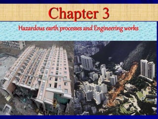
- 1. Chapter 3 Hazardous earth processes and Engineering works 11/6/2019 1
- 2. 2
- 3. Chapter Outline Introduction Landslide and its impact on the ground Earth quake hazard Volcanic hazards Land Subsidence and Collapse 3
- 4. At the end of this chapter Students able to understand different geohazard Students able to identify and mapping geohazard Students able to perform hazard/susceptibility mapping and seeking appropriate engineering solutions 4
- 5. Introduction What is geohazard ? is a geologic event that has the potential to causing great loss of life and property damage. What is natural hazard? • Natural events causing both destroy property and cause a loss of life or property damage
- 6. 6
- 7. 7 Definition and concepts Forecasting, or predicting, the interaction of engineering works with earth processes is necessary for safety and reliability. i. Natural hazard: means the probability of occurrence within a specified period of time and within a given area of a potentially damaging phenomena.
- 8. 8 ii. Vulnerability: means the degree of loss to a given element of set of elements at risk-resulting from the occurrence of a natural phenomena of a given magnitude. It is expressed on a scale from 0 (no damage) to 1 (total damage). iii.Elements at risk: means the population, properties, economic activities, including public services etc. at risk in a given area. iv.Specific risk: means the expected degree of loss due to a particular natural phenomena.
- 9. 9 Major Types of Geo-hazards (a) Slope failures are landslides, which can occur in almost any hilly or mountainous terrain, or offshore The potential for failure is identifiable, and therefore forewarning is possible, but the actual time of occurrence is not predictable. Most slopes can be stabilized, but under some conditions failure cannot be prevented by reasonable means.
- 10. 10 (b) Ground subsidence, collapse, and expansion usually are the result of human activities and range from minor to major hazards, although loss of life is seldom great as a consequence. Their potential for occurrence evaluated on the basis of geologic conditions, is for the most part readily recognizable and they are therefore preventable or their consequences are avoidable. (c) Earthquakes-represent the greatest hazard in terms of potential destruction and loss of life. They are the most difficult hazard to assess in terms of their probability of occurrence and magnitude as well as their vibrational characteristics, which must be known for a seismic design of structures. Recognition of the potential on the basis of geologic conditions and historical events provides the information for a seismic design.
- 11. 11 (d) Volcanic activities is the upcoming of materials from the interior part of the earth. it can be liquid (lava), solid (pyroclastic materials), and volatile gases (e) Floods- have a high frequency of occurrence, and under certain conditions can be anticipated. Protection is best provided by avoiding potential flood areas, which is not always practical. Prevention is possible under most conditions, but often at substantial costs. (f) Health hazards-related to geologic conditions include asbestos, silica and radon, and the various minerals found in groundwater such as arsenic and mercury. Recently, mold has been added to the list of health hazards.
- 12. 12 Slope Failures/ Landslides What are landslides ? What causes landslides ? How do we recognize landslides ?: active, dormant, potential? How do we analyze landslides? How do we remedy a landslide ?
- 13. Definition of a Landslide Landslides are rock, earth, and/or debris flowing or sliding down slopes due to gravity The slope could be natural or man-made, in excavation or fill in soil or rock
- 14. Natural Hill Slopes Cut Hill Slopes Man-made Embankments Excavations/Trenches In Natural Ground
- 15. The Failure Plane (Surface of Rupture) The failure plane may or may not be circular Slope failures in rock and soil are generally different – in soils the failure plane generally passes through the soil mass – in rocks the shear plane is generally along the discontinuities (joints)
- 16. Types of Landslide 16 b) Translational slides occurs when the failure surface is approximately flat or slightly undulated a) Rotational slides move along a surface of rupture that is curved and concave.
- 17. D) Toppling occurs when one or more rock units rotate about their base and Collapse. C) Fall: Free falling of detached bodies of bedrock (boulders) from a cliff or steep slope Types of Slope Movements C. FALL D. TOPPLE
- 18. Slope Movements… E. Various Flows Mudflow in Ineget area , Ethiopia Debris flow
- 19. Types of Slope Movements F. Lateral Spread Lateral spreading occurs when the soil mass spreads laterally and this spreading comes with tensional cracks in the soil mass.
- 20. 20 Creep is extremely slow downward movement of dry surfacial matter. Movement of the soil occurs in regions which are subjected to freeze-thaw conditions. The freeze lifts the particles of soil and rocks and when there is a thaw, the particles are set back down, but not in the same place as before. It is very important for CEs to know the rate of movement Soil Creep
- 21. Mechanism of slope failures • There are main types of slope failure mechanism which are: • Rotational failure • Wedge failure • Toppling failure • Plane failure 4/17/2018 12
- 24. States of Landslide An active landslide is currently moving A suspended landslide has moved within the last twelve months but is not active at present A reactivated landslide is an active landslide that has been inactive An inactive landslide has not moved within the last twelve months Inactive landslides can be subdivided into these states: A dormant landslide is an inactive landslide that can be reactivated by its original causes or other causes An abandoned landslide is an inactive landslide that is no longer affected by its original causes A stabilized landslide is an inactive landslide that has been protected from its original causes by artificial remedial measures A relict landslide is an inactive landslide that developed under geomorphological or climatic conditions considerably different from those at present 24
- 25. Sliding Block Experiment Increasing the normal force increases the resistance to sliding and vice versa N S T N S T N R T = N tan ø + C T/N = tan ø ø
- 26. T = N tan Ø + C Mohr- Coulomb Equation T = RESISTANCE N = NORMAL FORCE / STRESS Ø = ANGLE OF INTERNAL FRICTION C = COHESION INERCEPT FACTOR OF SAFETY (FOS) = RESISTING FORCE DISTURBING FORCE N tan Ø + C S FOS = FOS > 1; SLOPE IS STABLE FOS < 1; SLOPE IS UNSTABLE FOS = 1, ??
- 27. Sliding Block on Slope N S T N = W cos θ θ W S = W sin θ T = N tan Ø + C = (W cos θ) tan Ø + C N tan Ø + C S FOS = FOS = (W cos θ) tan Ø + C W sin θ
- 28. Effect of Water on Slope Stability Water induces an uplift pressure (buoyancy) U = Pore water pressure partially saturated soils fully saturated soils water flow in soils (seepage) Water in soil: is it beneficial or a detriment ? experiment with sand FOS = (W cos θ-U) tan Ø + C W sin θ
- 29. What Causes Landslides Factor of Safety = Decrease in Resisting Force Increase in Destabilizing Force Resisting Force Destabilizing Force
- 30. Increase in Destabilizing Force Earthquakes Loading at the Top Seepage Pressure EARTHQUAKE FORCE
- 31. Decrease in Resisting Force Toe Cutting Toe Erosion ` Steepening of Slope
- 32. Decrease in Resisting Force Increase in Pore Water Pressure Decrease in Negative Pore Water Pressure U U FOS = (W cos θ-U) tan Ø + C W sin θ N N FOS = (W cos θ-(-U) tan Ø + C W sin θ
- 33. Decrease in Resisting Force Draw Down Changes in Soil Properties With Time Deforestation C C
- 34. Recognizing Landslides Active landslides – most easily recognized – tell-tale signs Inactive (dormant) landslides – more difficult to recognize – some old tell-tale signs exist Potential landslides – most difficult to recognize – presence / absence of contributing factors – require detailed study – experience of region
- 35. Indicative Signs of Landslides Tension cracks Depression at top (water ponding) Bulging at toe
- 36. Indicative Signs of Landslides Water Seepage (Generally at Toe) Tilted and crooked trees Change in vegetation roots sheared
- 37. Indicative Signs of Landslides Change in topography Change in drainage pattern
- 38. 11/6/2019 38 F.C. Dai et al. (2002) landslide Hazard Mapping Methods and Procedures
- 39. Data Needs for Landslide hazard Mapping Data which required for LHZ is different for different methods, for instance, Statistical analysis methods will need: – Topographic map – Geologic map – Data of seismic history – Satellite / google earth image – Hydrologic record data – Landslide inventory map – Land use /land cover map – Slope map – Slope aspect map – Curvature map – Soil map – Elevation map – Geomorphology Geotechnical approach will need : soil thickness, soil strength, unit weight, groundwater pressures, slope geometry etc. 11/6/2019 39
- 40. landslide Hazard Zonation Procedure Three key assumptions are used to LHZ preparation such as – Identified landslides and factors of LS – Estimate relative significance of the factors – Estimate future slope instability based on factors of past LS Soft wares for landslide hazard mapping GIS, Excel, SPSS, GeoStudio, and Google Earth To prepare LHZ the following skills are important : RS & GIS analysis techniques Data collection & RS data type selection LS inventory map preparation Image processing & interpretation Data interpretation & verification11/6/2019 40
- 41. 1. Qualitative(a heuristic) assessment general steps: – Preparing casual factor data layer (GIS – Layer) – Normalization using internal weighting of the causal factors – Generation of weighted normalized data layers – External weighting of each criteria- data layer – Generation of a hazard index, – Classification of the area 2. Quantitative (a statistical) assessment general steps: – Recognizing & collecting of the causal factors & landslides – Calculating the statistical parameters – Determining the weights for causal factors – Sum all weighted causal factors in GIS. – Classifying the area 11/6/2019 landslide Hazard Zonation Procedure cont..
- 42. Information value & Logistic regression methods Z = b0 + b1x1+b2x2 + b3x3…bnxn N 11/6/2019 42
- 43. Flow Charts for Slope Stability Analysis using Limit equilibrium method n Limit equilibrium method
- 44. Remediation of Landslides DISTRESS SITE RECONNAISSANCE UNDERSTAND MECHANISM UNDERSTAND CAUSE GEOTECHNICAL INVESTIGATIONS ANALYSIS STUDY POSSIBLE ALTERNATIVE SOLUTIONS CHOOSE BEST OPTION THERE IS NO TYPICAL SOLUTION
- 45. 45 Stabilization/mitigation methods What are the remedies or measures specific to reducing the risks associated with: Slope failures? Earthquakes? Ground subsidence, heave, etc? Volcanic activity?
- 46. Remediation of Landslides Factor of safety = To increase the factor of safety – increase the resisting force – decrease the destabilizing force resisting force destabilizing force
- 47. Remediation of Landslides Increase the Resisting Forces Load the toe Provide resisting support – retaining walls Buttress concrete or masonry piled
- 48. Remediation of Landslides Increase the Resisting Forces Afforestation Increase soil resistance – additives – grouting – chemical treatment C
- 49. Remediation of Landslides Increase the Resisting Forces Reinforcement
- 50. Remediation of Landslides Decrease the destabilizing forces Flatten the slope Reduce surface and sub-surface water in the slopes U U FOS = (W cos θ-U) tan Ø + C W sin θ •interceptor drains •berm drains •toe drains •horizontal drains •sub-surface/toe drains
- 51. Remediation of Landslides Decrease the Destabilizing Forces Reduce load at the top Toe protection Surface protection
- 52. 52 Engineering Retaining Structures In soil slopes considerable stability can be attained by providing retaining structures. Permanent retaining structures Temporary retaining structures Permanent retaining structures; Gravity retaining wall- These walls depends upon their weight for stability. Semi gravity retaining wall-small amount of reinforcement is provided near the back face Cantilever retaining wall -are made of reinforced cement concrete. The wall consists of a thin stem and a base slab cast monolithically. 11/6/2019
- 53. 53 Surface protection of slope • Slopes in soft rock or soil are prone to serious erosion during heavy rain and some rock slopes suffer form deterioration due to weathering when exposed. • Local conditions and the types of materials will generally determine the measures which are taken on any particulars site. 11/6/2019 Vegetation cover is one of the most common methods of surface protection in shallow slope stability. This can be by; By reducing the pore water pressure through evapotranspiration, Intercept direct impact of precipitation and reducing the effective surface area to reduce percolation. The plant roots tightly strengthen the underlying soils.
- 54. 5411/6/2019 Slope reinforcement method • Rock bolt in rock slopes; rock bolt is a long anchor bolt, for stabilizing rock excavations, which may be used in tunnels or rock cuts. It transfers load from the unstable exterior, to the confined (and much stronger) interior of the rock mass. • Shotcrete : For the slopes having conditions prone to rapid weathering and break down upon exposure, use of pneumatically applied mortar or shotcrete is very effective. • Gabions: The use of gabions can be considered for slope protection. Gabions are rock filled wire baskets which are strong, heavy, flexible and permanent.
- 56. Landslide Hazard in Ethiopia 4 • landslide has been a frequent problem in Ethiopia spatially in the high land parts of north, south, western and rift escarpment valley (Ayele et al.,2014). • Over 700 landslide sites recorded in Ethiopia; mostly affecting rural communities, infrastructures, farm lands, dwelling houses (KifleWoldearegay,2013). Earth slide along Jimma-Agaro road 11/6/2019 56
- 57. Landslide type, factors ,distribution and effects in Ethiopia Landslide type in highland of Ethiopia Types of landslides triggered by rainfalls in the highlands of Ethiopia include: debris/earth slides, debris/earth flows, and rockslides. But rock fall& toppling have little association with rain fall Kifle Woldearegay(2013) 11/6/2019 57 Along Shire-May Tsebri road Tarmaber area, Feresmay area Jimma area Mush area (Debreberhan) Adishu area
- 58. landslide controlling factors in the highlands of Ethiopia Most of the slope failures in the highlands of Ethiopia are happened because of rainfall geological (lithological and structural) settings, slope shapes, slope gradients, Drainage lines(stream incisions/gullying) and Slope modification, and vegetation cover. 11/6/2019 58 produced by Ayalew (1999), Woldearegay et al. (2005), and Woldearegay (2005).
- 59. Landslide distribution in high land of Ethiopia The following areas are subjected for landslide hazard because of its complex geomorphological, hydrological, and geological setting. Desie town, norther highland of Ethiopia Abay Gorge centeral highland of Ethiopia Jima basin central highland of Ethiopia Goffa, gilgel gibe II & sodo shone area(southern Ethiopia ) Tekeze basin northern Ethiopia Paleozoic glacial & post glacial sediments in Tigray , northern Ethiopia Tarmaber & surrounding area in central highland of Ethiopia In different Welo area northern highland of Ethiopia Wondogenet area(southern Ethiopia ) Kifle Woldearegay(2013) Figure 7. Locations of landslide- affected areas in relation to the rainfall distribution (mean annual rainfall in mm) in Ethiopia. 11/6/2019 59
- 60. Landslide effects in the high land of Ethiopia landslides in the highlands of Ethiopia indicated that high hazards to economic, social and environmental significance. E.g. Researcher Magnitude of damage Year of occurrence Damaged Elements • L. Ayalew (1999) >100km >200 >500ha 300 1993 - 1998 • Asphalt road • Dwelling House demolished • Lands • Human lives climbed • Woldearegay (2005) 135 3500 $ 1.5M US Dollar 1998 - 2003 • human lives have been lost, • people were displaced and • an estimated worth property has been damaged • Ayenew and Barbieri (2005) • landslides in Dessie town have been affecting roads, buildings, pipe-lines, and other infrastructures in the town. • (Woldeaegay, 2008; Atsbeha, 2008; Schmeider et al., 2008) • >3000 • 1250 • 4 • 4 • over 1500 ha Landslide in tarmaber • people were displaced; • dwelling houses were demolished; • Churches, Mills, and one elementary school were destroyed; • farm land was devastated. 11/6/2019 60
- 61. 11/6/2019 61 Bonga-Mizan road Kifle Woldearegay(2013) Landslide effects in the high land of Ethiopia
- 62. 2. Landslide damage A) in Tora Meda B) in Getesemane C) in Yewaye D) in Angot E) in Ineget F) in Sekela and G) in Debre Yakob n Landslide Effects in the high land of Ethiopia
- 63. 10. Some examples of of landslide hard zonation in different part of Ethiopia Researcher LHZ/LSZ methods location Identified Factors Tenalem Ayenew a, Giulio Barbieri b(2004) Semi quantitative approach VES in the city of Dessie • Geology ,topography,geomorphology,geothechnical properties of soil & rocks • Hydro metrological conditions • Bekele et al (2009) Review & field survey Desie,Tigray, wondogenet & Blue Nile gorge • geological and hydrological conditions, human interference , springs and rain fall Birhanu Erimias 2014 slope stability susceptibility evaluation parameter (SSEP) route from Alem ketema – Ambat village, north Shewa • intrinsic parameters: slope geometry, slope material, structural discontinuities, land use/ land cover & groundwater • external triggering factors : seismicity, rainfall & manmade activities • B. Temesgen I**, M. U. Mohammed’ and T. Korme’ (2001) GIS environmental modelling and statistical approach Wondogenet Lithology,structure, slope aspect,watercourse,vegetation biomass 11/6/2019 63
- 64. Earth Quake An earthquake (also known as a quake, tremor or temblor) is the perceptible shaking of the surface of the Earth, resulting from the sudden release of energy in the Earth’s crust that creates seismic waves. 64
- 65. Seismology-science Seismograph-instrument Seismogram-recorded data Epicenter- point on the surface Hypocenter (focus)- source of earthquake Focal depth- vertical distance from epicenter to focus Earthquake magnitude- amount of energy Earthquake intensity- amount of damages 11/6/2019 65 Earth Quake Earthquake Terminologies
- 66. 66
- 67. Why Earthquakes are concentrated in plate boundary? 67 Usually, the rock is moving along large cracks in Earth's crust called faults. Most earthquakes happen at or near the boundaries between Earth's tectonic plates because that's where there is usually a large concentration of faults. Movement along those faults can cause earthquakes too
- 68. Earthquake Hazard Factors that influence the seismic response at a site are: Type and lithological composition of materials, especially superficial deposits with a geotechnical behavior corresponding to that of soils. Thickness of sediments and the depth of substratum Dynamic soil properties Depth of water table Surface and substratum morphology Presence of faults, their situation and characteristics. The building designs and construction materials Magnitude of the quake, The distance from the epicentre Depth of focus Density of the population11/6/2019 68
- 69. 1. Ground Shaking or Ground Motion The earth shakes with the passage of earthquake waves, which radiate energy that had been “stored” in stressed rocks, and were released when a fault broke and the rocks slipped to relieve the pent – up stress If an earthquake generates a large enough shaking intensity, structures like buildings, bridges, and dams can be severely damaged, and cliffs and sloping ground destabilized. Perched or stacked object may fall and injure or bury anyone close by. Ground shaking will vary over an area due to such factors as topography, bedrock type, and the location and orientation of the fault rupture.11/6/2019 69 Earthquake Hazard
- 70. 70
- 71. 1. Soft first story/inadequate shear strength Column failure/ broken joints/too much weight for building design or construction 11/6/2019 71
- 72. Mid-story collapse, Kobe earthquake 11/6/2019 72
- 73. 73 2. Ground or Surface Rupture Surface rupture is an offset of the ground surface when fault rupture extends to the Earth’s surface. Any structure built across the fault is at risk of being torn apart as the two sides of the fault slip past each other. Normal – and reverse – (collectively called dip – slip) faulting surface ruptures feature vertical offsets while strike – slip faulting produces lateral offsets. Many earthquake surface ruptures are combinations of both. Structures that span a surface fault are likely to suffer great damage surface ruptures Earthquake Hazard
- 74. 74 3. Liquefaction Soil liquefaction is a phenomenon in which the strength and stiffness of a soil is reduced by earthquake shaking or other rapid loading. It normally occur in saturated soils, that is, soils in which the space between the individual particles is completely filled with water. Prior to an earthquake, the water pressure is relatively low – the weight of the buried soil rests on the framework of grain contacts that comprise it. However, earthquake shaking can disrupt the structure, the soil particles no longer support and all the weight, and the groundwater pressure begins to rise. Earthquake Hazard
- 75. 75 4. Earthquake – induced ground subsidence and lateral spreading Subsidence, or lowering of the ground surface, often occurs during earthquakes. This may be due to downward vertical displacement on one side of a fault, and can sometimes affect a huge area of land. Coastal areas can become permanently flooded as a result. Subsidence can also occur as ground shaking causes loose sediments to settle and to lose their load bearing strength or to slump down sloping grounds. Lateral spreading occurs where sloping ground starts to move downhill, causing cracks to open up, that are often seen along hill crest and river banks. Earthquake Hazard
- 76. 76 5. Tsunami A tsunami also known as a seismic sea wave, is a series of waves in a water body caused by the displacement of a large volume of water, generally in an ocean or a large lake. Earthquakes, volcanic eruptions and other underwater explosions, landslides, glacier caving, meteorite impacts and other disturbances above or below water all have the potential to generate a tsunami. Earthquake Hazard
- 77. 77 Earthquake Hazard 6. Earthquake – induced landslides Landslides are frequently triggered by strong ground motions. They are important secondary earthquake hazards. The term landslide includes a wide range of ground movement, such as rock falls, deep failure of slopes, and shallow debris flows. However, gravity acting on a steep slope is the primary reason for all landslides. Strong earthquake- induced ground shaking greatly increases the likelihood of landslides where landscape is susceptible to these types of ground failure. If the ground is saturated with water, particularly following heavy rainfall, the shaking will result in more landslides than normal
- 78. Earthquake hazards in Ethiopia Ethiopia is situated along main African rift system along which active volcanic and earthquake have been taking place. Due to its location right on one of the major tectonic plates in the world, earthquakes have been a fact of life in Ethiopia for a very long time. Urbanization is increasing in Ethiopia and infrastructures are constructing without consideration of earthquake for a long period. The effects of earthquake depends on the soil thickness, soil wetness, construction materials and distance from the source. Based on these factors, buildings in Ethiopia are susceptible to earthquake destruction. Some record data shows that, Ethiopia was face difference earthquake magnitude in the past history. These earthquake are distributed along the rift valley. 11/6/2019 78
- 79. Location Year Magn Distance of Epicenter from Addis (kms) ** Damage • Langano 1906 6.8 110 Felt as far as Addis. • Kara Kore 1961 6.7 150 Town of Majete destroyed. Kara Kore seriously damaged. • Central Afar Area 1969 6.6 Town of Serdo destroyed. • Wendo Genet 1983 300 • Langano 1985 6.2 110 • Rift Valley Area 1987 6.2 200 Widely felt and widely- spread damage. • Dobi [Central Afar] 1989 6.3 200 Several bridges damaged. • Adama 1993 6.0 (?) < 100 Injuries and damage in Adama Also felt in Bishoftu and Addis Ababa. • Lake Shala - Adamitulu 1999 250 11/6/2019 79
- 80. To reduce this effect seismic building code is prepared in 1983. The Ethiopian building code standard (EBCS) has a series of ten standard to design building under different construction materials. – EBCS-1-95- Wind analysis and design of buildings – EBCS-2-95 - Structural Use of Concrete. – EBCS-3-95 - Design of Steel Structures. – EBCS-4-95 - Design of Composite Steel and Concrete Structures. – EBCS-5-95 - Utilization of Timber. – EBCS-6-95 - Design of Masonry Structures. – EBCS-7-95 - Foundations. – EBCS-8-95 Earthquake analysis and design of buildings. – EBCS-9-95 - Plumbing Services of Buildings. – EBCS-10-95 - Electrical Installation of Buildings. 11/6/2019 80
- 81. Based on the susceptibility of the area to damage when earth quake takes place, Ethiopia is zoned into five seismic zones. This zoning is used to develop seismic building code standard; which is a guide to design a safe building which can withstand a seismic effects. 11/6/2019 81
- 82. What to do? Much of the risk may be mitigated by: Implementation of Early Warning Systems. Improvement and implementation of building codes. Fault mapping. Hazard mapping used to selecting less susceptible area using hazard zonation map 82
- 83. Early Warning System In many cases, the magnitude of an impending earthquake may be estimated a few tens of seconds prior to the arrival of the destructive ground motion to the populated area. In such cases, many lives may be saved simply by: • Shutting down power supplies. • Shutting down of nuclear reactors. • Stopping or reducing the speed of fast trains. 30
- 84. Building codes • Earthquake don’t kill - buildings do (but also tsunami). • Earthquake resistant construction costs only 10% more than nonresistant construction. • Structures in CA built after 1976, when a new building code was implemented, suffered very little damage in the 1989 Loma Prieta and the 1994 Northridge. • The implementation gap. 31
- 85. Fault mapping * Earthquakes occur on faults. Yet, the location of some major faults is unknown. 32
- 86. How would you mitigate damages from…. • • • • Ground Rupture Liquefaction Ground Shaking Tsunami 48
- 87. 87 Ground Rupture Avoid construction Relocate sensitive facilities Implement low use facilities –Playing fields –Green space Liquefaction • Recognize liquefaction potential • In-situ remediation • Avoid construction in liquefaction prone areas
- 88. Tsunami Mitigation Early warning system – Broadcast signal to beaches after a major earthquake anywhere in the ocean basin Safety guidelines –Go to high ground –Climb a tree Ground Shaking Recognize the degree of probable ground shaking in the area Improve construction methods to accommodate shaking without collapse 88
- 91. Volcanic hazards 11/6/2019 91 What type of hazards can you think of associated with a volcanic eruption?
- 92. Volcanic hazards Primary Effects lava flows pyroclastic eruptions poisonous gas emissions Collapse/ subsidence Secondary Effects – mudflows and debris avalanches – flooding (glacial outburst floods) – Tsunamis – Seismicity – atmospheric effects and climate change 11/6/2019 92
- 93. Lava flow Lava is molten rock that flows out of a volcano or volcanic vent. Depending on its composition and temperature, lava can be very fluid or very sticky (viscous). Hazards of most lava that flow with slow speed can easily avoided, but a lava flow usually cannot be stopped or diverted. Because lava flows are extremely hot - between 1,000-2,000°C (1,800 - 3,600° F) - they can cause severe burns and often burn down vegetation and structures. Lava flowing from a vent also creates enormous amounts of pressure, which can crush or bury whatever survives being burned. 11/6/2019 93
- 94. Pyroclastic fall/ flow Pyroclastic falls occur when tephra ( fragmented rock) of variable size is ejected from a volcanic vent during an eruption and falls to the ground some distance away from the vent. The fall can destruct human and infrastructures by burying. Pyroclastic material injected into the atmosphere may have global as well as local consequences. When the volume of an eruption cloud is large enough, and the cloud is spread far enough by wind, pyroclastic material may actually block sunlight and cause temporary cooling of the Earth's surface 11/6/2019 94
- 95. 83
- 96. 84
- 97. 85
- 98. Lahars Lahars are a specific kind of mudflow made up of volcanic debris. Lahars flow like liquids, because they contain suspended material Lahars can travel at speeds of over 80 km/h. Lahars are not as fast or hot as other volcanic hazards, but they are extremely destructive. They will either bulldoze or bury anything in their path 11/6/2019 98
- 99. 86
- 100. 87
- 101. 88
- 102. Poisonous volcanic gas Most of the gas released in an eruption is water vapor (H2O), and relatively harmless, but volcanoes also produce carbon dioxide (CO2), sulfur dioxide (SO2), hydrogen sulfide (H2S), fluorine gas (F2), hydrogen fluoride (HF), and other gases. All of these gases can be hazardous - even deadly - in the right conditions. Secondary Effects – mudflows and debris avalanches – flooding (glacial outburst floods) – Tsunamis – Seismicity – atmospheric effects 11/6/2019 102
- 103. How Can We Get Information about Going Volcanic eruption? 1. Volcanos give signs like Very small earth quake beneath the volcano Inflation or swelling of the volcano Increased emission of heat and gas from the vents on the volcano 2. Using deformation monitoring Tilt meters are used to measure the deformation of the volcano 103
- 104. 94
- 105. 95 3. Gas Monitoring
- 106. 106
- 107. Volcanic Hazards- Management Volcanic Management falls in to :- P r e d i c t i o n a n d P r e v e n t i o n The vast power and scale makes prevention an almost impossible task. However prediction and disaster preparedness can reduce the risk and consequence of eruptions Volcanologist use:- Remote sensing (heat anomalies) Seismic Monitoring (Harmonic tremors) Gas analysis for example changes in S02 levels
- 108. 108 Volcanic Hazard in Ethiopia
- 109. 109 Volcanic Hazard in Ethiopia
- 110. Collapse and Subsidence These processes refer to vertical movements of material, in general terms sudden movements or collapse and slower movements or subsidence. Collapse of underground cavities in rock, which may or may not be reflected at ground level. Shallow collapse in rock or soil that reaches ground level. Subsidence or slow, gradual lowering of the ground level. In the first case, movements tend to occur as a result of the collapse of the ceiling of underground cavities, when the strength of the overlying rocks is not sufficient to bear the stresses upon them. The behavior of the material is brittle and their failure is violent. Whether the collapse affects ground level or not depends on the strength and geotechnical characteristics of the overlying material 110
- 111. Collapse Collapse depends on the following factors: Volume and shape of the cavities. Thickness of the overburden(depth of the cavity itself). Strength and mechanical behavior of the overlying materials. Natural cavities or caves are associated with karstic or soluble materials, such as carbonates and evaporate rocks, where dissolution process creates caves. When certain dimensions are reached, these generate a disequilibrium or instability causing the failure of the roof or ceiling of the cavity. If the strength is low, then the ground surface will collapse. Caves are also formed in volcanic materials. The surface results of karstic collapse are sinkholes, although these may also be generated by the gradual solution of surface rocks or by subsidence in the soft soils covering karstic materials. 111
- 112. Subsidence Subsidence is generally a very slow process although it is often accelerated by human activity. It can affect all ground types, generally soils and is due to ground stress changes caused by the following: – Lowering of the water table – Underground mining and tunnels – Extraction of petroleum or gas – Intensive aquifer exploitation – Slow process of material dissolution – Morph tectonic and sedimentation processes – Consolidation in soft and organic soils. – A drawdown of the water table, in periods of drought or because of pumping from aquifers, affects unconsolidated materials, which undergo changes in their state of stress as a result of decreasing water pressures. 112
- 113. Investigation of Collapse or Subsidence Surveys to evaluate the likelihood of movement in a given zone should be done to identify: Lithology liable to suffer settlement or collapse from natural processes: carbonate rocks, gypsum, salts etc.(karstic and saline materials in general) and areas with underground cavities and collapse that reach ground level. Soft and deformable lithology. Areas with natural or man made processes which may trigger subsidence. • Detecting underground cavities may be difficult depending on their size and depth. Geophysical and borehole methods are the most effective means of detection. 113
- 114. Corrective Measures As it is impossible to avoid large scale collapse and subsidence , measures to mitigate their effect should be based on their prevention. Cavities up to a certain volume should be filled once their volume and depth is known, ensuring that subsidence is no longer active. Subsidence may be prevented and controlled by acting on the processes which cause it. Ground can recover and return to the initial equilibrium conditions if it has not exceeded its elastic deformation, as in the case of ground affected by drawdown of the water table. Subsidence due to underground excavations can be countered by jet grouting and ground consolidation treatment. 114
- 115. 115 Ground shearing from unequal subsidence of recent sediments over an uneven bedrock surface Development of sinkholes by the collapse of soil arches in pinnacle weathered limestone as a consequence of the reduction of the groundwater table (from A to B)
- 116. 116 Collapse of limestone cavities can result from: Increase in arch span from cavity growth until the strength is insufficient to support the overburden weight. Increase in overburden weight over the arch by increased saturation from rainfall or other sources, or from groundwater lowering, which removes the buoyant force of water. Entry of granular soils by raveling into a cavity near the rock surface. Applications of load to the surface from structures, fills, etc.
- 117. 117 Recent sink, not shown in aerial photos dated 1969 (Figure 10.19). Photo taken in 1972. (From Hunt, R.E., Bull. Assoc. Eng. Geol., 10, 1973. With permission.)
- 118. Shrinkage, settlement and expansive hazards The Soil contracts due to its clay minerals and the structure of the clay allowing water to be imbedded in-between the clay layers Process is reversible, and causes contraction of the soil. 11/6/2019 118 • This processes is takes place due to change in moisture content. • The process develop cracking and failure on engineering structures built on them.
- 119. What can be done to reduce the effect? Test soil before building If expansion is greater then 10 %, it is critical Remove soil Mix soil with material that does not expand Keep consistent soil moisture Have strong foundations in buildings that can handle the changes in volume. Read in detail 11/6/2019 119