SlideShare une entreprise Scribd logo
1  sur  85
Geospatial Metadata and Spatial Data Workshop  Northumbria   University School of the Built and Natural Environment
Workshop Programme ,[object Object],[object Object],[object Object],[object Object],[object Object],[object Object],[object Object],[object Object],[object Object],[object Object]
Background ,[object Object],[object Object],[object Object],[object Object],[object Object],[object Object],[object Object],[object Object],[object Object],[object Object],[object Object],[object Object],[object Object],[object Object]
So what is  METADATA ? ,[object Object],but  metadata  represents something completely different…… Photographic Images copyright: Jupiter Images 2006
Photographic Images copyright: Jupiter Images 2006   and it’s not sun and holiday
Represents a documented and ordered summary of information that describes something, in this case, spatial data. Provides the  What, Where, When  and   Why  for a spatial dataset. Includes its  Ownership  and  Contact (Who)  details and  Access  and  Use  conditions.  Metadata (data describing data)
What  are the  ingredients? Where  were ingredients produced? Who  sells the ingredients? What  are the brewing steps? When  does the  fermentation  process end? Photographic Images copyright: Jupiter Images 2006  Think of metadata as a recipe for making beer.
metadata
Think of metadata as food product labelling. What  are the  ingredients? What  is the nutritional value? How  many calories and  how  much fat? When  is this product’s expiry date? Where  was it produced? Who  produced it?
metadata
[object Object],[object Object],[object Object],[object Object],[object Object],[object Object],[object Object],[object Object],Can you tell me from any of these files….. Now think of metadata as spatial data labelling.
What  do these polygons represent?  What  attribute information  is associated with these polygons?
What  do these  SOILCLASS  values mean? What  does this  attribute mean?
metadata
The importance of geospatial metadata ,[object Object],Metadata Record Spatial Dataset  Directory or  Repository Spatial Datasets Metadata Directory
[object Object],Geoportal Metadata  Record Spatial Datasets and Geo-services Spatial Data Discovery via a Geoportal
A  geoportal  enables users to search and discover spatial data via metadata using  free text ,  resource type ,  geographic location   (co-ordinate and placename) and  date .
Discovering spatial data through metadata offers the  prospect of developing new applications
Contours Raster Map Draped 3D Model and creating new datasets ©   Crown   Copyright/database   right 2008 ©   Crown   Copyright/database   right 2008 ©   Crown   Copyright/database   right 2008
Other benefits: data protection Photographic Images copyright: Jupiter Images 2006
[object Object],[object Object],[object Object],[object Object],[object Object],[object Object],[object Object],[object Object],[object Object],Metadata creation
[object Object],[object Object],[object Object],[object Object],[object Object],[object Object],[object Object],[object Object],[object Object],[object Object],[object Object],[object Object],[object Object],[object Object],[object Object],[object Object],Many concerns remain (metadata and data)
Metadata standards ,[object Object],[object Object],[object Object],[object Object],[object Object]
Dublin Core (ISO 15836) ,[object Object],Photographic Images copyright: Jupiter Images 2006
Geospatial metadata standards ,[object Object],[object Object],Geospatial metadata standards are critical for supporting metadata creation and…………………………
Other Content  Providers UK Location Programme Network Geo-data Gateway Geoportal portal interoperability and search capabilities across the internet. User Local Go-Geo! database
Centre for Ecology  and Hydrology (CEH) National Environment  Research Council (NERC) National Soil Resources  Institute (NSRI)
Geospatial Metadata Application Profiles ,[object Object]
* An application profile is derived from a standard and represents a  reduction of the number of entities and elements. * It should include the core element set of a standard to support interoperability across the wider geospatial community  ( Discovery  level  metadata). * Perhaps include elements for  Descriptive  level metadata? * A profile can be extended to include elements which are best suited for a working group’s specific applications. Example:  The Biological Data Profile (BDP) An approved profile with additional elements to document biological information such as  taxonomy ,  methodology  and  analytical tools . http://www.flickr.com/photos/f10n4/186861991/
Creating application profiles from ISO 19115 ISO 19115 Metadata   Standard ISO 19115 Core Element Set Application Profiles Academia  ( 43  + 47=90) Public Sector ( 43  + 62=105) Private Sector ( 43  + 12=55) 300+ elements 43  elements Environmental Sciences Specialised APs * INSPIRE Directive Metadata Guidelines   * UK GEMINI 2.1 , an INSPIRE compliant  geospatial metadata standard for the UK * ANZLIC Metadata Profile * North American Application Profile (NAP), Canada and the US Archaeology Biological Sciences Geo Sciences History Health Informatics
Infrastructure for Spatial Information in the European Community  (INSPIRE) *European Commission (EC) *European Environment  Agency (EEA) *Representatives from  Member States (Mapping/GIS) INSPIRE Directive Metadata Guidelines
INSPIRE Directive [2007 /2/ EC] ,[object Object],[object Object],[object Object],[object Object],[object Object],[object Object],[object Object]
[object Object],[object Object],[object Object],[object Object],[object Object],[object Object],[object Object],[object Object],INSPIRE Regulations for member states
INSPIRE spatial data themes and deadlines for creating metadata
 
INSPIRE Metadata Editor tool and Geoportal
* First released in 2004 to support creation of ISO 19115 and e-GMS compliant metadata - supersedes   the National Geospatial Data  Framework ( NGDF) * Targeting the UK public sector * 2010: UK Location Programme (UKLP)  revised UK GEMINI 2.1   to meet the  requirements of the EU INSPIRE Directive. UK GEMINI UK Location Programme (UKLP)  is a pan-government  collaborative initiative with the responsibility to develop and implement the INSPIRE Directive 2007/2/EC  and the UK Location Strategy.
UK Location Metadata Editor and Catalogue conform to  UK GEMINI 2.1
http://www.flickr.com/photos/musebrarian/3289649684 /#/
[object Object],[object Object]
UK Academic Geospatial Metadata Application Profile, Version 2.1 (UK AGMAP 2.1) UK AGMAP 2.1 created to   support the specific needs of the UK H&FE communities. Comprises elements from ISO 19115, UK GEMINI 2.1 and INSPIRE. Supports documentation of a dataset, dataset series or  geo service for the purpose of discovery and description. Mapped to Dublin Core, FGDC, INSPIRE, UK GEMINI 2.1 and DDI.
UK AGMAP 2.1 profile  for datasets and  dataset series  Contact details = 7 Drop down lists = 9 Red : Mandatory Green : Conditional 29 mandatory 90 elements
UK AGMAP 2.1 profile for  Geo-services Contact details: 7 Drop down lists: 6 Red : Mandatory Green : Conditional 22 mandatory 39 elements
UK AGMAP 2.1 Guidelines Contain descriptions and examples to assist metadata creators and  Go-Geo! portal users from eclectic range of academic disciplines.
Most spatial data information is stored in our heads. We need to move it from there to electronic files. Metadata Creation Photographic Images copyright: Jupiter Images 2006
Mind reading aliens? Solutions?
Spatial data extraction device?
Geodoc Metadata Editor Tool
Geodoc design and functionality ,[object Object],[object Object],[object Object],[object Object],[object Object],[object Object]
Direct links at click of button to metadata guidelines ‘Help’ pages
[object Object],[object Object]
Geodoc coordinate extent tool Map tool captures co-ordinate values for bounding box elements used to define the extent of a dataset’s study area.  Extents   for Nations  at the click of the mouse
Personal and secure directory for storing, editing and exporting metadata records.
[object Object],[object Object],[object Object]
Geodoc exports UK AGMAP 2.1 metadata records in  PDF format
Publication on open or private (institutional) nodes
1) create and validate record; 2) submit record for review;  3) metadata creator is contacted; and 4) record is published on the Go-Geo! portal. 1 2 3 A few easy steps to publication  of a geospatial metadata record 4 Photographic Images copyright: Jupiter Images 2006
A simple interface designed for  UK academia to run queries to  discover metadata for spatial  datasets.  The portal enables searching  by the use of various options  including  -free text  -date  -resource type  -geographic location www.gogeo.ac.uk Go-Geo! Portal
Go-Geo! simple search Placename search  using Unlock  middleware gazetteer
Search results page and extents display
Metadata record published on Go-Geo!
Links between Go-Geo! portal elements to UK AGMAP 2.1 guidelines
Advanced search - Data Type - Location - Text - Date Range *BGS JIDI Photo Collection *COPAC
Access to metadata records published on institutional (private) node
Why publish metadata on the Go-Geo! portal? ,[object Object],[object Object],[object Object],[object Object],[object Object],[object Object],[object Object],[object Object]
Geo resource channels over 3,000 resources and daily updates
MyGoGeo!: bookmark resources
Other geospatial metadata resources
Geospatial Metadata Workshops ,[object Object],[object Object],[object Object],[object Object],[object Object],[object Object],[object Object],[object Object],[object Object],[object Object],[object Object],[object Object],[object Object],[object Object],[object Object],[object Object],[object Object],[object Object],[object Object],[object Object],[object Object],[object Object],[object Object],[object Object],[object Object],[object Object],[object Object],[object Object],[object Object],[object Object],[object Object],[object Object],[object Object],[object Object],[object Object],[object Object],[object Object],[object Object],[object Object],[object Object],Civil Engineering Biological   Sciences Planning Environmental   Sciences Architecture Information   Technology Retailing Climate Sociology Library Science Landscape Planning Archaeology Mathematics Health Ecology Geosciences Computing ,[object Object],[object Object],[object Object],[object Object],[object Object],[object Object],[object Object]
ShareGeo Open ,[object Object],[object Object],[object Object],[object Object],[object Object],[object Object],[object Object]
Spatial dataset extraction
 
Spatial data submission: simple metadata record form to complete with extents extracted from dataset
Ordnance Survey (OS OpenData)
ShareGeo Digimap Addresses issues pertaining to spatial data derived from  licensed data.
Current and future activities
Rebuild Go-Geo! portal with GeoNetwork GeoNetwork: A standards based, free and  open source catalogue application to manage  spatially referenced resources through the web.  Provides metadata editing and search functions  as well as an embedded interactive web  map viewer.  http://www.flickr.com/photos/mndrix/4203609704/
Offer Go-Geo! resources for local spatial data management -UK AGMAP 2.1 -Guidelines -Geodoc metadata tool -Go-Geo! portal nodes -Workshops -eLearning objects Geography Archaeology Geological Sciences Biological Sciences Research
Go-Geo! University A Go-Geo! University B Go-Geo! University C Go-Geo! Open Spatial Data Infrastructure (SDI)  for UK academia Other resources  and portals Spatial Data  Repository Spatial data Metadata Search Data user Metadata UK AGMAP 2 Guidelines Geodoc tadata tool Customised Go-Geo! Portal Nodes Training Geography Archaeology Geological Sciences Biological Sciences Go-Geo! Go-Go! UK AGMAP 2  Guidelines Geodoc metadata tool Customised Go-Geo! Portal Nodes Training Geography Archaeology Geological Sciences Biological Sciences Go-Geo! Go-Go! UK AGMAP 2 Guidelines Geodoc metadata tool Customised Go-Geo! Portal Nodes Training Geography Archaeology Geological Sciences Biological Sciences Go-Geo! Go-Go! UK AGMAP 2 Guidelines Geodoc metadata tool  Customised Go-Geo! Portal Nodes Training Geography Archaeology Geological Sciences Biological Sciences Go-Geo! Go-Go! University D
Discover Locate Access Use Publish Fit for  purpose? Preserve Steps to data immortality
Questions?
Using the Geodoc Metadata Editor Tool to create a valid geospatial metadata record Practical 1
[object Object],[object Object],[object Object],[object Object],[object Object],[object Object]
[object Object],[object Object],Practical 2
[object Object],[object Object],[object Object]

Contenu connexe

Tendances

Guiding users through data deposit
Guiding users through data depositGuiding users through data deposit
Guiding users through data depositRobin Rice
 
COBWEB - infrastructure and platform for Environmental Crowd Sensing and Big ...
COBWEB - infrastructure and platform for Environmental Crowd Sensing and Big ...COBWEB - infrastructure and platform for Environmental Crowd Sensing and Big ...
COBWEB - infrastructure and platform for Environmental Crowd Sensing and Big ...EDINA, University of Edinburgh
 
The Keepers Registry: Enabling Trust in E-Journal Preservation
The Keepers Registry: Enabling Trust in E-Journal PreservationThe Keepers Registry: Enabling Trust in E-Journal Preservation
The Keepers Registry: Enabling Trust in E-Journal PreservationEDINA, University of Edinburgh
 
Now we are six: Integrating Edinburgh DataShare into local and internet in...
Now we are six: Integrating Edinburgh DataShare into local and internet in...Now we are six: Integrating Edinburgh DataShare into local and internet in...
Now we are six: Integrating Edinburgh DataShare into local and internet in...Robin Rice
 
Oxford University Geospatial Metadata Workshop 20110415
Oxford University Geospatial Metadata Workshop 20110415Oxford University Geospatial Metadata Workshop 20110415
Oxford University Geospatial Metadata Workshop 20110415EDINA, University of Edinburgh
 
Cambridge University Geospatial Metadata Workshop 20110524
Cambridge University Geospatial Metadata Workshop 20110524Cambridge University Geospatial Metadata Workshop 20110524
Cambridge University Geospatial Metadata Workshop 20110524EDINA, University of Edinburgh
 
Shibboleth Access Management Federations and Secure SDI: ESDIN Experience
Shibboleth Access Management Federations and Secure SDI: ESDIN Experience Shibboleth Access Management Federations and Secure SDI: ESDIN Experience
Shibboleth Access Management Federations and Secure SDI: ESDIN Experience EDINA, University of Edinburgh
 
Scottish Digital Library Consortium Meeting: Edinburgh DataShare
Scottish Digital Library Consortium Meeting: Edinburgh DataShareScottish Digital Library Consortium Meeting: Edinburgh DataShare
Scottish Digital Library Consortium Meeting: Edinburgh DataShareRobin Rice
 
Edinburgh DataShare – A DSpace Data Repository: Achievements and Aspirations
Edinburgh DataShare – A DSpace Data Repository: Achievements and Aspirations Edinburgh DataShare – A DSpace Data Repository: Achievements and Aspirations
Edinburgh DataShare – A DSpace Data Repository: Achievements and Aspirations EDINA, University of Edinburgh
 
Edin casestudy-ou-rr-2011
Edin casestudy-ou-rr-2011Edin casestudy-ou-rr-2011
Edin casestudy-ou-rr-2011Robin Rice
 
Data Library Services at the University of Edinburgh
Data Library Services at the University of EdinburghData Library Services at the University of Edinburgh
Data Library Services at the University of EdinburghRobin Rice
 

Tendances (20)

Guiding users through data deposit
Guiding users through data depositGuiding users through data deposit
Guiding users through data deposit
 
COBWEB - infrastructure and platform for Environmental Crowd Sensing and Big ...
COBWEB - infrastructure and platform for Environmental Crowd Sensing and Big ...COBWEB - infrastructure and platform for Environmental Crowd Sensing and Big ...
COBWEB - infrastructure and platform for Environmental Crowd Sensing and Big ...
 
The Keepers Registry: Enabling Trust in E-Journal Preservation
The Keepers Registry: Enabling Trust in E-Journal PreservationThe Keepers Registry: Enabling Trust in E-Journal Preservation
The Keepers Registry: Enabling Trust in E-Journal Preservation
 
Now we are six: Integrating Edinburgh DataShare into local and internet in...
Now we are six: Integrating Edinburgh DataShare into local and internet in...Now we are six: Integrating Edinburgh DataShare into local and internet in...
Now we are six: Integrating Edinburgh DataShare into local and internet in...
 
Oxford University Geospatial Metadata Workshop 20110415
Oxford University Geospatial Metadata Workshop 20110415Oxford University Geospatial Metadata Workshop 20110415
Oxford University Geospatial Metadata Workshop 20110415
 
Service Integration to Enhance RDM
Service Integration to Enhance RDMService Integration to Enhance RDM
Service Integration to Enhance RDM
 
Access Control in ESDIN: Shibboleth
Access Control in ESDIN: ShibbolethAccess Control in ESDIN: Shibboleth
Access Control in ESDIN: Shibboleth
 
Cambridge University Geospatial Metadata Workshop 20110524
Cambridge University Geospatial Metadata Workshop 20110524Cambridge University Geospatial Metadata Workshop 20110524
Cambridge University Geospatial Metadata Workshop 20110524
 
Shibboleth Access Management Federations and Secure SDI: ESDIN Experience
Shibboleth Access Management Federations and Secure SDI: ESDIN Experience Shibboleth Access Management Federations and Secure SDI: ESDIN Experience
Shibboleth Access Management Federations and Secure SDI: ESDIN Experience
 
Open Spatial Data: Sources and Tools
Open Spatial Data: Sources and ToolsOpen Spatial Data: Sources and Tools
Open Spatial Data: Sources and Tools
 
Scottish Digital Library Consortium Meeting: Edinburgh DataShare
Scottish Digital Library Consortium Meeting: Edinburgh DataShareScottish Digital Library Consortium Meeting: Edinburgh DataShare
Scottish Digital Library Consortium Meeting: Edinburgh DataShare
 
Open Access Repository Junction
Open Access Repository JunctionOpen Access Repository Junction
Open Access Repository Junction
 
Edinburgh DataShare – A DSpace Data Repository: Achievements and Aspirations
Edinburgh DataShare – A DSpace Data Repository: Achievements and Aspirations Edinburgh DataShare – A DSpace Data Repository: Achievements and Aspirations
Edinburgh DataShare – A DSpace Data Repository: Achievements and Aspirations
 
Organising and Documenting Data
Organising and Documenting DataOrganising and Documenting Data
Organising and Documenting Data
 
Ukla uksg 2013_final
Ukla uksg 2013_finalUkla uksg 2013_final
Ukla uksg 2013_final
 
Who is doing what, and how do we know? [PEPRS]
Who is doing what, and how do we know? [PEPRS]Who is doing what, and how do we know? [PEPRS]
Who is doing what, and how do we know? [PEPRS]
 
Edin casestudy-ou-rr-2011
Edin casestudy-ou-rr-2011Edin casestudy-ou-rr-2011
Edin casestudy-ou-rr-2011
 
RDM Programme @ Edinburgh - Service Interoperation
RDM Programme @ Edinburgh - Service InteroperationRDM Programme @ Edinburgh - Service Interoperation
RDM Programme @ Edinburgh - Service Interoperation
 
Delivering Postgraduate Training - MANTRA
Delivering Postgraduate Training - MANTRADelivering Postgraduate Training - MANTRA
Delivering Postgraduate Training - MANTRA
 
Data Library Services at the University of Edinburgh
Data Library Services at the University of EdinburghData Library Services at the University of Edinburgh
Data Library Services at the University of Edinburgh
 

En vedette

SAML protected resources: the theory and practice of granularity and manageme...
SAML protected resources: the theory and practice of granularity and manageme...SAML protected resources: the theory and practice of granularity and manageme...
SAML protected resources: the theory and practice of granularity and manageme...EDINA, University of Edinburgh
 
Introduction to Collaborative by Nature: Interoperable Geospatial Approaches ...
Introduction to Collaborative by Nature: Interoperable Geospatial Approaches ...Introduction to Collaborative by Nature: Interoperable Geospatial Approaches ...
Introduction to Collaborative by Nature: Interoperable Geospatial Approaches ...JISC GECO
 
Using OpenURL Activity Data - Activity Data Online Exchange Event
Using OpenURL Activity Data - Activity Data Online Exchange EventUsing OpenURL Activity Data - Activity Data Online Exchange Event
Using OpenURL Activity Data - Activity Data Online Exchange EventEDINA, University of Edinburgh
 
Research Data Management at Edinburgh: Effecting Culture Change
Research Data Management at Edinburgh: Effecting Culture ChangeResearch Data Management at Edinburgh: Effecting Culture Change
Research Data Management at Edinburgh: Effecting Culture ChangeEDINA, University of Edinburgh
 
The impact for learning and teaching of using Digimap for Schools in Scottish...
The impact for learning and teaching of using Digimap for Schools in Scottish...The impact for learning and teaching of using Digimap for Schools in Scottish...
The impact for learning and teaching of using Digimap for Schools in Scottish...EDINA, University of Edinburgh
 
Developing Research Data Management Policy and Services
Developing Research Data Management Policy and ServicesDeveloping Research Data Management Policy and Services
Developing Research Data Management Policy and ServicesRobin Rice
 
Knowing their Place: Improving the Spatial Literacy of Tomorrow’s Workforce [...
Knowing their Place: Improving the Spatial Literacy of Tomorrow’s Workforce [...Knowing their Place: Improving the Spatial Literacy of Tomorrow’s Workforce [...
Knowing their Place: Improving the Spatial Literacy of Tomorrow’s Workforce [...EDINA, University of Edinburgh
 
EPSRC research data expectations and research software management
EPSRC research data expectations and research software managementEPSRC research data expectations and research software management
EPSRC research data expectations and research software managementHistoric Environment Scotland
 
COBWEB Project: Overall Project Status and Deliverables
COBWEB Project: Overall Project Status and DeliverablesCOBWEB Project: Overall Project Status and Deliverables
COBWEB Project: Overall Project Status and DeliverablesEDINA, University of Edinburgh
 
Using OpenURL Activity Data for Activity Data Programme Meeting 05 July 2011
Using OpenURL Activity Data for Activity Data Programme Meeting 05 July 2011Using OpenURL Activity Data for Activity Data Programme Meeting 05 July 2011
Using OpenURL Activity Data for Activity Data Programme Meeting 05 July 2011EDINA, University of Edinburgh
 

En vedette (20)

Nature jobsexpo 26sept2012osborne
Nature jobsexpo 26sept2012osborneNature jobsexpo 26sept2012osborne
Nature jobsexpo 26sept2012osborne
 
SAML protected resources: the theory and practice of granularity and manageme...
SAML protected resources: the theory and practice of granularity and manageme...SAML protected resources: the theory and practice of granularity and manageme...
SAML protected resources: the theory and practice of granularity and manageme...
 
Introduction to Collaborative by Nature: Interoperable Geospatial Approaches ...
Introduction to Collaborative by Nature: Interoperable Geospatial Approaches ...Introduction to Collaborative by Nature: Interoperable Geospatial Approaches ...
Introduction to Collaborative by Nature: Interoperable Geospatial Approaches ...
 
Using OpenURL Activity Data - Activity Data Online Exchange Event
Using OpenURL Activity Data - Activity Data Online Exchange EventUsing OpenURL Activity Data - Activity Data Online Exchange Event
Using OpenURL Activity Data - Activity Data Online Exchange Event
 
Research Data Management at Edinburgh: Effecting Culture Change
Research Data Management at Edinburgh: Effecting Culture ChangeResearch Data Management at Edinburgh: Effecting Culture Change
Research Data Management at Edinburgh: Effecting Culture Change
 
COBWEB Project: Citizens Observatories Side Event
COBWEB Project: Citizens Observatories Side EventCOBWEB Project: Citizens Observatories Side Event
COBWEB Project: Citizens Observatories Side Event
 
Access to Digital Back Copy
Access to Digital Back CopyAccess to Digital Back Copy
Access to Digital Back Copy
 
JISC MediaHub, Overview January 2013
JISC MediaHub, Overview January 2013JISC MediaHub, Overview January 2013
JISC MediaHub, Overview January 2013
 
Repositories Update (UK)
Repositories Update (UK) Repositories Update (UK)
Repositories Update (UK)
 
The impact for learning and teaching of using Digimap for Schools in Scottish...
The impact for learning and teaching of using Digimap for Schools in Scottish...The impact for learning and teaching of using Digimap for Schools in Scottish...
The impact for learning and teaching of using Digimap for Schools in Scottish...
 
Introduction to EDINA & National Data Services
Introduction to EDINA & National Data ServicesIntroduction to EDINA & National Data Services
Introduction to EDINA & National Data Services
 
Engaging the Researcher in RDM
Engaging the Researcher in RDMEngaging the Researcher in RDM
Engaging the Researcher in RDM
 
UK RepositoryNet+: Jisc Oversight Group, 2012-11-29
UK RepositoryNet+: Jisc Oversight Group, 2012-11-29UK RepositoryNet+: Jisc Oversight Group, 2012-11-29
UK RepositoryNet+: Jisc Oversight Group, 2012-11-29
 
Developing Research Data Management Policy and Services
Developing Research Data Management Policy and ServicesDeveloping Research Data Management Policy and Services
Developing Research Data Management Policy and Services
 
Research Data Management: Policy Development
Research Data Management: Policy DevelopmentResearch Data Management: Policy Development
Research Data Management: Policy Development
 
Knowing their Place: Improving the Spatial Literacy of Tomorrow’s Workforce [...
Knowing their Place: Improving the Spatial Literacy of Tomorrow’s Workforce [...Knowing their Place: Improving the Spatial Literacy of Tomorrow’s Workforce [...
Knowing their Place: Improving the Spatial Literacy of Tomorrow’s Workforce [...
 
EPSRC research data expectations and research software management
EPSRC research data expectations and research software managementEPSRC research data expectations and research software management
EPSRC research data expectations and research software management
 
The WSTIERIA Project – A Web of Services
The  WSTIERIA Project – A Web of ServicesThe  WSTIERIA Project – A Web of Services
The WSTIERIA Project – A Web of Services
 
COBWEB Project: Overall Project Status and Deliverables
COBWEB Project: Overall Project Status and DeliverablesCOBWEB Project: Overall Project Status and Deliverables
COBWEB Project: Overall Project Status and Deliverables
 
Using OpenURL Activity Data for Activity Data Programme Meeting 05 July 2011
Using OpenURL Activity Data for Activity Data Programme Meeting 05 July 2011Using OpenURL Activity Data for Activity Data Programme Meeting 05 July 2011
Using OpenURL Activity Data for Activity Data Programme Meeting 05 July 2011
 

Similaire à Northumbria University Geospatial Metadata Workshop 20110505

Geospatial Metadata and Spatial Data: It's all Greek to me!
Geospatial Metadata and Spatial Data: It's all Greek to me!Geospatial Metadata and Spatial Data: It's all Greek to me!
Geospatial Metadata and Spatial Data: It's all Greek to me!EDINA, University of Edinburgh
 
Next-Generation Search Engines for Information Retrieval
Next-Generation Search Engines for Information RetrievalNext-Generation Search Engines for Information Retrieval
Next-Generation Search Engines for Information RetrievalWaqas Tariq
 
Urm concept for sharing information inside of communities
Urm concept for sharing information inside of communitiesUrm concept for sharing information inside of communities
Urm concept for sharing information inside of communitiesKarel Charvat
 
INSPIRE - ensuring access or continuity of access?
INSPIRE - ensuring access or continuity of access?INSPIRE - ensuring access or continuity of access?
INSPIRE - ensuring access or continuity of access?Martin Donnelly
 
OSFair2017 Workshop | EPOS: European Plate Observing System
OSFair2017 Workshop | EPOS: European Plate Observing SystemOSFair2017 Workshop | EPOS: European Plate Observing System
OSFair2017 Workshop | EPOS: European Plate Observing SystemOpen Science Fair
 
Geonetwork for Spatial Data
Geonetwork for Spatial DataGeonetwork for Spatial Data
Geonetwork for Spatial DataNizam GIS
 
The GoGeo Vision for Repositories (Pecha Kucha) - Tony Mathys
The GoGeo Vision for Repositories (Pecha Kucha) - Tony MathysThe GoGeo Vision for Repositories (Pecha Kucha) - Tony Mathys
The GoGeo Vision for Repositories (Pecha Kucha) - Tony MathysRepository Fringe
 
Tim Malthus_Towards standards for the exchange of field spectral datasets
Tim Malthus_Towards standards for the exchange of field spectral datasetsTim Malthus_Towards standards for the exchange of field spectral datasets
Tim Malthus_Towards standards for the exchange of field spectral datasetsTERN Australia
 
Why documenting research data? Is it worth the extra effort? learnings from t...
Why documenting research data? Is it worth the extra effort? learnings from t...Why documenting research data? Is it worth the extra effort? learnings from t...
Why documenting research data? Is it worth the extra effort? learnings from t...ILRI
 
The UK Location Programme
The UK Location ProgrammeThe UK Location Programme
The UK Location Programmeuklp
 
The Go-Geo! Spatial Data Portal: A Data Discovery and Research Tool for UK Ac...
The Go-Geo! Spatial Data Portal: A Data Discovery and Research Tool for UK Ac...The Go-Geo! Spatial Data Portal: A Data Discovery and Research Tool for UK Ac...
The Go-Geo! Spatial Data Portal: A Data Discovery and Research Tool for UK Ac...EDINA, University of Edinburgh
 
Data accessibility and the role of informatics in predicting the biosphere
Data accessibility and the role of informatics in predicting the biosphereData accessibility and the role of informatics in predicting the biosphere
Data accessibility and the role of informatics in predicting the biosphereAlex Hardisty
 
02 -how-will-inspire-influence-local-authorities-and-spatial-planning
02 -how-will-inspire-influence-local-authorities-and-spatial-planning02 -how-will-inspire-influence-local-authorities-and-spatial-planning
02 -how-will-inspire-influence-local-authorities-and-spatial-planningKarel Charvat
 
EOSC-Hub - Services for the European Open Science Cloud
EOSC-Hub - Services for the European Open Science CloudEOSC-Hub - Services for the European Open Science Cloud
EOSC-Hub - Services for the European Open Science Cloude-ROSA
 
INSPIRE Data Specification - Utility and Governamental Services v3.0
INSPIRE Data Specification - Utility and Governamental Services v3.0INSPIRE Data Specification - Utility and Governamental Services v3.0
INSPIRE Data Specification - Utility and Governamental Services v3.0Maksim Sestic
 

Similaire à Northumbria University Geospatial Metadata Workshop 20110505 (20)

Geospatial Metadata Workshop
Geospatial Metadata WorkshopGeospatial Metadata Workshop
Geospatial Metadata Workshop
 
Geospatial Metadata Workshop
Geospatial Metadata WorkshopGeospatial Metadata Workshop
Geospatial Metadata Workshop
 
Geospatial Metadata Workshop
Geospatial Metadata WorkshopGeospatial Metadata Workshop
Geospatial Metadata Workshop
 
Geospatial Metadata and Spatial Data: It's all Greek to me!
Geospatial Metadata and Spatial Data: It's all Greek to me!Geospatial Metadata and Spatial Data: It's all Greek to me!
Geospatial Metadata and Spatial Data: It's all Greek to me!
 
Glasgow University Geo Metadata Workshop
Glasgow University Geo Metadata WorkshopGlasgow University Geo Metadata Workshop
Glasgow University Geo Metadata Workshop
 
Why The Historic Environment Needs A Spatial Data Infrastructure
Why The Historic Environment Needs A Spatial Data InfrastructureWhy The Historic Environment Needs A Spatial Data Infrastructure
Why The Historic Environment Needs A Spatial Data Infrastructure
 
Next-Generation Search Engines for Information Retrieval
Next-Generation Search Engines for Information RetrievalNext-Generation Search Engines for Information Retrieval
Next-Generation Search Engines for Information Retrieval
 
Urm concept for sharing information inside of communities
Urm concept for sharing information inside of communitiesUrm concept for sharing information inside of communities
Urm concept for sharing information inside of communities
 
INSPIRE - ensuring access or continuity of access?
INSPIRE - ensuring access or continuity of access?INSPIRE - ensuring access or continuity of access?
INSPIRE - ensuring access or continuity of access?
 
OSFair2017 Workshop | EPOS: European Plate Observing System
OSFair2017 Workshop | EPOS: European Plate Observing SystemOSFair2017 Workshop | EPOS: European Plate Observing System
OSFair2017 Workshop | EPOS: European Plate Observing System
 
Geonetwork for Spatial Data
Geonetwork for Spatial DataGeonetwork for Spatial Data
Geonetwork for Spatial Data
 
The GoGeo Vision for Repositories (Pecha Kucha) - Tony Mathys
The GoGeo Vision for Repositories (Pecha Kucha) - Tony MathysThe GoGeo Vision for Repositories (Pecha Kucha) - Tony Mathys
The GoGeo Vision for Repositories (Pecha Kucha) - Tony Mathys
 
Tim Malthus_Towards standards for the exchange of field spectral datasets
Tim Malthus_Towards standards for the exchange of field spectral datasetsTim Malthus_Towards standards for the exchange of field spectral datasets
Tim Malthus_Towards standards for the exchange of field spectral datasets
 
Why documenting research data? Is it worth the extra effort? learnings from t...
Why documenting research data? Is it worth the extra effort? learnings from t...Why documenting research data? Is it worth the extra effort? learnings from t...
Why documenting research data? Is it worth the extra effort? learnings from t...
 
The UK Location Programme
The UK Location ProgrammeThe UK Location Programme
The UK Location Programme
 
The Go-Geo! Spatial Data Portal: A Data Discovery and Research Tool for UK Ac...
The Go-Geo! Spatial Data Portal: A Data Discovery and Research Tool for UK Ac...The Go-Geo! Spatial Data Portal: A Data Discovery and Research Tool for UK Ac...
The Go-Geo! Spatial Data Portal: A Data Discovery and Research Tool for UK Ac...
 
Data accessibility and the role of informatics in predicting the biosphere
Data accessibility and the role of informatics in predicting the biosphereData accessibility and the role of informatics in predicting the biosphere
Data accessibility and the role of informatics in predicting the biosphere
 
02 -how-will-inspire-influence-local-authorities-and-spatial-planning
02 -how-will-inspire-influence-local-authorities-and-spatial-planning02 -how-will-inspire-influence-local-authorities-and-spatial-planning
02 -how-will-inspire-influence-local-authorities-and-spatial-planning
 
EOSC-Hub - Services for the European Open Science Cloud
EOSC-Hub - Services for the European Open Science CloudEOSC-Hub - Services for the European Open Science Cloud
EOSC-Hub - Services for the European Open Science Cloud
 
INSPIRE Data Specification - Utility and Governamental Services v3.0
INSPIRE Data Specification - Utility and Governamental Services v3.0INSPIRE Data Specification - Utility and Governamental Services v3.0
INSPIRE Data Specification - Utility and Governamental Services v3.0
 

Plus de EDINA, University of Edinburgh

We have the technology... We have the data... What next?
We have the technology... We have the data... What next?We have the technology... We have the data... What next?
We have the technology... We have the data... What next?EDINA, University of Edinburgh
 
Reference Rot in Theses: A HiberActive Pilot - 10x10 session for Repository F...
Reference Rot in Theses: A HiberActive Pilot - 10x10 session for Repository F...Reference Rot in Theses: A HiberActive Pilot - 10x10 session for Repository F...
Reference Rot in Theses: A HiberActive Pilot - 10x10 session for Repository F...EDINA, University of Edinburgh
 
If I Googled You, What Would I Find? Managing your digital footprint - Nicola...
If I Googled You, What Would I Find? Managing your digital footprint - Nicola...If I Googled You, What Would I Find? Managing your digital footprint - Nicola...
If I Googled You, What Would I Find? Managing your digital footprint - Nicola...EDINA, University of Edinburgh
 
Managing your Digital Footprint : Taking control of the metadata and tracks a...
Managing your Digital Footprint : Taking control of the metadata and tracks a...Managing your Digital Footprint : Taking control of the metadata and tracks a...
Managing your Digital Footprint : Taking control of the metadata and tracks a...EDINA, University of Edinburgh
 
Social media and blogging to develop and communicate research in the arts and...
Social media and blogging to develop and communicate research in the arts and...Social media and blogging to develop and communicate research in the arts and...
Social media and blogging to develop and communicate research in the arts and...EDINA, University of Edinburgh
 
Enhancing your research impact through social media - Nicola Osborne
Enhancing your research impact through social media - Nicola OsborneEnhancing your research impact through social media - Nicola Osborne
Enhancing your research impact through social media - Nicola OsborneEDINA, University of Edinburgh
 
Social Media in Marketing in Support of Your Personal Brand - Nicola Osborne
Social Media in Marketing in Support of Your Personal Brand - Nicola OsborneSocial Media in Marketing in Support of Your Personal Brand - Nicola Osborne
Social Media in Marketing in Support of Your Personal Brand - Nicola OsborneEDINA, University of Edinburgh
 
Best Practice for Social Media in Teaching & Learning Contexts - Nicola Osborne
Best Practice for Social Media in Teaching & Learning Contexts - Nicola OsborneBest Practice for Social Media in Teaching & Learning Contexts - Nicola Osborne
Best Practice for Social Media in Teaching & Learning Contexts - Nicola OsborneEDINA, University of Edinburgh
 
Introduction to Edinburgh University Data Library and national data services
Introduction to Edinburgh University Data Library and national data servicesIntroduction to Edinburgh University Data Library and national data services
Introduction to Edinburgh University Data Library and national data servicesEDINA, University of Edinburgh
 
Digimap for Schools: Introduction to an ICT based cross curricular resource f...
Digimap for Schools: Introduction to an ICT based cross curricular resource f...Digimap for Schools: Introduction to an ICT based cross curricular resource f...
Digimap for Schools: Introduction to an ICT based cross curricular resource f...EDINA, University of Edinburgh
 

Plus de EDINA, University of Edinburgh (20)

The Making of the English Landscape:
The Making of the English Landscape: The Making of the English Landscape:
The Making of the English Landscape:
 
Spatial Data, Spatial Humanities
Spatial Data, Spatial HumanitiesSpatial Data, Spatial Humanities
Spatial Data, Spatial Humanities
 
Land Cover Map 2015
Land Cover Map 2015Land Cover Map 2015
Land Cover Map 2015
 
We have the technology... We have the data... What next?
We have the technology... We have the data... What next?We have the technology... We have the data... What next?
We have the technology... We have the data... What next?
 
Reference Rot in Theses: A HiberActive Pilot - 10x10 session for Repository F...
Reference Rot in Theses: A HiberActive Pilot - 10x10 session for Repository F...Reference Rot in Theses: A HiberActive Pilot - 10x10 session for Repository F...
Reference Rot in Theses: A HiberActive Pilot - 10x10 session for Repository F...
 
GeoForum EDINA report 2017
GeoForum EDINA report 2017GeoForum EDINA report 2017
GeoForum EDINA report 2017
 
If I Googled You, What Would I Find? Managing your digital footprint - Nicola...
If I Googled You, What Would I Find? Managing your digital footprint - Nicola...If I Googled You, What Would I Find? Managing your digital footprint - Nicola...
If I Googled You, What Would I Find? Managing your digital footprint - Nicola...
 
Moray housemarch2017
Moray housemarch2017Moray housemarch2017
Moray housemarch2017
 
Uniof stirlingmarch2017secondary
Uniof stirlingmarch2017secondaryUniof stirlingmarch2017secondary
Uniof stirlingmarch2017secondary
 
Uniof glasgow jan2017_secondary
Uniof glasgow jan2017_secondaryUniof glasgow jan2017_secondary
Uniof glasgow jan2017_secondary
 
Managing your Digital Footprint : Taking control of the metadata and tracks a...
Managing your Digital Footprint : Taking control of the metadata and tracks a...Managing your Digital Footprint : Taking control of the metadata and tracks a...
Managing your Digital Footprint : Taking control of the metadata and tracks a...
 
Social media and blogging to develop and communicate research in the arts and...
Social media and blogging to develop and communicate research in the arts and...Social media and blogging to develop and communicate research in the arts and...
Social media and blogging to develop and communicate research in the arts and...
 
Enhancing your research impact through social media - Nicola Osborne
Enhancing your research impact through social media - Nicola OsborneEnhancing your research impact through social media - Nicola Osborne
Enhancing your research impact through social media - Nicola Osborne
 
Social Media in Marketing in Support of Your Personal Brand - Nicola Osborne
Social Media in Marketing in Support of Your Personal Brand - Nicola OsborneSocial Media in Marketing in Support of Your Personal Brand - Nicola Osborne
Social Media in Marketing in Support of Your Personal Brand - Nicola Osborne
 
Best Practice for Social Media in Teaching & Learning Contexts - Nicola Osborne
Best Practice for Social Media in Teaching & Learning Contexts - Nicola OsborneBest Practice for Social Media in Teaching & Learning Contexts - Nicola Osborne
Best Practice for Social Media in Teaching & Learning Contexts - Nicola Osborne
 
SCURL and SUNCAT serials holdings comparison service
SCURL and SUNCAT serials holdings comparison serviceSCURL and SUNCAT serials holdings comparison service
SCURL and SUNCAT serials holdings comparison service
 
Big data in Digimap
Big data in DigimapBig data in Digimap
Big data in Digimap
 
Introduction to Edinburgh University Data Library and national data services
Introduction to Edinburgh University Data Library and national data servicesIntroduction to Edinburgh University Data Library and national data services
Introduction to Edinburgh University Data Library and national data services
 
Digimap for Schools: Introduction to an ICT based cross curricular resource f...
Digimap for Schools: Introduction to an ICT based cross curricular resource f...Digimap for Schools: Introduction to an ICT based cross curricular resource f...
Digimap for Schools: Introduction to an ICT based cross curricular resource f...
 
Digimap Update - Geoforum 2016 - Guy McGarva
Digimap Update - Geoforum 2016 - Guy McGarvaDigimap Update - Geoforum 2016 - Guy McGarva
Digimap Update - Geoforum 2016 - Guy McGarva
 

Dernier

On National Teacher Day, meet the 2024-25 Kenan Fellows
On National Teacher Day, meet the 2024-25 Kenan FellowsOn National Teacher Day, meet the 2024-25 Kenan Fellows
On National Teacher Day, meet the 2024-25 Kenan FellowsMebane Rash
 
Making communications land - Are they received and understood as intended? we...
Making communications land - Are they received and understood as intended? we...Making communications land - Are they received and understood as intended? we...
Making communications land - Are they received and understood as intended? we...Association for Project Management
 
HMCS Max Bernays Pre-Deployment Brief (May 2024).pptx
HMCS Max Bernays Pre-Deployment Brief (May 2024).pptxHMCS Max Bernays Pre-Deployment Brief (May 2024).pptx
HMCS Max Bernays Pre-Deployment Brief (May 2024).pptxEsquimalt MFRC
 
ICT Role in 21st Century Education & its Challenges.pptx
ICT Role in 21st Century Education & its Challenges.pptxICT Role in 21st Century Education & its Challenges.pptx
ICT Role in 21st Century Education & its Challenges.pptxAreebaZafar22
 
How to Manage Global Discount in Odoo 17 POS
How to Manage Global Discount in Odoo 17 POSHow to Manage Global Discount in Odoo 17 POS
How to Manage Global Discount in Odoo 17 POSCeline George
 
Food safety_Challenges food safety laboratories_.pdf
Food safety_Challenges food safety laboratories_.pdfFood safety_Challenges food safety laboratories_.pdf
Food safety_Challenges food safety laboratories_.pdfSherif Taha
 
FSB Advising Checklist - Orientation 2024
FSB Advising Checklist - Orientation 2024FSB Advising Checklist - Orientation 2024
FSB Advising Checklist - Orientation 2024Elizabeth Walsh
 
Understanding Accommodations and Modifications
Understanding  Accommodations and ModificationsUnderstanding  Accommodations and Modifications
Understanding Accommodations and ModificationsMJDuyan
 
Salient Features of India constitution especially power and functions
Salient Features of India constitution especially power and functionsSalient Features of India constitution especially power and functions
Salient Features of India constitution especially power and functionsKarakKing
 
How to Give a Domain for a Field in Odoo 17
How to Give a Domain for a Field in Odoo 17How to Give a Domain for a Field in Odoo 17
How to Give a Domain for a Field in Odoo 17Celine George
 
Basic Civil Engineering first year Notes- Chapter 4 Building.pptx
Basic Civil Engineering first year Notes- Chapter 4 Building.pptxBasic Civil Engineering first year Notes- Chapter 4 Building.pptx
Basic Civil Engineering first year Notes- Chapter 4 Building.pptxDenish Jangid
 
Towards a code of practice for AI in AT.pptx
Towards a code of practice for AI in AT.pptxTowards a code of practice for AI in AT.pptx
Towards a code of practice for AI in AT.pptxJisc
 
Single or Multiple melodic lines structure
Single or Multiple melodic lines structureSingle or Multiple melodic lines structure
Single or Multiple melodic lines structuredhanjurrannsibayan2
 
The basics of sentences session 3pptx.pptx
The basics of sentences session 3pptx.pptxThe basics of sentences session 3pptx.pptx
The basics of sentences session 3pptx.pptxheathfieldcps1
 
ComPTIA Overview | Comptia Security+ Book SY0-701
ComPTIA Overview | Comptia Security+ Book SY0-701ComPTIA Overview | Comptia Security+ Book SY0-701
ComPTIA Overview | Comptia Security+ Book SY0-701bronxfugly43
 
1029-Danh muc Sach Giao Khoa khoi 6.pdf
1029-Danh muc Sach Giao Khoa khoi  6.pdf1029-Danh muc Sach Giao Khoa khoi  6.pdf
1029-Danh muc Sach Giao Khoa khoi 6.pdfQucHHunhnh
 
Jual Obat Aborsi Hongkong ( Asli No.1 ) 085657271886 Obat Penggugur Kandungan...
Jual Obat Aborsi Hongkong ( Asli No.1 ) 085657271886 Obat Penggugur Kandungan...Jual Obat Aborsi Hongkong ( Asli No.1 ) 085657271886 Obat Penggugur Kandungan...
Jual Obat Aborsi Hongkong ( Asli No.1 ) 085657271886 Obat Penggugur Kandungan...ZurliaSoop
 
Graduate Outcomes Presentation Slides - English
Graduate Outcomes Presentation Slides - EnglishGraduate Outcomes Presentation Slides - English
Graduate Outcomes Presentation Slides - Englishneillewis46
 
This PowerPoint helps students to consider the concept of infinity.
This PowerPoint helps students to consider the concept of infinity.This PowerPoint helps students to consider the concept of infinity.
This PowerPoint helps students to consider the concept of infinity.christianmathematics
 

Dernier (20)

On National Teacher Day, meet the 2024-25 Kenan Fellows
On National Teacher Day, meet the 2024-25 Kenan FellowsOn National Teacher Day, meet the 2024-25 Kenan Fellows
On National Teacher Day, meet the 2024-25 Kenan Fellows
 
Making communications land - Are they received and understood as intended? we...
Making communications land - Are they received and understood as intended? we...Making communications land - Are they received and understood as intended? we...
Making communications land - Are they received and understood as intended? we...
 
HMCS Max Bernays Pre-Deployment Brief (May 2024).pptx
HMCS Max Bernays Pre-Deployment Brief (May 2024).pptxHMCS Max Bernays Pre-Deployment Brief (May 2024).pptx
HMCS Max Bernays Pre-Deployment Brief (May 2024).pptx
 
ICT Role in 21st Century Education & its Challenges.pptx
ICT Role in 21st Century Education & its Challenges.pptxICT Role in 21st Century Education & its Challenges.pptx
ICT Role in 21st Century Education & its Challenges.pptx
 
How to Manage Global Discount in Odoo 17 POS
How to Manage Global Discount in Odoo 17 POSHow to Manage Global Discount in Odoo 17 POS
How to Manage Global Discount in Odoo 17 POS
 
Food safety_Challenges food safety laboratories_.pdf
Food safety_Challenges food safety laboratories_.pdfFood safety_Challenges food safety laboratories_.pdf
Food safety_Challenges food safety laboratories_.pdf
 
FSB Advising Checklist - Orientation 2024
FSB Advising Checklist - Orientation 2024FSB Advising Checklist - Orientation 2024
FSB Advising Checklist - Orientation 2024
 
Understanding Accommodations and Modifications
Understanding  Accommodations and ModificationsUnderstanding  Accommodations and Modifications
Understanding Accommodations and Modifications
 
Salient Features of India constitution especially power and functions
Salient Features of India constitution especially power and functionsSalient Features of India constitution especially power and functions
Salient Features of India constitution especially power and functions
 
How to Give a Domain for a Field in Odoo 17
How to Give a Domain for a Field in Odoo 17How to Give a Domain for a Field in Odoo 17
How to Give a Domain for a Field in Odoo 17
 
Basic Civil Engineering first year Notes- Chapter 4 Building.pptx
Basic Civil Engineering first year Notes- Chapter 4 Building.pptxBasic Civil Engineering first year Notes- Chapter 4 Building.pptx
Basic Civil Engineering first year Notes- Chapter 4 Building.pptx
 
Towards a code of practice for AI in AT.pptx
Towards a code of practice for AI in AT.pptxTowards a code of practice for AI in AT.pptx
Towards a code of practice for AI in AT.pptx
 
Single or Multiple melodic lines structure
Single or Multiple melodic lines structureSingle or Multiple melodic lines structure
Single or Multiple melodic lines structure
 
The basics of sentences session 3pptx.pptx
The basics of sentences session 3pptx.pptxThe basics of sentences session 3pptx.pptx
The basics of sentences session 3pptx.pptx
 
Mehran University Newsletter Vol-X, Issue-I, 2024
Mehran University Newsletter Vol-X, Issue-I, 2024Mehran University Newsletter Vol-X, Issue-I, 2024
Mehran University Newsletter Vol-X, Issue-I, 2024
 
ComPTIA Overview | Comptia Security+ Book SY0-701
ComPTIA Overview | Comptia Security+ Book SY0-701ComPTIA Overview | Comptia Security+ Book SY0-701
ComPTIA Overview | Comptia Security+ Book SY0-701
 
1029-Danh muc Sach Giao Khoa khoi 6.pdf
1029-Danh muc Sach Giao Khoa khoi  6.pdf1029-Danh muc Sach Giao Khoa khoi  6.pdf
1029-Danh muc Sach Giao Khoa khoi 6.pdf
 
Jual Obat Aborsi Hongkong ( Asli No.1 ) 085657271886 Obat Penggugur Kandungan...
Jual Obat Aborsi Hongkong ( Asli No.1 ) 085657271886 Obat Penggugur Kandungan...Jual Obat Aborsi Hongkong ( Asli No.1 ) 085657271886 Obat Penggugur Kandungan...
Jual Obat Aborsi Hongkong ( Asli No.1 ) 085657271886 Obat Penggugur Kandungan...
 
Graduate Outcomes Presentation Slides - English
Graduate Outcomes Presentation Slides - EnglishGraduate Outcomes Presentation Slides - English
Graduate Outcomes Presentation Slides - English
 
This PowerPoint helps students to consider the concept of infinity.
This PowerPoint helps students to consider the concept of infinity.This PowerPoint helps students to consider the concept of infinity.
This PowerPoint helps students to consider the concept of infinity.
 

Northumbria University Geospatial Metadata Workshop 20110505

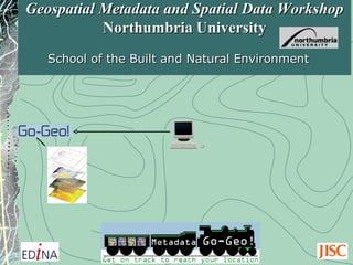
  • 1. Geospatial Metadata and Spatial Data Workshop Northumbria University School of the Built and Natural Environment
  • 2.
  • 3.
  • 4.
  • 5. Photographic Images copyright: Jupiter Images 2006 and it’s not sun and holiday
  • 6. Represents a documented and ordered summary of information that describes something, in this case, spatial data. Provides the What, Where, When and Why for a spatial dataset. Includes its Ownership and Contact (Who) details and Access and Use conditions. Metadata (data describing data)
  • 7. What are the ingredients? Where were ingredients produced? Who sells the ingredients? What are the brewing steps? When does the fermentation process end? Photographic Images copyright: Jupiter Images 2006 Think of metadata as a recipe for making beer.
  • 9. Think of metadata as food product labelling. What are the ingredients? What is the nutritional value? How many calories and how much fat? When is this product’s expiry date? Where was it produced? Who produced it?
  • 11.
  • 12. What do these polygons represent? What attribute information is associated with these polygons?
  • 13. What do these SOILCLASS values mean? What does this attribute mean?
  • 15.
  • 16.
  • 17. A geoportal enables users to search and discover spatial data via metadata using free text , resource type , geographic location (co-ordinate and placename) and date .
  • 18. Discovering spatial data through metadata offers the prospect of developing new applications
  • 19. Contours Raster Map Draped 3D Model and creating new datasets © Crown Copyright/database right 2008 © Crown Copyright/database right 2008 © Crown Copyright/database right 2008
  • 20. Other benefits: data protection Photographic Images copyright: Jupiter Images 2006
  • 21.
  • 22.
  • 23.
  • 24.
  • 25.
  • 26. Other Content Providers UK Location Programme Network Geo-data Gateway Geoportal portal interoperability and search capabilities across the internet. User Local Go-Geo! database
  • 27. Centre for Ecology and Hydrology (CEH) National Environment Research Council (NERC) National Soil Resources Institute (NSRI)
  • 28.
  • 29. * An application profile is derived from a standard and represents a reduction of the number of entities and elements. * It should include the core element set of a standard to support interoperability across the wider geospatial community ( Discovery level metadata). * Perhaps include elements for Descriptive level metadata? * A profile can be extended to include elements which are best suited for a working group’s specific applications. Example: The Biological Data Profile (BDP) An approved profile with additional elements to document biological information such as taxonomy , methodology and analytical tools . http://www.flickr.com/photos/f10n4/186861991/
  • 30. Creating application profiles from ISO 19115 ISO 19115 Metadata Standard ISO 19115 Core Element Set Application Profiles Academia ( 43 + 47=90) Public Sector ( 43 + 62=105) Private Sector ( 43 + 12=55) 300+ elements 43 elements Environmental Sciences Specialised APs * INSPIRE Directive Metadata Guidelines * UK GEMINI 2.1 , an INSPIRE compliant geospatial metadata standard for the UK * ANZLIC Metadata Profile * North American Application Profile (NAP), Canada and the US Archaeology Biological Sciences Geo Sciences History Health Informatics
  • 31. Infrastructure for Spatial Information in the European Community (INSPIRE) *European Commission (EC) *European Environment Agency (EEA) *Representatives from Member States (Mapping/GIS) INSPIRE Directive Metadata Guidelines
  • 32.
  • 33.
  • 34. INSPIRE spatial data themes and deadlines for creating metadata
  • 35.  
  • 36. INSPIRE Metadata Editor tool and Geoportal
  • 37. * First released in 2004 to support creation of ISO 19115 and e-GMS compliant metadata - supersedes the National Geospatial Data Framework ( NGDF) * Targeting the UK public sector * 2010: UK Location Programme (UKLP) revised UK GEMINI 2.1 to meet the requirements of the EU INSPIRE Directive. UK GEMINI UK Location Programme (UKLP) is a pan-government collaborative initiative with the responsibility to develop and implement the INSPIRE Directive 2007/2/EC and the UK Location Strategy.
  • 38. UK Location Metadata Editor and Catalogue conform to UK GEMINI 2.1
  • 40.
  • 41. UK Academic Geospatial Metadata Application Profile, Version 2.1 (UK AGMAP 2.1) UK AGMAP 2.1 created to support the specific needs of the UK H&FE communities. Comprises elements from ISO 19115, UK GEMINI 2.1 and INSPIRE. Supports documentation of a dataset, dataset series or geo service for the purpose of discovery and description. Mapped to Dublin Core, FGDC, INSPIRE, UK GEMINI 2.1 and DDI.
  • 42. UK AGMAP 2.1 profile for datasets and dataset series Contact details = 7 Drop down lists = 9 Red : Mandatory Green : Conditional 29 mandatory 90 elements
  • 43. UK AGMAP 2.1 profile for Geo-services Contact details: 7 Drop down lists: 6 Red : Mandatory Green : Conditional 22 mandatory 39 elements
  • 44. UK AGMAP 2.1 Guidelines Contain descriptions and examples to assist metadata creators and Go-Geo! portal users from eclectic range of academic disciplines.
  • 45. Most spatial data information is stored in our heads. We need to move it from there to electronic files. Metadata Creation Photographic Images copyright: Jupiter Images 2006
  • 46. Mind reading aliens? Solutions?
  • 49.
  • 50. Direct links at click of button to metadata guidelines ‘Help’ pages
  • 51.
  • 52. Geodoc coordinate extent tool Map tool captures co-ordinate values for bounding box elements used to define the extent of a dataset’s study area. Extents for Nations at the click of the mouse
  • 53. Personal and secure directory for storing, editing and exporting metadata records.
  • 54.
  • 55. Geodoc exports UK AGMAP 2.1 metadata records in PDF format
  • 56. Publication on open or private (institutional) nodes
  • 57. 1) create and validate record; 2) submit record for review; 3) metadata creator is contacted; and 4) record is published on the Go-Geo! portal. 1 2 3 A few easy steps to publication of a geospatial metadata record 4 Photographic Images copyright: Jupiter Images 2006
  • 58. A simple interface designed for UK academia to run queries to discover metadata for spatial datasets. The portal enables searching by the use of various options including -free text -date -resource type -geographic location www.gogeo.ac.uk Go-Geo! Portal
  • 59. Go-Geo! simple search Placename search using Unlock middleware gazetteer
  • 60. Search results page and extents display
  • 62. Links between Go-Geo! portal elements to UK AGMAP 2.1 guidelines
  • 63. Advanced search - Data Type - Location - Text - Date Range *BGS JIDI Photo Collection *COPAC
  • 64. Access to metadata records published on institutional (private) node
  • 65.
  • 66. Geo resource channels over 3,000 resources and daily updates
  • 69.
  • 70.
  • 72.  
  • 73. Spatial data submission: simple metadata record form to complete with extents extracted from dataset
  • 74. Ordnance Survey (OS OpenData)
  • 75. ShareGeo Digimap Addresses issues pertaining to spatial data derived from licensed data.
  • 76. Current and future activities
  • 77. Rebuild Go-Geo! portal with GeoNetwork GeoNetwork: A standards based, free and open source catalogue application to manage spatially referenced resources through the web. Provides metadata editing and search functions as well as an embedded interactive web map viewer. http://www.flickr.com/photos/mndrix/4203609704/
  • 78. Offer Go-Geo! resources for local spatial data management -UK AGMAP 2.1 -Guidelines -Geodoc metadata tool -Go-Geo! portal nodes -Workshops -eLearning objects Geography Archaeology Geological Sciences Biological Sciences Research
  • 79. Go-Geo! University A Go-Geo! University B Go-Geo! University C Go-Geo! Open Spatial Data Infrastructure (SDI) for UK academia Other resources and portals Spatial Data Repository Spatial data Metadata Search Data user Metadata UK AGMAP 2 Guidelines Geodoc tadata tool Customised Go-Geo! Portal Nodes Training Geography Archaeology Geological Sciences Biological Sciences Go-Geo! Go-Go! UK AGMAP 2 Guidelines Geodoc metadata tool Customised Go-Geo! Portal Nodes Training Geography Archaeology Geological Sciences Biological Sciences Go-Geo! Go-Go! UK AGMAP 2 Guidelines Geodoc metadata tool Customised Go-Geo! Portal Nodes Training Geography Archaeology Geological Sciences Biological Sciences Go-Geo! Go-Go! UK AGMAP 2 Guidelines Geodoc metadata tool Customised Go-Geo! Portal Nodes Training Geography Archaeology Geological Sciences Biological Sciences Go-Geo! Go-Go! University D
  • 80. Discover Locate Access Use Publish Fit for purpose? Preserve Steps to data immortality
  • 82. Using the Geodoc Metadata Editor Tool to create a valid geospatial metadata record Practical 1
  • 83.
  • 84.
  • 85.