4. Importance of City Planning - Dr. Toe Aung Ycdc
•
7 j'aime•1,513 vues

Myanmar Centre for Responsible Business (MCRB), Hanns Seidel Foundation (HSF) and Myanmar Responsible Tourism Institute (MRTI), co-hosted a second multistakeholder workshop on sustainable tourism in Ngapali from 8-9 May 2017. Read more: http://www.myanmar-responsiblebusiness.org/news/ngapali-workshop.html

Recommandé
Contenu connexe
Tendances
Tendances (20)
Similaire à 4. Importance of City Planning - Dr. Toe Aung Ycdc
Similaire à 4. Importance of City Planning - Dr. Toe Aung Ycdc (20)
Plus de Ethical Sector
Plus de Ethical Sector (20)
Dernier
Dernier (20)
4. Importance of City Planning - Dr. Toe Aung Ycdc
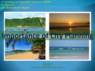
- 1. 2nd Workshop on Sustainable Tourism in Ngapali 8-9 May 2017 Jade Marina Resort, Ngapali Toe Aung Director Yangon City Development Committee 1
- 2. Outlines Planning Principles Planning Guidelines Development Planning for Ngapali Beach City 2
- 4. Global Urbanization Rates (2010) Between 2000 and 2050 urban space will need to be: • doubled in developed countries • expanded by 326 per cent in developing countries to accommodate people. This is a city the size of Greater London every month for the next 40 years. Local governments will have to manage this growth and the severe strain it will put on municipal finances. They will also have to address the resulting social inequality and make plans to reduce environmental degradation and deal with the effects of climate change. This growth will occur largely in intermediate cities, with little human resource capacity and limited budgets. Source: UN Habitat 4
- 5. • Unplanned settlements • Almost 50% of urban population lack full access to decent housing and services Source: UN Habitat 5
- 6. • Rapid growth of cities, unbalanced and led by private sector • Growth of middle class; industrial jobs; high land consumption and decreasing densities • Containing the tendency towards promoting urban sprawl Source: UN Habitat 6
- 7. The general decline in built-up area densities in 25 representatives cities Source: Making Room for a Planet of cities Urban Challenges: Density Decline 7
- 8. 8
- 9. Business as Usual versus Sustainable Urban Planning Urban Sprawl -> Compactness Segregation -> Integration Congestion -> Connectivity Source: UN Habitat 9
- 10. 20th Century Urban Development Model not sustainable • Rapid unmanaged and unplanned urban growth • Slums and Housing Backlog • Urban infrastructure and services backlog • Urban Sprawl • Car Dependency • High level of zoning • Homogeneity • Segregation and exclusion • Loss of Street Life • High energy demand and emission of greenhouse gases • Increasing number of urban disasters Source: UN Habitat 10
- 11. 1. ADEQUATE SPACE FOR STREETS AND PUBLIC SPACE IN AN EFFICIENT STREET NETWORK - 30-35% to the street 15-20% public space / 50 % plots. - At least 18 km of street length. - At least 80 crossings per km2 2.MIXED LAND USE - At least 40 percent of floor space allocated to economic use - Limited land-use specialization; single use blocks should cover less than 10% of any neighborhood 3.SOCIAL MIX - 20-50% of residential area should be low cost housing - Each tenure type should be not more than 50% of the total 4.ADEQUATE DENSITY At least 15.000 people per km2, that is 150 people/ha 5.CONNECTIVITY Emphasis on walking distances and public transport 5PRINCIPLES 21st Century Urban Development Model Source: UN Habitat 11
- 12. 21st Century Urban Development Model 12
- 13. street sections: 18 m street sections: 34 m street sections: 24 m Source: UN Habitat 13
- 14. 1. Rules and Regulations 2. Urban Design 3. Financial Plan Form that generates value. Good rules and regulations and a financial plan that manages value and attracts investment. FINANCIAL PLAN URBAN DESIGN Source: UN Habitat 14
- 15. The Virtuous Cycle of Planning 15
- 16. The Virtuous Cycle of Planning 16
- 17. The Virtuous Cycle of Planning 17
- 18. 1. Thriving cities have a framework for growth 2. Anticipating benefits the present 3. Planning helps leaders to make an impact, step by step 4. Urban form makes a difference 5. Having a direction has a positive impact on the urban economy 6. A collectively held plan builds lasting synergies 7. A broader territorial perspective helps cities attain economies of scale 8. Continuity generates credibility 9. Anticipating is more cost effective than reacting to problems 10. A framework gives consistency to messages 10 Reasons for Planning 18
- 20. 1. Zoning 2. Land use 3. Road Network 4. Social and Commercial Infrastructure Services and Open Space 5. Other Important Planning Control Factors 6. Heritage and Environmental Conservation 7. Healthful Residential Environment Planning Guidelines for the Development 20
- 21. Zoning For the purpose of planning regulations, zoning is usually classified in respect to the following factors: •Primacy Index •Population Density or Development Intensity •Central Place Functions 21
- 22. Zoning • Primacy Index Primacy Index = P2+P3+P4 P1 P1 = Population of the most populated area P2+P3+P4 = Population of three subsequent areas ranking 2, 3 & 4 • Population Density Population Density = Area Population 22
- 23. Zoning • Central Place Functions (CPF) • Economic Activities, • Social Services, • Transport and Communication, • Recreation, • Community Organisation, • Provision Services, • Infrastructure Facilities and • Personal services absent or present in the Area. Economic SocialServicesand Facilities Transport& Communications Recreation Community Organizations Government/ ProtectiveServices Infrastructure Facilities Personalservices Shopping Complex University/ College Bus/ Taxi Station Town park Chambers of Commerce Police station Electricity Supply Housing Developers Hypermarket Secondary School Railway Station Neighbourh ood Park Residents Association Fire Station Water Supply Optical Shop Supermarket Primary School Airport Football stadium Credit Cooperatives Government Office Complex Dump Site Photocopy Services Market Private School Seaport Sports Complex Professional Organisation s District office Sanitary Landfill Photo shop Merchant Bank International School Jetty Public Swimming Pool Consumers Association Local Authority office Central Sewerage Treatment Plant Lawyers Firm Commercial Bank Public Library Telephone Exchange Playfield Sports Organisation Security Organisation s Septic Tank System Surveyors Firm Industrial Estate Private Hospital Post Office Farmers Association Magistrates Court Hardware Shop Accountant s Firm SME Enterprise Government Hospital Mini Post High Court Workshop Engineering Firm Cottage Industry Government Health Centre IDD center Spareparts Shop Architect/ Planning Firm Hotel (≥20 rooms Private Clinic Real estate Agency Motel Religious Facilities Farm supply store Cemetery Office complex Community Hall Drugstore 23
- 24. Land Use Planning regulations usually take into consideration the following facts regarding Land Use: •Land Use Classification •Land Use Compatibility 24
- 25. Land Use • Land Use Classification Main Land Use Categories include •Residential •Commercial •Institutional •Recreational •Industrial •Social •Religious •Others 25
- 26. •Land Use Compatibility SOME OF THE LAND USES ARE INCOMPATIBLE TO EACH OTHER. COMPATIBILITY OF OTHER LAND USES WITH HOUSING INTRODUCTION TO PLANNING REGULATIONS COMPATIBILITY LISTING GENERAL DISCRIPTION COMPATIBILITY WITH HOUSING Parks and Playground Desiable Elementry School Community facility (Damayon) Desiable Desiable Housing in Good Condition Desiable Local Shopping Desiable Medical Facilities Desiable Stores or Shops Acceptable Acceptable Acceptable Acceptable Acceptable Highway with Buffer Strips. Housing in Fair Condition Industrial Park High School Industrial Used - Not Airport Highway without Properly Screened Not Acceptable Buffer Strip RailroadHighway without Buffer Strip Warehouses, Not Acceptable Not Acceptable Not Acceptable Not Acceptable Deteriorated or Dialapiated Housing Compatibility of Other Land Uses with Housing 26
- 27. Road Network Unclear and unsystematic hierarchy of road network planning usually jeopardizes safety. •Road Hierarchy Classification & Their Functions •Planning for Safety (Traffic Segregation, Parking, Access) 27
- 28. Road Network •Road Hierarchy Classification & Their Functions CAR CIRCULATION AND ACCESS Type of facility Functions and Design Features Spacing R.O.W Pavement Speed Other Features Expressways Provide metropolitan and city continuity and unity. Limited access; Some channalized grade crossing and signal at major intersection. Parking prohibited. Variable; generally radial or circumferential 200–250 ft (150-300 ft) Varies 12’ per lane; 8’-10’ shoulders; 8’- 30’ median strip. 50 mph Require service roads or adequate rear lot building setback lines. Major Roads (Major Arterial) Provide unity through contiguous urban areas. Usually from boundaries for neighborhoods. Minor access control; channelized intersection; parking generally prohibited. 1 ½ to 2 miles (1500 - 6000 ft) 120–150ft (100 ft) Min. for 4 lanes, parking and median strip 35-45mph Required detached sidewalks in urban areas, planting strips and adequate building setback line. Secondary Roads (Minor Arterial) Main feeder streets. Signals where needed; stop signs on side streets. Occasionally from boundaries from neighborhoods. ¾ to 1 miles (1000 -3000 ft) 80 ft (80 ft) 2-12’ or 4-12' traffic lanes 35-40mph Required detached sidewalks in urban areas, planting strips and adequate building setback line. Collector Streets Main interior streets. Stop sign on side streets. ¼ to ½ miles (800 -1500 ft) 64 ft (60 ft) 2-12’ traffic lanes; 2-10’ parking lane 30 mph Required at lease 4ft detached sidewalks, vertical curbs, planting strips are desirable, building setback line. Local Streets Local service streets. Non conductive to through traffic. At blocks 50 ft (40 ft) 2 - 9’ to 11’ traffic lanes 25 mph Sidewalks, vertical curbs, planting strips are desirable, building setback line. Cul-de-sac Street open at only one end, with provision for a practical turnaround at the other. Only whenever practical 50 ft (30 ft) (90 ft dia. Turnaround) Should not have length greater then 500 ft. 28
- 29. Road Network vrf;e,f 100 ay tus,f 4 vrf;oGm;vrf; TYPICAL 80-ft STREET CROSS SECTION MAJOR ROADS TYPES OF STREETSARTERIALROADORHIGHWAY ACCESSSTREET(SERVICEROAD) C O L L E C T O R S T R E E T MINORSTREET C U L - D E - S A C A L L E Y A L L E Y LOOPS Secondary Road CollectorRoad MajororRoad AssessRoad Loop Cul-de-sac 29
- 30. •Road Hierarchy Classification & Their Functions 30
- 31. •Road Hierarchy Classification & Their Functions 31
- 32. Road Network Road Categories Reserve Width Minimum Junction Spacing(m) Major Roads 150ft (or) more 2000 ft Secondary Roads 80ft (or)100ft 800 ft Collector Streets 60ft (or) 70ft 300 ft Access Roads 40ft (or) less 120’ (or) At blocks RECOMMENDED DISTANCE BETWEEN JUNCTIONS Car Parking Requirements Cinemas, Theatres & Concert Halls 1 car parking space for every 10 seats Hotels, Boarding Houses, Residential 1 car parking space per 200 sq.m of floor area Clubs and Hostels • Hotel Administration & Offices • Function Rooms & Exhibition Area 1 car parking space per 50 sq.m of floor area 32
- 33. Provision of Social & Commercial Infrastructure and Services has to be controlled by travel distance and the population size that will use it. Social & Commercial Infrastructure & Services 1/2to1/4 1 1/2 1/2 1 1/2 Collage, Special School Religious Places hourhour 3/4to1/2hour high school 1 mile Junior mile 1/2 m ile mile Journey from dwelling unit to selected destinations Museums, etc. Facilities, Theatre Major Cultural 1 1/2 to 1 hour Elementary School mile Walking distane Car or Public Recreation Facilities urpd15/d/nwayhmu/planning parameter chart 3/4 - 1 hour 1 hour Play-ground mile1/2to1/4 Employment Regional Transportation 3/4 hour High School1 mile Shopping Local 1/2to1/4mile 1to3/4hour Hospital Shopping center Regional Walking distane is measured in miles. Car or public transportation is measured in time. Remark 33
- 34. Social & Commercial Infrastructure, Services & Open Spaces PHYSICAL ELEMENTS IN THE ORGANIZATION OF THE NEIGHBORHOD General Planning and Neighborhood Organization Residential Element Area (radius) Number of Families Served Type of open Space and Community Facilities Required Apartment building 200-400 ft 10 - 150 Outdoor areas for play and sitting, roof deck, pool, community room, tot lot Complex of apartment buildings (or) residential block or street 400-800 ft 30 – 500 Outdoor areas for play and sitting, pool or pools, small community building Hamlet or Cluster of blocks 800-4000 ft 90 – 1500 Outdoor areas for sports, play and sitting, pool or pools, community building Single Neighborhood ¼ - ½ mi 1000 - 5000 Play field( sports), playground, sitting and picnic areas, pools, large community building Cluster of Neighborhood ½ - 2 mi Play fields, playgrounds, sitting and picnic areas possibly with a lake, pools, recreation and community center 34
- 35. 1. Utility Open Spaces • Resources Lands • Urban Utility Spaces • Flood Control & Drainage • Reserves & Preserves 2. Green Open Spaces • Protected Areas • Natural Parks • Urban Parks • Recreational Areas • Urban Development Open Spaces 3. Corridor Open Spaces • Rights of Ways • Set Back Buffers Open Space Classification 35
- 36. Prevention of Natural Disasters and Safety Set back: along the railway 75 ft each along the gas pipeline 75 ft each along the electrical power line 8-50 ft each Set Back Buffers 36
- 37. Other Important Planning Control Factors Other important Planning Control Factors that significantly influence the Urban Design include: •Building Coverage Ratio •Floor Area Ratio •Building Height to Street Width Ratio •Building or Site Access and Parking Requirements 37
- 38. DEFINITION OF BUILDING COVERAGE RATIO (BCR) • Building Coverage Area is defined to be the area delimited by the outer most edge line of the building when projected from the top. The outer most edge line can be the roof line or the parapet line or combination of both and the outer most edge of any element protruding from the building. If an unroofed court yard is included, the court yard area that is not under the roof may be excluded. Building Coverage Ratio(BCR) = Building Coverage Area Plot Area Other Important Planning Control Factors Building Area Plot Building Coverage Area 38
- 39. DEFINITION OF FLOOR AREA RATIO (FAR) Floor Area Ratio = Total Floor Area Plot Area Floor Area Ratio is the proportion of the total floor area of the building to the plot area. The area used for car parking in basement levels and on ground floor will be excluded from the floor area calculation. Conversion of Car Parking to any other use will not be allowed at any time. Other Important Planning Control Factors A Plot Boundary Plot Area -X B C 39
- 40. Building Height to Street Width Ratio Street Width : Building Height 1 : 1 OPEN 1 : 2 HUMANE / COMFORTABLE 1 : 3 JUST RIGHT 1 : 3< CORRIDOR / NARROW PERSON FEELING SMALL Other Important Planning Control Factors 40
- 41. Heritage and Environmental Conservation •The heritage sites and elements that contribute towards identity or character of the place have to be identified and conserved. •They can usually be either Natural or Man-made. Areas of Conservation Concerns Targets of conservation Criteria for identification A. Natural physical elements 1. Land form 2. Vegetation 3. Waterbody, lake 4. River front 5. Sea front Ecological value in the context of natural environmental setting including climate Amenity value Number of users B. Man-made physical elements 6. Single building 7. Building & Precinct 8. Building complex 9. Avenue, street 10. Street square 11. Parks, gardens Historically, 100 years or more old Association with national, regional or local historic event Overall aesthetic appeal Architectural merit, style Place of community congregation for prayers or other purposes Place of highly specialized activity Level of maintenance: good, fair, poor Structural uniqueness Number of users Place of active recreation Place of passive recreation Proximity to natural element river, lake Provides visual access to city land marks or other important elements C. Activities and Functions D. Social-economic-cultural characteristics Source: UNCRD (1995), pp.235-236. 41
- 42. Concept Traditional Recent Transitional Approaches • Conservation of single buildings • Ensembles approach • People-oriented heritage concepts Regulations • Antiquities Preservation Act (1957) • Amendment Act for the Preservation of Ancient Monument and Antiquities (1962) • Listed Building Notifications • Demarcation of Cultural Heritage Zones, Ancient Monuments and The Protection and Preservation of Cultural Heritage Regions Law (1998) • Amendment Law for the Protection and Preservation of cultural Heritage Regions Law (2009) Regulations/laws for: • Comprehensive heritage awareness and understanding • Participation of stakeholders • Public awareness and responsibility codes • Taxation and subsidies’ laws for heritage Instruments • Conservation, preservation, renovation, restoration • Zoning, demarcation, area development • Protection of sites • Reduction, limitation of usage • Awareness building of all stakeholders • Conservation from within the communities OPERATIONALIZATION: STEPS FOR HERITAGE CONSERVATION Frauke Kraas, Hlaing Maw Oo 42
- 43. 43 Urban Heritage Tangible heritage consisting of natural and cultural heritage along with man- made heritage indicative of the urban history combined with intangible heritage consisting of urbanscapes, urban silhouette, and important visual axis as well as the character and traditions of the people, defining the own distinctive character or an identity of an urban area can be defined as Urban Heritage.
- 44. Heritage and Environmental Conservation •Hierarchy of Environmental Issues has to be understood in order to be resolved at each level. •While Building Bylaws will have to cover Environmental Issues at Household and partially at Community level, •Planning Guidelines will usually cover Environmental Issues of the Community and City levels. 44
- 45. Healthful Housing Environment and Overcrowding Healthful Residential Environment Healthful Residential Environment is the one in which family can develop and flourish physically, mentally and socially. Standards of Housing Differs by countries, regions relating to the climate, social and cultural practices, local economy and availability of construction material. Overcrowding The numbers of units, rooms, living space, population ratio, gender issues are considerable. Regulations Municipalities needs to regulate the permission system for suitable type of housing. 45
- 46. Development Planning of Ngapali Beach City 46
- 47. Thandwe District Rakhine State Source: DUHD 47
- 48. Facts of Ngapali Coodinates: 18°21′-18°31′.50 ″N , 94°15′- 94°22′.30″E Wards: Gaw, Zi Byu Gon, Lin Tha, Mya Byin, Gyeik Taw Coastal Line: 206 km Area: 54.54 sq-km Population: 21,252 (2015) Population Density: 390 people/sq-km Source: DUHD 48
- 49. Strength & Weakness Strength A Special Development Zone with international standards The best beach resort in Myanmar Resort hotels with green environment Promoting socioeconomics related to the development of hotel zones Land availability for meeting, incentive, conversion and exhibition (MICE functions) and other amenities Weakness Mostly rely on air transportation Hotel room rates are costly to local tourists Weak in tourism amenities, services and management Inappr0priate urban infrastructure Beach cleansing system Need cross roads from the main road to the beach in the hotel zones of Lin Tha and Mya Byin High land cost and land speculation Conflicts within land ownership, fishing and development works of hotel zones Lack of transportation, electricity and drinking water causes underdevelopment of Gaw village. Waste generation much higher than the population and waste collecting vehicles Inappropriate waste disposal system, impacts to public health and environmental degradation 49
- 50. Land Use of Ngapali Source: DUHD 50
- 51. 23% 2% 3% 9% 1% 21% 20% 12% 8% 1% 1% 1% Green Area Golf Course Air Port Residential Religious Water Agricultural Mangrove Military(55) Market Institutional Land Commercial Area Land Use of Ngapali Source: DUHD 51
- 52. Waste Issues in Yangon 52
- 53. Recommendations Transportation and Infrastructure Development Electricity Solid Waste Management Natural Resources Human Resource Development and Opportunities Culture Tourism 53
- 54. Thank you for your kind attention !!! toeaungteza16@gmail.com 54