![GISST WebGIS for Sustainable Tourism Project idea ,[object Object],[object Object],[object Object],[object Object],Realized with European Union funds](data:image/gif;base64,R0lGODlhAQABAIAAAAAAAP///yH5BAEAAAAALAAAAAABAAEAAAIBRAA7)
Recommandé
Recommandé
Contenu connexe
En vedette
En vedette (18)
Similaire à 3.3 Le sous projet GISST
Similaire à 3.3 Le sous projet GISST (20)
Plus de grisicap
Plus de grisicap (20)
Dernier
Dernier (20)
3.3 Le sous projet GISST
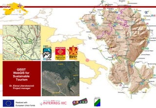
- 1. GISST WebGIS for Sustainable Tourism Dr. Elena Liberatoscioli Project manager INTERREG III C SUD GRISI - Geomatics Regional Information Society Initiative (cod. 3S0145R) Sub-project GISST- WebGIS for Sustainable Tourism (cod. 05) Realized with European Union funds
- 3. GISST WebGIS for Sustainable Tourism Leader and partners PARTNER : 1) REGIONAL COMMITTEE FOR TOURISM OF MIDI-PYRENEES Region: Midi-Pyrenees (FRANCE) 2) NATURAL PARK OF “SENORIO DE BERTIZ” Region: Navarra (SPAIN) LEADER : 1) MAJELLA NATIONAL PARK Region: Abruzzo (ITALY) Realized with European Union funds
- 4. Summarizing partners’ results CRT CRT has collected geographical coordinates of about 3000 villages and associated them the info available in the existing Tourist DBMS of the Department Committee of Tourism (such as hotels, restaurants, campings and so on) representing about 15.000 geographical elements. http://www.tourism.midi-pyrenees.org/ S ENORIO DE BERTIZ N ATURAL PARK Bertiz has collected a lot of tourist ’ s data both geographical coordinates than attributes such as for an hotel the telephone number, the address, etc.). For the moment they are available on Bertiz website both for downloading than for displaying thanks to Google Maps. http://www.parquedebertiz.es/?url=geo&sec=88 MAJELLA NATURAL PARK MNP has collected tourist data, but in particular Majella has created a very user friendly and standard compliant WebGISapplication. Besides has generated WMS services. http://www.gisst.eu Realized with European Union funds
- 5. Other principal results Majella and his partners have achieved a lot of important results: - A Tourist Geoportal available at www.gisst.euwith online maps and data collecting (both tourists data and basic cartography for example the ortophoto and the Digital Terrain Model); - WMS services to ensure interoperability (not only for Majella); - A metadata catalog ISO 19115 and INSPIRE compliant (available at Region Abruzzi GRISI Geoportal) - Promotion activities : www.panparks.org, www.parks.it ,www.freegis- italia.org , partner's websites and other, a brochure and a booklet; - Training and experience sharing: 2 partners' international meetings, a seminar for Park's operator Realized with European Union funds
- 7. GISST WebGIS for Sustainable Tourism Let’s have a look to the maps! www.gisst.eu/mappe This is the first screen when you access on Majella’s online maps realized with WebGIS standard technologies. Realized with European Union funds
- 8. GISST WebGIS for Sustainable Tourism Let’s have a look to the maps! www.gisst.eu/mappe Detailed map: this is how the map looks when you zoom in using WebGIS tools. Realized with European Union funds
- 9. GISST WebGIS for Sustainable Tourism Let’s have a look to the maps! www.gisst.eu/mappe How to query the database: clicking on a point you can obtain a popup with usefull information. Realized with European Union funds
- 10. GISST WebGIS for Sustainable Tourism Let’s have a look to the maps! www.gisst.eu/mappe Another example: clicking on an element in the map (a peak) the system shows you a photo of the locality. Realized with European Union funds
- 11. GISST WebGIS for Sustainable Tourism Let’s have a look to the maps! www.gisst.eu/mappe Another way to query and browse information is to write a keyword (such as animals, museums, etc.) in order to obtain a list of results and zoom in the map directly to the information you are looking for. Realized with European Union funds
- 13. Collection of tourist information about Señorío de Bertiz N. P. and the municipalities of his environment, such us: where to eat , where to sleep , museums, churches, tourism offices , information centres , trekking , ... Señorío de Bertiz Natural Park - results • Tourist data digitizing and georeferencing. • Transformation to shp, dxf, gpx format. • Data input in the website of Señorío de Bertiz N. P. www. parquedebertiz . es • Publication of georeferenced information, available to be used with a GPS by the visitors of the Park and its environment.
- 14. Señorío de Bertiz Natural Park - results Realized with European Union funds
- 15. Développements SIG Nouvelle version du site Internet Grand Public du CRT avec cartographie interactive Portail Extranet pour les professionnels Site de réservation en ligne avec mode de recherche cartographique Le sous projet GISST a contribué à financer la création et l’adaptation de fonds cartographiques, permettant des exploitations cartographiques de l’information touristique… … ainsi que des échanges d’expériences et de technologies dans le domaine des SIG, de nature à infléchir le développement des outils futurs du CRT… Droits d’utilisation des fonds cartographiques négociés pour les membres du réseau … et enfin des possibilités supplémentaires de partage et de mutualisation au sein du réseau régional… CRT Midi-Pyrénées - results En ligne depuis octobre 2007 Outils cartographiques. Géolocalisation des Objets d’Informations, … Observation économique de l’activité, … Itinéraires de randonnées, circuits , outils pratiques « se rendre à… », « trouver aux alentours » En ligne depuis janvier 2008 Realized with European Union funds
- 16. Innovating interactive cartography CRT Midi-Pyrénées - results
- 18. That’s all… Thanks for your attention ! Realized with European Union funds