Cultural North America
•Télécharger en tant que PPTX, PDF•
0 j'aime•352 vues

Canada and the USA as political and cultural communities of immigrants. Major cities of Canada and the USA, major aspects of culture and demographics.

Recommandé
Contenu connexe
Tendances
Tendances (20)
Similaire à Cultural North America
Similaire à Cultural North America (20)
Plus de Pinecrest Academy Nevada
Plus de Pinecrest Academy Nevada (20)
Dernier
Dernier (20)
Cultural North America
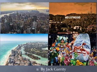
- 1. By Jack Garrity
- 4. Book pages 748-750
- 5. The United States of America is Republic and collection of 50 diverse states. The vast majority of Americans are immigrants from Europe, Asia, Africa, the Pacific Islands and South America. People trace there heritage from every country in the world and practice every know religion, making it the worlds most diverse country. Canada is a Constitutional Monarchy with 10 territories. During the American Revolution, people remaining loyal to the British King fled north, founding this sparsely populated country.
- 6. Less than 5 percent of the world’s population lives in the United States and Canada, yet have 37.5% of the world’s wealth.
- 7. The vast majority of the 329.2 million people of the United States and the 35 million people of Canada all are immigrants or descendants of immigrants.
- 8. Immigrants: People that move from one country to another.
- 9. Some arrived only recently. Others belong to families whose ancestors came to North America 1-4 centuries ago.
- 10. The first immigrants moved into the region from Asia tens of thousands of years ago.
- 11. Today, Native Americans number 2.5 million in the United States and 700,000 in Canada.
- 12. European, Asians, African, and Latin Americans continue to immigrate, making , the populations among the world’s most diverse.
- 13. Some immigrants came seeking political and religious freedom and to find better economic opportunities.
- 14. Others fled wars or natural disasters.
- 15. Economic opportunity, personal freedom attracts immigrants.
- 16. In the 1800’s, popular European songs sang “where the streets are paved with gold” of the US.
- 17. Chinese immigrants nicknamed the US “Gold Mountain.”
- 18. The rumors of gold were exaggerated, but the opportunities are real.
- 19. Immigrants faced discrimination and prejudices at first, but they offered hard work, talent, enthusiasm.
- 22. Second generations become Americanized, and discriminate the next wave of immigrates.
- 23. Third generations tend to celebrate their ancestry.
- 24. Like all the great civilizations of history, the United States and Canada benefit greatly from diversity.
- 25. Canada has an average population density of only 8 people per square mile (3 people per sq. km).
- 26. Population density is the concentration of individuals within a species in a specific geographic locale. Population density= Number of people per square mile. Our class 400 square feet. 400 square feet = 0.000014348025711662075 square miles 2090880 students per mile2 =30 students divided by 0.000014348025711662075 miles
- 27. 90 percent of Canadians live in a narrow strip of land along Canada’s border with the United States.
- 28. 38.01 million people 1.643 trillion USD GDP 43,241.62 USD GDP per Household (2020)
- 29. Official Languages English and French Constitutional Monarchy Has an elected Parliament that elects Prime Minister Justine Trudeau.
- 30. Head of State is British Monarch that appoints a Governor General Mary Simon.
- 31. Canada was settled by the French then English loyalists during the American Revolution against British King George III.
- 32. Canada has 10 Provinces and Territories each with its own capital.
- 33. The highest population density is along the St Lawrence River, the traditional trade water trade route to the world.
- 34. Canada’s 25 metropolitan areas are home to about 60 percent of the Canadian population.
- 35. The harsh climate of the Canadian Shield pushed settlement toward the fertile land and industrial resources of Quebec and Ontario.
- 36. metropolitan area includes a city with a population of at least 50,000 people and outlying communities (suburbs).
- 37. Metropolitan Area : a city and its surrounding area (suburbs) Henderson is a suburb of Las Vegas in the Vegas Metropolitan Area.
- 38. Ottawa, the capital of Canada, is located in Ontario Province.
- 39. Ottawa, the capital of Canada, is located in Ontario Province.
- 40. Ottawa population 994,837 (2.227 million Las Vegas and Henderson Area)
- 41. Ottawa sits on the Ottawa River, and has at its center Parliament Hil with grand Victorian architecture and museums such as the National Gallery of Canada.
- 42. The park-lined Rideau Canal is filled with boats in summer and ice-skaters in winter.. ―
- 43. The park-lined Rideau Canal is filled with boats in summer and ice-skaters in winter.. ―
- 44. Museums such as the National Gallery of Canada display noted collections of indigenous and other Canadian art.
- 45. Museums such as the National Gallery of Canada display noted collections of indigenous and other Canadian art.
- 47. Museums such as the National Gallery of Canada display noted collections of indigenous and other Canadian art.
- 51. Museums such as the National Gallery of Canada display noted collections of indigenous and other Canadian art.
- 53. Museums such as the National Gallery of Canada display noted collections of indigenous and other Canadian art.
- 54. Toronto also in Ontario Province has the largest population.
- 55. Toronto
- 56. Toronto with a population of 2.7 million is the economic hub of East Coast Canada.
- 57. Toronto its most famous landmark the CN tower at 1,815 feet , LV Stratosphere 1,149′.
- 59. The harsh climate of the Canadian Shield pushed settlement toward the fertile land and industrial resources of Quebec and Ontario.
- 60. Quebec is a city and a province name.
- 61. Quebec
- 63. Quebec (French), dating to 1608, has a fortified colonial core, Vieux-Québec and Place Royale, with stone buildings and narrow streets.
- 64. Quebec (French), dating to 1608, has a fortified colonial core, Vieux-Québec and Place Royale, with stone buildings and narrow streets.
- 65. The Petit Champlain district’s cobblestone streets are lined with bistros and boutiques.
- 66. Other population centers include the farming and ranching areas along the southern sweep of the prairies.
- 67. Provinces of Manitoba, Saskatchewan, and Alberta and the Pacific coast of British Columbia.
- 71. Winnipeg, on the Red River, and Saskatoon and Edmonton, on the Saskatchewan River, are inland population centers in western Canada. ..
- 72. Winapeg
- 73. Winnipeg, on the Red River, and Saskatoon and Edmonton, on the Saskatchewan River, are inland population centers in western Canada. ..
- 74. Edmonton
- 75. Vancouver 675,218 is the largest census metropolitan area by population in western Canada..
- 76. Vancouver
- 77. Vancouver is the major port city for trade with Asia.
- 78. Vancouver is the major port city for trade with Asia.
- 79. Vancouver is the major port city for trade with Asia.
- 81. The US has an average population density of 77 people per square mile .
- 82. Outside large urban areas, the population is widely distributed.
- 83. The Northeast and the Great Lakes regions are the most densely populated areas and the historic centers of American commerce and industry.
- 84. The Pacific coast has another population center with pleasant climate, abundant natural resources, and economic opportunities.
- 85. The least populated section of the country are Alaska, the desert parts of Great Basin, and the arid parts of the Great Plains.
- 86. California has the highest population of any state 39.35 million.
- 87. Wyoming has the lowest population of any state 581,348
- 88. Since the 1970s, the American South and South-west have become the country’s fastest growing areas,, nicknamed the Sunbelt.
- 89. The tourism industries and retirees choose the Sunbelt for its mild winters.
- 92. The area’s geographic closeness to Mexico and the Caribbean also draws immigrants from those two regions.
- 94. Both the U.S. and Canada began as agricultural societies, yet they have become highly urbanized.
- 95. Cities grew during the Industrial Revolution (1800-1900’s) as cities built factories and large commercial agriculture replaced family farms.
- 96. During the late 19th Century, people moved from rural areas to urban areas looking for jobs, education and fun.
- 97. Today most people live in metropolitan areas, including a city with a population of at least 50,000 and surrounding communities called suburbs.
- 98. Today most people live in metropolitan areas, including a city with a population of at least 50,000 and surrounding communities called suburbs.
- 104. More than 80 percent of the population of the United States lives in the country’s 276 metropolitan areas.
- 105. Along the northern Atlantic coast of the United States, a chain of closely linked metropolitan areas forms a megalopolis, or “great city.”
- 106. The geography of a region often shapes the culture that develops in the area.
- 107. 42 million people live in Boswash, the nickname combining Boston, New York, Philadelphia, Baltimore, and Washington, D.C.
- 108. Four of the cities—Boston,
- 110. Boston population is 689,326 (4.9 Metropolitan Area) was settled by English in 1630.
- 125. Boston began the American Revolution against the British in the 1770’s, and considers itself the birth place of the Republic.
- 130. Four of the cities—Boston, New York,
- 134. The total market capitalization of all publicly traded companies in 2020 was approximately US$93 trillion
- 142. The Harlem Renaissance, a cultural, social, and artistic explosion took place in Harlem, New York spanned the 1920s.
- 143. The international dance sensation Josephine Baker set fashion trends from Paris to NYC.
- 144. Poets like Countee Cullen ( The Black Christ and Other Poems (1929) ) and novelists Claude McKay wrote expressions of African American America.
- 149. Four of the cities—Boston, New York, Philadelphia, and Baltimore—are important world trade centers.
- 152. Philadelphia was the largest city in colonial times, and the colonists met and published the Declaration of Independence on July 4th 1776.
- 158. The planned city of Washington, D.C., established on the Potomac River near the Chesapeake Bay, is the country’s capital. Benjamin Banneker the genius that completed the design of the Nations Capital
- 169. Miami enjoys a pleasant climate and colorful Hispanic/ Caribbean cultures.
- 175. Trade on the Mississippi combine with French and African Americ culture makes New Orleans one of the gems of cultural diversity in the USA.
- 184. Houston, connected to the Gulf of Mexico by the Houston Ship Channel.
- 185. Houston is the southern end of a developing megalopolis that stretches north to the Dallas/Fort Worth metropolitan area.
- 191. 1 Saudi Arabia (OPEC) 10,625,000 2 Russia 10,254,000 3 United States 8,744,000 4 Iraq (OPEC) 4,415,000 5 China, People's Republic of 3,938,000 6 Iran (OPEC) 3,920,000 7 Canada 3,652,000 8 United Arab Emirates (OPEC) 3,188,000 9 Kuwait (OPEC) 3,000,000 10 Venezuela (OPEC) 2,316,000
- 192. On the Pacific coast, San Francisco has been the major link to the economies of Asia since the late 19th Century.
- 193. On the Pacific coast, San Francisco has been the major link to the economies of Asia since the late 19th Century.
- 197. A growing megalopolis stretches from San Francisco south through Los Angeles to San Diego.
- 198. To the east, Silicon Valley remains the center of the computer, internet, and space travel industry.
- 203. Hollywood in Los Angles, has been the center of the movie industry since the early 20th Century.
- 217. Seattle is the most northern west coast port, and grunge culture.
- 221. Inland cities grew up along rivers, lakes, and waterways.
- 230. Detroit, the center of the United States automobile industry, uses the Great Lakes for shipping goods.
- 236. A megalopolis links the U.S. Great Lakes cities of Chicago, Milwaukee, and Cleveland with Pittsburgh, a freshwater port on the Ohio River.
- 239. Frank Lloyd Wright ( 1867 – 1959) Prairie Style
- 247. In the desert Southwest, cities survive the climate with good conservation and water management.
- 248. Salt Lake City, Utah
- 249. Founded by Mormons escaping religious persecution.
- 254. Las Vegas, Nevada
- 266. end