SlideShare une entreprise Scribd logo
1  sur  20
New Jersey 2007 LULC In June 2010, the NJ DEP released the 2007 update to the NJ Land Use/Land Cover data. Data now spans 21 years, from 1986 to 2007. Dr. Hasse and Dr. Lathrop from CRSSA (Rutgers) analyzed the data, comparing it to previous time periods to study the urban growth patterns of the overall time period. This is the third iteration of the analysis.
Landscape Change
2002 Land Use
2007 Land Use
2002 Land Use
2007 Land Use
2007 Land Use
Dynamic Landscape Change 2007 Urban surpasses Forest In 21 years’ time: 323,811 acres of urban growth - 57% is residential, 2/3s large lot housing 178,337 acres of farmland loss 114,912 acres of forest loss 52,294 acres of wetlands loss
508,681 acres of impervious surface in New Jersey.Increasing at a rate of 4,270 acres per year.
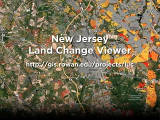
Requirements: Animated Comprehensive Quick and responsive Cheap NJ Land Change Viewer
Animation To convey the change graphically, we felt the map had to be animated. Animation was achieved by altering the tiled layers’ opacity in sequence. Attractive, flicker-free animated map!
Many Layers in the Report
Map Responsiveness The Land Change Viewer relies on pre-rendered map tiles. The complexity of the data and the need to show 4 or 5 time period renderings would cause considerable delay if each view was rendered from GIS data.
Land Change Viewer Google MapsBase Maps Bing MapsBird’s Eye CloudFront GeoServer Amazon S3 TileCache Land Change Viewer
Tile Rendering & Distribution CloudFront prevents rendering on-the-fly For the extent of NJ, (z8-15) approximately 60,000 tiles needed to be created. Each animation frame was one set of tiles. 1.5 million tiles had to be generated.
On the Cheap This iteration of the project had little to no funding. Would not have been possible to implement without Amazon Web Services. AWS bill at the time of release was about $60, and only about $100 by the end of 2010.
Next Steps GeoLab was awarded a $7,500 AWS grant to support further development. Extend the Viewer to include metrics at the County and Municipal level. Reshape the viewer into a tool for aiding local-level planning.  Use ArcGIS Server on AWS as a gateway into the data.
“Changing Landscapes”Report & Maps Available onlinehttp://gis.rowan.edu/projects/luc John HasseRowan Universityhasse@rowan.edu Rick LathropRutgers Universitylathrop@crssa.rutgers.edu ,[object Object]

Contenu connexe

Tendances

DSD-INT 2017 New features in iMOD for the dissemination of geological models ...
DSD-INT 2017 New features in iMOD for the dissemination of geological models ...DSD-INT 2017 New features in iMOD for the dissemination of geological models ...
DSD-INT 2017 New features in iMOD for the dissemination of geological models ...Deltares
 
S-Plus: The Data Reduction Process
S-Plus: The Data Reduction ProcessS-Plus: The Data Reduction Process
S-Plus: The Data Reduction ProcessEduardo S. Pereira
 
Crowd-Sourcing Approach of Building Ground Truth Database for Global Urban Ar...
Crowd-Sourcing Approach of Building Ground Truth Database for Global Urban Ar...Crowd-Sourcing Approach of Building Ground Truth Database for Global Urban Ar...
Crowd-Sourcing Approach of Building Ground Truth Database for Global Urban Ar...Hiroyuki Miyazaki
 
Interactive Simulation and Visualization of Large-Scale Flooding Scenarios (J...
Interactive Simulation and Visualization of Large-Scale Flooding Scenarios (J...Interactive Simulation and Visualization of Large-Scale Flooding Scenarios (J...
Interactive Simulation and Visualization of Large-Scale Flooding Scenarios (J...Christian Kehl
 
3D Analyst - Lake Lorelindu by GRASS
3D Analyst - Lake Lorelindu by GRASS3D Analyst - Lake Lorelindu by GRASS
3D Analyst - Lake Lorelindu by GRASSHartanto Sanjaya
 
People powered maps: A population-centric map projection
People powered maps: A population-centric map projectionPeople powered maps: A population-centric map projection
People powered maps: A population-centric map projectionBenjamin Hennig
 
OpenLayers Feature Frenzy
OpenLayers Feature FrenzyOpenLayers Feature Frenzy
OpenLayers Feature FrenzyAndreas Hocevar
 
Amin tayyebi: Big Data and Land Use Change Science
Amin tayyebi: Big Data and Land Use Change ScienceAmin tayyebi: Big Data and Land Use Change Science
Amin tayyebi: Big Data and Land Use Change Scienceknowdiff
 
5 population change
5   population change5   population change
5 population changehfonfe
 
Modeling Count-based Raster Data with ArcGIS and R
Modeling Count-based Raster Data with ArcGIS and RModeling Count-based Raster Data with ArcGIS and R
Modeling Count-based Raster Data with ArcGIS and RAzavea
 
Digital Globe Presentation for Earth Observation in the Cloud Demo Day
Digital Globe Presentation for Earth Observation in the Cloud Demo DayDigital Globe Presentation for Earth Observation in the Cloud Demo Day
Digital Globe Presentation for Earth Observation in the Cloud Demo DayAmazon Web Services
 
Y7 site and settlement putrajaya wksht
Y7 site and settlement putrajaya wkshtY7 site and settlement putrajaya wksht
Y7 site and settlement putrajaya wkshtHyolim
 
Making Beautiful Maps: Oct 5 2011
Making Beautiful Maps: Oct 5 2011Making Beautiful Maps: Oct 5 2011
Making Beautiful Maps: Oct 5 2011Jake Levitas
 

Tendances (20)

Virtual GIS Environment
Virtual GIS EnvironmentVirtual GIS Environment
Virtual GIS Environment
 
DSD-INT 2017 New features in iMOD for the dissemination of geological models ...
DSD-INT 2017 New features in iMOD for the dissemination of geological models ...DSD-INT 2017 New features in iMOD for the dissemination of geological models ...
DSD-INT 2017 New features in iMOD for the dissemination of geological models ...
 
S-Plus: The Data Reduction Process
S-Plus: The Data Reduction ProcessS-Plus: The Data Reduction Process
S-Plus: The Data Reduction Process
 
Crowd-Sourcing Approach of Building Ground Truth Database for Global Urban Ar...
Crowd-Sourcing Approach of Building Ground Truth Database for Global Urban Ar...Crowd-Sourcing Approach of Building Ground Truth Database for Global Urban Ar...
Crowd-Sourcing Approach of Building Ground Truth Database for Global Urban Ar...
 
Interactive Simulation and Visualization of Large-Scale Flooding Scenarios (J...
Interactive Simulation and Visualization of Large-Scale Flooding Scenarios (J...Interactive Simulation and Visualization of Large-Scale Flooding Scenarios (J...
Interactive Simulation and Visualization of Large-Scale Flooding Scenarios (J...
 
3D Analyst - Lake Lorelindu by GRASS
3D Analyst - Lake Lorelindu by GRASS3D Analyst - Lake Lorelindu by GRASS
3D Analyst - Lake Lorelindu by GRASS
 
05 b ge graphsttp2020
05 b  ge graphsttp202005 b  ge graphsttp2020
05 b ge graphsttp2020
 
3D Printing In Space
3D Printing In Space3D Printing In Space
3D Printing In Space
 
Cartograms
CartogramsCartograms
Cartograms
 
People Powered Maps
People Powered MapsPeople Powered Maps
People Powered Maps
 
People powered maps: A population-centric map projection
People powered maps: A population-centric map projectionPeople powered maps: A population-centric map projection
People powered maps: A population-centric map projection
 
OpenLayers Feature Frenzy
OpenLayers Feature FrenzyOpenLayers Feature Frenzy
OpenLayers Feature Frenzy
 
Amin tayyebi: Big Data and Land Use Change Science
Amin tayyebi: Big Data and Land Use Change ScienceAmin tayyebi: Big Data and Land Use Change Science
Amin tayyebi: Big Data and Land Use Change Science
 
5 population change
5   population change5   population change
5 population change
 
ccat
ccatccat
ccat
 
Modeling Count-based Raster Data with ArcGIS and R
Modeling Count-based Raster Data with ArcGIS and RModeling Count-based Raster Data with ArcGIS and R
Modeling Count-based Raster Data with ArcGIS and R
 
Digital Globe Presentation for Earth Observation in the Cloud Demo Day
Digital Globe Presentation for Earth Observation in the Cloud Demo DayDigital Globe Presentation for Earth Observation in the Cloud Demo Day
Digital Globe Presentation for Earth Observation in the Cloud Demo Day
 
Google Earth
Google EarthGoogle Earth
Google Earth
 
Y7 site and settlement putrajaya wksht
Y7 site and settlement putrajaya wkshtY7 site and settlement putrajaya wksht
Y7 site and settlement putrajaya wksht
 
Making Beautiful Maps: Oct 5 2011
Making Beautiful Maps: Oct 5 2011Making Beautiful Maps: Oct 5 2011
Making Beautiful Maps: Oct 5 2011
 

En vedette

Tutorial on photoshop
Tutorial on photoshopTutorial on photoshop
Tutorial on photoshopDiamondLSilva
 
How to Intensify Images in Photoshop
How to Intensify Images in PhotoshopHow to Intensify Images in Photoshop
How to Intensify Images in PhotoshopMetrodesk
 
Linked Data for the Enterprise: Opportunities and Challenges
Linked Data for the Enterprise: Opportunities and ChallengesLinked Data for the Enterprise: Opportunities and Challenges
Linked Data for the Enterprise: Opportunities and ChallengesMarin Dimitrov
 
How to Install Fonts in Photoshop
How to Install Fonts in PhotoshopHow to Install Fonts in Photoshop
How to Install Fonts in PhotoshopMetrodesk
 
Building a semantic-based decision support system to optimize the energy use ...
Building a semantic-based decision support system to optimize the energy use ...Building a semantic-based decision support system to optimize the energy use ...
Building a semantic-based decision support system to optimize the energy use ...Gonçal Costa Jutglar
 
6th Grade Social Studies Ancient Engineering
6th Grade Social Studies Ancient Engineering 6th Grade Social Studies Ancient Engineering
6th Grade Social Studies Ancient Engineering Aaron Maurer
 
MODAClouds Decision Support System for Cloud Service Selection
MODAClouds Decision Support System for Cloud Service SelectionMODAClouds Decision Support System for Cloud Service Selection
MODAClouds Decision Support System for Cloud Service SelectionLDBC council
 
Photoshop tutorial
Photoshop tutorialPhotoshop tutorial
Photoshop tutorialMahidi Hasan
 
Russian Revolution Part 1
Russian Revolution Part 1Russian Revolution Part 1
Russian Revolution Part 1Joseph Fuertsch
 
Russian Revolution Part 2
Russian Revolution Part 2Russian Revolution Part 2
Russian Revolution Part 2Joseph Fuertsch
 
Russian Revolution Part 3
Russian Revolution Part 3Russian Revolution Part 3
Russian Revolution Part 3Joseph Fuertsch
 
Vietnam...how did we get there
Vietnam...how did we get thereVietnam...how did we get there
Vietnam...how did we get thereJoseph Fuertsch
 
Ocean Globe, Ocean Geospatial Appliance
Ocean Globe, Ocean Geospatial ApplianceOcean Globe, Ocean Geospatial Appliance
Ocean Globe, Ocean Geospatial ApplianceHigh Tech Maui
 
Internet-enabled GIS for Planners
Internet-enabled GIS for PlannersInternet-enabled GIS for Planners
Internet-enabled GIS for PlannersJohn Reiser
 
Data Storage and Processing
Data Storage and ProcessingData Storage and Processing
Data Storage and ProcessingJohn Reiser
 
Processing and integrating soil map information from different regions into C...
Processing and integrating soil map information from different regions into C...Processing and integrating soil map information from different regions into C...
Processing and integrating soil map information from different regions into C...FAO
 

En vedette (20)

Tutorial on photoshop
Tutorial on photoshopTutorial on photoshop
Tutorial on photoshop
 
How to Intensify Images in Photoshop
How to Intensify Images in PhotoshopHow to Intensify Images in Photoshop
How to Intensify Images in Photoshop
 
Linked Data for the Enterprise: Opportunities and Challenges
Linked Data for the Enterprise: Opportunities and ChallengesLinked Data for the Enterprise: Opportunities and Challenges
Linked Data for the Enterprise: Opportunities and Challenges
 
How to Install Fonts in Photoshop
How to Install Fonts in PhotoshopHow to Install Fonts in Photoshop
How to Install Fonts in Photoshop
 
Building a semantic-based decision support system to optimize the energy use ...
Building a semantic-based decision support system to optimize the energy use ...Building a semantic-based decision support system to optimize the energy use ...
Building a semantic-based decision support system to optimize the energy use ...
 
6th Grade Social Studies Ancient Engineering
6th Grade Social Studies Ancient Engineering 6th Grade Social Studies Ancient Engineering
6th Grade Social Studies Ancient Engineering
 
MODAClouds Decision Support System for Cloud Service Selection
MODAClouds Decision Support System for Cloud Service SelectionMODAClouds Decision Support System for Cloud Service Selection
MODAClouds Decision Support System for Cloud Service Selection
 
Photoshop tutorial
Photoshop tutorialPhotoshop tutorial
Photoshop tutorial
 
Russian Revolution Part 1
Russian Revolution Part 1Russian Revolution Part 1
Russian Revolution Part 1
 
Russian Revolution Part 2
Russian Revolution Part 2Russian Revolution Part 2
Russian Revolution Part 2
 
Russian Revolution Part 3
Russian Revolution Part 3Russian Revolution Part 3
Russian Revolution Part 3
 
War in korea
War in koreaWar in korea
War in korea
 
Vietnam...how did we get there
Vietnam...how did we get thereVietnam...how did we get there
Vietnam...how did we get there
 
Ocean Globe, Ocean Geospatial Appliance
Ocean Globe, Ocean Geospatial ApplianceOcean Globe, Ocean Geospatial Appliance
Ocean Globe, Ocean Geospatial Appliance
 
Mapping the Way
Mapping the WayMapping the Way
Mapping the Way
 
Nioxon to ford 2011
Nioxon to ford 2011Nioxon to ford 2011
Nioxon to ford 2011
 
Fist 2008
Fist 2008Fist 2008
Fist 2008
 
Internet-enabled GIS for Planners
Internet-enabled GIS for PlannersInternet-enabled GIS for Planners
Internet-enabled GIS for Planners
 
Data Storage and Processing
Data Storage and ProcessingData Storage and Processing
Data Storage and Processing
 
Processing and integrating soil map information from different regions into C...
Processing and integrating soil map information from different regions into C...Processing and integrating soil map information from different regions into C...
Processing and integrating soil map information from different regions into C...
 

Similaire à New Jersey Land Change Viewer

NDGISUC2017 - New Lidar Technologies for 3DEP
NDGISUC2017 - New Lidar Technologies for 3DEPNDGISUC2017 - New Lidar Technologies for 3DEP
NDGISUC2017 - New Lidar Technologies for 3DEPNorth Dakota GIS Hub
 
GIS and Petroleum Land Management
GIS and Petroleum Land ManagementGIS and Petroleum Land Management
GIS and Petroleum Land Managementwlgardnerjr
 
Automated change detection in grass gis
Automated change detection in grass gisAutomated change detection in grass gis
Automated change detection in grass gisCOGS Presentations
 
Integration of GIS Based Survey procedure to update Road Network Geo-Database...
Integration of GIS Based Survey procedure to update Road Network Geo-Database...Integration of GIS Based Survey procedure to update Road Network Geo-Database...
Integration of GIS Based Survey procedure to update Road Network Geo-Database...Soumik Chakraborty
 
Digital Ortho Image Creation of Hall County Aerial Photos
Digital Ortho Image Creation of Hall County Aerial PhotosDigital Ortho Image Creation of Hall County Aerial Photos
Digital Ortho Image Creation of Hall County Aerial Photosmpadams77
 
2017 ASPRS-RMR Big Data Track: The National Map
2017 ASPRS-RMR Big Data Track: The National Map2017 ASPRS-RMR Big Data Track: The National Map
2017 ASPRS-RMR Big Data Track: The National MapGIS in the Rockies
 
Sql server 2008 r2 spatial data whitepaper
Sql server 2008 r2 spatial data whitepaperSql server 2008 r2 spatial data whitepaper
Sql server 2008 r2 spatial data whitepaperKlaudiia Jacome
 
A gis anchored technique to obtain optimal path through minimal alteration of...
A gis anchored technique to obtain optimal path through minimal alteration of...A gis anchored technique to obtain optimal path through minimal alteration of...
A gis anchored technique to obtain optimal path through minimal alteration of...csandit
 
A GIS ANCHORED TECHNIQUE TO OBTAIN OPTIMAL PATH THROUGH MINIMAL ALTERATION OF...
A GIS ANCHORED TECHNIQUE TO OBTAIN OPTIMAL PATH THROUGH MINIMAL ALTERATION OF...A GIS ANCHORED TECHNIQUE TO OBTAIN OPTIMAL PATH THROUGH MINIMAL ALTERATION OF...
A GIS ANCHORED TECHNIQUE TO OBTAIN OPTIMAL PATH THROUGH MINIMAL ALTERATION OF...cscpconf
 

Similaire à New Jersey Land Change Viewer (20)

NDGISUC2017 - New Lidar Technologies for 3DEP
NDGISUC2017 - New Lidar Technologies for 3DEPNDGISUC2017 - New Lidar Technologies for 3DEP
NDGISUC2017 - New Lidar Technologies for 3DEP
 
GIS and Petroleum Land Management
GIS and Petroleum Land ManagementGIS and Petroleum Land Management
GIS and Petroleum Land Management
 
Terra Cognito Projects
Terra Cognito ProjectsTerra Cognito Projects
Terra Cognito Projects
 
GIS PPT
GIS PPTGIS PPT
GIS PPT
 
TerraCognito Overview
TerraCognito OverviewTerraCognito Overview
TerraCognito Overview
 
Ijetcas14 474
Ijetcas14 474Ijetcas14 474
Ijetcas14 474
 
Theme m 2
Theme   m 2Theme   m 2
Theme m 2
 
Automated change detection in grass gis
Automated change detection in grass gisAutomated change detection in grass gis
Automated change detection in grass gis
 
Integration of GIS Based Survey procedure to update Road Network Geo-Database...
Integration of GIS Based Survey procedure to update Road Network Geo-Database...Integration of GIS Based Survey procedure to update Road Network Geo-Database...
Integration of GIS Based Survey procedure to update Road Network Geo-Database...
 
survey paper 2
survey paper 2survey paper 2
survey paper 2
 
IVC_SC Poster
IVC_SC PosterIVC_SC Poster
IVC_SC Poster
 
Gis
GisGis
Gis
 
Digital Ortho Image Creation of Hall County Aerial Photos
Digital Ortho Image Creation of Hall County Aerial PhotosDigital Ortho Image Creation of Hall County Aerial Photos
Digital Ortho Image Creation of Hall County Aerial Photos
 
GIS.ppt
GIS.pptGIS.ppt
GIS.ppt
 
2017 ASPRS-RMR Big Data Track: The National Map
2017 ASPRS-RMR Big Data Track: The National Map2017 ASPRS-RMR Big Data Track: The National Map
2017 ASPRS-RMR Big Data Track: The National Map
 
Sql server 2008 r2 spatial data whitepaper
Sql server 2008 r2 spatial data whitepaperSql server 2008 r2 spatial data whitepaper
Sql server 2008 r2 spatial data whitepaper
 
GIS Applications Portfolio
GIS Applications PortfolioGIS Applications Portfolio
GIS Applications Portfolio
 
Resume_update_2015
Resume_update_2015Resume_update_2015
Resume_update_2015
 
A gis anchored technique to obtain optimal path through minimal alteration of...
A gis anchored technique to obtain optimal path through minimal alteration of...A gis anchored technique to obtain optimal path through minimal alteration of...
A gis anchored technique to obtain optimal path through minimal alteration of...
 
A GIS ANCHORED TECHNIQUE TO OBTAIN OPTIMAL PATH THROUGH MINIMAL ALTERATION OF...
A GIS ANCHORED TECHNIQUE TO OBTAIN OPTIMAL PATH THROUGH MINIMAL ALTERATION OF...A GIS ANCHORED TECHNIQUE TO OBTAIN OPTIMAL PATH THROUGH MINIMAL ALTERATION OF...
A GIS ANCHORED TECHNIQUE TO OBTAIN OPTIMAL PATH THROUGH MINIMAL ALTERATION OF...
 

Plus de John Reiser

Python and GIS: Improving Your Workflow
Python and GIS: Improving Your WorkflowPython and GIS: Improving Your Workflow
Python and GIS: Improving Your WorkflowJohn Reiser
 
Habitat Change Analysis Project
Habitat Change Analysis ProjectHabitat Change Analysis Project
Habitat Change Analysis ProjectJohn Reiser
 
Using Dashboards to Understand Spatial Data
Using Dashboards to Understand Spatial DataUsing Dashboards to Understand Spatial Data
Using Dashboards to Understand Spatial DataJohn Reiser
 
Doing more with SQL
Doing more with SQLDoing more with SQL
Doing more with SQLJohn Reiser
 
Python Programming and GIS
Python Programming and GISPython Programming and GIS
Python Programming and GISJohn Reiser
 
NJ MAP: Building a different kind of GIS platform using open source tools.
NJ MAP: Building a different kind of GIS platform using open source tools.NJ MAP: Building a different kind of GIS platform using open source tools.
NJ MAP: Building a different kind of GIS platform using open source tools.John Reiser
 
Portfolio Workshop
Portfolio WorkshopPortfolio Workshop
Portfolio WorkshopJohn Reiser
 
GIS Day at BCC 2012
GIS Day at BCC 2012GIS Day at BCC 2012
GIS Day at BCC 2012John Reiser
 
Mapping the Human Environment
Mapping the Human EnvironmentMapping the Human Environment
Mapping the Human EnvironmentJohn Reiser
 
NJAPPA 2012 - Campus Facilities
NJAPPA 2012 - Campus FacilitiesNJAPPA 2012 - Campus Facilities
NJAPPA 2012 - Campus FacilitiesJohn Reiser
 
Mapping the Way - ESRI EdUC 2011
Mapping the Way - ESRI EdUC 2011Mapping the Way - ESRI EdUC 2011
Mapping the Way - ESRI EdUC 2011John Reiser
 
Going Mobile with HTML5
Going Mobile with HTML5Going Mobile with HTML5
Going Mobile with HTML5John Reiser
 
GIS & Facilities - NJAPPA Talk - April 26 2012
GIS & Facilities - NJAPPA Talk - April 26 2012GIS & Facilities - NJAPPA Talk - April 26 2012
GIS & Facilities - NJAPPA Talk - April 26 2012John Reiser
 
Introduction to 3D Data
Introduction to 3D DataIntroduction to 3D Data
Introduction to 3D DataJohn Reiser
 
Data Models - GIS I
Data Models - GIS IData Models - GIS I
Data Models - GIS IJohn Reiser
 
Network Analysis in ArcGIS
Network Analysis in ArcGISNetwork Analysis in ArcGIS
Network Analysis in ArcGISJohn Reiser
 
Classification Systems
Classification SystemsClassification Systems
Classification SystemsJohn Reiser
 
Measurement and Scale
Measurement and ScaleMeasurement and Scale
Measurement and ScaleJohn Reiser
 

Plus de John Reiser (20)

Python and GIS: Improving Your Workflow
Python and GIS: Improving Your WorkflowPython and GIS: Improving Your Workflow
Python and GIS: Improving Your Workflow
 
Habitat Change Analysis Project
Habitat Change Analysis ProjectHabitat Change Analysis Project
Habitat Change Analysis Project
 
Using Dashboards to Understand Spatial Data
Using Dashboards to Understand Spatial DataUsing Dashboards to Understand Spatial Data
Using Dashboards to Understand Spatial Data
 
Doing more with SQL
Doing more with SQLDoing more with SQL
Doing more with SQL
 
Python Programming and GIS
Python Programming and GISPython Programming and GIS
Python Programming and GIS
 
NJ MAP: Building a different kind of GIS platform using open source tools.
NJ MAP: Building a different kind of GIS platform using open source tools.NJ MAP: Building a different kind of GIS platform using open source tools.
NJ MAP: Building a different kind of GIS platform using open source tools.
 
Portfolio Workshop
Portfolio WorkshopPortfolio Workshop
Portfolio Workshop
 
GIS Day at BCC 2012
GIS Day at BCC 2012GIS Day at BCC 2012
GIS Day at BCC 2012
 
Mapping the Human Environment
Mapping the Human EnvironmentMapping the Human Environment
Mapping the Human Environment
 
NJAPPA 2012 - Campus Facilities
NJAPPA 2012 - Campus FacilitiesNJAPPA 2012 - Campus Facilities
NJAPPA 2012 - Campus Facilities
 
Mapping the Way - ESRI EdUC 2011
Mapping the Way - ESRI EdUC 2011Mapping the Way - ESRI EdUC 2011
Mapping the Way - ESRI EdUC 2011
 
Going Mobile with HTML5
Going Mobile with HTML5Going Mobile with HTML5
Going Mobile with HTML5
 
GIS & Facilities - NJAPPA Talk - April 26 2012
GIS & Facilities - NJAPPA Talk - April 26 2012GIS & Facilities - NJAPPA Talk - April 26 2012
GIS & Facilities - NJAPPA Talk - April 26 2012
 
Introduction to 3D Data
Introduction to 3D DataIntroduction to 3D Data
Introduction to 3D Data
 
GPS - Fall 2011
GPS - Fall 2011GPS - Fall 2011
GPS - Fall 2011
 
Data Models - GIS I
Data Models - GIS IData Models - GIS I
Data Models - GIS I
 
Network Analysis in ArcGIS
Network Analysis in ArcGISNetwork Analysis in ArcGIS
Network Analysis in ArcGIS
 
Classification Systems
Classification SystemsClassification Systems
Classification Systems
 
Measurement and Scale
Measurement and ScaleMeasurement and Scale
Measurement and Scale
 
Map Projections
Map ProjectionsMap Projections
Map Projections
 

Dernier

Holdier Curriculum Vitae (April 2024).pdf
Holdier Curriculum Vitae (April 2024).pdfHoldier Curriculum Vitae (April 2024).pdf
Holdier Curriculum Vitae (April 2024).pdfagholdier
 
Presentation by Andreas Schleicher Tackling the School Absenteeism Crisis 30 ...
Presentation by Andreas Schleicher Tackling the School Absenteeism Crisis 30 ...Presentation by Andreas Schleicher Tackling the School Absenteeism Crisis 30 ...
Presentation by Andreas Schleicher Tackling the School Absenteeism Crisis 30 ...EduSkills OECD
 
The basics of sentences session 3pptx.pptx
The basics of sentences session 3pptx.pptxThe basics of sentences session 3pptx.pptx
The basics of sentences session 3pptx.pptxheathfieldcps1
 
microwave assisted reaction. General introduction
microwave assisted reaction. General introductionmicrowave assisted reaction. General introduction
microwave assisted reaction. General introductionMaksud Ahmed
 
Basic Civil Engineering first year Notes- Chapter 4 Building.pptx
Basic Civil Engineering first year Notes- Chapter 4 Building.pptxBasic Civil Engineering first year Notes- Chapter 4 Building.pptx
Basic Civil Engineering first year Notes- Chapter 4 Building.pptxDenish Jangid
 
Grant Readiness 101 TechSoup and Remy Consulting
Grant Readiness 101 TechSoup and Remy ConsultingGrant Readiness 101 TechSoup and Remy Consulting
Grant Readiness 101 TechSoup and Remy ConsultingTechSoup
 
Measures of Dispersion and Variability: Range, QD, AD and SD
Measures of Dispersion and Variability: Range, QD, AD and SDMeasures of Dispersion and Variability: Range, QD, AD and SD
Measures of Dispersion and Variability: Range, QD, AD and SDThiyagu K
 
Introduction to Nonprofit Accounting: The Basics
Introduction to Nonprofit Accounting: The BasicsIntroduction to Nonprofit Accounting: The Basics
Introduction to Nonprofit Accounting: The BasicsTechSoup
 
Role Of Transgenic Animal In Target Validation-1.pptx
Role Of Transgenic Animal In Target Validation-1.pptxRole Of Transgenic Animal In Target Validation-1.pptx
Role Of Transgenic Animal In Target Validation-1.pptxNikitaBankoti2
 
Making and Justifying Mathematical Decisions.pdf
Making and Justifying Mathematical Decisions.pdfMaking and Justifying Mathematical Decisions.pdf
Making and Justifying Mathematical Decisions.pdfChris Hunter
 
Python Notes for mca i year students osmania university.docx
Python Notes for mca i year students osmania university.docxPython Notes for mca i year students osmania university.docx
Python Notes for mca i year students osmania university.docxRamakrishna Reddy Bijjam
 
Seal of Good Local Governance (SGLG) 2024Final.pptx
Seal of Good Local Governance (SGLG) 2024Final.pptxSeal of Good Local Governance (SGLG) 2024Final.pptx
Seal of Good Local Governance (SGLG) 2024Final.pptxnegromaestrong
 
1029-Danh muc Sach Giao Khoa khoi 6.pdf
1029-Danh muc Sach Giao Khoa khoi  6.pdf1029-Danh muc Sach Giao Khoa khoi  6.pdf
1029-Danh muc Sach Giao Khoa khoi 6.pdfQucHHunhnh
 
Ecological Succession. ( ECOSYSTEM, B. Pharmacy, 1st Year, Sem-II, Environmen...
Ecological Succession. ( ECOSYSTEM, B. Pharmacy, 1st Year, Sem-II, Environmen...Ecological Succession. ( ECOSYSTEM, B. Pharmacy, 1st Year, Sem-II, Environmen...
Ecological Succession. ( ECOSYSTEM, B. Pharmacy, 1st Year, Sem-II, Environmen...Shubhangi Sonawane
 
psychiatric nursing HISTORY COLLECTION .docx
psychiatric  nursing HISTORY  COLLECTION  .docxpsychiatric  nursing HISTORY  COLLECTION  .docx
psychiatric nursing HISTORY COLLECTION .docxPoojaSen20
 
Russian Escort Service in Delhi 11k Hotel Foreigner Russian Call Girls in Delhi
Russian Escort Service in Delhi 11k Hotel Foreigner Russian Call Girls in DelhiRussian Escort Service in Delhi 11k Hotel Foreigner Russian Call Girls in Delhi
Russian Escort Service in Delhi 11k Hotel Foreigner Russian Call Girls in Delhikauryashika82
 
Beyond the EU: DORA and NIS 2 Directive's Global Impact
Beyond the EU: DORA and NIS 2 Directive's Global ImpactBeyond the EU: DORA and NIS 2 Directive's Global Impact
Beyond the EU: DORA and NIS 2 Directive's Global ImpactPECB
 
1029 - Danh muc Sach Giao Khoa 10 . pdf
1029 -  Danh muc Sach Giao Khoa 10 . pdf1029 -  Danh muc Sach Giao Khoa 10 . pdf
1029 - Danh muc Sach Giao Khoa 10 . pdfQucHHunhnh
 

Dernier (20)

Holdier Curriculum Vitae (April 2024).pdf
Holdier Curriculum Vitae (April 2024).pdfHoldier Curriculum Vitae (April 2024).pdf
Holdier Curriculum Vitae (April 2024).pdf
 
INDIA QUIZ 2024 RLAC DELHI UNIVERSITY.pptx
INDIA QUIZ 2024 RLAC DELHI UNIVERSITY.pptxINDIA QUIZ 2024 RLAC DELHI UNIVERSITY.pptx
INDIA QUIZ 2024 RLAC DELHI UNIVERSITY.pptx
 
Presentation by Andreas Schleicher Tackling the School Absenteeism Crisis 30 ...
Presentation by Andreas Schleicher Tackling the School Absenteeism Crisis 30 ...Presentation by Andreas Schleicher Tackling the School Absenteeism Crisis 30 ...
Presentation by Andreas Schleicher Tackling the School Absenteeism Crisis 30 ...
 
The basics of sentences session 3pptx.pptx
The basics of sentences session 3pptx.pptxThe basics of sentences session 3pptx.pptx
The basics of sentences session 3pptx.pptx
 
microwave assisted reaction. General introduction
microwave assisted reaction. General introductionmicrowave assisted reaction. General introduction
microwave assisted reaction. General introduction
 
Basic Civil Engineering first year Notes- Chapter 4 Building.pptx
Basic Civil Engineering first year Notes- Chapter 4 Building.pptxBasic Civil Engineering first year Notes- Chapter 4 Building.pptx
Basic Civil Engineering first year Notes- Chapter 4 Building.pptx
 
Grant Readiness 101 TechSoup and Remy Consulting
Grant Readiness 101 TechSoup and Remy ConsultingGrant Readiness 101 TechSoup and Remy Consulting
Grant Readiness 101 TechSoup and Remy Consulting
 
Measures of Dispersion and Variability: Range, QD, AD and SD
Measures of Dispersion and Variability: Range, QD, AD and SDMeasures of Dispersion and Variability: Range, QD, AD and SD
Measures of Dispersion and Variability: Range, QD, AD and SD
 
Introduction to Nonprofit Accounting: The Basics
Introduction to Nonprofit Accounting: The BasicsIntroduction to Nonprofit Accounting: The Basics
Introduction to Nonprofit Accounting: The Basics
 
Asian American Pacific Islander Month DDSD 2024.pptx
Asian American Pacific Islander Month DDSD 2024.pptxAsian American Pacific Islander Month DDSD 2024.pptx
Asian American Pacific Islander Month DDSD 2024.pptx
 
Role Of Transgenic Animal In Target Validation-1.pptx
Role Of Transgenic Animal In Target Validation-1.pptxRole Of Transgenic Animal In Target Validation-1.pptx
Role Of Transgenic Animal In Target Validation-1.pptx
 
Making and Justifying Mathematical Decisions.pdf
Making and Justifying Mathematical Decisions.pdfMaking and Justifying Mathematical Decisions.pdf
Making and Justifying Mathematical Decisions.pdf
 
Python Notes for mca i year students osmania university.docx
Python Notes for mca i year students osmania university.docxPython Notes for mca i year students osmania university.docx
Python Notes for mca i year students osmania university.docx
 
Seal of Good Local Governance (SGLG) 2024Final.pptx
Seal of Good Local Governance (SGLG) 2024Final.pptxSeal of Good Local Governance (SGLG) 2024Final.pptx
Seal of Good Local Governance (SGLG) 2024Final.pptx
 
1029-Danh muc Sach Giao Khoa khoi 6.pdf
1029-Danh muc Sach Giao Khoa khoi  6.pdf1029-Danh muc Sach Giao Khoa khoi  6.pdf
1029-Danh muc Sach Giao Khoa khoi 6.pdf
 
Ecological Succession. ( ECOSYSTEM, B. Pharmacy, 1st Year, Sem-II, Environmen...
Ecological Succession. ( ECOSYSTEM, B. Pharmacy, 1st Year, Sem-II, Environmen...Ecological Succession. ( ECOSYSTEM, B. Pharmacy, 1st Year, Sem-II, Environmen...
Ecological Succession. ( ECOSYSTEM, B. Pharmacy, 1st Year, Sem-II, Environmen...
 
psychiatric nursing HISTORY COLLECTION .docx
psychiatric  nursing HISTORY  COLLECTION  .docxpsychiatric  nursing HISTORY  COLLECTION  .docx
psychiatric nursing HISTORY COLLECTION .docx
 
Russian Escort Service in Delhi 11k Hotel Foreigner Russian Call Girls in Delhi
Russian Escort Service in Delhi 11k Hotel Foreigner Russian Call Girls in DelhiRussian Escort Service in Delhi 11k Hotel Foreigner Russian Call Girls in Delhi
Russian Escort Service in Delhi 11k Hotel Foreigner Russian Call Girls in Delhi
 
Beyond the EU: DORA and NIS 2 Directive's Global Impact
Beyond the EU: DORA and NIS 2 Directive's Global ImpactBeyond the EU: DORA and NIS 2 Directive's Global Impact
Beyond the EU: DORA and NIS 2 Directive's Global Impact
 
1029 - Danh muc Sach Giao Khoa 10 . pdf
1029 -  Danh muc Sach Giao Khoa 10 . pdf1029 -  Danh muc Sach Giao Khoa 10 . pdf
1029 - Danh muc Sach Giao Khoa 10 . pdf
 

New Jersey Land Change Viewer

  • 1.
  • 2. New Jersey 2007 LULC In June 2010, the NJ DEP released the 2007 update to the NJ Land Use/Land Cover data. Data now spans 21 years, from 1986 to 2007. Dr. Hasse and Dr. Lathrop from CRSSA (Rutgers) analyzed the data, comparing it to previous time periods to study the urban growth patterns of the overall time period. This is the third iteration of the analysis.
  • 9. Dynamic Landscape Change 2007 Urban surpasses Forest In 21 years’ time: 323,811 acres of urban growth - 57% is residential, 2/3s large lot housing 178,337 acres of farmland loss 114,912 acres of forest loss 52,294 acres of wetlands loss
  • 10. 508,681 acres of impervious surface in New Jersey.Increasing at a rate of 4,270 acres per year.
  • 11. Requirements: Animated Comprehensive Quick and responsive Cheap NJ Land Change Viewer
  • 12. Animation To convey the change graphically, we felt the map had to be animated. Animation was achieved by altering the tiled layers’ opacity in sequence. Attractive, flicker-free animated map!
  • 13. Many Layers in the Report
  • 14.
  • 15. Map Responsiveness The Land Change Viewer relies on pre-rendered map tiles. The complexity of the data and the need to show 4 or 5 time period renderings would cause considerable delay if each view was rendered from GIS data.
  • 16. Land Change Viewer Google MapsBase Maps Bing MapsBird’s Eye CloudFront GeoServer Amazon S3 TileCache Land Change Viewer
  • 17. Tile Rendering & Distribution CloudFront prevents rendering on-the-fly For the extent of NJ, (z8-15) approximately 60,000 tiles needed to be created. Each animation frame was one set of tiles. 1.5 million tiles had to be generated.
  • 18. On the Cheap This iteration of the project had little to no funding. Would not have been possible to implement without Amazon Web Services. AWS bill at the time of release was about $60, and only about $100 by the end of 2010.
  • 19. Next Steps GeoLab was awarded a $7,500 AWS grant to support further development. Extend the Viewer to include metrics at the County and Municipal level. Reshape the viewer into a tool for aiding local-level planning. Use ArcGIS Server on AWS as a gateway into the data.
  • 20.