SlideShare une entreprise Scribd logo
1  sur  13
Topography How to create and read a topographical map
BASICS  Contour lines are lines drawn on a map connecting points of equal elevation. If you walk along a contour line you neither gain or lose elevation.  
The shape of the island is shown by location shoreline on the map.   Remember this shore line is a contour line.   It separates areas that are above sea level from those that are below sea level.   The shoreline itself is right at zero so we will call it the 0 ft. contour line (we could use m.,cm., in., or any other measurement for elevation).
But contour lines can have elevations other than sea level.   We can picture this by pretending that we can change the depth of the ocean.   The diagram below shows an island that is getting flooded as we raise  the water level 10 ft above the original sea level.  
By raising water levels to 20 ft and 30 ft above the original see level we  can find the location of the 20ft and 30 ft contour lines.  Notice our islands gets smaller and smaller
If we take each of the shorelines from the maps above and draw them  on the same map we will get a topographic map (see map below).  Taken all together the contour lines supply us with  much information on the topography of the island.   From the map (and the profile) we can see that this island  has two "high" points
 
With practice we can picture topography by looking at the  map even without the cross profile.   That is the power of topographic maps
A common use for a topographic map is to determine the elevation at a  specified locality.  The map below is an enlargement of the map of the  island from above.  Each of the letters from  A  to  E  represent locations for which we wish to determine elevation.  Use the map and determine  (or estimate) the elevation of each of the 5 points.  (Assume elevations are given in feet)
[object Object],[object Object],[object Object],[object Object],[object Object],[object Object],[object Object],[object Object],[object Object],[object Object]
Unlike the simple topographic map used above, real topographic maps have many  contour lines.  It is not possible to label the elevation of each contour line.   To make the map easier to read every fifth contour line vertically is an  index contour.   Index contours are shown by darker brown lines on the map.   These are the contour lines that are usually labeled
[object Object],[object Object],[object Object],[object Object],[object Object],[object Object],[object Object],[object Object],[object Object],[object Object],[object Object],[object Object],[object Object],[object Object]
 

Contenu connexe

Tendances

Reading a topographic map
Reading a topographic mapReading a topographic map
Reading a topographic map
Rachael Hubbard
 
Secondary 1 Geography-Topographic Map
Secondary 1 Geography-Topographic MapSecondary 1 Geography-Topographic Map
Secondary 1 Geography-Topographic Map
MarioSonic54
 
Topographic maps
Topographic mapsTopographic maps
Topographic maps
llaub
 
Reading Topographic Maps
Reading Topographic MapsReading Topographic Maps
Reading Topographic Maps
duncanpatti
 
Topographic maps presentation_mine
Topographic maps presentation_mineTopographic maps presentation_mine
Topographic maps presentation_mine
misterbatroms
 
Isolines and contour lines
Isolines and contour linesIsolines and contour lines
Isolines and contour lines
lschmidt1170
 
Contours
ContoursContours
Contours
igrant
 

Tendances (20)

Topographic Map Presentation
Topographic Map PresentationTopographic Map Presentation
Topographic Map Presentation
 
Reading a topographic map
Reading a topographic mapReading a topographic map
Reading a topographic map
 
Secondary 1 Geography-Topographic Map
Secondary 1 Geography-Topographic MapSecondary 1 Geography-Topographic Map
Secondary 1 Geography-Topographic Map
 
Topographic maps
Topographic mapsTopographic maps
Topographic maps
 
Contour lines
Contour linesContour lines
Contour lines
 
Toposheet indexing .
Toposheet indexing .Toposheet indexing .
Toposheet indexing .
 
Topo map package w images
Topo map package w imagesTopo map package w images
Topo map package w images
 
Reading Topographic Maps
Reading Topographic MapsReading Topographic Maps
Reading Topographic Maps
 
Topographic maps presentation_mine
Topographic maps presentation_mineTopographic maps presentation_mine
Topographic maps presentation_mine
 
Sec 2 Geography Topographical Map Skills
Sec 2 Geography Topographical Map SkillsSec 2 Geography Topographical Map Skills
Sec 2 Geography Topographical Map Skills
 
Isolines and contour lines
Isolines and contour linesIsolines and contour lines
Isolines and contour lines
 
Geography Skills: Contours
Geography Skills: ContoursGeography Skills: Contours
Geography Skills: Contours
 
Geography Skills Revision
Geography Skills RevisionGeography Skills Revision
Geography Skills Revision
 
Topographic maps for UDL lesson
Topographic maps for UDL lessonTopographic maps for UDL lesson
Topographic maps for UDL lesson
 
Geography M2 Drawing cross section
Geography M2 Drawing cross sectionGeography M2 Drawing cross section
Geography M2 Drawing cross section
 
Topography and its representation
Topography and its representationTopography and its representation
Topography and its representation
 
height on maps contours
 height on maps contours height on maps contours
height on maps contours
 
Contours
ContoursContours
Contours
 
Mapwork
MapworkMapwork
Mapwork
 
Contour map hw problems
Contour map hw problemsContour map hw problems
Contour map hw problems
 

Similaire à Topomaps

topo explain 2 satellite images.pdf
topo explain 2 satellite images.pdftopo explain 2 satellite images.pdf
topo explain 2 satellite images.pdf
shucaybcabdi
 
topographicmapsnotes-130930200052-phpapp01 (1).docx
topographicmapsnotes-130930200052-phpapp01 (1).docxtopographicmapsnotes-130930200052-phpapp01 (1).docx
topographicmapsnotes-130930200052-phpapp01 (1).docx
shucaybcabdi
 
Module 2 assignment 2.3.2a - bathymetric map lab
Module 2 assignment 2.3.2a - bathymetric map labModule 2 assignment 2.3.2a - bathymetric map lab
Module 2 assignment 2.3.2a - bathymetric map lab
Random Sandi
 
socialstudiesgeographyskills-contours-online-120601012740-phpapp02.pdf
socialstudiesgeographyskills-contours-online-120601012740-phpapp02.pdfsocialstudiesgeographyskills-contours-online-120601012740-phpapp02.pdf
socialstudiesgeographyskills-contours-online-120601012740-phpapp02.pdf
shucaybcabdi
 
Other map symbols on topographic maps Occasionally you will.pdf
Other map symbols on topographic maps Occasionally you will.pdfOther map symbols on topographic maps Occasionally you will.pdf
Other map symbols on topographic maps Occasionally you will.pdf
syedabdul78662
 
Maps-and-map-interpretation.pdf
Maps-and-map-interpretation.pdfMaps-and-map-interpretation.pdf
Maps-and-map-interpretation.pdf
shucaybcabdi
 
Lab four isolines and contour lines
Lab four isolines and contour linesLab four isolines and contour lines
Lab four isolines and contour lines
lschmidt1170
 

Similaire à Topomaps (20)

topo explain 2 satellite images.pdf
topo explain 2 satellite images.pdftopo explain 2 satellite images.pdf
topo explain 2 satellite images.pdf
 
contour analysis and visulaization documetation -1
contour analysis and visulaization documetation -1contour analysis and visulaization documetation -1
contour analysis and visulaization documetation -1
 
topographicmapsnotes-130930200052-phpapp01.pdf
topographicmapsnotes-130930200052-phpapp01.pdftopographicmapsnotes-130930200052-phpapp01.pdf
topographicmapsnotes-130930200052-phpapp01.pdf
 
topographicmapsnotes-130930200052-phpapp01 (1).docx
topographicmapsnotes-130930200052-phpapp01 (1).docxtopographicmapsnotes-130930200052-phpapp01 (1).docx
topographicmapsnotes-130930200052-phpapp01 (1).docx
 
Topo maps
Topo mapsTopo maps
Topo maps
 
Module 2 assignment 2.3.2a - bathymetric map lab
Module 2 assignment 2.3.2a - bathymetric map labModule 2 assignment 2.3.2a - bathymetric map lab
Module 2 assignment 2.3.2a - bathymetric map lab
 
Contouring
ContouringContouring
Contouring
 
socialstudiesgeographyskills-contours-online-120601012740-phpapp02.pdf
socialstudiesgeographyskills-contours-online-120601012740-phpapp02.pdfsocialstudiesgeographyskills-contours-online-120601012740-phpapp02.pdf
socialstudiesgeographyskills-contours-online-120601012740-phpapp02.pdf
 
Rivers and Bridges - Budapest
Rivers and Bridges - BudapestRivers and Bridges - Budapest
Rivers and Bridges - Budapest
 
Maps-and-map-interpretation.docx
Maps-and-map-interpretation.docxMaps-and-map-interpretation.docx
Maps-and-map-interpretation.docx
 
Other map symbols on topographic maps Occasionally you will.pdf
Other map symbols on topographic maps Occasionally you will.pdfOther map symbols on topographic maps Occasionally you will.pdf
Other map symbols on topographic maps Occasionally you will.pdf
 
Estudio e interpretación de un mapa topográfico
Estudio e interpretación de un mapa topográficoEstudio e interpretación de un mapa topográfico
Estudio e interpretación de un mapa topográfico
 
Introduction to photogrammetry
Introduction to photogrammetryIntroduction to photogrammetry
Introduction to photogrammetry
 
Watershed_Delineation
Watershed_DelineationWatershed_Delineation
Watershed_Delineation
 
Determination of strike and dip and geological cross section
Determination of strike and dip and geological cross section Determination of strike and dip and geological cross section
Determination of strike and dip and geological cross section
 
06_chapter 7 topographic surveying.pdf
06_chapter 7 topographic surveying.pdf06_chapter 7 topographic surveying.pdf
06_chapter 7 topographic surveying.pdf
 
Grade-6-Geography-Task-6-.pdf
Grade-6-Geography-Task-6-.pdfGrade-6-Geography-Task-6-.pdf
Grade-6-Geography-Task-6-.pdf
 
Maps-and-map-interpretation.pdf
Maps-and-map-interpretation.pdfMaps-and-map-interpretation.pdf
Maps-and-map-interpretation.pdf
 
Topographic maps for UDL lesson
Topographic maps for UDL lessonTopographic maps for UDL lesson
Topographic maps for UDL lesson
 
Lab four isolines and contour lines
Lab four isolines and contour linesLab four isolines and contour lines
Lab four isolines and contour lines
 

Plus de Sells Middle School (20)

Evidence... notes
Evidence... notesEvidence... notes
Evidence... notes
 
Periodic table
Periodic tablePeriodic table
Periodic table
 
Atoms bonding
Atoms bondingAtoms bonding
Atoms bonding
 
Chemical reactions
Chemical  reactionsChemical  reactions
Chemical reactions
 
Atoms structure
Atoms structureAtoms structure
Atoms structure
 
The science behind the fun of mentos
The science behind the fun of mentosThe science behind the fun of mentos
The science behind the fun of mentos
 
Evidence... notes
Evidence... notesEvidence... notes
Evidence... notes
 
Plate boundaries
Plate boundariesPlate boundaries
Plate boundaries
 
Plate Boundaries -Quick view
Plate Boundaries -Quick viewPlate Boundaries -Quick view
Plate Boundaries -Quick view
 
What is Topography
What is TopographyWhat is Topography
What is Topography
 
What are waves
What are wavesWhat are waves
What are waves
 
Checking... wave quest
Checking... wave questChecking... wave quest
Checking... wave quest
 
What is genetics
What is geneticsWhat is genetics
What is genetics
 
Spectrum
SpectrumSpectrum
Spectrum
 
Energy forms and_changes
Energy forms and_changesEnergy forms and_changes
Energy forms and_changes
 
Energy
EnergyEnergy
Energy
 
Light rays
Light raysLight rays
Light rays
 
The Life Of A Star
The Life Of A StarThe Life Of A Star
The Life Of A Star
 
Out Of This World
Out Of This WorldOut Of This World
Out Of This World
 
Momentum
MomentumMomentum
Momentum
 

Dernier

Activity 01 - Artificial Culture (1).pdf
Activity 01 - Artificial Culture (1).pdfActivity 01 - Artificial Culture (1).pdf
Activity 01 - Artificial Culture (1).pdf
ciinovamais
 
1029 - Danh muc Sach Giao Khoa 10 . pdf
1029 -  Danh muc Sach Giao Khoa 10 . pdf1029 -  Danh muc Sach Giao Khoa 10 . pdf
1029 - Danh muc Sach Giao Khoa 10 . pdf
QucHHunhnh
 
1029-Danh muc Sach Giao Khoa khoi 6.pdf
1029-Danh muc Sach Giao Khoa khoi  6.pdf1029-Danh muc Sach Giao Khoa khoi  6.pdf
1029-Danh muc Sach Giao Khoa khoi 6.pdf
QucHHunhnh
 

Dernier (20)

Grant Readiness 101 TechSoup and Remy Consulting
Grant Readiness 101 TechSoup and Remy ConsultingGrant Readiness 101 TechSoup and Remy Consulting
Grant Readiness 101 TechSoup and Remy Consulting
 
Food Chain and Food Web (Ecosystem) EVS, B. Pharmacy 1st Year, Sem-II
Food Chain and Food Web (Ecosystem) EVS, B. Pharmacy 1st Year, Sem-IIFood Chain and Food Web (Ecosystem) EVS, B. Pharmacy 1st Year, Sem-II
Food Chain and Food Web (Ecosystem) EVS, B. Pharmacy 1st Year, Sem-II
 
Unit-IV- Pharma. Marketing Channels.pptx
Unit-IV- Pharma. Marketing Channels.pptxUnit-IV- Pharma. Marketing Channels.pptx
Unit-IV- Pharma. Marketing Channels.pptx
 
Mixin Classes in Odoo 17 How to Extend Models Using Mixin Classes
Mixin Classes in Odoo 17  How to Extend Models Using Mixin ClassesMixin Classes in Odoo 17  How to Extend Models Using Mixin Classes
Mixin Classes in Odoo 17 How to Extend Models Using Mixin Classes
 
ICT Role in 21st Century Education & its Challenges.pptx
ICT Role in 21st Century Education & its Challenges.pptxICT Role in 21st Century Education & its Challenges.pptx
ICT Role in 21st Century Education & its Challenges.pptx
 
How to Give a Domain for a Field in Odoo 17
How to Give a Domain for a Field in Odoo 17How to Give a Domain for a Field in Odoo 17
How to Give a Domain for a Field in Odoo 17
 
Micro-Scholarship, What it is, How can it help me.pdf
Micro-Scholarship, What it is, How can it help me.pdfMicro-Scholarship, What it is, How can it help me.pdf
Micro-Scholarship, What it is, How can it help me.pdf
 
ComPTIA Overview | Comptia Security+ Book SY0-701
ComPTIA Overview | Comptia Security+ Book SY0-701ComPTIA Overview | Comptia Security+ Book SY0-701
ComPTIA Overview | Comptia Security+ Book SY0-701
 
psychiatric nursing HISTORY COLLECTION .docx
psychiatric  nursing HISTORY  COLLECTION  .docxpsychiatric  nursing HISTORY  COLLECTION  .docx
psychiatric nursing HISTORY COLLECTION .docx
 
2024-NATIONAL-LEARNING-CAMP-AND-OTHER.pptx
2024-NATIONAL-LEARNING-CAMP-AND-OTHER.pptx2024-NATIONAL-LEARNING-CAMP-AND-OTHER.pptx
2024-NATIONAL-LEARNING-CAMP-AND-OTHER.pptx
 
Introduction to Nonprofit Accounting: The Basics
Introduction to Nonprofit Accounting: The BasicsIntroduction to Nonprofit Accounting: The Basics
Introduction to Nonprofit Accounting: The Basics
 
Activity 01 - Artificial Culture (1).pdf
Activity 01 - Artificial Culture (1).pdfActivity 01 - Artificial Culture (1).pdf
Activity 01 - Artificial Culture (1).pdf
 
1029 - Danh muc Sach Giao Khoa 10 . pdf
1029 -  Danh muc Sach Giao Khoa 10 . pdf1029 -  Danh muc Sach Giao Khoa 10 . pdf
1029 - Danh muc Sach Giao Khoa 10 . pdf
 
Asian American Pacific Islander Month DDSD 2024.pptx
Asian American Pacific Islander Month DDSD 2024.pptxAsian American Pacific Islander Month DDSD 2024.pptx
Asian American Pacific Islander Month DDSD 2024.pptx
 
Energy Resources. ( B. Pharmacy, 1st Year, Sem-II) Natural Resources
Energy Resources. ( B. Pharmacy, 1st Year, Sem-II) Natural ResourcesEnergy Resources. ( B. Pharmacy, 1st Year, Sem-II) Natural Resources
Energy Resources. ( B. Pharmacy, 1st Year, Sem-II) Natural Resources
 
1029-Danh muc Sach Giao Khoa khoi 6.pdf
1029-Danh muc Sach Giao Khoa khoi  6.pdf1029-Danh muc Sach Giao Khoa khoi  6.pdf
1029-Danh muc Sach Giao Khoa khoi 6.pdf
 
Python Notes for mca i year students osmania university.docx
Python Notes for mca i year students osmania university.docxPython Notes for mca i year students osmania university.docx
Python Notes for mca i year students osmania university.docx
 
General Principles of Intellectual Property: Concepts of Intellectual Proper...
General Principles of Intellectual Property: Concepts of Intellectual  Proper...General Principles of Intellectual Property: Concepts of Intellectual  Proper...
General Principles of Intellectual Property: Concepts of Intellectual Proper...
 
Key note speaker Neum_Admir Softic_ENG.pdf
Key note speaker Neum_Admir Softic_ENG.pdfKey note speaker Neum_Admir Softic_ENG.pdf
Key note speaker Neum_Admir Softic_ENG.pdf
 
ICT role in 21st century education and it's challenges.
ICT role in 21st century education and it's challenges.ICT role in 21st century education and it's challenges.
ICT role in 21st century education and it's challenges.
 

Topomaps

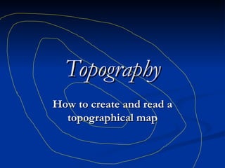
  • 1. Topography How to create and read a topographical map
  • 2. BASICS  Contour lines are lines drawn on a map connecting points of equal elevation. If you walk along a contour line you neither gain or lose elevation.  
  • 3. The shape of the island is shown by location shoreline on the map.  Remember this shore line is a contour line.  It separates areas that are above sea level from those that are below sea level.  The shoreline itself is right at zero so we will call it the 0 ft. contour line (we could use m.,cm., in., or any other measurement for elevation).
  • 4. But contour lines can have elevations other than sea level.  We can picture this by pretending that we can change the depth of the ocean.  The diagram below shows an island that is getting flooded as we raise the water level 10 ft above the original sea level.  
  • 5. By raising water levels to 20 ft and 30 ft above the original see level we can find the location of the 20ft and 30 ft contour lines. Notice our islands gets smaller and smaller
  • 6. If we take each of the shorelines from the maps above and draw them on the same map we will get a topographic map (see map below). Taken all together the contour lines supply us with much information on the topography of the island.  From the map (and the profile) we can see that this island has two "high" points
  • 7.  
  • 8. With practice we can picture topography by looking at the map even without the cross profile.  That is the power of topographic maps
  • 9. A common use for a topographic map is to determine the elevation at a specified locality.  The map below is an enlargement of the map of the island from above.  Each of the letters from A to E represent locations for which we wish to determine elevation.  Use the map and determine (or estimate) the elevation of each of the 5 points. (Assume elevations are given in feet)
  • 10.
  • 11. Unlike the simple topographic map used above, real topographic maps have many contour lines.  It is not possible to label the elevation of each contour line.  To make the map easier to read every fifth contour line vertically is an index contour.  Index contours are shown by darker brown lines on the map.  These are the contour lines that are usually labeled
  • 12.
  • 13.