SlideShare une entreprise Scribd logo
1  sur  160
Cover from Dimitris
PROVISION OF “CONCEPT DESIGN OF ROADS / INFRASTRUCTURE – PHASE 4”
Packages # 26 & 27
Design of Haloul Road
Design of Major Road In The Centre of Doha City
MAY 2016
CONCEPT DESIGN OPTIONS REPORT – URBAN DESIGN & STREETSCAPE CONCEPTS – REV. 1
This page intentionally left blank
PHASE 4- CONCEPT DESIGN OF ROADS & INFRASTRUCTURE – PACKAGES 26 & 27
CONCEPT DESIGN OPTIONS REPORT – URBAN DESIGN & STREETSCAPE CONCEPT
26 May 2016 1 Issued for Review & Approval WB WB DK
07 Sept 2015 0 Issued for Review & Approval WB WB DK
Date Rev. Status Prepared by Checked by Approved by
Document No. CTC-546-CDO-UDSC-0095 SHT: 01 OF: 151
PHASE 4 CONCEPT DESIGN OF ROADS
& INFRASTRUCTURE – PACKAGES 26 & 27
CONCEPT DESIGN OPTIONS REPORT
URBAN DESIGN & STREETSCAPE CONCEPT
REV.1
MAY 2016
This page intentionally left blank
II
Doha’seconomicfuture is
intimately
linked with creating a
place in which people wantto live
and bring up families.
Concept Designs (3)
Case Studies 73
Package 26
Landscape Concept Plans for Options, 1, 2, 3 74
Landscape Perspectives
Landscape Sections
Package 27
Landscape Concept Plans for Options 1, 2, 3 99
Landscape Perspectives
Landscape Sections
Landscape Elements
Planting Palette 132
Hardscape Palette 138
Public Amenities & Site Furnishings 139
Lighting Effects 141
SMART Technology 142
Pedestrian Wayfinding 143
Preface LIVABLE DOHA i
Executive Summary
Purpose and Objectives 1
Regional and Study Area Context 2
Road Segments 3
Corridors Analyses and Climatic Considerations
Hot, Dry, Lack of Shade 6
Climatic and Environmental Considerations 7
Site Analysis 9
Major Destinations 36
Existing Vacant Land 38
Public Parking and Sidewalks 40
Existing Parks 42
Design Principles
Retaining Cultural Values 44
Multi-Modal Approach 46
Land Use & Development Zones 47
Urban Design & Landscape Goals 51
Public Spaces 59
Parks and Open Spaces 62
Stormwater Management 66
Public Arts Strategy 69
Sustainability Approach 70
Major Attractions 72
TableofContents
“Global Cities of the Future”
“Doha is anticipated to be one of the world’s dramatic urban growth centers by 2025”
by
McKinsey & Company
The Concept Design Options Report explores three (3) concept options for the urban design and landscape architecture components of
Packages 26 & 27 in the Doha South proper. This report covers all such matters of design which discusses land use modifications,
enhanced public mobility and the creation of more vibrant streetscapes and united areas of the public realm. All areas within the limits
of the design will be examined and designed to the proposed design intensity levels of HLD/MLD/LLD (High Level Design, Medium Level
Design and Low Level Design).
The Goal for the Concept Design Options Report is to set forth an unprecedented standard of design for a green and walkable
community that is safe and possesses a sense of place. The Report does not supersede any existing approved area redevelopment plans.
The Plan will be used as a guide to the on-going review and amendment of these documents, where required, in order to implement
specific policies or actions.
Preface
I
EXECUTIVE SUMMARY
It is difficult to design a space that
will not attract people. What is
remarkable is how often this has
been accomplished.
WILLIAM H. WHYTE
Purpose and Objectives
The Concept Design of Packages 26 & 27 transportation corridors establishes a
framework for improved transportation circulation, land use compatibilities and
urban design character improvements. The Design Concept Plans are in
alignment with MMUP’s sustainability principles, urban renewal goals, improved
vehicular traffic movements and the soon to be approved “The New Qatari
Street” National Public Realm Guidelines. The concept plans were developed
with input from earlier studies and various Doha government department
engagement sessions. The concept plans provide guidance for the detailed
design of roadway corridors which include streetscape, pedestrian level lighting,
wayfinding & signage and pedestrian links to adjacent areas. The concept plans
primary objectives seek to achieve the following objectives:
Street design process and the wider scope of design considerations;
How existing and new street designs should relate to their immediate and
planned urban context respectively;
How streetscape components are arranged within the right of ways to achieve
optimal function and specific design themes; and
How the inherent landscape characters of Qatar are made apparent in the
public realm design.
THE NEW QATARI STREET. NATIONAL PUBLIC REALM GUIDELINES , Volume I –
Strategy, Interim 2014
Executive Summary
ConceptDesignOptionsReport
Green roof tunnels and decorative ramp walls Segregated bike lane with trees providing shade relief
1
Small pocket park tucked in to spaces between buildings
Al Sadu inspired patterning
1
1
Pedestrian circulation through unique paving design
ConceptDesignOptionsReport
Regional and Study Area Context
The targeted planning areas are described as “Packages 26 and 27.” As
illustrated in the attached exhibit, Package 26 is located along Haloul Road
extending from “C” Ring Road south to Ain Khaled Street . Package 27 is
generally located within the older study area area of Doha, west of the
new Hamad International Airport.
Package 26 Haloul Road typically consists of newer community
development/construction with land uses generally consisting of
Commercial, Retail Strip Centers and Residential developments. Haloul
Road is proposed to be widened accommodating traffic needs on a
north/south basis. The Haloul study area consists of some 8km of
continuous roadway and sundry combined traffic intersections.
Package 27 study area is generally located within the older study area area
with extensive mixed-use build-out of more aged to decrepit structures or
other dated structures/developments that may present a lower assessed
value than the actual land value. This potentially provides for excellent
opportunities for new carriageway improvements and development,
improvement of city character and presentation, and improvement in both
vehicular and pedestrian movements and capacities.
2
STUDY
AREA
C-RING
D-RING
B-RING OLD
HAMAD INT’L
AIRPORT
DOWNTOWN
DOHA
MUNTHAZA
MANSOURA
Packages 26 and 27 are integrated in the fact that the east/west roads link
Package 26, Haloul Road, to the airport and points east. Four (4) major roads, B-
Ring, C-Ring, D-Ring and E-Ring Roads are classified as arterial and expressways.
Most traffic utilizes these roads during rush hours and connects a large residential
population to west and north Doha. Haloul Road is a secondary means of routing
traffic off of Salwa Road which is a major arterial. Light commercial, offices and
schools line northern Haloul, while, southern Haloul is primarily occupied by
single family residential.
Current and future traffic needs within the study area will require the acquisition
of existing land parcels to achieve the required traffic flows and enhancements of
related public realm or domains. Existing land uses consist of light industrial,
heavy and light commercial, retail, mixed-use and multi-family residential uses.
The core area presents roughly 19km of carriageways under traffic engineering
investigation and proposed streetscape and public realm design enhancements.
3Road Segments
ConceptDesignOptionsReport
This page intentionally left blank
CORRIDORS ANALYSES AND CLIMATIC CONDITIONS
Corridor Analyses and Climatic Considerations
Hot, Dry, Lack of Shade
The public realm of south Doha is a hot, dry and pedestrian unfriendly
environment. Packages 26 and 27 consist of corridors where light industrial zoning
exists within residential areas with a lack of greenspace for residents use.
Package 26 does not provide any shade provisions nor pedestrian friendly
environment for safe pedestrian circulation, lack of adequate parking facilities
and appropriate public park spaces.
Package 27 is different in that its setting is within an existing urban area. The urban
area is currently a miss-match of land uses that conflict with one another causing
a decayed urban environment that has created a pedestrian unfriendly and
vehicle dominant environment.
Outside climatic challenges by the local residents and workforce, numerous
pedestrian hazards also exist within the public realm. These hazards include non-
paved and deteriorated walks, utility service boxes located within walkways,
private sector steps and ramps protruding in the public realm and parking on
walkways by residents and shop owners.
Minimum upgrades are required to provide a safe and comfortable means of
pedestrian circulation throughout south Doha. Integration of site furnishings
including benches, litter bins and the construction of walkways at vacant lots is
required.
Currently a healthy community does not exist and there is a much needed desire to
construct a community where improvements for a healthier city is desired.
6
ConceptDesignOptionsReport
7Climatic and Environmental Considerations – P26
Shading Strategy – P26
The shading strategy is approached by the road alignment and its
relation to the sides of the road needing shade.
Haloul Road will receive heavy later afternoon sun and shade
structures through the use of shade trees and man-made structures are
required along the Haloul Corridor.
Decorative Shade Structure Tree-lined Walkways
Existing photos along Haloul
ConceptDesignOptionsReport
Climatic Conditions – P278
Shading Strategy – P27
The shading strategy is approached by road
alignment and its relation to the angles needing
the most shade.
East west corridors need the shade the most and
the use of shade canopies and natural shade
amenities, such as shade trees, is required to
mitigate the hot, blinding sun.
Potential Decorative
Shade Structure
Potential Tree-lined
Walkways
ConceptDesignOptionsReport
Minimal shade provisions Zero shade provisions Zero shade provisions Zero shade provisions
Site Analysis – P26 9
ConceptDesignOptionsReport
Site Analysis – P2610
ConceptDesignOptionsReport
Site Analysis – P26 11
ConceptDesignOptionsReport
Site Analysis – P2612
ConceptDesignOptionsReport
Site Analysis – P26 13
ConceptDesignOptionsReport
Site Analysis – P2614
ConceptDesignOptionsReport
Site Analysis – P26 15
ConceptDesignOptionsReport
Site Analysis – P2616
ConceptDesignOptionsReport
Site Analysis – P26 17
ConceptDesignOptionsReport
Site Analysis – P2718
ConceptDesignOptionsReport
Site Analysis – P27 19
ConceptDesignOptionsReport
Site Analysis – P2720
ConceptDesignOptionsReport
Site Analysis – P27 21
ConceptDesignOptionsReport
Site Analysis – P2722
ConceptDesignOptionsReport
Site Analysis – P27 23
ConceptDesignOptionsReport
Site Analysis – P2724
ConceptDesignOptionsReport
Site Analysis – P27 25
ConceptDesignOptionsReport
Site Analysis – P2726
ConceptDesignOptionsReport
Site Analysis – P27 27
ConceptDesignOptionsReport
Site Analysis – P2728
ConceptDesignOptionsReport
Site Analysis – P27 29
ConceptDesignOptionsReport
Site Analysis – P2730
ConceptDesignOptionsReport
Site Analysis – P27 31
ConceptDesignOptionsReport
Site Analysis – P2732
ConceptDesignOptionsReport
Site Analysis – P27 33
ConceptDesignOptionsReport
Site Analysis – P2734
ConceptDesignOptionsReport
Site Analysis – P27 35
ConceptDesignOptionsReport
Major Destinations – P2636
ConceptDesignOptionsReport
Major Destinations – P27 37
ConceptDesignOptionsReport
P26 Existing Vacant Land38
ConceptDesignOptionsReport
P27 Existing Vacant Land 39
VACANT LAND
METRO STATIONS
ConceptDesignOptionsReport
Public Parking and Sidewalks – Package 2640
Information derived for both the Pedestrian and Cycling
Report & Parking Study for Package 26 & 27
ConceptDesignOptionsReport
Public Parking and Sidewalks– Package 27 41
ConceptDesignOptionsReport
Information derived for both the Pedestrian and Cycling
Report & Parking Study for Package 26 & 27
Existing Parks
Healthy Living through Parks
and Open Spaces
There is a lack of public parks
and open spaces in south
Doha. Shown are existing
parks and this report contains
a proposal for additional
parks and park network.
42
ConceptDesignOptionsReport
DESIGN PRINCIPLES
Retaining Cultural Values
Inspiring the Public Realm of Packages 26 & 27
The public realm of the study area is unique in its design having been inspired by
Al Sadu, the indigenous traditional weaving of the early nomadic tribes of Arabia.
Al Sadu is more than just a textile - it is an ‘intangible’ part of the cultural heritage
of Qatar and is recognized by the world cultural heritage and education body,
UNESCO, as one of several artifacts that symbolizes the Qatar’s history, culture and
traditions.
Al Sadu regionally, remains intrinsically woven into the fabric of everyday Middle
Eastern nomadic life and remains culturally significant. As an artifact that was
once a common feature in Bedouin life, the knowledge behind its manufacture
was transferred from generation to generation, helping to ensure the traditions
and stories that influenced design elements within the textile were preserved for
future generations. .
Unique Street Features
Each of the seven (8) roadway corridors within study area Doha will have an
individual color, pattern and identity derived from Al Sadu textiles. Such colors
(blue, red, brown, green and white) and intricate patterns serve both site aesthetics
and wayfinding purposes. The color coding is captured in the landscape,
community signage, lighting design, pavement and hardscape patterns,
monumentation and proposed public art, parks, shading structures, building
address plates and other landscape furnishings. These unique street features are in
conjunction with the Public Realm Guidelines that are under preparation.
In developing the Concept Design Options for the 8 corridors, the inspiration of Al
Sadu indigenous weaving and patterns has been abstracted from the historic
fabrics and physically applied within the extensive landscapes of these corridors
and study area. This will create a community with a living identity that is linked to
the Qatar’s history, traditions and culture and manifested in elements that populate
the public realm
44
Al Sadu
ConceptDesignOptionsReport
Capturing the Essence of Al Sadu
Zooming in on Package 26/27’s site design reveals a myriad of Al Sadu
elements that are woven into the various typographies. These are
represented through the use of specific Al Sadu colors and patterns
that are abstracted and embedded into the community landscape.
These colors adorn sun shades, plant geometries and hardscapes to
bring the vibrancy of the textile to life throughout the public realm.
Enhanced Connectivity
Connectivity into Package 26/27 will be via nine road gateways that
lead to the center of the community which is just over one kilometer
from each entrance.
Each gateway is monumented with colored elements corresponding
identity and color assigned to each road. In their design, these
monuments represent an abstract interpretation of the Al Sadu loom
components.
At the heart of the community will be the Najma and Mansoura
Greenspace Network, the largest proposed pedestrian oriented
public spaces within study area. As with the Al Sadu tapestry, the
Greenspace Network serves a uniting purpose of tying all the roads,
land uses and Mosques together at the center, which is reminiscent of
the knot or ‘Tarboush’ used within traditional Al Sadu weaving.
45
…..carried on
ConceptDesignOptionsReport
Al Sadu Themed Roads
Themed Road Designations
Theming of the various roads in both Packages 26 & 27 will bear the intricacy of the Al Sadu weave.
Patterns will be similar in nature for all corridors, but thematic coloring will differentiate each corridor.
Color enhancements will be carried through plant materials, site furnishings and hardscape materials.
Color themed corridors is also an additional method of wayfinding for local residents.
Multi-Modal Approach
Transit Oriented Development
South Doha is envisioned as a destination rather than a series of thoroughfares. Within a five-
minute walk or a five-minute bike ride, residents will be able to access a concentration of
retail, employment and other services.
What is a Transit Oriented Development (TOD)?
A TOD’s 1 kilometer radius includes:
A Hot Spot. The center or ‘Hot Spot’ contains a concentration of the community’s residential,
retail, employment, business, and service uses and a civic plaza or greenspace centered
around a transit facility.
Pedestrian-Friendly Sidewalks. The sidewalks leading to the Hot Spot are comfortable, safe
and vibrant protected bikeways. Bicyclists are separated from auto traffic in an ideal
situation.
Transit Supportive. Bus rapid transit will connect to districts and other centers in Doha South.
Metro Rail will provide premium transit access within the Doha South urban area with
connections to the International Airport, West Bay and The Pearl.
What are the benefits of a TOD to the Project Area?
New Hot Spots at Metro Stations. Newly created Hot Spots will be centered around the new
Metro Rail stations. Easy pedestrian access and park and ride facilities will allow for
increased mobility around Doha. The Metro Station at Najma and Mansoura will be at the
heart of the community.
Auto Trips are Reduced. Protected bike lanes, adequate walks and proximity to the Metro
Rail and new bus routing allows for the reduction of vehicular demand and increased
pedestrian movement.
Homeowners’ Fuel Costs are Reduced. By increased pedestrian activity, households within
the TOD could drive 50 percent fewer kilometers.
Increased Public Open Space and Parks. Pedestrian links through opens paces and parks
linking major attractions and transit Hot Spots provides for a safe environment for the
increased pedestrian activity.
Comfort and Safety For All Users
In the study area, intersections have a significant place-making function as well as a
transportation function. Significant land uses and architecturally significant buildings
are located at intersections and might provide pedestrian access directly from the
corners. Intersections may also serve as gateways and are frequently the first thing
visitors see when they enter a district. Included in intersection design are aesthetic
treatments and addressing safety issues.
Multimodal intersections operate with pedestrians, bicycles, cars, buses and trucks.
The diverse uses of intersections involve a high level of activity and shared space.
Intersections have the unique characteristic of accommodating the almost-constant
occurrence of conflicts between all modes.
Safety is the primary strategy for intersection treatments. Landscape treatments to
promote safe intersections include bulb-outs to minimize lengths of crosswalks, shade
provisions through the use of trees and maintaining a cone of vision to allow both
pedestrians and vehicles to see in advance of any potential dangers.
Mid-block crossings will be treated in a similar manner where push flashing lights will
be integrated alerting vehicles of pedestrians occupying the crosswalk and warning
signage will place in advance of these mid-block crossings,
Clarity – Announce pedestrian
crossings with raised painted
bars and other visual elements
Visibility - Good sight distance,
keep plantings low
Minimize Pedestrian Exposure –
Provide refuge islands and bulb
outs
Accessibility – Provide
adequate means of access
with no barriers to pedestrians
46
Walking, Biking, Jogging
Cone-of-Vision
Bulb-Outs
Short Crosswalks
H/C Ramps
Defined Routes
ConceptDesignOptionsReport
Land Use
To achieve the desired mix of vitality and activity, study area should be
comprised of a number of different Districts distinguished by land use and
population within the each zone. These zones include: the Core (comprised of
a high intensity mixed-use center with taller buildings surrounded by a vibrant
mixed-use area); two lesser, less intense mixed-use transition zones to the east
and west of the core; taller, more intense east and west gateway areas; the
Recreation District and the Mall District (see map to the right).
Further defined theme based Districts (areas identified by specialized uses,
such as parks and recreation, shopping and hotel, Mosque, restaurant, etc)
within these larger Districts are encouraged and should be strengthened
where they currently exist.
Development Zones
Urban Core: The study area urban core (approximate area bounded by Al
Matar and Munthaza Roads, B-Ring and Nawfal Bin Al Harith Roads) should be
a vibrant, compact, and walkable center of activity in the study area. The
core should be comprised of a central core area consisting of taller (max.
25m), high intensity mixed-use (residential/ commercial) buildings surrounded
by an equally vibrant, but shorter (max. 12-20m) mixed-use
(commercial/office/ residential) outer core area.
Transition Zones: The transition zones should serve as less intense connector
areas between the high intensity study area core and north, east and west
gateways to help create a varied study area experience. These areas are
ideal for theme based Districts (areas with similar or complementary uses such
as restaurants, retail shops, etc.) and should consist primarily of shorter, one to
two story (max. 10m.) commercial/office mixed-use buildings. Slightly taller
mixed-use buildings with ground floor retail/office and residential studios
above (max. 15m) are permitted both sides of Mansoura.
Gateways: The north and east entrances to the study area (along B-Ring Road
and Al Matar Road) should be well defined areas that make one’s entrance
into the study area a memorable experience. They should be taller (max.
20m), high intensity mixed-use at B-Ring Road (residential/ commercial) areas
with distinctive landscaping and signage marking the entrance to study area.
The Gateway treatment at Al Matar and Mansoura Roads is proposed to
integrate the southern end of the new Najma District with monument signage,
banners, extensive streetscape treatments.
The Mall/Hotel Zone: This zone is completely contained within the former Souq
Haraj property envelope and its land uses are re-zoned to accommodate the
new development. The zone’s location along Mansoura Road makes it an
integral part of the study area. It should be well connected through pedestrian
and greenspace linkages with the rest of the study area to ensure the success
of the entire study area.
Land Use & Development Zones
47
The Mosque Zone: The Mosque zone is an important historic area in the study area
of south Doha. It should contain many architecturally, socially, and culturally
elements in support of the new developments and the cultural importance of the
local Mosques. This zone should continue to retain the certain land uses to support
the growing residential community to enhance the overall character and create
a more healthy environment.
Within all of the study area, Districts (especially in the core and transition areas)
are being created with theme based zones. These zones should be lively,
walkable areas with similar or complementary uses that create a sense of zone
identity. These areas should be connected with each other and the central study
area core to create a dynamic and pedestrian friendly study area.
Mall/Hotel
Zone
Gateway
Gateway
Mosque
Zone
New
Park
Greenspace/
Gathering/Events
Najma
District
Center
Development Zones and Najma District Center
Mansoura
Najma
Mosque
Mosque
ConceptDesignOptionsReport
Proposed Land Use Plan – Package 26
Proposed land use changes consist of rezoning
street frontage along Haloul between C-Ring an D-
Ring Roads to Commercial. Numerous parks are
proposed with pedestrian links to provide safe and
attractive passage throughout the community. The
Wholesale Market is undergoing re-planning and
design and will better fit future development along
south Haloul.
48
Commercial
Corridor
Commercial
Corridor
Re-Planned
Wholesale Market
Single-Family
Residential
Corridor
ConceptDesignOptionsReport
Proposed Land Use Plan – Package 27 49
Proposed land use changes consist of relocating
light industrial and heavy commercial uses out of the
study area, removal of Souk Harjaj, integrating 1
Town Center and 3 District Centers. Numerous parks
are proposed with pedestrian links to provide safe
and attractive passage throughout the community.
ConceptDesignOptionsReport
Integrated Neighborhood Park
ConceptDesignOptionsReport
50
Integrating public parks, plazas and group
gathering spaces within the urban core are planned
to provide a more social, healthy and sustainable
living environment for the local residents.Healthy living…..
Overall Goals
The overall goals for the urban design and landscape design is to provide a
community where the local residents can live, work and play in a healthier
environment where social engagement is encouraged and promoted.
Shade Provisions
The comfort of the pedestrian is crucial to the development of any dense
development which strives to be economically viable. This is especially the case
today, when people have come to expect the climate control found in
contemporary buildings. Like much of the Middle East, Doha has many months of
extremely hot and dry weather.
Making the transition to a pedestrian oriented streetscape will require special
attention to the comfort of the walker. Dense development can increasingly
expect pedestrians to arrive by mass transit and walk to their destination.
Because they are the economic base for any development it is important that
pedestrians are comfortable. They will choose the most comfortable route,
avoiding blocks which are less comfortable or which create gaps in the
continuity of the protection.
Recommendations
• Overhead cover, offering adequate pedestrian protection from the sun and
rain should be provided along the right-of-way where buildings meet the street.
This should occur between three and 5 meters above the level of the sidewalk,
and should provide a minimum of 2.5 meters of cover in width. Cover should not
project closer to the curb than 1 meter.
• Overhead cover along the sidewalk may provide continuous protection
without being continuous itself.
• Cover may take the form of either a projection from the building, an arcade, or
a combination of the two. Arcades shall be open to the street.
51
• Projections may take the form of fabric awnings which are retractable, fabric
awnings which are not retractable, or fixed non-fabric projected covers.
• Projected covers may be occupied by the building user, but should be accessed
only from the building and not from the sidewalk. Where projected covers are
occupied, they may also be supported by columns which fall in the right-of-way.
Columns in the right-of-way should not interfere with pedestrians or emergency
functions of the sidewalk. Maintain clear sidewalk width not interrupted by columns.
Provide sufficient space between curb and columns to accommodate the potential
of vehicles jumping the curb.
• Where buildings have been permitted to pull significantly away from the property
line due to new setback requirements, a free standing cover or tree/palm should be
provided along the right-of-way. Owners are encouraged in this condition to provide
pedestrian cover additionally at the edge of the building where it does not touch the
property line.
• Existing buildings which experience significant renovation should be required to
provide pedestrian protection as well. Landmark buildings may comply by installing a
detached cover in front of the building.
Urban Design & Landscape Goals
TREES, CANOPIES, SHADE, COOL, COMFORTBLE
ConceptDesignOptionsReport
Enhanced Streetscape
Circulation from one part of a study area to another without relief can be daunting to some
pedestrians. Streetscape amenities such as benches, trash receptacles, planters, pole lights,
kiosks, telephones and charging stations, news stands, drinking fountains, bike racks,
sculpture and water features enliven and support the public realm.
Cafe tables in the right-of-way can bring activity to the street. Small temporary Parklets can
be integrated on weekends where one (1) parallel parking space can be converted in to a
small seating area along the pedestrian routes.
Recommendations
• Widening of sidewalks is encouraged to allow for street furniture in the public right-of-way
for pedestrian use. High priority should be given to Mansoura, north Najma, Munthaza and
Khalidiya Roads.
• Coordinate street furnishings with the Qatar National Public Realm design guidelines
where applicable.
• Street furniture may be fixed to the sidewalk if adequate clear passage for pedestrians
and emergency access is provided. Avoid intrusions into the accessible route.
• Cafe tables and kiosks may occupy a portion of the public right-of-way if adequate clear
passage for pedestrians and emergency access is provided. Minimum 1.8m clearance.
• The design of street furnishings should unify areas with distinct character. Participation from
private property owners is encouraged.
• Appropriate planting may be provided as well.
• The use of Qatari artisans and artists in the creation of street furniture and artwork is
encouraged.
• Integrate small water features to cool micro-environments.
• Themed decorative pots and planters for visual interest.
52
relax & enjoy
ConceptDesignOptionsReport
Pedestrian – Utility Structure Conflicts
Numerous utility boxes, manholes and other utility structures litter the existing
sidewalks and are a safety concern to the public, see images below. Relocation
of these structures is critical for ease of maintenance and to ensure the health,
safety and welfare of the local community.
Recommendations
• Utility connections and support should be located in the to avoid conflict with
pedestrian movement in the right-of-way and maintain accessible routes.
• Above ground utilities should be visually compatible with other streetscape
elements in color, material and finishes when possible.
• Utility lines (wires) should be placed underground in the public right-of-way.
• Manhole covers should be themed to the varying districts and integrate the Al
Sadu textures.
53
Pedestrian Level Lighting
Light quality can strongly affect the character of a place. Harsh light creates an
environment which seems inhuman, while too little light creates an environment which
feels unsafe.
The size and scale of lights and light poles will also impact the character of the
streetscape. Light fixtures scaled to the movement of cars will suggest to pedestrians
that they are in a car’s environment and that they may not be safe.
Both the scale of fixture and type of lighting can easily create the sense that the
sidewalks the domain of the pedestrian.
Proposed bases to these pedestrian level lighting fixtures are themed in the Al Sadu
colors and patterns.
Recommendations
• Urban Streets should be lit by pedestrian-scaled fixtures emitting warm light.
• A minimum of 12 lux of warm light should be provided in all space between the
building face and the curb along all streets.
• Lighting may be provided through the use of pedestrian-scaled pole fixtures, or
fixtures may be attached to the face of the building. The type and size of pole fixtures
should be as consistent as possible along a single block mounted on bases themed in
the Al Sadu colors and textures.
Visibility
ConceptDesignOptionsReport
Street Trees/Palms
Trees/Palms improve air quality, reduce storm water runoff, provide cooling effects for the
urban heat island, increase property values and create urban wildlife habitat.
They can also greatly increase the quality of life in Doha. An important design principle in
the streetscape design is the use of scale of the trees to the local space and its relevance
to the adjacent building and pedestrian corridor. Trees/palms that are too tall will dwarf
the pedestrian and will make the space uncomfortable.
Recommendations
• Trees should be provided along major pedestrian corridors in proper scale to the
pedestrians.
• Consider that the life span of street trees in urban areas is frequently limited by soil
volume. Provide as much soil volume as possible to support sustained tree growth in
existing or new sidewalks.
• Integration of Parklets should be considered providing temporary shade relief and
resting points for pedestrians. These Parklets will occupy one (1) parallel parking space
and will contain benches, trash receptacles and planting.
• Consider the use of structural soil or continuous street tree trenches to provide maximum
soil area for roots to spread, water and air to penetrate the root systems.
• Locate trees in expanded sidewalk areas in the parking zone to provide more area for
root systems.
• Allow sufficient room for tree canopies to grow and develop without conflict with other
building elements and signage.
• Install TSE and/or KISSS irrigation systems to provide recycled water to establish and
maintain trees. Provide drainage to storm sewer to not increase high water tables.
• In high pedestrian use areas, install tree guards to protect the trunks from damage.
• Consider the design of street tree layout in relation to the buildings and other
streetscape elements with regard to sustainable urban approaches.
• Select trees which are adapted to the harsh conditions of a desert urban environment.
• Allow stormwater to drain in to tree pits and planters with collector pipes to prevent
groundwater recharge.
54
palms
shade trees
ConceptDesignOptionsReport
Generous Pedestrian Level Windows
Long windowless walls prohibit visual connection between the inside of the building
and the sidewalk. People inside have no knowledge of those on the street and people
on the street cannot see inside. Walls with no windows can project the sense that
people outside are not trusted and that the area is not populated. It is this inability to
see inside and to be seen from the inside which creates the pedestrian’s sensation of
danger, and the real danger in unobserved places.
Windows not only create a feeling of trust and openness in a city, they also instill in
people on the street the feeling they could be assisted if in danger. This phenomenon,
“eyes on the street,” can help reduce crime by increasing the potential that offenders
would be seen.
Windows also provide visual interest such as ‘window shopping’ and allows pedestrians
to interact with shopkeepers.
Recommendations
• The lower two levels of buildings, where they face the street, should be made highly
transparent, through the use of windows or fixed glass panels.
• The use of reflective or highly tinted glass is not recommended and should be
discouraged.
55
Promote Pedestrian Activity
Pedestrian related concerns are a priority in the creation of a successful urban
environment.
Tourism, conventions, and daily business all create pedestrian traffic. Currently,
vehicular needs dominate the streetscape at the expense of pedestrians. In some
areas, discontinuous sidewalks force pedestrians into the street to compete for
space.
Major points of interest study area, the intersection of Najma and Mansoura,
Mansoura at Munthaza and all the major intersections of the arterial roads need
better pedestrian connections. Improved wayfinding tools such as signs and
graphics together with continuous and adequate sidewalks would encourage
walking.
Recommendations
• Appropriately wide sidewalks should be provided from corner to corner along all
boundary lines.
• Sidewalks should abut the street curb. Sidewalks extending on and of private
property will meet at grade.
• Blocks without pedestrian connections should be identified and prioritized for
sidewalk construction.
• A new street sign system which unites study area and other urban centers should
be developed.
• Encourage street vendors, sidewalk cafes, etc. – food attracts pedestrian activity.
• Buildings should address the streetscape and reinforce pedestrian activity.
cafe’, reading, social, fun & accessible
ConceptDesignOptionsReport
Palm lined street with shade trees
provide much needed shade
relief in summer months
Sidewalk bulbs shorten crosswalk
lengths and provides space for
additional plantings
Stepping back buildings opens up
view corridors and pedestrian
character
Convenient on-street parking and
traffic calming
Building Setbacks and Shade Provisions
Low level windows to provide
visual interest and shop
interaction
56
ConceptDesignOptionsReport
Urban Corner Treatments
Above: Corner building cutbacks and setbacks, sidewalk
bulbs, and towers should be used at important
intersections to create small public spaces with a sense of
place. Additional design elements, such as architectural
detailing, awnings, first floor retail with large display
windows, outdoor eating areas and landscaped areas,
add to pedestrian comfort and are recommended
where appropriate.
57
relaxation
ConceptDesignOptionsReport
Bike Lane
Converted one way,
single lane carriageway
allows for more parking
Additional on
street parking
Infill Parking58
ConceptDesignOptionsReport
Palm lined street with shade trees
provide much needed shade
relief in summer months
Numerous locations within the
study area are lacking adequate
parking facilities.
One option to provide additional
parking is to require future
buildings to provide on-site
parking for its tenants with a
minimum ratio of 1 parking space
per unit.
A second option would be to
demolish older dilapidated
buildings and provide infill smaller
parking lots 1 block off the main
corridors.
Pedestrian access through sikkas
will allow shoppers and shop
tenants easy access.
59
Public Spaces
ConceptDesignOptionsReport
INCORPORATE PUBLIC SPACE AND GREENWAYS
Neighborhoods will be organized around a
hierarchy of public spaces, parks and green
connections. These greenspaces are shared by the
local community, encouraging social interaction,
creating recreational opportunities and strong links
to the Hot Spots for mobility. Policies should include
following:
Hierarchy of Public Open Spaces
Public Open Space are created using a hierarchal
order differing in size and location. Neighborhoods
will contain a hierarchy of open spaces that range
from public parks to smaller outdoor rooms, sikkas
and plazas. Spaces will transition from smaller urban
spaces or pocket parks towards the center of the
TOD to larger parks on the fringe of the
neighborhoods and Hot Spots. Community
amenities, such as fountains, sculptures and other
public artwork and seating will help create
identifiable gathering spaces.
Public Spaces Organized as Feature Development
Public spaces, such as parks and plazas, will be
utilized as an organizing landscape element for
various neighborhood developments and serve as
focal points for each neighborhood area. Public
spaces provide easily accessible green pedestrian
links for local residents. These public spaces will be
incorporated into the design near transit stops and
metro stations to increase the functionality and
visibility of the spaces.
Establish Clear Linkages between Public Spaces
Clear pedestrian and bicycle linkages will be
provided within public spaces. Pedestrian linkages
are provided along primary streetscape corridors
and are designed as urban “greenways” with
enhancements such as street trees, benches,
pedestrian-scaled lighting, landscape plantings,
and other related amenities.
ConceptDesignOptionsReport
60
Examples of Space-Making
Providing more public space for pedestrians is one of the main goals of urban
renewal projects taking place in cities around the world.
By planting more trees, implementing more sidewalks and bike paths and
establishing new seating areas, it is possible to design more welcoming places with
less traffic congestion and that promote sustainable methods of transportation, such
as walking or biking.
Brazilian group Urb-l launched the “Before/After” project, which compiles before and
after photos that show how cities have redistributed their public space.
Below is a treatment at the intersection of Najma at Mansoura. Numerous highrise
residential buildings, a local mosque and the proposed Najma Neighborhood Park at
B-Ring Road gives the local residents a sense of community, gathering areas, small
event spaces and a cultural draw from surrounding neighborhoods.
Coenties Slip, New York
Griffith Park Boulevard, Los Angeles
(Brazilian urban planning collective called Urb-I scoured Google Street
View images to find the most stunning public space transformations from
around the world.)
Sikkas and Pedestrian Links
Opportunities exist within both Packages 26/27 to link
adjacent neighborhoods and commercial areas to one
another.
Sikkas will play an important role and will offer
pleasurable experience for pedestrians on the move.
Opportunities to integrate seating, planting, shade
provisions, water features, art work and accent paving.
Sikkas will provide safe passage and will reduce street
side public walk numbers.
61
ConceptDesignOptionsReport
Parks and Open Spaces
P26/27 will offer a diverse series of public open spaces
for residents and visitors, expressed through different
scales and park typologies. Each will be appropriately
planted and shaded to offer respite from the sun
during the summer months and to help in creating
pleasant settings for social interaction and
entertainment.
The overall success of the P26/27 parks, open spaces
and stormwater facilities is related to their liveability,
usability and functionality. Collectively, allowing
people to interact, engage and communicate these
in desirable spaces and places will enhance the vitality
of the overall community. The diversity of public spaces
provides opportunities for people to gather in
organized or informal fashion.
The stormwater facilities provides for much needed
collection of surface runoff while providing a
recreational amenity throughout most of the year.
These dry depressions or wadi’s, allow for natural
ecosystems to generate naturally and provide a
sanctuary for local wildlife.
62
livability
recreation
Healthy
Parks and Open Spaces
social
ConceptDesignOptionsReport
Proposed Parks Network
The proposed parks network
provides many recreational
amenities within walking or
biking distances to all south
Doha Residents.
The heirarchal park system
should be developed to
provide the much needed
sports, active and passive
recreation opportunities for all
local residents to enjoy and
experience.
Shown is the Park Network
with pedestrian linkages
through walks, jogging trails,
bikeways and service
corridors.
63Proposed Public Parks Network
Najma
Neighborhood
Park
South Najma
Linear Park
Matar
Park
ConceptDesignOptionsReport
64 Najma Neighborhood Park @ B-Ring Road
ConceptDesignOptionsReport
Najma Neighborhood Park - Proposed
Najma Neighborhood Park
Najma Neighborhood Park is located on a previously used
ASHGAL facility and is strategically located along B Ring and
Najma Roads.
Adjacent land uses consist of mid and high rise residential
buildings with a higher population density. There are no local
mosques or public facilities within 800 meters.
Proposed for Najma Neighborhood Park is a combination of
uses and functions. The park will first serve as a stormwater
collection and re-distribution facility. Stormwater will be
collected and then released downstream to capture localized
flooding and surface run-off.
The park’s secondary function is to provide much needed
recreational activities and public facilities. Opportunities exist
to integrate a local mosque and community center for the
local residents.
Recreational activities include both passive and active
recreation. Playground for 2-5 year olds and for 6-12 year olds
will be provided. A unique dinosaur dig adventure play is
proposed adjacent to the lower level stormwater basin.
Open lawn for free play, picnics and holiday events is provided
along with bbq facilities. The community center includes an
events plaza with a water feature
The stormwater facility is terraced to 3 levels. The lowest level is
proposed to be set below the existing groundwater line and
provide a living and functioning mangrove while the upper 2
levels will serve as reserve catchment for overflow from the
lowest basin.
Proposed South Najma
Desert Linear Park
The proposed South Najma Desert
Linear Park located along a utility
corridor on Najma Road provides for
passive recreational activities with
no built structures on top.
The park will consist of a walking,
biking and jogging trail system set in
a natural desert landscape.
Use of varying size gravels in different
colors will add contrast, create a
rhythmic stimulation and be low
maintenance in nature. Added
visual interest with sizeable boulders
for climbing and sitting.
Primary use of this park will be
though sports fields and related
facilities. Due to utility corridors
below, shade trees may not be
allowed and the use of constructed
shade shelters will be the alternative.
Raised berms or mounds, will provide
options for tree planting.
Opportunities for the park to serve as
a temporary stormwater catchment,
is one alternative to assist in flood
prevention and lowering of the
groundwater table.
65South Najma Linear Park
LAWN
LAWN
LAWN
DECORATIVE
GRAVEL
ORNAMENTAL
GRASSES
ORNAMENTAL
GRASSES
DECORATIVE
GRAVEL
JOGGING
PATH
BIKEWAY
ConceptDesignOptionsReport
South Najma Linear Desert Park - Proposed
South Najma
Linear Park
Basic Principles
Stormwater runoff is the result of manmade hydrologic
modifications that normally accompany urban and suburban
development. Impervious surfaces, soil compaction, and tree
and vegetation removal alter water's movement through the
environment by reducing interception, evapotranspiration,
and infiltration and converting precipitation to overland flow.
These modifications impact not only the characteristics of the
developed site, but also the watershed in which the
development is located. Stormwater has been identified as a
major source of pollution for all water body types around the
world. However, the impacts of stormwater pollution are not
static—they generally increase with more development and
urbanization.
Traditional stormwater management practices focus on the
collection and rapid removal of rainwater away from the point
of impact, through a system of underground pipes and storm
sewers, transferring water directly to sewer outfalls without
any sort of pre-treatment. The primary focus is to reduce or
control localized flooding. The water collected by these
extensive systems is treated as a waste product to be disposed
of. This approach generates vast quantities of polluted runoff,
disrupts the natural hydrologic cycle, and adds to the
contamination and scouring of streams and rivers. In contrast,
"green" or sustainable stormwater best management practices
(BMPs) treat water as a resource to be preserved and
maintained, taking advantage of natural processes to clean
and filter runoff and emphasizing the importance of the
hydrologic cycle.
This new approach seeks to manage stormwater on individual
development or redevelopment sites in a decentralized
manner as opposed to the traditional approach of
concentrating and conveying runoff through pipes and
hardened channels to large-scale, regional ponds or basins.
The new approach seeks to slow runoff, mimicking a site's pre-
development hydrology and protecting headwater streams and
runoff conveyances from erosive stormwater flows. Slowing the
movement of water through a system leads to fewer problems
with erosion and increases the chance for on-site filtration and
purification of overland flow. This is often accomplished by using
vegetated areas in place of impervious surfaces. Plants serve to
slow the movement of water through an area, leading to fewer
problems with stream bank erosion and increasing the chance for
on-site filtration and purification of overland flow.
Detention ponds designed to accommodate the particular needs
of a specific site or installation, can reduce the quantity of water
transferred to stormwater infrastructure, improve water quality,
and add aesthetic and recreational value. BMPs are also often
more economical than traditional approaches. The emphasis on
built structures is lessened, which reduces installation and
maintenance costs.
The shift to more sustainable stormwater practices involves more
than a simple change in structural components; it represents a
new way of approaching the concept of stormwater management
and water use. Stormwater permits often include specific
requirements for the quality and quantity of stormwater that
leaves a developed site. While it is important to address these
minimum requirements, a “lowest common denominator”
approach does not allow for a full exploration of how stormwater
can best be used onsite. It is important to recognize that these
spaces can be designed for people to use and enjoy while still
meeting water quality and quantity requirements.
Stormwater Management
66
ConceptDesignOptionsReport
Flood Prevention
Stormwater and Infiltration Planters
Infiltration planters reduce runoff volumes by allowing
water to seep into the surrounding soils. By contrast,
filtration planters only cleanse stormwater runoff; they do
not allow infiltration.
In fact, they are lined specifically to prevent infiltration in
unsafe conditions. Infiltration and filtration planters differ
slightly in their location, piping requirements, and some
design features.
Stormwater planters can be modified to fit almost any
physical setting, and are therefore, optimal alternatives
for sites with conditions that restrict the use of other best
management practices.
Water Sensitive Urban Design
Water Sensitive Urban Design (WSUD)
Water Sensitive Urban Design (WSUD) integrates water
cycle management into urban planning and design.
Key principles of WSUD
Protect waterways
So that South Doha will maintain valuable community
assets that enhance livability and support the
ecosystems within the area.
Manage stormwater in the landscape
This reduces the volume and frequency of stormwater
drained and increases the quality before stormwater
reaches the Public Works drainage system.
Add multiple benefits while minimizing development
costs
A range of benefits such as alternate supply, improved
amenity and safety, and contribute to enhanced
livability by enhancing natural features such as
catchments and swales (wadi’s). WSUD will also
minimizes drainage infrastructure development costs
by reducing pipe sizes and potentially replacing other
large scale reticulated water systems with localized
solutions.
How WSUD can be applied
WSUD applications will include a range of
applications, including:
Grassed or landscaped swales
Infiltration trenches and bio-retention systems
Stormwater harvesting and reuse
Grey water harvesting and reuse
Urban forests
Porous pavements
Water table recharge and reuse
Where WSUD will be implemented
The applications are flexible and will be implemented
across South Doha and at different scales, from a all
roadways to the open space and park system.
Some examples of applications include:
New roads;
Drainage systems;
Residential neighborhoods;
Urban Core and Hot Spots;
Parks and open spaces.
Swales provide for stormwater conveyance and they
screen and remove gross pollutants, such as litter and
coarse sediment from stormwater run-off.
They bind pollutants to organic matter and soil
particles and pollutant removal is remove them by
settling, filtrating and infiltrating into the subsoil.
Swales may be used as an alternative to the
conventional street nature strip or center median strip
of roads as run-off collection points in car park areas in
conjunction with the sealing of rural roads to reduce
negative impacts from increased run-off volume and
frequency (where space and slope allows).
Reduce and delay storm run-off.
Retain particulate pollutants close to source.
Aesthetically appealing than kerb and gutter.
Relatively inexpensive to construct.
Source: http://www.melbournewater.com.au/wsud
67
ConceptDesignOptionsReport
Combination Park and Stormwater Facility
Section through Catchment
Swale/Wadi Catchment &
Sports Fields
Swale/Wadi Slope TreatmentSlope Treatment
Section through Slope at Catchment
Swale/Wadi Slope TreatmentCatchment &
Sports Fields
68
ConceptDesignOptionsReport
Public Arts Strategy
The Strategy identifies a series of
opportunities and locations to providing
public art ranging from community based
local works to iconic new major art
projects attracting business and visitors to
Doha that recognize the City’s role as a
cultural center.
Two types of artworks are proposed for the
overall image of Doha. First, Primary art
pieces located at major junctions in south
Doha. Second, secondary art pieces
located along major thoroughfares
between the primary pieces set in a
rhythmic theme connecting the corridors
together.
These art pieces may be seasonal in
design and can be replaced on a regular
basis pending the time of year, holiday or
special events taking place in Doha.
For example, with the 2022 FIFA World Cup
coming, many of these pieces can be in a
football theme welcoming visitors from
around the world and ramping up the
football spirit as visitors arrive from the new
Hamad International Airport.
Public Arts Strategy
Wow effect!
69
ConceptDesignOptionsReport
Sustainable Design is the philosophy of designing physical objects, the built
environment and services to comply with the principles of social, economic and
ecological sustainability.
Packages 26 & 27 sustainable approach applies to all three (3) design intensity
levels. The differentiation between the 3 categories will be design intensity and
material quantities.
The sustainable approach encompasses seven (7) primary methods to obtain the
desired goals and targets:
1. Intensity/Connectivity
Intensity also refers to urban connectivity, which suggests that future urban
development should take place adjacent to existing urban structures. When the
concept is applied to existing rather than new urban fabric, it refers to the
containment of further sprawl, rather than the reduction of the present sprawl.
Compactness of urban space can minimize transport of energy, water, materials,
products and people.
2. Sustainable Transportation
A sustainable urban transportation system limits emissions and waste to within the
area’s ability to absorb; is powered by renewable energy sources, recycles its
components, and minimizes the use of land; provides equitable access for people
and their goods and helps achieve a healthy and desirable quality of life in each
generation; and is financially affordable, operates at maximum efficiency, and
supports a vibrant economy.
3. Density
Is the ratio of people or dwelling units to land area. The relationship between density
and urban character is also based on the concept of viable thresholds: at certain
densities (thresholds), the number of people within a given area becomes sufficient
to generate the interactions needed to make urban functions or activities viable.
4. Mixed Land Uses
Mixed land use indicates the diversity of functional land uses such as residential,
commercial, industrial, institutional, and those related to transportation. Reducing
the need for travel is on the agenda of achieving sustainable urban form, and mixed
land use has a prominent role in achieving it. Mixed land use reduces the probability
of using a car for commuting, shopping, and leisure trips, since jobs, shops, and
leisure facilities are located nearby.
70
Sustainability Approach
5. Diversity
Lack of concentrated diversity can put people into automobiles for almost all their needs.
Diverse development contains a mixture of land uses, building and housing types,
architectural styles, and rents.
6. Passive Solar Design
Passive solar design is central to achieving a sustainable urban form. generally, the idea
of this design is to reduce the demand for energy and to provide the best use of passive
energy in sustainable ways through specific design measures. This design affects the form
of the built environment through, for example, the orientation of buildings and urban
densities.
7. Greening
Greening seeks to embrace nature as integral to the city itself and to bring nature into the
life of city dwellers through a diversity of open landscapes. Greening of the city makes
urban and suburban places appealing, pleasant (Van der Ryn and Cowan 1995;
Nassauer 1997) and more sustainable.
Sustainability
Public transit
ConceptDesignOptionsReport
71
Specific samples of sustainable practices that are commonly being used are:
Treated Sewage Effluent (TSE):
Waste water from homes and commercial buildings are processed at municipal
treatment centers to produce tertiary quality water that can be used for irrigation
purposes. In this way, potable water is not used and wastewater is recycled.
Microclimate Amelioration:
A combination of shade, increased wind flow and strategic use of water features and
planting can enable passive cooling.
Intelligent Irrigation Systems:
Central control systems that monitor field moisture, temperature and atmospheric
conditions for Package 26/27 will ensure that automatic irrigation systems limit water
wastage and optimize water delivery to planted areas. Package 26/27 will also utilize
innovative water saving technologies to further reduce water consumption. This will
mean that most all landscapes will require less than two liters of water per square
meter per day.
Water Efficiency:
Water will be efficiently managed throughout the study area through the choice of a
primarily native planting palette with low water requirements.
ConceptDesignOptionsReport
72
Major Attractions
Major Attractions
Proposed major attractions in south Doha
are exciting and are much needed
improvements in south Doha.
Developers are planning 2 new large
shopping malls at key locations from both
vehicular and pedestrian circulation points.
The first new mall, on Mansoura, will integrate
a hotel in an area inclusive of existing hotels
and will be adjacent to the proposed Najma
District Center.
The second hotel on Mansoura at Munthaza,
will offer a multi-story shopping and dining
venue directly across the street from the
upgraded Munthaza Park.
New park facilities offering both active and
passive recreation are proposed at B-Ring
and Najma and a linear park is proposed
along south Najma above an underground
utility easement.
The south Najma park will provide for
walking, jogging, biking, athletic fields and
off-street parking. No trees will be planted,
but shade shelters that are removable will
be integrated to provide for much needed
shade.
destinations
Take me there!
ConceptDesignOptionsReport
CONCEPT DESIGN OPTIONS
This page intentionally left blank
Case Studies
Case Studies
Notable sights
Peabody Place covers a dense variety of spaces, ranging from the
restored historic Peabody Hotel to the Center for Southern Folklore to the
nationally recognized and modern street-level offices of the Red Deluxe
Brand Development advertising agency. The area encompasses some two
million square feet and is connected by skywalks, corridors and trolley
stations.
Tourist locations nearby include Beale Street, FedEx Forum, the Orpheum
Theatre and AutoZone Park. The project's new and restored historic
buildings include a 15-story modern office tower, two apartment projects,
two museums, an enclosed mall, and numerous restaurants.
Improvements:
Family friendly, walkable streets, shade, lighting, furnishings, mixed-use
businesses, safety, wayfinding and attractions.
Case Study 1
Peabody Place District
Downtown Memphis went through a renaissance where numerous historic
destinations and new developments were being planned.
Most of south downtown received road and improvements, upgraded
streetscape design and much needed plantings of street trees.
Gradual Change
Gradual change made the process politically feasible and gave people the
opportunity to incrementally adjust their behavior. Lanes of car traffic and parking
spaces in the city center were eliminated slowly, 2-3% per year. The freed up space
was put to new uses, including bicycle and bus lanes.
One third of Copenhagen commuters now travel by bicycle, with 60-70% of cyclists
choosing to pedal even through rain and winter cold. Four times as many people
come to the city center now than thirty years ago. Traffic jams are a thing of the
past.
Case Study 2
Throughout Copenhagen, parking lots were converted from places to store cars into
places to enjoy life—places with public squares and markets. Although Danes had
little tradition of using outdoor public spaces, pedestrian-friendly changes proved to
be very popular.
Improvements:
Family friendly, walkable streets, shade, lighting, furnishings, mixed-use businesses,
safety, wayfinding and attractions.
Copenhagen City Center
Copenhagen’s city center was transformed into a welcoming place through the
slow conversion of streets to pedestrian-friendly areas
75
ConceptDesignOptionsReport
Concept Design Options
Design Options and Design Intensity Levels
Required for both Packages 26 & 27 are is the production of three (3) design options
and are defined as first, maximum build-out, second, adherence to physical
restrictions and third, a combination of the first and second where best engineering
practices and urban design principles are used in determining the best routing, land
acquisition strategy, traffic signalization and implementation of ideal urban design
solutions.
Application of Urban Design and Landscape Architecture principles to the design of
roadway corridors can significantly improve the roads' amenity and safety. Roads
designed for functionality alone usually have poor amenities, split communities and
can be dangerous to both motorists and pedestrians. In contrast, roads that
incorporate urban design principles are more pleasant places to be in, more livable,
strengthen communities and are safer. Good connections enhance choice, support
social cohesion, make places lively and safe, and facilitate contact among people.
The requirements for three different levels of design outcomes: namely Low Level
Design (LLD), Medium Level Design (MLD) and High Level Design (HLD). All roads in
these packages are designated as requiring either low, medium or high level design
interventions with key landscape interfaces as shown on the urban and landscape
designations map. These categories of design are defined in more detail in the table
to the right.
The HLD roads consist of Mansoura, portion of Najma and Munthaza from B-Ring to
C-Ring Roads. These are highly urbanized areas and require more aesthetics and
enhancements due to the existing population numbers.
The MLD roads consist of Najma south to D-Ring Road, C-Ring Road, Munthaza south
from C-Ring to D-Ring Road and the northern stretch of Haloul from C-Ring Road to
D-Ring Road.
The LLD roads consist of Haloul Roads south of D-Ring Road, D-Ring Road and Najma
south of D-Ring Road.
76
URBAN AND LANDSCAPE DESIGN – LEVELS OF DESIGN DEFINITIONS DESIGN
LEVEL TYPICAL CHARACTERISTICS
HIGH (HLD) Extensive landscaping (shrubs, ground covers and trees)
High level of context sensitive design (connectivity,
integration with adjoining land-uses and street network);
Enhances legibility and way-finding via landmarks and
distinctive/unique streetscape themes which contrast
visually with existing network;
May incorporate enhancements/modifications to land-use,
building façades, adjoining roadways, pedestrian
access/circulation, historic structures, community facilities
etc;
MEDIUM (MLD) Above standard level of landscaping and overall streetscape
design;
Some non-standard fixtures such as heritage signs, lighting
and seating used;
Limited use of design themes;
Medium level of context sensitive design;
LOW (LLD) Basic (standard ) level of greenery and tree plantings;
Standard streetscape fixtures typically used;
Drought tolerant/Xeriscape plantings;
Basic level of context sensitive design;
ConceptDesignOptionsReport
Package 26 consists of a short stretch of Medium
Level Design Intensity while the remainder from the
Expressway south is of a low level design intensity.
Concentrations of the streetscape design will be to
provide a unified paving pattern with sustainable
materials, site furnishings complimentary of the
National master plan and the provision of shade trees
to allow comfortable movements within the
residential areas and the rejuvenated Wholesale
Market.
Low maintenance and colorful landscapes will
enhance the public character and bring life to this
suburban corridor.
77Design Intensity Levels – Package 26
ConceptDesignOptionsReport
Package 27 consists of numerous corridors ranging
from High Design Intensity Levels to Low Design
Intensity levels.
The urban design and streetscape enhancements
are addressed using in-kind elements and
complimentary furnishings, textures, colors and
patterns.
The concentration of streetscape amenities are
poised to improve both vehicular and pedestrian
movements, comfort, experience and calming
effects of an improved outdoor environment.
Design Intensity Levels – Package 2778
ConceptDesignOptionsReport
Concept Design Options (3)
Option 1, Maximum Build-Out, maximizes road widening, acquires numerous
properties and minimizes pedestrian spaces. This is not a preferred option from an
urban design point of view.
With the growing population of Doha, maximum build out and additional high
volume roads are required in certain areas to meet the traffic needs. The following
concept images shows the Concept Design for the major interchanges extended
out to on/off-ramps where applicable.
Option 2 Maintaining existing Constraints, minimizes land take and integrates the
design adhering to existing conditions. Utility service corridors are left undisturbed in
the existing study area, whereas, improvements are made in the outlying areas
where available land allows improvements to be made.
Option 3, the preferred option, capitalizes on the strengths of both Options 1 and 2
and utilizes best professional practices in solving both traffic issues and creating a
unique urban environment fit for a growing public realm.
The following options adhere to and follow the Qatar National Design Guidelines for
the Public Realm in the overall approach, with further unique enhancements to
create unique settings for the public.
The field studies performed, experiencing the spaces added a perspective to the
daily lives and how the local residents conduct everyday activities. Through these
experiences, this report fulfills the much needed amenities and enhancements
required to satisfy the needs of the communities.
79
ConceptDesignOptionsReport
Haloul @ C-Ring - Option 1Package 26
The proposed design for the intersection at
Haloul and C-Ring Roads consists of a
Medium Level Design Intensity. The
streetscape provides for shade provisions
through the use of shade trees with palm
accents.
Understory plantings providing year round
color have been strategically located in
the higher activity zones. Benches, litter
bins and pedestrian wayfinding provide
for a comfortable environment for the
enhanced pedestrian circulation routes.
80
ConceptDesignOptionsReport
81
Haloul @ C-Ring - Option 2
The proposed design for the intersection at
Haloul and C-Ring Roads consists of a Medium
Level Design Intensity. The streetscape provides
for shade provisions through the use of shade
trees with palm accents.
Understory plantings providing year round color
have been strategically located in the higher
activity zones. Benches, litter bins and
pedestrian wayfinding provide for a
comfortable environment for the enhanced
pedestrian circulation routes.
ConceptDesignOptionsReport
Haloul @ C-Ring - Option 3
The proposed design for the intersection at Haloul
and C-Ring Roads consists of a Medium Level
Design Intensity. The streetscape provides for
shade provisions through the use of shade trees
with palm accents.
Understory plantings providing year round color
have been strategically located in the higher
activity zones. Benches, litter bins and pedestrian
wayfinding provide for a comfortable
environment for the enhanced pedestrian
circulation routes.
82
ConceptDesignOptionsReport
VIEW
83
Haloul @ C-Ring - Perspective
ConceptDesignOptionsReport
Haloul @ D-Ring - Option 1
The proposed design for Option 1, maximum
build-out, at Haloul and D-Ring Roads consists of
a Medium Level Design Intensity. The
streetscape provides for shade provisions
through the use of shade trees with palm
accents.
South of D-Ring Road, Haloul the design intensity
drops form the Medium Level to the Low Level
for the remainder of the project limits.
Understory plantings providing year round color
have been strategically located in the higher
activity zones. Benches, litter bins and
pedestrian wayfinding provide for a comfortable
environment for the enhanced pedestrian
circulation routes.
Public Art has great potential in this refuge island
and the proposed treatments of the underpass
walls as well as the treatment of the columns
and walls of the overpass is themed with Al Sadu
accents.
84
ConceptDesignOptionsReport
85
Haloul @ D-Ring - Option 2
The proposed design for Option 2 at the
intersection at Haloul and D-Ring Roads
consists of a Medium Level Design Intensity.
There is no over/underpass restricting
pedestrian movements. The streetscape
provides for shade provisions through the
use of shade trees with palm accents with
deep shade provided under the overpass
within a large refuge island. Medians
provide opportunities for more greenery,
safer pedestrian refuge islands and greater
separation of vehicular movements.
Understory plantings providing year round
color have been strategically located in the
higher activity zones. Decorative gravel
bands create rhythmic patterning and
accents with boulders.
Benches, litter bins and pedestrian
wayfinding provide for a comfortable
environment for the enhanced pedestrian
circulation routes.
ConceptDesignOptionsReport
Haloul @ D-Ring - Option 3
The proposed design for Option 3 at the
intersection at Haloul and D-Ring Roads
consists of a Medium Level Design Intensity
with an intricate under/overpass system.
The streetscape provides for shade
provisions through the use of shade trees
with palm accents.
Understory plantings providing year round
color have been strategically located in
the higher activity zones. Benches, litter
bins and pedestrian wayfinding provide
for a comfortable environment for the
enhanced pedestrian circulation routes.
86
ConceptDesignOptionsReport
VIEW
87
Haloul @ D-Ring - Perspective
ConceptDesignOptionsReport
Haloul @ Messaimeer - Option 1
The proposed Option 1 design at Messaimeer
Road consists of a Medium Level Design
Intensity within an extensive multi-level
vehicular network. Low level design intensity
approaches Messaimeer in all directions with
the emphasis of design laced at the
intersection.
Understory plantings providing year round
color have been strategically included
beneath the overpasses and the design
integrates benches, litter bins and pedestrian
level lighting provides night time circulation.
Opportunities for public art integrated on to
the overpasses, underpass walls and
sculptural pieces anchoring the corners.
88
ConceptDesignOptionsReport
89
Haloul @ Messaimeer - Option 2
Option 2 at Messaimeer Road has less of a
vehicular ramp system, but provides for
more direct access by pedestrians.
Shading is still provided by the overpass
and integrating Public Art and decorative
treatments to the overpass underbelly and
columns will be themed.
Shade trees and palms are kept back from
the intersection to allow views of oncoming
traffic and understory plantings are kept
low and will provide year round color.
ConceptDesignOptionsReport
Haloul @ Messaimeer - Option 3
90
Option 3 is preferred due to ample
pedestrian movements, the ability to
provide shade for pedestrians and
providing safe pedestrian circulation
through this large intersection.
The overall design consists of Low Level
design intensity approaching the
intersection, while medium level design
upgrades it. Tthe concentration of
design efforts in maintaining the Al Sadu
theme and provides an enhance
pedestrian environment.
Shade and palm trees are more spread
out and sidewalk treatments are
minimized, but adhere to ASHGAL and
QNDF design guidelines.
ConceptDesignOptionsReport
VIEW
91
Haloul @ Messaimeer - Perspective
ConceptDesignOptionsReport
Haloul @ Wholesale Market - Option 1
Option 1, at Wholesale Market,
integrates a 3 level vehicular
network and provides ample room
at the intersection corners. The
intersection provides much greenery
and shade inclusive of benches,
trash receptacle, pedestrian level
lighting and accent landscape.
Outside of the intersection, Haloul
Road restricts the pedestrian
movements and little shade due to
the maximum build-out or the road
corridor.
Pedestrian access to the many
facilities within the Wholesale Market
are provided with the overall
character being enhanced through
shade trees which also softens the
enormous structure of the overpass
and provides more human scale
92
ConceptDesignOptionsReport
93
Haloul @ Wholesale Market - Option 2
Option 2 at Wholesale Market Road, has
minimal land grab, provides a more lively
setting where all vehicular movements are
on the ground plane.
Wider walks at the intersection provide an
abundance of space for pedestrian
circulation, but also reduces pedestrian
movements outside of the intersection.
Refuge islands play an important role to
pedestrians allowing brief stoppages while
crossing the roads.
Shade and palm trees supported by
flowering shrubs and groundcovers
enhance the setting to create an
enhanced arrival for the newly updated
Wholesale Market area.
ConceptDesignOptionsReport
Haloul @ Wholesale Market - Option 3
Option 3 at Wholesale Market Road is a
result of combining design principles from
both Options 1 and 2. Ample room is
provided throughout the pedestrian
circulation network and shade provisions
through the use of natural vegetation
creates an enhanced and enjoyable
pedestrian setting.
The Al Sadu design is integrated creating
a uniform and rhythmic progression in all
directions. The paving design and
landscape amenities meet QNDF the
Public Realm Design Guidelines minimum
standards for development.
94
ConceptDesignOptionsReport
VIEW
95
Haloul @ Wholesale Market - Perspective
ConceptDesignOptionsReport
Haloul @ Villas South - Option 1
Option 1 for south Haloul located in the
middle of single-family villas, is a Low Level
Design Intensity zone. Street trees are spaced
further apart, yet provide a cohesive and
repetitious planting scheme.
Walkways are much wider and bikeways are
separated providing a safe environment for
both pedestrians and cyclists.
Sikkas have been designed to allow safe and
time saving links from adjacent
neighborhoods. Benches, litter bins and
pedestrian lighting provide for a comfortable
environment for the enhanced pedestrian
circulation routes.
96
ConceptDesignOptionsReport
97
Haloul @ Villas South - Option 2
Similar to Option 1, Option 2 for south Haloul Villas
is a Low Level Design Intensity zone. Street trees
and spaced further apart, yet provide a cohesive
and repetitious planting scheme. Wider
walkways and bikeways are separated providing
a safe environment for both pedestrians and
cyclists.
The right-of-way is more reduced the land grab is
non-existent, with the exception of new setbacks.
Sikkas have been designed to allow safe and
time saving links from adjacent neighborhoods.
Benches, litter bins and pedestrian wayfinding
provide for a comfortable environment for the
enhanced pedestrian circulation routes.
ConceptDesignOptionsReport
Haloul @ Villas South - Option 3
In Option 3 Street trees are placed on
bisecting roads with palms accenting
the medians. Simplified paving patterns
through the use of concrete pavers
available locally provide for ample
pedestrian movements.
Sikkas have been designed to allow safe
and time saving links from adjacent
neighborhoods. Benches, litter bins and
pedestrian wayfinding provide for a
comfortable environment for the
enhanced pedestrian circulation routes.
Planters line the street separating
vehicles from the pedestrian circulation.
98
ConceptDesignOptionsReport
VIEW
99
Haloul @ Villas South - Perspective
ConceptDesignOptionsReport
100
Landscape Sections
ConceptDesignOptionsReport
Typical Section along Haloul Road
Munthaza @ C-Ring - Option 1
101
MUNTHAZA PARK
UPGRADED
HOLIDAY
VILLAS
The intersection of Munthaza and C-Ring
Road is unique with the soon to be
renovated Munthaza Park at the
northwest corner. With Holiday Villa
located at the northeast corner and
current expansions, anticipated
pedestrian traffic will increase.
The proposed design for the intersection
consists of a Medium Level Design
Intensity following the Al Sadu patterning
and provisions for shade through the use
of shade trees with palm accents.
Understory plantings providing year
round color have been strategically
located in the higher activity zones.
Benches, litter bins and pedestrian
lighting provide for a more comfortable
environment for the enhanced
pedestrian experience.
Package 27
ConceptDesignOptionsReport
Munthaza @ C-Ring - Option 2
Option 2 with its restricted land grab, integrates
a long underpass/tunnel system minimizing the
disturbance to the ground level vehicular and
pedestrian movements.
The proposed design provides on-street parking
adjacent to the new Munthaza Park and the
upgrading work at Holiday Villas. Ample
pedestrian space is provided with shade trees
encouraging increased pedestrian activities.
Understory plantings providing year round color
have been strategically located in the higher
activity zones. Benches, litter bins and
pedestrian wayfinding provide for a
comfortable environment for the enhanced
pedestrian experience.
102
MUNTHAZA PARK
UPGRADED
HOLIDAY
VILLAS
ConceptDesignOptionsReport
Munthaza @ C-Ring - Option 3 103
MUNTHAZA PARK
UPGRADED
HOLIDAY
VILLAS
Option 3 provides for full ground level
vehicular and pedestrian movements.
With added vehicular movements,
designing the pedestrian spaces and
circulation has been achieved.
Clear pavement markings, medium level
design intensity paving with enhance
landscape, provides safe and comfortable
movements to and from both the Holiday
Villas and Munthaza Park.
Flowering trees and shrubs soften the harsh
concrete landscape creating a gateway
treatment for traffic coming from all
directions.
Benches, pedestrian level lighting, litter bins
and decorative banners highlight the
newly upgraded Munthaza Park and
Holiday Villas.
Views to the iconic park structure will be
maintained for passersby.
ConceptDesignOptionsReport
VIEW
Munthaza @ C-Ring Perspective104
ConceptDesignOptionsReport
Najma @ C-Ring - Option 1 105
The intersection of Najma and C-Ring Roads
has a Medium Level Design Intensity and
consists of a multi-level vehicular circulation
network.
Al Sadu patterning plays a strong role in the
safety and comfort of pedestrian movements.
Understory plantings providing year round
color have been strategically located in the
higher activity zones. Benches, litter bins and
pedestrian wayfinding provide for a
comfortable environment for the enhanced
pedestrian experience. Refuge islands
circumventing the intersection allows for
opportunities for Public Art and the walls of the
underpasses are decorative and themed to
this locale.
C-RING NAJMA
ConceptDesignOptionsReport
Najma @ C-Ring - Option 2106
The intersection of Najma and C-Ring Roads has
a Medium Level Design Intensity and consists of
a multi-level vehicular circulation network.
Al Sadu patterning plays a strong role in the
safety and comfort of pedestrian movements.
Understory plantings providing year round color
have been strategically located in the higher
activity zones. Benches, litter bins and
pedestrian wayfinding provide for a
comfortable environment for the enhanced
pedestrian experience. Refuge islands
circumventing the intersection allows for
opportunities for Public Art and the walls of the
underpasses are decorative and themed to this
locale.
C-RING
NAJMA
ConceptDesignOptionsReport
Najma @ C-Ring - Option 3 107
The intersection of Najma and C-Ring Roads has
a Medium Level Design Intensity and consists of
a multi-level vehicular circulation network.
Al Sadu patterning plays a strong role in the
safety and comfort of pedestrian movements.
Understory plantings providing year round color
have been strategically located in the higher
activity zones. Benches, litter bins and
pedestrian wayfinding provide for a
comfortable environment for the enhanced
pedestrian experience. Refuge islands
circumventing the intersection allows for
opportunities for Public Art and the walls of the
underpasses are decorative and themed to this
locale.
C-RING
NAJMA
ConceptDesignOptionsReport
VIEW
Najma @ C-Ring Perspective108
ConceptDesignOptionsReport
Najma @ D-Ring - Option 1 109
Option 1 for Najma at D-Ring Roads
integrates two (2) overpasses are
proposed adding unique vertical and
overhead elements not seen on the first
two options. They do provide some shade
for pedestrian and will provide additional
palettes to reinforce the Al Sadu design.
Palm trees line the roads edges while
large shade trees are proposed along the
centerlines of walks. A Low Level Density is
proposed, incorporating the Al Sadu
theming, but on a limited scale.
Public art is integrated beneath the
overpasses and provides iconic landmarks
as a means of city beautification, cultural
showcase and wayfinding.
D-RING
NAJMA
ConceptDesignOptionsReport
Najma @ D-Ring - Option 2
Option 2, provides for Al Sadu pavement
markings, low level design intensity paving
with enhanced landscape, provides safe
and comfortable movements while
crossing this busy intersection.
Flowering trees and shrubs soften the harsh
concrete landscape creating a gateway
treatment for traffic coming from all
directions.
Benches, pedestrian level lighting, litter bins
and decorative banners highlight this
intersection where pedestrian movements
will be moderate.
110
D-RING
ConceptDesignOptionsReport
Najma @ D-Ring - Option 3 111
Option 3 for Najma at D-Ring Roads utilizes
best engineering and urban design
practices in providing much needed shade
provisions, safe pedestrian crossings and
landscape features enhancing the multi-
level intersection.
Paving designs support the proposed Public
Realm Design Guidelines and use of locally
sourced materials provides for a sustainable
hardscape approach.
Proposed softscape will utilize low water
demand materials with an underground
irrigation system provides 100% irrigation
supply with 0% evaporation.
Public art with night lighting add to the
visual interest for passersby and provides a
landmark as part of the wayfinding system.
D-RING
NAJMA
ConceptDesignOptionsReport
VIEW
112 C-Ring @ Najma Perspective
ConceptDesignOptionsReport
Al Matar @ D-Ring - Option 1 113
Option 1 for Al Matar at D-Ring Roads
takes advantage of its proximity to the
old Doha International Airport which is
currently being utilized by the Qatar Air
Force.
The interchange is inclusive of the
standard road intersection, but integrates
a much larger vehicular network with
lengthy on and off ramps.
An excellent opportunity to provide
themed landscape elements to enhance
the intersection and corridors aesthetic
and upgrade this intersection.
Both hard and softscape are minimized
and follow the “The New Qatari Street”
National Public Realm Guidelines.
ConceptDesignOptionsReport
114 Al Matar @ D-Ring - Option 2
Both Options 1 and 2 for this intersection
are identical. Only minor road
improvement differences were made
which did not affect the urban design
and landscape architecture
improvements.
ConceptDesignOptionsReport
Al Matar @ D-Ring - Option 3 115
Option 3 for Al Matar at D-Ring Roads
takes advantage of its proximity to
the old Doha International Airport
which is currently being utilized by the
Qatar Air Force.
The interchange is inclusive of the
standard road intersection, but
integrates a much larger vehicular
network with lengthy on and off
ramps.
An excellent opportunity to provide
themed landscape elements to
enhance the intersection and
corridors aesthetic and upgrade this
intersection.
Palm trees line the roads edges while
large shade trees are proposed
along the centerlines of walks. A Low
Level Density is proposed,
incorporating the Al Sadu theming,
but on a limited scale.
Both hard and softscape are
minimized and follow the “The New
Qatari Street” National Public Realm
Guidelines.
ConceptDesignOptionsReport
Al Matar @ D-Ring - Option 4116
OLD DOHA
INTERNATIONAL
AIRPORT
TOYOTA
ConceptDesignOptionsReport
Al Matar @ D-Ring - Option 4 Enlargement 117
Option 4 for Al Matar at D-Ring
Roads the takes of advantage of
its proximity to the old Doha
International Airport which is
currently being utilized by the
Qatar Air Force.
The interchange is inclusive of the
standard road intersection, but
integrates a much larger
vehicular network with lengthy on
and off ramps. With a VIP
entrance.
The interior of the on/off ramp is
composed of varying ornamental
grasses, similar to the Hamad
International Airport with
statuesque palms and flowering
trees. The design is of low
maintenance and will be irrigated
with TSE water.
Both hard and softscape are
minimized and follow the “The
New Qatari Street” National
Public Realm Guidelines.
ConceptDesignOptionsReport
MOSQUE
EXISTING
PARK
VIEW
118 D-Ring @ Airport Option 4 Perspective
ConceptDesignOptionsReport
Al Matar @ D-Ring - Option 5 Park Enlargement 119
Option 5 Park enlargement is
identical to Option 4 with regard
to traffic and road configurations.
This option connects the existing
park and Mosque to the inner
circle and expands park
amenities.
The new amenities include a
playground, jogging and walking
paths, large sweeping beds of
ornamental grasses and a host of
date palms accenting this new
space.
ConceptDesignOptionsReport
MOSQUE
EXISTING
PARK
PARK
EXTENSION
SUBWAY
CONNECTION
120 D-Ring @ Airport Option 5 Perspective
ConceptDesignOptionsReport
Mansoura @ Munthaza - Option 1 121
Option 1 for Munthaza at Mansoura is
designed with numerous future projects in
the planning and design stages. First, a
new shopping mall in on the design
boards at the southeast corner of this
intersection. Second, Munthaza Park
upgrades are being designed for the
southwest corner. The largest project is
the widening of Munthaza Road, doubling
the right-of-way width.
The left side of Munthaza will be widened
and all properties and structures have
been purchased by the Doha
Municipality for the widening.
The widening offers numerous
opportunities to upgrade the right-of-way
inclusive of the Mansoura intersection.
Pedestrian movements will receive long
awaited upgrades for pedestrian comfort
and safety.
Mansoura and Munthaza have High Level
Design Intensities where shade tees and
palms are spaced closer together with
upgraded pedestrian amenities. Added
benches, planters, litter bins and
pedestrian wayfinding enhance the
visitors experience.
Shade provisions is the greatest need for
the local residents in this area. Pedestrian
traffic will increase by large proportions
needing access to the upgraded
Munthaza Park and the new shopping
mall.
Shade trees, shade shelters at road
crossings and refuge islands will provided
for comfort and safety.
Future Shopping Mall
Upgraded
Munthaza
Park
View north along Munthaza with Mansoura
entering on right.
ConceptDesignOptionsReport
Mansoura @ Munthaza - Option 2
Option 2, minimizes land grab opportunities
and preserves the current vehicular
circulation.
The landscape and amenities proposed
consist of vandal resistant benches, litter
bins and a strong upscale paving
consisting of concrete pavers supporting
the National Design Guidelines for all of the
public realm.
Option 2 provides shorter crossing
distances for pedestrians entering the
intersection. Safe passage along the
median and refuge islands connects
pedestrians to both the future shopping
mall and the upgraded Munthaza Park.
122
D-RING
NAJMA
Future Shopping Mall
Upgraded
Munthaza
Park
ConceptDesignOptionsReport
Mansoura @ Munthaza - Option 3 123
Option 3 for Munthaza at Mansoura is
designed with numerous future projects in
the planning and design stages. First, a new
shopping mall in on the design boards at the
southeast corner of this intersection.
Second, Munthaza Park upgrades are being
designed for the southwest corner. The
largest project is the widening of Munthaza
Road, doubling the right-of-way width.
The left side of Munthaza will be widened
and all properties and structures have been
purchased by the Doha Municipality for the
widening.
The widening offers numerous opportunities
to upgrade the right-of-way inclusive of the
Mansoura intersection. Pedestrian
movements will receive long awaited
upgrades for pedestrian comfort and safety.
The new shopping mall, a destination place,
will increase pedestrian movements and the
streetscape should be enhanced and
capable of handling these increased
movements.
Mansoura and Munthaza have High Level
Design Intensities where shade tees and
palms are spaced closer together with
upgraded pedestrian amenities. Added
benches, planters, litter bins and pedestrian
wayfinding enhance the visitors experience.
Future Shopping Mall
Upgraded
Munthaza
Park
ConceptDesignOptionsReport
VIEW
124 Mansoura @ Munthaza Perspective
ConceptDesignOptionsReport
Mansoura @ Al Matar - Option 1 125
Option 1 for Munthaza at Mansoura is
designed with numerous future projects in
the planning and design stages. First, a
new shopping mall in on the design
boards at the southeast corner of this
intersection. Second, Munthaza Park
upgrades are being designed for the
southwest corner. The largest project is
the widening of Munthaza Road, doubling
the right-of-way width.
The left side of Munthaza will be widened
and all properties and structures have
been purchased by the Doha
Municipality for the widening.
The widening offers numerous
opportunities to upgrade the right-of-way
inclusive of the Mansoura intersection.
Pedestrian movements will receive long
awaited upgrades for pedestrian comfort
and safety.
The new shopping mall, a destination
place, will increase pedestrian
movements and the streetscape should
be enhanced and capable of handling
these increased movements.
Mansoura and Munthaza have High Level
Design Intensities where shade tees and
palms are spaced closer together with
upgraded pedestrian amenities. Added
benches, planters, litter bins and
pedestrian wayfinding enhance the
visitors experience.
Future Shopping
Jaidah Square
iKhatib & Alami
ConceptDesignOptionsReport
Mansoura @ Al Matar - Option 2126
D-RING
NAJMA
Both Options 1 and 2 for this intersection
are identical. Only minor road
improvement differences were made
which did not affect the urban design
and landscape architecture
improvements.
Future Shopping
Jaidah Square
iKhatib & Alami
ConceptDesignOptionsReport
Mansoura @ Al Matar- Option 3 127
Option 3 for Mansoura at Al Matar is
designed to create a gateway treatment.
An abundance of flowering trees, shrubs
and groundcovers having floral displays
throughout the year liven up this
intersection where new developments are
being undertaken.
Locally operated Crowne Plaza Hotel,
new high rise apartments and the Holiday
Inn under construction, pedestrian
movements are dramatically increasing.
The future shopping mall and hotel west
on Mansoura at the old Souq Haraj, will
also attract more vehicular and
pedestrian traffic.
Several hotels already exist along Al Matar
within walking distance and the planned
Town Center and Metro development will
increase the transit population in
dramatic proportions.
Safe passageways, adequate sidewalk
widths and pedestrian comforts will be
themed creating an urban environment
for this fast rising area.
Shade provisions do not exist along
Mansoura and with its east/west
orientation, long, hot summer afternoons
creates unbearable walking conditions.
The primary treatment for pedestrian
comfort will be shade trees and shade
structures to assist in micro-cooling the
pedestrian environment.
Jaidah Square
iKhatib & Alami
Future Shopping
ConceptDesignOptionsReport
VIEW
128 Mansoura @ Al Matar Perspective
ConceptDesignOptionsReport
129
ConceptDesignOptionsReport
Landscape Sections
Typical Section along Mansoura Road
NEW PROPOSED
RETAIL MALL
100
Landscape Sections
ConceptDesignOptionsReport
Typical Section along Najma Road
C-RING
129
ConceptDesignOptionsReport
Landscape Sections
Typical Section along Munthaza Road
MUNTHAZA
MUNTHAZA PARK
HOLIDAY VILLA
100
Landscape Sections
ConceptDesignOptionsReport
Typical Section along C-Ring Road
C-RING
129
ConceptDesignOptionsReport
Landscape Sections
Typical Section along D-Ring Road
D-RING
This page intentionally left blank
LANDSCAPE ELEMENTS
134
Plant Palette
The purpose of the Qatar Public Realm (QPR) Vegetation and Planting Strategy is:
The QPR Vegetation and Planting strategy is aligned with the Landscape Character
Areas Zoning Strategy that identifies a set of design and selection objectives.
Implementation of this strategy will contribute to achieving these objectives,
addressed through a robust, aesthetic and sustainable planting strategy.
The Value of Landscape
Vegetation is important for its inherent values, external values, and ecosystem
services. Both native and non-native plants provide benefits. Inherent values
include biodiversity, cultural and spiritual values. External values include social and
economic values. Key benefits include ecosystem services such as salinity
prevention and carbon suppression. In the urban environment vegetation is valued
for beautifying streetscapes, parks and gardens as well as regulating temperature
and providing shade.
Xeriscape
Central to this water-sensitive sustainable approach to planting is the use of
xeriscape principles that require little or no irrigation, using native tree and plant
species, which are naturally adapted to the climate of Qatar. This is especially
important in relation to rural roads and expressways. This will dramatically reduce
the need for TSE irrigation and will also support the indigenous habitat of Qatar’s
diverse flora and fauna. It is an internationally recognized concept that subscribes
to the following key principles:
• Water conserving landscaping
• Restricted use of plants that have high water demands such as lawn grass
• Use of drought tolerant / water sensitive plants
• Water harvesting techniques where applicable
• Appropriate and water efficient irrigation methods
• Use of mulches
• Appropriate maintenance practices
THE NEW QATARI STREET. NATIONAL PUBLIC REALM GUIDELINES , Volume 3 –
3.1 Strategic Planting Objectives, 2014
CO2
Reduction
Lower
temps
UV ray
deflectio
n
Wildlife
habitats Retail
frontage
Social
interaction
Stormwater
collection
Enhance
d comfort
Sustainable street tree planting approach
ConceptDesignOptionsReport
Packages 26 & 27 Planting Approach
The planting approach for Packages 26 & 27 is based on a thematic design
supporting the Al Sadu patterning and color selection based on each corridor.
The colored theming of the plant material through flower and leaf color, fruit color
and will be included in the palette of site furnishings.
Shade trees, of lower usage, will be the primary shade provider while using hardy
shrub and groundcover species to demark boundary edges, soften curb lines and
assist in reducing visual glare from vehicular traffic.
135
ConceptDesignOptionsReport
136
ConceptDesignOptionsReport
137
ConceptDesignOptionsReport
Plant Palette: Mansoura138
ConceptDesignOptionsReport
139Plant Palette: Najma
ConceptDesignOptionsReport
DRAFT Concept Design Report - Urban Design

Contenu connexe

Tendances

Constantinos apostolou doxiadis
Constantinos apostolou doxiadisConstantinos apostolou doxiadis
Constantinos apostolou doxiadisMoksha Bhatia
 
CITY PLANNING OF AHMEDABAD
CITY PLANNING OF AHMEDABADCITY PLANNING OF AHMEDABAD
CITY PLANNING OF AHMEDABADKSHIPRASHAH
 
City beautiful movement
City beautiful movementCity beautiful movement
City beautiful movementSamyuktha Samy
 
Planning concepts
Planning conceptsPlanning concepts
Planning conceptsctlachu
 
Presentation of urban design 1
Presentation of urban design 1Presentation of urban design 1
Presentation of urban design 1Amit Pokharel
 
Review of Mumbai Metropolitan regional development plan
Review of Mumbai Metropolitan regional development planReview of Mumbai Metropolitan regional development plan
Review of Mumbai Metropolitan regional development planAnoushka Tyagi
 
GARDEN CITY(garden city concept)
GARDEN CITY(garden city concept)GARDEN CITY(garden city concept)
GARDEN CITY(garden city concept)ARCHITECTURE SCHOOL
 
Urban Design Scales and Spaces for Architecture
Urban Design Scales and Spaces for ArchitectureUrban Design Scales and Spaces for Architecture
Urban Design Scales and Spaces for ArchitectureMimi Alguidano
 
George town as a core city
George town as a core cityGeorge town as a core city
George town as a core cityFarhana Farhath
 
Image of the city
Image of the cityImage of the city
Image of the cityCoEP
 
Neighbourhood Concept
Neighbourhood ConceptNeighbourhood Concept
Neighbourhood ConceptAnshul Abbasi
 
CARTER ROAD WATERFRONT DEVELOPMENT
CARTER ROAD WATERFRONT DEVELOPMENTCARTER ROAD WATERFRONT DEVELOPMENT
CARTER ROAD WATERFRONT DEVELOPMENTOmkar Nandavadekar
 
1.1_ INTRODUCTION - URBAN THEORY AND HISTORY.pdf
1.1_ INTRODUCTION - URBAN THEORY AND HISTORY.pdf1.1_ INTRODUCTION - URBAN THEORY AND HISTORY.pdf
1.1_ INTRODUCTION - URBAN THEORY AND HISTORY.pdfJaelaurenceCDiosana
 
DOXIADIS (HUMAN SETTLEMENT AND PLANING)
DOXIADIS (HUMAN SETTLEMENT AND PLANING)DOXIADIS (HUMAN SETTLEMENT AND PLANING)
DOXIADIS (HUMAN SETTLEMENT AND PLANING)ARCHITECTURE SCHOOL
 

Tendances (20)

Radburn
RadburnRadburn
Radburn
 
Constantinos apostolou doxiadis
Constantinos apostolou doxiadisConstantinos apostolou doxiadis
Constantinos apostolou doxiadis
 
CITY PLANNING OF AHMEDABAD
CITY PLANNING OF AHMEDABADCITY PLANNING OF AHMEDABAD
CITY PLANNING OF AHMEDABAD
 
City beautiful movement
City beautiful movementCity beautiful movement
City beautiful movement
 
Urban Street Edge
Urban Street EdgeUrban Street Edge
Urban Street Edge
 
Planning concepts
Planning conceptsPlanning concepts
Planning concepts
 
Presentation of urban design 1
Presentation of urban design 1Presentation of urban design 1
Presentation of urban design 1
 
Urban Design Definition
Urban Design DefinitionUrban Design Definition
Urban Design Definition
 
Roman town planning
Roman town planningRoman town planning
Roman town planning
 
Review of Mumbai Metropolitan regional development plan
Review of Mumbai Metropolitan regional development planReview of Mumbai Metropolitan regional development plan
Review of Mumbai Metropolitan regional development plan
 
GARDEN CITY(garden city concept)
GARDEN CITY(garden city concept)GARDEN CITY(garden city concept)
GARDEN CITY(garden city concept)
 
Neighborhood concepts
Neighborhood conceptsNeighborhood concepts
Neighborhood concepts
 
Urban Design Scales and Spaces for Architecture
Urban Design Scales and Spaces for ArchitectureUrban Design Scales and Spaces for Architecture
Urban Design Scales and Spaces for Architecture
 
George town as a core city
George town as a core cityGeorge town as a core city
George town as a core city
 
Image of the city
Image of the cityImage of the city
Image of the city
 
Neighbourhood Concept
Neighbourhood ConceptNeighbourhood Concept
Neighbourhood Concept
 
CARTER ROAD WATERFRONT DEVELOPMENT
CARTER ROAD WATERFRONT DEVELOPMENTCARTER ROAD WATERFRONT DEVELOPMENT
CARTER ROAD WATERFRONT DEVELOPMENT
 
1.1_ INTRODUCTION - URBAN THEORY AND HISTORY.pdf
1.1_ INTRODUCTION - URBAN THEORY AND HISTORY.pdf1.1_ INTRODUCTION - URBAN THEORY AND HISTORY.pdf
1.1_ INTRODUCTION - URBAN THEORY AND HISTORY.pdf
 
DOXIADIS (HUMAN SETTLEMENT AND PLANING)
DOXIADIS (HUMAN SETTLEMENT AND PLANING)DOXIADIS (HUMAN SETTLEMENT AND PLANING)
DOXIADIS (HUMAN SETTLEMENT AND PLANING)
 
Patrick geddes theory
Patrick geddes theoryPatrick geddes theory
Patrick geddes theory
 

Similaire à DRAFT Concept Design Report - Urban Design

Capital Campaign Analysis Sample
Capital Campaign Analysis SampleCapital Campaign Analysis Sample
Capital Campaign Analysis SampleGeorge Dusenbury
 
Urban Design SWOT Analysis, Doha, Qatar
Urban Design SWOT Analysis, Doha, QatarUrban Design SWOT Analysis, Doha, Qatar
Urban Design SWOT Analysis, Doha, QatarWalter Bone, RLA ASLA
 
Jersey City Real Estate 2060 Redevelopment Plan for Journal Square
Jersey City Real Estate 2060 Redevelopment Plan for Journal SquareJersey City Real Estate 2060 Redevelopment Plan for Journal Square
Jersey City Real Estate 2060 Redevelopment Plan for Journal SquareHudson Realty Group
 
Urban Design Guidelines for High-rise Buildings
Urban Design Guidelines  for High-rise BuildingsUrban Design Guidelines  for High-rise Buildings
Urban Design Guidelines for High-rise BuildingsBemnetLeykun
 
Types of urban design
Types of urban designTypes of urban design
Types of urban designGoby Cracked
 
UNLOCKING POTENTIAL OF URBAN LAND SPACE: BUILDING OVER RIGHT OF WAYS
UNLOCKING POTENTIAL OF URBAN LAND SPACE: BUILDING OVER RIGHT OF WAYSUNLOCKING POTENTIAL OF URBAN LAND SPACE: BUILDING OVER RIGHT OF WAYS
UNLOCKING POTENTIAL OF URBAN LAND SPACE: BUILDING OVER RIGHT OF WAYSanuarhab
 
Urban management of Duhok master plan
Urban management of Duhok master plan Urban management of Duhok master plan
Urban management of Duhok master plan Payman Bahjat
 
DESIGN FOLIO snapshot
DESIGN FOLIO snapshotDESIGN FOLIO snapshot
DESIGN FOLIO snapshotSandra Huang
 
Task 7 Urban renewal
Task 7 Urban renewalTask 7 Urban renewal
Task 7 Urban renewalYong Feng
 
Environmental and Social Management Framework (ESMF) - Karachi Neighborhood I...
Environmental and Social Management Framework (ESMF) - Karachi Neighborhood I...Environmental and Social Management Framework (ESMF) - Karachi Neighborhood I...
Environmental and Social Management Framework (ESMF) - Karachi Neighborhood I...zubeditufail
 
At Street Level
At Street LevelAt Street Level
At Street LevelIan Harper
 
150710_MYKD_Durham SmART Vision Plan_Final Submission.compressed
150710_MYKD_Durham SmART Vision Plan_Final Submission.compressed150710_MYKD_Durham SmART Vision Plan_Final Submission.compressed
150710_MYKD_Durham SmART Vision Plan_Final Submission.compressedchrisbeacham
 
Planning proposal Appendix 1 - Urban Context Report
Planning proposal Appendix 1 - Urban Context ReportPlanning proposal Appendix 1 - Urban Context Report
Planning proposal Appendix 1 - Urban Context ReportRockdaleCityNSW
 
EIA Project - Presentation
EIA Project - PresentationEIA Project - Presentation
EIA Project - PresentationEmma Syrat
 

Similaire à DRAFT Concept Design Report - Urban Design (20)

Experience Record
Experience RecordExperience Record
Experience Record
 
Capital Campaign Analysis Sample
Capital Campaign Analysis SampleCapital Campaign Analysis Sample
Capital Campaign Analysis Sample
 
Urban Design SWOT Analysis, Doha, Qatar
Urban Design SWOT Analysis, Doha, QatarUrban Design SWOT Analysis, Doha, Qatar
Urban Design SWOT Analysis, Doha, Qatar
 
Jersey City Real Estate 2060 Redevelopment Plan for Journal Square
Jersey City Real Estate 2060 Redevelopment Plan for Journal SquareJersey City Real Estate 2060 Redevelopment Plan for Journal Square
Jersey City Real Estate 2060 Redevelopment Plan for Journal Square
 
Capstone_Final V2
Capstone_Final V2Capstone_Final V2
Capstone_Final V2
 
Urban Design Guidelines for High-rise Buildings
Urban Design Guidelines  for High-rise BuildingsUrban Design Guidelines  for High-rise Buildings
Urban Design Guidelines for High-rise Buildings
 
Types of urban design
Types of urban designTypes of urban design
Types of urban design
 
UNLOCKING POTENTIAL OF URBAN LAND SPACE: BUILDING OVER RIGHT OF WAYS
UNLOCKING POTENTIAL OF URBAN LAND SPACE: BUILDING OVER RIGHT OF WAYSUNLOCKING POTENTIAL OF URBAN LAND SPACE: BUILDING OVER RIGHT OF WAYS
UNLOCKING POTENTIAL OF URBAN LAND SPACE: BUILDING OVER RIGHT OF WAYS
 
Urban management of Duhok master plan
Urban management of Duhok master plan Urban management of Duhok master plan
Urban management of Duhok master plan
 
DESIGN FOLIO snapshot
DESIGN FOLIO snapshotDESIGN FOLIO snapshot
DESIGN FOLIO snapshot
 
Design Portfolio 2015
Design Portfolio 2015Design Portfolio 2015
Design Portfolio 2015
 
Task 7 Urban renewal
Task 7 Urban renewalTask 7 Urban renewal
Task 7 Urban renewal
 
Environmental and Social Management Framework (ESMF) - Karachi Neighborhood I...
Environmental and Social Management Framework (ESMF) - Karachi Neighborhood I...Environmental and Social Management Framework (ESMF) - Karachi Neighborhood I...
Environmental and Social Management Framework (ESMF) - Karachi Neighborhood I...
 
At Street Level
At Street LevelAt Street Level
At Street Level
 
S2 p2
S2 p2S2 p2
S2 p2
 
convert_266361
convert_266361convert_266361
convert_266361
 
Upl2015 term project sample
Upl2015 term project sampleUpl2015 term project sample
Upl2015 term project sample
 
150710_MYKD_Durham SmART Vision Plan_Final Submission.compressed
150710_MYKD_Durham SmART Vision Plan_Final Submission.compressed150710_MYKD_Durham SmART Vision Plan_Final Submission.compressed
150710_MYKD_Durham SmART Vision Plan_Final Submission.compressed
 
Planning proposal Appendix 1 - Urban Context Report
Planning proposal Appendix 1 - Urban Context ReportPlanning proposal Appendix 1 - Urban Context Report
Planning proposal Appendix 1 - Urban Context Report
 
EIA Project - Presentation
EIA Project - PresentationEIA Project - Presentation
EIA Project - Presentation
 

Plus de Walter Bone, RLA ASLA

Landscape Middle East Magazine - February 2018
Landscape Middle East Magazine - February 2018Landscape Middle East Magazine - February 2018
Landscape Middle East Magazine - February 2018Walter Bone, RLA ASLA
 
Sands Cotai Central NW Corner Wow Feature
Sands Cotai Central NW Corner Wow FeatureSands Cotai Central NW Corner Wow Feature
Sands Cotai Central NW Corner Wow FeatureWalter Bone, RLA ASLA
 
Al Habtoor City Hotels Complex, Business Bay, Dubai
Al Habtoor City Hotels Complex, Business Bay, DubaiAl Habtoor City Hotels Complex, Business Bay, Dubai
Al Habtoor City Hotels Complex, Business Bay, DubaiWalter Bone, RLA ASLA
 
DPR Landscape Maintenance Guidelines
DPR Landscape Maintenance GuidelinesDPR Landscape Maintenance Guidelines
DPR Landscape Maintenance GuidelinesWalter Bone, RLA ASLA
 
Global 100 Theme Park Schematic for Holland
Global 100 Theme Park Schematic for HollandGlobal 100 Theme Park Schematic for Holland
Global 100 Theme Park Schematic for HollandWalter Bone, RLA ASLA
 
2017 Future Landscape & Public Realm Presentation - Abu Dhabi
2017 Future Landscape & Public Realm Presentation - Abu Dhabi2017 Future Landscape & Public Realm Presentation - Abu Dhabi
2017 Future Landscape & Public Realm Presentation - Abu DhabiWalter Bone, RLA ASLA
 
Trump International Golf Clubhouse @Akoya Oxygen in Dubai
Trump International Golf Clubhouse @Akoya Oxygen in DubaiTrump International Golf Clubhouse @Akoya Oxygen in Dubai
Trump International Golf Clubhouse @Akoya Oxygen in DubaiWalter Bone, RLA ASLA
 
Najmat Development - Reem Island, Abu Dhabi
Najmat Development - Reem Island, Abu DhabiNajmat Development - Reem Island, Abu Dhabi
Najmat Development - Reem Island, Abu DhabiWalter Bone, RLA ASLA
 
Landscape Middle East Magazine Nov 2016
Landscape Middle East Magazine Nov 2016Landscape Middle East Magazine Nov 2016
Landscape Middle East Magazine Nov 2016Walter Bone, RLA ASLA
 
2016 Future Landscape & Public Realm Presentation, Doha, Qatar
2016 Future Landscape & Public Realm Presentation, Doha, Qatar2016 Future Landscape & Public Realm Presentation, Doha, Qatar
2016 Future Landscape & Public Realm Presentation, Doha, QatarWalter Bone, RLA ASLA
 

Plus de Walter Bone, RLA ASLA (20)

Walter bone 2021-jan
Walter bone 2021-janWalter bone 2021-jan
Walter bone 2021-jan
 
Doha, Qatar Pre-Concept Streetscape
Doha, Qatar Pre-Concept StreetscapeDoha, Qatar Pre-Concept Streetscape
Doha, Qatar Pre-Concept Streetscape
 
Laguna Water Park @ La Mer, Dubai
Laguna Water Park @ La Mer, DubaiLaguna Water Park @ La Mer, Dubai
Laguna Water Park @ La Mer, Dubai
 
Portfolio 2018
Portfolio 2018Portfolio 2018
Portfolio 2018
 
Landscape Middle East Magazine - February 2018
Landscape Middle East Magazine - February 2018Landscape Middle East Magazine - February 2018
Landscape Middle East Magazine - February 2018
 
Hand Sketches
Hand SketchesHand Sketches
Hand Sketches
 
Spring Valley Community Park
Spring Valley Community ParkSpring Valley Community Park
Spring Valley Community Park
 
Sands Cotai Central NW Corner Wow Feature
Sands Cotai Central NW Corner Wow FeatureSands Cotai Central NW Corner Wow Feature
Sands Cotai Central NW Corner Wow Feature
 
Al Habtoor City Hotels Complex, Business Bay, Dubai
Al Habtoor City Hotels Complex, Business Bay, DubaiAl Habtoor City Hotels Complex, Business Bay, Dubai
Al Habtoor City Hotels Complex, Business Bay, Dubai
 
Theme Park & Attraction Experience
Theme Park & Attraction ExperienceTheme Park & Attraction Experience
Theme Park & Attraction Experience
 
DPR Landscape Maintenance Guidelines
DPR Landscape Maintenance GuidelinesDPR Landscape Maintenance Guidelines
DPR Landscape Maintenance Guidelines
 
The World of Hunger Games - Dubai
The World of Hunger Games - DubaiThe World of Hunger Games - Dubai
The World of Hunger Games - Dubai
 
Global 100 Theme Park Schematic for Holland
Global 100 Theme Park Schematic for HollandGlobal 100 Theme Park Schematic for Holland
Global 100 Theme Park Schematic for Holland
 
2017 Future Landscape & Public Realm Presentation - Abu Dhabi
2017 Future Landscape & Public Realm Presentation - Abu Dhabi2017 Future Landscape & Public Realm Presentation - Abu Dhabi
2017 Future Landscape & Public Realm Presentation - Abu Dhabi
 
Trump International Golf Clubhouse @Akoya Oxygen in Dubai
Trump International Golf Clubhouse @Akoya Oxygen in DubaiTrump International Golf Clubhouse @Akoya Oxygen in Dubai
Trump International Golf Clubhouse @Akoya Oxygen in Dubai
 
Najmat Development - Reem Island, Abu Dhabi
Najmat Development - Reem Island, Abu DhabiNajmat Development - Reem Island, Abu Dhabi
Najmat Development - Reem Island, Abu Dhabi
 
Legoland Water Park - Dubai
Legoland Water Park - DubaiLegoland Water Park - Dubai
Legoland Water Park - Dubai
 
Landscape Middle East Magazine Nov 2016
Landscape Middle East Magazine Nov 2016Landscape Middle East Magazine Nov 2016
Landscape Middle East Magazine Nov 2016
 
2016 Future Landscape & Public Realm Presentation, Doha, Qatar
2016 Future Landscape & Public Realm Presentation, Doha, Qatar2016 Future Landscape & Public Realm Presentation, Doha, Qatar
2016 Future Landscape & Public Realm Presentation, Doha, Qatar
 
Dong Hai Gardens Construction
Dong Hai Gardens ConstructionDong Hai Gardens Construction
Dong Hai Gardens Construction
 

Dernier

Recommendable # 971589162217 # philippine Young Call Girls in Dubai By Marina...
Recommendable # 971589162217 # philippine Young Call Girls in Dubai By Marina...Recommendable # 971589162217 # philippine Young Call Girls in Dubai By Marina...
Recommendable # 971589162217 # philippine Young Call Girls in Dubai By Marina...home
 
Brookefield Call Girls: 🍓 7737669865 🍓 High Profile Model Escorts | Bangalore...
Brookefield Call Girls: 🍓 7737669865 🍓 High Profile Model Escorts | Bangalore...Brookefield Call Girls: 🍓 7737669865 🍓 High Profile Model Escorts | Bangalore...
Brookefield Call Girls: 🍓 7737669865 🍓 High Profile Model Escorts | Bangalore...amitlee9823
 
Call Girls Basavanagudi Just Call 👗 7737669865 👗 Top Class Call Girl Service ...
Call Girls Basavanagudi Just Call 👗 7737669865 👗 Top Class Call Girl Service ...Call Girls Basavanagudi Just Call 👗 7737669865 👗 Top Class Call Girl Service ...
Call Girls Basavanagudi Just Call 👗 7737669865 👗 Top Class Call Girl Service ...amitlee9823
 
Top Rated Pune Call Girls Saswad ⟟ 6297143586 ⟟ Call Me For Genuine Sex Serv...
Top Rated  Pune Call Girls Saswad ⟟ 6297143586 ⟟ Call Me For Genuine Sex Serv...Top Rated  Pune Call Girls Saswad ⟟ 6297143586 ⟟ Call Me For Genuine Sex Serv...
Top Rated Pune Call Girls Saswad ⟟ 6297143586 ⟟ Call Me For Genuine Sex Serv...Call Girls in Nagpur High Profile
 
Jigani Call Girls Service: 🍓 7737669865 🍓 High Profile Model Escorts | Bangal...
Jigani Call Girls Service: 🍓 7737669865 🍓 High Profile Model Escorts | Bangal...Jigani Call Girls Service: 🍓 7737669865 🍓 High Profile Model Escorts | Bangal...
Jigani Call Girls Service: 🍓 7737669865 🍓 High Profile Model Escorts | Bangal...amitlee9823
 
Stark Industries Marketing Plan (1).pptx
Stark Industries Marketing Plan (1).pptxStark Industries Marketing Plan (1).pptx
Stark Industries Marketing Plan (1).pptxjeswinjees
 
(AISHA) Ambegaon Khurd Call Girls Just Call 7001035870 [ Cash on Delivery ] P...
(AISHA) Ambegaon Khurd Call Girls Just Call 7001035870 [ Cash on Delivery ] P...(AISHA) Ambegaon Khurd Call Girls Just Call 7001035870 [ Cash on Delivery ] P...
(AISHA) Ambegaon Khurd Call Girls Just Call 7001035870 [ Cash on Delivery ] P...ranjana rawat
 
Chapter 19_DDA_TOD Policy_First Draft 2012.pdf
Chapter 19_DDA_TOD Policy_First Draft 2012.pdfChapter 19_DDA_TOD Policy_First Draft 2012.pdf
Chapter 19_DDA_TOD Policy_First Draft 2012.pdfParomita Roy
 
Booking open Available Pune Call Girls Nanded City 6297143586 Call Hot India...
Booking open Available Pune Call Girls Nanded City  6297143586 Call Hot India...Booking open Available Pune Call Girls Nanded City  6297143586 Call Hot India...
Booking open Available Pune Call Girls Nanded City 6297143586 Call Hot India...Call Girls in Nagpur High Profile
 
call girls in Dakshinpuri (DELHI) 🔝 >༒9953056974 🔝 genuine Escort Service 🔝✔️✔️
call girls in Dakshinpuri  (DELHI) 🔝 >༒9953056974 🔝 genuine Escort Service 🔝✔️✔️call girls in Dakshinpuri  (DELHI) 🔝 >༒9953056974 🔝 genuine Escort Service 🔝✔️✔️
call girls in Dakshinpuri (DELHI) 🔝 >༒9953056974 🔝 genuine Escort Service 🔝✔️✔️9953056974 Low Rate Call Girls In Saket, Delhi NCR
 
Tapestry Clothing Brands: Collapsing the Funnel
Tapestry Clothing Brands: Collapsing the FunnelTapestry Clothing Brands: Collapsing the Funnel
Tapestry Clothing Brands: Collapsing the Funneljen_giacalone
 
Best VIP Call Girls Noida Sector 44 Call Me: 8448380779
Best VIP Call Girls Noida Sector 44 Call Me: 8448380779Best VIP Call Girls Noida Sector 44 Call Me: 8448380779
Best VIP Call Girls Noida Sector 44 Call Me: 8448380779Delhi Call girls
 
VVIP Pune Call Girls Hadapsar (7001035870) Pune Escorts Nearby with Complete ...
VVIP Pune Call Girls Hadapsar (7001035870) Pune Escorts Nearby with Complete ...VVIP Pune Call Girls Hadapsar (7001035870) Pune Escorts Nearby with Complete ...
VVIP Pune Call Girls Hadapsar (7001035870) Pune Escorts Nearby with Complete ...Call Girls in Nagpur High Profile
 
Pooja 9892124323, Call girls Services and Mumbai Escort Service Near Hotel Gi...
Pooja 9892124323, Call girls Services and Mumbai Escort Service Near Hotel Gi...Pooja 9892124323, Call girls Services and Mumbai Escort Service Near Hotel Gi...
Pooja 9892124323, Call girls Services and Mumbai Escort Service Near Hotel Gi...Pooja Nehwal
 
call girls in Vasundhra (Ghaziabad) 🔝 >༒8448380779 🔝 genuine Escort Service 🔝...
call girls in Vasundhra (Ghaziabad) 🔝 >༒8448380779 🔝 genuine Escort Service 🔝...call girls in Vasundhra (Ghaziabad) 🔝 >༒8448380779 🔝 genuine Escort Service 🔝...
call girls in Vasundhra (Ghaziabad) 🔝 >༒8448380779 🔝 genuine Escort Service 🔝...Delhi Call girls
 
2-tool presenthdbdbdbdbddhdhddation.pptx
2-tool presenthdbdbdbdbddhdhddation.pptx2-tool presenthdbdbdbdbddhdhddation.pptx
2-tool presenthdbdbdbdbddhdhddation.pptxsuhanimunjal27
 
The_Canvas_of_Creative_Mastery_Newsletter_April_2024_Version.pdf
The_Canvas_of_Creative_Mastery_Newsletter_April_2024_Version.pdfThe_Canvas_of_Creative_Mastery_Newsletter_April_2024_Version.pdf
The_Canvas_of_Creative_Mastery_Newsletter_April_2024_Version.pdfAmirYakdi
 
Call Girls in Kalkaji Delhi 8264348440 call girls ❤️
Call Girls in Kalkaji Delhi 8264348440 call girls ❤️Call Girls in Kalkaji Delhi 8264348440 call girls ❤️
Call Girls in Kalkaji Delhi 8264348440 call girls ❤️soniya singh
 
Escorts Service Basapura ☎ 7737669865☎ Book Your One night Stand (Bangalore)
Escorts Service Basapura ☎ 7737669865☎ Book Your One night Stand (Bangalore)Escorts Service Basapura ☎ 7737669865☎ Book Your One night Stand (Bangalore)
Escorts Service Basapura ☎ 7737669865☎ Book Your One night Stand (Bangalore)amitlee9823
 

Dernier (20)

Recommendable # 971589162217 # philippine Young Call Girls in Dubai By Marina...
Recommendable # 971589162217 # philippine Young Call Girls in Dubai By Marina...Recommendable # 971589162217 # philippine Young Call Girls in Dubai By Marina...
Recommendable # 971589162217 # philippine Young Call Girls in Dubai By Marina...
 
Brookefield Call Girls: 🍓 7737669865 🍓 High Profile Model Escorts | Bangalore...
Brookefield Call Girls: 🍓 7737669865 🍓 High Profile Model Escorts | Bangalore...Brookefield Call Girls: 🍓 7737669865 🍓 High Profile Model Escorts | Bangalore...
Brookefield Call Girls: 🍓 7737669865 🍓 High Profile Model Escorts | Bangalore...
 
Call Girls Basavanagudi Just Call 👗 7737669865 👗 Top Class Call Girl Service ...
Call Girls Basavanagudi Just Call 👗 7737669865 👗 Top Class Call Girl Service ...Call Girls Basavanagudi Just Call 👗 7737669865 👗 Top Class Call Girl Service ...
Call Girls Basavanagudi Just Call 👗 7737669865 👗 Top Class Call Girl Service ...
 
Top Rated Pune Call Girls Saswad ⟟ 6297143586 ⟟ Call Me For Genuine Sex Serv...
Top Rated  Pune Call Girls Saswad ⟟ 6297143586 ⟟ Call Me For Genuine Sex Serv...Top Rated  Pune Call Girls Saswad ⟟ 6297143586 ⟟ Call Me For Genuine Sex Serv...
Top Rated Pune Call Girls Saswad ⟟ 6297143586 ⟟ Call Me For Genuine Sex Serv...
 
Jigani Call Girls Service: 🍓 7737669865 🍓 High Profile Model Escorts | Bangal...
Jigani Call Girls Service: 🍓 7737669865 🍓 High Profile Model Escorts | Bangal...Jigani Call Girls Service: 🍓 7737669865 🍓 High Profile Model Escorts | Bangal...
Jigani Call Girls Service: 🍓 7737669865 🍓 High Profile Model Escorts | Bangal...
 
Stark Industries Marketing Plan (1).pptx
Stark Industries Marketing Plan (1).pptxStark Industries Marketing Plan (1).pptx
Stark Industries Marketing Plan (1).pptx
 
(AISHA) Ambegaon Khurd Call Girls Just Call 7001035870 [ Cash on Delivery ] P...
(AISHA) Ambegaon Khurd Call Girls Just Call 7001035870 [ Cash on Delivery ] P...(AISHA) Ambegaon Khurd Call Girls Just Call 7001035870 [ Cash on Delivery ] P...
(AISHA) Ambegaon Khurd Call Girls Just Call 7001035870 [ Cash on Delivery ] P...
 
Chapter 19_DDA_TOD Policy_First Draft 2012.pdf
Chapter 19_DDA_TOD Policy_First Draft 2012.pdfChapter 19_DDA_TOD Policy_First Draft 2012.pdf
Chapter 19_DDA_TOD Policy_First Draft 2012.pdf
 
Booking open Available Pune Call Girls Nanded City 6297143586 Call Hot India...
Booking open Available Pune Call Girls Nanded City  6297143586 Call Hot India...Booking open Available Pune Call Girls Nanded City  6297143586 Call Hot India...
Booking open Available Pune Call Girls Nanded City 6297143586 Call Hot India...
 
B. Smith. (Architectural Portfolio.).pdf
B. Smith. (Architectural Portfolio.).pdfB. Smith. (Architectural Portfolio.).pdf
B. Smith. (Architectural Portfolio.).pdf
 
call girls in Dakshinpuri (DELHI) 🔝 >༒9953056974 🔝 genuine Escort Service 🔝✔️✔️
call girls in Dakshinpuri  (DELHI) 🔝 >༒9953056974 🔝 genuine Escort Service 🔝✔️✔️call girls in Dakshinpuri  (DELHI) 🔝 >༒9953056974 🔝 genuine Escort Service 🔝✔️✔️
call girls in Dakshinpuri (DELHI) 🔝 >༒9953056974 🔝 genuine Escort Service 🔝✔️✔️
 
Tapestry Clothing Brands: Collapsing the Funnel
Tapestry Clothing Brands: Collapsing the FunnelTapestry Clothing Brands: Collapsing the Funnel
Tapestry Clothing Brands: Collapsing the Funnel
 
Best VIP Call Girls Noida Sector 44 Call Me: 8448380779
Best VIP Call Girls Noida Sector 44 Call Me: 8448380779Best VIP Call Girls Noida Sector 44 Call Me: 8448380779
Best VIP Call Girls Noida Sector 44 Call Me: 8448380779
 
VVIP Pune Call Girls Hadapsar (7001035870) Pune Escorts Nearby with Complete ...
VVIP Pune Call Girls Hadapsar (7001035870) Pune Escorts Nearby with Complete ...VVIP Pune Call Girls Hadapsar (7001035870) Pune Escorts Nearby with Complete ...
VVIP Pune Call Girls Hadapsar (7001035870) Pune Escorts Nearby with Complete ...
 
Pooja 9892124323, Call girls Services and Mumbai Escort Service Near Hotel Gi...
Pooja 9892124323, Call girls Services and Mumbai Escort Service Near Hotel Gi...Pooja 9892124323, Call girls Services and Mumbai Escort Service Near Hotel Gi...
Pooja 9892124323, Call girls Services and Mumbai Escort Service Near Hotel Gi...
 
call girls in Vasundhra (Ghaziabad) 🔝 >༒8448380779 🔝 genuine Escort Service 🔝...
call girls in Vasundhra (Ghaziabad) 🔝 >༒8448380779 🔝 genuine Escort Service 🔝...call girls in Vasundhra (Ghaziabad) 🔝 >༒8448380779 🔝 genuine Escort Service 🔝...
call girls in Vasundhra (Ghaziabad) 🔝 >༒8448380779 🔝 genuine Escort Service 🔝...
 
2-tool presenthdbdbdbdbddhdhddation.pptx
2-tool presenthdbdbdbdbddhdhddation.pptx2-tool presenthdbdbdbdbddhdhddation.pptx
2-tool presenthdbdbdbdbddhdhddation.pptx
 
The_Canvas_of_Creative_Mastery_Newsletter_April_2024_Version.pdf
The_Canvas_of_Creative_Mastery_Newsletter_April_2024_Version.pdfThe_Canvas_of_Creative_Mastery_Newsletter_April_2024_Version.pdf
The_Canvas_of_Creative_Mastery_Newsletter_April_2024_Version.pdf
 
Call Girls in Kalkaji Delhi 8264348440 call girls ❤️
Call Girls in Kalkaji Delhi 8264348440 call girls ❤️Call Girls in Kalkaji Delhi 8264348440 call girls ❤️
Call Girls in Kalkaji Delhi 8264348440 call girls ❤️
 
Escorts Service Basapura ☎ 7737669865☎ Book Your One night Stand (Bangalore)
Escorts Service Basapura ☎ 7737669865☎ Book Your One night Stand (Bangalore)Escorts Service Basapura ☎ 7737669865☎ Book Your One night Stand (Bangalore)
Escorts Service Basapura ☎ 7737669865☎ Book Your One night Stand (Bangalore)
 

DRAFT Concept Design Report - Urban Design

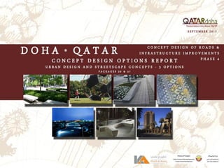
  • 1. Cover from Dimitris PROVISION OF “CONCEPT DESIGN OF ROADS / INFRASTRUCTURE – PHASE 4” Packages # 26 & 27 Design of Haloul Road Design of Major Road In The Centre of Doha City MAY 2016 CONCEPT DESIGN OPTIONS REPORT – URBAN DESIGN & STREETSCAPE CONCEPTS – REV. 1
  • 3. PHASE 4- CONCEPT DESIGN OF ROADS & INFRASTRUCTURE – PACKAGES 26 & 27 CONCEPT DESIGN OPTIONS REPORT – URBAN DESIGN & STREETSCAPE CONCEPT 26 May 2016 1 Issued for Review & Approval WB WB DK 07 Sept 2015 0 Issued for Review & Approval WB WB DK Date Rev. Status Prepared by Checked by Approved by Document No. CTC-546-CDO-UDSC-0095 SHT: 01 OF: 151 PHASE 4 CONCEPT DESIGN OF ROADS & INFRASTRUCTURE – PACKAGES 26 & 27 CONCEPT DESIGN OPTIONS REPORT URBAN DESIGN & STREETSCAPE CONCEPT REV.1 MAY 2016
  • 5.
  • 6. II Doha’seconomicfuture is intimately linked with creating a place in which people wantto live and bring up families.
  • 7. Concept Designs (3) Case Studies 73 Package 26 Landscape Concept Plans for Options, 1, 2, 3 74 Landscape Perspectives Landscape Sections Package 27 Landscape Concept Plans for Options 1, 2, 3 99 Landscape Perspectives Landscape Sections Landscape Elements Planting Palette 132 Hardscape Palette 138 Public Amenities & Site Furnishings 139 Lighting Effects 141 SMART Technology 142 Pedestrian Wayfinding 143 Preface LIVABLE DOHA i Executive Summary Purpose and Objectives 1 Regional and Study Area Context 2 Road Segments 3 Corridors Analyses and Climatic Considerations Hot, Dry, Lack of Shade 6 Climatic and Environmental Considerations 7 Site Analysis 9 Major Destinations 36 Existing Vacant Land 38 Public Parking and Sidewalks 40 Existing Parks 42 Design Principles Retaining Cultural Values 44 Multi-Modal Approach 46 Land Use & Development Zones 47 Urban Design & Landscape Goals 51 Public Spaces 59 Parks and Open Spaces 62 Stormwater Management 66 Public Arts Strategy 69 Sustainability Approach 70 Major Attractions 72 TableofContents
  • 8. “Global Cities of the Future” “Doha is anticipated to be one of the world’s dramatic urban growth centers by 2025” by McKinsey & Company The Concept Design Options Report explores three (3) concept options for the urban design and landscape architecture components of Packages 26 & 27 in the Doha South proper. This report covers all such matters of design which discusses land use modifications, enhanced public mobility and the creation of more vibrant streetscapes and united areas of the public realm. All areas within the limits of the design will be examined and designed to the proposed design intensity levels of HLD/MLD/LLD (High Level Design, Medium Level Design and Low Level Design). The Goal for the Concept Design Options Report is to set forth an unprecedented standard of design for a green and walkable community that is safe and possesses a sense of place. The Report does not supersede any existing approved area redevelopment plans. The Plan will be used as a guide to the on-going review and amendment of these documents, where required, in order to implement specific policies or actions. Preface I
  • 10. It is difficult to design a space that will not attract people. What is remarkable is how often this has been accomplished. WILLIAM H. WHYTE
  • 11. Purpose and Objectives The Concept Design of Packages 26 & 27 transportation corridors establishes a framework for improved transportation circulation, land use compatibilities and urban design character improvements. The Design Concept Plans are in alignment with MMUP’s sustainability principles, urban renewal goals, improved vehicular traffic movements and the soon to be approved “The New Qatari Street” National Public Realm Guidelines. The concept plans were developed with input from earlier studies and various Doha government department engagement sessions. The concept plans provide guidance for the detailed design of roadway corridors which include streetscape, pedestrian level lighting, wayfinding & signage and pedestrian links to adjacent areas. The concept plans primary objectives seek to achieve the following objectives: Street design process and the wider scope of design considerations; How existing and new street designs should relate to their immediate and planned urban context respectively; How streetscape components are arranged within the right of ways to achieve optimal function and specific design themes; and How the inherent landscape characters of Qatar are made apparent in the public realm design. THE NEW QATARI STREET. NATIONAL PUBLIC REALM GUIDELINES , Volume I – Strategy, Interim 2014 Executive Summary ConceptDesignOptionsReport Green roof tunnels and decorative ramp walls Segregated bike lane with trees providing shade relief 1 Small pocket park tucked in to spaces between buildings Al Sadu inspired patterning 1 1 Pedestrian circulation through unique paving design
  • 12. ConceptDesignOptionsReport Regional and Study Area Context The targeted planning areas are described as “Packages 26 and 27.” As illustrated in the attached exhibit, Package 26 is located along Haloul Road extending from “C” Ring Road south to Ain Khaled Street . Package 27 is generally located within the older study area area of Doha, west of the new Hamad International Airport. Package 26 Haloul Road typically consists of newer community development/construction with land uses generally consisting of Commercial, Retail Strip Centers and Residential developments. Haloul Road is proposed to be widened accommodating traffic needs on a north/south basis. The Haloul study area consists of some 8km of continuous roadway and sundry combined traffic intersections. Package 27 study area is generally located within the older study area area with extensive mixed-use build-out of more aged to decrepit structures or other dated structures/developments that may present a lower assessed value than the actual land value. This potentially provides for excellent opportunities for new carriageway improvements and development, improvement of city character and presentation, and improvement in both vehicular and pedestrian movements and capacities. 2 STUDY AREA C-RING D-RING B-RING OLD HAMAD INT’L AIRPORT DOWNTOWN DOHA MUNTHAZA MANSOURA Packages 26 and 27 are integrated in the fact that the east/west roads link Package 26, Haloul Road, to the airport and points east. Four (4) major roads, B- Ring, C-Ring, D-Ring and E-Ring Roads are classified as arterial and expressways. Most traffic utilizes these roads during rush hours and connects a large residential population to west and north Doha. Haloul Road is a secondary means of routing traffic off of Salwa Road which is a major arterial. Light commercial, offices and schools line northern Haloul, while, southern Haloul is primarily occupied by single family residential. Current and future traffic needs within the study area will require the acquisition of existing land parcels to achieve the required traffic flows and enhancements of related public realm or domains. Existing land uses consist of light industrial, heavy and light commercial, retail, mixed-use and multi-family residential uses. The core area presents roughly 19km of carriageways under traffic engineering investigation and proposed streetscape and public realm design enhancements.
  • 15. CORRIDORS ANALYSES AND CLIMATIC CONDITIONS
  • 16. Corridor Analyses and Climatic Considerations Hot, Dry, Lack of Shade The public realm of south Doha is a hot, dry and pedestrian unfriendly environment. Packages 26 and 27 consist of corridors where light industrial zoning exists within residential areas with a lack of greenspace for residents use. Package 26 does not provide any shade provisions nor pedestrian friendly environment for safe pedestrian circulation, lack of adequate parking facilities and appropriate public park spaces. Package 27 is different in that its setting is within an existing urban area. The urban area is currently a miss-match of land uses that conflict with one another causing a decayed urban environment that has created a pedestrian unfriendly and vehicle dominant environment. Outside climatic challenges by the local residents and workforce, numerous pedestrian hazards also exist within the public realm. These hazards include non- paved and deteriorated walks, utility service boxes located within walkways, private sector steps and ramps protruding in the public realm and parking on walkways by residents and shop owners. Minimum upgrades are required to provide a safe and comfortable means of pedestrian circulation throughout south Doha. Integration of site furnishings including benches, litter bins and the construction of walkways at vacant lots is required. Currently a healthy community does not exist and there is a much needed desire to construct a community where improvements for a healthier city is desired. 6 ConceptDesignOptionsReport
  • 17. 7Climatic and Environmental Considerations – P26 Shading Strategy – P26 The shading strategy is approached by the road alignment and its relation to the sides of the road needing shade. Haloul Road will receive heavy later afternoon sun and shade structures through the use of shade trees and man-made structures are required along the Haloul Corridor. Decorative Shade Structure Tree-lined Walkways Existing photos along Haloul ConceptDesignOptionsReport
  • 18. Climatic Conditions – P278 Shading Strategy – P27 The shading strategy is approached by road alignment and its relation to the angles needing the most shade. East west corridors need the shade the most and the use of shade canopies and natural shade amenities, such as shade trees, is required to mitigate the hot, blinding sun. Potential Decorative Shade Structure Potential Tree-lined Walkways ConceptDesignOptionsReport Minimal shade provisions Zero shade provisions Zero shade provisions Zero shade provisions
  • 19. Site Analysis – P26 9 ConceptDesignOptionsReport
  • 20. Site Analysis – P2610 ConceptDesignOptionsReport
  • 21. Site Analysis – P26 11 ConceptDesignOptionsReport
  • 22. Site Analysis – P2612 ConceptDesignOptionsReport
  • 23. Site Analysis – P26 13 ConceptDesignOptionsReport
  • 24. Site Analysis – P2614 ConceptDesignOptionsReport
  • 25. Site Analysis – P26 15 ConceptDesignOptionsReport
  • 26. Site Analysis – P2616 ConceptDesignOptionsReport
  • 27. Site Analysis – P26 17 ConceptDesignOptionsReport
  • 28. Site Analysis – P2718 ConceptDesignOptionsReport
  • 29. Site Analysis – P27 19 ConceptDesignOptionsReport
  • 30. Site Analysis – P2720 ConceptDesignOptionsReport
  • 31. Site Analysis – P27 21 ConceptDesignOptionsReport
  • 32. Site Analysis – P2722 ConceptDesignOptionsReport
  • 33. Site Analysis – P27 23 ConceptDesignOptionsReport
  • 34. Site Analysis – P2724 ConceptDesignOptionsReport
  • 35. Site Analysis – P27 25 ConceptDesignOptionsReport
  • 36. Site Analysis – P2726 ConceptDesignOptionsReport
  • 37. Site Analysis – P27 27 ConceptDesignOptionsReport
  • 38. Site Analysis – P2728 ConceptDesignOptionsReport
  • 39. Site Analysis – P27 29 ConceptDesignOptionsReport
  • 40. Site Analysis – P2730 ConceptDesignOptionsReport
  • 41. Site Analysis – P27 31 ConceptDesignOptionsReport
  • 42. Site Analysis – P2732 ConceptDesignOptionsReport
  • 43. Site Analysis – P27 33 ConceptDesignOptionsReport
  • 44. Site Analysis – P2734 ConceptDesignOptionsReport
  • 45. Site Analysis – P27 35 ConceptDesignOptionsReport
  • 46. Major Destinations – P2636 ConceptDesignOptionsReport
  • 47. Major Destinations – P27 37 ConceptDesignOptionsReport
  • 48. P26 Existing Vacant Land38 ConceptDesignOptionsReport
  • 49. P27 Existing Vacant Land 39 VACANT LAND METRO STATIONS ConceptDesignOptionsReport
  • 50. Public Parking and Sidewalks – Package 2640 Information derived for both the Pedestrian and Cycling Report & Parking Study for Package 26 & 27 ConceptDesignOptionsReport
  • 51. Public Parking and Sidewalks– Package 27 41 ConceptDesignOptionsReport Information derived for both the Pedestrian and Cycling Report & Parking Study for Package 26 & 27
  • 52. Existing Parks Healthy Living through Parks and Open Spaces There is a lack of public parks and open spaces in south Doha. Shown are existing parks and this report contains a proposal for additional parks and park network. 42 ConceptDesignOptionsReport
  • 54. Retaining Cultural Values Inspiring the Public Realm of Packages 26 & 27 The public realm of the study area is unique in its design having been inspired by Al Sadu, the indigenous traditional weaving of the early nomadic tribes of Arabia. Al Sadu is more than just a textile - it is an ‘intangible’ part of the cultural heritage of Qatar and is recognized by the world cultural heritage and education body, UNESCO, as one of several artifacts that symbolizes the Qatar’s history, culture and traditions. Al Sadu regionally, remains intrinsically woven into the fabric of everyday Middle Eastern nomadic life and remains culturally significant. As an artifact that was once a common feature in Bedouin life, the knowledge behind its manufacture was transferred from generation to generation, helping to ensure the traditions and stories that influenced design elements within the textile were preserved for future generations. . Unique Street Features Each of the seven (8) roadway corridors within study area Doha will have an individual color, pattern and identity derived from Al Sadu textiles. Such colors (blue, red, brown, green and white) and intricate patterns serve both site aesthetics and wayfinding purposes. The color coding is captured in the landscape, community signage, lighting design, pavement and hardscape patterns, monumentation and proposed public art, parks, shading structures, building address plates and other landscape furnishings. These unique street features are in conjunction with the Public Realm Guidelines that are under preparation. In developing the Concept Design Options for the 8 corridors, the inspiration of Al Sadu indigenous weaving and patterns has been abstracted from the historic fabrics and physically applied within the extensive landscapes of these corridors and study area. This will create a community with a living identity that is linked to the Qatar’s history, traditions and culture and manifested in elements that populate the public realm 44 Al Sadu ConceptDesignOptionsReport
  • 55. Capturing the Essence of Al Sadu Zooming in on Package 26/27’s site design reveals a myriad of Al Sadu elements that are woven into the various typographies. These are represented through the use of specific Al Sadu colors and patterns that are abstracted and embedded into the community landscape. These colors adorn sun shades, plant geometries and hardscapes to bring the vibrancy of the textile to life throughout the public realm. Enhanced Connectivity Connectivity into Package 26/27 will be via nine road gateways that lead to the center of the community which is just over one kilometer from each entrance. Each gateway is monumented with colored elements corresponding identity and color assigned to each road. In their design, these monuments represent an abstract interpretation of the Al Sadu loom components. At the heart of the community will be the Najma and Mansoura Greenspace Network, the largest proposed pedestrian oriented public spaces within study area. As with the Al Sadu tapestry, the Greenspace Network serves a uniting purpose of tying all the roads, land uses and Mosques together at the center, which is reminiscent of the knot or ‘Tarboush’ used within traditional Al Sadu weaving. 45 …..carried on ConceptDesignOptionsReport Al Sadu Themed Roads Themed Road Designations Theming of the various roads in both Packages 26 & 27 will bear the intricacy of the Al Sadu weave. Patterns will be similar in nature for all corridors, but thematic coloring will differentiate each corridor. Color enhancements will be carried through plant materials, site furnishings and hardscape materials. Color themed corridors is also an additional method of wayfinding for local residents.
  • 56. Multi-Modal Approach Transit Oriented Development South Doha is envisioned as a destination rather than a series of thoroughfares. Within a five- minute walk or a five-minute bike ride, residents will be able to access a concentration of retail, employment and other services. What is a Transit Oriented Development (TOD)? A TOD’s 1 kilometer radius includes: A Hot Spot. The center or ‘Hot Spot’ contains a concentration of the community’s residential, retail, employment, business, and service uses and a civic plaza or greenspace centered around a transit facility. Pedestrian-Friendly Sidewalks. The sidewalks leading to the Hot Spot are comfortable, safe and vibrant protected bikeways. Bicyclists are separated from auto traffic in an ideal situation. Transit Supportive. Bus rapid transit will connect to districts and other centers in Doha South. Metro Rail will provide premium transit access within the Doha South urban area with connections to the International Airport, West Bay and The Pearl. What are the benefits of a TOD to the Project Area? New Hot Spots at Metro Stations. Newly created Hot Spots will be centered around the new Metro Rail stations. Easy pedestrian access and park and ride facilities will allow for increased mobility around Doha. The Metro Station at Najma and Mansoura will be at the heart of the community. Auto Trips are Reduced. Protected bike lanes, adequate walks and proximity to the Metro Rail and new bus routing allows for the reduction of vehicular demand and increased pedestrian movement. Homeowners’ Fuel Costs are Reduced. By increased pedestrian activity, households within the TOD could drive 50 percent fewer kilometers. Increased Public Open Space and Parks. Pedestrian links through opens paces and parks linking major attractions and transit Hot Spots provides for a safe environment for the increased pedestrian activity. Comfort and Safety For All Users In the study area, intersections have a significant place-making function as well as a transportation function. Significant land uses and architecturally significant buildings are located at intersections and might provide pedestrian access directly from the corners. Intersections may also serve as gateways and are frequently the first thing visitors see when they enter a district. Included in intersection design are aesthetic treatments and addressing safety issues. Multimodal intersections operate with pedestrians, bicycles, cars, buses and trucks. The diverse uses of intersections involve a high level of activity and shared space. Intersections have the unique characteristic of accommodating the almost-constant occurrence of conflicts between all modes. Safety is the primary strategy for intersection treatments. Landscape treatments to promote safe intersections include bulb-outs to minimize lengths of crosswalks, shade provisions through the use of trees and maintaining a cone of vision to allow both pedestrians and vehicles to see in advance of any potential dangers. Mid-block crossings will be treated in a similar manner where push flashing lights will be integrated alerting vehicles of pedestrians occupying the crosswalk and warning signage will place in advance of these mid-block crossings, Clarity – Announce pedestrian crossings with raised painted bars and other visual elements Visibility - Good sight distance, keep plantings low Minimize Pedestrian Exposure – Provide refuge islands and bulb outs Accessibility – Provide adequate means of access with no barriers to pedestrians 46 Walking, Biking, Jogging Cone-of-Vision Bulb-Outs Short Crosswalks H/C Ramps Defined Routes ConceptDesignOptionsReport
  • 57. Land Use To achieve the desired mix of vitality and activity, study area should be comprised of a number of different Districts distinguished by land use and population within the each zone. These zones include: the Core (comprised of a high intensity mixed-use center with taller buildings surrounded by a vibrant mixed-use area); two lesser, less intense mixed-use transition zones to the east and west of the core; taller, more intense east and west gateway areas; the Recreation District and the Mall District (see map to the right). Further defined theme based Districts (areas identified by specialized uses, such as parks and recreation, shopping and hotel, Mosque, restaurant, etc) within these larger Districts are encouraged and should be strengthened where they currently exist. Development Zones Urban Core: The study area urban core (approximate area bounded by Al Matar and Munthaza Roads, B-Ring and Nawfal Bin Al Harith Roads) should be a vibrant, compact, and walkable center of activity in the study area. The core should be comprised of a central core area consisting of taller (max. 25m), high intensity mixed-use (residential/ commercial) buildings surrounded by an equally vibrant, but shorter (max. 12-20m) mixed-use (commercial/office/ residential) outer core area. Transition Zones: The transition zones should serve as less intense connector areas between the high intensity study area core and north, east and west gateways to help create a varied study area experience. These areas are ideal for theme based Districts (areas with similar or complementary uses such as restaurants, retail shops, etc.) and should consist primarily of shorter, one to two story (max. 10m.) commercial/office mixed-use buildings. Slightly taller mixed-use buildings with ground floor retail/office and residential studios above (max. 15m) are permitted both sides of Mansoura. Gateways: The north and east entrances to the study area (along B-Ring Road and Al Matar Road) should be well defined areas that make one’s entrance into the study area a memorable experience. They should be taller (max. 20m), high intensity mixed-use at B-Ring Road (residential/ commercial) areas with distinctive landscaping and signage marking the entrance to study area. The Gateway treatment at Al Matar and Mansoura Roads is proposed to integrate the southern end of the new Najma District with monument signage, banners, extensive streetscape treatments. The Mall/Hotel Zone: This zone is completely contained within the former Souq Haraj property envelope and its land uses are re-zoned to accommodate the new development. The zone’s location along Mansoura Road makes it an integral part of the study area. It should be well connected through pedestrian and greenspace linkages with the rest of the study area to ensure the success of the entire study area. Land Use & Development Zones 47 The Mosque Zone: The Mosque zone is an important historic area in the study area of south Doha. It should contain many architecturally, socially, and culturally elements in support of the new developments and the cultural importance of the local Mosques. This zone should continue to retain the certain land uses to support the growing residential community to enhance the overall character and create a more healthy environment. Within all of the study area, Districts (especially in the core and transition areas) are being created with theme based zones. These zones should be lively, walkable areas with similar or complementary uses that create a sense of zone identity. These areas should be connected with each other and the central study area core to create a dynamic and pedestrian friendly study area. Mall/Hotel Zone Gateway Gateway Mosque Zone New Park Greenspace/ Gathering/Events Najma District Center Development Zones and Najma District Center Mansoura Najma Mosque Mosque ConceptDesignOptionsReport
  • 58. Proposed Land Use Plan – Package 26 Proposed land use changes consist of rezoning street frontage along Haloul between C-Ring an D- Ring Roads to Commercial. Numerous parks are proposed with pedestrian links to provide safe and attractive passage throughout the community. The Wholesale Market is undergoing re-planning and design and will better fit future development along south Haloul. 48 Commercial Corridor Commercial Corridor Re-Planned Wholesale Market Single-Family Residential Corridor ConceptDesignOptionsReport
  • 59. Proposed Land Use Plan – Package 27 49 Proposed land use changes consist of relocating light industrial and heavy commercial uses out of the study area, removal of Souk Harjaj, integrating 1 Town Center and 3 District Centers. Numerous parks are proposed with pedestrian links to provide safe and attractive passage throughout the community. ConceptDesignOptionsReport
  • 60. Integrated Neighborhood Park ConceptDesignOptionsReport 50 Integrating public parks, plazas and group gathering spaces within the urban core are planned to provide a more social, healthy and sustainable living environment for the local residents.Healthy living…..
  • 61. Overall Goals The overall goals for the urban design and landscape design is to provide a community where the local residents can live, work and play in a healthier environment where social engagement is encouraged and promoted. Shade Provisions The comfort of the pedestrian is crucial to the development of any dense development which strives to be economically viable. This is especially the case today, when people have come to expect the climate control found in contemporary buildings. Like much of the Middle East, Doha has many months of extremely hot and dry weather. Making the transition to a pedestrian oriented streetscape will require special attention to the comfort of the walker. Dense development can increasingly expect pedestrians to arrive by mass transit and walk to their destination. Because they are the economic base for any development it is important that pedestrians are comfortable. They will choose the most comfortable route, avoiding blocks which are less comfortable or which create gaps in the continuity of the protection. Recommendations • Overhead cover, offering adequate pedestrian protection from the sun and rain should be provided along the right-of-way where buildings meet the street. This should occur between three and 5 meters above the level of the sidewalk, and should provide a minimum of 2.5 meters of cover in width. Cover should not project closer to the curb than 1 meter. • Overhead cover along the sidewalk may provide continuous protection without being continuous itself. • Cover may take the form of either a projection from the building, an arcade, or a combination of the two. Arcades shall be open to the street. 51 • Projections may take the form of fabric awnings which are retractable, fabric awnings which are not retractable, or fixed non-fabric projected covers. • Projected covers may be occupied by the building user, but should be accessed only from the building and not from the sidewalk. Where projected covers are occupied, they may also be supported by columns which fall in the right-of-way. Columns in the right-of-way should not interfere with pedestrians or emergency functions of the sidewalk. Maintain clear sidewalk width not interrupted by columns. Provide sufficient space between curb and columns to accommodate the potential of vehicles jumping the curb. • Where buildings have been permitted to pull significantly away from the property line due to new setback requirements, a free standing cover or tree/palm should be provided along the right-of-way. Owners are encouraged in this condition to provide pedestrian cover additionally at the edge of the building where it does not touch the property line. • Existing buildings which experience significant renovation should be required to provide pedestrian protection as well. Landmark buildings may comply by installing a detached cover in front of the building. Urban Design & Landscape Goals TREES, CANOPIES, SHADE, COOL, COMFORTBLE ConceptDesignOptionsReport
  • 62. Enhanced Streetscape Circulation from one part of a study area to another without relief can be daunting to some pedestrians. Streetscape amenities such as benches, trash receptacles, planters, pole lights, kiosks, telephones and charging stations, news stands, drinking fountains, bike racks, sculpture and water features enliven and support the public realm. Cafe tables in the right-of-way can bring activity to the street. Small temporary Parklets can be integrated on weekends where one (1) parallel parking space can be converted in to a small seating area along the pedestrian routes. Recommendations • Widening of sidewalks is encouraged to allow for street furniture in the public right-of-way for pedestrian use. High priority should be given to Mansoura, north Najma, Munthaza and Khalidiya Roads. • Coordinate street furnishings with the Qatar National Public Realm design guidelines where applicable. • Street furniture may be fixed to the sidewalk if adequate clear passage for pedestrians and emergency access is provided. Avoid intrusions into the accessible route. • Cafe tables and kiosks may occupy a portion of the public right-of-way if adequate clear passage for pedestrians and emergency access is provided. Minimum 1.8m clearance. • The design of street furnishings should unify areas with distinct character. Participation from private property owners is encouraged. • Appropriate planting may be provided as well. • The use of Qatari artisans and artists in the creation of street furniture and artwork is encouraged. • Integrate small water features to cool micro-environments. • Themed decorative pots and planters for visual interest. 52 relax & enjoy ConceptDesignOptionsReport
  • 63. Pedestrian – Utility Structure Conflicts Numerous utility boxes, manholes and other utility structures litter the existing sidewalks and are a safety concern to the public, see images below. Relocation of these structures is critical for ease of maintenance and to ensure the health, safety and welfare of the local community. Recommendations • Utility connections and support should be located in the to avoid conflict with pedestrian movement in the right-of-way and maintain accessible routes. • Above ground utilities should be visually compatible with other streetscape elements in color, material and finishes when possible. • Utility lines (wires) should be placed underground in the public right-of-way. • Manhole covers should be themed to the varying districts and integrate the Al Sadu textures. 53 Pedestrian Level Lighting Light quality can strongly affect the character of a place. Harsh light creates an environment which seems inhuman, while too little light creates an environment which feels unsafe. The size and scale of lights and light poles will also impact the character of the streetscape. Light fixtures scaled to the movement of cars will suggest to pedestrians that they are in a car’s environment and that they may not be safe. Both the scale of fixture and type of lighting can easily create the sense that the sidewalks the domain of the pedestrian. Proposed bases to these pedestrian level lighting fixtures are themed in the Al Sadu colors and patterns. Recommendations • Urban Streets should be lit by pedestrian-scaled fixtures emitting warm light. • A minimum of 12 lux of warm light should be provided in all space between the building face and the curb along all streets. • Lighting may be provided through the use of pedestrian-scaled pole fixtures, or fixtures may be attached to the face of the building. The type and size of pole fixtures should be as consistent as possible along a single block mounted on bases themed in the Al Sadu colors and textures. Visibility ConceptDesignOptionsReport
  • 64. Street Trees/Palms Trees/Palms improve air quality, reduce storm water runoff, provide cooling effects for the urban heat island, increase property values and create urban wildlife habitat. They can also greatly increase the quality of life in Doha. An important design principle in the streetscape design is the use of scale of the trees to the local space and its relevance to the adjacent building and pedestrian corridor. Trees/palms that are too tall will dwarf the pedestrian and will make the space uncomfortable. Recommendations • Trees should be provided along major pedestrian corridors in proper scale to the pedestrians. • Consider that the life span of street trees in urban areas is frequently limited by soil volume. Provide as much soil volume as possible to support sustained tree growth in existing or new sidewalks. • Integration of Parklets should be considered providing temporary shade relief and resting points for pedestrians. These Parklets will occupy one (1) parallel parking space and will contain benches, trash receptacles and planting. • Consider the use of structural soil or continuous street tree trenches to provide maximum soil area for roots to spread, water and air to penetrate the root systems. • Locate trees in expanded sidewalk areas in the parking zone to provide more area for root systems. • Allow sufficient room for tree canopies to grow and develop without conflict with other building elements and signage. • Install TSE and/or KISSS irrigation systems to provide recycled water to establish and maintain trees. Provide drainage to storm sewer to not increase high water tables. • In high pedestrian use areas, install tree guards to protect the trunks from damage. • Consider the design of street tree layout in relation to the buildings and other streetscape elements with regard to sustainable urban approaches. • Select trees which are adapted to the harsh conditions of a desert urban environment. • Allow stormwater to drain in to tree pits and planters with collector pipes to prevent groundwater recharge. 54 palms shade trees ConceptDesignOptionsReport
  • 65. Generous Pedestrian Level Windows Long windowless walls prohibit visual connection between the inside of the building and the sidewalk. People inside have no knowledge of those on the street and people on the street cannot see inside. Walls with no windows can project the sense that people outside are not trusted and that the area is not populated. It is this inability to see inside and to be seen from the inside which creates the pedestrian’s sensation of danger, and the real danger in unobserved places. Windows not only create a feeling of trust and openness in a city, they also instill in people on the street the feeling they could be assisted if in danger. This phenomenon, “eyes on the street,” can help reduce crime by increasing the potential that offenders would be seen. Windows also provide visual interest such as ‘window shopping’ and allows pedestrians to interact with shopkeepers. Recommendations • The lower two levels of buildings, where they face the street, should be made highly transparent, through the use of windows or fixed glass panels. • The use of reflective or highly tinted glass is not recommended and should be discouraged. 55 Promote Pedestrian Activity Pedestrian related concerns are a priority in the creation of a successful urban environment. Tourism, conventions, and daily business all create pedestrian traffic. Currently, vehicular needs dominate the streetscape at the expense of pedestrians. In some areas, discontinuous sidewalks force pedestrians into the street to compete for space. Major points of interest study area, the intersection of Najma and Mansoura, Mansoura at Munthaza and all the major intersections of the arterial roads need better pedestrian connections. Improved wayfinding tools such as signs and graphics together with continuous and adequate sidewalks would encourage walking. Recommendations • Appropriately wide sidewalks should be provided from corner to corner along all boundary lines. • Sidewalks should abut the street curb. Sidewalks extending on and of private property will meet at grade. • Blocks without pedestrian connections should be identified and prioritized for sidewalk construction. • A new street sign system which unites study area and other urban centers should be developed. • Encourage street vendors, sidewalk cafes, etc. – food attracts pedestrian activity. • Buildings should address the streetscape and reinforce pedestrian activity. cafe’, reading, social, fun & accessible ConceptDesignOptionsReport
  • 66. Palm lined street with shade trees provide much needed shade relief in summer months Sidewalk bulbs shorten crosswalk lengths and provides space for additional plantings Stepping back buildings opens up view corridors and pedestrian character Convenient on-street parking and traffic calming Building Setbacks and Shade Provisions Low level windows to provide visual interest and shop interaction 56 ConceptDesignOptionsReport
  • 67. Urban Corner Treatments Above: Corner building cutbacks and setbacks, sidewalk bulbs, and towers should be used at important intersections to create small public spaces with a sense of place. Additional design elements, such as architectural detailing, awnings, first floor retail with large display windows, outdoor eating areas and landscaped areas, add to pedestrian comfort and are recommended where appropriate. 57 relaxation ConceptDesignOptionsReport
  • 68. Bike Lane Converted one way, single lane carriageway allows for more parking Additional on street parking Infill Parking58 ConceptDesignOptionsReport Palm lined street with shade trees provide much needed shade relief in summer months Numerous locations within the study area are lacking adequate parking facilities. One option to provide additional parking is to require future buildings to provide on-site parking for its tenants with a minimum ratio of 1 parking space per unit. A second option would be to demolish older dilapidated buildings and provide infill smaller parking lots 1 block off the main corridors. Pedestrian access through sikkas will allow shoppers and shop tenants easy access.
  • 69. 59 Public Spaces ConceptDesignOptionsReport INCORPORATE PUBLIC SPACE AND GREENWAYS Neighborhoods will be organized around a hierarchy of public spaces, parks and green connections. These greenspaces are shared by the local community, encouraging social interaction, creating recreational opportunities and strong links to the Hot Spots for mobility. Policies should include following: Hierarchy of Public Open Spaces Public Open Space are created using a hierarchal order differing in size and location. Neighborhoods will contain a hierarchy of open spaces that range from public parks to smaller outdoor rooms, sikkas and plazas. Spaces will transition from smaller urban spaces or pocket parks towards the center of the TOD to larger parks on the fringe of the neighborhoods and Hot Spots. Community amenities, such as fountains, sculptures and other public artwork and seating will help create identifiable gathering spaces. Public Spaces Organized as Feature Development Public spaces, such as parks and plazas, will be utilized as an organizing landscape element for various neighborhood developments and serve as focal points for each neighborhood area. Public spaces provide easily accessible green pedestrian links for local residents. These public spaces will be incorporated into the design near transit stops and metro stations to increase the functionality and visibility of the spaces. Establish Clear Linkages between Public Spaces Clear pedestrian and bicycle linkages will be provided within public spaces. Pedestrian linkages are provided along primary streetscape corridors and are designed as urban “greenways” with enhancements such as street trees, benches, pedestrian-scaled lighting, landscape plantings, and other related amenities.
  • 70. ConceptDesignOptionsReport 60 Examples of Space-Making Providing more public space for pedestrians is one of the main goals of urban renewal projects taking place in cities around the world. By planting more trees, implementing more sidewalks and bike paths and establishing new seating areas, it is possible to design more welcoming places with less traffic congestion and that promote sustainable methods of transportation, such as walking or biking. Brazilian group Urb-l launched the “Before/After” project, which compiles before and after photos that show how cities have redistributed their public space. Below is a treatment at the intersection of Najma at Mansoura. Numerous highrise residential buildings, a local mosque and the proposed Najma Neighborhood Park at B-Ring Road gives the local residents a sense of community, gathering areas, small event spaces and a cultural draw from surrounding neighborhoods. Coenties Slip, New York Griffith Park Boulevard, Los Angeles (Brazilian urban planning collective called Urb-I scoured Google Street View images to find the most stunning public space transformations from around the world.)
  • 71. Sikkas and Pedestrian Links Opportunities exist within both Packages 26/27 to link adjacent neighborhoods and commercial areas to one another. Sikkas will play an important role and will offer pleasurable experience for pedestrians on the move. Opportunities to integrate seating, planting, shade provisions, water features, art work and accent paving. Sikkas will provide safe passage and will reduce street side public walk numbers. 61 ConceptDesignOptionsReport
  • 72. Parks and Open Spaces P26/27 will offer a diverse series of public open spaces for residents and visitors, expressed through different scales and park typologies. Each will be appropriately planted and shaded to offer respite from the sun during the summer months and to help in creating pleasant settings for social interaction and entertainment. The overall success of the P26/27 parks, open spaces and stormwater facilities is related to their liveability, usability and functionality. Collectively, allowing people to interact, engage and communicate these in desirable spaces and places will enhance the vitality of the overall community. The diversity of public spaces provides opportunities for people to gather in organized or informal fashion. The stormwater facilities provides for much needed collection of surface runoff while providing a recreational amenity throughout most of the year. These dry depressions or wadi’s, allow for natural ecosystems to generate naturally and provide a sanctuary for local wildlife. 62 livability recreation Healthy Parks and Open Spaces social ConceptDesignOptionsReport
  • 73. Proposed Parks Network The proposed parks network provides many recreational amenities within walking or biking distances to all south Doha Residents. The heirarchal park system should be developed to provide the much needed sports, active and passive recreation opportunities for all local residents to enjoy and experience. Shown is the Park Network with pedestrian linkages through walks, jogging trails, bikeways and service corridors. 63Proposed Public Parks Network Najma Neighborhood Park South Najma Linear Park Matar Park ConceptDesignOptionsReport
  • 74. 64 Najma Neighborhood Park @ B-Ring Road ConceptDesignOptionsReport Najma Neighborhood Park - Proposed Najma Neighborhood Park Najma Neighborhood Park is located on a previously used ASHGAL facility and is strategically located along B Ring and Najma Roads. Adjacent land uses consist of mid and high rise residential buildings with a higher population density. There are no local mosques or public facilities within 800 meters. Proposed for Najma Neighborhood Park is a combination of uses and functions. The park will first serve as a stormwater collection and re-distribution facility. Stormwater will be collected and then released downstream to capture localized flooding and surface run-off. The park’s secondary function is to provide much needed recreational activities and public facilities. Opportunities exist to integrate a local mosque and community center for the local residents. Recreational activities include both passive and active recreation. Playground for 2-5 year olds and for 6-12 year olds will be provided. A unique dinosaur dig adventure play is proposed adjacent to the lower level stormwater basin. Open lawn for free play, picnics and holiday events is provided along with bbq facilities. The community center includes an events plaza with a water feature The stormwater facility is terraced to 3 levels. The lowest level is proposed to be set below the existing groundwater line and provide a living and functioning mangrove while the upper 2 levels will serve as reserve catchment for overflow from the lowest basin.
  • 75. Proposed South Najma Desert Linear Park The proposed South Najma Desert Linear Park located along a utility corridor on Najma Road provides for passive recreational activities with no built structures on top. The park will consist of a walking, biking and jogging trail system set in a natural desert landscape. Use of varying size gravels in different colors will add contrast, create a rhythmic stimulation and be low maintenance in nature. Added visual interest with sizeable boulders for climbing and sitting. Primary use of this park will be though sports fields and related facilities. Due to utility corridors below, shade trees may not be allowed and the use of constructed shade shelters will be the alternative. Raised berms or mounds, will provide options for tree planting. Opportunities for the park to serve as a temporary stormwater catchment, is one alternative to assist in flood prevention and lowering of the groundwater table. 65South Najma Linear Park LAWN LAWN LAWN DECORATIVE GRAVEL ORNAMENTAL GRASSES ORNAMENTAL GRASSES DECORATIVE GRAVEL JOGGING PATH BIKEWAY ConceptDesignOptionsReport South Najma Linear Desert Park - Proposed South Najma Linear Park
  • 76. Basic Principles Stormwater runoff is the result of manmade hydrologic modifications that normally accompany urban and suburban development. Impervious surfaces, soil compaction, and tree and vegetation removal alter water's movement through the environment by reducing interception, evapotranspiration, and infiltration and converting precipitation to overland flow. These modifications impact not only the characteristics of the developed site, but also the watershed in which the development is located. Stormwater has been identified as a major source of pollution for all water body types around the world. However, the impacts of stormwater pollution are not static—they generally increase with more development and urbanization. Traditional stormwater management practices focus on the collection and rapid removal of rainwater away from the point of impact, through a system of underground pipes and storm sewers, transferring water directly to sewer outfalls without any sort of pre-treatment. The primary focus is to reduce or control localized flooding. The water collected by these extensive systems is treated as a waste product to be disposed of. This approach generates vast quantities of polluted runoff, disrupts the natural hydrologic cycle, and adds to the contamination and scouring of streams and rivers. In contrast, "green" or sustainable stormwater best management practices (BMPs) treat water as a resource to be preserved and maintained, taking advantage of natural processes to clean and filter runoff and emphasizing the importance of the hydrologic cycle. This new approach seeks to manage stormwater on individual development or redevelopment sites in a decentralized manner as opposed to the traditional approach of concentrating and conveying runoff through pipes and hardened channels to large-scale, regional ponds or basins. The new approach seeks to slow runoff, mimicking a site's pre- development hydrology and protecting headwater streams and runoff conveyances from erosive stormwater flows. Slowing the movement of water through a system leads to fewer problems with erosion and increases the chance for on-site filtration and purification of overland flow. This is often accomplished by using vegetated areas in place of impervious surfaces. Plants serve to slow the movement of water through an area, leading to fewer problems with stream bank erosion and increasing the chance for on-site filtration and purification of overland flow. Detention ponds designed to accommodate the particular needs of a specific site or installation, can reduce the quantity of water transferred to stormwater infrastructure, improve water quality, and add aesthetic and recreational value. BMPs are also often more economical than traditional approaches. The emphasis on built structures is lessened, which reduces installation and maintenance costs. The shift to more sustainable stormwater practices involves more than a simple change in structural components; it represents a new way of approaching the concept of stormwater management and water use. Stormwater permits often include specific requirements for the quality and quantity of stormwater that leaves a developed site. While it is important to address these minimum requirements, a “lowest common denominator” approach does not allow for a full exploration of how stormwater can best be used onsite. It is important to recognize that these spaces can be designed for people to use and enjoy while still meeting water quality and quantity requirements. Stormwater Management 66 ConceptDesignOptionsReport Flood Prevention
  • 77. Stormwater and Infiltration Planters Infiltration planters reduce runoff volumes by allowing water to seep into the surrounding soils. By contrast, filtration planters only cleanse stormwater runoff; they do not allow infiltration. In fact, they are lined specifically to prevent infiltration in unsafe conditions. Infiltration and filtration planters differ slightly in their location, piping requirements, and some design features. Stormwater planters can be modified to fit almost any physical setting, and are therefore, optimal alternatives for sites with conditions that restrict the use of other best management practices. Water Sensitive Urban Design Water Sensitive Urban Design (WSUD) Water Sensitive Urban Design (WSUD) integrates water cycle management into urban planning and design. Key principles of WSUD Protect waterways So that South Doha will maintain valuable community assets that enhance livability and support the ecosystems within the area. Manage stormwater in the landscape This reduces the volume and frequency of stormwater drained and increases the quality before stormwater reaches the Public Works drainage system. Add multiple benefits while minimizing development costs A range of benefits such as alternate supply, improved amenity and safety, and contribute to enhanced livability by enhancing natural features such as catchments and swales (wadi’s). WSUD will also minimizes drainage infrastructure development costs by reducing pipe sizes and potentially replacing other large scale reticulated water systems with localized solutions. How WSUD can be applied WSUD applications will include a range of applications, including: Grassed or landscaped swales Infiltration trenches and bio-retention systems Stormwater harvesting and reuse Grey water harvesting and reuse Urban forests Porous pavements Water table recharge and reuse Where WSUD will be implemented The applications are flexible and will be implemented across South Doha and at different scales, from a all roadways to the open space and park system. Some examples of applications include: New roads; Drainage systems; Residential neighborhoods; Urban Core and Hot Spots; Parks and open spaces. Swales provide for stormwater conveyance and they screen and remove gross pollutants, such as litter and coarse sediment from stormwater run-off. They bind pollutants to organic matter and soil particles and pollutant removal is remove them by settling, filtrating and infiltrating into the subsoil. Swales may be used as an alternative to the conventional street nature strip or center median strip of roads as run-off collection points in car park areas in conjunction with the sealing of rural roads to reduce negative impacts from increased run-off volume and frequency (where space and slope allows). Reduce and delay storm run-off. Retain particulate pollutants close to source. Aesthetically appealing than kerb and gutter. Relatively inexpensive to construct. Source: http://www.melbournewater.com.au/wsud 67 ConceptDesignOptionsReport
  • 78. Combination Park and Stormwater Facility Section through Catchment Swale/Wadi Catchment & Sports Fields Swale/Wadi Slope TreatmentSlope Treatment Section through Slope at Catchment Swale/Wadi Slope TreatmentCatchment & Sports Fields 68 ConceptDesignOptionsReport
  • 79. Public Arts Strategy The Strategy identifies a series of opportunities and locations to providing public art ranging from community based local works to iconic new major art projects attracting business and visitors to Doha that recognize the City’s role as a cultural center. Two types of artworks are proposed for the overall image of Doha. First, Primary art pieces located at major junctions in south Doha. Second, secondary art pieces located along major thoroughfares between the primary pieces set in a rhythmic theme connecting the corridors together. These art pieces may be seasonal in design and can be replaced on a regular basis pending the time of year, holiday or special events taking place in Doha. For example, with the 2022 FIFA World Cup coming, many of these pieces can be in a football theme welcoming visitors from around the world and ramping up the football spirit as visitors arrive from the new Hamad International Airport. Public Arts Strategy Wow effect! 69 ConceptDesignOptionsReport
  • 80. Sustainable Design is the philosophy of designing physical objects, the built environment and services to comply with the principles of social, economic and ecological sustainability. Packages 26 & 27 sustainable approach applies to all three (3) design intensity levels. The differentiation between the 3 categories will be design intensity and material quantities. The sustainable approach encompasses seven (7) primary methods to obtain the desired goals and targets: 1. Intensity/Connectivity Intensity also refers to urban connectivity, which suggests that future urban development should take place adjacent to existing urban structures. When the concept is applied to existing rather than new urban fabric, it refers to the containment of further sprawl, rather than the reduction of the present sprawl. Compactness of urban space can minimize transport of energy, water, materials, products and people. 2. Sustainable Transportation A sustainable urban transportation system limits emissions and waste to within the area’s ability to absorb; is powered by renewable energy sources, recycles its components, and minimizes the use of land; provides equitable access for people and their goods and helps achieve a healthy and desirable quality of life in each generation; and is financially affordable, operates at maximum efficiency, and supports a vibrant economy. 3. Density Is the ratio of people or dwelling units to land area. The relationship between density and urban character is also based on the concept of viable thresholds: at certain densities (thresholds), the number of people within a given area becomes sufficient to generate the interactions needed to make urban functions or activities viable. 4. Mixed Land Uses Mixed land use indicates the diversity of functional land uses such as residential, commercial, industrial, institutional, and those related to transportation. Reducing the need for travel is on the agenda of achieving sustainable urban form, and mixed land use has a prominent role in achieving it. Mixed land use reduces the probability of using a car for commuting, shopping, and leisure trips, since jobs, shops, and leisure facilities are located nearby. 70 Sustainability Approach 5. Diversity Lack of concentrated diversity can put people into automobiles for almost all their needs. Diverse development contains a mixture of land uses, building and housing types, architectural styles, and rents. 6. Passive Solar Design Passive solar design is central to achieving a sustainable urban form. generally, the idea of this design is to reduce the demand for energy and to provide the best use of passive energy in sustainable ways through specific design measures. This design affects the form of the built environment through, for example, the orientation of buildings and urban densities. 7. Greening Greening seeks to embrace nature as integral to the city itself and to bring nature into the life of city dwellers through a diversity of open landscapes. Greening of the city makes urban and suburban places appealing, pleasant (Van der Ryn and Cowan 1995; Nassauer 1997) and more sustainable. Sustainability Public transit ConceptDesignOptionsReport
  • 81. 71 Specific samples of sustainable practices that are commonly being used are: Treated Sewage Effluent (TSE): Waste water from homes and commercial buildings are processed at municipal treatment centers to produce tertiary quality water that can be used for irrigation purposes. In this way, potable water is not used and wastewater is recycled. Microclimate Amelioration: A combination of shade, increased wind flow and strategic use of water features and planting can enable passive cooling. Intelligent Irrigation Systems: Central control systems that monitor field moisture, temperature and atmospheric conditions for Package 26/27 will ensure that automatic irrigation systems limit water wastage and optimize water delivery to planted areas. Package 26/27 will also utilize innovative water saving technologies to further reduce water consumption. This will mean that most all landscapes will require less than two liters of water per square meter per day. Water Efficiency: Water will be efficiently managed throughout the study area through the choice of a primarily native planting palette with low water requirements. ConceptDesignOptionsReport
  • 82. 72 Major Attractions Major Attractions Proposed major attractions in south Doha are exciting and are much needed improvements in south Doha. Developers are planning 2 new large shopping malls at key locations from both vehicular and pedestrian circulation points. The first new mall, on Mansoura, will integrate a hotel in an area inclusive of existing hotels and will be adjacent to the proposed Najma District Center. The second hotel on Mansoura at Munthaza, will offer a multi-story shopping and dining venue directly across the street from the upgraded Munthaza Park. New park facilities offering both active and passive recreation are proposed at B-Ring and Najma and a linear park is proposed along south Najma above an underground utility easement. The south Najma park will provide for walking, jogging, biking, athletic fields and off-street parking. No trees will be planted, but shade shelters that are removable will be integrated to provide for much needed shade. destinations Take me there! ConceptDesignOptionsReport
  • 85. Case Studies Case Studies Notable sights Peabody Place covers a dense variety of spaces, ranging from the restored historic Peabody Hotel to the Center for Southern Folklore to the nationally recognized and modern street-level offices of the Red Deluxe Brand Development advertising agency. The area encompasses some two million square feet and is connected by skywalks, corridors and trolley stations. Tourist locations nearby include Beale Street, FedEx Forum, the Orpheum Theatre and AutoZone Park. The project's new and restored historic buildings include a 15-story modern office tower, two apartment projects, two museums, an enclosed mall, and numerous restaurants. Improvements: Family friendly, walkable streets, shade, lighting, furnishings, mixed-use businesses, safety, wayfinding and attractions. Case Study 1 Peabody Place District Downtown Memphis went through a renaissance where numerous historic destinations and new developments were being planned. Most of south downtown received road and improvements, upgraded streetscape design and much needed plantings of street trees. Gradual Change Gradual change made the process politically feasible and gave people the opportunity to incrementally adjust their behavior. Lanes of car traffic and parking spaces in the city center were eliminated slowly, 2-3% per year. The freed up space was put to new uses, including bicycle and bus lanes. One third of Copenhagen commuters now travel by bicycle, with 60-70% of cyclists choosing to pedal even through rain and winter cold. Four times as many people come to the city center now than thirty years ago. Traffic jams are a thing of the past. Case Study 2 Throughout Copenhagen, parking lots were converted from places to store cars into places to enjoy life—places with public squares and markets. Although Danes had little tradition of using outdoor public spaces, pedestrian-friendly changes proved to be very popular. Improvements: Family friendly, walkable streets, shade, lighting, furnishings, mixed-use businesses, safety, wayfinding and attractions. Copenhagen City Center Copenhagen’s city center was transformed into a welcoming place through the slow conversion of streets to pedestrian-friendly areas 75 ConceptDesignOptionsReport
  • 86. Concept Design Options Design Options and Design Intensity Levels Required for both Packages 26 & 27 are is the production of three (3) design options and are defined as first, maximum build-out, second, adherence to physical restrictions and third, a combination of the first and second where best engineering practices and urban design principles are used in determining the best routing, land acquisition strategy, traffic signalization and implementation of ideal urban design solutions. Application of Urban Design and Landscape Architecture principles to the design of roadway corridors can significantly improve the roads' amenity and safety. Roads designed for functionality alone usually have poor amenities, split communities and can be dangerous to both motorists and pedestrians. In contrast, roads that incorporate urban design principles are more pleasant places to be in, more livable, strengthen communities and are safer. Good connections enhance choice, support social cohesion, make places lively and safe, and facilitate contact among people. The requirements for three different levels of design outcomes: namely Low Level Design (LLD), Medium Level Design (MLD) and High Level Design (HLD). All roads in these packages are designated as requiring either low, medium or high level design interventions with key landscape interfaces as shown on the urban and landscape designations map. These categories of design are defined in more detail in the table to the right. The HLD roads consist of Mansoura, portion of Najma and Munthaza from B-Ring to C-Ring Roads. These are highly urbanized areas and require more aesthetics and enhancements due to the existing population numbers. The MLD roads consist of Najma south to D-Ring Road, C-Ring Road, Munthaza south from C-Ring to D-Ring Road and the northern stretch of Haloul from C-Ring Road to D-Ring Road. The LLD roads consist of Haloul Roads south of D-Ring Road, D-Ring Road and Najma south of D-Ring Road. 76 URBAN AND LANDSCAPE DESIGN – LEVELS OF DESIGN DEFINITIONS DESIGN LEVEL TYPICAL CHARACTERISTICS HIGH (HLD) Extensive landscaping (shrubs, ground covers and trees) High level of context sensitive design (connectivity, integration with adjoining land-uses and street network); Enhances legibility and way-finding via landmarks and distinctive/unique streetscape themes which contrast visually with existing network; May incorporate enhancements/modifications to land-use, building façades, adjoining roadways, pedestrian access/circulation, historic structures, community facilities etc; MEDIUM (MLD) Above standard level of landscaping and overall streetscape design; Some non-standard fixtures such as heritage signs, lighting and seating used; Limited use of design themes; Medium level of context sensitive design; LOW (LLD) Basic (standard ) level of greenery and tree plantings; Standard streetscape fixtures typically used; Drought tolerant/Xeriscape plantings; Basic level of context sensitive design; ConceptDesignOptionsReport
  • 87. Package 26 consists of a short stretch of Medium Level Design Intensity while the remainder from the Expressway south is of a low level design intensity. Concentrations of the streetscape design will be to provide a unified paving pattern with sustainable materials, site furnishings complimentary of the National master plan and the provision of shade trees to allow comfortable movements within the residential areas and the rejuvenated Wholesale Market. Low maintenance and colorful landscapes will enhance the public character and bring life to this suburban corridor. 77Design Intensity Levels – Package 26 ConceptDesignOptionsReport
  • 88. Package 27 consists of numerous corridors ranging from High Design Intensity Levels to Low Design Intensity levels. The urban design and streetscape enhancements are addressed using in-kind elements and complimentary furnishings, textures, colors and patterns. The concentration of streetscape amenities are poised to improve both vehicular and pedestrian movements, comfort, experience and calming effects of an improved outdoor environment. Design Intensity Levels – Package 2778 ConceptDesignOptionsReport
  • 89. Concept Design Options (3) Option 1, Maximum Build-Out, maximizes road widening, acquires numerous properties and minimizes pedestrian spaces. This is not a preferred option from an urban design point of view. With the growing population of Doha, maximum build out and additional high volume roads are required in certain areas to meet the traffic needs. The following concept images shows the Concept Design for the major interchanges extended out to on/off-ramps where applicable. Option 2 Maintaining existing Constraints, minimizes land take and integrates the design adhering to existing conditions. Utility service corridors are left undisturbed in the existing study area, whereas, improvements are made in the outlying areas where available land allows improvements to be made. Option 3, the preferred option, capitalizes on the strengths of both Options 1 and 2 and utilizes best professional practices in solving both traffic issues and creating a unique urban environment fit for a growing public realm. The following options adhere to and follow the Qatar National Design Guidelines for the Public Realm in the overall approach, with further unique enhancements to create unique settings for the public. The field studies performed, experiencing the spaces added a perspective to the daily lives and how the local residents conduct everyday activities. Through these experiences, this report fulfills the much needed amenities and enhancements required to satisfy the needs of the communities. 79 ConceptDesignOptionsReport
  • 90. Haloul @ C-Ring - Option 1Package 26 The proposed design for the intersection at Haloul and C-Ring Roads consists of a Medium Level Design Intensity. The streetscape provides for shade provisions through the use of shade trees with palm accents. Understory plantings providing year round color have been strategically located in the higher activity zones. Benches, litter bins and pedestrian wayfinding provide for a comfortable environment for the enhanced pedestrian circulation routes. 80 ConceptDesignOptionsReport
  • 91. 81 Haloul @ C-Ring - Option 2 The proposed design for the intersection at Haloul and C-Ring Roads consists of a Medium Level Design Intensity. The streetscape provides for shade provisions through the use of shade trees with palm accents. Understory plantings providing year round color have been strategically located in the higher activity zones. Benches, litter bins and pedestrian wayfinding provide for a comfortable environment for the enhanced pedestrian circulation routes. ConceptDesignOptionsReport
  • 92. Haloul @ C-Ring - Option 3 The proposed design for the intersection at Haloul and C-Ring Roads consists of a Medium Level Design Intensity. The streetscape provides for shade provisions through the use of shade trees with palm accents. Understory plantings providing year round color have been strategically located in the higher activity zones. Benches, litter bins and pedestrian wayfinding provide for a comfortable environment for the enhanced pedestrian circulation routes. 82 ConceptDesignOptionsReport VIEW
  • 93. 83 Haloul @ C-Ring - Perspective ConceptDesignOptionsReport
  • 94. Haloul @ D-Ring - Option 1 The proposed design for Option 1, maximum build-out, at Haloul and D-Ring Roads consists of a Medium Level Design Intensity. The streetscape provides for shade provisions through the use of shade trees with palm accents. South of D-Ring Road, Haloul the design intensity drops form the Medium Level to the Low Level for the remainder of the project limits. Understory plantings providing year round color have been strategically located in the higher activity zones. Benches, litter bins and pedestrian wayfinding provide for a comfortable environment for the enhanced pedestrian circulation routes. Public Art has great potential in this refuge island and the proposed treatments of the underpass walls as well as the treatment of the columns and walls of the overpass is themed with Al Sadu accents. 84 ConceptDesignOptionsReport
  • 95. 85 Haloul @ D-Ring - Option 2 The proposed design for Option 2 at the intersection at Haloul and D-Ring Roads consists of a Medium Level Design Intensity. There is no over/underpass restricting pedestrian movements. The streetscape provides for shade provisions through the use of shade trees with palm accents with deep shade provided under the overpass within a large refuge island. Medians provide opportunities for more greenery, safer pedestrian refuge islands and greater separation of vehicular movements. Understory plantings providing year round color have been strategically located in the higher activity zones. Decorative gravel bands create rhythmic patterning and accents with boulders. Benches, litter bins and pedestrian wayfinding provide for a comfortable environment for the enhanced pedestrian circulation routes. ConceptDesignOptionsReport
  • 96. Haloul @ D-Ring - Option 3 The proposed design for Option 3 at the intersection at Haloul and D-Ring Roads consists of a Medium Level Design Intensity with an intricate under/overpass system. The streetscape provides for shade provisions through the use of shade trees with palm accents. Understory plantings providing year round color have been strategically located in the higher activity zones. Benches, litter bins and pedestrian wayfinding provide for a comfortable environment for the enhanced pedestrian circulation routes. 86 ConceptDesignOptionsReport VIEW
  • 97. 87 Haloul @ D-Ring - Perspective ConceptDesignOptionsReport
  • 98. Haloul @ Messaimeer - Option 1 The proposed Option 1 design at Messaimeer Road consists of a Medium Level Design Intensity within an extensive multi-level vehicular network. Low level design intensity approaches Messaimeer in all directions with the emphasis of design laced at the intersection. Understory plantings providing year round color have been strategically included beneath the overpasses and the design integrates benches, litter bins and pedestrian level lighting provides night time circulation. Opportunities for public art integrated on to the overpasses, underpass walls and sculptural pieces anchoring the corners. 88 ConceptDesignOptionsReport
  • 99. 89 Haloul @ Messaimeer - Option 2 Option 2 at Messaimeer Road has less of a vehicular ramp system, but provides for more direct access by pedestrians. Shading is still provided by the overpass and integrating Public Art and decorative treatments to the overpass underbelly and columns will be themed. Shade trees and palms are kept back from the intersection to allow views of oncoming traffic and understory plantings are kept low and will provide year round color. ConceptDesignOptionsReport
  • 100. Haloul @ Messaimeer - Option 3 90 Option 3 is preferred due to ample pedestrian movements, the ability to provide shade for pedestrians and providing safe pedestrian circulation through this large intersection. The overall design consists of Low Level design intensity approaching the intersection, while medium level design upgrades it. Tthe concentration of design efforts in maintaining the Al Sadu theme and provides an enhance pedestrian environment. Shade and palm trees are more spread out and sidewalk treatments are minimized, but adhere to ASHGAL and QNDF design guidelines. ConceptDesignOptionsReport VIEW
  • 101. 91 Haloul @ Messaimeer - Perspective ConceptDesignOptionsReport
  • 102. Haloul @ Wholesale Market - Option 1 Option 1, at Wholesale Market, integrates a 3 level vehicular network and provides ample room at the intersection corners. The intersection provides much greenery and shade inclusive of benches, trash receptacle, pedestrian level lighting and accent landscape. Outside of the intersection, Haloul Road restricts the pedestrian movements and little shade due to the maximum build-out or the road corridor. Pedestrian access to the many facilities within the Wholesale Market are provided with the overall character being enhanced through shade trees which also softens the enormous structure of the overpass and provides more human scale 92 ConceptDesignOptionsReport
  • 103. 93 Haloul @ Wholesale Market - Option 2 Option 2 at Wholesale Market Road, has minimal land grab, provides a more lively setting where all vehicular movements are on the ground plane. Wider walks at the intersection provide an abundance of space for pedestrian circulation, but also reduces pedestrian movements outside of the intersection. Refuge islands play an important role to pedestrians allowing brief stoppages while crossing the roads. Shade and palm trees supported by flowering shrubs and groundcovers enhance the setting to create an enhanced arrival for the newly updated Wholesale Market area. ConceptDesignOptionsReport
  • 104. Haloul @ Wholesale Market - Option 3 Option 3 at Wholesale Market Road is a result of combining design principles from both Options 1 and 2. Ample room is provided throughout the pedestrian circulation network and shade provisions through the use of natural vegetation creates an enhanced and enjoyable pedestrian setting. The Al Sadu design is integrated creating a uniform and rhythmic progression in all directions. The paving design and landscape amenities meet QNDF the Public Realm Design Guidelines minimum standards for development. 94 ConceptDesignOptionsReport VIEW
  • 105. 95 Haloul @ Wholesale Market - Perspective ConceptDesignOptionsReport
  • 106. Haloul @ Villas South - Option 1 Option 1 for south Haloul located in the middle of single-family villas, is a Low Level Design Intensity zone. Street trees are spaced further apart, yet provide a cohesive and repetitious planting scheme. Walkways are much wider and bikeways are separated providing a safe environment for both pedestrians and cyclists. Sikkas have been designed to allow safe and time saving links from adjacent neighborhoods. Benches, litter bins and pedestrian lighting provide for a comfortable environment for the enhanced pedestrian circulation routes. 96 ConceptDesignOptionsReport
  • 107. 97 Haloul @ Villas South - Option 2 Similar to Option 1, Option 2 for south Haloul Villas is a Low Level Design Intensity zone. Street trees and spaced further apart, yet provide a cohesive and repetitious planting scheme. Wider walkways and bikeways are separated providing a safe environment for both pedestrians and cyclists. The right-of-way is more reduced the land grab is non-existent, with the exception of new setbacks. Sikkas have been designed to allow safe and time saving links from adjacent neighborhoods. Benches, litter bins and pedestrian wayfinding provide for a comfortable environment for the enhanced pedestrian circulation routes. ConceptDesignOptionsReport
  • 108. Haloul @ Villas South - Option 3 In Option 3 Street trees are placed on bisecting roads with palms accenting the medians. Simplified paving patterns through the use of concrete pavers available locally provide for ample pedestrian movements. Sikkas have been designed to allow safe and time saving links from adjacent neighborhoods. Benches, litter bins and pedestrian wayfinding provide for a comfortable environment for the enhanced pedestrian circulation routes. Planters line the street separating vehicles from the pedestrian circulation. 98 ConceptDesignOptionsReport VIEW
  • 109. 99 Haloul @ Villas South - Perspective ConceptDesignOptionsReport
  • 111. Munthaza @ C-Ring - Option 1 101 MUNTHAZA PARK UPGRADED HOLIDAY VILLAS The intersection of Munthaza and C-Ring Road is unique with the soon to be renovated Munthaza Park at the northwest corner. With Holiday Villa located at the northeast corner and current expansions, anticipated pedestrian traffic will increase. The proposed design for the intersection consists of a Medium Level Design Intensity following the Al Sadu patterning and provisions for shade through the use of shade trees with palm accents. Understory plantings providing year round color have been strategically located in the higher activity zones. Benches, litter bins and pedestrian lighting provide for a more comfortable environment for the enhanced pedestrian experience. Package 27 ConceptDesignOptionsReport
  • 112. Munthaza @ C-Ring - Option 2 Option 2 with its restricted land grab, integrates a long underpass/tunnel system minimizing the disturbance to the ground level vehicular and pedestrian movements. The proposed design provides on-street parking adjacent to the new Munthaza Park and the upgrading work at Holiday Villas. Ample pedestrian space is provided with shade trees encouraging increased pedestrian activities. Understory plantings providing year round color have been strategically located in the higher activity zones. Benches, litter bins and pedestrian wayfinding provide for a comfortable environment for the enhanced pedestrian experience. 102 MUNTHAZA PARK UPGRADED HOLIDAY VILLAS ConceptDesignOptionsReport
  • 113. Munthaza @ C-Ring - Option 3 103 MUNTHAZA PARK UPGRADED HOLIDAY VILLAS Option 3 provides for full ground level vehicular and pedestrian movements. With added vehicular movements, designing the pedestrian spaces and circulation has been achieved. Clear pavement markings, medium level design intensity paving with enhance landscape, provides safe and comfortable movements to and from both the Holiday Villas and Munthaza Park. Flowering trees and shrubs soften the harsh concrete landscape creating a gateway treatment for traffic coming from all directions. Benches, pedestrian level lighting, litter bins and decorative banners highlight the newly upgraded Munthaza Park and Holiday Villas. Views to the iconic park structure will be maintained for passersby. ConceptDesignOptionsReport VIEW
  • 114. Munthaza @ C-Ring Perspective104 ConceptDesignOptionsReport
  • 115. Najma @ C-Ring - Option 1 105 The intersection of Najma and C-Ring Roads has a Medium Level Design Intensity and consists of a multi-level vehicular circulation network. Al Sadu patterning plays a strong role in the safety and comfort of pedestrian movements. Understory plantings providing year round color have been strategically located in the higher activity zones. Benches, litter bins and pedestrian wayfinding provide for a comfortable environment for the enhanced pedestrian experience. Refuge islands circumventing the intersection allows for opportunities for Public Art and the walls of the underpasses are decorative and themed to this locale. C-RING NAJMA ConceptDesignOptionsReport
  • 116. Najma @ C-Ring - Option 2106 The intersection of Najma and C-Ring Roads has a Medium Level Design Intensity and consists of a multi-level vehicular circulation network. Al Sadu patterning plays a strong role in the safety and comfort of pedestrian movements. Understory plantings providing year round color have been strategically located in the higher activity zones. Benches, litter bins and pedestrian wayfinding provide for a comfortable environment for the enhanced pedestrian experience. Refuge islands circumventing the intersection allows for opportunities for Public Art and the walls of the underpasses are decorative and themed to this locale. C-RING NAJMA ConceptDesignOptionsReport
  • 117. Najma @ C-Ring - Option 3 107 The intersection of Najma and C-Ring Roads has a Medium Level Design Intensity and consists of a multi-level vehicular circulation network. Al Sadu patterning plays a strong role in the safety and comfort of pedestrian movements. Understory plantings providing year round color have been strategically located in the higher activity zones. Benches, litter bins and pedestrian wayfinding provide for a comfortable environment for the enhanced pedestrian experience. Refuge islands circumventing the intersection allows for opportunities for Public Art and the walls of the underpasses are decorative and themed to this locale. C-RING NAJMA ConceptDesignOptionsReport VIEW
  • 118. Najma @ C-Ring Perspective108 ConceptDesignOptionsReport
  • 119. Najma @ D-Ring - Option 1 109 Option 1 for Najma at D-Ring Roads integrates two (2) overpasses are proposed adding unique vertical and overhead elements not seen on the first two options. They do provide some shade for pedestrian and will provide additional palettes to reinforce the Al Sadu design. Palm trees line the roads edges while large shade trees are proposed along the centerlines of walks. A Low Level Density is proposed, incorporating the Al Sadu theming, but on a limited scale. Public art is integrated beneath the overpasses and provides iconic landmarks as a means of city beautification, cultural showcase and wayfinding. D-RING NAJMA ConceptDesignOptionsReport
  • 120. Najma @ D-Ring - Option 2 Option 2, provides for Al Sadu pavement markings, low level design intensity paving with enhanced landscape, provides safe and comfortable movements while crossing this busy intersection. Flowering trees and shrubs soften the harsh concrete landscape creating a gateway treatment for traffic coming from all directions. Benches, pedestrian level lighting, litter bins and decorative banners highlight this intersection where pedestrian movements will be moderate. 110 D-RING ConceptDesignOptionsReport
  • 121. Najma @ D-Ring - Option 3 111 Option 3 for Najma at D-Ring Roads utilizes best engineering and urban design practices in providing much needed shade provisions, safe pedestrian crossings and landscape features enhancing the multi- level intersection. Paving designs support the proposed Public Realm Design Guidelines and use of locally sourced materials provides for a sustainable hardscape approach. Proposed softscape will utilize low water demand materials with an underground irrigation system provides 100% irrigation supply with 0% evaporation. Public art with night lighting add to the visual interest for passersby and provides a landmark as part of the wayfinding system. D-RING NAJMA ConceptDesignOptionsReport VIEW
  • 122. 112 C-Ring @ Najma Perspective ConceptDesignOptionsReport
  • 123. Al Matar @ D-Ring - Option 1 113 Option 1 for Al Matar at D-Ring Roads takes advantage of its proximity to the old Doha International Airport which is currently being utilized by the Qatar Air Force. The interchange is inclusive of the standard road intersection, but integrates a much larger vehicular network with lengthy on and off ramps. An excellent opportunity to provide themed landscape elements to enhance the intersection and corridors aesthetic and upgrade this intersection. Both hard and softscape are minimized and follow the “The New Qatari Street” National Public Realm Guidelines. ConceptDesignOptionsReport
  • 124. 114 Al Matar @ D-Ring - Option 2 Both Options 1 and 2 for this intersection are identical. Only minor road improvement differences were made which did not affect the urban design and landscape architecture improvements. ConceptDesignOptionsReport
  • 125. Al Matar @ D-Ring - Option 3 115 Option 3 for Al Matar at D-Ring Roads takes advantage of its proximity to the old Doha International Airport which is currently being utilized by the Qatar Air Force. The interchange is inclusive of the standard road intersection, but integrates a much larger vehicular network with lengthy on and off ramps. An excellent opportunity to provide themed landscape elements to enhance the intersection and corridors aesthetic and upgrade this intersection. Palm trees line the roads edges while large shade trees are proposed along the centerlines of walks. A Low Level Density is proposed, incorporating the Al Sadu theming, but on a limited scale. Both hard and softscape are minimized and follow the “The New Qatari Street” National Public Realm Guidelines. ConceptDesignOptionsReport
  • 126. Al Matar @ D-Ring - Option 4116 OLD DOHA INTERNATIONAL AIRPORT TOYOTA ConceptDesignOptionsReport
  • 127. Al Matar @ D-Ring - Option 4 Enlargement 117 Option 4 for Al Matar at D-Ring Roads the takes of advantage of its proximity to the old Doha International Airport which is currently being utilized by the Qatar Air Force. The interchange is inclusive of the standard road intersection, but integrates a much larger vehicular network with lengthy on and off ramps. With a VIP entrance. The interior of the on/off ramp is composed of varying ornamental grasses, similar to the Hamad International Airport with statuesque palms and flowering trees. The design is of low maintenance and will be irrigated with TSE water. Both hard and softscape are minimized and follow the “The New Qatari Street” National Public Realm Guidelines. ConceptDesignOptionsReport MOSQUE EXISTING PARK VIEW
  • 128. 118 D-Ring @ Airport Option 4 Perspective ConceptDesignOptionsReport
  • 129. Al Matar @ D-Ring - Option 5 Park Enlargement 119 Option 5 Park enlargement is identical to Option 4 with regard to traffic and road configurations. This option connects the existing park and Mosque to the inner circle and expands park amenities. The new amenities include a playground, jogging and walking paths, large sweeping beds of ornamental grasses and a host of date palms accenting this new space. ConceptDesignOptionsReport MOSQUE EXISTING PARK PARK EXTENSION SUBWAY CONNECTION
  • 130. 120 D-Ring @ Airport Option 5 Perspective ConceptDesignOptionsReport
  • 131. Mansoura @ Munthaza - Option 1 121 Option 1 for Munthaza at Mansoura is designed with numerous future projects in the planning and design stages. First, a new shopping mall in on the design boards at the southeast corner of this intersection. Second, Munthaza Park upgrades are being designed for the southwest corner. The largest project is the widening of Munthaza Road, doubling the right-of-way width. The left side of Munthaza will be widened and all properties and structures have been purchased by the Doha Municipality for the widening. The widening offers numerous opportunities to upgrade the right-of-way inclusive of the Mansoura intersection. Pedestrian movements will receive long awaited upgrades for pedestrian comfort and safety. Mansoura and Munthaza have High Level Design Intensities where shade tees and palms are spaced closer together with upgraded pedestrian amenities. Added benches, planters, litter bins and pedestrian wayfinding enhance the visitors experience. Shade provisions is the greatest need for the local residents in this area. Pedestrian traffic will increase by large proportions needing access to the upgraded Munthaza Park and the new shopping mall. Shade trees, shade shelters at road crossings and refuge islands will provided for comfort and safety. Future Shopping Mall Upgraded Munthaza Park View north along Munthaza with Mansoura entering on right. ConceptDesignOptionsReport
  • 132. Mansoura @ Munthaza - Option 2 Option 2, minimizes land grab opportunities and preserves the current vehicular circulation. The landscape and amenities proposed consist of vandal resistant benches, litter bins and a strong upscale paving consisting of concrete pavers supporting the National Design Guidelines for all of the public realm. Option 2 provides shorter crossing distances for pedestrians entering the intersection. Safe passage along the median and refuge islands connects pedestrians to both the future shopping mall and the upgraded Munthaza Park. 122 D-RING NAJMA Future Shopping Mall Upgraded Munthaza Park ConceptDesignOptionsReport
  • 133. Mansoura @ Munthaza - Option 3 123 Option 3 for Munthaza at Mansoura is designed with numerous future projects in the planning and design stages. First, a new shopping mall in on the design boards at the southeast corner of this intersection. Second, Munthaza Park upgrades are being designed for the southwest corner. The largest project is the widening of Munthaza Road, doubling the right-of-way width. The left side of Munthaza will be widened and all properties and structures have been purchased by the Doha Municipality for the widening. The widening offers numerous opportunities to upgrade the right-of-way inclusive of the Mansoura intersection. Pedestrian movements will receive long awaited upgrades for pedestrian comfort and safety. The new shopping mall, a destination place, will increase pedestrian movements and the streetscape should be enhanced and capable of handling these increased movements. Mansoura and Munthaza have High Level Design Intensities where shade tees and palms are spaced closer together with upgraded pedestrian amenities. Added benches, planters, litter bins and pedestrian wayfinding enhance the visitors experience. Future Shopping Mall Upgraded Munthaza Park ConceptDesignOptionsReport VIEW
  • 134. 124 Mansoura @ Munthaza Perspective ConceptDesignOptionsReport
  • 135. Mansoura @ Al Matar - Option 1 125 Option 1 for Munthaza at Mansoura is designed with numerous future projects in the planning and design stages. First, a new shopping mall in on the design boards at the southeast corner of this intersection. Second, Munthaza Park upgrades are being designed for the southwest corner. The largest project is the widening of Munthaza Road, doubling the right-of-way width. The left side of Munthaza will be widened and all properties and structures have been purchased by the Doha Municipality for the widening. The widening offers numerous opportunities to upgrade the right-of-way inclusive of the Mansoura intersection. Pedestrian movements will receive long awaited upgrades for pedestrian comfort and safety. The new shopping mall, a destination place, will increase pedestrian movements and the streetscape should be enhanced and capable of handling these increased movements. Mansoura and Munthaza have High Level Design Intensities where shade tees and palms are spaced closer together with upgraded pedestrian amenities. Added benches, planters, litter bins and pedestrian wayfinding enhance the visitors experience. Future Shopping Jaidah Square iKhatib & Alami ConceptDesignOptionsReport
  • 136. Mansoura @ Al Matar - Option 2126 D-RING NAJMA Both Options 1 and 2 for this intersection are identical. Only minor road improvement differences were made which did not affect the urban design and landscape architecture improvements. Future Shopping Jaidah Square iKhatib & Alami ConceptDesignOptionsReport
  • 137. Mansoura @ Al Matar- Option 3 127 Option 3 for Mansoura at Al Matar is designed to create a gateway treatment. An abundance of flowering trees, shrubs and groundcovers having floral displays throughout the year liven up this intersection where new developments are being undertaken. Locally operated Crowne Plaza Hotel, new high rise apartments and the Holiday Inn under construction, pedestrian movements are dramatically increasing. The future shopping mall and hotel west on Mansoura at the old Souq Haraj, will also attract more vehicular and pedestrian traffic. Several hotels already exist along Al Matar within walking distance and the planned Town Center and Metro development will increase the transit population in dramatic proportions. Safe passageways, adequate sidewalk widths and pedestrian comforts will be themed creating an urban environment for this fast rising area. Shade provisions do not exist along Mansoura and with its east/west orientation, long, hot summer afternoons creates unbearable walking conditions. The primary treatment for pedestrian comfort will be shade trees and shade structures to assist in micro-cooling the pedestrian environment. Jaidah Square iKhatib & Alami Future Shopping ConceptDesignOptionsReport VIEW
  • 138. 128 Mansoura @ Al Matar Perspective ConceptDesignOptionsReport
  • 139. 129 ConceptDesignOptionsReport Landscape Sections Typical Section along Mansoura Road NEW PROPOSED RETAIL MALL
  • 141. 129 ConceptDesignOptionsReport Landscape Sections Typical Section along Munthaza Road MUNTHAZA MUNTHAZA PARK HOLIDAY VILLA
  • 144. This page intentionally left blank
  • 146. 134 Plant Palette The purpose of the Qatar Public Realm (QPR) Vegetation and Planting Strategy is: The QPR Vegetation and Planting strategy is aligned with the Landscape Character Areas Zoning Strategy that identifies a set of design and selection objectives. Implementation of this strategy will contribute to achieving these objectives, addressed through a robust, aesthetic and sustainable planting strategy. The Value of Landscape Vegetation is important for its inherent values, external values, and ecosystem services. Both native and non-native plants provide benefits. Inherent values include biodiversity, cultural and spiritual values. External values include social and economic values. Key benefits include ecosystem services such as salinity prevention and carbon suppression. In the urban environment vegetation is valued for beautifying streetscapes, parks and gardens as well as regulating temperature and providing shade. Xeriscape Central to this water-sensitive sustainable approach to planting is the use of xeriscape principles that require little or no irrigation, using native tree and plant species, which are naturally adapted to the climate of Qatar. This is especially important in relation to rural roads and expressways. This will dramatically reduce the need for TSE irrigation and will also support the indigenous habitat of Qatar’s diverse flora and fauna. It is an internationally recognized concept that subscribes to the following key principles: • Water conserving landscaping • Restricted use of plants that have high water demands such as lawn grass • Use of drought tolerant / water sensitive plants • Water harvesting techniques where applicable • Appropriate and water efficient irrigation methods • Use of mulches • Appropriate maintenance practices THE NEW QATARI STREET. NATIONAL PUBLIC REALM GUIDELINES , Volume 3 – 3.1 Strategic Planting Objectives, 2014 CO2 Reduction Lower temps UV ray deflectio n Wildlife habitats Retail frontage Social interaction Stormwater collection Enhance d comfort Sustainable street tree planting approach ConceptDesignOptionsReport Packages 26 & 27 Planting Approach The planting approach for Packages 26 & 27 is based on a thematic design supporting the Al Sadu patterning and color selection based on each corridor. The colored theming of the plant material through flower and leaf color, fruit color and will be included in the palette of site furnishings. Shade trees, of lower usage, will be the primary shade provider while using hardy shrub and groundcover species to demark boundary edges, soften curb lines and assist in reducing visual glare from vehicular traffic.