SlideShare une entreprise Scribd logo
1  sur  25
1
Ukraine
Institute of Geophysics and Problems
of the Earth
An Innovative Technology
for Remote Sounding
of Mineral Deposits
2
Innovative Technology of
Search and Survey of hydrocarbons
Contents
Introduction
1. About company "Institute of Geophysics and Problems of the Earth "
2. Innovative Geophysical Exploration Technology
3. Technology Features
4. Service Ideology using RSS-NMR technology
5. Diagnostics of territories (2D)
6. Detailed remote survey of deposits (3D)
7. Remote survey of drilling points
8. Conducting an expedition to the area
9. Comparative Effectiveness of Methods
10. Technical Peculiarities and some Know–How of the Technology
3
Introduction
When conducting exploration work, there are always risks of drilling “dry” wells
(complete absence of hydrocarbons), or risks of non-commercial
discovery of deposits
Further, the Presentation provides information on the methods and capabilities of the
RSS-NMR technology, as well as options for its application for solving a wide range of
Customer tasks
Proposed technology for the search and exploration of hydrocarbon deposits
can significantly minimize these risks.
Compared to traditional methods, our RSS-NMR hydrocarbon prospecting and
exploration technology is based on resonance phenomena, which allows us to
“directly” identify and quickly explore hydrocarbons on the territory of the
Customer.
The total effectiveness of our service is 90% or more, which means a
significant reduction in financial risks compared to classical methods.
4
1. About company "Institute of Geophysics and Problems
of the Earth "
Institute of Geophysics and Problems of the Earth is an innovative scientific and
technological production company that provides a wide range of services for the
identification and detailed examination of hydrocarbon deposits and various minerals.
The main goals of the company are the creation and implementation of high technology
innovative technologies that increase the efficiency of exploration of hydrocarbon and
other natural resources of the Earth.
The Company's strategy for the provision of geophysical services is always the same -
achieving the result with the greatest efficiency and with the lowest cost for the Customer,
that is:
- high performance,
- speed of task performance,
- inspection of territories without
restrictions,
- absolute environmental friendliness,
- relatively low cost of work.
The technology is based on the principle of resonance, which allows
directly identify and record the required substances
5
RSS-NMR technology classification
The “direct” method of prospecting and exploration of mineral deposits
Resonance Spectral Sounding
(RSS)
Remote surveying of territories
based on resonance processing
analog IR space images
Work on the ground with
using point-to-point NMR
sounding of deposits
Thus, RSS & NMR technology consists of methods:
RSS - for remote surveying of territories, sites, points.
NMR - for work on the ground / fieldwork .
At the same time, operational research of hydrocarbons, minerals, underground fresh
and thermal waters both on large and small territories of land and shelf is provided.
Nuclear magnetic resonance
(NMR)
2. Innovative Geophysical Exploration Technology
6
3. Technology Features
Territory of use - without restrictions (on land or on the shelf)
Survey area - virtually no limits
Depths of research - from 0 to 7 km
Searched minerals - oil, gas, water and other minerals
Efficiency - for hydrocarbons and water> 90%
The duration of the stages - up to 1 month.
Environmental safety - the method is absolutely safe for
people and the environment
4. Service Ideology using RSS&NMR technology
The presence of a highly effective remote research phase in combined with
a ground survey of deposits allows implement a unique geophysical service
covering almost all possible tasks of the customer.
These tasks include:
1. Rapid identification of hydrocarbon deposits on the Customer’s territory
and their contouring (“diagnostics” of the territory in 2D format);
2. Detailed remote examination of identified deposits (3D),
3. Testing of drilling points obtained by classical methods;
4. Conducting an expedition for a detailed survey of deposits (3D), etc.
A standard approach for examining the territory of the Customer is first to “diagnose” the site
and then, if there is a deposit (s) of hydrocarbons, conduct a detailed inspection of them.
This approach can significantly reduce time and costs in the event of the identification
of "empty" areas.
5. Diagnostics of territories (2D)
Survey areas may be from
units km square up to tens of
thousands of square kilometers.
Examination duration lies within
1 month.
As a result of the survey
we get the following
data:
- ground contours of identified
deposits,
- isolines of response levels of
signals,
- contours of fault zones,
- zones and points of maximum
signal responses,
- maximum gas pressure
in the horizons.
450 sq. km
6. Detailed remote survey of deposits (3D)
Survey Areas May range from
units to hundreds square km.
Examination duration
lies within 1 month.
As a result of the survey
we get the following
data:
- updated ground contours of
deposits and fault zones,
- zones and perspective points
for drilling wells,
- the number of horizons, their
thickness and depth,
- the presence of gas caps and
pressure in them, watering
horizons;
- transverse and longitudinal
sections of deposits, 3D model;
- predicted resources of the
deposit.
Gas
Oil
10
3
Figure 1 shows structural
map where black lines
longitudinal and cross
section of deposits.
Figure 2 shows one from
longitudinal sections of
deposits.
Figure 3 shows 3D
gas horizon model.
1 2
11
7. Remote survey of drilling points
Survey areas are several
km square.
Duration surveys lies within
2-3 weeks.
As a result of the survey we get
the following data:
- presence or absence
hydrocarbons at a point control,
- ground contours of the
reservoir,
- zones and points of maximum signal
responses,
- the number of horizons in drilling
point, their power, depth of
occurrence;
- the presence of gas caps and
pressure in them,
- contours of the nearest deposits in
case of a "dry" drilling point.
1212
Исх. № 02/08-15 10.08.2015
Директор / Director
of the company
Ю.В. Петров
Заключение
по результатам дистанционного
тестирования точки
бурения на нефть
В течение апреля 2015 г. украинская
компания «Институт геофизики и
проблем Земли» провела тестирование
точки, заложенной под бурение на
нефть на территории Республики Коми.
Тестирование точки проводилось
дистанционно, на основе прямого
геофизического метода обследования
территорий с использованием
радиационно-химической обработки
аналоговых космических снимков
инфракрасного диапазона.
Проведено сравнение результатов
дистанционного тестирования точки с
результатами проведенного бурения.
Данные тестирования и бурения
совпали полностью, показав 100%-ю
результативность использованного
метода тестирования.
Reference
on the results of remote testing of the
drilling point for oil
The Ukrainian company "Institute
of Geophysics and Problems of the
Earth" tested the point laid down for
drilling for oil in the Republic of
Komi during April 2015.
Point testing was conducted
remotely based on the direct
geophysical method of territory
survey using radiation-chemical
processing of analogue satellite
images of infrared range.
A comparison of results of remote
testing of the point with the drilling
results was carried out.
The data of testing and drilling
have coincided completely showing a
100% efficiency of the used testing
method.
8. Conducting an expedition to the area
13
The expedition is conducted on
plot with previously identified
deposit (s).
Survey area ranges from a few
km sq. up to tens of km square.
Expedition duration and
subsequent processing
received data lies in within
1 month.
The purpose of the expedition
is to clarify remote data surved.
As a result, we get:
- updated ground contours of the
reservoir,
- deep transverse and longitudinal
sections of the reservoir,
- refined resources calculation,
- affixed to the terrain well drilling
points.
9. Comparative Efficiency for large territories
Methods Executable works
Results (for an area ~1000 sq. km)
Effectiveness Duration
Average number
of mining holes
Traditional
methods
Space survey
Geological survey
Geophysical survey
Searching boring
30 - 35% 1 – 2
years
6
(From data of Russian
State Institute of Oil
and Gas)
Innovation
Тechnology
Resonance spectral
sounding of the analog
space images
Nuclear-magnetic
resonance sounding
of a deposit on-site
 80-85%
 90-92%
1
month
1
month
1
Comparative Characteristics with 3D Seismography
# Parameters 3D-Seismography "IT"
1 Topographical binding + (anomalies) +
2 Construction of 3D models of objects + (anomalies) +
3 Search of unstructured traps of oil and gas --- +
4 Detection of gas "caps" in oil horizons --- +
5 Definition of gas pressure in gas "caps" --- +
6 Definition of presence of oil mobility --- +
7 Detection of water horizons over oil and gas deposits --- +
14
Innovative methods are patented and tested
15
Testing in the USA at 5 wells
showed 100% effectiveness and
95% accuracy for depths of horizons
16
Technical Peculiarities and some
Know – How of the Technology
1. General Idea of the Technology
A
С
D
В
Oil
Test
waferOil
Reprinter
Preliminary the spectrum of the sought-for mineral is recorded on special test wafers
Broadband
radtation
Photograph Тest wafer X-ray film
Aerospace photographs
Test wafers are used as a resonator during radiation-
chemical processing of analogue aerospace
photographs of the territory
obtained in the infrared range.
Result is direct visualization of ground contours of
basins and deposits
Ground expedition
Point-by-point resonance sounding of an area:
improvement of deposit contours, obtainment of longitudinal
and transverse sections. Selection of optimal drilling points,
improved calculation of expected reserves.
Test wafers are used for spectral modulation of transmitter’s
radiation
2. Remote survey (RSS method)
Receiving space
images
Record EM spectrums
of minerals on
test wafers
Obtaining
samples of the
desired minerals
Resonance-spectral processing of
satellite images of the study area
Preparing
of report
Object
contour
visualization
Laboratory
production of
test wafers
Kirlian
camera,
computer
Transfer the
coordinates of
a satellite image
to terrain maps
Fixation
object and
analytical data
processing
Preliminary
work
Search
Object
Identification
Photogram-
metric
Calibration
Field contour
visualization
Fixing the
desired
object
Technological scheme
Generalized scheme
19
№
The list of technological operations
1 Preparatory works
Order and obtaining of aerospace photographs of the investigated territory and
ultra-pure chemical reagents. Laboratory manufacture of test gel-wafers.
Recording of electromagnetic spectrum of the sought-for substance on test wafers.
2 Object identification
Spectral resonance processing of satellite images in the presence of
test plates in accordance with patented technology.
Chemical processing of X-ray films that have undergone resonant effects.
3 Contour object deciphering
Visualization of the contours of identified objects using the Kirlian camera.
Getting a computer 2D image of objects.
4 Photogrammetric calibration of computer image of the object (geographic
connection of the image’s points and the area).
5 Object’s fixation – definition of its size, form and location on the area.
Transfer the contours of an object to a geographical map.
6 Analytical data processing to obtain 3D parameters of the reservoir and the
calculation of forecast resources.
7 Preparation of report and providing the Customer with it
20
Companies Halliburton and Schlumberger
+ Direct measurement of T1 to identify fluids,
porosity and permeability of reservoirs
- Small survey radius, powerful magnets,
powerful transmitter
(r =0,05-0,2m, f =0,6–1,2 MHz, В0=0,1-3Т, Р =50-300W)
3. Expedition (NMR method)
Known methods: Nuclear Magnetic logging Method (1)
Magnetic Resonance Sounding Method (MRS) (2)
Т/R
MRS response
Water horizon
Resonant signal
Loop
IRIS instruments and others
+ Direct measurement of Т2 parameter for
identification of water horizons, depth and
reservoir porosity
-- Shallow survey depth (up to 150m),
powerful transmitter (impulse 4000 W, 600 А)
Disadvantages caused by weak directionality of antennas:
Dipole
Gain coefficient
G ≤ 4
Low-suspended
horizontal frame
antenna
21
Our way - Increase of Radiating Power
The considered systems use sinusoidal resonance signal. However, oil consists of ~1,000
substances, therefore in order to reach maximum identification of the sought-for mineral
it is necessary to excite resonance in all types of molecules of the sought-for substance,
that is, to provide resonant spectral sounding.
Application of superdirective antenna
Prad
у
Superdirective
antenna
Dipole (frame)
х
R
Antenna’s radiating power:
Рrad = ηА
.GA
.Рtr
where Рtr is transmitter power,
ηА – antenna’s coefficient of efficiency,
GA – antenna gain
For dipole GА ~ 4,
For directive antenna:
GA = S1/SA = 4π .R2 / SA,
where SA is effective antenna area.
With R = 1m and SA = 10-6 m2 we receive power
increase of superdirective antenna
GA = 4π .106 ~ 12 . 106
Increase of Prospecting Accuracy
Superdirective antenna
predetermines point-to-point and not
acreage sounding of deposits
The transmitting part of the mobile equipment complex
Work on the ground is absolutely safe for people and the environment
Thus, deep-seated sounding of the reservoir is carried out pointwise, using a narrowly
directed spectrally modulated signal, which causes resonance in the desired substance
Response signal
ℓ2
ℓ1
1st horizon
2nd horizon
Modulation
signal
α
h1 h2
Measuring ribbonTest
wafer
In measuring point the
modulated laser beam is
directed towards deposit
under α angle. Modulated
signal spreads under
ground from test wafer.
Оperator moves along the
measuring ribbon with
receiver. Response signal
is registered at distance
from ℓ1 tо ℓ2.
Occurrence depths of a
horizon are calculated
with the help of the
following formulae
h1 = ℓ1
. tg α, h2 = ℓ2 . tgα. Horizon thickness ∆h = h2 - h1 = (ℓ2 - ℓ1) . tg α,
By placing test wafers with recording of own frequencies or natural gas at different pressure,
we are able to determine presence of gas cap and gas pressure in it.
Diagram of Measurement of Deposit Parameters
23
Seismography Innovative method
Using shock impacts on the ground surface
Effectiveness - about 30%
There are restrictions on the type of terrain,
Long duration of work and data processing,
Unfavorable to the environment and humans.
Study of the Earth's crust on the basis
of artificially excited acoustic waves
Study of mineral deposits on the basis
of nuclear-magnetic resonance
Using signals that excite resonance in
sought-for substances
Effectiveness about 90-92%
There are no restrictions on the type of terrain,
Short duration of work and data processing,
It has no harm to humans and the environment.
1 2 3
Transmitter of
shock impacts
Receivers of
acoustic waves
Anomaly Seeking
mineral
1
Transmitter of
resonance spectra
Receiver of the
Larmor
frequencies
Anomaly Sought-for
mineral
Comparative analysis of terrestrial technologies
24
We believe that application
of the Technology will have a significant economic
impact which can be achieved within very short time!
Thank you for your attention
Landline +591-33257175
Mobile +591-716-96657 (WhatsApp)
VoIP: + 1-786-352-8843
Skype mlf10357
Home Bolivia: +591-3-3330971
Michel.friedman@fands-llc.biz

Contenu connexe

Tendances

Self Potential Method (Electrical Survey)
Self Potential Method (Electrical Survey)Self Potential Method (Electrical Survey)
Self Potential Method (Electrical Survey)SudhanKumarSubedi
 
The use of geoinformatics in mineral exploration and exploitation
The use of geoinformatics in mineral exploration and exploitationThe use of geoinformatics in mineral exploration and exploitation
The use of geoinformatics in mineral exploration and exploitationMarguerite Walsh
 
Geological Field Report of Gilgit Baltistan
Geological Field Report of Gilgit BaltistanGeological Field Report of Gilgit Baltistan
Geological Field Report of Gilgit BaltistanAsim Mujtaba
 
Stages of exploration
Stages of explorationStages of exploration
Stages of explorationNgatcha Bryan
 
Chapter 2 diamond exploration principles and practices
Chapter 2 diamond exploration principles and practicesChapter 2 diamond exploration principles and practices
Chapter 2 diamond exploration principles and practicesJames AH Campbell
 
Field report on kirana hills
Field report on kirana hillsField report on kirana hills
Field report on kirana hillsSaba Saif
 
Field Geology Report_R
Field Geology Report_RField Geology Report_R
Field Geology Report_RR. J. Cannata
 
Lecture 13-electrical method -field procedure
Lecture 13-electrical method -field procedureLecture 13-electrical method -field procedure
Lecture 13-electrical method -field procedureKosygin Leishangthem
 
Self‐potential (SP) Method.pdf
Self‐potential (SP) Method.pdfSelf‐potential (SP) Method.pdf
Self‐potential (SP) Method.pdfPallavKashyap2
 
Geology and Stratigraphy of Hazara,Mansehra and Oghi Khaki Road Pakistan
Geology and Stratigraphy of Hazara,Mansehra and Oghi Khaki Road PakistanGeology and Stratigraphy of Hazara,Mansehra and Oghi Khaki Road Pakistan
Geology and Stratigraphy of Hazara,Mansehra and Oghi Khaki Road PakistanHammad Ahmad Sheikh
 
exploration lecture.pptx
exploration lecture.pptxexploration lecture.pptx
exploration lecture.pptxThomasHundasa1
 
Gsi exam preparation
Gsi exam preparationGsi exam preparation
Gsi exam preparationPramoda Raj
 

Tendances (20)

Self Potential Method (Electrical Survey)
Self Potential Method (Electrical Survey)Self Potential Method (Electrical Survey)
Self Potential Method (Electrical Survey)
 
Classification of Mineral Deposit in Egypt
Classification of Mineral Deposit in EgyptClassification of Mineral Deposit in Egypt
Classification of Mineral Deposit in Egypt
 
Fe-deposits
Fe-depositsFe-deposits
Fe-deposits
 
The use of geoinformatics in mineral exploration and exploitation
The use of geoinformatics in mineral exploration and exploitationThe use of geoinformatics in mineral exploration and exploitation
The use of geoinformatics in mineral exploration and exploitation
 
Geological Field Report of Gilgit Baltistan
Geological Field Report of Gilgit BaltistanGeological Field Report of Gilgit Baltistan
Geological Field Report of Gilgit Baltistan
 
laboratorio. d fisica iii
laboratorio. d fisica iiilaboratorio. d fisica iii
laboratorio. d fisica iii
 
Stages of exploration
Stages of explorationStages of exploration
Stages of exploration
 
Wall Rock Alteration.pdf
Wall Rock Alteration.pdfWall Rock Alteration.pdf
Wall Rock Alteration.pdf
 
CHROMITE ORE DEPOSITS IN EGYPT
CHROMITE ORE DEPOSITS IN EGYPTCHROMITE ORE DEPOSITS IN EGYPT
CHROMITE ORE DEPOSITS IN EGYPT
 
Chapter 2 diamond exploration principles and practices
Chapter 2 diamond exploration principles and practicesChapter 2 diamond exploration principles and practices
Chapter 2 diamond exploration principles and practices
 
Field report on kirana hills
Field report on kirana hillsField report on kirana hills
Field report on kirana hills
 
Field Geology Report_R
Field Geology Report_RField Geology Report_R
Field Geology Report_R
 
Lecture 13-electrical method -field procedure
Lecture 13-electrical method -field procedureLecture 13-electrical method -field procedure
Lecture 13-electrical method -field procedure
 
central indus basin
central indus basincentral indus basin
central indus basin
 
Self‐potential (SP) Method.pdf
Self‐potential (SP) Method.pdfSelf‐potential (SP) Method.pdf
Self‐potential (SP) Method.pdf
 
Source and reservoir of pakistan
Source and reservoir of pakistanSource and reservoir of pakistan
Source and reservoir of pakistan
 
Geology field visit report
Geology field visit reportGeology field visit report
Geology field visit report
 
Geology and Stratigraphy of Hazara,Mansehra and Oghi Khaki Road Pakistan
Geology and Stratigraphy of Hazara,Mansehra and Oghi Khaki Road PakistanGeology and Stratigraphy of Hazara,Mansehra and Oghi Khaki Road Pakistan
Geology and Stratigraphy of Hazara,Mansehra and Oghi Khaki Road Pakistan
 
exploration lecture.pptx
exploration lecture.pptxexploration lecture.pptx
exploration lecture.pptx
 
Gsi exam preparation
Gsi exam preparationGsi exam preparation
Gsi exam preparation
 

Similaire à Use of RSS and NMR for exploration in oil and gas industry but also for refurbish of mature oil fields

tech-uk-01-technology vulgarisation.pdf
tech-uk-01-technology vulgarisation.pdftech-uk-01-technology vulgarisation.pdf
tech-uk-01-technology vulgarisation.pdfmichellouisfriedman
 
Infos y pricing studies brownfields for refurbish
Infos y pricing studies brownfields for refurbish Infos y pricing studies brownfields for refurbish
Infos y pricing studies brownfields for refurbish Fands-llc
 
Monitoring measuring and verification, Gonzalo Zambrano, University of Alberta
Monitoring measuring and verification, Gonzalo Zambrano, University of AlbertaMonitoring measuring and verification, Gonzalo Zambrano, University of Alberta
Monitoring measuring and verification, Gonzalo Zambrano, University of AlbertaGlobal CCS Institute
 
FANDS-LLC /IGPE form and content of reports to clients
FANDS-LLC /IGPE  form and content of reports to clientsFANDS-LLC /IGPE  form and content of reports to clients
FANDS-LLC /IGPE form and content of reports to clientsFands-llc
 
Presentation of GeoNMR technology
Presentation of GeoNMR technology Presentation of GeoNMR technology
Presentation of GeoNMR technology Vlad Kholodov
 
Brief information for use nmr in geophysics1
Brief information for use nmr in geophysics1Brief information for use nmr in geophysics1
Brief information for use nmr in geophysics1Fands-llc
 
tech-sp-03-datas about RSS-NMR.pdf
tech-sp-03-datas about RSS-NMR.pdftech-sp-03-datas about RSS-NMR.pdf
tech-sp-03-datas about RSS-NMR.pdfmichellouisfriedman
 
West Med Seismic Survey Project Report - June 2009
West Med Seismic Survey Project Report - June 2009 West Med Seismic Survey Project Report - June 2009
West Med Seismic Survey Project Report - June 2009 Victoria Oil and Gas Plc
 
STAGR Technology
STAGR TechnologySTAGR Technology
STAGR Technologykt-energy
 
tech-uk-03-offshore example of work.pdf
tech-uk-03-offshore example of work.pdftech-uk-03-offshore example of work.pdf
tech-uk-03-offshore example of work.pdfmichellouisfriedman
 
PA DEP Proposal to Study Radiation Levels Associated with Shale Drilling
PA DEP Proposal to Study Radiation Levels Associated with Shale DrillingPA DEP Proposal to Study Radiation Levels Associated with Shale Drilling
PA DEP Proposal to Study Radiation Levels Associated with Shale DrillingMarcellus Drilling News
 
The Use of Geophysics In Ground Investigation
The Use of Geophysics In Ground InvestigationThe Use of Geophysics In Ground Investigation
The Use of Geophysics In Ground InvestigationClaire_Graham
 
Uk rss technology, comparison with conventional methods
Uk rss technology, comparison with conventional methodsUk rss technology, comparison with conventional methods
Uk rss technology, comparison with conventional methodsFands-llc
 
10h10 carlos roberto 21 08 botafogo
10h10 carlos roberto 21 08 botafogo10h10 carlos roberto 21 08 botafogo
10h10 carlos roberto 21 08 botafogoslides-mci
 
B0362010014
B0362010014B0362010014
B0362010014theijes
 
Structure-metric method FOR PREDICTIVE ESTIMATION of NATURAL RESOURCES
Structure-metric method FOR  PREDICTIVE ESTIMATION  of NATURAL RESOURCESStructure-metric method FOR  PREDICTIVE ESTIMATION  of NATURAL RESOURCES
Structure-metric method FOR PREDICTIVE ESTIMATION of NATURAL RESOURCESKaterinaKaritskaya
 

Similaire à Use of RSS and NMR for exploration in oil and gas industry but also for refurbish of mature oil fields (20)

tech-uk-01-technology vulgarisation.pdf
tech-uk-01-technology vulgarisation.pdftech-uk-01-technology vulgarisation.pdf
tech-uk-01-technology vulgarisation.pdf
 
Infos y pricing studies brownfields for refurbish
Infos y pricing studies brownfields for refurbish Infos y pricing studies brownfields for refurbish
Infos y pricing studies brownfields for refurbish
 
Monitoring measuring and verification, Gonzalo Zambrano, University of Alberta
Monitoring measuring and verification, Gonzalo Zambrano, University of AlbertaMonitoring measuring and verification, Gonzalo Zambrano, University of Alberta
Monitoring measuring and verification, Gonzalo Zambrano, University of Alberta
 
FANDS-LLC /IGPE form and content of reports to clients
FANDS-LLC /IGPE  form and content of reports to clientsFANDS-LLC /IGPE  form and content of reports to clients
FANDS-LLC /IGPE form and content of reports to clients
 
Presentation of GeoNMR technology
Presentation of GeoNMR technology Presentation of GeoNMR technology
Presentation of GeoNMR technology
 
Brief information for use nmr in geophysics1
Brief information for use nmr in geophysics1Brief information for use nmr in geophysics1
Brief information for use nmr in geophysics1
 
tech-sp-03-datas about RSS-NMR.pdf
tech-sp-03-datas about RSS-NMR.pdftech-sp-03-datas about RSS-NMR.pdf
tech-sp-03-datas about RSS-NMR.pdf
 
West Med Seismic Survey Project Report - June 2009
West Med Seismic Survey Project Report - June 2009 West Med Seismic Survey Project Report - June 2009
West Med Seismic Survey Project Report - June 2009
 
STAGR Technology
STAGR TechnologySTAGR Technology
STAGR Technology
 
tech-uk-03-offshore example of work.pdf
tech-uk-03-offshore example of work.pdftech-uk-03-offshore example of work.pdf
tech-uk-03-offshore example of work.pdf
 
Bgp igpe reference 2018
Bgp igpe reference 2018Bgp igpe reference 2018
Bgp igpe reference 2018
 
PA DEP Proposal to Study Radiation Levels Associated with Shale Drilling
PA DEP Proposal to Study Radiation Levels Associated with Shale DrillingPA DEP Proposal to Study Radiation Levels Associated with Shale Drilling
PA DEP Proposal to Study Radiation Levels Associated with Shale Drilling
 
The Use of Geophysics In Ground Investigation
The Use of Geophysics In Ground InvestigationThe Use of Geophysics In Ground Investigation
The Use of Geophysics In Ground Investigation
 
Napesco Geotechnical Service Profile
Napesco Geotechnical Service ProfileNapesco Geotechnical Service Profile
Napesco Geotechnical Service Profile
 
Uk rss technology, comparison with conventional methods
Uk rss technology, comparison with conventional methodsUk rss technology, comparison with conventional methods
Uk rss technology, comparison with conventional methods
 
TT_Introduction6
TT_Introduction6TT_Introduction6
TT_Introduction6
 
10h10 carlos roberto 21 08 botafogo
10h10 carlos roberto 21 08 botafogo10h10 carlos roberto 21 08 botafogo
10h10 carlos roberto 21 08 botafogo
 
B0362010014
B0362010014B0362010014
B0362010014
 
Structure-metric method FOR PREDICTIVE ESTIMATION of NATURAL RESOURCES
Structure-metric method FOR  PREDICTIVE ESTIMATION  of NATURAL RESOURCESStructure-metric method FOR  PREDICTIVE ESTIMATION  of NATURAL RESOURCES
Structure-metric method FOR PREDICTIVE ESTIMATION of NATURAL RESOURCES
 
Well logging
Well loggingWell logging
Well logging
 

Plus de Fands-llc

Tour Misiones y chiquitania con aguas calientes , chochis ofertas a operadores
 Tour Misiones y chiquitania con aguas calientes , chochis ofertas a operadores Tour Misiones y chiquitania con aguas calientes , chochis ofertas a operadores
Tour Misiones y chiquitania con aguas calientes , chochis ofertas a operadoresFands-llc
 
El Suto Aparthotel y las promociones permanentes para empleados de las empre...
 El Suto Aparthotel y las promociones permanentes para empleados de las empre... El Suto Aparthotel y las promociones permanentes para empleados de las empre...
El Suto Aparthotel y las promociones permanentes para empleados de las empre...Fands-llc
 
analyse des diverses sources d energies
analyse des diverses sources d energies analyse des diverses sources d energies
analyse des diverses sources d energies Fands-llc
 
Fr RSS-NMR technologie ET comparaison des techniques d exploration complete ...
Fr RSS-NMR  technologie ET comparaison des techniques d exploration complete ...Fr RSS-NMR  technologie ET comparaison des techniques d exploration complete ...
Fr RSS-NMR technologie ET comparaison des techniques d exploration complete ...Fands-llc
 
Sp deteccion espectral de resonancia -magnetica nuclear comparacion con la si...
Sp deteccion espectral de resonancia -magnetica nuclear comparacion con la si...Sp deteccion espectral de resonancia -magnetica nuclear comparacion con la si...
Sp deteccion espectral de resonancia -magnetica nuclear comparacion con la si...Fands-llc
 
2021 02-19-decision pour une sismique rss-nmr pour une entreprise d'etat-rev.0-
2021 02-19-decision pour une sismique rss-nmr pour une entreprise d'etat-rev.0-2021 02-19-decision pour une sismique rss-nmr pour une entreprise d'etat-rev.0-
2021 02-19-decision pour une sismique rss-nmr pour une entreprise d'etat-rev.0-Fands-llc
 
Seismic applications throughout_life_reservoir_or_2002
Seismic applications throughout_life_reservoir_or_2002Seismic applications throughout_life_reservoir_or_2002
Seismic applications throughout_life_reservoir_or_2002Fands-llc
 
Mcmahon best practice in 3d seismic 1999
Mcmahon best practice in 3d seismic 1999Mcmahon best practice in 3d seismic 1999
Mcmahon best practice in 3d seismic 1999Fands-llc
 
Geophysical methods
Geophysical methodsGeophysical methods
Geophysical methodsFands-llc
 
3 d land seismic surveys definition of geophysical parameter
3 d land seismic surveys definition of geophysical parameter3 d land seismic surveys definition of geophysical parameter
3 d land seismic surveys definition of geophysical parameterFands-llc
 
Ngi, references, 2020
Ngi, references, 2020Ngi, references, 2020
Ngi, references, 2020Fands-llc
 
Capture co2 100 % french
Capture co2 100 % frenchCapture co2 100 % french
Capture co2 100 % frenchFands-llc
 
Fands specific security training module weapons hostage and local security ...
Fands specific security training module weapons hostage and local security   ...Fands specific security training module weapons hostage and local security   ...
Fands specific security training module weapons hostage and local security ...Fands-llc
 
Fands-llc general security training module 1
Fands-llc  general security training   module 1 Fands-llc  general security training   module 1
Fands-llc general security training module 1 Fands-llc
 
strategie petroliere quand le cours est bas - strategy for oil and gas
strategie petroliere quand le cours est bas - strategy for oil and gas strategie petroliere quand le cours est bas - strategy for oil and gas
strategie petroliere quand le cours est bas - strategy for oil and gas Fands-llc
 
nuclear magnetic resonance Oilfi Review Winter 2008/2009: 20, no. 4. Copyri...
 nuclear magnetic resonance Oilfi  Review Winter 2008/2009: 20, no. 4. Copyri... nuclear magnetic resonance Oilfi  Review Winter 2008/2009: 20, no. 4. Copyri...
nuclear magnetic resonance Oilfi Review Winter 2008/2009: 20, no. 4. Copyri...Fands-llc
 
NMR & logging principles-and-applications by halliburton
NMR & logging principles-and-applications by halliburtonNMR & logging principles-and-applications by halliburton
NMR & logging principles-and-applications by halliburtonFands-llc
 
General ideas About NMR technology
General ideas About NMR technologyGeneral ideas About NMR technology
General ideas About NMR technologyFands-llc
 
Uso de la RSS y de la RMN para programas de exploracion de zona arides para b...
Uso de la RSS y de la RMN para programas de exploracion de zona arides para b...Uso de la RSS y de la RMN para programas de exploracion de zona arides para b...
Uso de la RSS y de la RMN para programas de exploracion de zona arides para b...Fands-llc
 
Uso de la RSS y de la RMN para programas de exploracion de yacimientos de ole...
Uso de la RSS y de la RMN para programas de exploracion de yacimientos de ole...Uso de la RSS y de la RMN para programas de exploracion de yacimientos de ole...
Uso de la RSS y de la RMN para programas de exploracion de yacimientos de ole...Fands-llc
 

Plus de Fands-llc (20)

Tour Misiones y chiquitania con aguas calientes , chochis ofertas a operadores
 Tour Misiones y chiquitania con aguas calientes , chochis ofertas a operadores Tour Misiones y chiquitania con aguas calientes , chochis ofertas a operadores
Tour Misiones y chiquitania con aguas calientes , chochis ofertas a operadores
 
El Suto Aparthotel y las promociones permanentes para empleados de las empre...
 El Suto Aparthotel y las promociones permanentes para empleados de las empre... El Suto Aparthotel y las promociones permanentes para empleados de las empre...
El Suto Aparthotel y las promociones permanentes para empleados de las empre...
 
analyse des diverses sources d energies
analyse des diverses sources d energies analyse des diverses sources d energies
analyse des diverses sources d energies
 
Fr RSS-NMR technologie ET comparaison des techniques d exploration complete ...
Fr RSS-NMR  technologie ET comparaison des techniques d exploration complete ...Fr RSS-NMR  technologie ET comparaison des techniques d exploration complete ...
Fr RSS-NMR technologie ET comparaison des techniques d exploration complete ...
 
Sp deteccion espectral de resonancia -magnetica nuclear comparacion con la si...
Sp deteccion espectral de resonancia -magnetica nuclear comparacion con la si...Sp deteccion espectral de resonancia -magnetica nuclear comparacion con la si...
Sp deteccion espectral de resonancia -magnetica nuclear comparacion con la si...
 
2021 02-19-decision pour une sismique rss-nmr pour une entreprise d'etat-rev.0-
2021 02-19-decision pour une sismique rss-nmr pour une entreprise d'etat-rev.0-2021 02-19-decision pour une sismique rss-nmr pour une entreprise d'etat-rev.0-
2021 02-19-decision pour une sismique rss-nmr pour une entreprise d'etat-rev.0-
 
Seismic applications throughout_life_reservoir_or_2002
Seismic applications throughout_life_reservoir_or_2002Seismic applications throughout_life_reservoir_or_2002
Seismic applications throughout_life_reservoir_or_2002
 
Mcmahon best practice in 3d seismic 1999
Mcmahon best practice in 3d seismic 1999Mcmahon best practice in 3d seismic 1999
Mcmahon best practice in 3d seismic 1999
 
Geophysical methods
Geophysical methodsGeophysical methods
Geophysical methods
 
3 d land seismic surveys definition of geophysical parameter
3 d land seismic surveys definition of geophysical parameter3 d land seismic surveys definition of geophysical parameter
3 d land seismic surveys definition of geophysical parameter
 
Ngi, references, 2020
Ngi, references, 2020Ngi, references, 2020
Ngi, references, 2020
 
Capture co2 100 % french
Capture co2 100 % frenchCapture co2 100 % french
Capture co2 100 % french
 
Fands specific security training module weapons hostage and local security ...
Fands specific security training module weapons hostage and local security   ...Fands specific security training module weapons hostage and local security   ...
Fands specific security training module weapons hostage and local security ...
 
Fands-llc general security training module 1
Fands-llc  general security training   module 1 Fands-llc  general security training   module 1
Fands-llc general security training module 1
 
strategie petroliere quand le cours est bas - strategy for oil and gas
strategie petroliere quand le cours est bas - strategy for oil and gas strategie petroliere quand le cours est bas - strategy for oil and gas
strategie petroliere quand le cours est bas - strategy for oil and gas
 
nuclear magnetic resonance Oilfi Review Winter 2008/2009: 20, no. 4. Copyri...
 nuclear magnetic resonance Oilfi  Review Winter 2008/2009: 20, no. 4. Copyri... nuclear magnetic resonance Oilfi  Review Winter 2008/2009: 20, no. 4. Copyri...
nuclear magnetic resonance Oilfi Review Winter 2008/2009: 20, no. 4. Copyri...
 
NMR & logging principles-and-applications by halliburton
NMR & logging principles-and-applications by halliburtonNMR & logging principles-and-applications by halliburton
NMR & logging principles-and-applications by halliburton
 
General ideas About NMR technology
General ideas About NMR technologyGeneral ideas About NMR technology
General ideas About NMR technology
 
Uso de la RSS y de la RMN para programas de exploracion de zona arides para b...
Uso de la RSS y de la RMN para programas de exploracion de zona arides para b...Uso de la RSS y de la RMN para programas de exploracion de zona arides para b...
Uso de la RSS y de la RMN para programas de exploracion de zona arides para b...
 
Uso de la RSS y de la RMN para programas de exploracion de yacimientos de ole...
Uso de la RSS y de la RMN para programas de exploracion de yacimientos de ole...Uso de la RSS y de la RMN para programas de exploracion de yacimientos de ole...
Uso de la RSS y de la RMN para programas de exploracion de yacimientos de ole...
 

Dernier

data_management_and _data_science_cheat_sheet.pdf
data_management_and _data_science_cheat_sheet.pdfdata_management_and _data_science_cheat_sheet.pdf
data_management_and _data_science_cheat_sheet.pdfJiananWang21
 
VIP Model Call Girls Kothrud ( Pune ) Call ON 8005736733 Starting From 5K to ...
VIP Model Call Girls Kothrud ( Pune ) Call ON 8005736733 Starting From 5K to ...VIP Model Call Girls Kothrud ( Pune ) Call ON 8005736733 Starting From 5K to ...
VIP Model Call Girls Kothrud ( Pune ) Call ON 8005736733 Starting From 5K to ...SUHANI PANDEY
 
AKTU Computer Networks notes --- Unit 3.pdf
AKTU Computer Networks notes ---  Unit 3.pdfAKTU Computer Networks notes ---  Unit 3.pdf
AKTU Computer Networks notes --- Unit 3.pdfankushspencer015
 
XXXXXXXXXXXXXXXXXXXXXXXXXXXXXXXXXXXXXXXXXXXXXXXXXXXX
XXXXXXXXXXXXXXXXXXXXXXXXXXXXXXXXXXXXXXXXXXXXXXXXXXXXXXXXXXXXXXXXXXXXXXXXXXXXXXXXXXXXXXXXXXXXXXXXXXXXXXXX
XXXXXXXXXXXXXXXXXXXXXXXXXXXXXXXXXXXXXXXXXXXXXXXXXXXXssuser89054b
 
Navigating Complexity: The Role of Trusted Partners and VIAS3D in Dassault Sy...
Navigating Complexity: The Role of Trusted Partners and VIAS3D in Dassault Sy...Navigating Complexity: The Role of Trusted Partners and VIAS3D in Dassault Sy...
Navigating Complexity: The Role of Trusted Partners and VIAS3D in Dassault Sy...Arindam Chakraborty, Ph.D., P.E. (CA, TX)
 
Generative AI or GenAI technology based PPT
Generative AI or GenAI technology based PPTGenerative AI or GenAI technology based PPT
Generative AI or GenAI technology based PPTbhaskargani46
 
Work-Permit-Receiver-in-Saudi-Aramco.pptx
Work-Permit-Receiver-in-Saudi-Aramco.pptxWork-Permit-Receiver-in-Saudi-Aramco.pptx
Work-Permit-Receiver-in-Saudi-Aramco.pptxJuliansyahHarahap1
 
Thermal Engineering -unit - III & IV.ppt
Thermal Engineering -unit - III & IV.pptThermal Engineering -unit - III & IV.ppt
Thermal Engineering -unit - III & IV.pptDineshKumar4165
 
Double rodded leveling 1 pdf activity 01
Double rodded leveling 1 pdf activity 01Double rodded leveling 1 pdf activity 01
Double rodded leveling 1 pdf activity 01KreezheaRecto
 
Unit 2- Effective stress & Permeability.pdf
Unit 2- Effective stress & Permeability.pdfUnit 2- Effective stress & Permeability.pdf
Unit 2- Effective stress & Permeability.pdfRagavanV2
 
Call Girls Walvekar Nagar Call Me 7737669865 Budget Friendly No Advance Booking
Call Girls Walvekar Nagar Call Me 7737669865 Budget Friendly No Advance BookingCall Girls Walvekar Nagar Call Me 7737669865 Budget Friendly No Advance Booking
Call Girls Walvekar Nagar Call Me 7737669865 Budget Friendly No Advance Bookingroncy bisnoi
 
UNIT - IV - Air Compressors and its Performance
UNIT - IV - Air Compressors and its PerformanceUNIT - IV - Air Compressors and its Performance
UNIT - IV - Air Compressors and its Performancesivaprakash250
 
Intro To Electric Vehicles PDF Notes.pdf
Intro To Electric Vehicles PDF Notes.pdfIntro To Electric Vehicles PDF Notes.pdf
Intro To Electric Vehicles PDF Notes.pdfrs7054576148
 
Top Rated Call Girls In chittoor 📱 {7001035870} VIP Escorts chittoor
Top Rated Call Girls In chittoor 📱 {7001035870} VIP Escorts chittoorTop Rated Call Girls In chittoor 📱 {7001035870} VIP Escorts chittoor
Top Rated Call Girls In chittoor 📱 {7001035870} VIP Escorts chittoordharasingh5698
 
University management System project report..pdf
University management System project report..pdfUniversity management System project report..pdf
University management System project report..pdfKamal Acharya
 

Dernier (20)

data_management_and _data_science_cheat_sheet.pdf
data_management_and _data_science_cheat_sheet.pdfdata_management_and _data_science_cheat_sheet.pdf
data_management_and _data_science_cheat_sheet.pdf
 
(INDIRA) Call Girl Aurangabad Call Now 8617697112 Aurangabad Escorts 24x7
(INDIRA) Call Girl Aurangabad Call Now 8617697112 Aurangabad Escorts 24x7(INDIRA) Call Girl Aurangabad Call Now 8617697112 Aurangabad Escorts 24x7
(INDIRA) Call Girl Aurangabad Call Now 8617697112 Aurangabad Escorts 24x7
 
VIP Model Call Girls Kothrud ( Pune ) Call ON 8005736733 Starting From 5K to ...
VIP Model Call Girls Kothrud ( Pune ) Call ON 8005736733 Starting From 5K to ...VIP Model Call Girls Kothrud ( Pune ) Call ON 8005736733 Starting From 5K to ...
VIP Model Call Girls Kothrud ( Pune ) Call ON 8005736733 Starting From 5K to ...
 
AKTU Computer Networks notes --- Unit 3.pdf
AKTU Computer Networks notes ---  Unit 3.pdfAKTU Computer Networks notes ---  Unit 3.pdf
AKTU Computer Networks notes --- Unit 3.pdf
 
NFPA 5000 2024 standard .
NFPA 5000 2024 standard                                  .NFPA 5000 2024 standard                                  .
NFPA 5000 2024 standard .
 
XXXXXXXXXXXXXXXXXXXXXXXXXXXXXXXXXXXXXXXXXXXXXXXXXXXX
XXXXXXXXXXXXXXXXXXXXXXXXXXXXXXXXXXXXXXXXXXXXXXXXXXXXXXXXXXXXXXXXXXXXXXXXXXXXXXXXXXXXXXXXXXXXXXXXXXXXXXXX
XXXXXXXXXXXXXXXXXXXXXXXXXXXXXXXXXXXXXXXXXXXXXXXXXXXX
 
Navigating Complexity: The Role of Trusted Partners and VIAS3D in Dassault Sy...
Navigating Complexity: The Role of Trusted Partners and VIAS3D in Dassault Sy...Navigating Complexity: The Role of Trusted Partners and VIAS3D in Dassault Sy...
Navigating Complexity: The Role of Trusted Partners and VIAS3D in Dassault Sy...
 
Generative AI or GenAI technology based PPT
Generative AI or GenAI technology based PPTGenerative AI or GenAI technology based PPT
Generative AI or GenAI technology based PPT
 
Work-Permit-Receiver-in-Saudi-Aramco.pptx
Work-Permit-Receiver-in-Saudi-Aramco.pptxWork-Permit-Receiver-in-Saudi-Aramco.pptx
Work-Permit-Receiver-in-Saudi-Aramco.pptx
 
Thermal Engineering -unit - III & IV.ppt
Thermal Engineering -unit - III & IV.pptThermal Engineering -unit - III & IV.ppt
Thermal Engineering -unit - III & IV.ppt
 
Water Industry Process Automation & Control Monthly - April 2024
Water Industry Process Automation & Control Monthly - April 2024Water Industry Process Automation & Control Monthly - April 2024
Water Industry Process Automation & Control Monthly - April 2024
 
Double rodded leveling 1 pdf activity 01
Double rodded leveling 1 pdf activity 01Double rodded leveling 1 pdf activity 01
Double rodded leveling 1 pdf activity 01
 
Unit 2- Effective stress & Permeability.pdf
Unit 2- Effective stress & Permeability.pdfUnit 2- Effective stress & Permeability.pdf
Unit 2- Effective stress & Permeability.pdf
 
Call Girls Walvekar Nagar Call Me 7737669865 Budget Friendly No Advance Booking
Call Girls Walvekar Nagar Call Me 7737669865 Budget Friendly No Advance BookingCall Girls Walvekar Nagar Call Me 7737669865 Budget Friendly No Advance Booking
Call Girls Walvekar Nagar Call Me 7737669865 Budget Friendly No Advance Booking
 
Call Girls in Netaji Nagar, Delhi 💯 Call Us 🔝9953056974 🔝 Escort Service
Call Girls in Netaji Nagar, Delhi 💯 Call Us 🔝9953056974 🔝 Escort ServiceCall Girls in Netaji Nagar, Delhi 💯 Call Us 🔝9953056974 🔝 Escort Service
Call Girls in Netaji Nagar, Delhi 💯 Call Us 🔝9953056974 🔝 Escort Service
 
FEA Based Level 3 Assessment of Deformed Tanks with Fluid Induced Loads
FEA Based Level 3 Assessment of Deformed Tanks with Fluid Induced LoadsFEA Based Level 3 Assessment of Deformed Tanks with Fluid Induced Loads
FEA Based Level 3 Assessment of Deformed Tanks with Fluid Induced Loads
 
UNIT - IV - Air Compressors and its Performance
UNIT - IV - Air Compressors and its PerformanceUNIT - IV - Air Compressors and its Performance
UNIT - IV - Air Compressors and its Performance
 
Intro To Electric Vehicles PDF Notes.pdf
Intro To Electric Vehicles PDF Notes.pdfIntro To Electric Vehicles PDF Notes.pdf
Intro To Electric Vehicles PDF Notes.pdf
 
Top Rated Call Girls In chittoor 📱 {7001035870} VIP Escorts chittoor
Top Rated Call Girls In chittoor 📱 {7001035870} VIP Escorts chittoorTop Rated Call Girls In chittoor 📱 {7001035870} VIP Escorts chittoor
Top Rated Call Girls In chittoor 📱 {7001035870} VIP Escorts chittoor
 
University management System project report..pdf
University management System project report..pdfUniversity management System project report..pdf
University management System project report..pdf
 

Use of RSS and NMR for exploration in oil and gas industry but also for refurbish of mature oil fields

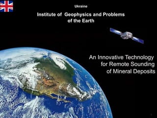
  • 1. 1 Ukraine Institute of Geophysics and Problems of the Earth An Innovative Technology for Remote Sounding of Mineral Deposits
  • 2. 2 Innovative Technology of Search and Survey of hydrocarbons Contents Introduction 1. About company "Institute of Geophysics and Problems of the Earth " 2. Innovative Geophysical Exploration Technology 3. Technology Features 4. Service Ideology using RSS-NMR technology 5. Diagnostics of territories (2D) 6. Detailed remote survey of deposits (3D) 7. Remote survey of drilling points 8. Conducting an expedition to the area 9. Comparative Effectiveness of Methods 10. Technical Peculiarities and some Know–How of the Technology
  • 3. 3 Introduction When conducting exploration work, there are always risks of drilling “dry” wells (complete absence of hydrocarbons), or risks of non-commercial discovery of deposits Further, the Presentation provides information on the methods and capabilities of the RSS-NMR technology, as well as options for its application for solving a wide range of Customer tasks Proposed technology for the search and exploration of hydrocarbon deposits can significantly minimize these risks. Compared to traditional methods, our RSS-NMR hydrocarbon prospecting and exploration technology is based on resonance phenomena, which allows us to “directly” identify and quickly explore hydrocarbons on the territory of the Customer. The total effectiveness of our service is 90% or more, which means a significant reduction in financial risks compared to classical methods.
  • 4. 4 1. About company "Institute of Geophysics and Problems of the Earth " Institute of Geophysics and Problems of the Earth is an innovative scientific and technological production company that provides a wide range of services for the identification and detailed examination of hydrocarbon deposits and various minerals. The main goals of the company are the creation and implementation of high technology innovative technologies that increase the efficiency of exploration of hydrocarbon and other natural resources of the Earth. The Company's strategy for the provision of geophysical services is always the same - achieving the result with the greatest efficiency and with the lowest cost for the Customer, that is: - high performance, - speed of task performance, - inspection of territories without restrictions, - absolute environmental friendliness, - relatively low cost of work.
  • 5. The technology is based on the principle of resonance, which allows directly identify and record the required substances 5 RSS-NMR technology classification The “direct” method of prospecting and exploration of mineral deposits Resonance Spectral Sounding (RSS) Remote surveying of territories based on resonance processing analog IR space images Work on the ground with using point-to-point NMR sounding of deposits Thus, RSS & NMR technology consists of methods: RSS - for remote surveying of territories, sites, points. NMR - for work on the ground / fieldwork . At the same time, operational research of hydrocarbons, minerals, underground fresh and thermal waters both on large and small territories of land and shelf is provided. Nuclear magnetic resonance (NMR) 2. Innovative Geophysical Exploration Technology
  • 6. 6 3. Technology Features Territory of use - without restrictions (on land or on the shelf) Survey area - virtually no limits Depths of research - from 0 to 7 km Searched minerals - oil, gas, water and other minerals Efficiency - for hydrocarbons and water> 90% The duration of the stages - up to 1 month. Environmental safety - the method is absolutely safe for people and the environment
  • 7. 4. Service Ideology using RSS&NMR technology The presence of a highly effective remote research phase in combined with a ground survey of deposits allows implement a unique geophysical service covering almost all possible tasks of the customer. These tasks include: 1. Rapid identification of hydrocarbon deposits on the Customer’s territory and their contouring (“diagnostics” of the territory in 2D format); 2. Detailed remote examination of identified deposits (3D), 3. Testing of drilling points obtained by classical methods; 4. Conducting an expedition for a detailed survey of deposits (3D), etc. A standard approach for examining the territory of the Customer is first to “diagnose” the site and then, if there is a deposit (s) of hydrocarbons, conduct a detailed inspection of them. This approach can significantly reduce time and costs in the event of the identification of "empty" areas.
  • 8. 5. Diagnostics of territories (2D) Survey areas may be from units km square up to tens of thousands of square kilometers. Examination duration lies within 1 month. As a result of the survey we get the following data: - ground contours of identified deposits, - isolines of response levels of signals, - contours of fault zones, - zones and points of maximum signal responses, - maximum gas pressure in the horizons. 450 sq. km
  • 9. 6. Detailed remote survey of deposits (3D) Survey Areas May range from units to hundreds square km. Examination duration lies within 1 month. As a result of the survey we get the following data: - updated ground contours of deposits and fault zones, - zones and perspective points for drilling wells, - the number of horizons, their thickness and depth, - the presence of gas caps and pressure in them, watering horizons; - transverse and longitudinal sections of deposits, 3D model; - predicted resources of the deposit. Gas Oil
  • 10. 10 3 Figure 1 shows structural map where black lines longitudinal and cross section of deposits. Figure 2 shows one from longitudinal sections of deposits. Figure 3 shows 3D gas horizon model. 1 2
  • 11. 11 7. Remote survey of drilling points Survey areas are several km square. Duration surveys lies within 2-3 weeks. As a result of the survey we get the following data: - presence or absence hydrocarbons at a point control, - ground contours of the reservoir, - zones and points of maximum signal responses, - the number of horizons in drilling point, their power, depth of occurrence; - the presence of gas caps and pressure in them, - contours of the nearest deposits in case of a "dry" drilling point.
  • 12. 1212 Исх. № 02/08-15 10.08.2015 Директор / Director of the company Ю.В. Петров Заключение по результатам дистанционного тестирования точки бурения на нефть В течение апреля 2015 г. украинская компания «Институт геофизики и проблем Земли» провела тестирование точки, заложенной под бурение на нефть на территории Республики Коми. Тестирование точки проводилось дистанционно, на основе прямого геофизического метода обследования территорий с использованием радиационно-химической обработки аналоговых космических снимков инфракрасного диапазона. Проведено сравнение результатов дистанционного тестирования точки с результатами проведенного бурения. Данные тестирования и бурения совпали полностью, показав 100%-ю результативность использованного метода тестирования. Reference on the results of remote testing of the drilling point for oil The Ukrainian company "Institute of Geophysics and Problems of the Earth" tested the point laid down for drilling for oil in the Republic of Komi during April 2015. Point testing was conducted remotely based on the direct geophysical method of territory survey using radiation-chemical processing of analogue satellite images of infrared range. A comparison of results of remote testing of the point with the drilling results was carried out. The data of testing and drilling have coincided completely showing a 100% efficiency of the used testing method.
  • 13. 8. Conducting an expedition to the area 13 The expedition is conducted on plot with previously identified deposit (s). Survey area ranges from a few km sq. up to tens of km square. Expedition duration and subsequent processing received data lies in within 1 month. The purpose of the expedition is to clarify remote data surved. As a result, we get: - updated ground contours of the reservoir, - deep transverse and longitudinal sections of the reservoir, - refined resources calculation, - affixed to the terrain well drilling points.
  • 14. 9. Comparative Efficiency for large territories Methods Executable works Results (for an area ~1000 sq. km) Effectiveness Duration Average number of mining holes Traditional methods Space survey Geological survey Geophysical survey Searching boring 30 - 35% 1 – 2 years 6 (From data of Russian State Institute of Oil and Gas) Innovation Тechnology Resonance spectral sounding of the analog space images Nuclear-magnetic resonance sounding of a deposit on-site  80-85%  90-92% 1 month 1 month 1 Comparative Characteristics with 3D Seismography # Parameters 3D-Seismography "IT" 1 Topographical binding + (anomalies) + 2 Construction of 3D models of objects + (anomalies) + 3 Search of unstructured traps of oil and gas --- + 4 Detection of gas "caps" in oil horizons --- + 5 Definition of gas pressure in gas "caps" --- + 6 Definition of presence of oil mobility --- + 7 Detection of water horizons over oil and gas deposits --- + 14
  • 15. Innovative methods are patented and tested 15 Testing in the USA at 5 wells showed 100% effectiveness and 95% accuracy for depths of horizons
  • 16. 16 Technical Peculiarities and some Know – How of the Technology
  • 17. 1. General Idea of the Technology A С D В Oil Test waferOil Reprinter Preliminary the spectrum of the sought-for mineral is recorded on special test wafers Broadband radtation Photograph Тest wafer X-ray film Aerospace photographs Test wafers are used as a resonator during radiation- chemical processing of analogue aerospace photographs of the territory obtained in the infrared range. Result is direct visualization of ground contours of basins and deposits Ground expedition Point-by-point resonance sounding of an area: improvement of deposit contours, obtainment of longitudinal and transverse sections. Selection of optimal drilling points, improved calculation of expected reserves. Test wafers are used for spectral modulation of transmitter’s radiation
  • 18. 2. Remote survey (RSS method) Receiving space images Record EM spectrums of minerals on test wafers Obtaining samples of the desired minerals Resonance-spectral processing of satellite images of the study area Preparing of report Object contour visualization Laboratory production of test wafers Kirlian camera, computer Transfer the coordinates of a satellite image to terrain maps Fixation object and analytical data processing Preliminary work Search Object Identification Photogram- metric Calibration Field contour visualization Fixing the desired object Technological scheme Generalized scheme
  • 19. 19 № The list of technological operations 1 Preparatory works Order and obtaining of aerospace photographs of the investigated territory and ultra-pure chemical reagents. Laboratory manufacture of test gel-wafers. Recording of electromagnetic spectrum of the sought-for substance on test wafers. 2 Object identification Spectral resonance processing of satellite images in the presence of test plates in accordance with patented technology. Chemical processing of X-ray films that have undergone resonant effects. 3 Contour object deciphering Visualization of the contours of identified objects using the Kirlian camera. Getting a computer 2D image of objects. 4 Photogrammetric calibration of computer image of the object (geographic connection of the image’s points and the area). 5 Object’s fixation – definition of its size, form and location on the area. Transfer the contours of an object to a geographical map. 6 Analytical data processing to obtain 3D parameters of the reservoir and the calculation of forecast resources. 7 Preparation of report and providing the Customer with it
  • 20. 20 Companies Halliburton and Schlumberger + Direct measurement of T1 to identify fluids, porosity and permeability of reservoirs - Small survey radius, powerful magnets, powerful transmitter (r =0,05-0,2m, f =0,6–1,2 MHz, В0=0,1-3Т, Р =50-300W) 3. Expedition (NMR method) Known methods: Nuclear Magnetic logging Method (1) Magnetic Resonance Sounding Method (MRS) (2) Т/R MRS response Water horizon Resonant signal Loop IRIS instruments and others + Direct measurement of Т2 parameter for identification of water horizons, depth and reservoir porosity -- Shallow survey depth (up to 150m), powerful transmitter (impulse 4000 W, 600 А) Disadvantages caused by weak directionality of antennas: Dipole Gain coefficient G ≤ 4 Low-suspended horizontal frame antenna
  • 21. 21 Our way - Increase of Radiating Power The considered systems use sinusoidal resonance signal. However, oil consists of ~1,000 substances, therefore in order to reach maximum identification of the sought-for mineral it is necessary to excite resonance in all types of molecules of the sought-for substance, that is, to provide resonant spectral sounding. Application of superdirective antenna Prad у Superdirective antenna Dipole (frame) х R Antenna’s radiating power: Рrad = ηА .GA .Рtr where Рtr is transmitter power, ηА – antenna’s coefficient of efficiency, GA – antenna gain For dipole GА ~ 4, For directive antenna: GA = S1/SA = 4π .R2 / SA, where SA is effective antenna area. With R = 1m and SA = 10-6 m2 we receive power increase of superdirective antenna GA = 4π .106 ~ 12 . 106 Increase of Prospecting Accuracy Superdirective antenna predetermines point-to-point and not acreage sounding of deposits
  • 22. The transmitting part of the mobile equipment complex Work on the ground is absolutely safe for people and the environment Thus, deep-seated sounding of the reservoir is carried out pointwise, using a narrowly directed spectrally modulated signal, which causes resonance in the desired substance
  • 23. Response signal ℓ2 ℓ1 1st horizon 2nd horizon Modulation signal α h1 h2 Measuring ribbonTest wafer In measuring point the modulated laser beam is directed towards deposit under α angle. Modulated signal spreads under ground from test wafer. Оperator moves along the measuring ribbon with receiver. Response signal is registered at distance from ℓ1 tо ℓ2. Occurrence depths of a horizon are calculated with the help of the following formulae h1 = ℓ1 . tg α, h2 = ℓ2 . tgα. Horizon thickness ∆h = h2 - h1 = (ℓ2 - ℓ1) . tg α, By placing test wafers with recording of own frequencies or natural gas at different pressure, we are able to determine presence of gas cap and gas pressure in it. Diagram of Measurement of Deposit Parameters 23
  • 24. Seismography Innovative method Using shock impacts on the ground surface Effectiveness - about 30% There are restrictions on the type of terrain, Long duration of work and data processing, Unfavorable to the environment and humans. Study of the Earth's crust on the basis of artificially excited acoustic waves Study of mineral deposits on the basis of nuclear-magnetic resonance Using signals that excite resonance in sought-for substances Effectiveness about 90-92% There are no restrictions on the type of terrain, Short duration of work and data processing, It has no harm to humans and the environment. 1 2 3 Transmitter of shock impacts Receivers of acoustic waves Anomaly Seeking mineral 1 Transmitter of resonance spectra Receiver of the Larmor frequencies Anomaly Sought-for mineral Comparative analysis of terrestrial technologies 24
  • 25. We believe that application of the Technology will have a significant economic impact which can be achieved within very short time! Thank you for your attention Landline +591-33257175 Mobile +591-716-96657 (WhatsApp) VoIP: + 1-786-352-8843 Skype mlf10357 Home Bolivia: +591-3-3330971 Michel.friedman@fands-llc.biz