
Recommandé
Contenu connexe
Tendances
Tendances (20)
En vedette
En vedette (20)
Similaire à 1. Celt to Caesar Roman Britain
Similaire à 1. Celt to Caesar Roman Britain (20)
Plus de Robert Ehrlich
Plus de Robert Ehrlich (20)
Dernier
Dernier (20)
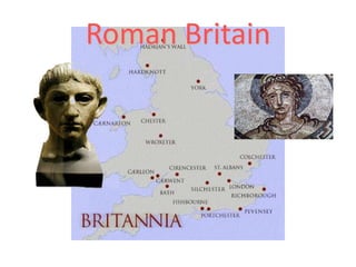
1. Celt to Caesar Roman Britain
- 2. From Celt to Caesar The ‘Celts’(and their predecessors)
- 3. Roman Britain - Britannia Iron Age (Celts) (500-50 BCE) Roman Influence (55 BCE-43 CE) Roman Domination (43 CE – 410 CE) Sub Roman (Britons) (410 CE - ?)
- 8. From Foragers to FarmersMesolithic – Neolithic Transition Monument Builders
- 9. Influences Neolithic – Introduction of agriculture, Monumental stone construction Chalcolithic – Introductions of metal working Bronze Age – Improved metal-working Iron age
- 10. Iron Age Hallstatt ~700-500 BCE La Têne ~500 BCE - Roman Belgae ~150 BCE - Roman
- 11. Celts-Languages
- 12. Celtic Language Groups Brythonic Welsh Breton Cornish Gaulish Substitute p for q Son(m)ap Horse epos Goidelic Gaelic (Irish) Gaelic (Scottish) Manx Q (kw) written as c Son mac Horse equos
- 13. The Iron Age Hallstat c.700-600 BCE in Austria Burials in 4 wheel chariots Serpent with ram’s head Gold torcs
- 14. Lyn Fawr Hoard750-600 BCE
- 15. Maiden Castle
- 17. Iron Age Maiden Castle
- 18. Effects of Agricultural Expansion
- 21. Vix Burial
- 22. Hallstatt Cult Wagon Strettweg , Austria7th c. BCE
- 23. The Middle Iron Age La Tene c. 500 BCE centered on Rhine and Marne Two wheeled chariots Vegetative designs
- 24. From Hallstatt to la Tene La Tene Hallstatt
- 25. Wetwang Chariot Burial 1
- 26. Wetwang Chariot Burial 2
- 29. On horse bit Coral and enamel studs
- 30. Weaving – Antler comb
- 31. Battersea Shield
- 34. Evolution of Celtic Coins Philip Late Celtic
- 35. Potin from Gaul, Winchester, 70 BCE
- 36. Potin, Dingar, Essex, 100-50 BCE
- 37. Potins c. 100 BCE
- 38. Staters Westerham Staterc. 70 BCE Chute Stater
- 40. Birdlip Grave
- 41. Desborough and Birdlip Mirrors Dated after Caesar’s invasion
- 42. Winchester Hoard
- 44. Trade with the Continent
- 45. Social strata Civitates-tribes Pagi-kinship units or clans Kings Class of knights (equitates) Class that included artists, craftsmen, bards, lawyers, genealogists, musicians and Druids.
- 46. Diet High protein diet No differences between sexes No differences between chariot burial and others No detectable consumption of marine resources
- 47. Iron Age Village Chysauster, Cornwall
- 48. Chysauster on the Ground
- 49. Timber Hut – Iron Age Carn Euny
- 51. Fogou
- 52. AgricultureChanges in the Iron Age Increasing population Use of land formerly marginal
- 53. Enclosures
- 54. Lynchets
- 55. Celtic Fields, Butser Hill, Hamps.
- 56. Crops Cereals Emmer, Einkhorn, Rivet and Spelt. Oats were grown mainly for animal feed Rye is another grain used for baking as bread. Barley for beer Vegetables Peas, Beans Onions, Garlic, Carrots, and Cabbage. Dye Plants Woad -Blue dye Madder-Red dye Weld -Yellow dye
- 57. Iron Age Cattle(?) – Dexter Cattle
- 58. Iron Age Sheep
- 59. Iron Age Agricultural Tools
- 60. Revolutionary domestic appliance Saddle quern, Cornwall Rotary quern, Yorkshire
- 61. Roman Knowledge of Britain
- 62. Mediterranean Reports C.600 IERNE (Ireland) and ALBION (Britain) described in Massilia (Marseille) 325 BCE Pytheas,a Phoenician claims he had sailed around Britain 135-150 BCE Posidonius, or Poseidonios - of Syria writes about Druids 56 BCE DiodorusSiculus combines accounts Orca Cantium Belerium
- 63. Posidonius’ Map (150-130 B.C.)
- 64. Tribes
- 65. Religion and its Manifestations Causeways 1500-300 BCE Deposits in waterways Shrines 400 BCE-43 CE Often connected with Romano-British temples Druids
- 68. Trackway, Corlea
- 69. Iron Age Road?
- 71. Development of a ShrinePhases – Hayling Island Phase I: Two enclosures and pit ~50 BCE Association with Belgae and Commius? Phase II Temple: Circular structure surrounds pit ~0-25 CE Roman Temple ~60 CE
- 73. Human Sacrifice
- 74. Human Sacrifice Cauldron found In Denmark
- 76. Druids Repository of traditional knowledge Gods Tribal Law Administration of justice. Supervision of sacrifices. Used lunar calendar.
- 77. Goddess?
- 78. Celt and Roman Worldviews Nature Human sacrifice Individualistic Abstract Higher status for women Oral tradition Engineering Execution(abolished human sacrifice in 97 BCE) Organized Realistic Low status for women Written tradition
- 79. Trade
- 81. SE England
- 82. Oppida Administrative centers Fortified Industrial Trading centers Mints
- 83. Impending Clash Rivalry between tribes Relationship with Gauls Roman expansion into Gaul An ambitious warrior - Caesar
Notes de l'éditeur
- Cauldrons were used for cooking food, especially during feasts. They were also regarded as ceremonial possessions, invested with symbolic powers of regeneration and fertility.This cauldron is made of bronze hammered out into four flat sheets with a circular base-piece. They are joined with bossed, bronze rivets. The cauldron could be suspended by means of a pair of circular handles.These artefacts were buried in a complete, rather than a broken state, and many were items of the highest quality, some of which originated in other parts of Britain and the Continent. Could this material have been a gift to the deities of the 'Other world'? The reflective lake waters may have been seen as a boundary between two worlds.The LlynFawr hoard is extremely important because it illustrates the cross over between the Bronze and Iron Ages. It is unusual because of the mixed styles of objects that suggest a wide range of origins. Indeed on the British scale the name LlynFawr is given to the period of time dating from 750-600BC.Some of the earliest iron objects made in Britain are included in this hoard, such as a sickle and a sword. We do not know where the iron was being mined or smelted. A local source of ore is possible.The LlynFawr cauldron is so big that you can't get your arms around it. It measures 352mm in height and the metal is 1-2mm thick. It weighs 7580g.Hallstattt C iron sword found also iron spear head and sickles.
- Antler weaving combIron Age, 300-100 BCDanebury, Hampshire, EnglandBroken when making Iron Age clothesThis is a weaving comb, a very common object found on excavations of Iron Age settlements in Britain. It is made of antler and was used when weaving woollen cloth on a loom. The comb has a hole made through the end of the handle so it could have a leather thong or piece of rope passed through to tie the comb to a person's belt. The comb has clearly been used and many of the teeth at the end of the comb have been broken.The comb was found in 1852 at the Iron Age hillfort of Danebury, Hampshire. The hillfort, occupied from about 500 to 100 BC, was excavated over a period of twenty years by Professor Barry Cunliffe of the University of Oxford. Results of the excavations, one of the largest ever to have taken place on a prehistoric site in Europe, provide a detailed picture daily life, ritual and politics of an Iron Age community.B.W. Cunliffe, Danebury: anatomy of an Iron A (Batsford/English Heritage, 1983)S. James and V. Rigby, Britain and the Celtic Iron Ag (London, The British Museum Press, 1997)
- Ard
- Excavation has revealed that the crop and soil marks recorded by Riley and others are the result of extensive ditch systems Some of these define a variety of subrectangular or curvilinear enclosures which may contain the traces of circular or rectangular buildings. These are occasionally visible on aerial photographs (Riley 1980: 54), but their presence has also been established or confirmed through excavation, as at Chainbridge Lane (Eccles, Caldwell and Mincher 1988), Dunston's Clump (Garton 1987), Wild Goose Cottage (Garton and Salisbury 1995), HolmePierrepont (Guilbert, Fearn and Woodhouse 1994) and Staunton (Todd 1975) in Nottinghamshire; and at Newton Kyme (Monaghan 1991) and Dalton Parlours in West Yorkshire (Wrathmell and Nicholson 1990). In South Yorkshire, enclosures at Warning Tongue Lane, Bessacarr (Atkinson and Merrony 1994) and Pickburn Leys (Sydes and Symonds 1985, Sydes 1993) also featured buildings.Contextual perspectivesArguments that propose a 'pastoral economy' and that see the farmsteads as 'wool-producing units' (Branigan 1989: 164) suffer from the fundamental misconception of transposing modern soil characteristics and modern 'common sense' farming techniques back in time to the later prehistoric and Romano-British periods. The soils present today are the products of over two thousand years of erosion or cultivation, and over this time their nutrient quality has surely deteriorated. The excavation of a double-ditched trackway at Stripe Road, Rossington revealed soil deposits of relatively good quality which may have been derived from the extant fields (Chadwick 1992: 8). As for manuring, the lack of pottery scatters is not surprising given that cultural factors may have influenced the disposal of broken or worn artefacts. Evidence for this will be examined below. Until detailed micromorphological and environmental sampling is carried out, ancient soil quality and the occurrence of manuring cannot be ascertained.From a modern Western capitalist perspective, the field systems represent economic intensification and a rationalisation of the landscape. These ordered landscapes can thus be portrayed as essentially familiar to us in the present, and from such a modernist viewpoint the ditches are merely passive functional agricultural features. In Britain, traditional views of iron age societies portray the bulk of the population as lumpen and undistinguished farming masses controlled by 'Celtic' warrior elites and druids (cf. Cunliffe 1984, 1991; Harding 1974), in turn replaced by Roman rule which radically transformed not only the physical landscape but the nature of society as a whole. Approaches that portray aspects of the iron age and Romano-British periods as 'familiar' or unproblematic have been critically re-examined (Barrett and Foster 1991; Hill 1989, 1992; Hill and Ireland 1996, Merriman 1987, Reece 1988)."The late Iron Age and Roman periods suit interpretation from a late 20th Century perspective to an extent which no other periods do. We see, for instance, the origins and development of urbanism in temperate Europe, the introduction of coinage, the use of linear frontiers, road networks and other phenomena which all lend themselves to naive interpretations arising from our own social experience." (Aitchison 1987: 96).Recent work has suggested that during the later prehistoric period there was sometimes marked ordering of the layout and use of household and settlement space (Fitzpatrick 1994, Parker Pearson 1996) and the deposition of artefacts and refuse (Hill 1989). Ditches and boundaries may have held significance above and beyond functional concerns (Bowden and McOmish 1987, Hingley 1990a), and remains of the dead were dispersed across settlements or incorporated into storage pits and boundary ditches (Cunliffe 1991). This evidence may reveal aspects of a wider belief system which stressed fertility, the seasons and cycles of birth, death and renewal (Parker Pearson 1996). That the organisation of space may have been culturally constrained during the Roman occupation has also been suggested (Hingley 1990b, Scott 1990). Ethnographic studies have shown that in many small-scale societies people's lives and routine practices may be vivified by larger cosmologies
- A lynchet is a bank of earth that builds up on the downslope of a field ploughed over a long period of time.[1] The disturbed soil slips down the hillside to create a positive lynchet while the area reduced in level becomes a negative lynchet. They are also referred to as strip lynchets.They are a feature of ancient field systems such as the Celtic fields of the British Isles. Some believe that they were passively formed under the long-term action of gravity and weathering on the loosened soil of a ploughed slope, while others believe they may have been intentionally formed, to prevent erosion and slippage of the ploughed slope.The word is the diminutive form of lynch, now rarely appearing in the English language, indicating an agricultural terrace.
- The picture shows some of the slopes of Butser Hill to the west of the A3(M) to London, which is on the far right. These slopes are roughly northwards of the Butser farm site, the public demonstration area set up when the Queen Elizabeth Country Park was opened. The Little Butser Research Site was over the top of the hill, just left of centre. The entire boundary system comprises Celtic Fields. With no snow covering the boundaries are only apparent in low angle light.
- Soay sheep come from the remote islands of Soay and Hirta, sixty miles off the northwest coast of Scotland, where they have survived as a stranded, isolated population for thousands of years, completely unmanaged by man. They are thought to have descended from the flocks of primitive Bronze Age shepherds. Rare in their home territory and even rarer in North America, this ancient breed is truly worthy of conservation. Soay are small, averaging 55-65 pounds.Shetland Rams usually weigh 90 to 125 lb (41 to 57 kg) and ewes about 75 to 100 lb (34 to 45 kg)In the early Iron Age the sheep were small and hardy with a wool that was plucked off every year, very similar to the soay sheep of today. By the late period (pre Roman) larger sheep had been bred, with a longer wool that required shearing
- Iron Age, about 200 BC-AD 43 From Stantonbury Hill hillfort, Somerset, EnglandThese are common tools used by farmers in Iron Age Britain. The curved objects are iron blades of sickles or pruning hooks. The other object is the iron tip from an 'ard', a type of plough used by Iron Age farmers. Only the iron parts of these tools have survived; the wooden handles of the sickles or pruning hooks have rotted away. The ard would have been made from wood; the tip that cut into ground was the only part to be covered by iron.Sickles or pruning hooks were not just used to harvest crops. They were also used for cutting and shaping branches and hurdles. Looking after trees and hedges was an important job for Iron Age farmers. Trees needed to be carefully managed to ensure a large supply of hurdles and other useful-sized timber to make buildings, tools and vehicles and also for firewood and charcoal. At the same time farmers needed to lay and maintain the many hedges that surrounded fields and settlements.Iron Age ploughs lacked the mould boards or large blades used on more recent European ploughs to turn the soil over. Instead, the ard had a pointed wooden tip clad with iron, which made a simple furrow or narrow trench to sow the seed in. The ard's iron tip helped to cut through heavy clay soil more easily than was previously possible.All these objects, along with an iron axe, were buried together at Stantonbury Hill hillfort in Somerset. They were found by someone using a metal detector.R. JacksonCamerton. A. Catalogue of Late Iron Age and Early Roman. Metalwork, London 1991e (London, The British Museum Press, 1990)S. James and V. Rigby, Britain and the Celtic Iron Ag (London, The British Museum Press, 1997)
- Iron Age, about 400-300 BC From Burton Agnes, East Yorkshire, EnglandA revolutionary domestic applianceThis is the top part of an Iron Age rotatory quern. Quern stones such as this one would have been found on almost every Iron Age farm and village. They were used to grind grains of wheat, barley or rye into flour to make bread and other foods.A rotatory quern consisted of two quern stones, one on top of the other. The lower stone did not move; the top stone was turned around a wooden axle that passed up through the hole in its centre. A slot on the top stone, which can be seen in this example, was fitted with a wooden handle used to turn the stone around. The hard, rough surfaces of the quern stones moving against each other ground the grains into flour.The rotatory quern was an important new technology that probably transformed daily life in Iron Age Britain. The idea for a rotatory quern arrived in Britain in the middle of the Iron Age (about 400-300 BC) and quickly spread. Before this time people used saddle querns. The new rotatory querns made flour-making much quicker and easier.The hard stone used for quern stones was cut from particular quarries across Britain. It is often possible to identify the location of the quern's source by examining small samples of stone under a microscope. This allows archaeologists to reconstruct the, often long, journeys that querns travelled when they were traded or exchanged.S. James and V. Rigby, Britain and the Celtic Iron Ag (London, The British Museum Press, 1997)
- The term ‘shrine’ is used loosely as it is not clear what specific ritual functions may have taken place, but these sites were probably the focus of activities involving communication with the supernatural.
- Over 150 years later when a dyke was being cleaned, a series of posts were found together with an early to mid Iron Age sword. Subsequent excavations in 1981 revealed the posts to be a wooden causeway which dendrologists dated to a period between 457 and 300 BC. It appeared to have been repaired and added to every eighteen years or so during that period and the construction and maintenance of a walkway on such a scale at that time would have been a major feat of engineering. Hundreds of artifacts were also found around the causeway, including eleven spears, six swords, woodworking and metalworking tools, as well as part of a human skull which had a crescent-shaped chop mark, probably inflicted by a sword; this injury is unlikely to have killed the man.[4]Twenty years later in further excavations more sections of the causeway were dug out, some of them containing posts several metres long, plus a complete spear, a currency bar, a sword, a dagger and some bronze fittings, all of which appeared to have been deliberately damaged before their burial.[5] The most important discovery was two votive Iron Age boats. One of these boats as well as other artifacts can be seen at The Collection in Lincoln.The pre-Roman Iron Age wooden causeway at Fiskerton was excavated in part in 1981 (Field and ParkerPearson 2003). Associated with the causeway are ferrous weapons, tools and other artefacts, and finds ofbronze, pottery, stone, bone, jet and amber. The causeway appears to run from the site of the modern village ofFiskerton (five miles east of the city of Lincoln), down to the now canalised River Witham. Dendrochronologyhas dated the causeway to have been in use from at least 457 to 321 BC, although its precise function has not yetbeen established
- The boat was apparently a votive deposit. It looks as if it had never been run on to a beach and was wedged into place with the back end actually pegged into place.
- Wide enough for two carts. Hazel and ash. 3-3.5 m. 148 bc. Fragments that might have come from a cart.
- Materials coral copper alloy La Tène Techniques repoussé inlaid engraved Found/Acquired Witham, River Lincolnshire, 400BC-300BC
- Phase I Three main elements formed the focus of the ritual ensemble:an enclosure (c. 25 x 25 m) with its entrance aligned to the east, aninner enclosure, also with an eastern entrance, and a pit set on thewestern margin of the inner enclosure.o The outer enclosure was defined by a narrow square-shaped slotthat was widened at intervals by semicircular post-holes. This onlysurvived well just to the south of the entrance where it had not beendestroyed by the phase II enclosure ditch. In form, it was probably a fence of upright posts with planking or wattles in between. There areindications that the enclosure had a double or multiple boundary, asreflected in the parallel traces of ditches for part of the boundary.o The inner enclosure was much better preserved, taking the form ofa deep slot with preserved plank impressions in places, andsubstantial square post-holes at the corners and at intervals tosupport what must have been a plank-built fence. It was bestpreserved on its southern and eastern sides, showing clear evidencefor an inturned entrance in the middle of the eastern side. Becauseof later structures little survived of the western side, except for ashallow beam slot to the north of the pit that interrupted thealignment on this side. The distance between the east and west sidesof the enclosure is 8.60 m, which may conform to 28 units of amodule of 307 mm. This is close to the modules of 310 mm atManching and 304.2 mm at Mont Beuvray (Schubert and Schubert1993; Schubert 1994), and may indicate use of a metrical unit inlaying out the enclosure. Subsidiary measurements of the innerenclosure suggest that the module was used for some of the detailsof the layout (further analysis of which is proceeding). The innerenclosure was also probably laid out so that the east-west to northsouthratio was c. 4:5.o The pit appears to have been an integral part of this phase, sincethe entrances appear to have been aligned on it, and the beam-slotreferred to above respects its position. It was c. 2.5 x 1.7 m, and 0.65m deep, but since the fill dates to phase II, it is possible that the pitcould have been smaller in phase I, but subsequently enlarged. o APhase II The significant change was the probable round-house-likebuilding that replaced the inner enclosure. As discussed above, thisresembles a domestic structure in plan, and as such, can be regarded asa 'house' for the deity. The motivation for this phase of apparenttectonisation is not entirely clear: was it a dim reflection of the Graeco-Roman practice of building temples for the gods (Brunaux 1988:32;King 1990:223), or a 'domestication' of the deity arising out of localcultural changes and preferences, or merely the desire to build a shelterfor valuable votive offerings that needed to be placed near the ritualfocus?
- On eof three found at Lindow. Last meal wheat, barley and mistletoe. Lindow Man was a healthy male in his mid-20s. He may have been someone of high status, as his body shows little evidence of heavy or rough work. The nature of his death was violent, perhaps ritualistic; after a last meal of charred bread, Lindow Man was strangled, hit on the head, and his throat was cut. Lindrow woman. Forensics identified the skull as belonging to a woman, probably aged 30–50.[5] On hearing the news of the discovery of the remains Peter Reyn-Bardt, who lived near Lindow Moss, believed it was the body of his wife. MrsReyn-Bardt had disappeared in 1960 and was the subject of an ongoing investigation by police. Peter Reyn-Bardt confessed to the murder of his wife and was tried and convicted.
- Aust-on-SevernRomantemple of Henley Wood near Yattonin north Somerset, and of course inour same Bristol Channel Region.This figurine, which must also be assigned tothe end of the Iron Age, is now in theWoodspring Museum, We s t o n - s u p e r- M a re .It is tempting to label bothimages as ‘Venus figurines’because the Roman goddessconnected with love and procreation,who is often portrayedunclothed is so familiar to us.But the subjects of this note arenot directly connected withGraeco-Roman art and they mustrepresent a purely native powerof this region. Although we willprobably never know for certainwhat she was called, the onlylocal goddess known to us byname is Sulis, later equated bythe Romans with Minerva andgiven a temple at Bath. Is itpossible that the Aust on Severn figurineshows Sulis in her pre-Roman guise when shewas, above all, a goddess of fecundity?