Fusion360 Rendering deep dive (updated)
•
3 j'aime•403 vues
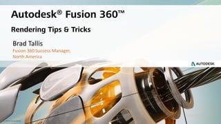
Fusion360 - Tips and tricks Brad Tallis | Fusion 360 Success Manager | Autodesk, Inc. Office 970-226-3938, Mobile 970-310-7308 | brad.tallis@autodesk.com | LinkedIn
Signaler
Partager
Signaler
Partager
Télécharger pour lire hors ligne

Recommandé
PowerPoint Fusion360 - BIM Caténaires - Français
Autodesk Fusion360, Fusion Team, BIM Caténaires et Cloud Computing
PowerPoint Fusion360 - BIM OLE - English
The document discusses Quentin Marquette's presentation on using Autodesk Fusion 360 for overhead line engineering (OLE) processes. The summary includes:
1) Fusion 360 was created in 2012 as Inventor Fusion and is now a cloud-based parametric modeling software for product design and manufacturing.
2) The presentation covers importing Civil 3D corridor models into Fusion 360, creating OLE component libraries, assembling pole models, and inserting permanent ways.
3) Key advantages of Fusion 360 for OLE include real-time collaboration, mobile access to models, and integrating feedback from multiple stakeholders into a shared component library.
Advanced Road Design with InfraWorks
This document contains a Q&A session on Autodesk InfraWorks. Questions covered include tutorials for creating assemblies, performance of large models, new features in the 2019 version, terrain accuracy, and integrating data between InfraWorks and Civil 3D. The responses provide links to tutorials, best practices for performance, and confirm the 2019 version will be released soon with new upgrades.
Unfortunately there was no time left to demonstrate bringing Civil 3D designs into InfraWorks as requested.
Connected BIM Webinar Series - Immersive Visualization
This document contains a question and answer session covering the capabilities and limitations of Autodesk Revit Live. Some key points addressed include:
- Revit Live allows measuring distances and elevations in VR and viewing section cuts from Revit.
- Models can get quite large but performance depends on computer specs, especially GPU.
- Changes must be re-uploaded to the cloud but there is no additional cost beyond the subscription.
- Revit Live is compatible with Vive, Rift and Windows MR headsets for VR viewing but does not currently support annotations, parameter changes or multi-user experiences.
Reality Capture - ReCap & Civil3D
Connected BIM Webinar series
Reality Capture
ReCap (Pro / Photo) and Civil 3D
John Sayre
Technical Marketing Manager Infrastructure
john.sayre@autodesk.com
BIM Ready Episode 2 - Horizontal and vertical BIM
BIM Ready,
30 minutes of Strategy, Implementation, and Tips and Tricks using the Autodesk portfolio,
Episode 2 - Horizontal & Vertical BIM
Jad Dellel
Raquel Bascones Recio
Simon Whitbread
Lucy Kuhns
Autodesk
Introduction to Parking Lot Layout using Autodesk Vehicle Tracking
Autodesk Civil Engineering Community Webcast Series
Introduction to Parking Lot Layout using Autodesk Vehicle Tracking
Eric Chappell - Civil Community Evangelist
Nigel Peters - Software Development Manager
InfraWorks Design Slam PostGame Show - Autodesk University Vegas 2017
Autodesk Civil Engineering Community Webcast Series
InfraWorks Design Smal Postgame Show
Eric Chappell - Autodesk,
Chris DuBois - VHB,
Dan Iliyn - David Evans & Assoc.,
Matt Wunch - AI Engineers
Schneider Electric - Autodesk - BIM : les bonnes pratiques pour la création d...
BIM : les bonnes pratiques pour la création du lot éléctrique
1ère partie : courant fort en phases APS et APD.
Schneider Electric
- Hervé Boileau - Responsable Marketing Clientèles - Bureau d'études techniques,
- Bruno Guillaumont - Directeur Développement Marché et Intelligence Business BIM.
Autodesk
- Julien Drouet - Spécialiste BIM, Construction, Electricité, CVC & Plomberie.
Webinar BIM Ready - Episode 1 - The Kickoff
BIM Ready
30 minutes of strategy, implementation, and tips and tricks using the Autodesk portfolio
Immerse Yourself in your Infrastructure Project: Intro to VR
Eric Chappell - Civil Community Evangelist
John Sayre - Technical Marketing Manager
Webinar polls:
- What type of projects do you currently work on? 26% transportation, 25% land development, 7% municipal, 7% water, 36% other,
- Are you currently creating VR experiences? 32% yes, 68% no,
- Which of the statements resonate with you? 45% VR is typically too time-consuming and difficult to create, 39% VR hardware costs are a stumbling block for us, 27% we would need to hire a visualization person for VR creation, 12% don't see visualization as a need for projects, 12% all the above.
Streetsmart pour AutoCAD - Utilisation des vues panoramiques 360 degrés
Utilisation des vues immersives et LiDAR Cyclomedia dans les logiciels Autodesk
- Pascal Boyeau - Business Development Manager - Cyclomedia France - pboyeau@cyclomedia.com - 0033.(0)6.66.00.24.12,
- Stephen Brockwell - Président - Brockwell IT Consulting,
- Yannick Veillet - Chargé de projet / Analyste en géomatique sénior - Geomap GIS America
-
Autodesk Vehicle Tracking - Introduction to Swept Path Analysis
Eric Chappell - Civil Community Evangelist
Nigel Peters - Software Development Manager
eric.chappell@autodesk.com
nigel.peters@autodesk.com
Conférence Prodware - Management de projet BIM
MBP - Management de Projet BIM
Thierry Minchella
Responsable BIM Development - Prodware France
tminchella@prodware.fr
2018
Rail infrastructures with BIM, more than 50 solutions to improve the quality ...
Rail infrastructures with BIM, more than 50 solutions to improve the quality of your design (transportation)
Ferroviaire : panorama des solutions BIM envisageables
Développement des infrastructures ferroviaires
Panorama des solutions BIM envisageables [FR]
https://www.linkedin.com/pulse/panorama-des-solutions-bim-envisageables-pour-le-quentin-marquette/
Autodesk
Bentley Systems
Trimble - Vianova Systems
Dassault Systèmes
Nemetschek AG
McNeel & Associates
Transoft Solutions
InfraWorks 2018.2 - Enhancements to road modeling and quantities
InfraWorks 2018.2 - Enhancements to road modeling and quantities
Webcast series 01-04-2018
Eric Chappell
Prateek Hejmady
What's new in InfraWorks 2018.2?
What's new in InfraWorks 2018.2?
Autodesk Civil Engineering Community Webcast Series.
--------------------------------------------------------------------------
Thanks to Eric Chappell and Sarah Cunningham for sharing their knowledge.
Capture de la réalité - Scanner Leica BLK360 - Autodesk ReCap Pro
Présentation du 19 Décembre 2017. [FRENCH VERSION]
Webinaire « Simplifier la capture de la réalité avec le scanner Leica BLK360 et Autodesk ReCap Pro ».
Le scanner avec imagerie Leica BLK360 capture des images sphériques 360° et des nuages de points 3D précis. Le logiciel Autodesk ReCap Pro permet le traitement des données, sur le terrain comme au bureau, pour la visualisation, la collaboration et la conception. Rejoignez notre Webinar gratuit et passez à la réalité 3D.
Agenda :
- Présentation du Scanner Leica BLK360
- Acquisition 3D avec le Leica BLK360 à partir de l'application mobile ReCap Pro sur iPad
- Capture de la réalité avec des images 360° et des nuages de points 3D
- Visualisation et traitement du nuage de points dans l'écosystème Autodesk
- Présentation des applications
Merci d’envoyer vos questions, commentaires et impressions à : marketing.france@leica-geosystems.fr
-------------------------------------------------------------------------
Merci à Olivier BAYLE d'Autodesk et Jonathan CHOINARD de chez Leica Geosystems pour les présentations respectives de leurs produits.
Contenu connexe
Plus de Quentin Marquette
Schneider Electric - Autodesk - BIM : les bonnes pratiques pour la création d...
BIM : les bonnes pratiques pour la création du lot éléctrique
1ère partie : courant fort en phases APS et APD.
Schneider Electric
- Hervé Boileau - Responsable Marketing Clientèles - Bureau d'études techniques,
- Bruno Guillaumont - Directeur Développement Marché et Intelligence Business BIM.
Autodesk
- Julien Drouet - Spécialiste BIM, Construction, Electricité, CVC & Plomberie.
Webinar BIM Ready - Episode 1 - The Kickoff
BIM Ready
30 minutes of strategy, implementation, and tips and tricks using the Autodesk portfolio
Immerse Yourself in your Infrastructure Project: Intro to VR
Eric Chappell - Civil Community Evangelist
John Sayre - Technical Marketing Manager
Webinar polls:
- What type of projects do you currently work on? 26% transportation, 25% land development, 7% municipal, 7% water, 36% other,
- Are you currently creating VR experiences? 32% yes, 68% no,
- Which of the statements resonate with you? 45% VR is typically too time-consuming and difficult to create, 39% VR hardware costs are a stumbling block for us, 27% we would need to hire a visualization person for VR creation, 12% don't see visualization as a need for projects, 12% all the above.
Streetsmart pour AutoCAD - Utilisation des vues panoramiques 360 degrés
Utilisation des vues immersives et LiDAR Cyclomedia dans les logiciels Autodesk
- Pascal Boyeau - Business Development Manager - Cyclomedia France - pboyeau@cyclomedia.com - 0033.(0)6.66.00.24.12,
- Stephen Brockwell - Président - Brockwell IT Consulting,
- Yannick Veillet - Chargé de projet / Analyste en géomatique sénior - Geomap GIS America
-
Autodesk Vehicle Tracking - Introduction to Swept Path Analysis
Eric Chappell - Civil Community Evangelist
Nigel Peters - Software Development Manager
eric.chappell@autodesk.com
nigel.peters@autodesk.com
Conférence Prodware - Management de projet BIM
MBP - Management de Projet BIM
Thierry Minchella
Responsable BIM Development - Prodware France
tminchella@prodware.fr
2018
Rail infrastructures with BIM, more than 50 solutions to improve the quality ...
Rail infrastructures with BIM, more than 50 solutions to improve the quality of your design (transportation)
Ferroviaire : panorama des solutions BIM envisageables
Développement des infrastructures ferroviaires
Panorama des solutions BIM envisageables [FR]
https://www.linkedin.com/pulse/panorama-des-solutions-bim-envisageables-pour-le-quentin-marquette/
Autodesk
Bentley Systems
Trimble - Vianova Systems
Dassault Systèmes
Nemetschek AG
McNeel & Associates
Transoft Solutions
InfraWorks 2018.2 - Enhancements to road modeling and quantities
InfraWorks 2018.2 - Enhancements to road modeling and quantities
Webcast series 01-04-2018
Eric Chappell
Prateek Hejmady
What's new in InfraWorks 2018.2?
What's new in InfraWorks 2018.2?
Autodesk Civil Engineering Community Webcast Series.
--------------------------------------------------------------------------
Thanks to Eric Chappell and Sarah Cunningham for sharing their knowledge.
Capture de la réalité - Scanner Leica BLK360 - Autodesk ReCap Pro
Présentation du 19 Décembre 2017. [FRENCH VERSION]
Webinaire « Simplifier la capture de la réalité avec le scanner Leica BLK360 et Autodesk ReCap Pro ».
Le scanner avec imagerie Leica BLK360 capture des images sphériques 360° et des nuages de points 3D précis. Le logiciel Autodesk ReCap Pro permet le traitement des données, sur le terrain comme au bureau, pour la visualisation, la collaboration et la conception. Rejoignez notre Webinar gratuit et passez à la réalité 3D.
Agenda :
- Présentation du Scanner Leica BLK360
- Acquisition 3D avec le Leica BLK360 à partir de l'application mobile ReCap Pro sur iPad
- Capture de la réalité avec des images 360° et des nuages de points 3D
- Visualisation et traitement du nuage de points dans l'écosystème Autodesk
- Présentation des applications
Merci d’envoyer vos questions, commentaires et impressions à : marketing.france@leica-geosystems.fr
-------------------------------------------------------------------------
Merci à Olivier BAYLE d'Autodesk et Jonathan CHOINARD de chez Leica Geosystems pour les présentations respectives de leurs produits.
Plus de Quentin Marquette (11)
Schneider Electric - Autodesk - BIM : les bonnes pratiques pour la création d...
Schneider Electric - Autodesk - BIM : les bonnes pratiques pour la création d...
Immerse Yourself in your Infrastructure Project: Intro to VR
Immerse Yourself in your Infrastructure Project: Intro to VR
Streetsmart pour AutoCAD - Utilisation des vues panoramiques 360 degrés
Streetsmart pour AutoCAD - Utilisation des vues panoramiques 360 degrés
Autodesk Vehicle Tracking - Introduction to Swept Path Analysis
Autodesk Vehicle Tracking - Introduction to Swept Path Analysis
Rail infrastructures with BIM, more than 50 solutions to improve the quality ...
Rail infrastructures with BIM, more than 50 solutions to improve the quality ...
Ferroviaire : panorama des solutions BIM envisageables
Ferroviaire : panorama des solutions BIM envisageables
InfraWorks 2018.2 - Enhancements to road modeling and quantities
InfraWorks 2018.2 - Enhancements to road modeling and quantities
Capture de la réalité - Scanner Leica BLK360 - Autodesk ReCap Pro
Capture de la réalité - Scanner Leica BLK360 - Autodesk ReCap Pro