
Recommandé
Recommandé
Contenu connexe
Tendances
Tendances (20)
En vedette
En vedette (7)
Similaire à Urban Systems Collaborative Seminar | Peter Williams, Global Flood Model
Similaire à Urban Systems Collaborative Seminar | Peter Williams, Global Flood Model (20)
Plus de urbansystemssymposium
Plus de urbansystemssymposium (15)
Dernier
Dernier (20)
Urban Systems Collaborative Seminar | Peter Williams, Global Flood Model
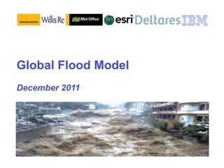
- 1. Global Flood Model December 2011
- 2. Endorsement Dear Peter, Thank you for the opportunity to meet with the 'volunteer' team. I enjoyed the opportunity not only to learn more about the initiative but also to meet all of you who are making this joint effort work. I have since we met in fact presented the idea to the senior management of FEMA USA. Clearly interested in the concept as it includes what they do not (yet) have; the modelling of future flood risks. I invited them to join the effort. And I think we may receive a positive answer. I will in the coming weeks introduce it to others as well. Yes, you can certainly use my ' name' when you present the idea and the concept - as supportive and engaged in working to get it piloted and tested as soon as possible. I will meanwhile, also ask colleagues here in the Secretariat to familiarize themselves with the concept and yes, be ready to comment on the project proposal when you are ready to share it. I look forward to our continued work on the Global Flood Model. With best regards Margareta Wahlstrom Special Representative of the Secretary-General for Disaster Risk Reduction United Nations International Strategy for Disaster Reduction (UNISDR) Email: wahlstromm@un.org Website: http://www.unisdr.org
- 3. The challenge to which the Global Flood Model responds: The Pakistan floods in 2010 (as one recent example) killed thousands, displaced millions and materially reduced the country’s GDP for years to come. Australia, Brazil, Philippines, Poland, Thailand, Turkey and USA and others have also experienced severe-to-catastrophic flood impacts since the Pakistan event. “For any given flood-prone location, how can we create a global community platform that enables better understanding of the complex causes behind the risk of flood impact - the better to support the decisions, and also the education and communication, needed to mitigate that risk before, during and after the flood event itself?” “Flood impact” = any adverse economic, social or environmental consequence Covers hydrometeorological or coastal flooding
- 4. 1. What will the GFM do? The GFM will provide, for any flood-prone location on earth, tools for: – Predicting the risk of floods, and for devising long-run mitigation strategies such as land-use changes and infrastructure improvements. – Forecasting the timing, location and severity of specific flood events, and enabling effective emergency response and post-flood recovery.
- 5. The GFM covers the entire causal web behind flood impacts See appendix for coastal inundation variant of this chart
- 6. The GFM enables a holistic, integrated response to flood risk Hazard Vulnerability Risk characterization, Exposure - Failure modes and based on: - Geographic extent of resilience of critical - Climate trends hazard infrastructures - Rainfall ground - Location of economic - Effectiveness of flood interactions activity, populations, defenses - River and lake critical infrastructure - Building codes behavior Mitigation & Recovery Resilience & Adaptation - Engineered “flood - Knowledge of risk and proofing” mitigation - Land use decisions, siting - Natural systems – of critical assets marshes, mangroves etc - Relocation - Short and medium range - Emergency planning forecasting of floods and - Costs and benefits impacts
- 7. Why now? Because understanding, data and IT are catching up with need For the first time in history, the causes of flood impacts can be understood and addressed in a holistic way: Flood impacts such as that in Pakistan seem to be – Scientific and engineering increasing, driven by: understanding of causes and mitigation strategies are growing; – the impact of climate change on rainfall events; – Remote and in situ-sensed data sets enable granular understanding – The impact of of global and location-specific risk; urbanization and poor land-use decisions in – Modeling, optimization and placing more people and visualization tools provide the ability value in harm’s way; to use that data to make better risk- management decisions; – Sub-optimal flood event response. – Processing power enables us to process massive data sets, as well as complex, integrated models and frameworks, cost effectively.
- 8. 2. Who will benefit? The GFM combines humanitarian and commercial motives. Its beneficiaries will be: – The public, seeking to preserve personal safety and property; – State and local governments, seeking to safeguard economic activity, and improve resilience; – NGOs, similarly seeking to respond proactively to flood events; – The insurance sector, seeking to understand and price flood risk; – Large corporations, seeking to protect global operations and supply chains.
- 9. Humanitarian and financial/economic benefits* from the GFM *To be validated Humanitarian and quantified Loss of Life Lives saved Families saved (reduced loss of parents, bread- Economic security Social/Political Cohesion winners) Resilience: Shared understanding Protection of education, Property protection infrastructure, social Poverty avoidance, quality programs of life protection Protection of economic Avoidance of population activity (w/w benefit to dislocation Global Flood global supply chains) Model Health Capital Markets Injury avoidance Reduction in risk – Water-borne disease reduced cost of capital, avoidance Economic Expansion increased health of Shelter and nutrition New insurance markets insurance sector protected New service opportunities – engineering, consulting Financial & Economic
- 10. The GFM will have many groups of users, benefiting in specific ways Citizens: how can I understand the risks from floods to myself, my family and property and either remove those risks or make effective plans for dealing with them? City or state managers, NGOs: how can I understand long term flood risk arising from the interactions of weather, sea levels, hydrology and land use patterns? – How can I make my city’s infrastructure and society more resilient? – How do I forecast flood events and impacts, evacuate people, and help my city recover after an event? Insurers: how do I understand, price and aggregate flood risk, so enabling me to offer cover? Corporate entities: – How do I plan for flood risk to my operations, and/or my supply chain? – How can I manage my flood insurance costs? – How do I help the communities in which we operate become more resilient? Scientists or engineers: how can I advance the science, and contribute my understanding, of the issues involved to help create practical solutions to these needs?
- 11. 3. How will the GFM be built? The GFM is a set or “stack” of integrated modules, each composed of models and data. – There are two core elements: a framework of specifications for each module, and a live “reference version” (a worked example) of each. – Users may work with this reference version, or substitute their own models and data. If these meet the specification for the relevant module, they should interoperate with the rest of the GFM. – Our intent is to improve local adoption and stimulate the development of multiple – but compatible – alternatives, so strengthening mankind’s ability to manage flood impacts.
- 12. Illustrative “stack” of modules in the GFM Set of integrated modules and Fluvial/pluvial “stack” Illu str indices, each containing ativ e models and data. Each module captures part of the flood impact causal web, and adds value in its own right. Each may require inputs (data, calculations, indices) from logically antecedent modules, and provide outputs to others. Collectively, modules form the complete “stack” covering the causal web. Modules enable dis- aggregated construction and See appendix for coastal inundation variant of this chart
- 13. GFM specifications Role: what need does the module meet? Specifications for each module Function: what does the module provide? will: Required outputs: content and semantics, scale, frequency, tolerances/uncertainty levels – Define the needs that the (inherent in each module and from module meets, and how combination with other modules), formats, – Define interfaces and ensure standards, screen layouts. interoperability of the complete Required inputs: as above, plus validated data GFM “stack” sources. – Enable local models and data Models, functionality and data transformations that comply with specifications required to generate the specified outputs. to interoperate with the rest of Application programming interfaces (APIs) the GFM that allow interfaces to other modules and also insertion of local models and content. Specifications will include a means of tracking accumulated Intended evolution: levels of function and uncertainty through the GFM resolution that will be added in the future as science and data availability permit. “stack”. Technical issues foreseen.
- 14. GFM live “reference version” Prove the functionality of each module and the GFM as a whole Provide “worked examples” to enable user needs to coalesce around an actual system as the GFM evolves Reference versions will be Benchmark module/model skill and usability piloted for different locations around the world Ensure global coverage in lieu of local offering specific alternatives (see later) combinations of physical Provide reference points and examples to characteristics and risk support development of local alternatives exposures Enable some models that are inherently – This potentially global: exposure models, financial market provides a means to models … engage key countries Enable end-to-end simulation and exploration of “what-ifs” across GFM modules Support outreach and marketing activities
- 15. Global foundation, local implementation “Localization”: – Local needs – Local data, models, Country/ Country/ Country/ Country/ adaptations thereof location- location- location- location- – Local expertise specific specific specific specific – Implementation model model model model and data- and data- and data- and data- – Visualization set set set set – Feedback 1 2 3 n… – Engagement and commitment Specifications, standards, reference Global Foundation version(s)
- 16. Evolution path – guided pragmatism Iterations of GFM modules will be prioritized by value: where need exists, and where data, model skill, resolution, usability and accumulated uncertainty can be improved at justified cost. The precise evolution – The baseline (“Version 0.1”): will consist of path will be determined modules that drive most variance in flood in a feasibility study impact, and do most to improve risk that determines the management and event response. best balance user – Some modules may provide higher-level need, value, and indices that enable deferral of others until scientific and scientific advance or data availability makes computing possibility greater precision worth the cost. – Some modules may initially be applied globally, while others will be local. We will achieve greater granularity over time, again
- 17. 4. How will the GFM be organized and financed? The GFM will be developed and managed by non-profit public-private foundation created for the purpose. – The business model will be derived from open source software (eg Linux): the core specifications and reference version of the GFM will be licensed free for non-profit usage. – For profit users such as software companies, engineering companies and business or risk management consultancies will pay an annual license fee. This will contribute to the upkeep and maintenance of the GFM.
- 18. Key principles The GFM will be created and managed as a public good, by a non-profit public- private foundation established for the purpose. Its core IP will be open-sourced: – It will be placed in the public domain and given appropriate legal protections to enable unencumbered use. – Access will be free of charge for non-profit use Following the model of open-sourced initiatives such as Linux, we will stimulate an “ecosystem” of for-profit users –engineers, risk consultancies, software companies and others - who add value to the core models for their own commercial purposes. – Fees that ecosystem users pay will cover GFM’s running costs and perhaps make it self-funding in the longer run.
- 19. Business model Founder members - core group who set direction and oversee design of GFM Affiliates - make a smaller donation than founders in exchange for early access to deliverables, or (in case of cities) the chance to become a pilot location. Founders and affiliates include insurers/re- insurers, large corporates, national governments, and supranationals (UN, World Bank and others) Ecosystem (“Accredited users”) - ecosystem members would pay certification/ accreditation and license fees for use of core IP – idea is for GFM to become self-funding over time.
- 20. Revenue structure Launch funding: – Donated by founder members (would receive some level of free access to all deliverables over some period of time to be determined) – Affiliates will make smaller donations in exchange for chance to become a pilot location, or early access to deliverables. – Wealthier countries may be also invited to purchase blanket access for non- profit users within their boundaries). – Required donation sizes to be determined. We estimate that we will require ~ $50 million, to cover a 5 year development program, to be confirmed in feasibility study. Work would begin well before this sum is raised Ecosystem – illustratively, world wide: – 50 for-profit users, paying $25,000 per year and 200 for-profit users paying $10,000 per year = $3.25 million per year to support ongoing running costs.
- 21. Organizational Model – based on Global Earthquake Model (GEM)? As an analogous program, GEM has solved many of the problems that GFM will have to address. It may therefore be a model for solutions to the organization and management issues that GFM will have to address: – Attracting initial funding – Enabling peer reviewed science, in the service of carefully defined user needs Modeled after Global Earthquake Model – Enabling cross-disciplinary input – several branches of science, engineering – Enabling national needs and aspirations to be heard and accommodated – Execution, progress tracking and issue resolution within a complex, multi-year program – Transparency and accountability Some data files that GEM has assembled – for example – Outreach building or infrastructure inventories in specific areas – may in principle be reusable for GFM.
- 22. 5. Next Steps The GFM is being created by Willis Reinsurance, UK Met Office, Esri, Deltares and IBM, who are each committing substantial pro-bono resources to the initiative. Our first task will be to create a demonstrator, which will be available early in 2012. – We will then require donor funding in order fully to investigate the feasibility of the concept and commence the process of building the GFM.
- 23. Demonstrator and Beyond We will undertake a feasibility study, that in We are currently creating a the light of reactions to the demonstrator: demonstrator/proof of – Defines the overall program for the GFM, concept for the GFM, which including completion of the baseline; we hope to have available by Jan 2012. – Captures initial user requirements; – This will provide a focus – Proposes a development sequence and for attracting views and evolution plan; inputs, and for fund-raising – Identifies existing and planned models efforts while also providing and datasets that we can use; measurable value in its own right. – Identifies the required organization structure, business and IP model; – The demonstrator will become a large part of the – Defines the required technology “baseline” GFM referred to architecture; earlier – Creates detailed plans and business case.
- 25. Complex webs of causation – coastal inundation
- 27. Localization: “module by location*” structure *The definition of “location” applies at multiple scales – grid square, suburb, city, country, river basin, region - depending on the nature of the phenomenon, the ability of the science to add value and the focus of the decisions being made.
- 28. Global foundation: supporting elements for the GFM (1/4) Requirements set – Who are the users and what do they want? What are the “use cases”? – What do users need the GFM to do, in what timescales, at what scale and accuracy? What services do they require? – What is the value? Systems dynamics model – Describes causal chains behind flood impacts of different kinds – Captures the “reference set” of causes we will attempt to model – Helps define boundary of each module and required interactions
- 29. Global foundation: supporting elements for the GFM (2/4) Reference data model – Definitions, frequencies, tolerances, standards of key data items exchanged between modules – Integrated into a single ontology and semantic model for all GFM elements – May or may not be based on existing standards Reference model library – Collection of models and tools adopted in GFM modules, plus interfacing & co-calibration needs – Supporting documentation – how to use each model appropriately
- 30. Global foundation: supporting elements for the GFM (3/4) Reference dataset library – Collection of global/local datasets created or adopted in GFM modules – Supporting documentation – how to use each dataset appropriately Quality control framework: – Specifies uncertainty levels, tolerances, for each module and the stack as a whole – Identifies valid combinations of modules, datasets and models, by version – Specifies validation and peer review process for each module, and records outcomes – Service levels
- 31. Global foundation: supporting elements for the GFM (4/4) Computing platform – Supports delivery of GFM modeling service – Technology architecture, including hardware, operating software and core tools (eg database, GIS, simulation engine and etc) – Collaboration toolset – exchanging model runs, comparing results etc – Driven by requirements to run models etc - reference standards as well as physical products – Probably “cloud” based, to enable access and scalability to a worldwide community May become separate business in its own right?
- 32. GFM and scientific advance The GFM requires the active engagement of the scientific community in many domains. It will provide the framework for, and catalyze, scientific and engineering advances required for its evolution. As a major example, one area where advance is required is hydro- meteorology and the creation of a “global rainfall model” – the GFM modules within the red box, right. Potentially, other required areas of advance are: – Management of urban run-off – Financial market modeling
- 33. Development methods Method Advantages Multiple smaller iterations Demonstrates progress rather than “big bang” changes Smaller funding amounts can be tied to specific increments Reduces technical risk – if any one increment fails, less impact Specifications Creates envelope in which development to each module need to “fit” Enables disaggregation of workload to multiple parties Enables local inputs and local creation of models, data etc Rationale for, and expectations of, each module are clear at all times Prototyping (reference Engages users (and creators) visually versions) – design GFM Helps ensure fit with user requirements modules “from the user screen backwards” and early releases Provides means to engage with potential sponsors Multi-disciplinary teaming Essential in project such as GFM where multiple inputs needed to (within each module and over complete the whole – regular interactions maximize shared the whole) understanding of the whole Open development methods Engages community and ensures “ownership” (users as co-developers, early Proven capability in rapid, accurate development of complex integrated releases, modularity, etc) software (Linux etc) Peer review of models and Ensures scientific rigor and validity specifications
Notes de l'éditeur
- Building a smarter planet is IBM's point of view on how interconnected technologies are changing the way the world literally works. It is all about how the world now beckoning us is one of enormous change and promise. Smarter planet is also the foundation for IBM’s vision for smarter cities--a vision that demonstrates how cities can lead the way into a prosperous and sustainable future. We see cities as the brightest opportunity to begin working toward a smarter planet. \n\nIn spite of our optimism, today’s cities face a range of challenges and threats to their sustainability—challenges across their systems and core infrastructures such as transport, water, energy, government services, education and healthcare.\n\nAs a point of interest for the audience, let’s first take a moment to understand the meaning of a smart city from the members of the audience. What is your personal definition and/or perspective? Just what is a smart city? \n(Note: use the input/comments collected from audience as insight and leverage to make points during the presentation.) \nThank you for your input.\n\nFrom IBM’s perspective, we see a smarter city as an urban development that employs instrumentation, interconnection, and intelligence to provide awareness of and coordinated responsiveness to activities and events within the city. These capabilities enable the people and the local industry to benefit from a great place to live, work, and run a business... A city that is adaptive, collaborative, efficient, personalized, secure, supportive, and sustainable. \n\nAs we explore the meaning of a smarter city and how we become one, we must also understand that the aforementioned services and challenges must be addressed holistically… today’s presentation is intended to give you further insight and considerations for becoming a smarter city. Though first, let’s explore cities from an historical perspective.\n
- \n
- \n
- \n
- \n
- \n
- \n
- \n
- \n
- \n
- \n
- \n
- \n
- \n
- \n
- \n
- \n
- \n
- \n
- \n
- \n
- \n
- \n
- \n
- \n
- \n
- \n
- \n
- \n
- \n
- \n
- \n
- \n