Medieval cities
•Télécharger en tant que PPTX, PDF•
16 j'aime•5,917 vues

As a part of our study of cities and growth - a town planning group assignment copyrights reserved by vibhuti pathare fourth yrbarch

Recommandé
Contenu connexe
Tendances
Tendances (20)
En vedette
Similaire à Medieval cities
Similaire à Medieval cities (20)
Dernier
Dernier (20)
Medieval cities
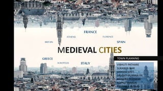
- 1. MEDIEVAL CITIES TOWN PLANNING FRANCE ITALY SPAIN GREECE ATHENS ACROPOLIS FLORENCE BRITAIN VIBHUTI PATHARE SUKANYA NAR VARSHA SHET SRUSHTI PUNYARTHI ASHWINI DUESKAR RUPALI THAKUR PRIYANKA JADHAV
- 2. MEDIEVAL CITIES DARK AGES FEUDALISM CRUSADES 400 500 600 800 900 1000 1100 1200 1300 1400 700 CLASSICAL GREECE &ATHENS DECLINE OF ROMAN EMPIRE RENAISSANCECONSTANTINE TO BYZANTINE FRANCE FLORENCE ITALY HIPPODAMUS ARISTOTLE CONSTANTINE EMPIRE T O W N P L A N N E R S HELLENTHIS PARIS TIMELINE
- 3. INDIA ITALY SPAIN FRANCE GREECE Medieval cities in the European Middle Ages. took many forms, Greatly in central-northern Italy based on partial democracy, while in Germany they became free cities, independent from local nobility. TYPES OF LOCATIONS e.g. the hill towns of southern France, southern Germany, and of central Italy. ORIENTATION topography. SHAPE geometric shapes; yet simple, geometric plans were adopted CLASSIFICATION Medieval towns can be classified according to function e.g.: Farm Towns - especially in Scandinavia and Britain Fortress Towns - Toledo, Edinburgh, Tours, Warwick Church Towns - York, Chartres Merchant Prince Towns - Florence, Siena Merchant Guild Towns - Hanseatic League towns
- 4. THE WALLED TOWN SECURITY WAS A MAJOR FACTOR. CLASSICAL ATHENS HAD PROTECTED ITSELF AGAINST ITS ENEMIES AND HAD BUILT THE “LONG WALLS,” HELLENISTIC WORLD, TOWNS WERE WALLED, TOWERS WERE BUILT, AND THE MULTI-FOCAL TOWN A SMALL NUMBER OF VILLAGES THAT HAD PREVIOUSLY CROWNED ITS HILLS. THIS PATTERN WAS TO BE REPLICATED DIFFERING INSTITUTIONAL NUCLEI—A CASTLE, CATHEDRAL, MONASTERY, OR MARKET—WHICH IN TIME CAME TO COMPLEMENT ONE ANOTHER. CARCASSONNE IT CONTAINS MARKET SQUARE, CASTLE & CHURCH OF ST.NAZZAIR. IRREGULAR PATTERN FOR STREETS IS SEEN. PLANNED TOWN IT HAD LAID OUT STRAIGHT STREETS, INTERSECTING AT RIGHT ANGLES, AND THUS ENCLOSING RECTANGULAR BLOCKS. PIRAEUS •THE PLANNED EUROPEAN CITY WAS NOT RESTRICTED TO THOSE THAT DERIVED FROM THE GREEKS OR THE ROMANS.
- 5. ORIGINS of MEDIEVAL ClTIES 1. CATHEDRAL, CHURCH, CLOISTER, 2. MONASTERY I.E. THE BISHOP’S SEAT 3. FORTRESSES (ROYAL CASTLES, PALACES; 4. PRINCELY COURTS) 5. THE MARKET PLACE/STAGING POINTS 6. THE FREE SETTLEMENTS (I.E. INDEPENDENT) 7. THE HISTORIC TOWNS (USUALLY OLD ROMAN ONES)
- 6. MEDIEVAL CITIES LOCATION OF MEDIEVAL CITIES EUROPE Piraeus Olynthus Rhodes
- 7. • The entire development of Athens has originated from the acropolis. It is the focal point of Athens. • The Acropolis hill, so called the "Sacred Rock" of Athens, is the most important site of the city. ACROPOLIS
- 8. TIMELINE 460 BC 432 BC 408 BC PIRAEUS OLYNTHUS RHODES
- 9. INTRODUCTION MEDIEVAL MORPHOLOGY OF TOWNS – BASTIDES AND MEDIEVAL TOWN PLANS BASTIDES IN MEDIEVAL TIMES GRID MORPHOLOGY IN MEDIEVAL ROMAN TIMES
- 10. ARCHAIC ATHENS (800 BC/750 BC -494 BC) Peisistratos built the first wall around the city. This wall was almost circular and had eight gates. Many monuments were built on the Acropolis No concrete town planning appears to have existed; the streets of the city were in their majority narrow and irregular in shape, while the inhabitants built their houses arbitrarily
- 11. Hippodamos devised an ideal city to be inhabited by 50,000 people He studied the functional problems of cities and linked them to the state administration system. As a result he divided the citizens into three classes (soldiers, artisans and 'husbandmen'), with the land also divided into three (sacred, public and private). Broad, straight streets Right angles Open space for development of agora Classical Athens (494 BC -478 BC)
- 12. DARK AGES (1,150 BC/1,100 BC–900 BC) Invasion of Peloponnese which came as a blow and the Athenians took time to stand up again. The attack resulted in the reduction of population.
- 13. Hellenistic Athens (339 BC - 168 BC) • Demand for regularity. • Acropolis was the initial core. • Some main streets started at its entrance, as well as from the road immediately surrounding it, proceeded radially throughout the city and came to an end at the city wall gates. • In doing so, they left some free areas, the most important of which was Agora. PRIVATE SPACE OPEN SPACE
- 14. Roman Athens(183 BC-BC 31) ACROPOLIS ATHENIAN AGORA- NEW BUILDINGS BUILT HERE NEW NEW ROMAN CLOSED AGORA- HOUSES AND BUILDINGS HERE WERE DEMOLISHED.
- 15. ATHENS IN THE 19TH CENTURY • orientation was aimed at Piraeus and primarily the Acropolis, at whose feet it spread out in an open embrace. • extending from it to the West, the North and the East. • The road network was elaborated in part as spokes with hubs at circular plazas, and in part as horizontals and verticals in the direction of the main axes, always with absolute regularity. ACROPOLIS PIRAEUS SPOKES AT CIRCULAR PLAZAS HORIZONTAL & VERTICAL • The shape of the main axes would be an isosceles triangle, with its peak at today’s Omonia Square, its sides defined by Piraeus and Stadiou streets, and Ermou Street as its base.
- 16. FORMATION OF SQUARE BY FOUR BOULEVARDS AND TO HOUSE THE ROYAL PALACE
- 17. THE EXPANSION OF FLORENCE BEYOND ROMAN WALLS FLORENCE FLORENCE, Tuscany – CAPITAL • has a population of around half a million inhabitants, • spreads on the banks of the Arno, between the Adriatic and the Tyrrhenian seas. • It is a city which bustles with industry and craft, commerce and culture, art and science. • it is easily accessible from most important places both in Italy and abroad
- 21. Typical layout of medieval manor
- 23. OPEN SPACES •DIVERSE LAND USE MIX IN A CITY OF SHORT DISTANCES •HIGH QUALITY GREEN SPACES •SPATIAL CONCEPT-PRINCIPLES OF GRADUAL DENSITY •FLEXIBLE MOBILITY IN ATTRACTIVE URBAN SPACES
- 24. STREETS NETWORK Rectangular in plan, it was enclosed in a wall about 1800 meters long. The built-up area, like all the cities founded by the Romans, was characterized by straight roads which crossed at right angles.