Recent Advances in Crop Classification
•Télécharger en tant que PPTX, PDF•
2 j'aime•2,059 vues

Remote sensing –Beyond images Mexico 14-15 December 2013 The workshop was organized by CIMMYT Global Conservation Agriculture Program (GCAP) and funded by the Bill & Melinda Gates Foundation (BMGF), the Mexican Secretariat of Agriculture, Livestock, Rural Development, Fisheries and Food (SAGARPA), the International Maize and Wheat Improvement Center (CIMMYT), CGIAR Research Program on Maize, the Cereal System Initiative for South Asia (CSISA) and the Sustainable Modernization of the Traditional Agriculture (MasAgro)

Recommandé
Recommandé
Contenu connexe
Similaire à Recent Advances in Crop Classification
Similaire à Recent Advances in Crop Classification (20)
Plus de CIMMYT
Plus de CIMMYT (20)
Dernier
Dernier (20)
Recent Advances in Crop Classification
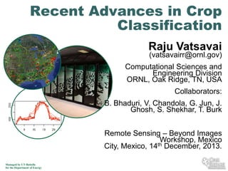
- 1. Recent Advances in Crop Classification Raju Vatsavai (vatsavairr@ornl.gov) Computational Sciences and Engineering Division ORNL, Oak Ridge, TN, USA Collaborators: B. Bhaduri, V. Chandola, G. Jun, J. Ghosh, S. Shekhar, T. Burk Remote Sensing – Beyond Images Workshop, Mexico th December, 2013. City, Mexico, 14 Managed by UT-Battelle for the Department of Energy
- 2. Outline Better spectral and spatial resolution – Fine-grained (species) classification – Complex (compound) object recognition Challenges – Limited ground-truth: Semi-supervised learning (SSL) – Spatial homogeneity: SSL + Markov Random Fields – Spatial heterogeneity: Gaussian Process (GP) learning – Aggregate vs. Subclasses: Fine-grained classification – Phenology: Multi-view learning Conclusions 2 Managed by UT-Battelle for the Department of Energy
- 3. Challenge 1: Limited Training Data Increasing spectral resolution: 4 to 224 Bands Challenges – #of training samples ~ (10 to 30) * (number of dimensions) – Costly ~ $500-$800 per plot (depends on geographic area) – Accessibility – Private/Privacy issues (e.g., USFS may average 5% denied access) – Real-time – Emergency situations, such as, forest fires, floods Solutions – Reduce number of dimensions – (Artificially) Increase number of samples – By incorporating unlabeled samples Naïve semi-supervised (Nigam et al. [JML-2000]) – Bagging [Breiman, ML-96] 3 Managed by UT-Battelle for the Department of Energy
- 4. True Distribution Estimated Distribution (Small Samples; MLE are good asymptotically) 4 Managed by UT-Battelle for the Department of Energy
- 5. Initial Estimates + Unlabeled Samples 5 Managed by UT-Battelle for the Department of Energy
- 6. Iteratively Update Parameters Using Unlabeled Samples 6 Managed by UT-Battelle for the Department of Energy
- 7. Iteratively Update Parameters Using Unlabeled Samples 7 Managed by UT-Battelle for the Department of Energy
- 8. Iteratively Update Parameters Using Unlabeled Samples 8 Managed by UT-Battelle for the Department of Energy
- 9. Final parameters after convergence 9 Managed by UT-Battelle for the Department of Energy
- 10. Solution: Semi-supervised Learning Assume Samples are generated by a Gaussian Mixture Model (GMM) • Estimate Parameters with Expectation Maximization (EM) E-Step { } T 1 ˆj ˆ j ˆj xi - m k ) S-1,k ( xi - m k ) ( 2 eij = -1/2 T M 1 ˆ ˆ ˆ ˆ Slk exp - ( xi - mlk ) S-1,k ( xi - mlk ) ål=1 l 2 ˆ Skj -1/2 exp - { M-Step aj å = N i=1 N eij N ˆj m k+1 , i=1 ij i N i=1 ij å ˆ Sk+1 = i=1 j N and å ex, = å e ˆj ˆj eij ( xi - m k+1 ) ( xi - m k+1 ) å N e i=1 ij ithdata vector, jth class 10 Managed by UT-Battelle for the Department of Energy T }
- 11. Results Small Subset of 20 Training Samples 10 Classes, 100 Training Samples (10-30) x No of dimensions / class 20 labeled + 80 unlabeled samples S u p e rvise d (B C ) vs. S e m i-su p e rvise d (B C -E M ) 80 Ranga Raju Vatsavai, Shashi Shekhar, Thomas E. Burk: A SemiSupervised Learning Method for Remote Sensing Data Mining. ICTAI 2005: 207-211 A c c u ra c y 70 60 50 B C - W o rs t B C - B est B C (E M ) - B e s t 40 30 0 20 40 60 80 100 F ixe d U n la b e le d (8 5 ) a n d V a ryin g (In c re a s in g ) L a b e le d 11 Managed by UT-Battelle for the Department of Energy 120
- 12. Challenge 2: Spatial Homogeneity Spatial Homogeneity Bayes Theorem: p(c|x) = p(x|c)p(c)/p(x) For Markov random field , the conditional distribution of a point in the field given all other Prior Distribution Model: points is only dependent on its neighbors. p{ ( s ) | Where (S s )} p{ ( s ) | ( s )} For a first - order neighborhood system S is an image lattice S s denotes a set of points in S excluding s p( ) 1 z c t ( e C ) e.q.1 c x x s x x 12 Managed by UT-Battelle for the Department of Energy x x x x s x x x x x x x x x x s x x x x x x t ( ) is the total number of horizantally and vertially neighboring points of different value in in clique c . e.q.1 is Gibbs distribution and therefore, an MRF. is emphirically determined weight. c t ( ) 1 if ( i, j ) otherwise. { 0, ( k ,l )
- 13. Solution: Spatial Classification • • BC (60%) BC-EM (68%) BC-MRF (65%) BC-EM-MRF (72%) • 13 Managed by UT-Battelle for the Department of Energy Shashi Shekhar, Paul R. Schrater, Ranga Raju Vatsavai, Weili Wu, Sanjay Chawla: Spatial contextual classification and prediction models for mining geospatial data. IEEE Transactions on Multimedia 4(2): 174-188 (2002) Baris M. Kazar, Shashi Shekhar, David J. Lilja, Ranga Raju Vatsavai, R. Kelley Pace: Comparing Exact and Approximate Spatial Autoregression Model Solutions for Spatial Data Analysis. GIScience 2004: 140-161 Ranga Raju Vatsavai, Shashi Shekhar, Thomas E. Burk: An efficient spatial semi-supervised learning algorithm. IJPEDS 22(6): 427-437 (2007)
- 14. Challenge 3: Spatial Heterogeneity Going From Local to Global – Signature continuity is a problem in classifying large geographic regions Solutions – Assume constant variance structure over space, that is, train one model, use it on other regions – poor performance – Train separate model for each region – needs lot of data – Train one model covering samples from all regions – needs an adaptive model to capture spatial heterogeneity 14 Managed by UT-Battelle for the Department of Energy
- 15. Solution: Gaussian Process (GP) Classification Change of distribution over space is modeled by p(x | y) ~ N ( , ) p ( x ( s ) | y ) ~ N ( ( s ), ( s )) Goo Jun, Ranga Raju Vatsavai, Joydeep Ghosh: Spatially Adaptive Classification and Active Learning of Multispectral Data with Gaussian Processes. SSTDM 2009: 597-603 15 Managed by UT-Battelle for the Department of Energy
- 16. Challenge 4: Aggregate Vs. Subclasses Spectral Classes vs. Thematic Classes Insufficient Ground-truth Subjective/domain-dependent Parametric – assumption violations 16 Managed by UT-Battelle for the Department of Energy
- 17. Solution: Sub-class Classification Coarse-to-fine Resolution Information Extraction – Characterizing the nature of the change Fallow to Switch grass, Wheat to Corn, or crop damage Coarse Classes (MODIS) Each class is Gaussian Sub-Classes (AWiFS) Each class is MoG Model Selection (BIC,AIC) How many components? Parameter Estimation Semi-supervised Learning Characterize Changes 17 Managed by UT-Battelle for the Department of Energy
- 18. Results: Sub-class Classification Dataset: LandSat ETM+ Data (Cloquet, Carleton, MN, May 31, 2000) 1. •6 Bands, 4 Classes, 60 plots •Independent test data: 205 plots •Forest (4 Subclasses; 2 subclasses are combined into 1) 2. •2 Labeled plots per sub-class 18 Managed by UT-Battelle for the Department of Energy Ranga Raju Vatsavai, Shashi Shekhar, Budhendra L. Bhaduri: A Learning Scheme for Recognizing Sub-classes from Model Trained on Aggregate Classes. SSPR/SPR 2008: 967-976 Ranga Raju Vatsavai, Shashi Shekhar, Budhendra L. Bhaduri: A Semi-supervised Learning Algorithm for Recognizing Sub-classes. SSTDM 2008: 458-467
- 19. Crop (Opium) Classification Helmand accounts for 75% of the world’s opium production GeoEye 4-Band Image, 13th May 2011 19 Managed by UT-Battelle for the Department of Energy
- 20. Ground-truth (Aggregate Classes) Ground-truth collected for 4 classes 1-Other Crops (Yellow), 2-Poppy (Red), 3-Soils (Cyan), 4-Water (Blue) 20 Managed by UT-Battelle for the Department of Energy
- 21. Classified (Aggregate) Image Maximum Likelihood Classification (Widely used) Also did lot of other standard classification schemes – Decision Trees, Random Forest, Neural Nets, … 21 Managed by UT-Battelle for the Department of Energy
- 22. Classified (Sub-classes) Image Sub-class classification – Identifying finer classes from aggregate class – new scheme – 1 -> 11,12,13; 2 -> 21,22,23, 3->31,32, 4->41 (Overall Accuracy Improved by ~10%) 22 Managed by UT-Battelle for the Department of Energy
- 23. Challenge 5: Phenology AWiFS (May 3, 2008; FCC (4,3,2)) 23 Managed by UT-Battelle for the Department of Energy AWiFS (July 14, 2008; FCC (4,3,2)) Thematic Classes: C-Corn, S-Soy
- 24. More Formally 24 Managed by UT-Battelle for the Department of Energy
- 25. Solution: Multi-view Learning Multi-temporal images are different views of same phenomena – Learn single classifier on different views, chose the best one through empirical evaluation – Combine different views into a single view, train classifier on single combined view – stacked vector approach – Learn classifier on single view and combine predictions of individual classifiers – multiple classifier systems Bayesian Model Averaging – Co-training Learn a classifier independently on each view Use predictions of each classifier on unlabeled data instances to augment training dataset for other classifier Varun Chandola, Ranga Raju Vatsavai: Multi-temporal remote sensing image classification - A multi-view approach. CIDU 2010: 258-270 25 Managed by UT-Battelle for the Department of Energy
- 26. Conclusions We developed several innovative solutions that address big spatiotemporal data challenges – – – – Semi-supervised learning Spatial classification (homogeneity and heterogeneity) Temporal classification Sub-class classification Ongoing – Transfer learning: Adopt model learned in area to the other with very little additional ground-truth – Compound object classification (multiple instance learning) – Semantic classification (beyond pixels and objects) – Scaling Heterogeneous (OpenMP + MPI + CUDA) Cloud computing (MapReduce) 26 Managed by UT-Battelle for the Department of Energy
- 27. Acknowledgements Prepared by Oak Ridge National Laboratory, P.O. Box 2008, Oak Ridge, Tennessee 378316285, managed by UT-Battelle, LLC for the U. S. Department of Energy under contract no. DEAC05-00OR22725. Collaborators and Sponsors 27 Managed by UT-Battelle for the Department of Energy