SlideShare une entreprise Scribd logo
1  sur  47
Chap 2. Physiography of India
Himalayas
LM Thakare - Physiography of India - Himalayas
1. Western H.
2. Central H.
3. Eastern H.
4. NE ranges
5. Brahmaputra Valley
6. Northern plains
7. Western plains
8. North central Highlands
9. South C. H.
10. North Deccan
11. South Deccan
12. Eastern Plateau
13. Western Ghats
14. Eastern Ghats
15. Western Coast
16. Eastern Coasts
17. Islands
Mountain = >1200 m
Hilly = 700 – 1200m
Plateau = 700 -300 m
Highland = 500 m
Plain = < 300m
LM Thakare - Physiography of India - Himalayas
THE NORTHERN MOUNTAINS
HIMALAYAS
1. Origin of Himalayas – Plate tectonics
2. Divisions of Himalayas – Two types
3. Highest peaks of each range
4. Mountain passes
5. Glaciers
6. Importance of Himalayas
LM Thakare - Physiography of India - Himalayas
Origin of Himalayas
Plate tectonics and Geosynclines
Formation of Himalayas
K Siddharth
LM Thakare - Physiography of India - Himalayas
Geological History of Himalayas
• Rock formation : Pre-Cambrian era (600 mya) to recent.
• Acc. to R. L. Singh (1971)
LM Thakare - Physiography of India - Himalayas
VII
Tertiary – Oligocene
(25-40 mya)
Collision of Indian plate with Eurasian.
Himadri / Greater Himalayas
Mid – Miocene
(14 mya)
Himachal / Lesser Himalayas
Pliocene (750 Tya) Shiwalik / outer Himalayas
Mid -pliocene Sedimentation along Indo-Gangetic trough
Pliestocene Evolution of present drainage pattern , Narmada –Tapi trough
Phase Period Significance
I
Pre-Cambrian
(600 mya)
Cooling and Solidification of earth crust – Gneisses and
Granite.
II
Cambrian Period
(500 mya)
undulations and crumpling of Dharwarian Sediements.
III calcareous deposition in Cuddapah and Vindhyan basins.
IV
Carboniferous period
(270 mya)
Gondwana rocks formed-95% coal resources of India.
V 200 mya
Gondwana ruptured peninsula drifted to north. Upliftment of
Vindhya. Formation of western Ghats
VI
Cretaceous
(135 mya)
Lava flow – formation of Deccan trap
LM Thakare - Physiography of India - Himalayas
Formation of Himalayas
• Origin and formation of Himalayas
• Plate tectonics - Age of Himayalas is 75 to 45 mya
• The Himalayas continue to rise more than 1 cm a year -- a growth rate of 10 km in a
million years
Classifications
CHARACTERISTICS OF HIMALAYAS
• The most characteristic features of the Himalayas are their
• soaring heights,
• steep-sided jagged peaks,
• valley and alpine glaciers
• topography deeply cut by erosion
• river gorges,
• complex geologic structure, and
• series of elevational belts (or zones)
• that display different ecological associations of flora, fauna, and climate.
LM Thakare - Physiography of India - Himalayas
Over the past 65 million years, powerful global plate-tectonic forces have moved the
Earth’s crust to form the band of Eurasian mountain ranges—including the
Himalayas—that stretch from the Alps to the mountains of Southeast Asia.
LM Thakare - Physiography of India - Himalayas
Physiographic divisions of Himalayas
1
Trans – Himalayan ranges
1. Karakoram range
2. Ladakh
3. Zaskar
4. Kailash
LM Thakare - Physiography of India - Himalayas
1 Karakoram range
2 Ladakh range
3 Kailash
4 Zaskar
5 Greater Himalayas
6 Lesser Himalayas
7 Shiwalik / outer Him.
1
2
3
45
6
7
7
LM Thakare - Physiography of India - Himalayas
Trans Himalayas
LM Thakare - Physiography of India - Himalayas
1.Karakoram range
- It is also known as Krishnagiri situated in the northern most range of the Trans-Himalayan ranges.
- The Karakoram is a mountain range spanning the borders of China, India, and Pakistan, with the northwest
extremity of the range extending to Afghanistan and Tajikistan.
- It extends eastwards from the Pamir for about 800 km.
- It is the second highest mountain range in the world
- Length = 500km (most heavily glaciated part of the world outside the polar region)
- Average width is 120-140 km.
- greatest Glaciers (22) of the world located Siachen Glacier at 76 km (2nd longest in world) and the Biafo
Glacier at 63 km (3rd largest), Godwin-Austen Glacier and Baltoro Glacier
- elevation 5,500 m.
- Some of the peaks are more than 8,000 m msl
- K2 is the second highest peak in the world and
- It has been named as Godwin Austen by the Britishers and Qogir by the China.
- Major peaks
•K2: 8,611 metres
•Gasherbrum : 8,080 metres
LM Thakare - Physiography of India - Himalayas
- Godwin-Austen Glacier
1. Karakoram range - Baltoro Glacier - is one of the
longest glaciers outside the polar regions
LM Thakare - Physiography of India - Himalayas
1. Karakoram range
P O K
LM Thakare - Physiography of India - Himalayas
• Northern extension of K2 range
• elevation 6000 m.
• length =370km
• highest peak = Stok Kangri (6,153 m)
• No major peaks.
• It lies to the north of the Leh
• It lies between the Indus and Shyok river valleys
• an important part of the Trans-Himalayan range that merges with the
Kailash range in Tibet.
• The important passes that lie to the north east of Leh are- Kardung
La, and Digar La.
• The extension of the Ladakh Range into China is known as Kailash
Range.
• Fine Pashmina Wool
3. Zaskar range
• Runs parallel to great Himalayan Range.
• The Nanga Parbat (8126 m) is the highest point in the north-
west
• adjoining Deosai Mountain and Ladakh range is in north.
• elevation 5800 m.
• length 300 km
• few peaks of this range attains height of over 6000 m
• The Rakaposhi-Haramosh ranges beyond the Indus may be
treated as extension of the Ladakh range to the northwest.LM Thakare - Physiography of India - Himalayas
4. Kailash range
• It is a branch of the Ladakh range which is
situated in the western Tibet. Its average elevation
is elevation 5500 m.
• Length 57 km
• highest peak =Mount Kailash (6638) is the
highest peak of this range.
• River Indus originates from the northern slope of
the Kailash range.
• The mountain is located near Lake
Manasarovar and Lake Rakshastal, close to
the source of some of the longest Asian rivers:
the Indus, Sutlej, Brahmaputra, and Karnali also
known as Ghaghara.
LM Thakare - Physiography of India - Himalayas
1. Trans – Himalayan ranges1. Karakoram range
2. Ladakh range 3. Zaskar range 4. Kailash range
- It is also known as Krishnagiri
situated in the northern most
range of the Trans-Himalayan
ranges.
- Afghanistan and China and
acts as watershed between
India and Turkestan.
- It extends eastwards from
the Pamir for about 800 km.
- The average width is 120-
140 km.
- elevation 6100 m.
- length =500km
- greatest Glaciers of the world
located
- Some of the peaks are more
than 8,000 m msl
- K2 is the second highest
peak in the world and
- It has been named as
Godwin Austen by the
Britishers and Qogir by the
China.
• Northern extension of
K2 range
• elevation 6000 m.
• length =370km
• highest peak = Stok
Kangri (6,153 m)
• No major peaks.
• It lies to the north of the
Leh
• It lies between
the Indus and Shyok ri
ver valleys
• an important part of the
Trans-Himalayan range
that merges with the
Kailash range in Tibet.
• The important passes
that lie to the north east
of Leh are- Kardung La,
and Digar La.
• Fine Pashmina Wool
• Runs parallel to great
Himalayan Range.
• The Nanga Parbat (8126
mt) is the highest point in
the north-west
• adjoining Deosai Mountain
• Ladakh range is in north
• elevation 5800 m.
• Length 300 km
• few peaks of this range
attains height of over 6000
m
• The Rakaposhi-Haramosh
ranges beyond the Indus
may be treated as
extension of the Ladakh
range to the northwest.
• It is a branch of the Ladakh
range which is situated in
the western Tibet. Its
average elevation is
elevation 5500 m.
• Length 57 km
• highest peak =Mount
Kailash (6638) is the
highest peak of this range.
River Indus originates from
the northern slope of the
Kailash range.
• The mountain is located
near Lake
Manasarovar and Lake
Rakshastal, close to
the source of some of
the longest Asian rivers:
the Indus, Sutlej, Brahmaputr
a, and Karnali also known
as Ghaghara.
The extension of the Ladakh Range into
China is known as Kailash Range.LM Thakare - Physiography of India - Himalayas
LM Thakare - Physiography of India - Himalayas
Greater Himalayas
• The Great Himalayas or Greater Himalayas (Hindi: महान हहमालय हहमाहि) is the highest mountain
range of the Himalayan Range System, part of the Alpines belt.
• This range is separated from Trans Himalaya mountain ranges by the Main Central Thrust Fault, which
lies north of it. Entities the range is within include Pakistan, China, India, Nepal, and Tibet.
• The world's highest peak, Mount Everest, and other "near−highest" peaks -
K2, Kangchenjunga, Lhotse, Nanga Parbat, etc., are part of the Greater Himalayas range.
• The total west to east extension of the great Himalayas is 2400 km and
• their average elevation is 6000 m
• They are home to many glaciers like Gangotri Glacier, Satopanth Glacier etc.
LM Thakare - Physiography of India - Himalayas
Highest peaks in
Greater Himalayas
•Mount Everest was first located
by George Everest, the then
Surveyor General of India in
1841 and in 1852 it was
established as the highest peak
of the world by the Great
Trigonometrical Survey of India.
LM Thakare - Physiography of India - Himalayas
Average elevation of 6,100 m above sea level and an average width of about 25 km.
It is mainly formed of the central crystallines (granites, schist and gneisses) overlain by
metamorphosed sediments [limestone].
The folds in this range are asymmetrical with steep south slope and gentle north
slope giving ‘hog back (a long, steep hill or mountain ridge)’ topography.
State Passes of Greater Himalayas
Jammu and Kashmir
1.Burzil Pass
2.Zoji La [La means pass]
Himachal Pradesh
1.Bara Lacha La
2.Shipki La [The Hindustan-Tibet Road connecting Shimla with Gartok in Western Tibet]
Uttarakhand
1.Thaga La
2.Niti Pass
3.Lipu Lekh
Sikkim
1.Nathu La
2.Jelep La [important trade route connecting Kalimpong (near Darjeeling) with Lhasa in
Tibet, passes through Jelep La (4,386 m)LM Thakare - Physiography of India - Himalayas
LM Thakare - Physiography of India - Himalayas
• Lower/ inner/middle or Lesser Himalayas is 80 km in width, 4000-4500m average
elevation
--- Geology – unfossiliferous or metamorphosed crystalline rocks – slate,
limestone, qaurtzites.
--- The region is subject to extensive erosion due to heavy rains, deforestation and
urbanization along the hill slopes.
Lesser Himalayas
LM Thakare - Physiography of India - Himalayas
• Pirpanjal in Jammu and Kashmir,
• Dhauladhar in Himachal Pradesh and Jammu and Kashmir.
• Nag Tibba in Himachal Pradesh and Uttarakhand, etc.
• are some of the famous mountain ranges.
• The Srinagar valley lies in the Lesser Himalayas.
• The Jhelum meanders and enters the Wular Lake, and leaves it near Sopore.
• This Srinagar Valley is between the greater Himalayas and the Lesser Himalaya in Kashmir.
LM Thakare - Physiography of India - Himalayas
Assignment 6
1. Mapping of all the Himalayan ranges
2. Highest peaks – Trans / Greater Him.
3. List of all peaks, passes and valleys along
the Him range.
LM Thakare - Physiography of India - Himalayas
Shiwalik / Outer Himalayas
Siwalik Range, also called Siwalik Hills or Outer Himalayas, Siwalik also spelled Shiwalik,
• sub-Himalayan range of the northern Indian subcontinent.
• It extends west-northwestward for more than 1,600 km from the Tista River in Sikkim state, northeastern
India, through Nepal, across northwestern India, and into northern Pakistan.
• 16 km width
• An average elevation of 900 to 1,200 meters.
• It rises abruptly from the plain of the Indus and Ganges (Ganga) rivers (south) and parallels the main range
of the Himalayas (north), from which it is separated by valleys.
• The Shiwalik are sometimes considered to include the
southern foothills of the Assam Himalayas, which
extend eastward for 640 km across southern Bhutan to
the bend of the Brahmaputra River.
• The name Siwalik (from Sanskrit, meaning “Belonging to
[the God] Shiva”) was formerly restricted, is the 320 km
of foothills in India extending from the Ganges River at
Haridwar, Uttarakhand state, northwestward to the
Beas River.
Nepal’s portion of the range is called the Churia Range.
Abi Gamin is a highest mountain peak in Shiwalik mostly
situated in the Chamoli district of UttarakhandLM Thakare - Physiography of India - Himalayas
LM Thakare - Physiography of India - Himalayas
Assi -7
4 divisions:
1. Location w .r to Indian subconti
2. Peak.
3. Significant –passes, valleys,
4 mt ranges
5Geology
6 Width and
7 avrg elevation,
8 length
LM Thakare - Physiography of India - Himalayas
Longitudinal divisions of Himalayas
1.The Kashmir /Punjab/ Himachal Himalayas
2.The Kumaun Himalayas
3.The Central/ Nepal Himalayas
4.The Assam/ Eastern Himalayas
LM Thakare - Physiography of India - Himalayas
The Kashmir /Punjab/ Himachal Himalayas
Kashmir Himalayas lies between the Indus River and Sutlej. A significant portion
of the Himalayas lies in Jammu and Kashmir and Himachal Pradesh..
In Jammu and Kashmir region:
-- high snow-covered peaks, deep valleys, interlocked spurs, and High Mountain passes.
The range stretches for 700km in length and 500 km in width.
It has a height of 3000 m with a large number of glaciers.
The Ladakh region of the Kashmir Himalayas is dominated by cold desert conditions.
The Kashmir valley = surrounded by the Greater and the Lesser Himalayas.
The Karewa soil is found here and this area is famous for the saffron and other
dry fruit cultivation. Important passes and peaks (PTO).
In the Himachal Pradesh Region:
All the three ranges- the greater, the lesser, and the outer Himalayas are well represented in this region.
The northern slopes are covered with thick forests, plains, and lakes.
The southern slopes are rugged with forest-clad.
The Kangra valley, Kullu- Manali lies here.
These areas are highly productive and well known for orchards and scenic beauty.
Dalhousie, Shimla, Chamba, Kullu- Manali and Dharam sala is the important hill station in this region.
The important passes are Rohtang pass, Bara-Lacha, Shipki La.
LM Thakare - Physiography of India - Himalayas
Important passes of the Kashmir Himalayas: Pir panjal,
Banihal, Zoji La, Burzil, Khardungla, Pensi- La, Saser-
La, Lanak- La, Jara- La, Tasaka-La, Umasi-La and
Qara-Tagh-La.
The important snow-capped peaks are
Nanda Devi, Trisul, Nunkun, Kamath and
Nanga-Parbat
LM Thakare - Physiography of India - Himalayas
The Kumaun Himalayas
• This division lies between the Satluj and Kali River.
• The highest peak in this division is Nanda Devi.
• Important peaks =Nanda Devi, Trisul, Kedarnath, Dunagiri, Kamet, Badrinath, Jaonli, Gangotri, and
Bandarpunch.
• Glaciers= Pindari, Gangotri, and Milam
• Hill stations = Mussorie, Nainital, Ranikhet, Almora, and Bageshwar.
• Passes = Thaga La, Muling La, Mana, Mangsha Dhura, and Lipu Lekh.
LM Thakare - Physiography of India - Himalayas
The Central / Nepal Himalayas
This division stretches from the Kali River to the Tista River. The major part of it lies in Nepal except for the
extreme eastern part- Sikkim Himalayas. The important peaks are the Mt. Everest, Kanchenjunga, Makalu, Dhaula
Giri, Annapurna, Manaslu, and Gosainath.
Nathu La and Jelep La are the important passes in this region.
LM Thakare - Physiography of India - Himalayas
The Assam/ Eastern Himalayas
• lies between Tista and the Brahmaputra
River (Dihang).
• It occupies the state of Arunachal
Pradesh in India and Bhutan.
• On the southern border of Arunachal
Pradesh, it takes a southerly turn, and
ranges are arranged in North-South
direction passing through Nagaland,
Manipur, Mizoram, and Tripura called
Purvanchal.
• The Purvanchal is joined by Meghalaya
Plateau in the west and its extension of
the Myanmar mountain chain continues
to Andaman and Nicobar Islands and
the Archipelago of Indonesia.
• The Himalayas rise very rapidly in the
plains of Assam and narrow at the
foothills of Shiwaliks.
PDF Here LM Thakare - Physiography of India - Himalayas
LM Thakare - Physiography of India - Himalayas
Assam Himalayas
LM Thakare - Physiography of India - Himalayas
• It comprises of many hills
called Aka hills, Dafla hills, Miri
hills, Abor hills, Mishmi hills,
and Namcha Barwa.
• The important hills of eastern
Himalayas are Pakai bum,
Manipur hills, Blue Mountain,
Tripura range, and Brail range.
• The important passes in this
region are Bomdi La,
Yonggyap, Diphu, Pangsau,
Tse La, Dihang, Debang,
Tunga, and Bom La.
LM Thakare - Physiography of India - Himalayas
Significance of Himalayas
1. Climatic Influence,
2. Defence,
3. Source of Rivers,
4. Fertile Soil,
5. Hydroelectricity,
6. Forest Wealth,
7. Agriculture,
8. Tourism,
9. Pilgrimage,
10. Minerals
LM Thakare - Physiography of India - Himalayas
1. Climatic Influence:
• By virtue of their high altitude, length and direction, they effectively intercept the summer monsoons coming from the
Bay of Bengal and Arabian Sea and cause precipitation in the form of rain or snow.
• Besides, they prevent the cold continental air masses of central Asia from entering into India.
• No Himalayas, the whole of India would have been a desert in the absence of precipitation and its winters would have
been very severe under the influence of cold air masses coming from Central Asia.
• According to the latest meteorological studies, the Himalayas are responsible for splitting the jet stream into two
branches and these in turn play an extremely important role in bring monsoons in India.
2. Defence:
The Himalayas have been protecting India from outside invaders since the early times thus serving as a defence barrier. But
the Chinese aggression on India in October, 1962 has reduced the defence significance of the Himalayas to a considerable
extent.
3. Source of Rivers:
• Abundant rainfall and vast snow-fields as well as large glaciers
• Snow melt in summer provides water to these rivers even during dry season and these are perennial rivers.
• The Himalayan Rivers, along with hundreds of their tributaries, form the very basis of life in the whole of north India.
LM Thakare - Physiography of India - Himalayas
4. Fertile Soil:
The great rivers and their tributaries carry enormous quantities of alluvium while descending from the Himalayas. This is
deposited in the Great Plain of North India in the form of fertile soil, making the plain one of the most fertile lands of the
world.
It has been estimated that the Ganga and the Indus carry 19 and 10 lakh tonnes of silt, per day respectively and the silt carried
by the Brahmaputra is even more.
5. Hydroelectricity:
• used for producing hydroelectricity.
• There are natural waterfalls at certain places while dams can be constructed across rivers at some other places.
6. Forest Wealth:
• a succession of vegetal cover from the tropical to the Alpine.
• The Himalayan forests provide fuel wood, raw materials , medicinal plants
• Several patches are covered with grass offering rich pastures for grazing animals.
7. Agriculture:
• The Himalayas do not offer extensive flat lands for agriculture but some of the slopes are terraced for cultivation.
• Rice is the main crop on the terraced slopes. Tea is a unique crop which can be grown on the hill slopes only.
• The other crops are wheat, maize, potatoes, tobacco and ginger.
• A wide variety of fruits such as apples, pears, grapes, mulberry, walnut, cherries, peaches, apricot, etc. are also grown in the
Himalayan region.
LM Thakare - Physiography of India - Himalayas
8. Tourism:
• By virtue of their scenic beauty and healthy environment, cool and comfortable climate
• when the neighbouring plains are reeling under the scorching heat of the summer season.
• winter sports and the craze to enjoy snowfall
• Srinagar, Dalhousie, Dharamshala, Chamba, Shimla, Kulu, Manali, Mussoorie, Nainital, Ranikhet, Almora, Darjeeling,
Mirik, Gangtok, etc. are important tourist centres in the Himalayas.
9. Pilgrimage:
Large number of pilgrims trek through difficult terrain to pay their reverence to these sacred shrines. Kailas, Amarnath,
Badrinath, Kedamath, Vaishnu Devi, Jwalaji, Uttarkashi, Gangotri, Yamunotri, etc. are important places of pilgrimage.
10. Minerals:
• The Himalayan region contains many valuable minerals. There are vast potentialities of mineral oil in the tertiary
rocks. Coal is found in Kashmir.
• Copper, lead, zinc, nickel, cobalt, antimony, tungsten, gold, silver, limestone, semi-precious and precious stones,
gypsum and magnetite are known to occur at more than 100 localities in the Himalayas.
LM Thakare - Physiography of India - Himalayas
THE NORTHERN MOUNTAINS
LM Thakare - Physiography of India - Himalayas
Thank you
LM Thakare - Physiography of India - Himalayas

Contenu connexe

Tendances

Physical features of india
Physical features of indiaPhysical features of india
Physical features of indiaArtsUday
 
HIMALAYAN MOUNTAIN
HIMALAYAN MOUNTAINHIMALAYAN MOUNTAIN
HIMALAYAN MOUNTAINshubhamrathi
 
Geomorphic processes
Geomorphic processesGeomorphic processes
Geomorphic processesPramoda Raj
 
Topography (the Karakoram range)
Topography (the Karakoram range)Topography (the Karakoram range)
Topography (the Karakoram range)Haroon Khaliq
 
Human Geography Nature and scope
Human Geography Nature and scopeHuman Geography Nature and scope
Human Geography Nature and scopessuser8eb588
 
peninsula plateau made by yash chauhan
peninsula plateau made by yash chauhanpeninsula plateau made by yash chauhan
peninsula plateau made by yash chauhanYash Chauhan
 
Interior of the earth
Interior of the earthInterior of the earth
Interior of the earthparag sonwane
 
Social science power point presentaion.
Social science power point presentaion.Social science power point presentaion.
Social science power point presentaion.JIBIN JOSEPH
 
The physiographic features of india - By Jnanam Shah
The physiographic features of india - By Jnanam ShahThe physiographic features of india - By Jnanam Shah
The physiographic features of india - By Jnanam ShahSoham
 
The physical features of india
The physical features of indiaThe physical features of india
The physical features of indiaAanikett
 
Physical features of india
Physical features  of indiaPhysical features  of india
Physical features of indiaAnkush Saini
 
Sst project of PHysical featuers of india
Sst project of PHysical featuers of indiaSst project of PHysical featuers of india
Sst project of PHysical featuers of indiaRaghav Sudan
 
Evolution of himalaya
Evolution of himalayaEvolution of himalaya
Evolution of himalayaShivam Jain
 
Fundmetal concepts of geomorphology
Fundmetal concepts of geomorphologyFundmetal concepts of geomorphology
Fundmetal concepts of geomorphologyNikhil Sherekar
 
Physical Features of India 2 northern plains
Physical Features of India 2 northern plainsPhysical Features of India 2 northern plains
Physical Features of India 2 northern plainsMahendra SST
 

Tendances (20)

Physical features of india
Physical features of indiaPhysical features of india
Physical features of india
 
HIMALAYAN MOUNTAIN
HIMALAYAN MOUNTAINHIMALAYAN MOUNTAIN
HIMALAYAN MOUNTAIN
 
Geomorphic processes
Geomorphic processesGeomorphic processes
Geomorphic processes
 
The Indian Ocean
The Indian OceanThe Indian Ocean
The Indian Ocean
 
The northern plains 1 final-g
The northern plains 1 final-gThe northern plains 1 final-g
The northern plains 1 final-g
 
Topography (the Karakoram range)
Topography (the Karakoram range)Topography (the Karakoram range)
Topography (the Karakoram range)
 
Human Geography Nature and scope
Human Geography Nature and scopeHuman Geography Nature and scope
Human Geography Nature and scope
 
peninsula plateau made by yash chauhan
peninsula plateau made by yash chauhanpeninsula plateau made by yash chauhan
peninsula plateau made by yash chauhan
 
Interior of the earth
Interior of the earthInterior of the earth
Interior of the earth
 
Social science power point presentaion.
Social science power point presentaion.Social science power point presentaion.
Social science power point presentaion.
 
Mahanadi
MahanadiMahanadi
Mahanadi
 
The physiographic features of india - By Jnanam Shah
The physiographic features of india - By Jnanam ShahThe physiographic features of india - By Jnanam Shah
The physiographic features of india - By Jnanam Shah
 
The physical features of india
The physical features of indiaThe physical features of india
The physical features of india
 
The peninsular plateau g
The peninsular plateau gThe peninsular plateau g
The peninsular plateau g
 
Physical features of india
Physical features  of indiaPhysical features  of india
Physical features of india
 
Sst project of PHysical featuers of india
Sst project of PHysical featuers of indiaSst project of PHysical featuers of india
Sst project of PHysical featuers of india
 
Evolution of himalaya
Evolution of himalayaEvolution of himalaya
Evolution of himalaya
 
The northern plains ppt
The northern  plains pptThe northern  plains ppt
The northern plains ppt
 
Fundmetal concepts of geomorphology
Fundmetal concepts of geomorphologyFundmetal concepts of geomorphology
Fundmetal concepts of geomorphology
 
Physical Features of India 2 northern plains
Physical Features of India 2 northern plainsPhysical Features of India 2 northern plains
Physical Features of India 2 northern plains
 

Similaire à Physiography of India- northern Mountains -Himalayas -Divisions of Himalayas

Physical features of India- Himalayan mountains.pptx
Physical features of India- Himalayan mountains.pptxPhysical features of India- Himalayan mountains.pptx
Physical features of India- Himalayan mountains.pptxDeepakGarnaik2
 
SST PPT PRESENTATION
SST PPT PRESENTATIONSST PPT PRESENTATION
SST PPT PRESENTATIONAmal Krishna
 
GEO_L9_Physiography_India_Part_1.pptx
GEO_L9_Physiography_India_Part_1.pptxGEO_L9_Physiography_India_Part_1.pptx
GEO_L9_Physiography_India_Part_1.pptxKRISHNATRIVEDI36
 
physiography_of_india_upsc_notes_10.pdf
physiography_of_india_upsc_notes_10.pdfphysiography_of_india_upsc_notes_10.pdf
physiography_of_india_upsc_notes_10.pdfprabanjanprabanjan
 
Mountains of Pakistan | by M.Hassaan Anjum
Mountains of Pakistan | by M.Hassaan AnjumMountains of Pakistan | by M.Hassaan Anjum
Mountains of Pakistan | by M.Hassaan AnjumHassaan Anjum
 
Amit kumar sst ppt
Amit kumar sst pptAmit kumar sst ppt
Amit kumar sst pptamit kumar
 
mountain ranges of world.pptx
mountain ranges of world.pptxmountain ranges of world.pptx
mountain ranges of world.pptxAngelaDavidson19
 
mountain ranges of world.pptx
mountain ranges of world.pptxmountain ranges of world.pptx
mountain ranges of world.pptxAngelaDavidson19
 
UNIT 1 PPT physiographic division.pdf
UNIT 1  PPT physiographic division.pdfUNIT 1  PPT physiographic division.pdf
UNIT 1 PPT physiographic division.pdfSayeedArzu
 
Indian and world geography
Indian and world geographyIndian and world geography
Indian and world geographyradhe1023
 
Northern mountain ranges
Northern mountain rangesNorthern mountain ranges
Northern mountain rangesrabbia javaid
 
Himalaya mountains
Himalaya mountainsHimalaya mountains
Himalaya mountainsMehul Thakur
 
Physical features of India.pptx
Physical features of India.pptxPhysical features of India.pptx
Physical features of India.pptxparvaizmalik
 
majormountainrangesoftheworld-161110071208.pdf
majormountainrangesoftheworld-161110071208.pdfmajormountainrangesoftheworld-161110071208.pdf
majormountainrangesoftheworld-161110071208.pdfFrancis de Castro
 
Major mountain ranges of the world
Major mountain ranges of the worldMajor mountain ranges of the world
Major mountain ranges of the worldStill Student
 
Topography of Pakistan by Haider Salman
Topography of Pakistan by Haider SalmanTopography of Pakistan by Haider Salman
Topography of Pakistan by Haider SalmanM.Haider Salman
 
Pakistan 130518164845-phpapp02
Pakistan 130518164845-phpapp02Pakistan 130518164845-phpapp02
Pakistan 130518164845-phpapp02Munim Ajmal
 
The Indian Himalayan Range
The Indian Himalayan RangeThe Indian Himalayan Range
The Indian Himalayan RangeJatin Chhabra
 
Major Physiographic Divisions of India
Major Physiographic Divisions of IndiaMajor Physiographic Divisions of India
Major Physiographic Divisions of IndiaThendral Kumaresan
 

Similaire à Physiography of India- northern Mountains -Himalayas -Divisions of Himalayas (20)

Physical features of India- Himalayan mountains.pptx
Physical features of India- Himalayan mountains.pptxPhysical features of India- Himalayan mountains.pptx
Physical features of India- Himalayan mountains.pptx
 
SST PPT PRESENTATION
SST PPT PRESENTATIONSST PPT PRESENTATION
SST PPT PRESENTATION
 
GEO_L9_Physiography_India_Part_1.pptx
GEO_L9_Physiography_India_Part_1.pptxGEO_L9_Physiography_India_Part_1.pptx
GEO_L9_Physiography_India_Part_1.pptx
 
Physical features of india g
Physical features of india gPhysical features of india g
Physical features of india g
 
physiography_of_india_upsc_notes_10.pdf
physiography_of_india_upsc_notes_10.pdfphysiography_of_india_upsc_notes_10.pdf
physiography_of_india_upsc_notes_10.pdf
 
Mountains of Pakistan | by M.Hassaan Anjum
Mountains of Pakistan | by M.Hassaan AnjumMountains of Pakistan | by M.Hassaan Anjum
Mountains of Pakistan | by M.Hassaan Anjum
 
Amit kumar sst ppt
Amit kumar sst pptAmit kumar sst ppt
Amit kumar sst ppt
 
mountain ranges of world.pptx
mountain ranges of world.pptxmountain ranges of world.pptx
mountain ranges of world.pptx
 
mountain ranges of world.pptx
mountain ranges of world.pptxmountain ranges of world.pptx
mountain ranges of world.pptx
 
UNIT 1 PPT physiographic division.pdf
UNIT 1  PPT physiographic division.pdfUNIT 1  PPT physiographic division.pdf
UNIT 1 PPT physiographic division.pdf
 
Indian and world geography
Indian and world geographyIndian and world geography
Indian and world geography
 
Northern mountain ranges
Northern mountain rangesNorthern mountain ranges
Northern mountain ranges
 
Himalaya mountains
Himalaya mountainsHimalaya mountains
Himalaya mountains
 
Physical features of India.pptx
Physical features of India.pptxPhysical features of India.pptx
Physical features of India.pptx
 
majormountainrangesoftheworld-161110071208.pdf
majormountainrangesoftheworld-161110071208.pdfmajormountainrangesoftheworld-161110071208.pdf
majormountainrangesoftheworld-161110071208.pdf
 
Major mountain ranges of the world
Major mountain ranges of the worldMajor mountain ranges of the world
Major mountain ranges of the world
 
Topography of Pakistan by Haider Salman
Topography of Pakistan by Haider SalmanTopography of Pakistan by Haider Salman
Topography of Pakistan by Haider Salman
 
Pakistan 130518164845-phpapp02
Pakistan 130518164845-phpapp02Pakistan 130518164845-phpapp02
Pakistan 130518164845-phpapp02
 
The Indian Himalayan Range
The Indian Himalayan RangeThe Indian Himalayan Range
The Indian Himalayan Range
 
Major Physiographic Divisions of India
Major Physiographic Divisions of IndiaMajor Physiographic Divisions of India
Major Physiographic Divisions of India
 

Plus de Lalit Thakare

Location, extent, Historical background of India,
Location, extent, Historical background of India, Location, extent, Historical background of India,
Location, extent, Historical background of India, Lalit Thakare
 
Chap 2 tropical geomorphology deep weathering in tropics - part 2
Chap 2 tropical geomorphology  deep weathering in tropics - part 2Chap 2 tropical geomorphology  deep weathering in tropics - part 2
Chap 2 tropical geomorphology deep weathering in tropics - part 2Lalit Thakare
 
Tropical Geomorphology -weathering in Tropics - part 1- Chap 2
Tropical Geomorphology  -weathering in Tropics - part 1- Chap 2Tropical Geomorphology  -weathering in Tropics - part 1- Chap 2
Tropical Geomorphology -weathering in Tropics - part 1- Chap 2Lalit Thakare
 
Introduction to Tropical Geomorphology
Introduction to Tropical GeomorphologyIntroduction to Tropical Geomorphology
Introduction to Tropical GeomorphologyLalit Thakare
 
Hydraulic geometry of a river
Hydraulic geometry of a riverHydraulic geometry of a river
Hydraulic geometry of a riverLalit Thakare
 
Open channel hydraulics
Open channel hydraulicsOpen channel hydraulics
Open channel hydraulicsLalit Thakare
 
Wine tourism in nashik district rmid -2020
Wine tourism in nashik district    rmid -2020Wine tourism in nashik district    rmid -2020
Wine tourism in nashik district rmid -2020Lalit Thakare
 
Definition of Oceanography
Definition of OceanographyDefinition of Oceanography
Definition of OceanographyLalit Thakare
 

Plus de Lalit Thakare (8)

Location, extent, Historical background of India,
Location, extent, Historical background of India, Location, extent, Historical background of India,
Location, extent, Historical background of India,
 
Chap 2 tropical geomorphology deep weathering in tropics - part 2
Chap 2 tropical geomorphology  deep weathering in tropics - part 2Chap 2 tropical geomorphology  deep weathering in tropics - part 2
Chap 2 tropical geomorphology deep weathering in tropics - part 2
 
Tropical Geomorphology -weathering in Tropics - part 1- Chap 2
Tropical Geomorphology  -weathering in Tropics - part 1- Chap 2Tropical Geomorphology  -weathering in Tropics - part 1- Chap 2
Tropical Geomorphology -weathering in Tropics - part 1- Chap 2
 
Introduction to Tropical Geomorphology
Introduction to Tropical GeomorphologyIntroduction to Tropical Geomorphology
Introduction to Tropical Geomorphology
 
Hydraulic geometry of a river
Hydraulic geometry of a riverHydraulic geometry of a river
Hydraulic geometry of a river
 
Open channel hydraulics
Open channel hydraulicsOpen channel hydraulics
Open channel hydraulics
 
Wine tourism in nashik district rmid -2020
Wine tourism in nashik district    rmid -2020Wine tourism in nashik district    rmid -2020
Wine tourism in nashik district rmid -2020
 
Definition of Oceanography
Definition of OceanographyDefinition of Oceanography
Definition of Oceanography
 

Dernier

Understanding Accommodations and Modifications
Understanding  Accommodations and ModificationsUnderstanding  Accommodations and Modifications
Understanding Accommodations and ModificationsMJDuyan
 
Unit-IV; Professional Sales Representative (PSR).pptx
Unit-IV; Professional Sales Representative (PSR).pptxUnit-IV; Professional Sales Representative (PSR).pptx
Unit-IV; Professional Sales Representative (PSR).pptxVishalSingh1417
 
This PowerPoint helps students to consider the concept of infinity.
This PowerPoint helps students to consider the concept of infinity.This PowerPoint helps students to consider the concept of infinity.
This PowerPoint helps students to consider the concept of infinity.christianmathematics
 
Holdier Curriculum Vitae (April 2024).pdf
Holdier Curriculum Vitae (April 2024).pdfHoldier Curriculum Vitae (April 2024).pdf
Holdier Curriculum Vitae (April 2024).pdfagholdier
 
How to Create and Manage Wizard in Odoo 17
How to Create and Manage Wizard in Odoo 17How to Create and Manage Wizard in Odoo 17
How to Create and Manage Wizard in Odoo 17Celine George
 
Key note speaker Neum_Admir Softic_ENG.pdf
Key note speaker Neum_Admir Softic_ENG.pdfKey note speaker Neum_Admir Softic_ENG.pdf
Key note speaker Neum_Admir Softic_ENG.pdfAdmir Softic
 
Single or Multiple melodic lines structure
Single or Multiple melodic lines structureSingle or Multiple melodic lines structure
Single or Multiple melodic lines structuredhanjurrannsibayan2
 
Graduate Outcomes Presentation Slides - English
Graduate Outcomes Presentation Slides - EnglishGraduate Outcomes Presentation Slides - English
Graduate Outcomes Presentation Slides - Englishneillewis46
 
SKILL OF INTRODUCING THE LESSON MICRO SKILLS.pptx
SKILL OF INTRODUCING THE LESSON MICRO SKILLS.pptxSKILL OF INTRODUCING THE LESSON MICRO SKILLS.pptx
SKILL OF INTRODUCING THE LESSON MICRO SKILLS.pptxAmanpreet Kaur
 
Unit-V; Pricing (Pharma Marketing Management).pptx
Unit-V; Pricing (Pharma Marketing Management).pptxUnit-V; Pricing (Pharma Marketing Management).pptx
Unit-V; Pricing (Pharma Marketing Management).pptxVishalSingh1417
 
Unit-IV- Pharma. Marketing Channels.pptx
Unit-IV- Pharma. Marketing Channels.pptxUnit-IV- Pharma. Marketing Channels.pptx
Unit-IV- Pharma. Marketing Channels.pptxVishalSingh1417
 
TỔNG ÔN TẬP THI VÀO LỚP 10 MÔN TIẾNG ANH NĂM HỌC 2023 - 2024 CÓ ĐÁP ÁN (NGỮ Â...
TỔNG ÔN TẬP THI VÀO LỚP 10 MÔN TIẾNG ANH NĂM HỌC 2023 - 2024 CÓ ĐÁP ÁN (NGỮ Â...TỔNG ÔN TẬP THI VÀO LỚP 10 MÔN TIẾNG ANH NĂM HỌC 2023 - 2024 CÓ ĐÁP ÁN (NGỮ Â...
TỔNG ÔN TẬP THI VÀO LỚP 10 MÔN TIẾNG ANH NĂM HỌC 2023 - 2024 CÓ ĐÁP ÁN (NGỮ Â...Nguyen Thanh Tu Collection
 
UGC NET Paper 1 Mathematical Reasoning & Aptitude.pdf
UGC NET Paper 1 Mathematical Reasoning & Aptitude.pdfUGC NET Paper 1 Mathematical Reasoning & Aptitude.pdf
UGC NET Paper 1 Mathematical Reasoning & Aptitude.pdfNirmal Dwivedi
 
Fostering Friendships - Enhancing Social Bonds in the Classroom
Fostering Friendships - Enhancing Social Bonds  in the ClassroomFostering Friendships - Enhancing Social Bonds  in the Classroom
Fostering Friendships - Enhancing Social Bonds in the ClassroomPooky Knightsmith
 
Food safety_Challenges food safety laboratories_.pdf
Food safety_Challenges food safety laboratories_.pdfFood safety_Challenges food safety laboratories_.pdf
Food safety_Challenges food safety laboratories_.pdfSherif Taha
 
Basic Civil Engineering first year Notes- Chapter 4 Building.pptx
Basic Civil Engineering first year Notes- Chapter 4 Building.pptxBasic Civil Engineering first year Notes- Chapter 4 Building.pptx
Basic Civil Engineering first year Notes- Chapter 4 Building.pptxDenish Jangid
 
Kodo Millet PPT made by Ghanshyam bairwa college of Agriculture kumher bhara...
Kodo Millet  PPT made by Ghanshyam bairwa college of Agriculture kumher bhara...Kodo Millet  PPT made by Ghanshyam bairwa college of Agriculture kumher bhara...
Kodo Millet PPT made by Ghanshyam bairwa college of Agriculture kumher bhara...pradhanghanshyam7136
 
ICT role in 21st century education and it's challenges.
ICT role in 21st century education and it's challenges.ICT role in 21st century education and it's challenges.
ICT role in 21st century education and it's challenges.MaryamAhmad92
 
Google Gemini An AI Revolution in Education.pptx
Google Gemini An AI Revolution in Education.pptxGoogle Gemini An AI Revolution in Education.pptx
Google Gemini An AI Revolution in Education.pptxDr. Sarita Anand
 

Dernier (20)

Understanding Accommodations and Modifications
Understanding  Accommodations and ModificationsUnderstanding  Accommodations and Modifications
Understanding Accommodations and Modifications
 
Unit-IV; Professional Sales Representative (PSR).pptx
Unit-IV; Professional Sales Representative (PSR).pptxUnit-IV; Professional Sales Representative (PSR).pptx
Unit-IV; Professional Sales Representative (PSR).pptx
 
This PowerPoint helps students to consider the concept of infinity.
This PowerPoint helps students to consider the concept of infinity.This PowerPoint helps students to consider the concept of infinity.
This PowerPoint helps students to consider the concept of infinity.
 
Holdier Curriculum Vitae (April 2024).pdf
Holdier Curriculum Vitae (April 2024).pdfHoldier Curriculum Vitae (April 2024).pdf
Holdier Curriculum Vitae (April 2024).pdf
 
How to Create and Manage Wizard in Odoo 17
How to Create and Manage Wizard in Odoo 17How to Create and Manage Wizard in Odoo 17
How to Create and Manage Wizard in Odoo 17
 
Key note speaker Neum_Admir Softic_ENG.pdf
Key note speaker Neum_Admir Softic_ENG.pdfKey note speaker Neum_Admir Softic_ENG.pdf
Key note speaker Neum_Admir Softic_ENG.pdf
 
Single or Multiple melodic lines structure
Single or Multiple melodic lines structureSingle or Multiple melodic lines structure
Single or Multiple melodic lines structure
 
Spatium Project Simulation student brief
Spatium Project Simulation student briefSpatium Project Simulation student brief
Spatium Project Simulation student brief
 
Graduate Outcomes Presentation Slides - English
Graduate Outcomes Presentation Slides - EnglishGraduate Outcomes Presentation Slides - English
Graduate Outcomes Presentation Slides - English
 
SKILL OF INTRODUCING THE LESSON MICRO SKILLS.pptx
SKILL OF INTRODUCING THE LESSON MICRO SKILLS.pptxSKILL OF INTRODUCING THE LESSON MICRO SKILLS.pptx
SKILL OF INTRODUCING THE LESSON MICRO SKILLS.pptx
 
Unit-V; Pricing (Pharma Marketing Management).pptx
Unit-V; Pricing (Pharma Marketing Management).pptxUnit-V; Pricing (Pharma Marketing Management).pptx
Unit-V; Pricing (Pharma Marketing Management).pptx
 
Unit-IV- Pharma. Marketing Channels.pptx
Unit-IV- Pharma. Marketing Channels.pptxUnit-IV- Pharma. Marketing Channels.pptx
Unit-IV- Pharma. Marketing Channels.pptx
 
TỔNG ÔN TẬP THI VÀO LỚP 10 MÔN TIẾNG ANH NĂM HỌC 2023 - 2024 CÓ ĐÁP ÁN (NGỮ Â...
TỔNG ÔN TẬP THI VÀO LỚP 10 MÔN TIẾNG ANH NĂM HỌC 2023 - 2024 CÓ ĐÁP ÁN (NGỮ Â...TỔNG ÔN TẬP THI VÀO LỚP 10 MÔN TIẾNG ANH NĂM HỌC 2023 - 2024 CÓ ĐÁP ÁN (NGỮ Â...
TỔNG ÔN TẬP THI VÀO LỚP 10 MÔN TIẾNG ANH NĂM HỌC 2023 - 2024 CÓ ĐÁP ÁN (NGỮ Â...
 
UGC NET Paper 1 Mathematical Reasoning & Aptitude.pdf
UGC NET Paper 1 Mathematical Reasoning & Aptitude.pdfUGC NET Paper 1 Mathematical Reasoning & Aptitude.pdf
UGC NET Paper 1 Mathematical Reasoning & Aptitude.pdf
 
Fostering Friendships - Enhancing Social Bonds in the Classroom
Fostering Friendships - Enhancing Social Bonds  in the ClassroomFostering Friendships - Enhancing Social Bonds  in the Classroom
Fostering Friendships - Enhancing Social Bonds in the Classroom
 
Food safety_Challenges food safety laboratories_.pdf
Food safety_Challenges food safety laboratories_.pdfFood safety_Challenges food safety laboratories_.pdf
Food safety_Challenges food safety laboratories_.pdf
 
Basic Civil Engineering first year Notes- Chapter 4 Building.pptx
Basic Civil Engineering first year Notes- Chapter 4 Building.pptxBasic Civil Engineering first year Notes- Chapter 4 Building.pptx
Basic Civil Engineering first year Notes- Chapter 4 Building.pptx
 
Kodo Millet PPT made by Ghanshyam bairwa college of Agriculture kumher bhara...
Kodo Millet  PPT made by Ghanshyam bairwa college of Agriculture kumher bhara...Kodo Millet  PPT made by Ghanshyam bairwa college of Agriculture kumher bhara...
Kodo Millet PPT made by Ghanshyam bairwa college of Agriculture kumher bhara...
 
ICT role in 21st century education and it's challenges.
ICT role in 21st century education and it's challenges.ICT role in 21st century education and it's challenges.
ICT role in 21st century education and it's challenges.
 
Google Gemini An AI Revolution in Education.pptx
Google Gemini An AI Revolution in Education.pptxGoogle Gemini An AI Revolution in Education.pptx
Google Gemini An AI Revolution in Education.pptx
 

Physiography of India- northern Mountains -Himalayas -Divisions of Himalayas

  • 1. Chap 2. Physiography of India Himalayas LM Thakare - Physiography of India - Himalayas
  • 2. LM Thakare - Physiography of India - Himalayas
  • 3. 1. Western H. 2. Central H. 3. Eastern H. 4. NE ranges 5. Brahmaputra Valley 6. Northern plains 7. Western plains 8. North central Highlands 9. South C. H. 10. North Deccan 11. South Deccan 12. Eastern Plateau 13. Western Ghats 14. Eastern Ghats 15. Western Coast 16. Eastern Coasts 17. Islands Mountain = >1200 m Hilly = 700 – 1200m Plateau = 700 -300 m Highland = 500 m Plain = < 300m LM Thakare - Physiography of India - Himalayas
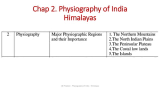
  • 4. THE NORTHERN MOUNTAINS HIMALAYAS 1. Origin of Himalayas – Plate tectonics 2. Divisions of Himalayas – Two types 3. Highest peaks of each range 4. Mountain passes 5. Glaciers 6. Importance of Himalayas LM Thakare - Physiography of India - Himalayas
  • 5. Origin of Himalayas Plate tectonics and Geosynclines Formation of Himalayas K Siddharth LM Thakare - Physiography of India - Himalayas
  • 6. Geological History of Himalayas • Rock formation : Pre-Cambrian era (600 mya) to recent. • Acc. to R. L. Singh (1971) LM Thakare - Physiography of India - Himalayas
  • 7. VII Tertiary – Oligocene (25-40 mya) Collision of Indian plate with Eurasian. Himadri / Greater Himalayas Mid – Miocene (14 mya) Himachal / Lesser Himalayas Pliocene (750 Tya) Shiwalik / outer Himalayas Mid -pliocene Sedimentation along Indo-Gangetic trough Pliestocene Evolution of present drainage pattern , Narmada –Tapi trough Phase Period Significance I Pre-Cambrian (600 mya) Cooling and Solidification of earth crust – Gneisses and Granite. II Cambrian Period (500 mya) undulations and crumpling of Dharwarian Sediements. III calcareous deposition in Cuddapah and Vindhyan basins. IV Carboniferous period (270 mya) Gondwana rocks formed-95% coal resources of India. V 200 mya Gondwana ruptured peninsula drifted to north. Upliftment of Vindhya. Formation of western Ghats VI Cretaceous (135 mya) Lava flow – formation of Deccan trap LM Thakare - Physiography of India - Himalayas
  • 8. Formation of Himalayas • Origin and formation of Himalayas • Plate tectonics - Age of Himayalas is 75 to 45 mya • The Himalayas continue to rise more than 1 cm a year -- a growth rate of 10 km in a million years Classifications
  • 9. CHARACTERISTICS OF HIMALAYAS • The most characteristic features of the Himalayas are their • soaring heights, • steep-sided jagged peaks, • valley and alpine glaciers • topography deeply cut by erosion • river gorges, • complex geologic structure, and • series of elevational belts (or zones) • that display different ecological associations of flora, fauna, and climate. LM Thakare - Physiography of India - Himalayas
  • 10. Over the past 65 million years, powerful global plate-tectonic forces have moved the Earth’s crust to form the band of Eurasian mountain ranges—including the Himalayas—that stretch from the Alps to the mountains of Southeast Asia. LM Thakare - Physiography of India - Himalayas
  • 11. Physiographic divisions of Himalayas 1 Trans – Himalayan ranges 1. Karakoram range 2. Ladakh 3. Zaskar 4. Kailash LM Thakare - Physiography of India - Himalayas
  • 12. 1 Karakoram range 2 Ladakh range 3 Kailash 4 Zaskar 5 Greater Himalayas 6 Lesser Himalayas 7 Shiwalik / outer Him. 1 2 3 45 6 7 7 LM Thakare - Physiography of India - Himalayas
  • 13. Trans Himalayas LM Thakare - Physiography of India - Himalayas
  • 14. 1.Karakoram range - It is also known as Krishnagiri situated in the northern most range of the Trans-Himalayan ranges. - The Karakoram is a mountain range spanning the borders of China, India, and Pakistan, with the northwest extremity of the range extending to Afghanistan and Tajikistan. - It extends eastwards from the Pamir for about 800 km. - It is the second highest mountain range in the world - Length = 500km (most heavily glaciated part of the world outside the polar region) - Average width is 120-140 km. - greatest Glaciers (22) of the world located Siachen Glacier at 76 km (2nd longest in world) and the Biafo Glacier at 63 km (3rd largest), Godwin-Austen Glacier and Baltoro Glacier - elevation 5,500 m. - Some of the peaks are more than 8,000 m msl - K2 is the second highest peak in the world and - It has been named as Godwin Austen by the Britishers and Qogir by the China. - Major peaks •K2: 8,611 metres •Gasherbrum : 8,080 metres LM Thakare - Physiography of India - Himalayas
  • 15. - Godwin-Austen Glacier 1. Karakoram range - Baltoro Glacier - is one of the longest glaciers outside the polar regions LM Thakare - Physiography of India - Himalayas
  • 16. 1. Karakoram range P O K LM Thakare - Physiography of India - Himalayas
  • 17. • Northern extension of K2 range • elevation 6000 m. • length =370km • highest peak = Stok Kangri (6,153 m) • No major peaks. • It lies to the north of the Leh • It lies between the Indus and Shyok river valleys • an important part of the Trans-Himalayan range that merges with the Kailash range in Tibet. • The important passes that lie to the north east of Leh are- Kardung La, and Digar La. • The extension of the Ladakh Range into China is known as Kailash Range. • Fine Pashmina Wool 3. Zaskar range • Runs parallel to great Himalayan Range. • The Nanga Parbat (8126 m) is the highest point in the north- west • adjoining Deosai Mountain and Ladakh range is in north. • elevation 5800 m. • length 300 km • few peaks of this range attains height of over 6000 m • The Rakaposhi-Haramosh ranges beyond the Indus may be treated as extension of the Ladakh range to the northwest.LM Thakare - Physiography of India - Himalayas
  • 18. 4. Kailash range • It is a branch of the Ladakh range which is situated in the western Tibet. Its average elevation is elevation 5500 m. • Length 57 km • highest peak =Mount Kailash (6638) is the highest peak of this range. • River Indus originates from the northern slope of the Kailash range. • The mountain is located near Lake Manasarovar and Lake Rakshastal, close to the source of some of the longest Asian rivers: the Indus, Sutlej, Brahmaputra, and Karnali also known as Ghaghara. LM Thakare - Physiography of India - Himalayas
  • 19. 1. Trans – Himalayan ranges1. Karakoram range 2. Ladakh range 3. Zaskar range 4. Kailash range - It is also known as Krishnagiri situated in the northern most range of the Trans-Himalayan ranges. - Afghanistan and China and acts as watershed between India and Turkestan. - It extends eastwards from the Pamir for about 800 km. - The average width is 120- 140 km. - elevation 6100 m. - length =500km - greatest Glaciers of the world located - Some of the peaks are more than 8,000 m msl - K2 is the second highest peak in the world and - It has been named as Godwin Austen by the Britishers and Qogir by the China. • Northern extension of K2 range • elevation 6000 m. • length =370km • highest peak = Stok Kangri (6,153 m) • No major peaks. • It lies to the north of the Leh • It lies between the Indus and Shyok ri ver valleys • an important part of the Trans-Himalayan range that merges with the Kailash range in Tibet. • The important passes that lie to the north east of Leh are- Kardung La, and Digar La. • Fine Pashmina Wool • Runs parallel to great Himalayan Range. • The Nanga Parbat (8126 mt) is the highest point in the north-west • adjoining Deosai Mountain • Ladakh range is in north • elevation 5800 m. • Length 300 km • few peaks of this range attains height of over 6000 m • The Rakaposhi-Haramosh ranges beyond the Indus may be treated as extension of the Ladakh range to the northwest. • It is a branch of the Ladakh range which is situated in the western Tibet. Its average elevation is elevation 5500 m. • Length 57 km • highest peak =Mount Kailash (6638) is the highest peak of this range. River Indus originates from the northern slope of the Kailash range. • The mountain is located near Lake Manasarovar and Lake Rakshastal, close to the source of some of the longest Asian rivers: the Indus, Sutlej, Brahmaputr a, and Karnali also known as Ghaghara. The extension of the Ladakh Range into China is known as Kailash Range.LM Thakare - Physiography of India - Himalayas
  • 20. LM Thakare - Physiography of India - Himalayas
  • 21. Greater Himalayas • The Great Himalayas or Greater Himalayas (Hindi: महान हहमालय हहमाहि) is the highest mountain range of the Himalayan Range System, part of the Alpines belt. • This range is separated from Trans Himalaya mountain ranges by the Main Central Thrust Fault, which lies north of it. Entities the range is within include Pakistan, China, India, Nepal, and Tibet. • The world's highest peak, Mount Everest, and other "near−highest" peaks - K2, Kangchenjunga, Lhotse, Nanga Parbat, etc., are part of the Greater Himalayas range. • The total west to east extension of the great Himalayas is 2400 km and • their average elevation is 6000 m • They are home to many glaciers like Gangotri Glacier, Satopanth Glacier etc. LM Thakare - Physiography of India - Himalayas
  • 22. LM Thakare - Physiography of India - Himalayas
  • 23. Highest peaks in Greater Himalayas •Mount Everest was first located by George Everest, the then Surveyor General of India in 1841 and in 1852 it was established as the highest peak of the world by the Great Trigonometrical Survey of India. LM Thakare - Physiography of India - Himalayas
  • 24. Average elevation of 6,100 m above sea level and an average width of about 25 km. It is mainly formed of the central crystallines (granites, schist and gneisses) overlain by metamorphosed sediments [limestone]. The folds in this range are asymmetrical with steep south slope and gentle north slope giving ‘hog back (a long, steep hill or mountain ridge)’ topography. State Passes of Greater Himalayas Jammu and Kashmir 1.Burzil Pass 2.Zoji La [La means pass] Himachal Pradesh 1.Bara Lacha La 2.Shipki La [The Hindustan-Tibet Road connecting Shimla with Gartok in Western Tibet] Uttarakhand 1.Thaga La 2.Niti Pass 3.Lipu Lekh Sikkim 1.Nathu La 2.Jelep La [important trade route connecting Kalimpong (near Darjeeling) with Lhasa in Tibet, passes through Jelep La (4,386 m)LM Thakare - Physiography of India - Himalayas
  • 25. LM Thakare - Physiography of India - Himalayas
  • 26. • Lower/ inner/middle or Lesser Himalayas is 80 km in width, 4000-4500m average elevation --- Geology – unfossiliferous or metamorphosed crystalline rocks – slate, limestone, qaurtzites. --- The region is subject to extensive erosion due to heavy rains, deforestation and urbanization along the hill slopes. Lesser Himalayas LM Thakare - Physiography of India - Himalayas
  • 27. • Pirpanjal in Jammu and Kashmir, • Dhauladhar in Himachal Pradesh and Jammu and Kashmir. • Nag Tibba in Himachal Pradesh and Uttarakhand, etc. • are some of the famous mountain ranges. • The Srinagar valley lies in the Lesser Himalayas. • The Jhelum meanders and enters the Wular Lake, and leaves it near Sopore. • This Srinagar Valley is between the greater Himalayas and the Lesser Himalaya in Kashmir. LM Thakare - Physiography of India - Himalayas
  • 28. Assignment 6 1. Mapping of all the Himalayan ranges 2. Highest peaks – Trans / Greater Him. 3. List of all peaks, passes and valleys along the Him range. LM Thakare - Physiography of India - Himalayas
  • 29. Shiwalik / Outer Himalayas Siwalik Range, also called Siwalik Hills or Outer Himalayas, Siwalik also spelled Shiwalik, • sub-Himalayan range of the northern Indian subcontinent. • It extends west-northwestward for more than 1,600 km from the Tista River in Sikkim state, northeastern India, through Nepal, across northwestern India, and into northern Pakistan. • 16 km width • An average elevation of 900 to 1,200 meters. • It rises abruptly from the plain of the Indus and Ganges (Ganga) rivers (south) and parallels the main range of the Himalayas (north), from which it is separated by valleys. • The Shiwalik are sometimes considered to include the southern foothills of the Assam Himalayas, which extend eastward for 640 km across southern Bhutan to the bend of the Brahmaputra River. • The name Siwalik (from Sanskrit, meaning “Belonging to [the God] Shiva”) was formerly restricted, is the 320 km of foothills in India extending from the Ganges River at Haridwar, Uttarakhand state, northwestward to the Beas River. Nepal’s portion of the range is called the Churia Range. Abi Gamin is a highest mountain peak in Shiwalik mostly situated in the Chamoli district of UttarakhandLM Thakare - Physiography of India - Himalayas
  • 30. LM Thakare - Physiography of India - Himalayas
  • 31. Assi -7 4 divisions: 1. Location w .r to Indian subconti 2. Peak. 3. Significant –passes, valleys, 4 mt ranges 5Geology 6 Width and 7 avrg elevation, 8 length LM Thakare - Physiography of India - Himalayas
  • 32. Longitudinal divisions of Himalayas 1.The Kashmir /Punjab/ Himachal Himalayas 2.The Kumaun Himalayas 3.The Central/ Nepal Himalayas 4.The Assam/ Eastern Himalayas LM Thakare - Physiography of India - Himalayas
  • 33. The Kashmir /Punjab/ Himachal Himalayas Kashmir Himalayas lies between the Indus River and Sutlej. A significant portion of the Himalayas lies in Jammu and Kashmir and Himachal Pradesh.. In Jammu and Kashmir region: -- high snow-covered peaks, deep valleys, interlocked spurs, and High Mountain passes. The range stretches for 700km in length and 500 km in width. It has a height of 3000 m with a large number of glaciers. The Ladakh region of the Kashmir Himalayas is dominated by cold desert conditions. The Kashmir valley = surrounded by the Greater and the Lesser Himalayas. The Karewa soil is found here and this area is famous for the saffron and other dry fruit cultivation. Important passes and peaks (PTO). In the Himachal Pradesh Region: All the three ranges- the greater, the lesser, and the outer Himalayas are well represented in this region. The northern slopes are covered with thick forests, plains, and lakes. The southern slopes are rugged with forest-clad. The Kangra valley, Kullu- Manali lies here. These areas are highly productive and well known for orchards and scenic beauty. Dalhousie, Shimla, Chamba, Kullu- Manali and Dharam sala is the important hill station in this region. The important passes are Rohtang pass, Bara-Lacha, Shipki La. LM Thakare - Physiography of India - Himalayas
  • 34. Important passes of the Kashmir Himalayas: Pir panjal, Banihal, Zoji La, Burzil, Khardungla, Pensi- La, Saser- La, Lanak- La, Jara- La, Tasaka-La, Umasi-La and Qara-Tagh-La. The important snow-capped peaks are Nanda Devi, Trisul, Nunkun, Kamath and Nanga-Parbat LM Thakare - Physiography of India - Himalayas
  • 35. The Kumaun Himalayas • This division lies between the Satluj and Kali River. • The highest peak in this division is Nanda Devi. • Important peaks =Nanda Devi, Trisul, Kedarnath, Dunagiri, Kamet, Badrinath, Jaonli, Gangotri, and Bandarpunch. • Glaciers= Pindari, Gangotri, and Milam • Hill stations = Mussorie, Nainital, Ranikhet, Almora, and Bageshwar. • Passes = Thaga La, Muling La, Mana, Mangsha Dhura, and Lipu Lekh. LM Thakare - Physiography of India - Himalayas
  • 36. The Central / Nepal Himalayas This division stretches from the Kali River to the Tista River. The major part of it lies in Nepal except for the extreme eastern part- Sikkim Himalayas. The important peaks are the Mt. Everest, Kanchenjunga, Makalu, Dhaula Giri, Annapurna, Manaslu, and Gosainath. Nathu La and Jelep La are the important passes in this region. LM Thakare - Physiography of India - Himalayas
  • 37. The Assam/ Eastern Himalayas • lies between Tista and the Brahmaputra River (Dihang). • It occupies the state of Arunachal Pradesh in India and Bhutan. • On the southern border of Arunachal Pradesh, it takes a southerly turn, and ranges are arranged in North-South direction passing through Nagaland, Manipur, Mizoram, and Tripura called Purvanchal. • The Purvanchal is joined by Meghalaya Plateau in the west and its extension of the Myanmar mountain chain continues to Andaman and Nicobar Islands and the Archipelago of Indonesia. • The Himalayas rise very rapidly in the plains of Assam and narrow at the foothills of Shiwaliks. PDF Here LM Thakare - Physiography of India - Himalayas
  • 38. LM Thakare - Physiography of India - Himalayas
  • 39. Assam Himalayas LM Thakare - Physiography of India - Himalayas
  • 40. • It comprises of many hills called Aka hills, Dafla hills, Miri hills, Abor hills, Mishmi hills, and Namcha Barwa. • The important hills of eastern Himalayas are Pakai bum, Manipur hills, Blue Mountain, Tripura range, and Brail range. • The important passes in this region are Bomdi La, Yonggyap, Diphu, Pangsau, Tse La, Dihang, Debang, Tunga, and Bom La. LM Thakare - Physiography of India - Himalayas
  • 41. Significance of Himalayas 1. Climatic Influence, 2. Defence, 3. Source of Rivers, 4. Fertile Soil, 5. Hydroelectricity, 6. Forest Wealth, 7. Agriculture, 8. Tourism, 9. Pilgrimage, 10. Minerals LM Thakare - Physiography of India - Himalayas
  • 42. 1. Climatic Influence: • By virtue of their high altitude, length and direction, they effectively intercept the summer monsoons coming from the Bay of Bengal and Arabian Sea and cause precipitation in the form of rain or snow. • Besides, they prevent the cold continental air masses of central Asia from entering into India. • No Himalayas, the whole of India would have been a desert in the absence of precipitation and its winters would have been very severe under the influence of cold air masses coming from Central Asia. • According to the latest meteorological studies, the Himalayas are responsible for splitting the jet stream into two branches and these in turn play an extremely important role in bring monsoons in India. 2. Defence: The Himalayas have been protecting India from outside invaders since the early times thus serving as a defence barrier. But the Chinese aggression on India in October, 1962 has reduced the defence significance of the Himalayas to a considerable extent. 3. Source of Rivers: • Abundant rainfall and vast snow-fields as well as large glaciers • Snow melt in summer provides water to these rivers even during dry season and these are perennial rivers. • The Himalayan Rivers, along with hundreds of their tributaries, form the very basis of life in the whole of north India. LM Thakare - Physiography of India - Himalayas
  • 43. 4. Fertile Soil: The great rivers and their tributaries carry enormous quantities of alluvium while descending from the Himalayas. This is deposited in the Great Plain of North India in the form of fertile soil, making the plain one of the most fertile lands of the world. It has been estimated that the Ganga and the Indus carry 19 and 10 lakh tonnes of silt, per day respectively and the silt carried by the Brahmaputra is even more. 5. Hydroelectricity: • used for producing hydroelectricity. • There are natural waterfalls at certain places while dams can be constructed across rivers at some other places. 6. Forest Wealth: • a succession of vegetal cover from the tropical to the Alpine. • The Himalayan forests provide fuel wood, raw materials , medicinal plants • Several patches are covered with grass offering rich pastures for grazing animals. 7. Agriculture: • The Himalayas do not offer extensive flat lands for agriculture but some of the slopes are terraced for cultivation. • Rice is the main crop on the terraced slopes. Tea is a unique crop which can be grown on the hill slopes only. • The other crops are wheat, maize, potatoes, tobacco and ginger. • A wide variety of fruits such as apples, pears, grapes, mulberry, walnut, cherries, peaches, apricot, etc. are also grown in the Himalayan region. LM Thakare - Physiography of India - Himalayas
  • 44. 8. Tourism: • By virtue of their scenic beauty and healthy environment, cool and comfortable climate • when the neighbouring plains are reeling under the scorching heat of the summer season. • winter sports and the craze to enjoy snowfall • Srinagar, Dalhousie, Dharamshala, Chamba, Shimla, Kulu, Manali, Mussoorie, Nainital, Ranikhet, Almora, Darjeeling, Mirik, Gangtok, etc. are important tourist centres in the Himalayas. 9. Pilgrimage: Large number of pilgrims trek through difficult terrain to pay their reverence to these sacred shrines. Kailas, Amarnath, Badrinath, Kedamath, Vaishnu Devi, Jwalaji, Uttarkashi, Gangotri, Yamunotri, etc. are important places of pilgrimage. 10. Minerals: • The Himalayan region contains many valuable minerals. There are vast potentialities of mineral oil in the tertiary rocks. Coal is found in Kashmir. • Copper, lead, zinc, nickel, cobalt, antimony, tungsten, gold, silver, limestone, semi-precious and precious stones, gypsum and magnetite are known to occur at more than 100 localities in the Himalayas. LM Thakare - Physiography of India - Himalayas
  • 45. THE NORTHERN MOUNTAINS LM Thakare - Physiography of India - Himalayas
  • 46. LM Thakare - Physiography of India - Himalayas
  • 47. Thank you LM Thakare - Physiography of India - Himalayas