SlideShare une entreprise Scribd logo
1  sur  483
Télécharger pour lire hors ligne
FERC/DEIS-270D
DRAFT ENVIRONMENTAL IMPACT STATEMENT
Volume I
NEXUS Gas Transmission Project and
Texas Eastern Appalachian Lease Project
Source: State of Ohio Office of Information Technology
NEXUS Gas Transmission, LLC Docket Nos.: CP16-22-000
Texas Eastern Transmission, LP CP16-23-000
DTE Gas Company CP16-24-000
Vector Pipeline L.P. CP16-102-000
Federal Energy Regulatory Commission
Office of Energy Projects
Washington, DC 20426
Office of
Energy
Projects
July 2016
Cooperating Agencies:
U.S. Environmental Protection Agency U.S. Fish and Wildlife Service
FEDERAL ENERGY REGULATORY COMMISSION
WASHINGTON, D.C. 20426
OFFICE OF ENERGY PROJECTS In Reply Refer To:
OEP/DG2E/Gas 2
NEXUS Gas Transmission, LLC
Texas Eastern Transmission, LP
DTE Gas Company
Vector Pipeline L.P.
Docket Nos. CP16-22-000
CP16-23-000
CP16-24-000
CP16-102-000
FERC/EIS-270D
TO THE PARTY ADDRESSED:
The staff of the Federal Energy Regulatory Commission (FERC or Commission)
has prepared a draft environmental impact statement (EIS) for the NEXUS Gas
Transmission (NGT) Project and Texas Eastern Appalachian Lease (TEAL) Project
(jointly referred to as “Projects”), proposed by NEXUS Gas Transmission, LLC
(NEXUS) and Texas Eastern Transmission, LP (Texas Eastern) in the above-referenced
dockets. NEXUS and Texas Eastern request authorization to construct a new Greenfield
pipeline and expand an existing pipeline system from the Appalachian Basin to deliver
1.5 million dekatherms per day to consuming markets in Northern Ohio, Southeastern
Michigan, and Ontario, Canada. DTE Gas Company and Vector Pipeline L.P. are
requesting approval to lease capacity on their systems to NEXUS.
The draft EIS assesses the potential environmental effects of the construction and
operation of the Projects in accordance with the requirements of the National
Environmental Policy Act. The FERC staff concludes that approval of the Projects
would result in some adverse environmental impacts; however, most of these impacts
would be reduced to less-than-significant levels with the implementation of NEXUS’s
and Texas Eastern’s proposed mitigation measures and the additional recommendations
in the draft EIS.
Some of the route alternatives suggested during scoping would affect landowners
that have not been part of the FERC’s environmental scoping process, as further
discussed on page 5. Therefore, by this letter we are notifying these parties of our
evaluation and requesting comments about the following alternative routes
presented in section 3 of the draft EIS: City of Green Route Alternative, Chippewa
Lake C Route Variation, and Reserve Avenue Route Variation.
- 2 -
The U.S. Fish and Wildlife Service (FWS) and U.S. Environmental Protection
Agency (EPA) participated as cooperating agencies in the preparation of the draft EIS.
Cooperating agencies have jurisdiction by law or special expertise with respect to
resources potentially affected by the proposal and participate in the National
Environmental Policy Act analysis. Although the FWS and EPA provided input to the
conclusions and recommendations presented in the draft EIS, the FWS and EPA will each
present its own conclusions and recommendations in its respective record of decision or
determination for the Projects.
The draft EIS addresses the potential environmental effects of the construction and
operation of both the NGT and TEAL Projects. The NGT Project consists of about 255.9
miles of pipeline composed of the following facilities:
 208.9 miles of new 36-inch-diameter natural gas pipeline in Ohio;
 47 miles of new 36-inch-diameter natural gas pipeline in Michigan;
 associated equipment and facilities.
The TEAL Project would include two main components:
 4.4 miles of new 36-inch-diameter loop pipeline in Ohio;
 0.3 mile of new 30-inch-diameter interconnecting pipeline Ohio; and
 associated equipment and facilities.
The Projects’ proposed aboveground facilities include five new compressor
stations in Ohio; additional compression and related modifications to one existing
compressor station in Ohio; five new metering and regulating stations in Ohio; one new
metering and regulating station in Michigan; and minor modifications at existing
aboveground facilities at various locations across Ohio.
The FERC staff mailed copies of the draft EIS to federal, state, and local
government representatives and agencies; elected officials; environmental and public
interest groups; Native American tribes; potentially affected landowners and other
interested individuals and groups; and newspapers and libraries near the Projects. Paper
copy versions of this draft EIS were mailed to those specifically requesting them; all
others received a CD version. In addition, the draft EIS is available for public viewing on
the FERC’s website (www.ferc.gov) using the eLibrary link.
- 3 -
A limited number of copies are available for distribution and public inspection at:
Federal Energy Regulatory Commission
Public Reference Room
888 First Street NE, Room 2A
Washington, DC 20426
(202) 502-8371
Any person wishing to comment on the draft EIS may do so. To ensure
consideration of your comments on the proposal in the final EIS, it is important that the
Commission receive your comments on or before August 29, 2016.
For your convenience, there are four methods you can use to submit your
comments to the Commission. In all instances, please reference the Projects’ docket
numbers (CP16-22-000 for the NGT Project and CP16-23-000 for the TEAL Project)
with your submission. The Commission encourages electronic filing of comments and
has expert staff available to assist you at (202) 502-8258 or efiling@ferc.gov.
1) You can file your comments electronically using the eComment feature on
the Commission's website (www.ferc.gov) under the link to Documents and
Filings. This is an easy method for submitting brief, text-only comments
on a project.
2) You can file your comments electronically by using the eFiling feature on
the Commission's website (www.ferc.gov) under the link to Documents and
Filings. With eFiling, you can provide comments in a variety of formats by
attaching them as a file with your submission. New eFiling users must first
create an account by clicking on “eRegister.” If you are filing a comment
on a particular project, please select “Comment on a Filing” as the filing
type.
3) You can file a paper copy of your comments by mailing them to the
following address:
Nathaniel J. Davis, Sr., Deputy Secretary
Federal Energy Regulatory Commission
888 First Street NE, Room 1A
Washington, DC 20426
4) In lieu of sending written or electronic comments, the Commission invites
you to attend one of the public comment meetings its staff will conduct in
the Project areas to receive comments on the draft EIS. We1
encourage
1
“We,” “us,” and “our” refer to the environmental staff of the FERC's Office of
Energy Projects.
- 4 -
interested groups and individuals to attend and present oral comments on
the draft EIS at any of the meeting locations provided on page 4.
There will not be a formal start of the meeting nor a formal presentation by
Commission staff, but FERC staff will be available to answer your
questions about the environmental review process. You may arrive at any
time after 5:00 PM and we will stop taking comments at 10:00 PM Eastern
Time Zone. The primary goal is to have your verbal environmental
comments on the draft EIS documented in the public record.
Date Location
August 10, 2016 Swanton High School
604 North Main Street
Swanton, OH 43558
(419) 826-3045
August 11, 2016 Tecumseh Center for the Arts
400 North Maumee Street
Tecumseh, MI 49286
(517) 423-6617
August 15, 2016 Quality Inn, Freemont
3422 Port Clinton Road
Fremont, OH 43420
(419) 332-0601
August 16, 2016 Elyria High School Performing Arts Center
601 Middle Avenue
Elyria, OH 44035
(440) 284-5209
August 17, 2016 Wadsworth High School – James A. Mcilvaine
Performing Arts Center
625 Broad Street
Wadsworth, OH 44281
(330) 335-1369
August 18, 2016 Green High School
1474 Boettler Road
Uniontown, OH 44685
(330) 896-7575
Verbal comments will be recorded by court reporter(s) and transcriptions will be
placed into the docket for the Projects and made available for public viewing on FERC’s
eLibrary system (see page 5 for instructions on using eLibrary). It is important to note
that verbal comments hold the same weight as written or electronically submitted
comments. If a significant number of people are interested in providing verbal
comments, a time limit of 3 to 5 minutes may be implemented for each commenter to
- 5 -
ensure all those wishing to comment have the opportunity to do so within the designated
meeting time. Time limits will be strictly enforced if they are implemented.
Any person seeking to become a party to the proceeding must file a motion to
intervene pursuant to Rule 214 of the Commission’s Rules of Practice and Procedures
(Title 18 Code of Federal Regulations Part 385.214).2
Only intervenors have the right to
seek rehearing of the Commission’s decision. The Commission grants affected
landowners and others with environmental concerns intervenor status upon showing good
cause by stating that they have a clear and direct interest in this proceeding that no other
party can adequately represent. Simply filing environmental comments will not give
you intervenor status, but you do not need intervenor status to have your comments
considered.
Route Alternatives
As indicated on page 1, some landowners are receiving this draft EIS because their
property has been identified as potentially being affected by certain route alternatives
recommended or being considered by FERC staff to avoid or lessen environmental
impacts along NEXUS’s proposed pipeline route in several locations. Refer to
discussions in section 3.3.3 of the draft EIS for the City of Green Route Alternative,
section 3.4.10 for the Chippewa Lake C Route Variation, and section 3.4.12 for the
Reserve Avenue Route Variation. Please note that while staff has recommended the use
of the last two listed alternatives, a decision whether or not to recommend the use of the
City of Green Route Alternative has not been made. The Commission staff wants to
ensure that all potentially affected landowners have the opportunity to participate in the
environmental review process, thus staff is soliciting comments to assist with the
environmental analysis of these route alternatives, which will be presented in the final
EIS.
Questions?
Additional information about the Projects is available from the Commission’s
Office of External Affairs, at (866) 208-FERC, or on the FERC website (www.ferc.gov)
using the eLibrary link. Click on the eLibrary link, click on “General Search,” and enter
the docket number excluding the last three digits in the Docket Number field
(i.e., CP16-22). Be sure you have selected an appropriate date range. For assistance,
please contact FERC Online Support at FercOnlineSupport@ferc.gov or toll free at
(866) 208-3676; for TTY, contact (202) 502-8659. The eLibrary link also provides
access to the texts of formal documents issued by the Commission, such as orders,
notices, and rulemakings.
2
See the previous discussion on the methods for filing comments.
- 6 -
In addition, the Commission offers a free service called eSubscription that allows
you to keep track of all formal issuances and submittals in specific dockets. This can
reduce the amount of time you spend researching proceedings by automatically providing
you with notification of these filings, document summaries, and direct links to the
documents. Go to www.ferc.gov/docs-filing/esubscription.asp to subscribe.
Nathaniel J. Davis, Sr.,
Deputy Secretary
TABLE OF CONTENTS
i Table of Contents
NEXUS Gas Transmission, LLC
NEXUS Gas Transmission Project
Texas Eastern Transmission, LP
Texas Eastern Appalachian Lease Project
VOLUME I
TABLE OF CONTENTS ............................................................................................................................i
LIST OF APPENDICES ............................................................................................................................ v
LIST OF TABLES....................................................................................................................................vii
LIST OF FIGURES.................................................................................................................................... x
TECHNICAL ACRONYMS ....................................................................................................................xi
EXECUTIVE SUMMARY ..................................................................................................................ES-1
INTRODUCTION .....................................................................................................................ES-1
PROPOSED ACTION...............................................................................................................ES-1
PUBLIC INVOLVEMENT .......................................................................................................ES-2
ENVIRONMENTAL IMPACTS AND MITIGATION............................................................ES-3
ALTERNATIVES....................................................................................................................ES-15
CONCLUSIONS .....................................................................................................................ES-16
1.0 INTRODUCTION.......................................................................................................................1-1
1.1 PROJECT PURPOSE AND NEED.................................................................................1-3
1.1.1 NGT Project........................................................................................................1-3
1.1.2 TEAL Project......................................................................................................1-4
1.2 PURPOSE AND SCOPE OF THIS EIS..........................................................................1-5
1.2.1 Federal Energy Regulatory Commission............................................................1-5
1.2.2 U.S. Environmental Protection Agency Purpose and Role.................................1-6
1.2.3 U.S. Fish and Wildlife Service Purpose and Role ..............................................1-7
1.3 PUBLIC REVIEW AND COMMENT............................................................................1-7
1.4 NON-JURISDICTIONAL FACILITIES.......................................................................1-13
1.5 PERMITS, APPROVALS, AND REGULATORY REQUIREMENTS.......................1-14
2.0 DESCRIPTION OF PROPOSED ACTION.............................................................................2-1
2.1 PROPOSED FACILITIES...............................................................................................2-1
2.1.1 NGT Project........................................................................................................2-1
2.1.2 TEAL Project......................................................................................................2-8
2.2 LAND REQUIREMENTS...............................................................................................2-9
2.2.1 NGT Project......................................................................................................2-10
2.2.2 TEAL Project....................................................................................................2-12
2.3 CONSTRUCTION PROCEDURES..............................................................................2-13
2.3.1 General Pipeline Construction Procedures .......................................................2-15
TABLE OF CONTENTS
Table of Contents ii
2.3.2 Special Pipeline Construction Procedures ........................................................2-20
2.3.3 Aboveground Facility Construction..................................................................2-28
2.4 CONSTRUCTION SCHEDULE AND WORKFORCE ...............................................2-28
2.5 ENVIRONMENTAL INSPECTION, COMPLIANCE MONITORING, AND POST-
APPROVAL VARIANCES...........................................................................................2-29
2.5.1 Coordination and Training................................................................................2-29
2.5.2 Environmental Inspection.................................................................................2-29
2.5.3 Post-Approval Variance Process ......................................................................2-31
2.5.4 Compliance Monitoring....................................................................................2-31
2.5.5 Post-construction Monitoring ...........................................................................2-32
2.6 OPERATION AND MAINTENANCE.........................................................................2-32
2.6.1 Pipeline Surveys and Inspections .....................................................................2-32
2.6.2 Right-of-way Maintenance ...............................................................................2-33
3.0 NGT AND TEAL PROJECTS ALTERNATIVES..................................................................3-1
3.1 NO ACTION ALTERNATIVE.......................................................................................3-3
3.2 SYSTEM ALTERNATIVES...........................................................................................3-4
3.2.1 Existing Pipeline Systems...................................................................................3-4
3.2.2 Proposed Pipeline Systems .................................................................................3-5
3.3 MAJOR ROUTE ALTERNATIVES...............................................................................3-7
3.3.1 Rover Route Alternative...................................................................................3-11
3.3.2 Southern Route Alternative ..............................................................................3-18
3.3.3 City of Green Route Alternative.......................................................................3-22
3.3.4 Electric Transmission Line Route Alternative..................................................3-27
3.3.5 Canton A Route Alternative .............................................................................3-30
3.3.6 Canton B Route Alternative..............................................................................3-32
3.3.7 Canton C Route Alternative..............................................................................3-34
3.3.8 Doylestown Route Alternative..........................................................................3-36
3.3.9 Turnpike Route Alternative ..............................................................................3-38
3.3.10 Oak Openings Route Alternative......................................................................3-41
3.3.11 Waterville Route Alternative............................................................................3-43
3.3.12 CORN Western Route Alternative ...................................................................3-45
3.4 MINOR ROUTE VARIATIONS ..................................................................................3-47
3.4.1 Middlebranch Avenue Route Variations ..........................................................3-47
3.4.2 Electric Transmission Line Route Variation.....................................................3-49
3.4.3 Kent Avenue Route Variation...........................................................................3-51
3.4.4 Interstate 76 Route Variation............................................................................3-53
3.4.5 Mount Eaton Road Route Variation .................................................................3-55
3.4.6 Eastern Road North Route Variation................................................................3-57
3.4.7 Eastern Road South Route Variation................................................................3-59
3.4.8 Pifer Road Route Variation...............................................................................3-61
3.4.9 Mennonite Road Route Variation.....................................................................3-63
3.4.10 Chippewa Lake Route Variations.....................................................................3-65
3.4.11 Kennedy Road Route Variation........................................................................3-73
3.4.12 Reserve Avenue Route Variation .....................................................................3-75
3.4.13 Butler Road Route Variation ............................................................................3-77
3.4.14 Luckey Road Route Variation ..........................................................................3-79
3.4.15 Martz Road Route Variation.............................................................................3-81
3.5 ABOVEGROUND FACILITY SITE ALTERNATIVES.............................................3-83
3.5.1 NGT Compressor Station Alternatives.............................................................3-83
TABLE OF CONTENTS
iii Table of Contents
3.5.2 TEAL Compressor Station Alternatives...........................................................3-92
3.5.3 Electric Compressors........................................................................................3-94
4.0 ENVIRONMENTAL ANALYSIS.............................................................................................4-1
4.1 GEOLOGY......................................................................................................................4-2
4.1.1 Existing Environment .........................................................................................4-2
4.1.2 Mineral Resources ..............................................................................................4-5
4.1.3 Geologic Hazards................................................................................................4-9
4.1.4 Paleontological Resources................................................................................4-16
4.1.5 Impacts and Mitigation.....................................................................................4-16
4.2 SOILS ............................................................................................................................4-21
4.2.1 Existing Environment .......................................................................................4-21
4.2.2 General Impacts and Mitigation........................................................................4-28
4.3 WATER RESOURCES .................................................................................................4-32
4.3.1 Groundwater Resources....................................................................................4-32
4.3.2 Surface Water Resources..................................................................................4-40
4.4 WETLANDS .................................................................................................................4-56
4.4.1 Existing Wetland Resources .............................................................................4-56
4.4.2 General Impacts and Mitigation........................................................................4-59
4.4.3 Alternative Measures........................................................................................4-62
4.4.4 Conclusion........................................................................................................4-65
4.5 VEGETATION..............................................................................................................4-66
4.5.1 Existing Environment .......................................................................................4-66
4.5.2 Impacts and Mitigation.....................................................................................4-69
4.5.3 General Construction and Restoration Procedures ...........................................4-73
4.5.4 Noxious Weeds and Pathogens.........................................................................4-74
4.5.5 Fragmentation and Edge Effect ........................................................................4-76
4.5.6 Pollinator Habitat..............................................................................................4-77
4.5.7 Conclusion........................................................................................................4-78
4.6 WILDLIFE.....................................................................................................................4-78
4.6.1 Existing Environment .......................................................................................4-78
4.6.2 Impacts and Mitigation.....................................................................................4-81
4.6.3 Sensitive or Managed Wildlife Habitats...........................................................4-83
4.6.4 Habitat Fragmentation and Edge Effect............................................................4-83
4.6.5 Game Species and Game Harvesting................................................................4-84
4.6.6 Migratory Birds.................................................................................................4-85
4.6.7 Conclusion........................................................................................................4-89
4.7 FISHERIES AND AQUATIC RESOURCES...............................................................4-89
4.7.1 Existing environment........................................................................................4-89
4.7.2 Impacts and Mitigation.....................................................................................4-90
4.7.3 Conclusion........................................................................................................4-94
4.8 SPECIAL STATUS SPECIES.......................................................................................4-94
4.8.1 Federally Listed Threatened and Endangered Species .....................................4-94
4.8.2 State-listed Species .........................................................................................4-104
4.9 LAND USE, RECREATION, SPECIAL INTEREST AREAS, AND VISUAL
RESOURCES ..............................................................................................................4-109
4.9.1 Environmental Setting ....................................................................................4-113
4.9.2 Project-specific Impacts and Mitigation.........................................................4-117
4.9.3 Land Ownership and Easement Requirements ...............................................4-119
4.9.4 Existing Residences, Commercial Buildings, and Planned Developments ....4-120
TABLE OF CONTENTS
Table of Contents iv
4.9.5 Agricultural Areas...........................................................................................4-126
4.9.6 Roadways and Railroads.................................................................................4-134
4.9.7 Recreation and Special Interest Areas ............................................................4-137
4.9.8 Coastal Zone Management Areas...................................................................4-163
4.9.9 Contaminated Sites .........................................................................................4-164
4.9.10 Visual Resources.............................................................................................4-165
4.10 SOCIOECONOMICS..................................................................................................4-171
4.10.1 NGT Project Study Area.................................................................................4-172
4.10.2 TEAL Project Study Area...............................................................................4-174
4.10.3 Population and Employment...........................................................................4-174
4.10.4 Housing4-178
4.10.5 Public Services................................................................................................4-180
4.10.6 Tourism4-183
4.10.7 Transportation.................................................................................................4-185
4.10.8 Property Values...............................................................................................4-187
4.10.9 Economy and Tax Revenues...........................................................................4-189
4.10.10 Environmental Justice.....................................................................................4-191
4.11 CULTURAL RESOURCES........................................................................................4-194
4.11.1 Cultural Resources Surveys............................................................................4-194
4.11.2 Native American Consultations......................................................................4-201
4.11.3 Unanticipated Discovery Plans.......................................................................4-203
4.11.4 General Impacts and Mitigation......................................................................4-203
4.12 AIR QUALITY AND NOISE .....................................................................................4-204
4.12.1 Air Quality......................................................................................................4-204
4.12.2 Noise 4-221
4.13 RELIABILITY AND SAFETY...................................................................................4-231
4.13.1 Safety Standards .............................................................................................4-232
4.13.2 Pipeline Accident Data ...................................................................................4-241
4.13.3 Impacts on Public Safety ................................................................................4-244
4.13.4 Terrorism ........................................................................................................4-245
4.14 CUMULATIVE IMPACTS.........................................................................................4-247
4.14.1 Background.....................................................................................................4-248
4.14.2 Present and Reasonably Foreseeable Projects ................................................4-250
4.14.3 Natural Gas Production...................................................................................4-250
4.14.4 FERC Jurisdictional Pipeline Projects............................................................4-252
4.14.5 Non-jurisdictional Project-related Facilities...................................................4-254
4.14.6 Energy Projects...............................................................................................4-256
4.14.7 Transportation and Commercial/Residential Development Projects..............4-256
4.14.8 Potential Cumulative Impacts of the Proposed Action...................................4-257
4.14.9 Conclusion......................................................................................................4-272
5.0 CONCLUSIONS AND RECOMMENDATIONS....................................................................5-1
5.1 SUMMARY OF THE ENVIRONMENTAL ANALYSIS..............................................5-1
5.1.1 Geology...............................................................................................................5-1
5.1.2 Soils ....................................................................................................................5-2
5.1.3 Water Resources .................................................................................................5-3
5.1.4 Wetlands .............................................................................................................5-5
5.1.5 Vegetation...........................................................................................................5-5
5.1.6 Wildlife and Aquatic Resources .........................................................................5-6
5.1.7 Threatened, Endangered, and Other Special Status Species...............................5-7
TABLE OF CONTENTS
v Table of Contents
5.1.8 Land Use, Recreation, and Visual Resources.....................................................5-9
5.1.9 Socioeconomics ................................................................................................5-11
5.1.10 Cultural Resources............................................................................................5-12
5.1.11 Air Quality and Noise.......................................................................................5-13
5.1.12 Safety and Reliability........................................................................................5-15
5.1.13 Cumulative Impacts..........................................................................................5-15
5.1.14 Alternatives.......................................................................................................5-17
5.2 FERC STAFF’S RECOMMENDED MITIGATION....................................................5-18
LIST OF TABLES
List of Tables vi
Table 1.1.1-1 Contracted Volumes for the NGT Project.....................................................................1-4
Table 1.3-1 Environmental Issues and Concerns Raised During Public Scoping for the NGT
and TEAL Projects......................................................................................................1-10
Table 1.5-1 Major Environmental Permits, Licenses, Approvals, and Consultations Required
for the NGT and TEAL Projects .................................................................................1-14
Table 2.1.1-1 NGT Project Pipeline Facilities.....................................................................................2-4
Table 2.1.1-2 NGT Project Aboveground Facilities............................................................................2-4
Table 2.1.1-3 NGT Project Tee-taps....................................................................................................2-7
Table 2.1.2-1 TEAL Project Aboveground Facilities..........................................................................2-8
Table 2.2-1 Summary of Land Requirements Associated with the Projects ....................................2-9
Table 2.2.1-1 NGT Project Aboveground Facility Land Requirements............................................2-11
Table 2.2.2-1 TEAL Project Aboveground Facility Land Requirements..........................................2-13
Table 2.3-1 Summary of Proposed Modifications to the FERC’s Plan and Procedures ................2-14
Table 2.3-2 Construction, Restoration, and Mitigation Plans Associated with the NGT and
TEAL Projects.............................................................................................................2-15
Table 2.3.2-1 NGT Project Horizontal Direction Drill Crossings.....................................................2-23
Table 3.3.1-1 Analysis of the Rover Route Alternative......................................................................3-11
Table 3.3.2-1 Analysis of the Southern Route Alternative................................................................3-18
Table 3.3.3-1 Analysis of the City of Green Route Alternative ........................................................3-23
Table 3.3.4-1 Analysis of the Electric Transmission Line Route Alternative...................................3-28
Table 3.3.5-1 Analysis of the Canton A Route Alternative...............................................................3-30
Table 3.3.6-1 Analysis of the Canton B Route Alternative...............................................................3-32
Table 3.3.7-1 Analysis of the Canton C Route Alternative...............................................................3-34
Table 3.3.8-1 Analysis of the Doylestown Route Alternative...........................................................3-36
Table 3.3.9-1 Analysis of the Turnpike Route Alternative................................................................3-38
Table 3.3.10-1 Analysis of the Oak Openings Route Alternative...........................................................3-41
Table 3.3.11-1 Analysis of the Waterville Route Alternative .............................................................3-43
Table 3.3.12-1 Analysis of the CORN Western Route Alternative.....................................................3-45
Table 3.4.1-1 Analysis of the Middlebranch Avenue Route Variation .............................................3-47
Table 3.4.2-1 Analysis of the Electric Transmission Line Route Variation......................................3-49
Table 3.4.3-1 Analysis of the Kent Avenue Route Variation............................................................3-51
Table 3.4.4-1 Analysis of the Interstate 76 Route Variation .............................................................3-53
Table 3.4.5-1 Analysis of the Mount Eaton Road Route Variation...................................................3-55
Table 3.4.6-1 Analysis of the Eastern Road North Route Variation .................................................3-57
Table 3.4.7-1 Analysis of the Eastern Road South Route Variation .................................................3-59
Table 3.4.8-1 Analysis of the Pifer Road Route Variation................................................................3-61
Table 3.4.9-1 Analysis of the Mennonite Road Route Variation ......................................................3-63
Table 3.4.10-1 Chippewa Hydrologic Assessment..............................................................................3-65
Table 3.4.10-2 Analysis of the Chippewa Lake A Route Variation....................................................3-67
Table 3.4.10-3 Analysis of the Chippewa Lake B Route Variation ....................................................3-68
Table 3.4.10-4 Analysis of the Chippewa Lake C Route Variation ....................................................3-69
Table 3.4.11-1 Analysis of the Kennedy Road Route Variation .........................................................3-73
Table 3.4.12-1 Analysis of the Reserve Avenue Route Variation.......................................................3-75
Table 3.4.13-1 Analysis of the Butler Road Route Variation..............................................................3-77
Table 3.4.14-1 Analysis of the Luckey Road Route Variation............................................................3-79
Table 3.4.15-1 Analysis of the Martz Road Route Variation..............................................................3-81
Table 3.5.1-1 Comparison of Alternatives for Hanoverton Compressor Station (CS1) ......................3-84
Table 3.5.1-2 Comparison of Alternatives for Wadsworth Compressor Station (CS 2) ...................3-86
Table 3.5.1-3 Comparison of Alternatives for Clyde Compressor Station (CS 3) ............................3-88
Table 3.5.1-4 Comparison of Alternatives for Waterville Compressor Station (CS 4).....................3-90
Table 3.5.2-1 Comparison of Alternatives for Salineville Compressor Station ................................3-92
LIST OF TABLES
vii List of Tables
Table 4.1.1-1 Surficial Geology of the NGT and TEAL Projects.......................................................4-3
Table 4.1.2-1 Non-fuel Mineral Resource Mines within 0.25 mile of the NGT Project.....................4-7
Table 4.1.2-2 Inactive or Abandoned Fuel Mineral Resource Mines within 0.25 mile of the NGT
and TEAL Projects and Aboveground Facilities...........................................................4-8
Table 4.1.3.4-1 Landslide Susceptibility and Occurrence for the NGT and Teal Projects...................4-11
Table 4.1.3-2 Karst Features within 1,500 feet of the NGT Project..................................................4-13
Table 4.2.1-1 Summary of Soil Characteristics Affected by Construction of the NGT and TEAL
Projects........................................................................................................................4-23
Table 4.2.1-2 Summary of Soil Characteristics Affected by Operation of the NGT and TEAL
Projects........................................................................................................................4-24
Table 4.2.1-3 Summary of Topsoil Depths within the NGT and TEAL Project Construction
Footprints ....................................................................................................................4-28
Table 4.3.1-1 Wellhead Protection Areas Crossed by the NGT Project Mainline ............................4-35
Table 4.3.2-1 Watersheds Crossed by the NGT and TEAL Projects.................................................4-42
Table 4.3.2-2 Surface Water Intakes within 3 Miles Downstream of NGT Project Crossings .........4-43
Table 4.3.2-3 Sensitive Waters Crossed by the NGT Project Pipeline Facilities..............................4-46
Table 4.3.2-4 Summary of Waterbodies Crossed by NGT Project HDDs ........................................4-49
Table 4.3.2-5 Potential Sources of HDD and Hydrostatic Test Water for NGT and TEAL
Projects........................................................................................................................4-54
Table 4.4.3-1 Summary of Wetland Impacts Associated with the NGT and TEAL Projects ...........4-63
Table 4.5.1-1 Vegetation Cover Types Crossed by the NGT Project .................................................4-67
Table 4.5.1-2 Vegetation Cover Types Crossed by the TEAL Project ...............................................4-69
Table 4.5.2-1 Vegetation Communities Affected by Construction and Operation of the NGT and
TEAL Projects.............................................................................................................4-71
Table 4.5.4-1 Regulated Noxious and Invasive Species in Ohio and Michigan.................................4-75
Table 4.6.1-1 Wildlife Species Potentially Occurring within the NGT Project Area ..........................4-79
Table 4.6.1-2 Wildlife Species Potentially Occurring within the TEAL Project Area ........................4-79
Table 4.6.6-1 Birds of Conservation Concern Potentially Occurring within the NGT Project Area...4-86
Table 4.6.6-2 Birds of Conservation Concern Potentially Occurring within the TEAL Project Area.4-87
Table 4.7.1-1 Typical Fish Species within the NGT and TEAL Projects Area ...................................4-90
Table 4.8.1-1 Summary of Effects on Federally Listed Species for the NGT Project.........................4-96
Table 4.8.1-2 Summary of Effects to Federally Listed Species for the TEAL Project......................4-102
Table 4.9.1-1 Acreage Affected by Construction and Operation of the NGT and TEAL Projects....4-110
Table 4.9.1-2 Summary of NGT Project Access Roads.....................................................................4-117
Table 4.9.3-1 Septic Systems Crossed by the NGT Project...............................................................4-121
Table 4.9.3-2 Organic Farm Lands and Specialty Crop Lands Crossed by the NGT Project............4-127
Table 4.9.3-3 Forest Management Program and Conservation Easement Enrolled Lands Crossed
by the NGT Project ...................................................................................................4-131
Table 4.9.4-4 Summary of Roadways Crossed by the NGT Project..................................................4-135
Table 4.9.4-5 Railroads Crossed by the NGT Project........................................................................4-136
Table 4.9.7-1 Recreation and Special Interest Areas Crossed by the NGT Project...........................4-138
Table 4.9.5-2 Recreation and Special Interest Areas within 0.25 Mile of the NGT Project..............4-141
Table 4.10.1-1 Counties Crossed and Communities within 10 Miles of the NGT Project................4-172
Table 4.10.2-1 Counties Crossed and Communities within 10 Miles of the TEAL Project..............4-174
Table 4.10.3-1 Existing Population Levels and Trends for the NGT and TEAL Projects’
Socioeconomic Study Areas......................................................................................4-175
Table 4.10.3-2 Estimated Populations and Employment of Counties in the NGT and TEAL
Projects Area .............................................................................................................4-176
Table 4.10.4-1 Available Housing in the NGT and TEAL Projects Area.........................................4-178
Table 4.10.5-1 Public Services Available within 10 Miles of the NGT and TEAL Projects ............4-181
Table 4.10.6-1 Tourism Economy in the NGT Project Area.............................................................4-184
LIST OF TABLES
List of Tables viii
Table 4.10.6-2 Tourism Economy in the TEAL Project Area...........................................................4-185
Table 4.10.9-1 Estimated Economic Effects for Operations for the NGT Project in Ohio...............4-190
Table 4.11.2-1 Consultation with Federally Recognized Native American Tribes for the NGT
Project .......................................................................................................................4-201
Table 4.11.4-2 Consultation with Federally Recognized Native American Tribes for the TEAL
Project .......................................................................................................................4-203
Table 4.12.1-1 Attainment Status of NGT and TEAL Projects Counties..........................................4-206
Table 4.12.1-2 General Conformity Applicability Analysis for NGT and TEAL Projects...............4-209
Table 4.12.1-3 Estimated Construction Emissions for the NGT and TEAL Projects .......................4-212
Table 4.12.1-4 Proposed Hanoverton Compressor Station Emissions Summary (tpy).....................4-213
Table 4.12.1-5 Proposed Wadsworth Compressor Station Emissions Summary (tpy) .....................4-214
Table 4.12.1-6 Proposed Clyde Compressor Station Emissions Summary (tpy) ..............................4-214
Table 4.12.1-7 Proposed Waterville Compressor Station Emissions Summary (tpy).......................4-215
Table 4.12.1-8 Proposed Salineville Compressor Station Emissions Summary (tpy).......................4-215
Table 4.12.1-9 Proposed Colerain Compressor Station Modification Emissions Summary (tpy) ....4-216
Table 4.12.1-10 AERSCREEN Modeling Results for NGT Project Compressor Stations.................4-216
Table 4.12.1-11 AERSCREEN Modeling Results for TEAL Project Compressor Stations...............4-217
Table 4.12.1-11 AERSCREEN Modeling Results for TEAL Project Compressor Stations...............4-218
Table 4.12.1-12 Estimated Emissions from NGT Project M&R Stations (tpy) ..................................4-220
Table 4.12.1-13 Estimated Emissions from the NGT and Teal Project Pipelines (tpy) ......................4-220
Table 4.12.2-1 Noise Levels of Major Construction Equipment.......................................................4-223
Table 4.12.2-2 Estimated Noise Levels for HDD Entry and Exit Sites Along the NGT Project
Route 4-225
Table 4.12.2-3 Estimated Noise Levels for HDDs that Could Exceed the Sound Criterion at the
Closest NSA..............................................................................................................4-227
Table 4.12.2-4 Estimated Noise Levels for NGT Project M&R Stations..........................................4-228
Table 4.12.2-5 Estimated Noise Levels for NGT Project Compressor Stations................................4-229
Table 4.12.2-6 Estimated Noise Levels for TEAL Project Compressor Stations..............................4-230
Table 4.13.1-1 NGT Project Pipeline Class Locations......................................................................4-233
Table 4.13.1-2 Location of High Consequence Areas along the NGT Project Pipeline Facilities....4-237
Table 4.13.2-1 Natural Gas Transmission Pipeline Significant Incidents by Cause (1996 to 2015).4-242
Table 4.13.2-2 Incidents Caused by External Corrosion and Level of Protection (1970 through
June 1984).................................................................................................................4-243
Table 4.13.2-3 Outside Force Incidents by Cause (1996 to 2015) ....................................................4-243
Table 4.13.3-1 Injuries and Fatalities – Natural Gas Transmission Pipelines...................................4-244
Table 4.13.3-2 Nationwide Accidental Deaths..................................................................................4-245
Table 4.14.5-1 Cumulative PTE Emissions from Willow Run M&R Station and DTE Gas’ Willow
Run Compressor Station............................................................................................4-255
LIST OF FIGURES
ix List of Figures
Figure 2.1-1 NGT Project Overview..................................................................................................2-2
Figure 2.1-2 TEAL Project Overview................................................................................................2-3
Figure 2.3.1-1 Construction Sequence Overview ...............................................................................2-18
Figure 3.2.1-1 Existing Pipeline Systems.............................................................................................3-6
Figure 3.2.2-1 Proposed Rover System ................................................................................................3-8
Figure 3.2.2-2 Proposed Leech Xpress System ....................................................................................3-9
Figure 3.2.2-3 Proposed ANR East System........................................................................................3-10
Figure 3.3.1-1 Rover Route Alternative..............................................................................................3-12
Figure 3.3.2-1 Southern Route Alternative.........................................................................................3-19
Figure 3.3.3-1 City of Green Route Alternative .................................................................................3-25
Figure 3.3.4-1 Electric Transmission Line Route Alternative............................................................3-29
Figure 3.3.5-1 Canton A Route Alternative........................................................................................3-31
Figure 3.3.6-1 Canton B Route Alternative ........................................................................................3-33
Figure 3.3.7-1 Canton C Route Alternative ........................................................................................3-35
Figure 3.3.8-1 Doylestown Route Alternative....................................................................................3-37
Figure 3.3.9-1 Turnpike Route Alternative.........................................................................................3-39
Figure 3.3.10-1 Oak Openings Route Alternative ................................................................................3-42
Figure 3.3.11-1 Waterville Route Alternative ......................................................................................3-44
Figure 3.3.12-1 CORN Western Route Alternative..............................................................................3-46
Figure 3.4.1-1 Middlebranch Avenue Route Variation ......................................................................3-48
Figure 3.4.2-1 Electric Transmission Line Route Variation...............................................................3-50
Figure 3.4.3-1 Kent Avenue Route Variation.....................................................................................3-52
Figure 3.4.4-1 Interstate 76 Route Variation ......................................................................................3-54
Figure 3.4.5-1 Mount Eaton Road Route Variation............................................................................3-56
Figure 3.4.6-1 Eastern Road North Route Variation...........................................................................3-58
Figure 3.4.7-1 Eastern Road South Route Variation...........................................................................3-60
Figure 3.4.8-1 Pifer Road Route Variation.........................................................................................3-62
Figure 3.4.9-1 Mennonite Road Route Variation ...............................................................................3-64
Figure 3.4.10-1 Chippewa Hydrologic Assessment..............................................................................3-66
Figure 3.4.10-2 Chippewa Lake A Route Variation.............................................................................3-70
Figure 3.4.10-3 Chippewa Lake B Route Variation .............................................................................3-71
Figure 3.4.10-4 Chippewa Lake C Route Variation .............................................................................3-72
Figure 3.4.11-1 Kennedy Road Route Variation ..................................................................................3-74
Figure 3.4.12-1 Reserve Avenue Route Variation................................................................................3-76
Figure 3.4.13-1 Butler Road Route Variation.......................................................................................3-78
Figure 3.4.14-1 Luckey Road Route Variation.....................................................................................3-80
Figure 3.4.15-1 Martz Road Route Variation .......................................................................................3-82
Figure 3.5.1-1 Hanoverton Compressor Station Alternatives.............................................................3-85
Figure 3.5.1-2 Wadsworth Compressor Station Alternatives .............................................................3-87
Figure 3.5.1-3 Clyde Compressor Station Alternatives ......................................................................3-89
Figure 3.5.1-4 Waterville Compressor Station Alternatives...............................................................3-91
Figure 3.5.2-1 Salineville Compressor Station Alternatives...............................................................3-93
Figure 4.3.1-1 Bedrock Aquifers ........................................................................................................4-34
Figure 4.3.2-1 Watersheds..................................................................................................................4-41
LIST OF APPENDICES
List of Appendices x
VOLUME I
APPENDIX A Draft EIS Distribution List
APPENDIX B NGT and TEAL Project Route Maps
APPENDIX C Project Description Tables
APPENDIX C-1 Summary of NGT Pipeline Co-Location with Existing Rights-of-
Way
APPENDIX C-2
APPENDIX C-3
Summary of ATWS Associated with the NGT Pipeline Project
Pipe/Contractor Yards and Staging Areas for the NGT Project
APPENDIX C-4 Proposed New, Improved, and Private Access Roads for the
NGT and TEAL Projects
APPENDIX C-5 Summary of ATWS Associated with the TEAL Pipeline Project
VOLUME II
APPENDIX D Typical Right-of-Way Configurations
APPENDIX E Construction, Restoration, and Mitigation Plans
APPENDIX E-1 NGT Project Blasting Plan
APPENDIX E-2 TEAL Project Blasting Plan
APPENDIX E-3 NGT Project Drain Tile Mitigation Plan
APPENDIX E-4 HDD Design Report and HDD Monitoring and Inadvertent
Return Contingency Plan
APPENDIX E-5 NGT Residential Construction Plans
APPENDIX F NGT Project Incorporated Route Variations
APPENDIX G Geology Tables
APPENDIX G-1 Bedrock Geology of the NGT and TEAL Projects
APPENDIX G-2 Oil and Gas Wells within 0.25 mile of the NGT and TEAL
Projects
APPENDIX H Water Resource Tables
APPENDIX H-1 Water Supply Wells and Springs within 150 feet of the NGT and
TEAL Projects
APPENDIX H-2 Waterbodies Crossed by the NGT and TEAL Projects
APPENDIX H-3 Surface Public Water Supply Protection Areas Crossed by NGT
and TEAL Projects
APPENDIX H-4 Impaired Surface Waters Crossed by the NGT and TEAL
Projects
APPENDIX H-5 FEMA Flood Zones Crossed by the NGT Project
APPENDIX H-6 ATWS within 50 Feet of Wetlands and Waterbodies on the NGT
and TEAL Projects
APPENDIX I Wetlands Tables
APPENDIX I-1 NGT Project Wetland Impacts
APPENDIX I-2 TEAL Project Wetland Impacts
LIST OF APPENDICES
xi List of Appendices
APPENDIX J State-listed Species Potentially Occurring within or near the NGT and
TEAL Projects
APPENDIX K Land Use Tables
APPENDIX K-1 Summary of Existing Utilities Crossed by the NGT Project
APPENDIX K-2 Buildings within 50 Feet of the NGT Project
APPENDIX K-3 Planned Developments near the NGT Project
APPENDIX K-4 Known FSA-enrolled Lands Crossed by the NGT Project
APPENDIX K-5 Agricultural Drain Tiles and Irrigation Systems Crossed by the
NGT Project
APPENDIX K-6 Roadways Crossed by the NGT Project
APPENDIX K-7 Roadways Crossed by the TEAL Project
APPENDIX K-8 Recreation and Special Interest Areas Crossed by the NGT
Project
APPENDIX L Socioeconomic Tables
APPENDIX L-1 Average Daily Traffic County on Roads in the NGT Project
Area
APPENDIX L-2 Average Daily Traffic County on Roads in the TEAL Project
Area
APPENDIX L-3 Racial, Ethnic, and Poverty Statistics for Census Tracts within 1
mile of the NGT Pipeline and Major Aboveground Facilities in
Ohio
APPENDIX L-4 Racial, Ethnic, and Poverty Statistics for Census Tracts within 1
Mile of the NGT Pipeline and Major Aboveground Facilities in
Michigan
APPENDIX L-5 Racial, Ethnic, and Poverty Statistics for Census Tracts within 1
Mile of the TEAL Pipeline and Major Aboveground Facilities
APPENDIX M NSA Figures
APPENDIX N Recently Completed, Current, and Potential Future Projects near the
NGT and TEAL Projects
APPENDIX O List of References
APPENDIX P List of Preparers
LIST OF ACRONYMS
List of Acronyms xii
°F degrees Fahrenheit
μg/m3 micrograms per cubic meter
ACHP Advisory Council on Historic Preservation
ACR Abandonment and Capacity Restoration Project
ACS American Community Survey
AG-PEM agricultural palustrine emergent
AMSL Above Mean Sea Level
ANR ANR Pipeline Co.
ANR East ANR East Pipeline Project
APBA Applicant-Prepared BA
APE area of potential effect
AQCR Air Quality Control Regions
ATWS additional temporary workspace
AWS agricultural water supply
BA Biological Assessment
BCC Birds of Conservation Concern
BGEPA Bald and Golden Eagle Protection Act
BMP best management practices
CAA Clean Air Act of 1970 and its 1977 and 1990 amendments
CAUV Current Agricultural Use Value
CAZ critical assessment zone
CEQ Council on Environmental Quality
Certificate Certificate of Public Convenience and Necessity
CFR Code of Federal Regulations
cfs cubic feet per second
CH4 Methane
Chippewa MWCD Chippewa Subdistrict of the Muskingum Watershed Conservancy
District
CMNH Cleveland Museum of Natural History
CO carbon monoxide
CO2 carbon dioxide
CO2e carbon dioxide equivalent
Columbia Columbia Gas Transmission
Commission Federal Energy Regulatory Commission
CORN Coalition to Reroute NEXUS
CREP Conservation Reserve Enhancement Program
LIST OF ACRONYMS
xiii List of Acronyms
CRP Conservation Reserve Program
CS compressor station
CVSR Cuyahoga Valley Scenic Railroad
CWA Clean Water Act
CZMA Coastal Zone Management Area
dBA A-weighted decibels
dbh diameter at breast height
DDAGW Division of Drinking and Ground Water
DEO Dominion East Ohio
DHHS U.S. Department of Health and Human Services
Dominion Dominion Transmission
DOE Department of Energy
DOT U.S. Department of Transportation
DTE Gas DTE Gas Company
Dth/d dekatherms per day
E&SCP Erosion and Sediment Control Plan
EI Environmental Inspector
EIS Environmental Impact Statement
EM electromagnetic
EPA U.S. Environmental Protection Agency
ESA Endangered Species Act
FEMA Federal Emergency Management Agency
FERC Federal Energy Regulatory Commission
FERC OEP FERC’s Office of Energy Projects
FERC Plan Upland Erosion Control, Revegetation, and Maintenance Plan
FERC Procedures Wetland and Waterbody Construction and Mitigation Procedures
FHWA Federal Highways Administration
FSA Farm Service Agency
FWS U.S. Fish and Wildlife Service
g gravity
GHG greenhouse gases
GIS geographic information system
gpm gallons per minute
GWP global warming potential
HAP hazardous air pollutant
HCA high-consequence area
LIST OF ACRONYMS
List of Acronyms xiv
HDD horizontal directional drill
HDD Plan HDD Monitoring and Inadvertent Return Contingency Plan
hp horsepower
HPSA Health Professional Shortage Area
HUC Hydrologic Unit Code
IMP Integrity Management Program
IPCC Intergovernmental Panel on Climate Change
ISMP Invasive Species Management Plan
IWS industrial water supply
kV kilovolt
Ldn day-night sound level
Leq equivalent sound level
M&R metering and regulating
MAC Michigan Administrative Code
MAOP maximum allowable operating pressure
MBCP Migratory Bird Conservation Plan
MBTA Migratory Bird Treaty Act
MDEQ Michigan Department of Environmental Quality
MDNR Michigan Department of Natural Resources
MDOT Michigan Department of Transportation
Memorandum Memorandum of Understanding on Natural Gas Transportation
Facilities
MLV mainline valve
MMBtu/hr million British thermal units per hour
MNFI Michigan Natural Features Inventory
MP milepost
MUA/P Medically Underserved Area or Population
MWH modified warm water habitat
N2O nitrous oxide
NAAQS National Ambient Air Quality Standards
NCNST North Country National Scenic Trail
NEPA National Environmental Policy Act
NESHAP National Emission Standards for Hazardous Air Pollutants for Source
Categories
NEXUS NEXUS Gas Transmission, LLC
NGA Natural Gas Act
NGT Project NEXUS Gas Transmission Project
LIST OF ACRONYMS
xv List of Acronyms
NHA National Heritage Area
NHPA National Historic Preservation Act
NMFS National Marine Fisheries Service
NNSR Nonattainment New Source Review
NOAA National Oceanic and Atmospheric Administration
NOI Notice of Intent
NOP National Organic Program
NOx nitrogen oxides
NPDES National Pollutant Discharge Elimination System
NPS National Park Service
NRCS Natural Resources Conservation Service
NRHP National Register of Historic Places
NRI National Rivers Inventory
NSA noise-sensitive area
NSPS New Source Performance Standards
NSR New Source Review
NWI National Wetland Inventory
OAC Ohio Administrative Code
OCRM Ocean and Coastal Resource Management
ODGS Ohio Division of Geologic Survey
ODNR Ohio Department of Natural Resources
ODOT Ohio Department of Transportation
OEMA Ohio Emergency Management Agency
OEP Office of Energy Projects
OEPA Ohio Environmental Protection Agency
OFTL Ohio Forest Tax Law
OPEN Ohio Pipeline Energy Network
ORAM Ohio Rapid Assessment Method
ORV outstandingly remarkable value
OSW Ohio Special Waters
PADEP Pennsylvania Department of Environmental Protection
Panhandle Eastern Panhandle Eastern Pipe Line
Pb (airborne) lead
pCi/L picocuries per liter
PEM palustrine emergent
PFO palustrine forested
LIST OF ACRONYMS
List of Acronyms xvi
PGA peak ground acceleration
PHMSA Pipeline and Hazardous Materials Safety Administration
PM10 inhalable particulate matter with an aerodynamic diameter less than or
equal to 10
PM2.5 inhalable particulate matter with an aerodynamic diameter less than or
equal to 2.5
ppb parts per billion
ppm parts per million
PSD Prevention of Significant Deterioration
PSS palustrine scrub-shrub
PTE potential to emit
PTIO Permit-to-Install-and-Operate
PUB palustrine unconsolidated bottom
PVC polyvinyl chloride
PWS Public Water System
RACER Revitalizing Auto Communities Environmental Response
RCP Residential Construction Plan
REX Rockies Express Pipeline
RHA Rivers and Harbor Act
Rover Rover Pipeline, LLC
RR Resource Report
SDWA Safe Drinking Water Act
SHPO State Historic Preservation Office
SO2 sulfur dioxide
SPCC Plan Spill Prevention, Control, and Countermeasure Plan
SSA sole source aquifer
SSURGO Soil Survey Geographic database
Structure II-A Muskingum Watershed Conservation District’s Structure II-A
SWAP Source Water Assessment Program
SWAPP Source Water Assessment and Protection Program
TEAL Project Texas Eastern Appalachian Lease Project
Texas Eastern Texas Eastern Transmission, LP
TGP Tennessee Gas Pipeline Company, LLC
tpy tons per year
TSA Transportation Safety Administration
USACE U.S. Army Corps of Engineers
USC United States Code
LIST OF ACRONYMS
xvii List of Acronyms
USDA U.S. Department of Agriculture
USGCRP U.S. Global Change Research Program
USGS U.S. Geological Survey
Vector Vector Pipeline L.P.
VOC volatile organic compound
WHPA Wellhead Protection Area
WHPP Wellhead Protection Program
WNS White Nose Syndrome
WWH warm water habitat
ES-1 Executive Summary
EXECUTIVE SUMMARY
INTRODUCTION
On November 20, 2015, NEXUS Gas Transmission, LLC (NEXUS) filed an application with the
Federal Energy Regulatory Commission (FERC or Commission) in Docket No. CP16-22-000 pursuant to
Section 7(c) of the Natural Gas Act (NGA) and Parts 157 and 284 of the Commission’s regulations.
NEXUS is seeking a Certificate of Public Convenience and Necessity (Certificate) to construct, own, and
operate a new natural gas pipeline system in Ohio and Michigan. NEXUS’ proposed project is referred to
as the NEXUS Gas Transmission Project (NGT Project).
On November 20, 2015, Texas Eastern Transmission, LP (Texas Eastern) filed an abbreviated
application with FERC in Docket No. CP16-23-000 pursuant to Sections 7(b) and 7(c) of the NGA and
Parts 157 and 284 of the Commission’s regulations for a Certificate to construct, own, and operate a
natural gas pipeline and related facilities in Ohio as well as approval to abandon by lease to NEXUS the
capacity created by the Texas Eastern Appalachian Lease Project (TEAL Project) facilities. Collectively
the applications are referred to as the “Projects.”1
The purpose of this environmental impact statement (EIS) is to inform FERC decision-makers,
the public, and the permitting agencies about the potential adverse and beneficial environmental impacts
of the Projects, as well as alternatives, and recommend mitigation measures that would reduce adverse
impacts to the extent practicable. We2
prepared this EIS to assess the environmental impacts associated
with construction and operation of the Projects as required under the National Environmental Policy Act
of 1969 (NEPA), as amended. Our analysis was based on information provided by the applicants and
further developed from data requests; field investigations; scoping; literature research; contacts with or
comments from federal, state, and local agencies; and comments from individual members of the public.
The U.S. Environmental Protection Agency (EPA) and U.S. Fish and Wildlife Service (FWS) are
participating as cooperating agencies in the preparation of this EIS.3
PROPOSED ACTION
The NGT and TEAL Projects include about 260.6 miles of pipeline composed of the following
facilities:
 NEXUS’ mainline, which consists of about 255.7 miles of new 36-inch-diameter
mainline pipeline in Ohio and Michigan;
 NEXUS’ interconnecting pipeline, which consists of about 0.9 mile of new 36-inch-
diameter interconnecting pipeline in Ohio;
1
In a related matter, on November 24, 2015, DTE Gas Company (DTE Gas) filed an application with FERC in Docket
No. CP16-24-000 seeking approval of a lease of capacity on DTE Gas’s system to NEXUS. On March 11, 2015,
Vector Pipeline L.P. (Vector) filed an application with FERC in Docket No. CP16-102-000 seeking approval of a lease
of capacity on Vector’s system to NEXUS. Any new or modified facilities associated with these actions are proposed
to be constructed under an existing Blanket Certificate or are under the jurisdiction of another agency or country.
2
“We,” “us,” and “our” refer to the environmental staff of FERC’s Office of Energy Projects.
3
A cooperating agency has jurisdiction by law or special expertise with respect to environmental impacts involved with
the proposed project and is involved in the NEPA analysis.
Executive Summary ES-2
 Texas Eastern’s pipeline loop, which comprises about 4.4 miles of new 36-inch-diameter
loop pipeline in Ohio; and
 Texas Eastern’s connecting pipeline, which comprises about 0.3 mile of new 30-inch-
diameter interconnecting pipeline in Ohio.
The Projects’ aboveground facilities include:
 NEXUS’ 4 new compressor stations, 6 new metering and regulating (M&R) stations, and
17 new mainline valves;
 Texas Eastern’s new compressor station, modifications of an existing compressor station,
two new pig4
launchers/receivers, and temporary pig launcher/receiver; and
 additional new facilities and modifications, such as pig launchers/receivers,
communication towers, and regulators, installed at other aboveground facility sites.
Subject to the receipt of FERC authorization and all other applicable permits, authorizations, and
approvals, the applicants anticipate starting construction as soon as possible, with an in-service date of
November 2017, except for Texas Eastern’s modifications to its existing compressor station, which has an
in-service date of October 2018.
The Projects would provide for the transportation of 1.5 million dekatherms per day of natural gas
from the Appalachian Basin to consuming markets in Northern Ohio and Southeastern Michigan as well
as the Dawn Hub in Ontario, Canada. Supply also would be able to reach the Chicago Hub in northern
Illinois and other Midwestern markets through interconnections with other pipelines. NEXUS indicated
that the need for the Projects originates from an increase in demand for natural gas in the region for
electric generation, home heating, and industrial use, coupled with a decrease of imports of natural gas to
the region by traditional supply sources, mainly western Canada and the Gulf Coast. The Projects would
meet this need by importing natural gas to the region from newly available sources, mainly the
Appalachian Basin.
PUBLIC INVOLVEMENT
On January 9, 2015, and January 26, 2015, FERC began its pre-filing review of the NGT Project
and TEAL Project, respectively, and established pre-filing Docket Nos. PF15-10-000 and PF15-11-000 to
place information related to the Projects into the public record.
On April 8, 2015, FERC issued a Notice of Intent to Prepare an Environmental Impact Statement
for the Planned Nexus Gas Transmission Project and Texas Eastern Appalachian Lease Project, Request
for Comments on Environmental Issues, and Notice of Public Scoping Meetings (NOI). The NOI was
published in the Federal Register on April 15, 2015, and mailed to 4,319 interested parties, including
federal, state, and local agencies; elected officials; environmental and public interest groups; Native
American tribes; potentially affected landowners; local libraries and newspapers; and other stakeholders
who had indicated an interest in the NGT and TEAL Projects. Publication of the NOI established a 30-
day public comment period for the submission of comments, concerns, and issues related to the
environmental aspects of the Projects.
4
A pig is an internal tool that can be used to clean and dry a pipeline and/or to inspect it for damage or corrosion. A pig
launcher/receiver is an aboveground facility where pigs are inserted into or received from the pipeline.
ES-3 Executive Summary
Between April 28, 2015, and May 7, 2015, FERC conducted public scoping meetings in Grafton,
Wadsworth, Louisville, Swanton, and Fremont, Ohio; and Tecumseh, Michigan to provide an opportunity
for agencies, stakeholders, and the general public to learn more about the planned pipeline Project and
participate in the environmental analysis by commenting on the issues to be addressed in the draft EIS.
On April 15, 2016, the Commission issued a letter to certain affected landowners describing route
modifications on the NGT Project, inviting newly affected landowners to participate in the environmental
review process, and opening an additional 30-day scoping period.
Substantive environmental issues identified through this public review process are addressed in
this EIS. The transcripts of the public scoping meetings and all written comments are part of FERC’s
public record for each Project and are available for viewing using the appropriate docket number.
ENVIRONMENTAL IMPACTS AND MITIGATION
We evaluated the potential impacts of construction and operation of the Projects on geology;
soils; water resources; wetlands; vegetation; wildlife and aquatic resources; threatened, endangered, and
special status species; land use, recreation, and visual resources; socioeconomics; cultural resources; air
quality and noise; reliability and safety; and cumulative impacts. Where necessary, we recommend
additional mitigation measures to minimize or avoid these impacts. In Section 3 of this EIS, we
summarize the evaluation of alternatives to the Projects, including the no-action alternative, system
alternatives, major route alternatives, and minor route variations. Sections 5.1 and 5.2 of the EIS contain
our conclusions and a compilation of our recommended mitigation measures, respectively.
Construction of the Projects would affect a total of 5,250.9 acres of land, including land for the
pipeline facilities, aboveground facilities, contractor yards, staging areas and access roads. Permanent
operations would require about 1,707.4 acres of land, including land for the new permanent pipeline
rights-of-way, aboveground facility sites, and permanent access roads. The remaining 3,543.5 acres of
land disturbed during construction would be restored and allowed to revert to its former use.
Important issues identified as a result of our analyses, scoping comments, and agency
consultations include impacts on geology; water resources, and wetlands; vegetation, wildlife, and aquatic
species; special status species; land use, recreation, and visual resources; cultural resources; air quality
and noise; safety and reliability; and cumulative impacts.
Geology
The overall effect of the Projects on geologic resources would be minor. Geologic impacts would
be limited to disturbance to the existing topography within the Projects area. All areas disturbed during
construction, including in rugged terrain, would be returned as closely as possible to preconstruction
contours during cleanup and restoration.
The removal of bedrock, including by blasting, may be required if bedrock is encountered within
the pipeline trench or at aboveground facility sites. We have reviewed the applicants’ Blasting Plans and
find them acceptable.
The potential for the Projects to be adversely affected by seismic activity, active faults, or soil
liquefaction is low due to the low probability of significant earthquakes in the area. The potential for the
NGT Project to be adversely affected by landslide also is low; however, the TEAL Project is in an area of
elevated landslide risk. During final design, Texas Eastern has committed to conducting geotechnical
investigations to further evaluate landslide risk in areas of steep slopes, and would implement best
Executive Summary ES-4
management practices as outlined in its Erosion and Sediment Control Plan (E&SCP) to manage surface
water and maintain slope stability. We have reviewed the E&SCP and found it consistent with our
Upland Erosion Control, Revegetation, and Maintenance Plan and Wetland and Waterbody Construction
and Mitigation Procedures. Where the E&SCP differed from our plans, we found the modifications
acceptable. To ensure landslide risks are appropriately mitigated, Texas Eastern would file the results of
the geotechnical studies and final landslide mitigation measures with the Commission for review and
approval prior to construction.
There are areas along the NGT Project where a karst hazard may be present; no karst hazards
exist along the TEAL Project. NEXUS has routed the NGT Project to avoid known sinkholes and
conducted electromagnetic geophysical surveys to identify additional karst. All construction supervisory
staff and inspectors would be trained to recognize the signs of sinkhole formation. If previously
undocumented karst features are encountered during construction, NEXUS would implement a minor
reroute, if possible, to avoid the feature, or stabilize the feature to avoid further sinkhole development.
Ground subsidence could occur in areas where abandoned underground mines are crossed.
NEXUS has routed the NGT Project to avoid all known abandoned underground mines. Texas Eastern
has routed the TEAL Project above abandoned underground mines at the same location as its existing
facilities, which have been unaffected by mine subsidence. NEXUS would implement additional
investigation (and mitigation, if necessary) in the event that a previously undocumented abandoned
underground mine is discovered prior to or during construction.
Flash flooding is a potential hazard in the Projects area. NEXUS and Texas Eastern would bury
the pipeline to a depth that would provide at least 5 feet of cover below the existing streambed. In
addition, NEXUS and Texas Eastern would implement the measures in their respective E&SCPs to
reduce the likelihood of sedimentation and erosion during flash flood events.
With the implementation of NEXUS’ and Texas Eastern’s E&SCPs, Blasting Plans, plans to
further evaluate landslide risk, and procedures to be followed in the event of discovery of previously
undocumented karst features or abandoned underground mines, we conclude that impacts on geological
resources would be adequately minimized.
Groundwater, Surface Water, Water Use, and Wetlands
Construction of the Projects could result in increased turbidity and alteration of flow in shallow
aquifers if encountered within trench depth or during grading and excavation at aboveground facilities.
These impacts would be minimized by measures included in the applicants’ E&SCPs. An inadvertent
release of fuel, lubricants, and other substances would be minimized and mitigated by implementing the
applicants’ Project-specific Spill Prevention, Control, and Countermeasure Plans (SPCC Plans) that
identify contractor training, the use of environmental inspectors, procedures for the safe storage and use
of hazardous materials, and remedial actions that would be taken to address a spill. We have reviewed the
SPCC Plans and find them acceptable.
A total of 245 wells and 6 springs were identified within 150 feet of the Projects. Additionally,
the NGT Project would cross 16 wellhead protection areas; the TEAL Project would not cross any
wellhead protection areas. To mitigate impacts on wells, springs, and wellhead protection areas, the
applicants would offer to conduct pre- and post-construction testing of water quality and yield in all wells
within 150 feet of the construction workspace. The applicants would also implement their SPCC Plans to
avoid, minimize, and mitigate any chemical spills, and would prohibit fueling within 200 feet of a private
well and within 400 feet of a public well. In addition, the applicants would repair or replace any wells
that are adversely affected, or would otherwise compensate the well owner.
ES-5 Executive Summary
NEXUS proposes to use the horizontal directional drill (HDD) construction method at several
locations. Texas Eastern would not use the HDD construction method. An inadvertent release of drilling
mud could occur during drilling operations, affecting groundwater quality. NEXUS would implement
measures detailed in its Project-specific HDD Monitoring and Inadvertent Return Contingency Plan to
avoid or minimize the inadvertent release of drilling mud, which we have reviewed and find acceptable.
NEXUS identified 112 sites with known or suspected soil and groundwater contamination within
0.25 mile of the NGT Project. Texas Eastern did not identify any sites within 0.25 mile of the TEAL
Project. The majority of these sites were determined to be unlikely to impact groundwater quality
beneath the NGT Project; however, we recommend that NEXUS further assess the potential for 11 of the
sites to impact groundwater quality beneath the NGT Project and to provide site-specific plans to manage
pre-existing contamination, if applicable, to the Commission for our review and approval.
The Projects would not significantly affect groundwater resources because the majority of
construction would involve shallow, temporary, and localized excavation. Potential impacts would be
avoided or further minimized by the use of construction techniques and mitigation measures described in
the applicants’ E&SCPs, SPCC Plans, and NEXUS’ HDD Monitoring and Inadvertent Return
Contingency Plan, as well as our recommendations.
The Projects would cross a total of 475 waterbodies (208 perennial, 156 intermittent, 90
ephemeral, 1 named reservoir, 5 ponds, and 5 unclassified). The applicants would use the HDD method
at 18 waterbody crossings, including all Section 10 navigable, National River Inventory-designated, and
Ohio Environmental Protection Agency (OEPA)-designated outstanding and superior water quality
streams. The applicants would use the conventional bore method to cross 69 waterbodies. The remaining
waterbodies would be crossed using dry (dam-and-pump or flume) and open-cut wet crossing methods.
Successful implementation of HDD or bore methods would avoid impacts on waterbodies. Impacts on
waterbodies that would be crossed using dry and open-cut wet crossing methods would be minimized by
implementing mitigation measures outlined in the applicants’ E&SCPs and other project-specific plans.
We recommend that NEXUS file additional geotechnical feasibility data at several locations prior to
beginning HDD construction and also file, in the event of an unsuccessful HDD, contingency crossing
plans for these waterbodies, for our review and written approval.
The Projects would cross 12 surface water protection areas and 5 waterbodies that have public
water intakes within 3 miles downstream. The applicants would avoid or minimize impacts by
implementing the BMPs detailed in each Project’s E&SCP and SPCC Plan, and the NGT Project Blasting
Plan, if needed, and would use HDD and conventional bore crossing methods for several stream
crossings.
The applicants requested use of additional temporary workspace (ATWS) in several areas where
they concluded that site-specific conditions do not allow for a 50-foot setback of extra workspace from
waterbodies. Based on our review, we believe that NEXUS has provided adequate justification for the
need of the ATWS at all locations on the NGT Project. We recommend that Texas Eastern provide
further justification for several ATWS on the TEAL Project, or move the workspaces to a distance of 50
feet or greater from waterbodies.
No long-term effects on surface waters would result from construction and operation of the
Project. No designated water uses would be permanently affected. During maintenance activities in or
near streams, the applicants would employ protective measures similar to those proposed for construction
of the Projects. Consequently, we conclude that any maintenance-related effects would be short term.
Executive Summary ES-6
The applicants would use both surface water and water trucks as sources for hydrostatic testing,
the HDD construction method, and dust suppression. The source of water transported by trucks could be
from municipal or groundwater sources. Impacts associated with the withdrawal of surface water would
be effectively minimized by using pumps placed adjacent to the waterbody with hoses placed into the
waterbody with floating intake structures that would be screened to prevent the uptake of aquatic
organisms and fish. Additionally, water withdrawals would be conducted in compliance with all
necessary permits required for surface water extraction. Discharge of water to upland areas could
contribute to erosion, which would be minimized by adhering to the measures contained in the Projects’
E&SCPs.
Based on the mitigation measures developed by the applicants as described in this summary, as
well as our recommendations, we conclude that the Projects would not have significant adverse impacts
on surface water resources.
Construction of the pipeline facilities associated with the Projects would temporarily affect a total
of 191.6 acres of wetlands. No wetlands would be permanently filled. Impacts on emergent wetlands
would be relatively brief because the emergent vegetation would regenerate quickly, typically within one
to three years. Impacts on scrub-shrub and forested wetlands would be long-term or permanent because
the woody vegetation would take several years to grow back. Additionally, the applicants would maintain
a 10-foot-wide corridor centered over the pipeline in an herbaceous state and would selectively cut trees
within 15 feet of the pipeline centerline. Approximately 39.9 acres would be converted from forested or
scrub-shrub wetland to emergent or scrub-shrub wetland.
Construction and operation-related impacts on wetlands would be mitigated by the applicants.
NEXUS would create a project-specific Wetland Mitigation Plan in consultation with the U.S. Army
Corps of Engineers (USACE), Michigan Department of Environmental Quality (MDEQ), and OEPA,
where mitigation would include the purchase of wetland mitigation credits from established wetland
mitigation banks, the use of an in-lieu fee program, or a combination of the two. Texas Eastern would
create a project-specific Wetland Mitigation Plan in consultation with USACE and OEPA. Mitigation
would include the purchase of wetland mitigation credits from established wetland mitigation banks, the
use of an in-lieu fee program, or a combination of the two. We recommend that each applicant file its
final Wetland Mitigation Plan with the Commission prior to construction.
The applicants requested use of ATWS in several areas where they concluded that site-specific
conditions do not allow for a 50-foot setback of extra workspace from wetlands. Based on our review, we
believe that NEXUS has provided adequate justification for the need of the ATWS at all locations on the
NGT Project. We recommend that Texas Eastern provide further justification for several ATWS on the
TEAL Project, or move the workspaces to a distance of 50 feet or greater from wetlands.
Based on the types and amounts of wetlands that would be impacted and the applicants’ measures
to avoid, minimize, and mitigate wetlands impacts as described in their construction and restoration plans,
as well as our recommendations, we conclude that impacts on wetlands would be effectively minimized
or mitigated. These impacts would be further minimized and mitigated by the applicants’ compliance
with USACE Section 404 and state permit requirements, including the purchase of wetland mitigation
credits and use of in-lieu fee programs.
Vegetation, Wildlife, and Aquatic Resources
Construction of the Projects would affect 371.5 acres of forested upland, 43.3 acres of forested
wetland, 571.8 acres of open upland, 43.8 acres of emergent wetland, and 19.5 acres of scrub-shrub
wetland. The remaining 4,202.7 acres are agricultural land, developed land, or open water. Operation of
ES-7 Executive Summary
the Projects would affect 148.0 acres of forested upland, 26.7 acres of forested wetland, 154.5 acres of
open upland, 21.0 acres of emergent wetland, and 10.0 acres of scrub-shrub wetland. The remaining
1,347.4 acres are agricultural land, developed land, or open water.
Impacts on upland open land, emergent wetlands, and agricultural lands would be short term as
these vegetation cover types would likely return to their pre-construction states within one to three
growing seasons after restoration is complete. Impacts on forested uplands, forest wetlands, and scrub-
shrub wetlands would be long-term or permanent. However, due to the prevalence of forested habitats
within the Projects area, the ability to co-locate the proposed facilities adjacent to existing rights-of-way
(46 percent of the route would be co-located), and the eventual regrowth of forested areas outside of the
permanent right-of-way, we conclude that the permanent conversion of forested lands would not result in
a significant impact. In addition, impacts on forested and non-forested vegetation types would be further
mitigated through implementation of the applicants’ construction and restoration plans, as well as our
recommendations.
The NGT Project would cross approximately 9.7 miles of the Oak Openings Region in Henry and
Fulton Counties, Ohio. Roughly 99 percent of the ecosystem has been altered and fragmented by
agricultural development, primarily through tree clearing and wetland draining. Botanical surveys
confirmed two remnant communities totaling about 0.5 mile in length would be crossed by the NGT
Project: the Swamp White Oak-Pin Oak Flatwoods and the Black Oak-White Oak/Blueberry Forest Plant
communities. Neither of these areas contained all of the indicative species that would be present in high-
quality remnant communities, and most of the clearing would be adjacent to the existing forest edge.
Therefore, based on our review, impacts on the Oak Openings Region would be minor.
Construction of the Projects would temporarily impact about 1,049.9 acres of pollinator habitat
(including upland forest, forested wetland, upland open land, emergent wetland, and scrub-shrub
wetland). The applicants would revegetate both the temporary workspaces and permanent rights-of-way
immediately after the pipeline facilities are installed with herbaceous and riparian seed mixes in
consultation with the Natural Resources Conservation Service. Once revegetated, the restored
workspaces and permanent rights-of-way would provide pollinator habitat after the first or second
growing season, and may naturally improve pollinator habitat along the Projects area. We recommend
that the Applicants provide a plan describing the feasibility of incorporating plant seeds that support
pollinators into the seed mixes used for restoration of construction workspaces.
The applicants have identified several areas where noxious weeds or invasive species are present
or are located near the construction right-of-way. NEXUS and Texas Eastern have each developed
Invasive Species Management Plans to minimize and control the spread of the noxious and invasive
species, which we reviewed and find acceptable.
The Projects could have both direct and indirect impacts on wildlife species and their habitats,
including the displacement of wildlife, potential individual mortality, and reduction in habitat. Forest
fragmentation would increase in certain locations due to clearing, thus reducing the amount of habitat
available for interior forest species (i.e. movement and dispersal corridors). With habitat conversion and
forest fragmentation, there is also a risk of intrusion by invasive or noxious species. To minimize wildlife
impacts, the applicants have routed the pipelines to avoid a number of sensitive areas, co-locate with
existing rights-of-way where practical, and reduce workspace in wetlands and interior forest areas. The
applicants also would adhere to their respective E&SCPs and Invasive Species Management Plans.
A variety of migratory bird species, including Birds of Conservation Concern, are associated with
the habitats that would be affected by the Projects. NEXUS has prepared a draft Migratory Bird
Conservation Plan in coordination with the FWS Region 3 office for the portions of the NGT Project in
Executive Summary ES-8
Michigan. The purpose of the plan is to reduce direct and indirect effects on migratory birds and their
habitats. We recommend that NEXUS provide final Migratory Bird Conservation Plans for both
Michigan and Ohio facilities prior to construction. During operations, the applicants would avoid
mortalities or injuries of breeding birds and their eggs or young by conducting vegetation clearing and
maintenance activities outside of the breeding season to the extent practicable, particularly in key habitat
areas. Vegetative maintenance in the permanent right-of-way would take place no more than once every
3 years, and impacts on ground-nesting birds in upland areas would be minimized by conducting
maintenance activities outside the nesting season (i.e., March 31 to August 1).
Based on the presence of suitable adjacent habitat available for use and given the impact
avoidance, minimization, and mitigation measures proposed by NEXUS, as well as our recommendations,
we conclude that the construction and operation of the Projects would not have a significant adverse
effect on wildlife.
The Projects would involve crossing 465 waterbodies, many of which support fisheries and
aquatic habitat. All of the waterbodies are classified as warmwater fisheries. Construction and operation
of the Projects could result in temporary and permanent impacts on fisheries and aquatic habitat. To
minimize impacts on fisheries and aquatic habitat, the applicants would follow their respective E&SCPs.
Further, all waterbodies identified as fisheries of concern (potentially containing federally or state-listed
species) would be crossed using dry crossing methods or HDDs. Based on our review of the potential
impacts, we conclude that construction and operation of the Projects would not significantly impact
fisheries or aquatic resources.
Threatened, Endangered, and Other Special Status Species
To comply with Section 7 of the Endangered Species Act (ESA), we consulted either directly or
indirectly (through the applicants’ informal consultation) with the FWS and state resource agencies
regarding the presence of federally listed, proposed for listing, or state-listed species in the Projects area.
Based on these consultations, we identified 11 federally listed or proposed species as potentially
occurring in the Projects area. We determined that the northern riffleshell, the snuffbox mussel,
Mitchell’s satyr butterfly, the Poweshiek skipperling, the Karner blue butterfly, and the eastern prairie
fringed orchid would not be affected by construction and operation of the Projects. We also determined
that the Projects may affect, but would not likely adversely affect, the Indiana bat, Kirtland’s warbler, the
rayed bean mussel, and the eastern massasauga rattlesnake. The Projects may affect, and are likely to
adversely affect, the northern long-eared bat; however, under the current 4(d) rule, incidental take of this
species is not prohibited.
NEXUS is preparing an Applicant-Prepared Biological Assessment (APBA) as a contingency for
adjustments to construction schedules and constraints regarding access to properties, and in the event the
4(d) rule is no longer applicable for the northern long-eared bat due to pending legal challenges. The
APBA would define anticipated impacts on both Indiana bats and northern long-eared bats in the event
that spring and/or summer clearing may be required, and would provide the data necessary for the FWS to
calculate levels of take for both species. We recommend that NEXUS continue Section 7 consultations
with the FWS and file all results of its consultations with the Secretary for review prior to construction.
In addition, because spring emergence surveys are pending for the eastern massasauga rattlesnake
(currently proposed for listing under the ESA) we recommend that prior to construction of the NGT
Project, NEXUS should file with the Secretary the 2016 survey results and any mitigation measures
developed in consultation with the FWS for the eastern massasauga rattlesnake.
ES-9 Executive Summary
The bald eagle retains federal protection under the Bald and Golden Eagle Protection Act and the
Migratory Bird Treaty Act, which prohibit the taking of eagles, their eggs, or their nests. NEXUS
conducted aerial bald eagle nest surveys along the NGT Project route in spring 2015. No bald eagle nests
were identified within 660 feet of the NGT Project area; therefore, no impact on bald eagles is
anticipated. However, we recommend that prior to construction, NEXUS should conduct additional bald
eagle nest surveys to determine if any new eagle nests are present within 660 feet of the construction
workspace.
A total of 91 state-listed species may occur in the Projects area. Seventy-seven (77) species are
listed at the state level only; 11 species are also listed as federally protected, while 3 are listed as federally
protected, but are not present in the Projects area. The applicants have proposed measures to reduce
habitat and species impacts, and continue to consult with resource agencies to identify and develop
additional conservation and mitigation measures to further minimize impacts on state-listed species. State
permitting agencies have further opportunity during their permit review and authorization processes to
require additional conservation and mitigation measures that would further protect and conserve sensitive
species and their habitats according to each agencies’ mission and conservation goals.
Although a number of other candidate, state-listed, or special concern species were identified as
potentially present in the Projects area, none were detected during surveys and we do not expect any
adverse effects given the applicants’ proposed measures and our recommendations. Based on
implementation of these measures and our recommendations, we conclude that impacts on special-status
species would be adequately avoided or minimized.
Land Use, Recreation, and Visual Resources
Construction of the Projects would affect a total of 5,223.7 acres of land. About 85.6 percent of
this acreage would be utilized for the pipeline facilities, including the construction right-of-way
(59.1 percent) and additional temporary workspace (26.5 percent). The remaining acreage affected during
construction would be associated with contractor yards (4.5 percent), staging areas (0.9 percent), new and
modified aboveground facilities (7.7 percent), and access roads (1.3 percent). During operation, the new
permanent pipeline right-of-way, aboveground facilities, and permanent access roads would affect
1,707.4 acres of land.
The land retained as new permanent right-of-way would generally be allowed to revert to its
former use, except for forest/woodland and tree crops. Certain activities, such as the construction of
permanent structures or the planting of trees, would be prohibited within the permanent right-of-way. To
facilitate pipeline inspection, operation, and maintenance, the entire permanent right-of-way in upland
areas would be maintained in an herbaceous vegetated state. This maintained right-of-way would be
mowed no more than once every 3 years, but a 10-foot-wide strip centered over the pipeline might be
mowed more frequently to facilitate corrosion and other operational surveys.
The NGT Project’s proposed construction work area is within 50 feet of 178 structures including
15 residences and/or their associated structures. The TEAL Project is not within 50 feet of any structure.
NEXUS has developed site-specific residential construction plans for the residential structures within
50 feet of the construction work area. We reviewed these plans and find them acceptable; however, we
are encouraging the owners of each of these residences to provide us comments on the plan specific for
their property (see appendix E-5). Also, to further minimize effects on residences, we recommend that
for all residences located within 10 feet of the construction work area, NEXUS provide evidence of
landowner concurrence with the Site-specific Residential Construction Plans. NEXUS has also
developed an Issue Resolution Plan that identifies how stakeholders can contact pipeline company
Draft FERC EIS for NEXUS Pipeline

Contenu connexe

Tendances

1.43.3.1 2009-hartland-landfill-groundwater-surface-water-and-leachate-monito...
1.43.3.1 2009-hartland-landfill-groundwater-surface-water-and-leachate-monito...1.43.3.1 2009-hartland-landfill-groundwater-surface-water-and-leachate-monito...
1.43.3.1 2009-hartland-landfill-groundwater-surface-water-and-leachate-monito...
Adrian Frantescu
 
fhwa_all_public_road_geospatial_representative_study
fhwa_all_public_road_geospatial_representative_studyfhwa_all_public_road_geospatial_representative_study
fhwa_all_public_road_geospatial_representative_study
John Formby
 
04/24/13: State of the Highway Trust Fund: Long-Term Solutions for Solvency
04/24/13: State of the Highway Trust Fund: Long-Term Solutions for Solvency04/24/13: State of the Highway Trust Fund: Long-Term Solutions for Solvency
04/24/13: State of the Highway Trust Fund: Long-Term Solutions for Solvency
artba
 

Tendances (15)

1.43.3.1 2009-hartland-landfill-groundwater-surface-water-and-leachate-monito...
1.43.3.1 2009-hartland-landfill-groundwater-surface-water-and-leachate-monito...1.43.3.1 2009-hartland-landfill-groundwater-surface-water-and-leachate-monito...
1.43.3.1 2009-hartland-landfill-groundwater-surface-water-and-leachate-monito...
 
Natural Gas Pipelines and FERC
Natural Gas Pipelines and FERCNatural Gas Pipelines and FERC
Natural Gas Pipelines and FERC
 
fhwa_all_public_road_geospatial_representative_study
fhwa_all_public_road_geospatial_representative_studyfhwa_all_public_road_geospatial_representative_study
fhwa_all_public_road_geospatial_representative_study
 
04/24/13: State of the Highway Trust Fund: Long-Term Solutions for Solvency
04/24/13: State of the Highway Trust Fund: Long-Term Solutions for Solvency04/24/13: State of the Highway Trust Fund: Long-Term Solutions for Solvency
04/24/13: State of the Highway Trust Fund: Long-Term Solutions for Solvency
 
CCSP Email 11.4.05
CCSP Email 11.4.05CCSP Email 11.4.05
CCSP Email 11.4.05
 
CCSP Email 2.20.03
CCSP Email 2.20.03CCSP Email 2.20.03
CCSP Email 2.20.03
 
43 cfr part3160
43 cfr part316043 cfr part3160
43 cfr part3160
 
Waterkeeper's submission to the NR Standing Committee on the current state an...
Waterkeeper's submission to the NR Standing Committee on the current state an...Waterkeeper's submission to the NR Standing Committee on the current state an...
Waterkeeper's submission to the NR Standing Committee on the current state an...
 
FERC Downeast LNG Rejection Notice
FERC Downeast LNG Rejection NoticeFERC Downeast LNG Rejection Notice
FERC Downeast LNG Rejection Notice
 
EIA Report: Trends in U.S. Oil and Natural Gas Upstream Costs
EIA Report: Trends in U.S. Oil and Natural Gas Upstream CostsEIA Report: Trends in U.S. Oil and Natural Gas Upstream Costs
EIA Report: Trends in U.S. Oil and Natural Gas Upstream Costs
 
October 2014 Fracking Policy Monitor
October 2014 Fracking Policy MonitorOctober 2014 Fracking Policy Monitor
October 2014 Fracking Policy Monitor
 
Estimating a Statewide Transportation Funding Shortfall Using MPO Long Range ...
Estimating a Statewide Transportation Funding Shortfall Using MPO Long Range ...Estimating a Statewide Transportation Funding Shortfall Using MPO Long Range ...
Estimating a Statewide Transportation Funding Shortfall Using MPO Long Range ...
 
Brownfields Under Trump panel
Brownfields Under Trump panelBrownfields Under Trump panel
Brownfields Under Trump panel
 
NEXUS Gas Transmission FERC Pre-Filing, Dec 30, 2014
NEXUS Gas Transmission FERC Pre-Filing, Dec 30, 2014NEXUS Gas Transmission FERC Pre-Filing, Dec 30, 2014
NEXUS Gas Transmission FERC Pre-Filing, Dec 30, 2014
 
Evolution of MPO Planning in Florida: 1997-2008
Evolution of MPO Planning in Florida: 1997-2008Evolution of MPO Planning in Florida: 1997-2008
Evolution of MPO Planning in Florida: 1997-2008
 

En vedette

magnetohydrodynamic_simulation_of_the_ejection_of_magnetic_flux_rope
magnetohydrodynamic_simulation_of_the_ejection_of_magnetic_flux_ropemagnetohydrodynamic_simulation_of_the_ejection_of_magnetic_flux_rope
magnetohydrodynamic_simulation_of_the_ejection_of_magnetic_flux_rope
tunde akinsanmi
 

En vedette (17)

william Mckinly
william Mckinly william Mckinly
william Mckinly
 
To alicia
To aliciaTo alicia
To alicia
 
C4021 2014 S2: LE SITE WEB
C4021 2014 S2: LE SITE WEBC4021 2014 S2: LE SITE WEB
C4021 2014 S2: LE SITE WEB
 
Social Entrepreneurship Ideas-vikasacenter
Social Entrepreneurship Ideas-vikasacenterSocial Entrepreneurship Ideas-vikasacenter
Social Entrepreneurship Ideas-vikasacenter
 
1017.full
1017.full1017.full
1017.full
 
Mayores logros de manuel elkin patarroyo
Mayores logros de manuel  elkin  patarroyoMayores logros de manuel  elkin  patarroyo
Mayores logros de manuel elkin patarroyo
 
인터넷바둑이게임μ\ tc824。c0m \μ실전바둑이
인터넷바둑이게임μ\ tc824。c0m \μ실전바둑이 인터넷바둑이게임μ\ tc824。c0m \μ실전바둑이
인터넷바둑이게임μ\ tc824。c0m \μ실전바둑이
 
magnetohydrodynamic_simulation_of_the_ejection_of_magnetic_flux_rope
magnetohydrodynamic_simulation_of_the_ejection_of_magnetic_flux_ropemagnetohydrodynamic_simulation_of_the_ejection_of_magnetic_flux_rope
magnetohydrodynamic_simulation_of_the_ejection_of_magnetic_flux_rope
 
M.Sc. Thesis Published
M.Sc. Thesis PublishedM.Sc. Thesis Published
M.Sc. Thesis Published
 
Web 2.0
Web 2.0Web 2.0
Web 2.0
 
C4020 : Introduction
C4020 : IntroductionC4020 : Introduction
C4020 : Introduction
 
Revisiting the classics
Revisiting the classicsRevisiting the classics
Revisiting the classics
 
Miami Herald article
Miami Herald articleMiami Herald article
Miami Herald article
 
trade and Inventory
trade and Inventorytrade and Inventory
trade and Inventory
 
Impact of IT on environment
Impact of IT on environmentImpact of IT on environment
Impact of IT on environment
 
Flexibles Storage Management unter Linux mit OpenATTIC - Kielux 2015-09-18
Flexibles Storage Management unter Linux mit OpenATTIC - Kielux 2015-09-18Flexibles Storage Management unter Linux mit OpenATTIC - Kielux 2015-09-18
Flexibles Storage Management unter Linux mit OpenATTIC - Kielux 2015-09-18
 
Ets ciencia
Ets cienciaEts ciencia
Ets ciencia
 

Similaire à Draft FERC EIS for NEXUS Pipeline

Testimony Of ARTBA July 15 EPA Veto Hearing
Testimony Of ARTBA  July 15 EPA Veto HearingTestimony Of ARTBA  July 15 EPA Veto Hearing
Testimony Of ARTBA July 15 EPA Veto Hearing
artba
 
Sample Pres. Gov't Center
Sample Pres. Gov't CenterSample Pres. Gov't Center
Sample Pres. Gov't Center
CEQAplanner
 
03/05: Multi-Industry Permit Streamlining Letter
03/05: Multi-Industry Permit Streamlining Letter03/05: Multi-Industry Permit Streamlining Letter
03/05: Multi-Industry Permit Streamlining Letter
artba
 
eco-air-monitoring-as-a-tool
eco-air-monitoring-as-a-tooleco-air-monitoring-as-a-tool
eco-air-monitoring-as-a-tool
Kim Perrotta
 

Similaire à Draft FERC EIS for NEXUS Pipeline (20)

FERC Draft Environmental Impact Statement for Constitution Pipeline
FERC Draft Environmental Impact Statement for Constitution PipelineFERC Draft Environmental Impact Statement for Constitution Pipeline
FERC Draft Environmental Impact Statement for Constitution Pipeline
 
Final Environmental Impact Statement for NEXUS Gas Transmission Project
Final Environmental Impact Statement for NEXUS Gas Transmission ProjectFinal Environmental Impact Statement for NEXUS Gas Transmission Project
Final Environmental Impact Statement for NEXUS Gas Transmission Project
 
Testimony Of ARTBA July 15 EPA Veto Hearing
Testimony Of ARTBA  July 15 EPA Veto HearingTestimony Of ARTBA  July 15 EPA Veto Hearing
Testimony Of ARTBA July 15 EPA Veto Hearing
 
Sample Pres. Gov't Center
Sample Pres. Gov't CenterSample Pres. Gov't Center
Sample Pres. Gov't Center
 
CAR Email 2.10.03
CAR Email 2.10.03CAR Email 2.10.03
CAR Email 2.10.03
 
Streamlined Permitting for Renewable Energy Transmission
Streamlined Permitting for Renewable Energy TransmissionStreamlined Permitting for Renewable Energy Transmission
Streamlined Permitting for Renewable Energy Transmission
 
Letter: Atlantic Coast Pipeline LLC special use permit application
Letter: Atlantic Coast Pipeline LLC special use permit applicationLetter: Atlantic Coast Pipeline LLC special use permit application
Letter: Atlantic Coast Pipeline LLC special use permit application
 
Appeal Against Shell's PA Ethane Cracker Plant Air Quality Permit
Appeal Against Shell's PA Ethane Cracker Plant Air Quality PermitAppeal Against Shell's PA Ethane Cracker Plant Air Quality Permit
Appeal Against Shell's PA Ethane Cracker Plant Air Quality Permit
 
03/05: Multi-Industry Permit Streamlining Letter
03/05: Multi-Industry Permit Streamlining Letter03/05: Multi-Industry Permit Streamlining Letter
03/05: Multi-Industry Permit Streamlining Letter
 
eco-air-monitoring-as-a-tool
eco-air-monitoring-as-a-tooleco-air-monitoring-as-a-tool
eco-air-monitoring-as-a-tool
 
Nepa streamlining icf_rw_041818
Nepa streamlining icf_rw_041818Nepa streamlining icf_rw_041818
Nepa streamlining icf_rw_041818
 
2011HSTS contractor meeting (Van Wert)
2011HSTS contractor meeting (Van Wert)2011HSTS contractor meeting (Van Wert)
2011HSTS contractor meeting (Van Wert)
 
EPA Science Advisory Board - Dissenting Opinion from Hydraulic Fracturing Res...
EPA Science Advisory Board - Dissenting Opinion from Hydraulic Fracturing Res...EPA Science Advisory Board - Dissenting Opinion from Hydraulic Fracturing Res...
EPA Science Advisory Board - Dissenting Opinion from Hydraulic Fracturing Res...
 
ARTBA Comments Supporting FHWA and FTA Proposed Streamlining Rule
ARTBA Comments Supporting FHWA and FTA Proposed Streamlining RuleARTBA Comments Supporting FHWA and FTA Proposed Streamlining Rule
ARTBA Comments Supporting FHWA and FTA Proposed Streamlining Rule
 
CMAQ in Tennessee: Policy and Process
CMAQ in Tennessee: Policy and ProcessCMAQ in Tennessee: Policy and Process
CMAQ in Tennessee: Policy and Process
 
AICP Prep Course - Transportation Planning
AICP Prep Course - Transportation PlanningAICP Prep Course - Transportation Planning
AICP Prep Course - Transportation Planning
 
AICP Prep Course - Transportation Module
AICP Prep Course - Transportation ModuleAICP Prep Course - Transportation Module
AICP Prep Course - Transportation Module
 
EPA Proposed Amendments to Air Regulations for the Oil and Natural Gas Indust...
EPA Proposed Amendments to Air Regulations for the Oil and Natural Gas Indust...EPA Proposed Amendments to Air Regulations for the Oil and Natural Gas Indust...
EPA Proposed Amendments to Air Regulations for the Oil and Natural Gas Indust...
 
Pipe Materials Guide
Pipe Materials GuidePipe Materials Guide
Pipe Materials Guide
 
nchrp_syn_159.pdf
nchrp_syn_159.pdfnchrp_syn_159.pdf
nchrp_syn_159.pdf
 

Plus de Marcellus Drilling News

Plus de Marcellus Drilling News (20)

Five facts about shale: it’s coming back, and coming back strong
Five facts about shale: it’s coming back, and coming back strongFive facts about shale: it’s coming back, and coming back strong
Five facts about shale: it’s coming back, and coming back strong
 
Quarterly legislative action update: Marcellus and Utica shale region (4Q16)
Quarterly legislative action update: Marcellus and Utica shale region (4Q16)Quarterly legislative action update: Marcellus and Utica shale region (4Q16)
Quarterly legislative action update: Marcellus and Utica shale region (4Q16)
 
Access Northeast Pipeline Project - Dec 2016 Update
Access Northeast Pipeline Project - Dec 2016 UpdateAccess Northeast Pipeline Project - Dec 2016 Update
Access Northeast Pipeline Project - Dec 2016 Update
 
Rover Pipeline Letter to FERC Requesting Final Certificate
Rover Pipeline Letter to FERC Requesting Final CertificateRover Pipeline Letter to FERC Requesting Final Certificate
Rover Pipeline Letter to FERC Requesting Final Certificate
 
DOE Order Granting Elba Island LNG Right to Export to Non-FTA Countries
DOE Order Granting Elba Island LNG Right to Export to Non-FTA CountriesDOE Order Granting Elba Island LNG Right to Export to Non-FTA Countries
DOE Order Granting Elba Island LNG Right to Export to Non-FTA Countries
 
LSE Study: Fracking is Revitalizing U.S. Manufacturing
LSE Study: Fracking is Revitalizing U.S. ManufacturingLSE Study: Fracking is Revitalizing U.S. Manufacturing
LSE Study: Fracking is Revitalizing U.S. Manufacturing
 
Letter From 24 States Asking Trump & Congress to Withdraw the Unlawful Clean ...
Letter From 24 States Asking Trump & Congress to Withdraw the Unlawful Clean ...Letter From 24 States Asking Trump & Congress to Withdraw the Unlawful Clean ...
Letter From 24 States Asking Trump & Congress to Withdraw the Unlawful Clean ...
 
Report: New U.S. Power Costs: by County, with Environmental Externalities
Report: New U.S. Power Costs: by County, with Environmental ExternalitiesReport: New U.S. Power Costs: by County, with Environmental Externalities
Report: New U.S. Power Costs: by County, with Environmental Externalities
 
U.S. Crude Oil and Natural Gas Proved Reserves, Year-end 2015
U.S. Crude Oil and Natural Gas Proved Reserves, Year-end 2015U.S. Crude Oil and Natural Gas Proved Reserves, Year-end 2015
U.S. Crude Oil and Natural Gas Proved Reserves, Year-end 2015
 
U.S. EIA's Drilling Productivity Report - December 2015
U.S. EIA's Drilling Productivity Report - December 2015U.S. EIA's Drilling Productivity Report - December 2015
U.S. EIA's Drilling Productivity Report - December 2015
 
Velocys Plan to "Build the Business" - Gas-to-Liquids Plants
Velocys Plan to "Build the Business" - Gas-to-Liquids PlantsVelocys Plan to "Build the Business" - Gas-to-Liquids Plants
Velocys Plan to "Build the Business" - Gas-to-Liquids Plants
 
PA DEP Revised Permit for Natural Gas Compression Stations, Processing Plants...
PA DEP Revised Permit for Natural Gas Compression Stations, Processing Plants...PA DEP Revised Permit for Natural Gas Compression Stations, Processing Plants...
PA DEP Revised Permit for Natural Gas Compression Stations, Processing Plants...
 
PA DEP Permit for Unconventional NatGas Well Site Operations and Remote Piggi...
PA DEP Permit for Unconventional NatGas Well Site Operations and Remote Piggi...PA DEP Permit for Unconventional NatGas Well Site Operations and Remote Piggi...
PA DEP Permit for Unconventional NatGas Well Site Operations and Remote Piggi...
 
PA DEP: Methane Reduction Strategies for Natural Gas Operations
PA DEP: Methane Reduction Strategies for Natural Gas OperationsPA DEP: Methane Reduction Strategies for Natural Gas Operations
PA DEP: Methane Reduction Strategies for Natural Gas Operations
 
US EIA's December 2016 Short-Term Energy Outlook
US EIA's December 2016 Short-Term Energy OutlookUS EIA's December 2016 Short-Term Energy Outlook
US EIA's December 2016 Short-Term Energy Outlook
 
Northeast Gas Association's 2016 Statistical Guide
Northeast Gas Association's 2016 Statistical GuideNortheast Gas Association's 2016 Statistical Guide
Northeast Gas Association's 2016 Statistical Guide
 
PA PUC Responses to Auditor General's Act 13 Impact Fee Audit
PA PUC Responses to Auditor General's Act 13 Impact Fee AuditPA PUC Responses to Auditor General's Act 13 Impact Fee Audit
PA PUC Responses to Auditor General's Act 13 Impact Fee Audit
 
Pennsylvania Public Utility Commission Act 13/Impact Fees Audit by PA Auditor...
Pennsylvania Public Utility Commission Act 13/Impact Fees Audit by PA Auditor...Pennsylvania Public Utility Commission Act 13/Impact Fees Audit by PA Auditor...
Pennsylvania Public Utility Commission Act 13/Impact Fees Audit by PA Auditor...
 
Clyde Mine Discharge/Tenmile Creek Water Quality Final Report
Clyde Mine Discharge/Tenmile Creek Water Quality Final ReportClyde Mine Discharge/Tenmile Creek Water Quality Final Report
Clyde Mine Discharge/Tenmile Creek Water Quality Final Report
 
FERC Order Denying Stay of Kinder Morgan's Broad Run Expansion Project
FERC Order Denying Stay of Kinder Morgan's Broad Run Expansion ProjectFERC Order Denying Stay of Kinder Morgan's Broad Run Expansion Project
FERC Order Denying Stay of Kinder Morgan's Broad Run Expansion Project
 

Dernier

THE OBSTACLES THAT IMPEDE THE DEVELOPMENT OF BRAZIL IN THE CONTEMPORARY ERA A...
THE OBSTACLES THAT IMPEDE THE DEVELOPMENT OF BRAZIL IN THE CONTEMPORARY ERA A...THE OBSTACLES THAT IMPEDE THE DEVELOPMENT OF BRAZIL IN THE CONTEMPORARY ERA A...
THE OBSTACLES THAT IMPEDE THE DEVELOPMENT OF BRAZIL IN THE CONTEMPORARY ERA A...
Faga1939
 
{Qatar{^🚀^(+971558539980**}})Abortion Pills for Sale in Dubai. .abu dhabi, sh...
{Qatar{^🚀^(+971558539980**}})Abortion Pills for Sale in Dubai. .abu dhabi, sh...{Qatar{^🚀^(+971558539980**}})Abortion Pills for Sale in Dubai. .abu dhabi, sh...
{Qatar{^🚀^(+971558539980**}})Abortion Pills for Sale in Dubai. .abu dhabi, sh...
hyt3577
 
The political system of the united kingdom
The political system of the united kingdomThe political system of the united kingdom
The political system of the united kingdom
lunadelior
 
9953056974 Call Girls In Pratap Nagar, Escorts (Delhi) NCR
9953056974 Call Girls In Pratap Nagar, Escorts (Delhi) NCR9953056974 Call Girls In Pratap Nagar, Escorts (Delhi) NCR
9953056974 Call Girls In Pratap Nagar, Escorts (Delhi) NCR
9953056974 Low Rate Call Girls In Saket, Delhi NCR
 

Dernier (20)

05052024_First India Newspaper Jaipur.pdf
05052024_First India Newspaper Jaipur.pdf05052024_First India Newspaper Jaipur.pdf
05052024_First India Newspaper Jaipur.pdf
 
Job-Oriеntеd Courses That Will Boost Your Career in 2024
Job-Oriеntеd Courses That Will Boost Your Career in 2024Job-Oriеntеd Courses That Will Boost Your Career in 2024
Job-Oriеntеd Courses That Will Boost Your Career in 2024
 
America Is the Target; Israel Is the Front Line _ Andy Blumenthal _ The Blogs...
America Is the Target; Israel Is the Front Line _ Andy Blumenthal _ The Blogs...America Is the Target; Israel Is the Front Line _ Andy Blumenthal _ The Blogs...
America Is the Target; Israel Is the Front Line _ Andy Blumenthal _ The Blogs...
 
Transformative Leadership: N Chandrababu Naidu and TDP's Vision for Innovatio...
Transformative Leadership: N Chandrababu Naidu and TDP's Vision for Innovatio...Transformative Leadership: N Chandrababu Naidu and TDP's Vision for Innovatio...
Transformative Leadership: N Chandrababu Naidu and TDP's Vision for Innovatio...
 
Politician uddhav thackeray biography- Full Details
Politician uddhav thackeray biography- Full DetailsPolitician uddhav thackeray biography- Full Details
Politician uddhav thackeray biography- Full Details
 
Group_5_US-China Trade War to understand the trade
Group_5_US-China Trade War to understand the tradeGroup_5_US-China Trade War to understand the trade
Group_5_US-China Trade War to understand the trade
 
KING VISHNU BHAGWANON KA BHAGWAN PARAMATMONKA PARATOMIC PARAMANU KASARVAMANVA...
KING VISHNU BHAGWANON KA BHAGWAN PARAMATMONKA PARATOMIC PARAMANU KASARVAMANVA...KING VISHNU BHAGWANON KA BHAGWAN PARAMATMONKA PARATOMIC PARAMANU KASARVAMANVA...
KING VISHNU BHAGWANON KA BHAGWAN PARAMATMONKA PARATOMIC PARAMANU KASARVAMANVA...
 
THE OBSTACLES THAT IMPEDE THE DEVELOPMENT OF BRAZIL IN THE CONTEMPORARY ERA A...
THE OBSTACLES THAT IMPEDE THE DEVELOPMENT OF BRAZIL IN THE CONTEMPORARY ERA A...THE OBSTACLES THAT IMPEDE THE DEVELOPMENT OF BRAZIL IN THE CONTEMPORARY ERA A...
THE OBSTACLES THAT IMPEDE THE DEVELOPMENT OF BRAZIL IN THE CONTEMPORARY ERA A...
 
*Navigating Electoral Terrain: TDP's Performance under N Chandrababu Naidu's ...
*Navigating Electoral Terrain: TDP's Performance under N Chandrababu Naidu's ...*Navigating Electoral Terrain: TDP's Performance under N Chandrababu Naidu's ...
*Navigating Electoral Terrain: TDP's Performance under N Chandrababu Naidu's ...
 
declarationleaders_sd_re_greens_theleft_5.pdf
declarationleaders_sd_re_greens_theleft_5.pdfdeclarationleaders_sd_re_greens_theleft_5.pdf
declarationleaders_sd_re_greens_theleft_5.pdf
 
Embed-2 (1).pdfb[k[k[[k[kkkpkdpokkdpkopko
Embed-2 (1).pdfb[k[k[[k[kkkpkdpokkdpkopkoEmbed-2 (1).pdfb[k[k[[k[kkkpkdpokkdpkopko
Embed-2 (1).pdfb[k[k[[k[kkkpkdpokkdpkopko
 
{Qatar{^🚀^(+971558539980**}})Abortion Pills for Sale in Dubai. .abu dhabi, sh...
{Qatar{^🚀^(+971558539980**}})Abortion Pills for Sale in Dubai. .abu dhabi, sh...{Qatar{^🚀^(+971558539980**}})Abortion Pills for Sale in Dubai. .abu dhabi, sh...
{Qatar{^🚀^(+971558539980**}})Abortion Pills for Sale in Dubai. .abu dhabi, sh...
 
06052024_First India Newspaper Jaipur.pdf
06052024_First India Newspaper Jaipur.pdf06052024_First India Newspaper Jaipur.pdf
06052024_First India Newspaper Jaipur.pdf
 
04052024_First India Newspaper Jaipur.pdf
04052024_First India Newspaper Jaipur.pdf04052024_First India Newspaper Jaipur.pdf
04052024_First India Newspaper Jaipur.pdf
 
The political system of the united kingdom
The political system of the united kingdomThe political system of the united kingdom
The political system of the united kingdom
 
422524114-Patriarchy-Kamla-Bhasin gg.pdf
422524114-Patriarchy-Kamla-Bhasin gg.pdf422524114-Patriarchy-Kamla-Bhasin gg.pdf
422524114-Patriarchy-Kamla-Bhasin gg.pdf
 
Gujarat-SEBCs.pdf pfpkoopapriorjfperjreie
Gujarat-SEBCs.pdf pfpkoopapriorjfperjreieGujarat-SEBCs.pdf pfpkoopapriorjfperjreie
Gujarat-SEBCs.pdf pfpkoopapriorjfperjreie
 
Embed-4.pdf lkdiinlajeklhndklheduhuekjdh
Embed-4.pdf lkdiinlajeklhndklheduhuekjdhEmbed-4.pdf lkdiinlajeklhndklheduhuekjdh
Embed-4.pdf lkdiinlajeklhndklheduhuekjdh
 
9953056974 Call Girls In Pratap Nagar, Escorts (Delhi) NCR
9953056974 Call Girls In Pratap Nagar, Escorts (Delhi) NCR9953056974 Call Girls In Pratap Nagar, Escorts (Delhi) NCR
9953056974 Call Girls In Pratap Nagar, Escorts (Delhi) NCR
 
China's soft power in 21st century .pptx
China's soft power in 21st century   .pptxChina's soft power in 21st century   .pptx
China's soft power in 21st century .pptx
 

Draft FERC EIS for NEXUS Pipeline

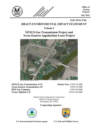
  • 1. FERC/DEIS-270D DRAFT ENVIRONMENTAL IMPACT STATEMENT Volume I NEXUS Gas Transmission Project and Texas Eastern Appalachian Lease Project Source: State of Ohio Office of Information Technology NEXUS Gas Transmission, LLC Docket Nos.: CP16-22-000 Texas Eastern Transmission, LP CP16-23-000 DTE Gas Company CP16-24-000 Vector Pipeline L.P. CP16-102-000 Federal Energy Regulatory Commission Office of Energy Projects Washington, DC 20426 Office of Energy Projects July 2016 Cooperating Agencies: U.S. Environmental Protection Agency U.S. Fish and Wildlife Service
  • 2. FEDERAL ENERGY REGULATORY COMMISSION WASHINGTON, D.C. 20426 OFFICE OF ENERGY PROJECTS In Reply Refer To: OEP/DG2E/Gas 2 NEXUS Gas Transmission, LLC Texas Eastern Transmission, LP DTE Gas Company Vector Pipeline L.P. Docket Nos. CP16-22-000 CP16-23-000 CP16-24-000 CP16-102-000 FERC/EIS-270D TO THE PARTY ADDRESSED: The staff of the Federal Energy Regulatory Commission (FERC or Commission) has prepared a draft environmental impact statement (EIS) for the NEXUS Gas Transmission (NGT) Project and Texas Eastern Appalachian Lease (TEAL) Project (jointly referred to as “Projects”), proposed by NEXUS Gas Transmission, LLC (NEXUS) and Texas Eastern Transmission, LP (Texas Eastern) in the above-referenced dockets. NEXUS and Texas Eastern request authorization to construct a new Greenfield pipeline and expand an existing pipeline system from the Appalachian Basin to deliver 1.5 million dekatherms per day to consuming markets in Northern Ohio, Southeastern Michigan, and Ontario, Canada. DTE Gas Company and Vector Pipeline L.P. are requesting approval to lease capacity on their systems to NEXUS. The draft EIS assesses the potential environmental effects of the construction and operation of the Projects in accordance with the requirements of the National Environmental Policy Act. The FERC staff concludes that approval of the Projects would result in some adverse environmental impacts; however, most of these impacts would be reduced to less-than-significant levels with the implementation of NEXUS’s and Texas Eastern’s proposed mitigation measures and the additional recommendations in the draft EIS. Some of the route alternatives suggested during scoping would affect landowners that have not been part of the FERC’s environmental scoping process, as further discussed on page 5. Therefore, by this letter we are notifying these parties of our evaluation and requesting comments about the following alternative routes presented in section 3 of the draft EIS: City of Green Route Alternative, Chippewa Lake C Route Variation, and Reserve Avenue Route Variation.
  • 3. - 2 - The U.S. Fish and Wildlife Service (FWS) and U.S. Environmental Protection Agency (EPA) participated as cooperating agencies in the preparation of the draft EIS. Cooperating agencies have jurisdiction by law or special expertise with respect to resources potentially affected by the proposal and participate in the National Environmental Policy Act analysis. Although the FWS and EPA provided input to the conclusions and recommendations presented in the draft EIS, the FWS and EPA will each present its own conclusions and recommendations in its respective record of decision or determination for the Projects. The draft EIS addresses the potential environmental effects of the construction and operation of both the NGT and TEAL Projects. The NGT Project consists of about 255.9 miles of pipeline composed of the following facilities:  208.9 miles of new 36-inch-diameter natural gas pipeline in Ohio;  47 miles of new 36-inch-diameter natural gas pipeline in Michigan;  associated equipment and facilities. The TEAL Project would include two main components:  4.4 miles of new 36-inch-diameter loop pipeline in Ohio;  0.3 mile of new 30-inch-diameter interconnecting pipeline Ohio; and  associated equipment and facilities. The Projects’ proposed aboveground facilities include five new compressor stations in Ohio; additional compression and related modifications to one existing compressor station in Ohio; five new metering and regulating stations in Ohio; one new metering and regulating station in Michigan; and minor modifications at existing aboveground facilities at various locations across Ohio. The FERC staff mailed copies of the draft EIS to federal, state, and local government representatives and agencies; elected officials; environmental and public interest groups; Native American tribes; potentially affected landowners and other interested individuals and groups; and newspapers and libraries near the Projects. Paper copy versions of this draft EIS were mailed to those specifically requesting them; all others received a CD version. In addition, the draft EIS is available for public viewing on the FERC’s website (www.ferc.gov) using the eLibrary link.
  • 4. - 3 - A limited number of copies are available for distribution and public inspection at: Federal Energy Regulatory Commission Public Reference Room 888 First Street NE, Room 2A Washington, DC 20426 (202) 502-8371 Any person wishing to comment on the draft EIS may do so. To ensure consideration of your comments on the proposal in the final EIS, it is important that the Commission receive your comments on or before August 29, 2016. For your convenience, there are four methods you can use to submit your comments to the Commission. In all instances, please reference the Projects’ docket numbers (CP16-22-000 for the NGT Project and CP16-23-000 for the TEAL Project) with your submission. The Commission encourages electronic filing of comments and has expert staff available to assist you at (202) 502-8258 or efiling@ferc.gov. 1) You can file your comments electronically using the eComment feature on the Commission's website (www.ferc.gov) under the link to Documents and Filings. This is an easy method for submitting brief, text-only comments on a project. 2) You can file your comments electronically by using the eFiling feature on the Commission's website (www.ferc.gov) under the link to Documents and Filings. With eFiling, you can provide comments in a variety of formats by attaching them as a file with your submission. New eFiling users must first create an account by clicking on “eRegister.” If you are filing a comment on a particular project, please select “Comment on a Filing” as the filing type. 3) You can file a paper copy of your comments by mailing them to the following address: Nathaniel J. Davis, Sr., Deputy Secretary Federal Energy Regulatory Commission 888 First Street NE, Room 1A Washington, DC 20426 4) In lieu of sending written or electronic comments, the Commission invites you to attend one of the public comment meetings its staff will conduct in the Project areas to receive comments on the draft EIS. We1 encourage 1 “We,” “us,” and “our” refer to the environmental staff of the FERC's Office of Energy Projects.
  • 5. - 4 - interested groups and individuals to attend and present oral comments on the draft EIS at any of the meeting locations provided on page 4. There will not be a formal start of the meeting nor a formal presentation by Commission staff, but FERC staff will be available to answer your questions about the environmental review process. You may arrive at any time after 5:00 PM and we will stop taking comments at 10:00 PM Eastern Time Zone. The primary goal is to have your verbal environmental comments on the draft EIS documented in the public record. Date Location August 10, 2016 Swanton High School 604 North Main Street Swanton, OH 43558 (419) 826-3045 August 11, 2016 Tecumseh Center for the Arts 400 North Maumee Street Tecumseh, MI 49286 (517) 423-6617 August 15, 2016 Quality Inn, Freemont 3422 Port Clinton Road Fremont, OH 43420 (419) 332-0601 August 16, 2016 Elyria High School Performing Arts Center 601 Middle Avenue Elyria, OH 44035 (440) 284-5209 August 17, 2016 Wadsworth High School – James A. Mcilvaine Performing Arts Center 625 Broad Street Wadsworth, OH 44281 (330) 335-1369 August 18, 2016 Green High School 1474 Boettler Road Uniontown, OH 44685 (330) 896-7575 Verbal comments will be recorded by court reporter(s) and transcriptions will be placed into the docket for the Projects and made available for public viewing on FERC’s eLibrary system (see page 5 for instructions on using eLibrary). It is important to note that verbal comments hold the same weight as written or electronically submitted comments. If a significant number of people are interested in providing verbal comments, a time limit of 3 to 5 minutes may be implemented for each commenter to
  • 6. - 5 - ensure all those wishing to comment have the opportunity to do so within the designated meeting time. Time limits will be strictly enforced if they are implemented. Any person seeking to become a party to the proceeding must file a motion to intervene pursuant to Rule 214 of the Commission’s Rules of Practice and Procedures (Title 18 Code of Federal Regulations Part 385.214).2 Only intervenors have the right to seek rehearing of the Commission’s decision. The Commission grants affected landowners and others with environmental concerns intervenor status upon showing good cause by stating that they have a clear and direct interest in this proceeding that no other party can adequately represent. Simply filing environmental comments will not give you intervenor status, but you do not need intervenor status to have your comments considered. Route Alternatives As indicated on page 1, some landowners are receiving this draft EIS because their property has been identified as potentially being affected by certain route alternatives recommended or being considered by FERC staff to avoid or lessen environmental impacts along NEXUS’s proposed pipeline route in several locations. Refer to discussions in section 3.3.3 of the draft EIS for the City of Green Route Alternative, section 3.4.10 for the Chippewa Lake C Route Variation, and section 3.4.12 for the Reserve Avenue Route Variation. Please note that while staff has recommended the use of the last two listed alternatives, a decision whether or not to recommend the use of the City of Green Route Alternative has not been made. The Commission staff wants to ensure that all potentially affected landowners have the opportunity to participate in the environmental review process, thus staff is soliciting comments to assist with the environmental analysis of these route alternatives, which will be presented in the final EIS. Questions? Additional information about the Projects is available from the Commission’s Office of External Affairs, at (866) 208-FERC, or on the FERC website (www.ferc.gov) using the eLibrary link. Click on the eLibrary link, click on “General Search,” and enter the docket number excluding the last three digits in the Docket Number field (i.e., CP16-22). Be sure you have selected an appropriate date range. For assistance, please contact FERC Online Support at FercOnlineSupport@ferc.gov or toll free at (866) 208-3676; for TTY, contact (202) 502-8659. The eLibrary link also provides access to the texts of formal documents issued by the Commission, such as orders, notices, and rulemakings. 2 See the previous discussion on the methods for filing comments.
  • 7. - 6 - In addition, the Commission offers a free service called eSubscription that allows you to keep track of all formal issuances and submittals in specific dockets. This can reduce the amount of time you spend researching proceedings by automatically providing you with notification of these filings, document summaries, and direct links to the documents. Go to www.ferc.gov/docs-filing/esubscription.asp to subscribe. Nathaniel J. Davis, Sr., Deputy Secretary
  • 8. TABLE OF CONTENTS i Table of Contents NEXUS Gas Transmission, LLC NEXUS Gas Transmission Project Texas Eastern Transmission, LP Texas Eastern Appalachian Lease Project VOLUME I TABLE OF CONTENTS ............................................................................................................................i LIST OF APPENDICES ............................................................................................................................ v LIST OF TABLES....................................................................................................................................vii LIST OF FIGURES.................................................................................................................................... x TECHNICAL ACRONYMS ....................................................................................................................xi EXECUTIVE SUMMARY ..................................................................................................................ES-1 INTRODUCTION .....................................................................................................................ES-1 PROPOSED ACTION...............................................................................................................ES-1 PUBLIC INVOLVEMENT .......................................................................................................ES-2 ENVIRONMENTAL IMPACTS AND MITIGATION............................................................ES-3 ALTERNATIVES....................................................................................................................ES-15 CONCLUSIONS .....................................................................................................................ES-16 1.0 INTRODUCTION.......................................................................................................................1-1 1.1 PROJECT PURPOSE AND NEED.................................................................................1-3 1.1.1 NGT Project........................................................................................................1-3 1.1.2 TEAL Project......................................................................................................1-4 1.2 PURPOSE AND SCOPE OF THIS EIS..........................................................................1-5 1.2.1 Federal Energy Regulatory Commission............................................................1-5 1.2.2 U.S. Environmental Protection Agency Purpose and Role.................................1-6 1.2.3 U.S. Fish and Wildlife Service Purpose and Role ..............................................1-7 1.3 PUBLIC REVIEW AND COMMENT............................................................................1-7 1.4 NON-JURISDICTIONAL FACILITIES.......................................................................1-13 1.5 PERMITS, APPROVALS, AND REGULATORY REQUIREMENTS.......................1-14 2.0 DESCRIPTION OF PROPOSED ACTION.............................................................................2-1 2.1 PROPOSED FACILITIES...............................................................................................2-1 2.1.1 NGT Project........................................................................................................2-1 2.1.2 TEAL Project......................................................................................................2-8 2.2 LAND REQUIREMENTS...............................................................................................2-9 2.2.1 NGT Project......................................................................................................2-10 2.2.2 TEAL Project....................................................................................................2-12 2.3 CONSTRUCTION PROCEDURES..............................................................................2-13 2.3.1 General Pipeline Construction Procedures .......................................................2-15
  • 9. TABLE OF CONTENTS Table of Contents ii 2.3.2 Special Pipeline Construction Procedures ........................................................2-20 2.3.3 Aboveground Facility Construction..................................................................2-28 2.4 CONSTRUCTION SCHEDULE AND WORKFORCE ...............................................2-28 2.5 ENVIRONMENTAL INSPECTION, COMPLIANCE MONITORING, AND POST- APPROVAL VARIANCES...........................................................................................2-29 2.5.1 Coordination and Training................................................................................2-29 2.5.2 Environmental Inspection.................................................................................2-29 2.5.3 Post-Approval Variance Process ......................................................................2-31 2.5.4 Compliance Monitoring....................................................................................2-31 2.5.5 Post-construction Monitoring ...........................................................................2-32 2.6 OPERATION AND MAINTENANCE.........................................................................2-32 2.6.1 Pipeline Surveys and Inspections .....................................................................2-32 2.6.2 Right-of-way Maintenance ...............................................................................2-33 3.0 NGT AND TEAL PROJECTS ALTERNATIVES..................................................................3-1 3.1 NO ACTION ALTERNATIVE.......................................................................................3-3 3.2 SYSTEM ALTERNATIVES...........................................................................................3-4 3.2.1 Existing Pipeline Systems...................................................................................3-4 3.2.2 Proposed Pipeline Systems .................................................................................3-5 3.3 MAJOR ROUTE ALTERNATIVES...............................................................................3-7 3.3.1 Rover Route Alternative...................................................................................3-11 3.3.2 Southern Route Alternative ..............................................................................3-18 3.3.3 City of Green Route Alternative.......................................................................3-22 3.3.4 Electric Transmission Line Route Alternative..................................................3-27 3.3.5 Canton A Route Alternative .............................................................................3-30 3.3.6 Canton B Route Alternative..............................................................................3-32 3.3.7 Canton C Route Alternative..............................................................................3-34 3.3.8 Doylestown Route Alternative..........................................................................3-36 3.3.9 Turnpike Route Alternative ..............................................................................3-38 3.3.10 Oak Openings Route Alternative......................................................................3-41 3.3.11 Waterville Route Alternative............................................................................3-43 3.3.12 CORN Western Route Alternative ...................................................................3-45 3.4 MINOR ROUTE VARIATIONS ..................................................................................3-47 3.4.1 Middlebranch Avenue Route Variations ..........................................................3-47 3.4.2 Electric Transmission Line Route Variation.....................................................3-49 3.4.3 Kent Avenue Route Variation...........................................................................3-51 3.4.4 Interstate 76 Route Variation............................................................................3-53 3.4.5 Mount Eaton Road Route Variation .................................................................3-55 3.4.6 Eastern Road North Route Variation................................................................3-57 3.4.7 Eastern Road South Route Variation................................................................3-59 3.4.8 Pifer Road Route Variation...............................................................................3-61 3.4.9 Mennonite Road Route Variation.....................................................................3-63 3.4.10 Chippewa Lake Route Variations.....................................................................3-65 3.4.11 Kennedy Road Route Variation........................................................................3-73 3.4.12 Reserve Avenue Route Variation .....................................................................3-75 3.4.13 Butler Road Route Variation ............................................................................3-77 3.4.14 Luckey Road Route Variation ..........................................................................3-79 3.4.15 Martz Road Route Variation.............................................................................3-81 3.5 ABOVEGROUND FACILITY SITE ALTERNATIVES.............................................3-83 3.5.1 NGT Compressor Station Alternatives.............................................................3-83
  • 10. TABLE OF CONTENTS iii Table of Contents 3.5.2 TEAL Compressor Station Alternatives...........................................................3-92 3.5.3 Electric Compressors........................................................................................3-94 4.0 ENVIRONMENTAL ANALYSIS.............................................................................................4-1 4.1 GEOLOGY......................................................................................................................4-2 4.1.1 Existing Environment .........................................................................................4-2 4.1.2 Mineral Resources ..............................................................................................4-5 4.1.3 Geologic Hazards................................................................................................4-9 4.1.4 Paleontological Resources................................................................................4-16 4.1.5 Impacts and Mitigation.....................................................................................4-16 4.2 SOILS ............................................................................................................................4-21 4.2.1 Existing Environment .......................................................................................4-21 4.2.2 General Impacts and Mitigation........................................................................4-28 4.3 WATER RESOURCES .................................................................................................4-32 4.3.1 Groundwater Resources....................................................................................4-32 4.3.2 Surface Water Resources..................................................................................4-40 4.4 WETLANDS .................................................................................................................4-56 4.4.1 Existing Wetland Resources .............................................................................4-56 4.4.2 General Impacts and Mitigation........................................................................4-59 4.4.3 Alternative Measures........................................................................................4-62 4.4.4 Conclusion........................................................................................................4-65 4.5 VEGETATION..............................................................................................................4-66 4.5.1 Existing Environment .......................................................................................4-66 4.5.2 Impacts and Mitigation.....................................................................................4-69 4.5.3 General Construction and Restoration Procedures ...........................................4-73 4.5.4 Noxious Weeds and Pathogens.........................................................................4-74 4.5.5 Fragmentation and Edge Effect ........................................................................4-76 4.5.6 Pollinator Habitat..............................................................................................4-77 4.5.7 Conclusion........................................................................................................4-78 4.6 WILDLIFE.....................................................................................................................4-78 4.6.1 Existing Environment .......................................................................................4-78 4.6.2 Impacts and Mitigation.....................................................................................4-81 4.6.3 Sensitive or Managed Wildlife Habitats...........................................................4-83 4.6.4 Habitat Fragmentation and Edge Effect............................................................4-83 4.6.5 Game Species and Game Harvesting................................................................4-84 4.6.6 Migratory Birds.................................................................................................4-85 4.6.7 Conclusion........................................................................................................4-89 4.7 FISHERIES AND AQUATIC RESOURCES...............................................................4-89 4.7.1 Existing environment........................................................................................4-89 4.7.2 Impacts and Mitigation.....................................................................................4-90 4.7.3 Conclusion........................................................................................................4-94 4.8 SPECIAL STATUS SPECIES.......................................................................................4-94 4.8.1 Federally Listed Threatened and Endangered Species .....................................4-94 4.8.2 State-listed Species .........................................................................................4-104 4.9 LAND USE, RECREATION, SPECIAL INTEREST AREAS, AND VISUAL RESOURCES ..............................................................................................................4-109 4.9.1 Environmental Setting ....................................................................................4-113 4.9.2 Project-specific Impacts and Mitigation.........................................................4-117 4.9.3 Land Ownership and Easement Requirements ...............................................4-119 4.9.4 Existing Residences, Commercial Buildings, and Planned Developments ....4-120
  • 11. TABLE OF CONTENTS Table of Contents iv 4.9.5 Agricultural Areas...........................................................................................4-126 4.9.6 Roadways and Railroads.................................................................................4-134 4.9.7 Recreation and Special Interest Areas ............................................................4-137 4.9.8 Coastal Zone Management Areas...................................................................4-163 4.9.9 Contaminated Sites .........................................................................................4-164 4.9.10 Visual Resources.............................................................................................4-165 4.10 SOCIOECONOMICS..................................................................................................4-171 4.10.1 NGT Project Study Area.................................................................................4-172 4.10.2 TEAL Project Study Area...............................................................................4-174 4.10.3 Population and Employment...........................................................................4-174 4.10.4 Housing4-178 4.10.5 Public Services................................................................................................4-180 4.10.6 Tourism4-183 4.10.7 Transportation.................................................................................................4-185 4.10.8 Property Values...............................................................................................4-187 4.10.9 Economy and Tax Revenues...........................................................................4-189 4.10.10 Environmental Justice.....................................................................................4-191 4.11 CULTURAL RESOURCES........................................................................................4-194 4.11.1 Cultural Resources Surveys............................................................................4-194 4.11.2 Native American Consultations......................................................................4-201 4.11.3 Unanticipated Discovery Plans.......................................................................4-203 4.11.4 General Impacts and Mitigation......................................................................4-203 4.12 AIR QUALITY AND NOISE .....................................................................................4-204 4.12.1 Air Quality......................................................................................................4-204 4.12.2 Noise 4-221 4.13 RELIABILITY AND SAFETY...................................................................................4-231 4.13.1 Safety Standards .............................................................................................4-232 4.13.2 Pipeline Accident Data ...................................................................................4-241 4.13.3 Impacts on Public Safety ................................................................................4-244 4.13.4 Terrorism ........................................................................................................4-245 4.14 CUMULATIVE IMPACTS.........................................................................................4-247 4.14.1 Background.....................................................................................................4-248 4.14.2 Present and Reasonably Foreseeable Projects ................................................4-250 4.14.3 Natural Gas Production...................................................................................4-250 4.14.4 FERC Jurisdictional Pipeline Projects............................................................4-252 4.14.5 Non-jurisdictional Project-related Facilities...................................................4-254 4.14.6 Energy Projects...............................................................................................4-256 4.14.7 Transportation and Commercial/Residential Development Projects..............4-256 4.14.8 Potential Cumulative Impacts of the Proposed Action...................................4-257 4.14.9 Conclusion......................................................................................................4-272 5.0 CONCLUSIONS AND RECOMMENDATIONS....................................................................5-1 5.1 SUMMARY OF THE ENVIRONMENTAL ANALYSIS..............................................5-1 5.1.1 Geology...............................................................................................................5-1 5.1.2 Soils ....................................................................................................................5-2 5.1.3 Water Resources .................................................................................................5-3 5.1.4 Wetlands .............................................................................................................5-5 5.1.5 Vegetation...........................................................................................................5-5 5.1.6 Wildlife and Aquatic Resources .........................................................................5-6 5.1.7 Threatened, Endangered, and Other Special Status Species...............................5-7
  • 12. TABLE OF CONTENTS v Table of Contents 5.1.8 Land Use, Recreation, and Visual Resources.....................................................5-9 5.1.9 Socioeconomics ................................................................................................5-11 5.1.10 Cultural Resources............................................................................................5-12 5.1.11 Air Quality and Noise.......................................................................................5-13 5.1.12 Safety and Reliability........................................................................................5-15 5.1.13 Cumulative Impacts..........................................................................................5-15 5.1.14 Alternatives.......................................................................................................5-17 5.2 FERC STAFF’S RECOMMENDED MITIGATION....................................................5-18
  • 13. LIST OF TABLES List of Tables vi Table 1.1.1-1 Contracted Volumes for the NGT Project.....................................................................1-4 Table 1.3-1 Environmental Issues and Concerns Raised During Public Scoping for the NGT and TEAL Projects......................................................................................................1-10 Table 1.5-1 Major Environmental Permits, Licenses, Approvals, and Consultations Required for the NGT and TEAL Projects .................................................................................1-14 Table 2.1.1-1 NGT Project Pipeline Facilities.....................................................................................2-4 Table 2.1.1-2 NGT Project Aboveground Facilities............................................................................2-4 Table 2.1.1-3 NGT Project Tee-taps....................................................................................................2-7 Table 2.1.2-1 TEAL Project Aboveground Facilities..........................................................................2-8 Table 2.2-1 Summary of Land Requirements Associated with the Projects ....................................2-9 Table 2.2.1-1 NGT Project Aboveground Facility Land Requirements............................................2-11 Table 2.2.2-1 TEAL Project Aboveground Facility Land Requirements..........................................2-13 Table 2.3-1 Summary of Proposed Modifications to the FERC’s Plan and Procedures ................2-14 Table 2.3-2 Construction, Restoration, and Mitigation Plans Associated with the NGT and TEAL Projects.............................................................................................................2-15 Table 2.3.2-1 NGT Project Horizontal Direction Drill Crossings.....................................................2-23 Table 3.3.1-1 Analysis of the Rover Route Alternative......................................................................3-11 Table 3.3.2-1 Analysis of the Southern Route Alternative................................................................3-18 Table 3.3.3-1 Analysis of the City of Green Route Alternative ........................................................3-23 Table 3.3.4-1 Analysis of the Electric Transmission Line Route Alternative...................................3-28 Table 3.3.5-1 Analysis of the Canton A Route Alternative...............................................................3-30 Table 3.3.6-1 Analysis of the Canton B Route Alternative...............................................................3-32 Table 3.3.7-1 Analysis of the Canton C Route Alternative...............................................................3-34 Table 3.3.8-1 Analysis of the Doylestown Route Alternative...........................................................3-36 Table 3.3.9-1 Analysis of the Turnpike Route Alternative................................................................3-38 Table 3.3.10-1 Analysis of the Oak Openings Route Alternative...........................................................3-41 Table 3.3.11-1 Analysis of the Waterville Route Alternative .............................................................3-43 Table 3.3.12-1 Analysis of the CORN Western Route Alternative.....................................................3-45 Table 3.4.1-1 Analysis of the Middlebranch Avenue Route Variation .............................................3-47 Table 3.4.2-1 Analysis of the Electric Transmission Line Route Variation......................................3-49 Table 3.4.3-1 Analysis of the Kent Avenue Route Variation............................................................3-51 Table 3.4.4-1 Analysis of the Interstate 76 Route Variation .............................................................3-53 Table 3.4.5-1 Analysis of the Mount Eaton Road Route Variation...................................................3-55 Table 3.4.6-1 Analysis of the Eastern Road North Route Variation .................................................3-57 Table 3.4.7-1 Analysis of the Eastern Road South Route Variation .................................................3-59 Table 3.4.8-1 Analysis of the Pifer Road Route Variation................................................................3-61 Table 3.4.9-1 Analysis of the Mennonite Road Route Variation ......................................................3-63 Table 3.4.10-1 Chippewa Hydrologic Assessment..............................................................................3-65 Table 3.4.10-2 Analysis of the Chippewa Lake A Route Variation....................................................3-67 Table 3.4.10-3 Analysis of the Chippewa Lake B Route Variation ....................................................3-68 Table 3.4.10-4 Analysis of the Chippewa Lake C Route Variation ....................................................3-69 Table 3.4.11-1 Analysis of the Kennedy Road Route Variation .........................................................3-73 Table 3.4.12-1 Analysis of the Reserve Avenue Route Variation.......................................................3-75 Table 3.4.13-1 Analysis of the Butler Road Route Variation..............................................................3-77 Table 3.4.14-1 Analysis of the Luckey Road Route Variation............................................................3-79 Table 3.4.15-1 Analysis of the Martz Road Route Variation..............................................................3-81 Table 3.5.1-1 Comparison of Alternatives for Hanoverton Compressor Station (CS1) ......................3-84 Table 3.5.1-2 Comparison of Alternatives for Wadsworth Compressor Station (CS 2) ...................3-86 Table 3.5.1-3 Comparison of Alternatives for Clyde Compressor Station (CS 3) ............................3-88 Table 3.5.1-4 Comparison of Alternatives for Waterville Compressor Station (CS 4).....................3-90 Table 3.5.2-1 Comparison of Alternatives for Salineville Compressor Station ................................3-92
  • 14. LIST OF TABLES vii List of Tables Table 4.1.1-1 Surficial Geology of the NGT and TEAL Projects.......................................................4-3 Table 4.1.2-1 Non-fuel Mineral Resource Mines within 0.25 mile of the NGT Project.....................4-7 Table 4.1.2-2 Inactive or Abandoned Fuel Mineral Resource Mines within 0.25 mile of the NGT and TEAL Projects and Aboveground Facilities...........................................................4-8 Table 4.1.3.4-1 Landslide Susceptibility and Occurrence for the NGT and Teal Projects...................4-11 Table 4.1.3-2 Karst Features within 1,500 feet of the NGT Project..................................................4-13 Table 4.2.1-1 Summary of Soil Characteristics Affected by Construction of the NGT and TEAL Projects........................................................................................................................4-23 Table 4.2.1-2 Summary of Soil Characteristics Affected by Operation of the NGT and TEAL Projects........................................................................................................................4-24 Table 4.2.1-3 Summary of Topsoil Depths within the NGT and TEAL Project Construction Footprints ....................................................................................................................4-28 Table 4.3.1-1 Wellhead Protection Areas Crossed by the NGT Project Mainline ............................4-35 Table 4.3.2-1 Watersheds Crossed by the NGT and TEAL Projects.................................................4-42 Table 4.3.2-2 Surface Water Intakes within 3 Miles Downstream of NGT Project Crossings .........4-43 Table 4.3.2-3 Sensitive Waters Crossed by the NGT Project Pipeline Facilities..............................4-46 Table 4.3.2-4 Summary of Waterbodies Crossed by NGT Project HDDs ........................................4-49 Table 4.3.2-5 Potential Sources of HDD and Hydrostatic Test Water for NGT and TEAL Projects........................................................................................................................4-54 Table 4.4.3-1 Summary of Wetland Impacts Associated with the NGT and TEAL Projects ...........4-63 Table 4.5.1-1 Vegetation Cover Types Crossed by the NGT Project .................................................4-67 Table 4.5.1-2 Vegetation Cover Types Crossed by the TEAL Project ...............................................4-69 Table 4.5.2-1 Vegetation Communities Affected by Construction and Operation of the NGT and TEAL Projects.............................................................................................................4-71 Table 4.5.4-1 Regulated Noxious and Invasive Species in Ohio and Michigan.................................4-75 Table 4.6.1-1 Wildlife Species Potentially Occurring within the NGT Project Area ..........................4-79 Table 4.6.1-2 Wildlife Species Potentially Occurring within the TEAL Project Area ........................4-79 Table 4.6.6-1 Birds of Conservation Concern Potentially Occurring within the NGT Project Area...4-86 Table 4.6.6-2 Birds of Conservation Concern Potentially Occurring within the TEAL Project Area.4-87 Table 4.7.1-1 Typical Fish Species within the NGT and TEAL Projects Area ...................................4-90 Table 4.8.1-1 Summary of Effects on Federally Listed Species for the NGT Project.........................4-96 Table 4.8.1-2 Summary of Effects to Federally Listed Species for the TEAL Project......................4-102 Table 4.9.1-1 Acreage Affected by Construction and Operation of the NGT and TEAL Projects....4-110 Table 4.9.1-2 Summary of NGT Project Access Roads.....................................................................4-117 Table 4.9.3-1 Septic Systems Crossed by the NGT Project...............................................................4-121 Table 4.9.3-2 Organic Farm Lands and Specialty Crop Lands Crossed by the NGT Project............4-127 Table 4.9.3-3 Forest Management Program and Conservation Easement Enrolled Lands Crossed by the NGT Project ...................................................................................................4-131 Table 4.9.4-4 Summary of Roadways Crossed by the NGT Project..................................................4-135 Table 4.9.4-5 Railroads Crossed by the NGT Project........................................................................4-136 Table 4.9.7-1 Recreation and Special Interest Areas Crossed by the NGT Project...........................4-138 Table 4.9.5-2 Recreation and Special Interest Areas within 0.25 Mile of the NGT Project..............4-141 Table 4.10.1-1 Counties Crossed and Communities within 10 Miles of the NGT Project................4-172 Table 4.10.2-1 Counties Crossed and Communities within 10 Miles of the TEAL Project..............4-174 Table 4.10.3-1 Existing Population Levels and Trends for the NGT and TEAL Projects’ Socioeconomic Study Areas......................................................................................4-175 Table 4.10.3-2 Estimated Populations and Employment of Counties in the NGT and TEAL Projects Area .............................................................................................................4-176 Table 4.10.4-1 Available Housing in the NGT and TEAL Projects Area.........................................4-178 Table 4.10.5-1 Public Services Available within 10 Miles of the NGT and TEAL Projects ............4-181 Table 4.10.6-1 Tourism Economy in the NGT Project Area.............................................................4-184
  • 15. LIST OF TABLES List of Tables viii Table 4.10.6-2 Tourism Economy in the TEAL Project Area...........................................................4-185 Table 4.10.9-1 Estimated Economic Effects for Operations for the NGT Project in Ohio...............4-190 Table 4.11.2-1 Consultation with Federally Recognized Native American Tribes for the NGT Project .......................................................................................................................4-201 Table 4.11.4-2 Consultation with Federally Recognized Native American Tribes for the TEAL Project .......................................................................................................................4-203 Table 4.12.1-1 Attainment Status of NGT and TEAL Projects Counties..........................................4-206 Table 4.12.1-2 General Conformity Applicability Analysis for NGT and TEAL Projects...............4-209 Table 4.12.1-3 Estimated Construction Emissions for the NGT and TEAL Projects .......................4-212 Table 4.12.1-4 Proposed Hanoverton Compressor Station Emissions Summary (tpy).....................4-213 Table 4.12.1-5 Proposed Wadsworth Compressor Station Emissions Summary (tpy) .....................4-214 Table 4.12.1-6 Proposed Clyde Compressor Station Emissions Summary (tpy) ..............................4-214 Table 4.12.1-7 Proposed Waterville Compressor Station Emissions Summary (tpy).......................4-215 Table 4.12.1-8 Proposed Salineville Compressor Station Emissions Summary (tpy).......................4-215 Table 4.12.1-9 Proposed Colerain Compressor Station Modification Emissions Summary (tpy) ....4-216 Table 4.12.1-10 AERSCREEN Modeling Results for NGT Project Compressor Stations.................4-216 Table 4.12.1-11 AERSCREEN Modeling Results for TEAL Project Compressor Stations...............4-217 Table 4.12.1-11 AERSCREEN Modeling Results for TEAL Project Compressor Stations...............4-218 Table 4.12.1-12 Estimated Emissions from NGT Project M&R Stations (tpy) ..................................4-220 Table 4.12.1-13 Estimated Emissions from the NGT and Teal Project Pipelines (tpy) ......................4-220 Table 4.12.2-1 Noise Levels of Major Construction Equipment.......................................................4-223 Table 4.12.2-2 Estimated Noise Levels for HDD Entry and Exit Sites Along the NGT Project Route 4-225 Table 4.12.2-3 Estimated Noise Levels for HDDs that Could Exceed the Sound Criterion at the Closest NSA..............................................................................................................4-227 Table 4.12.2-4 Estimated Noise Levels for NGT Project M&R Stations..........................................4-228 Table 4.12.2-5 Estimated Noise Levels for NGT Project Compressor Stations................................4-229 Table 4.12.2-6 Estimated Noise Levels for TEAL Project Compressor Stations..............................4-230 Table 4.13.1-1 NGT Project Pipeline Class Locations......................................................................4-233 Table 4.13.1-2 Location of High Consequence Areas along the NGT Project Pipeline Facilities....4-237 Table 4.13.2-1 Natural Gas Transmission Pipeline Significant Incidents by Cause (1996 to 2015).4-242 Table 4.13.2-2 Incidents Caused by External Corrosion and Level of Protection (1970 through June 1984).................................................................................................................4-243 Table 4.13.2-3 Outside Force Incidents by Cause (1996 to 2015) ....................................................4-243 Table 4.13.3-1 Injuries and Fatalities – Natural Gas Transmission Pipelines...................................4-244 Table 4.13.3-2 Nationwide Accidental Deaths..................................................................................4-245 Table 4.14.5-1 Cumulative PTE Emissions from Willow Run M&R Station and DTE Gas’ Willow Run Compressor Station............................................................................................4-255
  • 16. LIST OF FIGURES ix List of Figures Figure 2.1-1 NGT Project Overview..................................................................................................2-2 Figure 2.1-2 TEAL Project Overview................................................................................................2-3 Figure 2.3.1-1 Construction Sequence Overview ...............................................................................2-18 Figure 3.2.1-1 Existing Pipeline Systems.............................................................................................3-6 Figure 3.2.2-1 Proposed Rover System ................................................................................................3-8 Figure 3.2.2-2 Proposed Leech Xpress System ....................................................................................3-9 Figure 3.2.2-3 Proposed ANR East System........................................................................................3-10 Figure 3.3.1-1 Rover Route Alternative..............................................................................................3-12 Figure 3.3.2-1 Southern Route Alternative.........................................................................................3-19 Figure 3.3.3-1 City of Green Route Alternative .................................................................................3-25 Figure 3.3.4-1 Electric Transmission Line Route Alternative............................................................3-29 Figure 3.3.5-1 Canton A Route Alternative........................................................................................3-31 Figure 3.3.6-1 Canton B Route Alternative ........................................................................................3-33 Figure 3.3.7-1 Canton C Route Alternative ........................................................................................3-35 Figure 3.3.8-1 Doylestown Route Alternative....................................................................................3-37 Figure 3.3.9-1 Turnpike Route Alternative.........................................................................................3-39 Figure 3.3.10-1 Oak Openings Route Alternative ................................................................................3-42 Figure 3.3.11-1 Waterville Route Alternative ......................................................................................3-44 Figure 3.3.12-1 CORN Western Route Alternative..............................................................................3-46 Figure 3.4.1-1 Middlebranch Avenue Route Variation ......................................................................3-48 Figure 3.4.2-1 Electric Transmission Line Route Variation...............................................................3-50 Figure 3.4.3-1 Kent Avenue Route Variation.....................................................................................3-52 Figure 3.4.4-1 Interstate 76 Route Variation ......................................................................................3-54 Figure 3.4.5-1 Mount Eaton Road Route Variation............................................................................3-56 Figure 3.4.6-1 Eastern Road North Route Variation...........................................................................3-58 Figure 3.4.7-1 Eastern Road South Route Variation...........................................................................3-60 Figure 3.4.8-1 Pifer Road Route Variation.........................................................................................3-62 Figure 3.4.9-1 Mennonite Road Route Variation ...............................................................................3-64 Figure 3.4.10-1 Chippewa Hydrologic Assessment..............................................................................3-66 Figure 3.4.10-2 Chippewa Lake A Route Variation.............................................................................3-70 Figure 3.4.10-3 Chippewa Lake B Route Variation .............................................................................3-71 Figure 3.4.10-4 Chippewa Lake C Route Variation .............................................................................3-72 Figure 3.4.11-1 Kennedy Road Route Variation ..................................................................................3-74 Figure 3.4.12-1 Reserve Avenue Route Variation................................................................................3-76 Figure 3.4.13-1 Butler Road Route Variation.......................................................................................3-78 Figure 3.4.14-1 Luckey Road Route Variation.....................................................................................3-80 Figure 3.4.15-1 Martz Road Route Variation .......................................................................................3-82 Figure 3.5.1-1 Hanoverton Compressor Station Alternatives.............................................................3-85 Figure 3.5.1-2 Wadsworth Compressor Station Alternatives .............................................................3-87 Figure 3.5.1-3 Clyde Compressor Station Alternatives ......................................................................3-89 Figure 3.5.1-4 Waterville Compressor Station Alternatives...............................................................3-91 Figure 3.5.2-1 Salineville Compressor Station Alternatives...............................................................3-93 Figure 4.3.1-1 Bedrock Aquifers ........................................................................................................4-34 Figure 4.3.2-1 Watersheds..................................................................................................................4-41
  • 17. LIST OF APPENDICES List of Appendices x VOLUME I APPENDIX A Draft EIS Distribution List APPENDIX B NGT and TEAL Project Route Maps APPENDIX C Project Description Tables APPENDIX C-1 Summary of NGT Pipeline Co-Location with Existing Rights-of- Way APPENDIX C-2 APPENDIX C-3 Summary of ATWS Associated with the NGT Pipeline Project Pipe/Contractor Yards and Staging Areas for the NGT Project APPENDIX C-4 Proposed New, Improved, and Private Access Roads for the NGT and TEAL Projects APPENDIX C-5 Summary of ATWS Associated with the TEAL Pipeline Project VOLUME II APPENDIX D Typical Right-of-Way Configurations APPENDIX E Construction, Restoration, and Mitigation Plans APPENDIX E-1 NGT Project Blasting Plan APPENDIX E-2 TEAL Project Blasting Plan APPENDIX E-3 NGT Project Drain Tile Mitigation Plan APPENDIX E-4 HDD Design Report and HDD Monitoring and Inadvertent Return Contingency Plan APPENDIX E-5 NGT Residential Construction Plans APPENDIX F NGT Project Incorporated Route Variations APPENDIX G Geology Tables APPENDIX G-1 Bedrock Geology of the NGT and TEAL Projects APPENDIX G-2 Oil and Gas Wells within 0.25 mile of the NGT and TEAL Projects APPENDIX H Water Resource Tables APPENDIX H-1 Water Supply Wells and Springs within 150 feet of the NGT and TEAL Projects APPENDIX H-2 Waterbodies Crossed by the NGT and TEAL Projects APPENDIX H-3 Surface Public Water Supply Protection Areas Crossed by NGT and TEAL Projects APPENDIX H-4 Impaired Surface Waters Crossed by the NGT and TEAL Projects APPENDIX H-5 FEMA Flood Zones Crossed by the NGT Project APPENDIX H-6 ATWS within 50 Feet of Wetlands and Waterbodies on the NGT and TEAL Projects APPENDIX I Wetlands Tables APPENDIX I-1 NGT Project Wetland Impacts APPENDIX I-2 TEAL Project Wetland Impacts
  • 18. LIST OF APPENDICES xi List of Appendices APPENDIX J State-listed Species Potentially Occurring within or near the NGT and TEAL Projects APPENDIX K Land Use Tables APPENDIX K-1 Summary of Existing Utilities Crossed by the NGT Project APPENDIX K-2 Buildings within 50 Feet of the NGT Project APPENDIX K-3 Planned Developments near the NGT Project APPENDIX K-4 Known FSA-enrolled Lands Crossed by the NGT Project APPENDIX K-5 Agricultural Drain Tiles and Irrigation Systems Crossed by the NGT Project APPENDIX K-6 Roadways Crossed by the NGT Project APPENDIX K-7 Roadways Crossed by the TEAL Project APPENDIX K-8 Recreation and Special Interest Areas Crossed by the NGT Project APPENDIX L Socioeconomic Tables APPENDIX L-1 Average Daily Traffic County on Roads in the NGT Project Area APPENDIX L-2 Average Daily Traffic County on Roads in the TEAL Project Area APPENDIX L-3 Racial, Ethnic, and Poverty Statistics for Census Tracts within 1 mile of the NGT Pipeline and Major Aboveground Facilities in Ohio APPENDIX L-4 Racial, Ethnic, and Poverty Statistics for Census Tracts within 1 Mile of the NGT Pipeline and Major Aboveground Facilities in Michigan APPENDIX L-5 Racial, Ethnic, and Poverty Statistics for Census Tracts within 1 Mile of the TEAL Pipeline and Major Aboveground Facilities APPENDIX M NSA Figures APPENDIX N Recently Completed, Current, and Potential Future Projects near the NGT and TEAL Projects APPENDIX O List of References APPENDIX P List of Preparers
  • 19. LIST OF ACRONYMS List of Acronyms xii °F degrees Fahrenheit μg/m3 micrograms per cubic meter ACHP Advisory Council on Historic Preservation ACR Abandonment and Capacity Restoration Project ACS American Community Survey AG-PEM agricultural palustrine emergent AMSL Above Mean Sea Level ANR ANR Pipeline Co. ANR East ANR East Pipeline Project APBA Applicant-Prepared BA APE area of potential effect AQCR Air Quality Control Regions ATWS additional temporary workspace AWS agricultural water supply BA Biological Assessment BCC Birds of Conservation Concern BGEPA Bald and Golden Eagle Protection Act BMP best management practices CAA Clean Air Act of 1970 and its 1977 and 1990 amendments CAUV Current Agricultural Use Value CAZ critical assessment zone CEQ Council on Environmental Quality Certificate Certificate of Public Convenience and Necessity CFR Code of Federal Regulations cfs cubic feet per second CH4 Methane Chippewa MWCD Chippewa Subdistrict of the Muskingum Watershed Conservancy District CMNH Cleveland Museum of Natural History CO carbon monoxide CO2 carbon dioxide CO2e carbon dioxide equivalent Columbia Columbia Gas Transmission Commission Federal Energy Regulatory Commission CORN Coalition to Reroute NEXUS CREP Conservation Reserve Enhancement Program
  • 20. LIST OF ACRONYMS xiii List of Acronyms CRP Conservation Reserve Program CS compressor station CVSR Cuyahoga Valley Scenic Railroad CWA Clean Water Act CZMA Coastal Zone Management Area dBA A-weighted decibels dbh diameter at breast height DDAGW Division of Drinking and Ground Water DEO Dominion East Ohio DHHS U.S. Department of Health and Human Services Dominion Dominion Transmission DOE Department of Energy DOT U.S. Department of Transportation DTE Gas DTE Gas Company Dth/d dekatherms per day E&SCP Erosion and Sediment Control Plan EI Environmental Inspector EIS Environmental Impact Statement EM electromagnetic EPA U.S. Environmental Protection Agency ESA Endangered Species Act FEMA Federal Emergency Management Agency FERC Federal Energy Regulatory Commission FERC OEP FERC’s Office of Energy Projects FERC Plan Upland Erosion Control, Revegetation, and Maintenance Plan FERC Procedures Wetland and Waterbody Construction and Mitigation Procedures FHWA Federal Highways Administration FSA Farm Service Agency FWS U.S. Fish and Wildlife Service g gravity GHG greenhouse gases GIS geographic information system gpm gallons per minute GWP global warming potential HAP hazardous air pollutant HCA high-consequence area
  • 21. LIST OF ACRONYMS List of Acronyms xiv HDD horizontal directional drill HDD Plan HDD Monitoring and Inadvertent Return Contingency Plan hp horsepower HPSA Health Professional Shortage Area HUC Hydrologic Unit Code IMP Integrity Management Program IPCC Intergovernmental Panel on Climate Change ISMP Invasive Species Management Plan IWS industrial water supply kV kilovolt Ldn day-night sound level Leq equivalent sound level M&R metering and regulating MAC Michigan Administrative Code MAOP maximum allowable operating pressure MBCP Migratory Bird Conservation Plan MBTA Migratory Bird Treaty Act MDEQ Michigan Department of Environmental Quality MDNR Michigan Department of Natural Resources MDOT Michigan Department of Transportation Memorandum Memorandum of Understanding on Natural Gas Transportation Facilities MLV mainline valve MMBtu/hr million British thermal units per hour MNFI Michigan Natural Features Inventory MP milepost MUA/P Medically Underserved Area or Population MWH modified warm water habitat N2O nitrous oxide NAAQS National Ambient Air Quality Standards NCNST North Country National Scenic Trail NEPA National Environmental Policy Act NESHAP National Emission Standards for Hazardous Air Pollutants for Source Categories NEXUS NEXUS Gas Transmission, LLC NGA Natural Gas Act NGT Project NEXUS Gas Transmission Project
  • 22. LIST OF ACRONYMS xv List of Acronyms NHA National Heritage Area NHPA National Historic Preservation Act NMFS National Marine Fisheries Service NNSR Nonattainment New Source Review NOAA National Oceanic and Atmospheric Administration NOI Notice of Intent NOP National Organic Program NOx nitrogen oxides NPDES National Pollutant Discharge Elimination System NPS National Park Service NRCS Natural Resources Conservation Service NRHP National Register of Historic Places NRI National Rivers Inventory NSA noise-sensitive area NSPS New Source Performance Standards NSR New Source Review NWI National Wetland Inventory OAC Ohio Administrative Code OCRM Ocean and Coastal Resource Management ODGS Ohio Division of Geologic Survey ODNR Ohio Department of Natural Resources ODOT Ohio Department of Transportation OEMA Ohio Emergency Management Agency OEP Office of Energy Projects OEPA Ohio Environmental Protection Agency OFTL Ohio Forest Tax Law OPEN Ohio Pipeline Energy Network ORAM Ohio Rapid Assessment Method ORV outstandingly remarkable value OSW Ohio Special Waters PADEP Pennsylvania Department of Environmental Protection Panhandle Eastern Panhandle Eastern Pipe Line Pb (airborne) lead pCi/L picocuries per liter PEM palustrine emergent PFO palustrine forested
  • 23. LIST OF ACRONYMS List of Acronyms xvi PGA peak ground acceleration PHMSA Pipeline and Hazardous Materials Safety Administration PM10 inhalable particulate matter with an aerodynamic diameter less than or equal to 10 PM2.5 inhalable particulate matter with an aerodynamic diameter less than or equal to 2.5 ppb parts per billion ppm parts per million PSD Prevention of Significant Deterioration PSS palustrine scrub-shrub PTE potential to emit PTIO Permit-to-Install-and-Operate PUB palustrine unconsolidated bottom PVC polyvinyl chloride PWS Public Water System RACER Revitalizing Auto Communities Environmental Response RCP Residential Construction Plan REX Rockies Express Pipeline RHA Rivers and Harbor Act Rover Rover Pipeline, LLC RR Resource Report SDWA Safe Drinking Water Act SHPO State Historic Preservation Office SO2 sulfur dioxide SPCC Plan Spill Prevention, Control, and Countermeasure Plan SSA sole source aquifer SSURGO Soil Survey Geographic database Structure II-A Muskingum Watershed Conservation District’s Structure II-A SWAP Source Water Assessment Program SWAPP Source Water Assessment and Protection Program TEAL Project Texas Eastern Appalachian Lease Project Texas Eastern Texas Eastern Transmission, LP TGP Tennessee Gas Pipeline Company, LLC tpy tons per year TSA Transportation Safety Administration USACE U.S. Army Corps of Engineers USC United States Code
  • 24. LIST OF ACRONYMS xvii List of Acronyms USDA U.S. Department of Agriculture USGCRP U.S. Global Change Research Program USGS U.S. Geological Survey Vector Vector Pipeline L.P. VOC volatile organic compound WHPA Wellhead Protection Area WHPP Wellhead Protection Program WNS White Nose Syndrome WWH warm water habitat
  • 25. ES-1 Executive Summary EXECUTIVE SUMMARY INTRODUCTION On November 20, 2015, NEXUS Gas Transmission, LLC (NEXUS) filed an application with the Federal Energy Regulatory Commission (FERC or Commission) in Docket No. CP16-22-000 pursuant to Section 7(c) of the Natural Gas Act (NGA) and Parts 157 and 284 of the Commission’s regulations. NEXUS is seeking a Certificate of Public Convenience and Necessity (Certificate) to construct, own, and operate a new natural gas pipeline system in Ohio and Michigan. NEXUS’ proposed project is referred to as the NEXUS Gas Transmission Project (NGT Project). On November 20, 2015, Texas Eastern Transmission, LP (Texas Eastern) filed an abbreviated application with FERC in Docket No. CP16-23-000 pursuant to Sections 7(b) and 7(c) of the NGA and Parts 157 and 284 of the Commission’s regulations for a Certificate to construct, own, and operate a natural gas pipeline and related facilities in Ohio as well as approval to abandon by lease to NEXUS the capacity created by the Texas Eastern Appalachian Lease Project (TEAL Project) facilities. Collectively the applications are referred to as the “Projects.”1 The purpose of this environmental impact statement (EIS) is to inform FERC decision-makers, the public, and the permitting agencies about the potential adverse and beneficial environmental impacts of the Projects, as well as alternatives, and recommend mitigation measures that would reduce adverse impacts to the extent practicable. We2 prepared this EIS to assess the environmental impacts associated with construction and operation of the Projects as required under the National Environmental Policy Act of 1969 (NEPA), as amended. Our analysis was based on information provided by the applicants and further developed from data requests; field investigations; scoping; literature research; contacts with or comments from federal, state, and local agencies; and comments from individual members of the public. The U.S. Environmental Protection Agency (EPA) and U.S. Fish and Wildlife Service (FWS) are participating as cooperating agencies in the preparation of this EIS.3 PROPOSED ACTION The NGT and TEAL Projects include about 260.6 miles of pipeline composed of the following facilities:  NEXUS’ mainline, which consists of about 255.7 miles of new 36-inch-diameter mainline pipeline in Ohio and Michigan;  NEXUS’ interconnecting pipeline, which consists of about 0.9 mile of new 36-inch- diameter interconnecting pipeline in Ohio; 1 In a related matter, on November 24, 2015, DTE Gas Company (DTE Gas) filed an application with FERC in Docket No. CP16-24-000 seeking approval of a lease of capacity on DTE Gas’s system to NEXUS. On March 11, 2015, Vector Pipeline L.P. (Vector) filed an application with FERC in Docket No. CP16-102-000 seeking approval of a lease of capacity on Vector’s system to NEXUS. Any new or modified facilities associated with these actions are proposed to be constructed under an existing Blanket Certificate or are under the jurisdiction of another agency or country. 2 “We,” “us,” and “our” refer to the environmental staff of FERC’s Office of Energy Projects. 3 A cooperating agency has jurisdiction by law or special expertise with respect to environmental impacts involved with the proposed project and is involved in the NEPA analysis.
  • 26. Executive Summary ES-2  Texas Eastern’s pipeline loop, which comprises about 4.4 miles of new 36-inch-diameter loop pipeline in Ohio; and  Texas Eastern’s connecting pipeline, which comprises about 0.3 mile of new 30-inch- diameter interconnecting pipeline in Ohio. The Projects’ aboveground facilities include:  NEXUS’ 4 new compressor stations, 6 new metering and regulating (M&R) stations, and 17 new mainline valves;  Texas Eastern’s new compressor station, modifications of an existing compressor station, two new pig4 launchers/receivers, and temporary pig launcher/receiver; and  additional new facilities and modifications, such as pig launchers/receivers, communication towers, and regulators, installed at other aboveground facility sites. Subject to the receipt of FERC authorization and all other applicable permits, authorizations, and approvals, the applicants anticipate starting construction as soon as possible, with an in-service date of November 2017, except for Texas Eastern’s modifications to its existing compressor station, which has an in-service date of October 2018. The Projects would provide for the transportation of 1.5 million dekatherms per day of natural gas from the Appalachian Basin to consuming markets in Northern Ohio and Southeastern Michigan as well as the Dawn Hub in Ontario, Canada. Supply also would be able to reach the Chicago Hub in northern Illinois and other Midwestern markets through interconnections with other pipelines. NEXUS indicated that the need for the Projects originates from an increase in demand for natural gas in the region for electric generation, home heating, and industrial use, coupled with a decrease of imports of natural gas to the region by traditional supply sources, mainly western Canada and the Gulf Coast. The Projects would meet this need by importing natural gas to the region from newly available sources, mainly the Appalachian Basin. PUBLIC INVOLVEMENT On January 9, 2015, and January 26, 2015, FERC began its pre-filing review of the NGT Project and TEAL Project, respectively, and established pre-filing Docket Nos. PF15-10-000 and PF15-11-000 to place information related to the Projects into the public record. On April 8, 2015, FERC issued a Notice of Intent to Prepare an Environmental Impact Statement for the Planned Nexus Gas Transmission Project and Texas Eastern Appalachian Lease Project, Request for Comments on Environmental Issues, and Notice of Public Scoping Meetings (NOI). The NOI was published in the Federal Register on April 15, 2015, and mailed to 4,319 interested parties, including federal, state, and local agencies; elected officials; environmental and public interest groups; Native American tribes; potentially affected landowners; local libraries and newspapers; and other stakeholders who had indicated an interest in the NGT and TEAL Projects. Publication of the NOI established a 30- day public comment period for the submission of comments, concerns, and issues related to the environmental aspects of the Projects. 4 A pig is an internal tool that can be used to clean and dry a pipeline and/or to inspect it for damage or corrosion. A pig launcher/receiver is an aboveground facility where pigs are inserted into or received from the pipeline.
  • 27. ES-3 Executive Summary Between April 28, 2015, and May 7, 2015, FERC conducted public scoping meetings in Grafton, Wadsworth, Louisville, Swanton, and Fremont, Ohio; and Tecumseh, Michigan to provide an opportunity for agencies, stakeholders, and the general public to learn more about the planned pipeline Project and participate in the environmental analysis by commenting on the issues to be addressed in the draft EIS. On April 15, 2016, the Commission issued a letter to certain affected landowners describing route modifications on the NGT Project, inviting newly affected landowners to participate in the environmental review process, and opening an additional 30-day scoping period. Substantive environmental issues identified through this public review process are addressed in this EIS. The transcripts of the public scoping meetings and all written comments are part of FERC’s public record for each Project and are available for viewing using the appropriate docket number. ENVIRONMENTAL IMPACTS AND MITIGATION We evaluated the potential impacts of construction and operation of the Projects on geology; soils; water resources; wetlands; vegetation; wildlife and aquatic resources; threatened, endangered, and special status species; land use, recreation, and visual resources; socioeconomics; cultural resources; air quality and noise; reliability and safety; and cumulative impacts. Where necessary, we recommend additional mitigation measures to minimize or avoid these impacts. In Section 3 of this EIS, we summarize the evaluation of alternatives to the Projects, including the no-action alternative, system alternatives, major route alternatives, and minor route variations. Sections 5.1 and 5.2 of the EIS contain our conclusions and a compilation of our recommended mitigation measures, respectively. Construction of the Projects would affect a total of 5,250.9 acres of land, including land for the pipeline facilities, aboveground facilities, contractor yards, staging areas and access roads. Permanent operations would require about 1,707.4 acres of land, including land for the new permanent pipeline rights-of-way, aboveground facility sites, and permanent access roads. The remaining 3,543.5 acres of land disturbed during construction would be restored and allowed to revert to its former use. Important issues identified as a result of our analyses, scoping comments, and agency consultations include impacts on geology; water resources, and wetlands; vegetation, wildlife, and aquatic species; special status species; land use, recreation, and visual resources; cultural resources; air quality and noise; safety and reliability; and cumulative impacts. Geology The overall effect of the Projects on geologic resources would be minor. Geologic impacts would be limited to disturbance to the existing topography within the Projects area. All areas disturbed during construction, including in rugged terrain, would be returned as closely as possible to preconstruction contours during cleanup and restoration. The removal of bedrock, including by blasting, may be required if bedrock is encountered within the pipeline trench or at aboveground facility sites. We have reviewed the applicants’ Blasting Plans and find them acceptable. The potential for the Projects to be adversely affected by seismic activity, active faults, or soil liquefaction is low due to the low probability of significant earthquakes in the area. The potential for the NGT Project to be adversely affected by landslide also is low; however, the TEAL Project is in an area of elevated landslide risk. During final design, Texas Eastern has committed to conducting geotechnical investigations to further evaluate landslide risk in areas of steep slopes, and would implement best
  • 28. Executive Summary ES-4 management practices as outlined in its Erosion and Sediment Control Plan (E&SCP) to manage surface water and maintain slope stability. We have reviewed the E&SCP and found it consistent with our Upland Erosion Control, Revegetation, and Maintenance Plan and Wetland and Waterbody Construction and Mitigation Procedures. Where the E&SCP differed from our plans, we found the modifications acceptable. To ensure landslide risks are appropriately mitigated, Texas Eastern would file the results of the geotechnical studies and final landslide mitigation measures with the Commission for review and approval prior to construction. There are areas along the NGT Project where a karst hazard may be present; no karst hazards exist along the TEAL Project. NEXUS has routed the NGT Project to avoid known sinkholes and conducted electromagnetic geophysical surveys to identify additional karst. All construction supervisory staff and inspectors would be trained to recognize the signs of sinkhole formation. If previously undocumented karst features are encountered during construction, NEXUS would implement a minor reroute, if possible, to avoid the feature, or stabilize the feature to avoid further sinkhole development. Ground subsidence could occur in areas where abandoned underground mines are crossed. NEXUS has routed the NGT Project to avoid all known abandoned underground mines. Texas Eastern has routed the TEAL Project above abandoned underground mines at the same location as its existing facilities, which have been unaffected by mine subsidence. NEXUS would implement additional investigation (and mitigation, if necessary) in the event that a previously undocumented abandoned underground mine is discovered prior to or during construction. Flash flooding is a potential hazard in the Projects area. NEXUS and Texas Eastern would bury the pipeline to a depth that would provide at least 5 feet of cover below the existing streambed. In addition, NEXUS and Texas Eastern would implement the measures in their respective E&SCPs to reduce the likelihood of sedimentation and erosion during flash flood events. With the implementation of NEXUS’ and Texas Eastern’s E&SCPs, Blasting Plans, plans to further evaluate landslide risk, and procedures to be followed in the event of discovery of previously undocumented karst features or abandoned underground mines, we conclude that impacts on geological resources would be adequately minimized. Groundwater, Surface Water, Water Use, and Wetlands Construction of the Projects could result in increased turbidity and alteration of flow in shallow aquifers if encountered within trench depth or during grading and excavation at aboveground facilities. These impacts would be minimized by measures included in the applicants’ E&SCPs. An inadvertent release of fuel, lubricants, and other substances would be minimized and mitigated by implementing the applicants’ Project-specific Spill Prevention, Control, and Countermeasure Plans (SPCC Plans) that identify contractor training, the use of environmental inspectors, procedures for the safe storage and use of hazardous materials, and remedial actions that would be taken to address a spill. We have reviewed the SPCC Plans and find them acceptable. A total of 245 wells and 6 springs were identified within 150 feet of the Projects. Additionally, the NGT Project would cross 16 wellhead protection areas; the TEAL Project would not cross any wellhead protection areas. To mitigate impacts on wells, springs, and wellhead protection areas, the applicants would offer to conduct pre- and post-construction testing of water quality and yield in all wells within 150 feet of the construction workspace. The applicants would also implement their SPCC Plans to avoid, minimize, and mitigate any chemical spills, and would prohibit fueling within 200 feet of a private well and within 400 feet of a public well. In addition, the applicants would repair or replace any wells that are adversely affected, or would otherwise compensate the well owner.
  • 29. ES-5 Executive Summary NEXUS proposes to use the horizontal directional drill (HDD) construction method at several locations. Texas Eastern would not use the HDD construction method. An inadvertent release of drilling mud could occur during drilling operations, affecting groundwater quality. NEXUS would implement measures detailed in its Project-specific HDD Monitoring and Inadvertent Return Contingency Plan to avoid or minimize the inadvertent release of drilling mud, which we have reviewed and find acceptable. NEXUS identified 112 sites with known or suspected soil and groundwater contamination within 0.25 mile of the NGT Project. Texas Eastern did not identify any sites within 0.25 mile of the TEAL Project. The majority of these sites were determined to be unlikely to impact groundwater quality beneath the NGT Project; however, we recommend that NEXUS further assess the potential for 11 of the sites to impact groundwater quality beneath the NGT Project and to provide site-specific plans to manage pre-existing contamination, if applicable, to the Commission for our review and approval. The Projects would not significantly affect groundwater resources because the majority of construction would involve shallow, temporary, and localized excavation. Potential impacts would be avoided or further minimized by the use of construction techniques and mitigation measures described in the applicants’ E&SCPs, SPCC Plans, and NEXUS’ HDD Monitoring and Inadvertent Return Contingency Plan, as well as our recommendations. The Projects would cross a total of 475 waterbodies (208 perennial, 156 intermittent, 90 ephemeral, 1 named reservoir, 5 ponds, and 5 unclassified). The applicants would use the HDD method at 18 waterbody crossings, including all Section 10 navigable, National River Inventory-designated, and Ohio Environmental Protection Agency (OEPA)-designated outstanding and superior water quality streams. The applicants would use the conventional bore method to cross 69 waterbodies. The remaining waterbodies would be crossed using dry (dam-and-pump or flume) and open-cut wet crossing methods. Successful implementation of HDD or bore methods would avoid impacts on waterbodies. Impacts on waterbodies that would be crossed using dry and open-cut wet crossing methods would be minimized by implementing mitigation measures outlined in the applicants’ E&SCPs and other project-specific plans. We recommend that NEXUS file additional geotechnical feasibility data at several locations prior to beginning HDD construction and also file, in the event of an unsuccessful HDD, contingency crossing plans for these waterbodies, for our review and written approval. The Projects would cross 12 surface water protection areas and 5 waterbodies that have public water intakes within 3 miles downstream. The applicants would avoid or minimize impacts by implementing the BMPs detailed in each Project’s E&SCP and SPCC Plan, and the NGT Project Blasting Plan, if needed, and would use HDD and conventional bore crossing methods for several stream crossings. The applicants requested use of additional temporary workspace (ATWS) in several areas where they concluded that site-specific conditions do not allow for a 50-foot setback of extra workspace from waterbodies. Based on our review, we believe that NEXUS has provided adequate justification for the need of the ATWS at all locations on the NGT Project. We recommend that Texas Eastern provide further justification for several ATWS on the TEAL Project, or move the workspaces to a distance of 50 feet or greater from waterbodies. No long-term effects on surface waters would result from construction and operation of the Project. No designated water uses would be permanently affected. During maintenance activities in or near streams, the applicants would employ protective measures similar to those proposed for construction of the Projects. Consequently, we conclude that any maintenance-related effects would be short term.
  • 30. Executive Summary ES-6 The applicants would use both surface water and water trucks as sources for hydrostatic testing, the HDD construction method, and dust suppression. The source of water transported by trucks could be from municipal or groundwater sources. Impacts associated with the withdrawal of surface water would be effectively minimized by using pumps placed adjacent to the waterbody with hoses placed into the waterbody with floating intake structures that would be screened to prevent the uptake of aquatic organisms and fish. Additionally, water withdrawals would be conducted in compliance with all necessary permits required for surface water extraction. Discharge of water to upland areas could contribute to erosion, which would be minimized by adhering to the measures contained in the Projects’ E&SCPs. Based on the mitigation measures developed by the applicants as described in this summary, as well as our recommendations, we conclude that the Projects would not have significant adverse impacts on surface water resources. Construction of the pipeline facilities associated with the Projects would temporarily affect a total of 191.6 acres of wetlands. No wetlands would be permanently filled. Impacts on emergent wetlands would be relatively brief because the emergent vegetation would regenerate quickly, typically within one to three years. Impacts on scrub-shrub and forested wetlands would be long-term or permanent because the woody vegetation would take several years to grow back. Additionally, the applicants would maintain a 10-foot-wide corridor centered over the pipeline in an herbaceous state and would selectively cut trees within 15 feet of the pipeline centerline. Approximately 39.9 acres would be converted from forested or scrub-shrub wetland to emergent or scrub-shrub wetland. Construction and operation-related impacts on wetlands would be mitigated by the applicants. NEXUS would create a project-specific Wetland Mitigation Plan in consultation with the U.S. Army Corps of Engineers (USACE), Michigan Department of Environmental Quality (MDEQ), and OEPA, where mitigation would include the purchase of wetland mitigation credits from established wetland mitigation banks, the use of an in-lieu fee program, or a combination of the two. Texas Eastern would create a project-specific Wetland Mitigation Plan in consultation with USACE and OEPA. Mitigation would include the purchase of wetland mitigation credits from established wetland mitigation banks, the use of an in-lieu fee program, or a combination of the two. We recommend that each applicant file its final Wetland Mitigation Plan with the Commission prior to construction. The applicants requested use of ATWS in several areas where they concluded that site-specific conditions do not allow for a 50-foot setback of extra workspace from wetlands. Based on our review, we believe that NEXUS has provided adequate justification for the need of the ATWS at all locations on the NGT Project. We recommend that Texas Eastern provide further justification for several ATWS on the TEAL Project, or move the workspaces to a distance of 50 feet or greater from wetlands. Based on the types and amounts of wetlands that would be impacted and the applicants’ measures to avoid, minimize, and mitigate wetlands impacts as described in their construction and restoration plans, as well as our recommendations, we conclude that impacts on wetlands would be effectively minimized or mitigated. These impacts would be further minimized and mitigated by the applicants’ compliance with USACE Section 404 and state permit requirements, including the purchase of wetland mitigation credits and use of in-lieu fee programs. Vegetation, Wildlife, and Aquatic Resources Construction of the Projects would affect 371.5 acres of forested upland, 43.3 acres of forested wetland, 571.8 acres of open upland, 43.8 acres of emergent wetland, and 19.5 acres of scrub-shrub wetland. The remaining 4,202.7 acres are agricultural land, developed land, or open water. Operation of
  • 31. ES-7 Executive Summary the Projects would affect 148.0 acres of forested upland, 26.7 acres of forested wetland, 154.5 acres of open upland, 21.0 acres of emergent wetland, and 10.0 acres of scrub-shrub wetland. The remaining 1,347.4 acres are agricultural land, developed land, or open water. Impacts on upland open land, emergent wetlands, and agricultural lands would be short term as these vegetation cover types would likely return to their pre-construction states within one to three growing seasons after restoration is complete. Impacts on forested uplands, forest wetlands, and scrub- shrub wetlands would be long-term or permanent. However, due to the prevalence of forested habitats within the Projects area, the ability to co-locate the proposed facilities adjacent to existing rights-of-way (46 percent of the route would be co-located), and the eventual regrowth of forested areas outside of the permanent right-of-way, we conclude that the permanent conversion of forested lands would not result in a significant impact. In addition, impacts on forested and non-forested vegetation types would be further mitigated through implementation of the applicants’ construction and restoration plans, as well as our recommendations. The NGT Project would cross approximately 9.7 miles of the Oak Openings Region in Henry and Fulton Counties, Ohio. Roughly 99 percent of the ecosystem has been altered and fragmented by agricultural development, primarily through tree clearing and wetland draining. Botanical surveys confirmed two remnant communities totaling about 0.5 mile in length would be crossed by the NGT Project: the Swamp White Oak-Pin Oak Flatwoods and the Black Oak-White Oak/Blueberry Forest Plant communities. Neither of these areas contained all of the indicative species that would be present in high- quality remnant communities, and most of the clearing would be adjacent to the existing forest edge. Therefore, based on our review, impacts on the Oak Openings Region would be minor. Construction of the Projects would temporarily impact about 1,049.9 acres of pollinator habitat (including upland forest, forested wetland, upland open land, emergent wetland, and scrub-shrub wetland). The applicants would revegetate both the temporary workspaces and permanent rights-of-way immediately after the pipeline facilities are installed with herbaceous and riparian seed mixes in consultation with the Natural Resources Conservation Service. Once revegetated, the restored workspaces and permanent rights-of-way would provide pollinator habitat after the first or second growing season, and may naturally improve pollinator habitat along the Projects area. We recommend that the Applicants provide a plan describing the feasibility of incorporating plant seeds that support pollinators into the seed mixes used for restoration of construction workspaces. The applicants have identified several areas where noxious weeds or invasive species are present or are located near the construction right-of-way. NEXUS and Texas Eastern have each developed Invasive Species Management Plans to minimize and control the spread of the noxious and invasive species, which we reviewed and find acceptable. The Projects could have both direct and indirect impacts on wildlife species and their habitats, including the displacement of wildlife, potential individual mortality, and reduction in habitat. Forest fragmentation would increase in certain locations due to clearing, thus reducing the amount of habitat available for interior forest species (i.e. movement and dispersal corridors). With habitat conversion and forest fragmentation, there is also a risk of intrusion by invasive or noxious species. To minimize wildlife impacts, the applicants have routed the pipelines to avoid a number of sensitive areas, co-locate with existing rights-of-way where practical, and reduce workspace in wetlands and interior forest areas. The applicants also would adhere to their respective E&SCPs and Invasive Species Management Plans. A variety of migratory bird species, including Birds of Conservation Concern, are associated with the habitats that would be affected by the Projects. NEXUS has prepared a draft Migratory Bird Conservation Plan in coordination with the FWS Region 3 office for the portions of the NGT Project in
  • 32. Executive Summary ES-8 Michigan. The purpose of the plan is to reduce direct and indirect effects on migratory birds and their habitats. We recommend that NEXUS provide final Migratory Bird Conservation Plans for both Michigan and Ohio facilities prior to construction. During operations, the applicants would avoid mortalities or injuries of breeding birds and their eggs or young by conducting vegetation clearing and maintenance activities outside of the breeding season to the extent practicable, particularly in key habitat areas. Vegetative maintenance in the permanent right-of-way would take place no more than once every 3 years, and impacts on ground-nesting birds in upland areas would be minimized by conducting maintenance activities outside the nesting season (i.e., March 31 to August 1). Based on the presence of suitable adjacent habitat available for use and given the impact avoidance, minimization, and mitigation measures proposed by NEXUS, as well as our recommendations, we conclude that the construction and operation of the Projects would not have a significant adverse effect on wildlife. The Projects would involve crossing 465 waterbodies, many of which support fisheries and aquatic habitat. All of the waterbodies are classified as warmwater fisheries. Construction and operation of the Projects could result in temporary and permanent impacts on fisheries and aquatic habitat. To minimize impacts on fisheries and aquatic habitat, the applicants would follow their respective E&SCPs. Further, all waterbodies identified as fisheries of concern (potentially containing federally or state-listed species) would be crossed using dry crossing methods or HDDs. Based on our review of the potential impacts, we conclude that construction and operation of the Projects would not significantly impact fisheries or aquatic resources. Threatened, Endangered, and Other Special Status Species To comply with Section 7 of the Endangered Species Act (ESA), we consulted either directly or indirectly (through the applicants’ informal consultation) with the FWS and state resource agencies regarding the presence of federally listed, proposed for listing, or state-listed species in the Projects area. Based on these consultations, we identified 11 federally listed or proposed species as potentially occurring in the Projects area. We determined that the northern riffleshell, the snuffbox mussel, Mitchell’s satyr butterfly, the Poweshiek skipperling, the Karner blue butterfly, and the eastern prairie fringed orchid would not be affected by construction and operation of the Projects. We also determined that the Projects may affect, but would not likely adversely affect, the Indiana bat, Kirtland’s warbler, the rayed bean mussel, and the eastern massasauga rattlesnake. The Projects may affect, and are likely to adversely affect, the northern long-eared bat; however, under the current 4(d) rule, incidental take of this species is not prohibited. NEXUS is preparing an Applicant-Prepared Biological Assessment (APBA) as a contingency for adjustments to construction schedules and constraints regarding access to properties, and in the event the 4(d) rule is no longer applicable for the northern long-eared bat due to pending legal challenges. The APBA would define anticipated impacts on both Indiana bats and northern long-eared bats in the event that spring and/or summer clearing may be required, and would provide the data necessary for the FWS to calculate levels of take for both species. We recommend that NEXUS continue Section 7 consultations with the FWS and file all results of its consultations with the Secretary for review prior to construction. In addition, because spring emergence surveys are pending for the eastern massasauga rattlesnake (currently proposed for listing under the ESA) we recommend that prior to construction of the NGT Project, NEXUS should file with the Secretary the 2016 survey results and any mitigation measures developed in consultation with the FWS for the eastern massasauga rattlesnake.
  • 33. ES-9 Executive Summary The bald eagle retains federal protection under the Bald and Golden Eagle Protection Act and the Migratory Bird Treaty Act, which prohibit the taking of eagles, their eggs, or their nests. NEXUS conducted aerial bald eagle nest surveys along the NGT Project route in spring 2015. No bald eagle nests were identified within 660 feet of the NGT Project area; therefore, no impact on bald eagles is anticipated. However, we recommend that prior to construction, NEXUS should conduct additional bald eagle nest surveys to determine if any new eagle nests are present within 660 feet of the construction workspace. A total of 91 state-listed species may occur in the Projects area. Seventy-seven (77) species are listed at the state level only; 11 species are also listed as federally protected, while 3 are listed as federally protected, but are not present in the Projects area. The applicants have proposed measures to reduce habitat and species impacts, and continue to consult with resource agencies to identify and develop additional conservation and mitigation measures to further minimize impacts on state-listed species. State permitting agencies have further opportunity during their permit review and authorization processes to require additional conservation and mitigation measures that would further protect and conserve sensitive species and their habitats according to each agencies’ mission and conservation goals. Although a number of other candidate, state-listed, or special concern species were identified as potentially present in the Projects area, none were detected during surveys and we do not expect any adverse effects given the applicants’ proposed measures and our recommendations. Based on implementation of these measures and our recommendations, we conclude that impacts on special-status species would be adequately avoided or minimized. Land Use, Recreation, and Visual Resources Construction of the Projects would affect a total of 5,223.7 acres of land. About 85.6 percent of this acreage would be utilized for the pipeline facilities, including the construction right-of-way (59.1 percent) and additional temporary workspace (26.5 percent). The remaining acreage affected during construction would be associated with contractor yards (4.5 percent), staging areas (0.9 percent), new and modified aboveground facilities (7.7 percent), and access roads (1.3 percent). During operation, the new permanent pipeline right-of-way, aboveground facilities, and permanent access roads would affect 1,707.4 acres of land. The land retained as new permanent right-of-way would generally be allowed to revert to its former use, except for forest/woodland and tree crops. Certain activities, such as the construction of permanent structures or the planting of trees, would be prohibited within the permanent right-of-way. To facilitate pipeline inspection, operation, and maintenance, the entire permanent right-of-way in upland areas would be maintained in an herbaceous vegetated state. This maintained right-of-way would be mowed no more than once every 3 years, but a 10-foot-wide strip centered over the pipeline might be mowed more frequently to facilitate corrosion and other operational surveys. The NGT Project’s proposed construction work area is within 50 feet of 178 structures including 15 residences and/or their associated structures. The TEAL Project is not within 50 feet of any structure. NEXUS has developed site-specific residential construction plans for the residential structures within 50 feet of the construction work area. We reviewed these plans and find them acceptable; however, we are encouraging the owners of each of these residences to provide us comments on the plan specific for their property (see appendix E-5). Also, to further minimize effects on residences, we recommend that for all residences located within 10 feet of the construction work area, NEXUS provide evidence of landowner concurrence with the Site-specific Residential Construction Plans. NEXUS has also developed an Issue Resolution Plan that identifies how stakeholders can contact pipeline company