Soumettre la recherche
Mettre en ligne
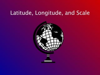
Latitude, Longitude, And Scale
•
Télécharger en tant que PPT, PDF
•
1 j'aime
•
5,054 vues
A
acavis
Suivre
Formation
Technologie
Signaler
Partager
Signaler
Partager
1 sur 9
Télécharger maintenant
Recommandé
Scale is used from mapwork in Geography - NSW Curriculum
Scale - Geography Skill
Scale - Geography Skill
Mr Shipp
Geography Skills
Types of Map Scales
Types of Map Scales
Lyric Treco-Hanna
Lab three map scale
Lab three map scale
lschmidt1170
An introduction to teaching scale measurement in Geography.
Geography Skills: Scale
Geography Skills: Scale
Tim Bonnar
By the end of the lesson students should be able to: -measure straight line distances on a map and covert them into ‘real world’ distance -measure curved distances (roads & rivers) and convert them into ‘real world’ distance
Measuring scale on OS Maps
Measuring scale on OS Maps
Mr Dowdican
compass direction and bearing
Sec 2 Geography Topographical Skills
Sec 2 Geography Topographical Skills
Karen Kang-Lim
Class Notes 9/20/10 and 9/21/10
Earth Science Chapter 1
Earth Science Chapter 1
mshenry
Vertical Exaggeration for Topographis maps
Vertical Exaggeration
Vertical Exaggeration
Rob Marchetto
TB page 40 to 46
Chapter 2 - Topo Map Reading
Chapter 2 - Topo Map Reading
GeographyByTian
Lesson plan map Master 2
Lesson plan map
Lesson plan map
caroline06
Introduction to Maps
Introduction to Maps
itutor
Department Land Affairs South Africa
Mapwork Basic Skills.ppt
Mapwork Basic Skills.ppt
marcguybrown
Earth science 1.3
Earth science 1.3
Tamara
Latitude and Longitude - Hurricane Plotting Information
Latitude and Longitude
Latitude and Longitude
dwinter1
measuring straight line distance, using map symbols and contour lines
Sec 2 Geography Topographical Map Skills
Sec 2 Geography Topographical Map Skills
Karen Kang-Lim
Secondary 1 Geography-Topographic Map
Secondary 1 Geography-Topographic Map
MarioSonic54
Latitude And Longitude Primer
Latitude And Longitude Primer
Stuart Kirkham
Latitude & longitude class 2013 notes
Latitude & longitude class 2013 notes
Connie Lopez Fink
Holt Science & Technology
Maps as Models of Earth
Maps as Models of Earth
mlong24
Latitude Longitude Types of Maps Topo Maps
Models of the Earth - Mapping
Models of the Earth - Mapping
mkeller1977
Gps1
Gps1
pendemann
Unidad 1 G&H 1º ESO
Tema 1 1 eso 2019
Tema 1 1 eso 2019
Angel Muñoz Álvarez
Map reading
Map reading
Kennyboo Brown
Map scale1
Map scale1
13bermanjor
This presentation covers the following topics: 1. Geographic coordinate system, i.e, latitude and longitudes 2. Size and location of India (because before understanding the size and location our country, Geographic coordinate system, i.e, latitude and longitudes are important) which enables the students to locate all four hemispheres including Northern Hemisphere Southern Hemisphere Eastern Hemisphere Western Hemisphere Students will be able to identify which line divides the earth into the correct hemispheres. Students will be able to find locations on map using longitude and latitude.
Latitudes and longitudes and india size and location
Latitudes and longitudes and india size and location
Rajesh Kumar
Readingmaps 1
Readingmaps 1
Deb Crahen
Map reading (1)
Map reading (1)
Yanjie Luo
Map scale and projection
Map scale and projection
lschmidt1170
Lab three map scale
Lab three map scale
Lisa Schmidt
Measurement and Scale
Measurement and Scale
John Reiser
Contenu connexe
Tendances
TB page 40 to 46
Chapter 2 - Topo Map Reading
Chapter 2 - Topo Map Reading
GeographyByTian
Lesson plan map Master 2
Lesson plan map
Lesson plan map
caroline06
Introduction to Maps
Introduction to Maps
itutor
Department Land Affairs South Africa
Mapwork Basic Skills.ppt
Mapwork Basic Skills.ppt
marcguybrown
Earth science 1.3
Earth science 1.3
Tamara
Latitude and Longitude - Hurricane Plotting Information
Latitude and Longitude
Latitude and Longitude
dwinter1
measuring straight line distance, using map symbols and contour lines
Sec 2 Geography Topographical Map Skills
Sec 2 Geography Topographical Map Skills
Karen Kang-Lim
Secondary 1 Geography-Topographic Map
Secondary 1 Geography-Topographic Map
MarioSonic54
Latitude And Longitude Primer
Latitude And Longitude Primer
Stuart Kirkham
Latitude & longitude class 2013 notes
Latitude & longitude class 2013 notes
Connie Lopez Fink
Holt Science & Technology
Maps as Models of Earth
Maps as Models of Earth
mlong24
Latitude Longitude Types of Maps Topo Maps
Models of the Earth - Mapping
Models of the Earth - Mapping
mkeller1977
Gps1
Gps1
pendemann
Unidad 1 G&H 1º ESO
Tema 1 1 eso 2019
Tema 1 1 eso 2019
Angel Muñoz Álvarez
Map reading
Map reading
Kennyboo Brown
Map scale1
Map scale1
13bermanjor
This presentation covers the following topics: 1. Geographic coordinate system, i.e, latitude and longitudes 2. Size and location of India (because before understanding the size and location our country, Geographic coordinate system, i.e, latitude and longitudes are important) which enables the students to locate all four hemispheres including Northern Hemisphere Southern Hemisphere Eastern Hemisphere Western Hemisphere Students will be able to identify which line divides the earth into the correct hemispheres. Students will be able to find locations on map using longitude and latitude.
Latitudes and longitudes and india size and location
Latitudes and longitudes and india size and location
Rajesh Kumar
Readingmaps 1
Readingmaps 1
Deb Crahen
Map reading (1)
Map reading (1)
Yanjie Luo
Map scale and projection
Map scale and projection
lschmidt1170
Tendances
(20)
Chapter 2 - Topo Map Reading
Chapter 2 - Topo Map Reading
Lesson plan map
Lesson plan map
Introduction to Maps
Introduction to Maps
Mapwork Basic Skills.ppt
Mapwork Basic Skills.ppt
Earth science 1.3
Earth science 1.3
Latitude and Longitude
Latitude and Longitude
Sec 2 Geography Topographical Map Skills
Sec 2 Geography Topographical Map Skills
Secondary 1 Geography-Topographic Map
Secondary 1 Geography-Topographic Map
Latitude And Longitude Primer
Latitude And Longitude Primer
Latitude & longitude class 2013 notes
Latitude & longitude class 2013 notes
Maps as Models of Earth
Maps as Models of Earth
Models of the Earth - Mapping
Models of the Earth - Mapping
Gps1
Gps1
Tema 1 1 eso 2019
Tema 1 1 eso 2019
Map reading
Map reading
Map scale1
Map scale1
Latitudes and longitudes and india size and location
Latitudes and longitudes and india size and location
Readingmaps 1
Readingmaps 1
Map reading (1)
Map reading (1)
Map scale and projection
Map scale and projection
Similaire à Latitude, Longitude, And Scale
Lab three map scale
Lab three map scale
Lisa Schmidt
Measurement and Scale
Measurement and Scale
John Reiser
Topic 1 of Social Science (CAPS).
Social Science Grade 8 Maps and Globes.pptx
Social Science Grade 8 Maps and Globes.pptx
AntonHartman
Looking at models and scale
Scale and scale factor
Scale and scale factor
sciencenerd42 McCarthy
1. How does a topographic map show the shape of the land surface? For example, how do topographic maps indicate steeper slopes? How are gentler slopes portrayed? How can you identify stream or river valleys on maps? 2. What are contour lines? What is an index contour? 3. Define contour interval. 4. What does a fractional scale of 1:48,000 mean? 5. What is a bar scale and how is it used? 6. The basic unit of latitude and longitude is the degree. How is the degree subdivided? 7. Latitude is measured in degrees N or S of what line? What is the range of possible values (in degrees) for latitude? 8. Longitude is measured in degrees W or E of what line? Where is that line located? What is the range of possible values (in degrees) for longitude? Introduction Topograpbic maps illustrate scale, width, length, and height of landforms. Geologic maps show the distribution of different rock units and geologic features, such as faults, at the surface of the Earth. In this lab you will become familiar with both types of maps which are important tools for anyone studying the earth or its resources. Learning Outcomes - Explain how contours are used to show elevation information and landforms on a map. (questions 13) - Understand and explain different types of map scale, such as fractional scale and bar scale. (questions 4-5) - Explain how latitude and longitude are used to describe location. (questions 6-8) - Draw and use contours to visualize spatial data (such as spot elevations). (question 9) - Find the latitude and longitude of a location on a map. (questions 10, 17, 18) - Read elevation data and interpret contours on a topographic map.(questions 11, 12, 19) - Calculate elevation change and gradient (slope) from topographic maps.(questions 13, 21) - Read distances on a map using a ruler and bar scale.(questions 14-16; 20) - Interpret ages of rock units on a geologic map (questions 22-23) - Identify geologic structures on a geologic map (questions 24-27) - Draw a geologic cross section using locations of contacts and angles of dip on a geologic map (questions 28-30) - Identify types of folds or faults on a geologic cross section (questions 28-30) Map Coordinate Systems A coordinate system allows us to describe the location of any point on the surface of the Earth. Lines of latitude (also known as parallels) are the horizontal lines that circle the globe. These lines are known as parallels because the run in the same direction as (are parallel to) the Equator. The Equator is the imaginary line located at 0 latitude and is halfway between the North Pole and the South Pole, which are 180 apart. This means the South Pole is 90 S and the North Pole is 90N. Lines that run from the North Pole to the South Pole are lines of longitude (also known as meridians). The line at 0 longitude is the prime meridian and runs through the Royal Observatory in Greenwich, England. Meridians are counted east and west from the prime meridian up to a maximum of 180 longitude at the.
1 How does a topographic map show the shape of the land sur.pdf
1 How does a topographic map show the shape of the land sur.pdf
cbholla1
Map Skills
Geography_Map Skills .pptx
Geography_Map Skills .pptx
NataliaBurgess
Introduction to various GIS software, google earth. Intro types, types of maps, map projections and hands on to Q GIS software. Introduction to latitude longitude system, shape file generation, geo referencing and digitization.
1.pptx
1.pptx
SejalDesai30
An introduction to the basic concept o cartography.
M09U01_ppt_cartograph.ppt
M09U01_ppt_cartograph.ppt
RalphNavelino3
Chapter1
Chapter1
lschmidt1170
map projections in GIS
projections.ppt
projections.ppt
ssuser37f552
projection system
projections.ppt
projections.ppt
ssuser37f552
topographical projection
projections.ppt
projections.ppt
GauravSingh338805
Importance of Geometry in our day to day life.
Geometry in real life
Geometry in real life
Lavanya
Easy calculations for mapwork.
Mapwork calculations
Mapwork calculations
fenslin
9 perimeter, area volume
9 perimeter, area volume
Skills for Life, Suffolk New college
perimeter, area volume
perimeter, area volume
Skills for Life, Suffolk New college
basic mapping skill geography
Mapping .pptx
Mapping .pptx
kristieMurphy2
WORLD MAP direction LOCATION (LATITUDE & LONGITUDE )GPS calculation and other methods
Dogmatic WORLD MAP
Dogmatic WORLD MAP
Nandi Sudheer
Topographic maps presentation_mine
Topographic maps presentation_mine
misterbatroms
A coordinate system is a reference system used to represent the locations of geographic features, imagery, and observations, within a common geographic framework. Coordinate systems enable geographic datasets to use common locations for integration.
Basic coordinate system
Basic coordinate system
Shayan Ahmad Yar
Similaire à Latitude, Longitude, And Scale
(20)
Lab three map scale
Lab three map scale
Measurement and Scale
Measurement and Scale
Social Science Grade 8 Maps and Globes.pptx
Social Science Grade 8 Maps and Globes.pptx
Scale and scale factor
Scale and scale factor
1 How does a topographic map show the shape of the land sur.pdf
1 How does a topographic map show the shape of the land sur.pdf
Geography_Map Skills .pptx
Geography_Map Skills .pptx
1.pptx
1.pptx
M09U01_ppt_cartograph.ppt
M09U01_ppt_cartograph.ppt
Chapter1
Chapter1
projections.ppt
projections.ppt
projections.ppt
projections.ppt
projections.ppt
projections.ppt
Geometry in real life
Geometry in real life
Mapwork calculations
Mapwork calculations
9 perimeter, area volume
9 perimeter, area volume
perimeter, area volume
perimeter, area volume
Mapping .pptx
Mapping .pptx
Dogmatic WORLD MAP
Dogmatic WORLD MAP
Topographic maps presentation_mine
Topographic maps presentation_mine
Basic coordinate system
Basic coordinate system
Plus de acavis
Polygon Notes
Polygon Notes
acavis
Building Blocks Of Geometry
Building Blocks Of Geometry
acavis
The Geometry Of Solids Notes
The Geometry Of Solids Notes
acavis
Polygon Notes
Polygon Notes
acavis
Similar Triangles Notes
Similar Triangles Notes
acavis
Pythagoras And The Pythagorean Theorem
Pythagoras And The Pythagorean Theorem
acavis
Congruence Shortcuts Notes
Congruence Shortcuts Notes
acavis
Polygon Notes
Polygon Notes
acavis
Logic Notes
Logic Notes
acavis
Describes what fractals are and gives examples of them
Fractals Notes
Fractals Notes
acavis
Plus de acavis
(10)
Polygon Notes
Polygon Notes
Building Blocks Of Geometry
Building Blocks Of Geometry
The Geometry Of Solids Notes
The Geometry Of Solids Notes
Polygon Notes
Polygon Notes
Similar Triangles Notes
Similar Triangles Notes
Pythagoras And The Pythagorean Theorem
Pythagoras And The Pythagorean Theorem
Congruence Shortcuts Notes
Congruence Shortcuts Notes
Polygon Notes
Polygon Notes
Logic Notes
Logic Notes
Fractals Notes
Fractals Notes
Dernier
FSB Advising Checklist
FSB Advising Checklist - Orientation 2024
FSB Advising Checklist - Orientation 2024
Elizabeth Walsh
Wizards are very useful for creating a good user experience. In all businesses, interactive sessions are most beneficial. To improve the user experience, wizards in Odoo provide an interactive session. For creating wizards, we can use transient models or abstract models. This gives features of a model class except the data storing. Transient and abstract models have permanent database persistence. For them, database tables are made, and the records in such tables are kept until they are specifically erased.
How to Create and Manage Wizard in Odoo 17
How to Create and Manage Wizard in Odoo 17
Celine George
ICT Role in 21st Century Education & its Challenges •This presentation gives an overall view of education in 21st century and how it is facilitated by the integration of ICT. •It also gives a detailed explanation of the challenges faced in ICT-based education and further elaborates the strategies that can help in overcoming the challenges.
ICT Role in 21st Century Education & its Challenges.pptx
ICT Role in 21st Century Education & its Challenges.pptx
AreebaZafar22
https://app.box.com/s/7hlvjxjalkrik7fb082xx3jk7xd7liz3
TỔNG ÔN TẬP THI VÀO LỚP 10 MÔN TIẾNG ANH NĂM HỌC 2023 - 2024 CÓ ĐÁP ÁN (NGỮ Â...
TỔNG ÔN TẬP THI VÀO LỚP 10 MÔN TIẾNG ANH NĂM HỌC 2023 - 2024 CÓ ĐÁP ÁN (NGỮ Â...
Nguyen Thanh Tu Collection
The pricing and discounting feature is very essential for Odoo POS. Global discount is actually a discount that will apply to the entire order. And it indicates that the discount is applied to every item in the order, regardless of how much each item costs separately. This slide will show how to manage global discounts in odoo 17 POS.
How to Manage Global Discount in Odoo 17 POS
How to Manage Global Discount in Odoo 17 POS
Celine George
This slide will show how to set domains for a field in odoo 17. Domain is mainly used to select records from the models. It is possible to limit the number of records shown in the field by applying domain to a field, i.e. add some conditions for selecting limited records.
How to Give a Domain for a Field in Odoo 17
How to Give a Domain for a Field in Odoo 17
Celine George
38 K-12 educators from North Carolina public schools
On National Teacher Day, meet the 2024-25 Kenan Fellows
On National Teacher Day, meet the 2024-25 Kenan Fellows
Mebane Rash
Explore the world of IT certification with CompTIA. Discover how the CompTIA Security+ Book SY0-701 can elevate your cybersecurity expertise and open doors to new career opportunities. This PDF provides essential insights into the CompTIA Security+ certification, guiding you through exam preparation and showcasing the benefits of becoming CompTIA-certified. Download now to embark on your journey to IT excellence with CompTIA.
ComPTIA Overview | Comptia Security+ Book SY0-701
ComPTIA Overview | Comptia Security+ Book SY0-701
bronxfugly43
Mehran University Newsletter is a Quarterly Publication from Public Relations Office
Mehran University Newsletter Vol-X, Issue-I, 2024
Mehran University Newsletter Vol-X, Issue-I, 2024
Mehran University of Engineering & Technology, Jamshoro
Students will get the knowledge of the following- meaning of the pricing, its importance, objectives, methods of pricing, factors affecting the price of products, An overview of DPCO (Drug Price Control Order) and NPPA (National Pharmaceutical Pricing Authority)
Unit-V; Pricing (Pharma Marketing Management).pptx
Unit-V; Pricing (Pharma Marketing Management).pptx
VishalSingh1417
This Presentation is about the Unit 5 Mathematical Reasoning of UGC NET Paper 1 General Studies where we have included Types of Reasoning, Mathematical reasoning like number series, letter series etc. and mathematical aptitude like Fraction, Time and Distance, Average etc. with their solved questions and answers.
UGC NET Paper 1 Mathematical Reasoning & Aptitude.pdf
UGC NET Paper 1 Mathematical Reasoning & Aptitude.pdf
Nirmal Dwivedi
https://medicaleducationelearning.blogspot.com/2024/02/using-micro-scholarship-to-incentivize.html
Micro-Scholarship, What it is, How can it help me.pdf
Micro-Scholarship, What it is, How can it help me.pdf
Poh-Sun Goh
Basic Civil Engineering notes first year Notes Building notes Selection of site for Building Layout of a Building What is Burjis, Mutam Building Bye laws Basic Concept of sunlight ventilation in building National Building Code of India Set back or building line Types of Buildings Floor Space Index (F.S.I) Institutional Vs Educational Building Components & function Sills, Lintels, Cantilever Doors, Windows and Ventilators Types of Foundation AND THEIR USES Plinth Area Shallow and Deep Foundation Super Built-up & carpet area Floor Area Ratio (F.A.R) RCC Reinforced Cement Concrete RCC VS PCC
Basic Civil Engineering first year Notes- Chapter 4 Building.pptx
Basic Civil Engineering first year Notes- Chapter 4 Building.pptx
Denish Jangid
Klinik_ Apotek Onlin 085657271886 Solusi Menggugurkan Masalah Kehamilan Anda Jual Obat Aborsi Asli KLINIK ABORSI TERPEECAYA _ Jual Obat Aborsi Cytotec Misoprostol Asli 100% Ampuh Hanya 3 Jam Langsung Gugur || OBAT PENGGUGUR KANDUNGAN AMPUH MANJUR OBAT ABORSI OLINE" APOTIK Jual Obat Cytotec, Gastrul, Gynecoside Asli Ampuh. JUAL ” Obat Aborsi Tuntas | Obat Aborsi Manjur | Obat Aborsi Ampuh | Obat Penggugur Janin | Obat Pencegah Kehamilan | Obat Pelancar Haid | Obat terlambat Bulan | Ciri Obat Aborsi Asli | Obat Telat Bulan | Pil Aborsi Asli | Cara Menggugurkan Konten | Cara Aborsi Tuntas | Harga Obat Aborsi Asli | Pil Aborsi | Jual Obat Aborsi Cytotec | Cara Aborsi Sendiri | Cara Aborsi Usia 1 Bulan | Cara Aborsi Usia 2 Tahun | Cara Aborsi Usia 3 Bulan | Obat Aborsi Usia 4 Bulan | Cara Abrasi Usia 5 Bulan | Cara Menggugurkan Konten | Kandungan Obat Penggugur | Cara Menghitung Usia Konten | Cara Mengatasi Terlambat Bulan | Penjual Obat Aborsi Asli | Obat Aborsi Garansi | Kandungan Obat Peluntur | Obat Telat Datang Bulan | Obat Telat Haid | Obat Aborsi Paling Murah | Klinik Jual Obat Aborsi | Jual Pil Cytotec | Apotik Jual Obat Aborsi | Kandungan Dokter Abrasi | Cara Aborsi Cepat | Jual Obat Aborsi Bergaransi | Jual Obat Cytotec Asli | Obat Aborsi Aman Manjur | Obat Misoprostol Cytotec Asli. "APA ITU ABORSI" “Aborsi Adalah dengan membendung hormon yang di perlukan untuk mempertahankan kehamilan yaitu hormon progesteron, karena hormon ini dibendung, maka jalur kehamilan mulai membuka dan leher rahim menjadi melunak,sehingga mengeluarkan darah yang merupakan tanda bahwa obat telah bekerja || maksimal 1 jam obat diminum || PENJELASAN OBAT ABORSI USIA 1 _7 BULAN Pada usia kandungan ini, pasien akan merasakan sakit yang sedikit tidak berlebihan || sekitar 1 jam ||. namun hanya akan terjadi pada saatdarah keluar merupakan pertanda menstruasi. Hal ini dikarenakan pada usiakandungan 3 bulan,janin sudah terbentuk sebesar kepalan tangan orang dewasa. Cara kerja obat aborsi : JUAL OBAT ABORSI AMPUH dosis 3 bulan secara umum sama dengan cara kerja || DOSIS OBAT ABORSI 2 bulan”, hanya berbedanya selain mengisolasijanin juga menghancurkan janin dengan formula methotrexate dikandungdidalamnya. Formula methotrexate ini sangat ampuh untuk menghancurkan janinmenjadi serpihan-serpihan kecil akan sangat berguna pada saat dikeluarkan nanti. APA ALASAN WANITA MELAKUKAN ABORSI? Aborsi di lakukan wanita hamil baik yang sudah menikah maupun belum menikah dengan berbagai alasan , akan tetapi alasan yang utama adalah alasan-alasan non medis (termasuk aborsi sendiri / di sengaja/ buatan] MELAYANI PEMESANAN OBAT ABORSI SETIAP HARI, SIAP KIRIM KESELURUH KOTA BESAR DI INDONESIA DAN LUAR NEGERI. HUBUNGI PEMESANAN LEBIH NYAMAN VIA WA/: 085657271886
Jual Obat Aborsi Hongkong ( Asli No.1 ) 085657271886 Obat Penggugur Kandungan...
Jual Obat Aborsi Hongkong ( Asli No.1 ) 085657271886 Obat Penggugur Kandungan...
ZurliaSoop
For more information about my speaking and training work, visit: https://www.pookyknightsmith.com/speaking/
Fostering Friendships - Enhancing Social Bonds in the Classroom
Fostering Friendships - Enhancing Social Bonds in the Classroom
Pooky Knightsmith
Students will get the knowledge of the following: - meaning of Pharmaceutical sales representative (PSR) - purpose of detailing, training & supervision - norms of customer calls - motivating, evaluating, compensation and future aspects of PSR
Unit-IV; Professional Sales Representative (PSR).pptx
Unit-IV; Professional Sales Representative (PSR).pptx
VishalSingh1417
A short exhibit showcasing three concepts from sociology.
Sociology 101 Demonstration of Learning Exhibit
Sociology 101 Demonstration of Learning Exhibit
jbellavia9
Wednesday 20 March 2024, 09:30-15:30.
Towards a code of practice for AI in AT.pptx
Towards a code of practice for AI in AT.pptx
Jisc
Wednesday 20 March 2024, 09:30-15:30.
Accessible Digital Futures project (20/03/2024)
Accessible Digital Futures project (20/03/2024)
Jisc
SOC 101 Final Powerpoint
SOC 101 Demonstration of Learning Presentation
SOC 101 Demonstration of Learning Presentation
camerronhm
Dernier
(20)
FSB Advising Checklist - Orientation 2024
FSB Advising Checklist - Orientation 2024
How to Create and Manage Wizard in Odoo 17
How to Create and Manage Wizard in Odoo 17
ICT Role in 21st Century Education & its Challenges.pptx
ICT Role in 21st Century Education & its Challenges.pptx
TỔNG ÔN TẬP THI VÀO LỚP 10 MÔN TIẾNG ANH NĂM HỌC 2023 - 2024 CÓ ĐÁP ÁN (NGỮ Â...
TỔNG ÔN TẬP THI VÀO LỚP 10 MÔN TIẾNG ANH NĂM HỌC 2023 - 2024 CÓ ĐÁP ÁN (NGỮ Â...
How to Manage Global Discount in Odoo 17 POS
How to Manage Global Discount in Odoo 17 POS
How to Give a Domain for a Field in Odoo 17
How to Give a Domain for a Field in Odoo 17
On National Teacher Day, meet the 2024-25 Kenan Fellows
On National Teacher Day, meet the 2024-25 Kenan Fellows
ComPTIA Overview | Comptia Security+ Book SY0-701
ComPTIA Overview | Comptia Security+ Book SY0-701
Mehran University Newsletter Vol-X, Issue-I, 2024
Mehran University Newsletter Vol-X, Issue-I, 2024
Unit-V; Pricing (Pharma Marketing Management).pptx
Unit-V; Pricing (Pharma Marketing Management).pptx
UGC NET Paper 1 Mathematical Reasoning & Aptitude.pdf
UGC NET Paper 1 Mathematical Reasoning & Aptitude.pdf
Micro-Scholarship, What it is, How can it help me.pdf
Micro-Scholarship, What it is, How can it help me.pdf
Basic Civil Engineering first year Notes- Chapter 4 Building.pptx
Basic Civil Engineering first year Notes- Chapter 4 Building.pptx
Jual Obat Aborsi Hongkong ( Asli No.1 ) 085657271886 Obat Penggugur Kandungan...
Jual Obat Aborsi Hongkong ( Asli No.1 ) 085657271886 Obat Penggugur Kandungan...
Fostering Friendships - Enhancing Social Bonds in the Classroom
Fostering Friendships - Enhancing Social Bonds in the Classroom
Unit-IV; Professional Sales Representative (PSR).pptx
Unit-IV; Professional Sales Representative (PSR).pptx
Sociology 101 Demonstration of Learning Exhibit
Sociology 101 Demonstration of Learning Exhibit
Towards a code of practice for AI in AT.pptx
Towards a code of practice for AI in AT.pptx
Accessible Digital Futures project (20/03/2024)
Accessible Digital Futures project (20/03/2024)
SOC 101 Demonstration of Learning Presentation
SOC 101 Demonstration of Learning Presentation
Latitude, Longitude, And Scale
1.
Latitude, Longitude, and
Scale
2.
3.
4.
5.
6.
7.
8.
9.
Télécharger maintenant
![Latitude and Longitude ,[object Object]](data:image/gif;base64,R0lGODlhAQABAIAAAAAAAP///yH5BAEAAAAALAAAAAABAAEAAAIBRAA7)