SlideShare une entreprise Scribd logo
1  sur  49
GEOLAND
A learning path
for HE students and professors
Luc Zwartjes, Ghent University, geography department
Christos Polykretis Dimitris Alexakis, FORTH Greece
Karl Donert, EUROGEO
Rafael de Miguel González, University of Zaragoza
Aims
• establish a learning path for the Higher Education students and
their professors so that they are able to apply their geospatial
analysis knowledge in decision-making for landscape
management, planning and protection of NATURA 2000 sites
across Europe
• focus in promoting digital skills like PPGIS (public participation
GIS), low-cost geoinformatic tools and the digital readiness of
higher education students in the Covid-19 pandemic era.
PARTNERS
Geoland goals
Main goals of the GEOLAND: develop
• an Educational Handbook for monitoring European
Landscape,
• a Web based GIS platform where numerous geospatial data
may be uploaded and analysed and students’ opinion about
landscape will be obtained through questionnaires and
crowdsourcing.
Geoland outcomes
• O1: Educational Handbook for monitoring European Landscape presenting a
homogeneous methodology for educating Higher Education students in studying
European Landscape with means of Geoinformatics and citizen science methodology.
• O2: Training course – Web-based GIS platform used by Higher Education students and
Professors in order to apply Landscape Character Assessment (LCA) for assessing
Landscape quality in Natura 2000 zones.
• O3: Policy outreach  provide a unique opportunity to Higher Education students to
study how European Landscape Convention (ELC) is implemented and adopted in
different EU countries.
• 04: Online gallery of students work
• 05: develop the Digital Readiness Tool, DERT, for the assessment of the digital readiness
of the Higher Education students and courses.
Geoland handbook
https://bit.ly/3sbJSzp
Formation of the landschape
natural processes socio-economic processes
natural differentiation decisions and actions
land use
antropogenic differentiation
traditional landscapes
recent landscapes
NATURAL FACTORS HUMAN FACTORS
e.g. Uniformity
(reparcelling)
Open field landscape of Artois Bocage landscape of the Boulonnais
internal forces (tectonics)
external forces (climate …)
development, organisation,
capital, entrepreneurship
perception
observer
s
i
g
h
t
s
m
e
l
l
h
e
a
r
i
n
g
f
e
e
l
i
n
g
Commitment – knowledge – memory – emotion – age …
g
n
g
Commitment – knowledge – memory – emotion – age …
recorded image recorded experience other sensations
measurements perception
(objective value) (subjective value)
relief morphology
degree of building
variation
spatial structure
transparancy
panoramic feeling
attractiveness
security
sense of space
naturalness
landscape values
spatial value
socio-economic value natural value aesthetic value historical value
panoramic opportunities – openess – transparancy – scale – relational structure
- habitability
- opportunities for
agriculture, recreation,
traffic
- natural variation
- ecological richness
- biological dynamic
- diversity of forms
- colorfulness
- compostion
- light variation
- evoking memories
- association woth
expreriences
- showing the past
Monotonous production landscape Intricate and varied residential landscape
Protecting the landscape: the European
Landscape Convention
• adopted by the Council of Europe, 2000
• obliges the signatory member countries of EU to incorporate the
landscape dimension in their legislation  policies with possible
direct or indirect impact on landscape
• covers all landscapes, both outstanding and ordinary or even
degraded, that determine the quality of people’s living
environment.
• provides a framework for integrated intergovernmental efforts
towards the preservation of landscape character and its quality
Landscape character assessment
• an environmental system must be assessed before planning,
for the purpose of decision-making and learning
• One of the major principles, which ELC is based on, is the
identification of landscape character, as well as the pressures
and drivers of change, as regards the implementation of
strategies for landscape management, planning, and
protection. Such principles and strategies require a
systematic knowledge of their variation, spanning the full
range of spatial scales that define the landscape level, i.e., in
landscape typologies (Terkenli et al., 2021).
two major types of attributes, or
components, related to landscapes:
• the bio-physical attributes linked to
natural (e.g. geology, soils, landform,
hydrology, climatic conditions)
and socio-cultural (e.g. land use,
settlement pattern, economic activities)
inheritance where a landscape is
considered in space, and
• the perceptual/aesthetic attributes linked
to how a landscape is perceived, with
regard to scenic quality, visual beauty and
human well-being.
The purpose of landscape
classification is to initially
identify areas of distinct
character, and then classify and
map them.
specific combinations of natural,
socio-cultural and perceptual
attributes existing in different
areas lead to similar landscape
character types
5 stages in GIS-based holistic LCA
methodological framework
employing public participation,
• Purpose definition
• Desk-based data collection
• Field-based data collection
• Classification
• Overall evaluation
Landscape character
assessment
Case Gentbrugse meersen and
Damvallei
Geography
Gentbrugse Meersen and Damvallei
650 ha nature area in Ghent
• 240 ha Gentbrugse meersen
• 410 ha Damvallei
Damvallei
Gentbrugse
Meersen
Natura 2000 - Zeeschelde
• Tidal zone of the river Scheldt –
“the artery of Flanders”
• Total of 8957 ha
• 16 protected habitats, 13 protected
species
• Also multifunctional landscape in a
highly dynamic and economic
region
• Included in SIGMA: to protect the
area against flooding and promote
specific nature qualities
Sigmaplan – until 2030
Geology, geomorphology, soils
Coastal marsland was grazed by sheep until the land reclaimation and the
development of polderland
Dry sandy soils used as grazing
land, later reforested
Higher sandy loamy
soils used as
cropland
Wet alluvial marshland
produced hay
Wet sandy soils were
drained
(after De Moor & Heyse 1995)
Site of
Ghent
Fields on wet soils are
bordered with ditches
Riverbanks and dunes
limit alluvial plain
Rivers and canals have
embankements
Digital Elevation Model
based on Lidar (© AGIV)
docks
Blandijn
Kuip
kouters
(openfield)
Meersen
(marsh lands)
bulken
(bocage landscape)
Reforested common
grazing land and dunes
Scheldt
Scheldt
 Situation 1770
 Map de Ferraris
 Situation 1770
 Map de Ferraris
 Situation 1863
 Dépôt de la
Guerre
 Situation 1950
 l' Institut Géographique
Militaire
 Situation 1982
 Nationaal Geografisch
Instituut
 Situation 1982
 Nationaal Geografisch
Instituut
© Stad Gent
 Situation 1982
 Nationaal Geografisch
Instituut
© Sigmaplan
Biological evaluation map
Grasslands
Natura 2000 - habitats
Potential natural vegetation
(A) Wet alder forest
(B) Oak beech forest
A
B
(A)
(B)
Cultural heritage
Testing:
Exercise landscape ecology
Niina Käyhkö 24.1.2012
I N T E R A C T I O N
ABIOTIC
AND
BIOTIC
ENVIRONMENT
SPATIAL PATTERNS
Pattern – process – change
Landscape as a spatio-temporal system
Concepts to be analysed
1. Interaction between
spatial pattern and
processes
2. Connectivity and
connectedness
3. Multifunctionality
4. Landscape heterogeneity
and diversity > Mapping the pattern, structure – landscape elements (land
cover)
> Mapping the functions (land use), management
> Use of landscape metrics to quantify the spatial pattern of
land cover and landscape elements
1. Interaction between
spatial pattern and
processes
2. Connectivity and
connectedness
3. Multifunctionality
4. Landscape heterogeneity
and diversity
> Focus on fragmentation of habitats, functions
> Use of landscape metrics to quantify the qualities of
connectivity and fragmentation
Concepts to be analysed
1. Interaction between
spatial pattern and
processes
2. Connectivity and
connectedness
3. Multifunctionality
4. Landscape heterogeneity
and diversity
Concepts to be analysed
1. Interaction between
spatial pattern and
processes
2. Connectivity and
connectedness
3. Multifunctionality
4. Landscape heterogeneity
and diversity
B
a
B
B
B
B
a
a
a
a
a
D
100m
Concepts to be analysed
Ortho 90
Raster analysis: cell as spatial integrator to calculate
entropy
Destelbergen Verrebroek
250m²x250m²
2 transects per raster
• 3 types
• Area
• line
• points
• 3 time periods
Antrop 1998
Antrop 1998
Destelbergen: changes
Destelbergen: evolution entropy land use
0
2
4
6
8
10
12
14
0.2 0.4 0.6 0.8 1.0 1.2 1.4 1.6 1.8 2.0 2.2 2.4 2.6 2.8 3.0
Entropy (bits)
Frequency
1910
1962
1995
1962
1910
1995
suburban
Homogeneous heterogeneous
Low # cat
Dominant cat
Large # cat
Fragmentated
104 transects
Mapping and monitoring landscape, habitats, biodiversity
OBSERVATION SHEET – GEOLAND
Date: ID observation (letter transect + number sample):
Hour: Place (village):
Observers:
GPS
X – coordinate:
Y- coordinate:
Z-coordinate:
Distance to previous sample point (m)
Weather conditions:
Photograph numbers:
1. Topography: (1) flat (2) slope (N S E W) (3) undulating
In case of slope: concave – convex
2. Slope: (1) 0-2° (2) 2-8° (3) 8-22° (4) > 22°
Exact percentage or degrees (to be calculated based on XYZ coordinates)
3. Soil
Moisture conditions: |----------------------------------------------------------------------|
(circle along the gradient) dry wet
Colour soil (Munsell scale code):
Top-soil
conditions:
(circle one or more options)
(1) bare
bedrock
(> 75%)
(2) bedrock,
partially bare
(50/50%)
(3) loose soils dominating (>75%):
gravel, clay, sand, loam, marl
(circle one or more options)
(4) man-made,
anthropogenic
Other bedrock, soil or topography observations of the site (erosion, weathering, deposition):
4. Vegetation
If yes, specify
Ground layer coverage: (1) bare %
(2) grass %
(3) herbs %
(4) cultivated %
Number of tree & scrub layers: 0 1 2 more
Layer heights: (1) < 0,3m (2) 0,3-0,6m (3) 0,6-2m (4) 2-5m(5) > 5m
Coverage: (1) open <25% (2) semi-open 25-50% (3) semi-closed 50-75% (4) closed >75%
Spatial distribution: (1) continuous (2) uneven (3) patchy
5. Management
What are the current land use activities in this area?
Are there any evidences of past land uses in the site today?
Are there any animals? Which and how much?
6. Conclusion
General
Habitat
category
Global/env.
qualifier
Site qualifier Man. qualifier Life form/species Comment
Life form % Species %
• More information
• https://www.geolandproject.eu
• https://www.facebook.com/GEOLANDthePROJECT

Contenu connexe

Similaire à Geoland-EUROGEO conference 2022.pptx

7th euregeo volume_1 164_165
7th euregeo volume_1 164_1657th euregeo volume_1 164_165
7th euregeo volume_1 164_165
Ricardo Brasil
 
GEOLAND Presentation UN-GGIM
GEOLAND Presentation UN-GGIMGEOLAND Presentation UN-GGIM
GEOLAND Presentation UN-GGIM
Karl Donert
 
Gis Applications Presentation
Gis Applications PresentationGis Applications Presentation
Gis Applications Presentation
Idua Olunwa
 
PERI-URBAN LAND USE CHANGE IN LAGOS THE MEGA-CITY SEMINAR 2
PERI-URBAN LAND USE CHANGE IN LAGOS THE MEGA-CITY SEMINAR 2PERI-URBAN LAND USE CHANGE IN LAGOS THE MEGA-CITY SEMINAR 2
PERI-URBAN LAND USE CHANGE IN LAGOS THE MEGA-CITY SEMINAR 2
Samuel Dekolo
 
From global to regional scale: Remote sensing-based concepts and methods for ...
From global to regional scale: Remote sensing-based concepts and methods for ...From global to regional scale: Remote sensing-based concepts and methods for ...
From global to regional scale: Remote sensing-based concepts and methods for ...
Repository Ipb
 

Similaire à Geoland-EUROGEO conference 2022.pptx (20)

GIS and Remote Sensing
GIS and Remote SensingGIS and Remote Sensing
GIS and Remote Sensing
 
7th euregeo volume_1 164_165
7th euregeo volume_1 164_1657th euregeo volume_1 164_165
7th euregeo volume_1 164_165
 
GEOLAND Presentation UN-GGIM
GEOLAND Presentation UN-GGIMGEOLAND Presentation UN-GGIM
GEOLAND Presentation UN-GGIM
 
Digital Soil Mapping by Ronald Vargas Rojas
Digital Soil Mapping by Ronald Vargas RojasDigital Soil Mapping by Ronald Vargas Rojas
Digital Soil Mapping by Ronald Vargas Rojas
 
Gis Applications Presentation
Gis Applications PresentationGis Applications Presentation
Gis Applications Presentation
 
ISRIC’s role in a digitizing world facing scarcity of natural resources by Pr...
ISRIC’s role in a digitizing world facing scarcity of natural resources by Pr...ISRIC’s role in a digitizing world facing scarcity of natural resources by Pr...
ISRIC’s role in a digitizing world facing scarcity of natural resources by Pr...
 
wasteland mapping
wasteland mappingwasteland mapping
wasteland mapping
 
Rajeshwari Urban Environment, RS and GIS
Rajeshwari  Urban Environment, RS and GISRajeshwari  Urban Environment, RS and GIS
Rajeshwari Urban Environment, RS and GIS
 
Deliverables per system Land Use Strategic Master Plans
Deliverables per system Land Use Strategic Master PlansDeliverables per system Land Use Strategic Master Plans
Deliverables per system Land Use Strategic Master Plans
 
file_1622440466657.pdf
file_1622440466657.pdffile_1622440466657.pdf
file_1622440466657.pdf
 
Monitoring Land Use and Land Cover through Remote Sensing and GIS
Monitoring Land Use and Land Cover through Remote Sensing and GISMonitoring Land Use and Land Cover through Remote Sensing and GIS
Monitoring Land Use and Land Cover through Remote Sensing and GIS
 
PERI-URBAN LAND USE CHANGE IN LAGOS THE MEGA-CITY SEMINAR 2
PERI-URBAN LAND USE CHANGE IN LAGOS THE MEGA-CITY SEMINAR 2PERI-URBAN LAND USE CHANGE IN LAGOS THE MEGA-CITY SEMINAR 2
PERI-URBAN LAND USE CHANGE IN LAGOS THE MEGA-CITY SEMINAR 2
 
The Making of the English Landscape:
The Making of the English Landscape: The Making of the English Landscape:
The Making of the English Landscape:
 
B08 A55s 134 Diapo Kouzmine En
B08 A55s 134 Diapo Kouzmine EnB08 A55s 134 Diapo Kouzmine En
B08 A55s 134 Diapo Kouzmine En
 
Cost-Effective Raster Image Processing for Geoecological Analysis Using “ISOC...
Cost-Effective Raster Image Processing for Geoecological Analysis Using “ISOC...Cost-Effective Raster Image Processing for Geoecological Analysis Using “ISOC...
Cost-Effective Raster Image Processing for Geoecological Analysis Using “ISOC...
 
An Approach For Recreation Suitability Analysis To Recreation Planning In G L...
An Approach For Recreation Suitability Analysis To Recreation Planning In G L...An Approach For Recreation Suitability Analysis To Recreation Planning In G L...
An Approach For Recreation Suitability Analysis To Recreation Planning In G L...
 
DSD-NL 2018 Evolutie in het leveren van ruimtelijke en temporele water gerela...
DSD-NL 2018 Evolutie in het leveren van ruimtelijke en temporele water gerela...DSD-NL 2018 Evolutie in het leveren van ruimtelijke en temporele water gerela...
DSD-NL 2018 Evolutie in het leveren van ruimtelijke en temporele water gerela...
 
Assessing ecosystem services over large areas
Assessing ecosystem services over large areasAssessing ecosystem services over large areas
Assessing ecosystem services over large areas
 
From global to regional scale: Remote sensing-based concepts and methods for ...
From global to regional scale: Remote sensing-based concepts and methods for ...From global to regional scale: Remote sensing-based concepts and methods for ...
From global to regional scale: Remote sensing-based concepts and methods for ...
 
Remote Sensing and GIS Techniques
Remote Sensing and GIS TechniquesRemote Sensing and GIS Techniques
Remote Sensing and GIS Techniques
 

Dernier

Making and Justifying Mathematical Decisions.pdf
Making and Justifying Mathematical Decisions.pdfMaking and Justifying Mathematical Decisions.pdf
Making and Justifying Mathematical Decisions.pdf
Chris Hunter
 
Seal of Good Local Governance (SGLG) 2024Final.pptx
Seal of Good Local Governance (SGLG) 2024Final.pptxSeal of Good Local Governance (SGLG) 2024Final.pptx
Seal of Good Local Governance (SGLG) 2024Final.pptx
negromaestrong
 
1029-Danh muc Sach Giao Khoa khoi 6.pdf
1029-Danh muc Sach Giao Khoa khoi  6.pdf1029-Danh muc Sach Giao Khoa khoi  6.pdf
1029-Danh muc Sach Giao Khoa khoi 6.pdf
QucHHunhnh
 
The basics of sentences session 3pptx.pptx
The basics of sentences session 3pptx.pptxThe basics of sentences session 3pptx.pptx
The basics of sentences session 3pptx.pptx
heathfieldcps1
 

Dernier (20)

2024-NATIONAL-LEARNING-CAMP-AND-OTHER.pptx
2024-NATIONAL-LEARNING-CAMP-AND-OTHER.pptx2024-NATIONAL-LEARNING-CAMP-AND-OTHER.pptx
2024-NATIONAL-LEARNING-CAMP-AND-OTHER.pptx
 
Basic Civil Engineering first year Notes- Chapter 4 Building.pptx
Basic Civil Engineering first year Notes- Chapter 4 Building.pptxBasic Civil Engineering first year Notes- Chapter 4 Building.pptx
Basic Civil Engineering first year Notes- Chapter 4 Building.pptx
 
Role Of Transgenic Animal In Target Validation-1.pptx
Role Of Transgenic Animal In Target Validation-1.pptxRole Of Transgenic Animal In Target Validation-1.pptx
Role Of Transgenic Animal In Target Validation-1.pptx
 
Web & Social Media Analytics Previous Year Question Paper.pdf
Web & Social Media Analytics Previous Year Question Paper.pdfWeb & Social Media Analytics Previous Year Question Paper.pdf
Web & Social Media Analytics Previous Year Question Paper.pdf
 
This PowerPoint helps students to consider the concept of infinity.
This PowerPoint helps students to consider the concept of infinity.This PowerPoint helps students to consider the concept of infinity.
This PowerPoint helps students to consider the concept of infinity.
 
Explore beautiful and ugly buildings. Mathematics helps us create beautiful d...
Explore beautiful and ugly buildings. Mathematics helps us create beautiful d...Explore beautiful and ugly buildings. Mathematics helps us create beautiful d...
Explore beautiful and ugly buildings. Mathematics helps us create beautiful d...
 
General Principles of Intellectual Property: Concepts of Intellectual Proper...
General Principles of Intellectual Property: Concepts of Intellectual  Proper...General Principles of Intellectual Property: Concepts of Intellectual  Proper...
General Principles of Intellectual Property: Concepts of Intellectual Proper...
 
Making and Justifying Mathematical Decisions.pdf
Making and Justifying Mathematical Decisions.pdfMaking and Justifying Mathematical Decisions.pdf
Making and Justifying Mathematical Decisions.pdf
 
Application orientated numerical on hev.ppt
Application orientated numerical on hev.pptApplication orientated numerical on hev.ppt
Application orientated numerical on hev.ppt
 
Ecological Succession. ( ECOSYSTEM, B. Pharmacy, 1st Year, Sem-II, Environmen...
Ecological Succession. ( ECOSYSTEM, B. Pharmacy, 1st Year, Sem-II, Environmen...Ecological Succession. ( ECOSYSTEM, B. Pharmacy, 1st Year, Sem-II, Environmen...
Ecological Succession. ( ECOSYSTEM, B. Pharmacy, 1st Year, Sem-II, Environmen...
 
Seal of Good Local Governance (SGLG) 2024Final.pptx
Seal of Good Local Governance (SGLG) 2024Final.pptxSeal of Good Local Governance (SGLG) 2024Final.pptx
Seal of Good Local Governance (SGLG) 2024Final.pptx
 
Python Notes for mca i year students osmania university.docx
Python Notes for mca i year students osmania university.docxPython Notes for mca i year students osmania university.docx
Python Notes for mca i year students osmania university.docx
 
TỔNG ÔN TẬP THI VÀO LỚP 10 MÔN TIẾNG ANH NĂM HỌC 2023 - 2024 CÓ ĐÁP ÁN (NGỮ Â...
TỔNG ÔN TẬP THI VÀO LỚP 10 MÔN TIẾNG ANH NĂM HỌC 2023 - 2024 CÓ ĐÁP ÁN (NGỮ Â...TỔNG ÔN TẬP THI VÀO LỚP 10 MÔN TIẾNG ANH NĂM HỌC 2023 - 2024 CÓ ĐÁP ÁN (NGỮ Â...
TỔNG ÔN TẬP THI VÀO LỚP 10 MÔN TIẾNG ANH NĂM HỌC 2023 - 2024 CÓ ĐÁP ÁN (NGỮ Â...
 
Key note speaker Neum_Admir Softic_ENG.pdf
Key note speaker Neum_Admir Softic_ENG.pdfKey note speaker Neum_Admir Softic_ENG.pdf
Key note speaker Neum_Admir Softic_ENG.pdf
 
Advanced Views - Calendar View in Odoo 17
Advanced Views - Calendar View in Odoo 17Advanced Views - Calendar View in Odoo 17
Advanced Views - Calendar View in Odoo 17
 
Measures of Central Tendency: Mean, Median and Mode
Measures of Central Tendency: Mean, Median and ModeMeasures of Central Tendency: Mean, Median and Mode
Measures of Central Tendency: Mean, Median and Mode
 
INDIA QUIZ 2024 RLAC DELHI UNIVERSITY.pptx
INDIA QUIZ 2024 RLAC DELHI UNIVERSITY.pptxINDIA QUIZ 2024 RLAC DELHI UNIVERSITY.pptx
INDIA QUIZ 2024 RLAC DELHI UNIVERSITY.pptx
 
1029-Danh muc Sach Giao Khoa khoi 6.pdf
1029-Danh muc Sach Giao Khoa khoi  6.pdf1029-Danh muc Sach Giao Khoa khoi  6.pdf
1029-Danh muc Sach Giao Khoa khoi 6.pdf
 
The basics of sentences session 3pptx.pptx
The basics of sentences session 3pptx.pptxThe basics of sentences session 3pptx.pptx
The basics of sentences session 3pptx.pptx
 
Unit-IV; Professional Sales Representative (PSR).pptx
Unit-IV; Professional Sales Representative (PSR).pptxUnit-IV; Professional Sales Representative (PSR).pptx
Unit-IV; Professional Sales Representative (PSR).pptx
 

Geoland-EUROGEO conference 2022.pptx

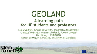
  • 1. GEOLAND A learning path for HE students and professors Luc Zwartjes, Ghent University, geography department Christos Polykretis Dimitris Alexakis, FORTH Greece Karl Donert, EUROGEO Rafael de Miguel González, University of Zaragoza
  • 2. Aims • establish a learning path for the Higher Education students and their professors so that they are able to apply their geospatial analysis knowledge in decision-making for landscape management, planning and protection of NATURA 2000 sites across Europe • focus in promoting digital skills like PPGIS (public participation GIS), low-cost geoinformatic tools and the digital readiness of higher education students in the Covid-19 pandemic era.
  • 4. Geoland goals Main goals of the GEOLAND: develop • an Educational Handbook for monitoring European Landscape, • a Web based GIS platform where numerous geospatial data may be uploaded and analysed and students’ opinion about landscape will be obtained through questionnaires and crowdsourcing.
  • 5. Geoland outcomes • O1: Educational Handbook for monitoring European Landscape presenting a homogeneous methodology for educating Higher Education students in studying European Landscape with means of Geoinformatics and citizen science methodology. • O2: Training course – Web-based GIS platform used by Higher Education students and Professors in order to apply Landscape Character Assessment (LCA) for assessing Landscape quality in Natura 2000 zones. • O3: Policy outreach  provide a unique opportunity to Higher Education students to study how European Landscape Convention (ELC) is implemented and adopted in different EU countries. • 04: Online gallery of students work • 05: develop the Digital Readiness Tool, DERT, for the assessment of the digital readiness of the Higher Education students and courses.
  • 7. Formation of the landschape natural processes socio-economic processes natural differentiation decisions and actions land use antropogenic differentiation traditional landscapes recent landscapes NATURAL FACTORS HUMAN FACTORS e.g. Uniformity (reparcelling) Open field landscape of Artois Bocage landscape of the Boulonnais internal forces (tectonics) external forces (climate …) development, organisation, capital, entrepreneurship perception observer s i g h t s m e l l h e a r i n g f e e l i n g Commitment – knowledge – memory – emotion – age …
  • 8. g n g Commitment – knowledge – memory – emotion – age … recorded image recorded experience other sensations measurements perception (objective value) (subjective value) relief morphology degree of building variation spatial structure transparancy panoramic feeling attractiveness security sense of space naturalness landscape values spatial value socio-economic value natural value aesthetic value historical value panoramic opportunities – openess – transparancy – scale – relational structure - habitability - opportunities for agriculture, recreation, traffic - natural variation - ecological richness - biological dynamic - diversity of forms - colorfulness - compostion - light variation - evoking memories - association woth expreriences - showing the past Monotonous production landscape Intricate and varied residential landscape
  • 9. Protecting the landscape: the European Landscape Convention • adopted by the Council of Europe, 2000 • obliges the signatory member countries of EU to incorporate the landscape dimension in their legislation  policies with possible direct or indirect impact on landscape • covers all landscapes, both outstanding and ordinary or even degraded, that determine the quality of people’s living environment. • provides a framework for integrated intergovernmental efforts towards the preservation of landscape character and its quality
  • 10.
  • 11. Landscape character assessment • an environmental system must be assessed before planning, for the purpose of decision-making and learning • One of the major principles, which ELC is based on, is the identification of landscape character, as well as the pressures and drivers of change, as regards the implementation of strategies for landscape management, planning, and protection. Such principles and strategies require a systematic knowledge of their variation, spanning the full range of spatial scales that define the landscape level, i.e., in landscape typologies (Terkenli et al., 2021).
  • 12. two major types of attributes, or components, related to landscapes: • the bio-physical attributes linked to natural (e.g. geology, soils, landform, hydrology, climatic conditions) and socio-cultural (e.g. land use, settlement pattern, economic activities) inheritance where a landscape is considered in space, and • the perceptual/aesthetic attributes linked to how a landscape is perceived, with regard to scenic quality, visual beauty and human well-being.
  • 13. The purpose of landscape classification is to initially identify areas of distinct character, and then classify and map them. specific combinations of natural, socio-cultural and perceptual attributes existing in different areas lead to similar landscape character types
  • 14. 5 stages in GIS-based holistic LCA methodological framework employing public participation, • Purpose definition • Desk-based data collection • Field-based data collection • Classification • Overall evaluation
  • 16. Geography Gentbrugse Meersen and Damvallei 650 ha nature area in Ghent • 240 ha Gentbrugse meersen • 410 ha Damvallei
  • 18.
  • 19. Natura 2000 - Zeeschelde • Tidal zone of the river Scheldt – “the artery of Flanders” • Total of 8957 ha • 16 protected habitats, 13 protected species • Also multifunctional landscape in a highly dynamic and economic region • Included in SIGMA: to protect the area against flooding and promote specific nature qualities
  • 21. Geology, geomorphology, soils Coastal marsland was grazed by sheep until the land reclaimation and the development of polderland Dry sandy soils used as grazing land, later reforested Higher sandy loamy soils used as cropland Wet alluvial marshland produced hay Wet sandy soils were drained (after De Moor & Heyse 1995) Site of Ghent
  • 22. Fields on wet soils are bordered with ditches Riverbanks and dunes limit alluvial plain Rivers and canals have embankements Digital Elevation Model based on Lidar (© AGIV) docks Blandijn Kuip
  • 23. kouters (openfield) Meersen (marsh lands) bulken (bocage landscape) Reforested common grazing land and dunes Scheldt Scheldt  Situation 1770  Map de Ferraris
  • 24.  Situation 1770  Map de Ferraris
  • 25.  Situation 1863  Dépôt de la Guerre
  • 26.  Situation 1950  l' Institut Géographique Militaire
  • 27.  Situation 1982  Nationaal Geografisch Instituut
  • 28.  Situation 1982  Nationaal Geografisch Instituut
  • 30.  Situation 1982  Nationaal Geografisch Instituut
  • 34. Natura 2000 - habitats
  • 35. Potential natural vegetation (A) Wet alder forest (B) Oak beech forest A B (A) (B)
  • 38. Niina Käyhkö 24.1.2012 I N T E R A C T I O N ABIOTIC AND BIOTIC ENVIRONMENT SPATIAL PATTERNS Pattern – process – change Landscape as a spatio-temporal system
  • 39. Concepts to be analysed 1. Interaction between spatial pattern and processes 2. Connectivity and connectedness 3. Multifunctionality 4. Landscape heterogeneity and diversity > Mapping the pattern, structure – landscape elements (land cover) > Mapping the functions (land use), management > Use of landscape metrics to quantify the spatial pattern of land cover and landscape elements
  • 40. 1. Interaction between spatial pattern and processes 2. Connectivity and connectedness 3. Multifunctionality 4. Landscape heterogeneity and diversity > Focus on fragmentation of habitats, functions > Use of landscape metrics to quantify the qualities of connectivity and fragmentation Concepts to be analysed
  • 41. 1. Interaction between spatial pattern and processes 2. Connectivity and connectedness 3. Multifunctionality 4. Landscape heterogeneity and diversity Concepts to be analysed
  • 42. 1. Interaction between spatial pattern and processes 2. Connectivity and connectedness 3. Multifunctionality 4. Landscape heterogeneity and diversity B a B B B B a a a a a D 100m Concepts to be analysed
  • 43. Ortho 90 Raster analysis: cell as spatial integrator to calculate entropy Destelbergen Verrebroek 250m²x250m²
  • 44. 2 transects per raster • 3 types • Area • line • points • 3 time periods Antrop 1998
  • 45. Antrop 1998 Destelbergen: changes Destelbergen: evolution entropy land use 0 2 4 6 8 10 12 14 0.2 0.4 0.6 0.8 1.0 1.2 1.4 1.6 1.8 2.0 2.2 2.4 2.6 2.8 3.0 Entropy (bits) Frequency 1910 1962 1995 1962 1910 1995 suburban Homogeneous heterogeneous Low # cat Dominant cat Large # cat Fragmentated 104 transects
  • 46.
  • 47. Mapping and monitoring landscape, habitats, biodiversity
  • 48. OBSERVATION SHEET – GEOLAND Date: ID observation (letter transect + number sample): Hour: Place (village): Observers: GPS X – coordinate: Y- coordinate: Z-coordinate: Distance to previous sample point (m) Weather conditions: Photograph numbers: 1. Topography: (1) flat (2) slope (N S E W) (3) undulating In case of slope: concave – convex 2. Slope: (1) 0-2° (2) 2-8° (3) 8-22° (4) > 22° Exact percentage or degrees (to be calculated based on XYZ coordinates) 3. Soil Moisture conditions: |----------------------------------------------------------------------| (circle along the gradient) dry wet Colour soil (Munsell scale code): Top-soil conditions: (circle one or more options) (1) bare bedrock (> 75%) (2) bedrock, partially bare (50/50%) (3) loose soils dominating (>75%): gravel, clay, sand, loam, marl (circle one or more options) (4) man-made, anthropogenic Other bedrock, soil or topography observations of the site (erosion, weathering, deposition): 4. Vegetation If yes, specify Ground layer coverage: (1) bare % (2) grass % (3) herbs % (4) cultivated % Number of tree & scrub layers: 0 1 2 more Layer heights: (1) < 0,3m (2) 0,3-0,6m (3) 0,6-2m (4) 2-5m(5) > 5m Coverage: (1) open <25% (2) semi-open 25-50% (3) semi-closed 50-75% (4) closed >75% Spatial distribution: (1) continuous (2) uneven (3) patchy 5. Management What are the current land use activities in this area? Are there any evidences of past land uses in the site today? Are there any animals? Which and how much? 6. Conclusion General Habitat category Global/env. qualifier Site qualifier Man. qualifier Life form/species Comment Life form % Species %
  • 49. • More information • https://www.geolandproject.eu • https://www.facebook.com/GEOLANDthePROJECT