Who's in Danger - Race, Poverty & Chemical
•
1 j'aime•710 vues

This report analyzes 3,433 chemical facilities across several industries that store or use hazardous chemicals. It finds that over 134 million Americans live within "vulnerability zones" delineating the areas that could be impacted by a worst-case chemical disaster. Residents near these facilities are disproportionately people of color and low-income communities. They have lower property values and incomes, plus higher poverty and less education, than national averages. The report aims to document demographic characteristics of populations endangered by industrial chemical hazards for the first time. It shares stories of impacted communities and analyzes policy solutions to better protect workers and residents from unnecessary risks.

Recommandé
Recommandé
Contenu connexe
Similaire à Who's in Danger - Race, Poverty & Chemical
Similaire à Who's in Danger - Race, Poverty & Chemical (20)
Plus de v2zq
Plus de v2zq (20)
Dernier
Dernier (20)
Who's in Danger - Race, Poverty & Chemical
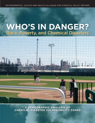
- 1. WHO’S IN DANGER? RACE, POVERTY, AND CHEMICAL DISASTERS | A ENVIRONMENTAL JUSTICE AND HEALTH ALLIANCE FOR CHEMICAL POLICY REFORM WHO’S IN DANGER? Race, Poverty, and Chemical Disasters A DEMOGRAPHIC ANALYSIS OF CHEMICAL DISASTER VULNERABILITY ZONES
- 3. WHO’S IN DANGER? Race, Poverty, and Chemical Disasters A DEMOGRAPHIC ANALYSIS OF CHEMICAL DISASTER VULNERABILITY ZONES May 2014 ENVIRONMENTAL JUSTICE AND HEALTH ALLIANCE FOR CHEMICAL POLICY REFORM
- 4. ii | WHO’S IN DANGER? RACE, POVERTY, AND CHEMICAL DISASTERS Authors Paul Orum Richard Moore, Environmental Justice and Health Alliance for Chemical Policy Reform Michele Roberts, Environmental Justice and Health Alliance for Chemical Policy Reform Joaquín Sánchez, Los Jardines Institute (The Gardens Institute) Contributors Robin Saha, Ph.D., School of Public and Community Health Sciences, University of Montana Elizabeth Crowe, Coming Clean Sean Moulton, Center for Effective Government Yudith Nieto, Texas Environmental Justice Advocacy Services Sofia Plagakis, Center for Effective Government Judy Robinson, Coming Clean Steve Taylor, Coming Clean Reviewers Paul Mohai, Ph.D., School of Natural Resources and Environment, University of Michigan Chingwen Cheng, Ph.D., School of Natural Resources and Environment, University of Michigan John Deans, Greenpeace Rick Hind, Greenpeace Research Paul Orum Demographic Analysis Denise Moore, Center for Effective Government Design David Gerratt, NonprofitDesign.com The findings, conclusions, and recommendations in this report are those of the authors and sponsoring organizations and do not necessarily reflect the views and opinions of the contributors, reviewers, or funders. The authors and sponsors accept all responsibility for any errors or omissions in this work. THIS REPORT IS A COLLABORATIVE PRODUCT OF THE FOLLOWING ORGANIZATIONS: The Environmental Justice and Health Alliance for Chemical Policy Reform networks grassroots organizations throughout the country to build collective intelligence and advocate for chemical policy reforms that protect environmental justice communities. Visit www.comingcleaninc.org/ programs/environmental-justice. Coming Clean unites community organizers, scientists, advocates, business leaders, commu- nications specialists, and diverse issue experts in collaborative work to transform the chemical and fossil fuel industries so they are sources of health, economic sustainability, and justice rather than of pollution, disease, and planetary harm. Visit www.comingcleaninc.org. The Center for Effective Government works to build an open, accountable government that invests in the common good, protects people and the environment, and advances the national priorities defined by an active, informed citizenry. Visit www.foreffectivegov.org. THE SPONSORING ORGANIZATIONS WOULD LIKE TO THANK THESE FUNDERS FOR THEIR GENEROUS SUPPORT OF WORK RELATED TO THIS REPORT: Bauman Foundation Cedar Tree Foundation CS Fund The Fine Fund Ford Foundation John Merck Fund Marisla Foundation New York Community Trust Open Society Foundations Park Foundation Rockefeller Brothers Fund Sills Family Foundation Cover Photo: Whiting, Indiana © Global Community Monitor Title Page: Anniston, Alabama © Coming Clean
- 5. WHO’S IN DANGER? RACE, POVERTY, AND CHEMICAL DISASTERS | iii TA B L E O F C O N T E N T S iv Figures, Tables and Boxes 1 Glossary of Terms and Abbreviations 2 Executive Summary C H A P T E R O N E 4 Introduction 4 Background on Environmental Justice and Chemical Safety 12 Selected Events in the History of Environmental Justice, 1964–2014 Community Stories 14 Alaska Community Action on Toxics, Savoonga, St. Lawrence Island, Alaska 15 The Just Transition Alliance 16 West County Toxics Coalition, Richmond, California 18 Mossville Environmental Action Now (MEAN), Mossville, Louisiana 20 Los Jardines Institute (The Gardens Institute), South Valley of Albuquerque, New Mexico 22 Texas Environmental Justice Advocacy Services (t.e.j.a.s.), Houston, Texas 24 People Concerned About Chemical Safety, Charleston, West Virginia C H A P T E R T W O 26 Demographic Analysis of Chemical Facility Vulnerability Zones 27 National Findings 30 Industry Sector Findings C H A P T E R T H R E E 35 Removing Chemical Hazards: Solutions for Companies and Communities C H A P T E R F O U R 38 Conclusions and Recommendations 44 Endnotes A P P E N D I X A 46 Methodology A P P E N D I X B 49 “Shelter in Place” Timeline Worksheet A P P E N D I X C 50 Vulnerability Zones of 3,433 Chemical Facilities
- 6. iv | WHO’S IN DANGER? RACE, POVERTY, AND CHEMICAL DISASTERS F I G U R E S , TA B L E S A N D B OX E S F I G U R E S 9 Figure 1 Distribution of Chemical Facility Vulnerability Zones by Size 10 Figure 2 National Map of 3,433 Chemical Facilities in This Report 1 1 Figure 3 Map of Sample Vulnerability Zones and Fenceline Zones 27 Figure 4 Average Home Value in Fenceline Zones Compared to U.S. Average 27 Figure 5 Average Household Income in Fenceline Zones Compared to U.S. Average 28 Figure 6 Black and Latino Populations in Fenceline Zones Compared to the U.S. 29 Figure 7 Educational Attainment in Fenceline Zones Compared to the U.S. 29 Figure 8 Poverty Rate in Fenceline Zones Compared to the U.S. 36 Figure 9 Reduction in Vulnerability Zones through Safer Alternatives TA B L E S 11 Table 1 Chemical Facilities and Vulnerability Zone Populations by Industry Sector 27 Table 2 Housing Value in Vulnerability Zones 27 Table 3 Household Income in Vulnerability Zones 28 Table 4 Race and Ethnicity in Vulnerability Zones 28 Table 5 Education Levels in Vulnerability Zones 29 Table 6 Poverty Rates in Vulnerability Zones 30 Table 7 Housing Values in Vulnerability Zones by Industry Sector 31 Table 8 Household Incomes in Vulnerability Zones by Industry Sector 32 Table 9 Race and Ethnicity in Vulnerability Zones by Industry Sector 32 Table 10 Education Levels in Vulnerability Zones by Industry Sector 33 Table 1 1 Poverty Rates in Vulnerability Zones by Industry Sector 33 Table 12 Vulnerability Zone Distances and Populations by Industry Sector 34 Table 13 Comparison of Vulnerability Zones within Two Industry Sectors 34 Table 14 Top Ten Chemicals in This Report B OX E S 11 Box 1 “Vulnerability Zones” in This Report 40 Box 2 The Toxic Substances Control Act and Chemical Safety
- 7. WHO’S IN DANGER? RACE, POVERTY, AND CHEMICAL DISASTERS | 1 G L O S S A R Y O F T E R M S A N D A B B R E V I AT I O N S A C C American Chemistry Council, the largest trade association of basic chemical manufacturers. F E N C E L I N E Z O N E An area designated as one-tenth the distance of the vulnerability zone, in which those affected are least likely to be able to escape from a toxic or flammable chemical emergency, but not representing the outer bounds of potential harm. For example, if the vulnerability zone is a radius of 10 miles around the facility, then the fenceline zone is a radius of one mile around the facility. See Figure 3 on page 11 for a graphic representation of sample vulner- ability zones and fenceline zones. R M P Risk Management Plan, a plan prepared under the chemical accident prevention provisions of the Clean Air Act, section 112(r), and submitted to the U.S. Environmental Protection Agency by a facility that produces, handles, processes, distributes, or stores more than a threshold amount of certain extremely hazardous substances (77 toxic or 63 flammable chemicals). S O C M A Society of Chemical Manufacturers and Affiliates, a trade association of batch, custom, and specialty chemical manufacturers. V U L N E R A B I L I T Y Z O N E An estimate made by a facility under EPA’s Risk Management Planning program of the maximum possible area where people could be harmed by a worst-case release of certain toxic or flammable chemicals. The vulnerability zone is a radius (or circle) distance around the facility, for example one mile, five miles, or 20 miles in all direc- tions. See Figure 3 on page 11 for a graphic representation of sample vulnerability zones and fenceline zones. W O R S T- C A S E S C E N A R I O An estimate made by a facility under EPA’s Risk Management Planning program of the largest potential chemical release from a single vessel or process under conditions that result in the maximum possible affected area.
- 8. 2 | WHO’S IN DANGER? RACE, POVERTY, AND CHEMICAL DISASTERS E X E C U T I V E S U M M A R Y M ore than 134 million Americans live in the danger zones around 3,433 facilities in several common industries that store or use highly hazardous chemicals. Millions more people work, play, shop, and worship in these areas. But who are the people that live daily with the ever- present danger of a chemical disaster? This report is the first public accounting of the demo- graphic characteristics of populations within the “vulner- ability zones” of entire industry sectors that manufacture chemicals, treat water or wastewater, produce bleach, generate electric power, refine petroleum, produce pulp and paper, or otherwise have large numbers of people living in the path of a potential worst-case chemical release. It also shares the stories of some of these communities. The new research presented in this report finds that residents of chemical facility vulnerability zones are disproportionately Black (African American) or Latino, have higher rates of poverty than the U.S. as a whole, and have lower housing values, incomes, and education levels than the national average. The disproportionate or unequal danger is sharply magnified in the “fenceline” areas nearest the facilities. Almost thirty years ago, the Union Carbide chemical spill in Bhopal, India killed thousands of people and drew stark attention to the need for improved chemical facility safety. Unfortunately, no U.S. federal law, regulation, or guidance adopted before or since requires companies to fully assess and substantiate whether the toxic chemicals they use or store are truly necessary—or whether effective and safer alternatives might be used instead. Chemical facilities, many of which endanger thousands of people, continue using highly hazardous chemicals even when safer alter- natives are available, effective, and affordable. These policy failures have led to the needless persistence of catastrophic chemical hazards in communities. The U.S. experiences several serious toxic chemical releases every week, including the August, 2012 explosion at the Chevron refinery in Richmond, CA that sent 15,000 people to hospitals seeking treatment, and the April, 2013 fertilizer storage facility explosion in West, TX that killed 15 people and leveled an entire neighborhood. In a typical year, the U.S. Chemical Safety Board screens more than 250 high consequence chemical incidents involving death, injury, evacuation, or serious environ- mental or property damage—and these are only the very worst incidents. KEY FINDINGS Our analysis produced striking findings about the fenceline zones nearest to the facilities, where residents live closest to hazardous chemicals and with the least time to react in the event of a catastrophic release. In Louisville, KY, industrial facilities border the Chickasaw Park, an historic gathering place for the local African American community that is also contaminated with dioxin from industry emissions. ©ElizabethCrowe
- 9. WHO’S IN DANGER? RACE, POVERTY, AND CHEMICAL DISASTERS | 3 home values 33% below the national average. are 22% below the national average. is 75% greater than for the U.S. as a whole, while the percentage of Latinos in the fenceline zones is 60% greater than for the U.S. as a whole. less than a high school degree is 46% greater than for the U.S. as a whole, and the percentage of adults in the fenceline zones with a college or other post- secondary degree is 27% lower than for the U.S. as a whole. higher than for the U.S. as a whole. Separate analysis of different industry sectors generally con- firms these findings with some regional and other variations. Fortunately, many existing options can dramatically reduce these dangers and protect workers and communi- ties. For example, a wastewater plant that switches from chlorine gas to ultraviolet light disinfection removes the danger of a chlorine gas release. A power plant that replaces highly toxic anhydrous ammonia gas with safer aqueous ammonia dramatically reduces the size of its vul- nerability zone. But because federal laws and rules don’t require companies to research safer alternatives or convert even when it’s easily affordable, existing solutions are not in use by thousands of facilities. Simple changes could protect millions of Americans, reduce costs and liabilities for companies, and modernize chemical facilities and regulations. TIME FOR ACTION Action to prevent a major chemical disaster is needed now—workers, communities, businesses, and govern- ments face severe potential costs to life, health, and finances from chemical hazards that are often unnecessary. Federal policies have missed obvious opportunities to im- prove safety and security by removing avoidable hazards. This report recommends several policy solutions that can remove millions of Americans from potential harm in and around hazardous chemical facilities. Some solu- tions can—and should—be implemented immediately. Others may require more time, but should also be started now and aggressively pursued. 1. Make information on chemical hazards and alter- natives widely available, and ensure that workers, communities, and government at all levels are fully informed and actively engaged in prevention planning. 2. Require companies that use or store hazardous chemicals to assess and document whether safer chemicals or processes could be used that would remove hazards and prevent disasters. 3. Develop accessible national data on alternatives based on companies’ assessments and lessons learned by facilities that have successfully removed chemical hazards. 4. Require companies to convert to safer alternatives when feasible, and justify in detail any decisions not to remove major chemical hazards when alternatives are available, effective, and affordable. 5. End government policies that subsidize danger, and ensure that existing patchwork chemical safety and security requirements are complete, comprehensive, up to date, and mutually reinforcing. For almost 30 years since the Bhopal disaster, chemical facilities, Congress, and a series of Presidential Administra- tions have neglected the potential for toxic disaster that millions of Americans—who are disproportionately Black, Latino, and low income—live with every day. While some companies have adopted safer alternatives, thousands of similar facilities have not. Enough is enough. It’s time for the federal government, state and local governments, and the industries themselves to implement the most effective strategies that reduce and eliminate avoidable chemical hazards whenever possible, and adopt a comprehensive set of policies to protect workers and communities. Waiting for a catastrophe is not acceptable. Communities that already bear the brunt of industrial pollution will also bear the greatest harm from a chemical disaster—making chemical safety and security a central environmental justice issue of our time.
- 10. 4 | WHO’S IN DANGER? RACE, POVERTY, AND CHEMICAL DISASTERS CHAPTER ONE I N T R O D U C T I O N M ore than 134 million Americans, and their homes, schools, businesses, parks, and places of worship, live in harm’s way of a toxic chemical release from several basic industries, according to this new analysis of 3,433 facilities that use or store extremely hazardous chemicals. Neighbors of facilities in these industries are disproportionately Black (African American) or Latino,1 have higher rates of poverty than for the U.S. as a whole, and have lower housing values, incomes, and education levels than the national average. This report is the first to assess the demographic charac- teristics of populations within the “vulnerability zones” of entire industry sectors that manufacture chemicals, treat water or wastewater, produce bleach, generate elec- tric power, refine petroleum, produce pulp and paper, or otherwise have 100,000 or more people living in the path of a potential worst-case chemical release.2 These zones— which are delineated and reported by the companies themselves—are the areas around facilities, sometimes ex- tending for many miles, in which people can be seriously Background on Environmental Justice and Chemical Safetya P eople and organizations who live and work in the shadow of chemical and fossil fuels facilities have been concerned about their toxic outputs since long before the term “environmental racism” was coined. But once data began to be collected proving the connection between where these facilities were located and the demographics of the surrounding communities (includ- ing the 1987 report Toxic Wastes and Race in the United States) groups concerned about these environmental health hazards began creating a more coordinated, grass- roots movement to prevent harm to disenfranchised areas. The First National People of Color Leadership Summit, held in 1991, helped advance this process and expand the emerging movement into issues beyond the location of hazardous facilities. Then in 1994, with little movement in Congress toward reforms that would protect disproportionately impacted communities, President Bill Clinton responded to the out- cry for action and issued Executive Order 12898 to address Environmental Justice in Minority and Low-Income Popula- tions. Under this Order, government agencies are required to consider and assess potential disproportionate impacts of activities on low-income and minority communities before the activity takes place. Community environmental justice and advocacy groups were able to use the Executive T H I S R E P O R T I S T H E F I R S T to assess the demographic characteristics of populations within the “vulnerability zones” of entire industry sectors that manufacture chemicals, treat water or wastewater, produce bleach, generate electric power, refine petroleum, produce pulp and paper, or otherwise have 100,000 or more people living in the path of a potential worst-case chemical release. a This brief summary includes selected environmental justice events that are most relevant to the information contained in this report. For a more complete history and timeline of the EJ movement, we recommend Robert Bullard, Ph.D, et al, Environmental Justice Milestones and Accomplishments: 1964–2014 (Barbara Jordan-Mickey Leland School of Public Affairs, Texas Southern University, February 2014), available at http://www.tsu.edu/academics/colleges__schools/publicaffairs/files/pdf/EJMILESTONES2014.pdf. 4 | WHO’S IN DANGER? RACE, POVERTY, AND CHEMICAL DISASTERS
- 11. WHO’S IN DANGER? RACE, POVERTY, AND CHEMICAL DISASTERS | 5 hurt or killed by the sudden release of toxic or flammable chemicals. Our analysis uses data reported to the U.S. Environmen- tal Protection Agency (EPA) in Risk Management Plans (RMPs) by facilities that produce, handle, process, distrib- ute, or store certain extremely hazardous substances. The plans include companies’ own assessments of a potential worst-case release of specific toxic gases or flammable chemicals. These RMP assessments identify vulnerability zones that are intended to inform people in nearby homes, schools, and businesses that they are within range of a potentially deadly chemical release and to encourage preventive action by industry. Although each facility uses only one chemical to prepare a worst-case release scenario, many facilities store or use several other hazardous chemicals as well. The vulnerability zones examined in this report vary wide- ly in scope, ranging from a radius of 0.01 to 25 miles. But their potential magnitude can be understood in view of one of the world’s worst industrial disasters—the Union Carbide Company’s pesticide factory tragedy in Bhopal, India. Thousands of people died near the Bhopal factory in December 1984 and many thousands more were per- manently injured by toxic gases that leaked at night into the surrounding community. Though decades have since passed, comparable hazards remain across America virtu- ally unchecked, as people live and work next to hazardous chemical facilities with minimal government oversight and little community awareness. In many cases, local police, firefighters, and government officials are not aware of the specific chemical hazards in their community and the potential for disaster—or the safer options that can help make communities more secure. While Bhopal-scale chemical catastrophes are thankfully rare, chemical fires and spills are remarkably common. In a typical year, the U.S. Chemical Safety Board screens more than 250 high consequence chemical incidents in- volving death, injury, evacuation, or serious environmental or property damage.3 Chemical incidents in recent years have killed workers, first responders, and nearby residents, and destroyed homes, businesses, and schools. On April 17, 2013, an explosion in West, TX leveled an entire neighborhood. On August 6, 2012, a fire and explosion at the Chevron refinery in Richmond, CA sent 15,000 people to hospitals seeking treatment.4 Other chemical release incidents in recent years include Big Spring TX; Paulsboro, NJ; Danvers, MA; Rosedale, MD; Delaware City, DE.; Mossville, LA; and Charleston, WV; among others. The United States has fortunately avoided in recent years a chemical disaster of the scale that occurred in Texas City in 1947, when a ship laden with ammonium nitrate exploded killing at least 581 people. Order as a tool to expose the ongoing human rights violations of people of color and low-income people living in environments contaminated with toxic chemicals. However, because the Executive Order carried no legal mandates and because there has since been no meaning- ful federal chemical policy reform (and few significant state reforms), the toxic contamination and disproportionate impacts have continued. Community leaders and other environmental health advocates began to conceptualize a more comprehensive reform solution to protect fenceline communities, workers, and people exposed to chemicals from industrial facilities, fossil fuel operations, and products purchased and used each day. In 2004, members of a nationwide collaborative environmental health and justice network, known as Coming Clean, put these concepts to paper in a document called the Louisville Charter for Safer Chemicals. The Charter was named at a meeting held in Louisville, Kentucky, at which the Charter was finalized. C O N T I N U E D O N N E X T PA G E Flaring oil refineries in Port Arthur, TX are an all-too-common sight for local residents. ©HiltonKelly,CIDA WHO’S IN DANGER? RACE, POVERTY, AND CHEMICAL DISASTERS | 5
- 12. 6 | WHO’S IN DANGER? RACE, POVERTY, AND CHEMICAL DISASTERS The name honors the struggles of the largely African American “Rubbertown” community in West Louisville, where industrial facilities released 11 millions of pounds per year of toxic air emissions and where numerous chemical disasters have taken place. Seventy-four diverse organi- zations endorsed the Charter as a common platform for chemical safety policies based on health and justice.b Hundreds of groups and networks have used the Louisville Charter as a measuring stick against which local, state and federal policies can be compared to the health and safety needs of all communities. Communities from each of the ten Environmental Protection Agency (EPA) Regions led discussions about the Charter among hundreds of people and dozens of organizations over the next two years, as a way to share and harmonize local and national priorities to lift all communities out of environmental injustice. In 2006, in an effort to raise the profile of the need for comprehensive chemical policy reforms, groups carried out a national event called “EJ For ALL,” a three-bus, 40-stop tour of communities dis- proportionately impacted by toxic pollution and hazards.c The Tour placed the environmental exploitation of low- income people and people of color by polluting industries before the public and on the notice of Federal agencies and EPA Regional Offices. The northeastern and southern legs of the Tour converged in Washington, DC, while the western leg concluded in Los Angeles. While traveling together and visiting each other, far-flung groups shared similar stories of sickness and chronic conditions caused by toxic exposures in their communities. Many who traveled and gathered were stricken with various forms of cancer and heart disease, asthma, learning disabilities, childhood leukemia, and neurological illnesses. They also represented the many others, young CHEMICAL FACILITIES AND ENVIRONMENTAL JUSTICE In 1987, a landmark national study, Toxic Wastes and Race in the United States, helped document a national pattern that many people knew anecdotally from daily life: indus- trial and environmental hazards are concentrated in poorer areas and areas with more people of color. Toxic Wastes and Race helped catalyze a national movement—known as the environmental justice movement—by making visible the adverse environmental and health impacts to workers and vulnerable communities living near the fencelines of chemical facilities. This movement asserts that equal pro- tection and a healthy environment are basic human rights, and promotes precaution and prevention by design as a primary strategy to achieve health and justice for all. Subsequent research has confirmed the core findings from 1987. Two decades later the report Toxic Wastes and Race at Twenty 1987–2007 replicated the 1987 study using newer data and analytical methods, and found that people of color and poor people are even more heavily concen- trated around hazardous waste facilities than the 1987 and other earlier studies found.5 In addition, dozens of other quantitative studies have documented inequitable distri- bution of environmental hazards, such as chemical plants, refineries, incinerators, power plants, waste facilities, and other polluting industries.6 These studies have consistently found people of color and low-income communities are disproportionately affected; they endure an unfair share of adverse impacts to air and water quality, human health, property values and the local economy. Now, this report—Who’s in Danger? Race, Poverty and Chemical Disasters—presents new evidence that the dangers associated with large quantities of toxic and flammable industrial chemicals are unequally distributed. This new research presents troubling findings about housing values, household incomes, race and ethnicity, education levels, and poverty rates of people who live within range of chemical fires and spills from 3,433 industrial facilities, and especially of people who live closest to the facilities. (See Appendix C for a listing of the facilities and their vulnerability zones.) CURRENT OPPORTUNITIES Over the years, many initiatives have sought to address the avoidable chemical hazards that exist unchecked in many communities. In 1994, the same year that President Clinton signed his Executive Order 12898, Federal Actions to Address Environmental Justice in Minority Populations and Low-Income Populations, scores of public interest organizations urged the EPA to make the systematic search for safer solutions part of risk management planning rules. Unfortunately, the agency took public comment but did not act. Every session of Congress since 1999 has considered b “Endorsers of the Louisville Charter for Safer Chemicals,” accessed April 20, 2014, http://www.louisvillecharter.org/endorsements.shtml. c A record of the Tour, including photos, video, and profiles, can be found at http://www.ej4all.org. 6 | WHO’S IN DANGER? RACE, POVERTY, AND CHEMICAL DISASTERS
- 13. WHO’S IN DANGER? RACE, POVERTY, AND CHEMICAL DISASTERS | 7 and old, who had already died from toxic conditions at home and could not join them. The Tour helped galvanize interest not only in revising federal laws to reduce chemical hazards that could result in a toxic release or explosion, but even more so in reform- ing the Toxic Substances Control Act (TSCA), a law enacted in 1976 that was supposed to protect people from every- day toxic chemical exposures. However, since 1976 only a handful of chemicals have been fully examined for health and safety impacts under TSCA, and only five have ever been restricted. Federal bills to revise TSCA have variously included elements of meaningful reform and reduction of hazards from toxic chemicals, but also proposals advocated by the chemical industry to weaken TSCA even further.d chemical safety and security legislation that would give structure and priority to preventing chemical incidents. Yet most workers and residents endangered by the most hazardous chemical facilities are still awaiting solutions beyond more security guards and fences. In 2002, Homeland Security and the EPA prepared policy options that included reducing chemical inventories, substituting materials, or otherwise modifying processes to avoid chemical hazards, but the Bush White House blocked the proposal.7 Starting in 2006, then-Senator Obama cosponsored legislation and spoke of using safer technology to make communities safer and chemical plants less attrac- tive targets for terrorists.8 In 2009, with the support of the Obama administration, the House of Representatives passed a comprehensive chemical security bill to make removing unnecessary chemical targets a core tenet of chemical security.9 Unfortunately, the bill stalled in the Senate. Federal agencies including the Government Accountability Office and Chemical Safety Board have called out opportunities to incorporate prevention through design into federal chemical regulations.10,11 In March 2012, the National Environmental Justice Advisory Council (NEJAC) recommended that the EPA use its existing authority under the Clean Air Act to reduce or eliminate catastrophic chemical hazards wherever feasible. On August 1, 2013, in response to the devastating fertilizer plant explosion at West, TX, as well as to years of orga- nizing, President Obama signed Executive Order 13650, Improving Chemical Facility Safety and Security. This Executive Order sets forth a process with deadlines for improving and modernizing chemical safety and security regulations. After months of public input, the federal agencies charged with carrying out the Executive Order are now considering various measures to improve chemical safety and security, including new prevention requirements M O M E N T U M F O R R E F O R M has continued to grow among grassroots community groups and policy advocacy networks all over the U.S., who have spoken out as constituents to their own legislators and collectively to the Administration—the White House, EPA and other agencies—for meaning- ful action to reduce chemical hazards and exposures. C O N T I N U E D O N N E X T PA G E d Bills have included the Kid-Safe Chemicals Act (2008), the Safe Chemicals Act (2010–2013), the Chemical Safety Improvement Act (2013), and the Chemicals in Commerce Act (2014). Members of the Environmental Justice and Health Alliance at the February 2014 EPA National Environmental Justice Advisory Council meeting in Denver, CO. ©JuanParras WHO’S IN DANGER? RACE, POVERTY, AND CHEMICAL DISASTERS | 7
- 14. 8 | WHO’S IN DANGER? RACE, POVERTY, AND CHEMICAL DISASTERS Momentum for reform has continued to grow among grassroots community groups and policy advocacy net- works all over the U.S., who have spoken out as constituents to their own legislators and collectively to the Administra- tion—the White House, EPA and other agencies—for mean- ingful action to reduce chemical hazards and exposures. These EJ messengers come from groups in more than 12 states—primarily states with weak policies and regulations, where fossil fuel extraction often takes place, or where major oil, gas and chemical facilities are located. Some EJ groups are near military bases and harmed by military toxics. Others are farmworkers, or farmer and rancher net- works whose livelihoods are threatened by toxic releases to land and water from chemical facilities or extractive industries. Together, these groups, working together as the Environmental Justice and Health Alliance for Chemical Policy Reform (EJHA), seek to further the work established by the environmental justice movement, the Just Transition Alliance, and groups working locally to strengthen their communities and secure long-lasting reforms and practical solutions. for safer chemicals and processes that could be implemented using existing authorities. SCOPE OF ANALYSIS The Clean Air Act Amendments of 1990 require indus- trial facilities that make, distribute, or use large amounts of certain extremely hazardous chemicals to prepare Risk Management Plans (RMP) and submit the plans to the U.S. EPA.12 The plans are intended to save lives, protect property, and prevent pollution. Some 12,600 facilities currently submit RMPs.13 The RMPs include companies’ own assessments of a worst-case chemical emergency, including the distance from the facility where toxic or flammable chemicals could cause serious harm if released. Areas within these distances —called “vulnerability zones”—extend from 0.01 to 25 miles from the facility depending on the amount and characteristics of the chemical stored or used at the facility that poses the greatest danger to the surrounding commu- nity.14 Company chemical release scenarios are intended to inform people in the circular vulnerability zones around the facilities that they are within range of potential harm and to encourage preventive action by industry. Figure 1 shows the size distribution of the 3,433 vulnerabil- ity zones used this report, by the distance range around the chemical facilities. Of the distance ranges shown, the largest number of facilities (1,172 or 34%) have vulner- ability zones that range in distance from 1.01 to 2.50 miles around the chemical facilities, and a large majority of facilities (82% or 2,813) have vulnerability zones within five miles of their respective chemical facilities. Some 18% of facilities, or 620, have vulnerability zones greater than five miles. Only 5% of facilities, or 168, have RMP vulnerabil- ity zone distances that are greater than 20 miles in radius. The RMP vulnerability zone distances provide the basis for the demographic analysis in this report. In order to obtain each facility’s vulnerability zone distance, we first had to research RMP information at federal reading rooms. We limited our analysis to a complete review of RMP facilities in several basic industries: water treatment; wastewater treatment; bleach manufacturing; electric power generation; petroleum refining; pulp and paper production; and chemical manufacturing. We added RMP facilities not already included that have 100,000 or more people residing in their self-reported vulnerability zones, in order to include facilities that pose chemical safety risks to the largest populations. Following an established method, we used Geographic Information Systems (GIS) software and the most recent U.S. Census Bureau population data to estimate residen- tial populations within the vulnerability zone distances. (See Appendix A for a discussion of the methods.) These environmental justice groups advance a vision for change that includes an energy and chemical system that makes proven safe alternatives a priority; a movement for change in the manufacturing, production, and movement of goods in this country; and a movement for local farm- ing that is just and provides all people and the land with the right to health and life. EJHA’s work adheres to the Principles of Environmental Justice, the Jemez Principles for Democratic Organizing, and the Louisville Charter for Safer Chemicals as a platform for chemical policy reforms. These initiatives are challenging all levels of government to be accountable and provide the transparency necessary to address the inter-related issues that keep environmental justice communities exploited. To that end, the critical issue of chemical safety and secu- rity needed to be addressed. Many community organizations had for decades been concerned with acute exposures and deaths as a result of leaks, spills and explosions at chemical facilities. Following the September 11, 2001 attacks in New 8 | WHO’S IN DANGER? RACE, POVERTY, AND CHEMICAL DISASTERS
- 15. WHO’S IN DANGER? RACE, POVERTY, AND CHEMICAL DISASTERS | 9 treatment, chemical manufacturing, and wastewater treatment sectors have the greatest number of these RMP facilities, 1,284, 778, and 686, respectively. Of the various industry sectors examined, the chemical and bleach manufacturing sectors have the largest York City, Pennsylvania, and the Pentagon near Washing- ton, DC, chemical security risks from terrorism gained the attention of legislators, but still no policies that focused on prevention of chemical hazards were adopted. EJ, labor, health, environmental, and advocacy organizations that had been working for some time to prevent toxic chemical releases banded together in 2011 to form the Coalition to Prevent Chemical Disasters. Since then, community members have testified repeatedly in public meetings to the EPA, as well as local and state agencies, to address ongoing legacy contamination issues and for more effective chemical disaster prevention policies based on the use of safer design wherever feasible. EJ groups and allies urged President Obama and the National Environmental Justice Advisory Council (NEJAC) to move the U.S. EPA to use existing authority under the Clean Air Act to require disaster prevention at chemical facilities. In August 2013, President Obama issued an Executive Order on Chemical Facility Safety and Security—a welcome action, but one that community groups know will require Altogether, 134 million U.S. residents live within the vulnerability zones of one or more of the 3,433 facilities studied in this report. Table 1 shows the populations resid- ing in facility vulnerability zones by industry sector and the number of these RMP facilities in each sector. Water ongoing pressure to result in meaningful reform and health protections. Behind the petitions and beyond the statistics are the stories that news outlets rarely report, including how local agencies are made aware of hazards at nearby industrial operations and yet do not respond until after disasters happen. News accounts often ignore the lies communities are told about how safe facilities are or how many jobs will come to residents when polluting industries move or expand near their homes and schools. We don’t often hear about the lack of existing infrastructure (sewer, water, drainage, and fire hydrants) to support safe operations, or the absence of knowledge, protocols and trained staff and community members in the event of a chemical release or explosion. Given how many people in America live daily in the shadow of extremely dangerous chemical facilities— more than 134 million as documented by this report—it is shocking how little we know about these people and their experience. This report sheds light on who lives in these chemical disaster zones and tells some of their stories. F I G U R E 1 Distribution of 3,433 Facility Vulnerability Zones by Size (distance ranges around chemical facilities in miles) 1,200 1,100 1,000 900 800 700 600 500 400 300 200 100 0 0.50 0.51–1.00 1.01–2.50 2.51–5.00 5.01–10.00 10.01–15.00 15.01–20.00 20.01–25.00+ Miles Frequency(numberoffacilities) 357 472 1172 812 210 171 71 168 WHO’S IN DANGER? RACE, POVERTY, AND CHEMICAL DISASTERS | 9
- 16. 10 | WHO’S IN DANGER? RACE, POVERTY, AND CHEMICAL DISASTERS are located at or near the boundary—or fenceline—of industrial facilities. But the full vulnerability zones used in this report (see Box 1 and Figure 3) can cover circular areas as large as 25 miles in radius around a facility and can encompass enormous areas—entire cities in some cases, such as Los Angeles, Houston, Memphis, Louisville, and Chicago. Over such large areas, people choose where they live based on many factors such as access to transpor- tation, schools, jobs, and open space. They may not be aware of the dangers of chemical accidents. For this reason, we examined both the populations that live inside the reported full vulnerability zones and those that live within one-tenth the distance of the full zones, where people live closest to potential harm. We refer to this nearer zone as the “fenceline zone.” For example, if the full vulnerability zone distance encompasses a circular area seven miles around the facility, then the fenceline F I G U R E 2 3,433 Chemical Facilities in This Report populations living in the vulnerability zones, 79.7 million and 64.0 million, respectively. Additionally, an estimated 400,000 full time equivalent personnel work at these sites, and uncounted additional people work, travel, shop, study, worship, or recreate in vulnerability zones.15 The shipment of extremely hazard- ous chemicals by rail and truck also further distributes the dangers into unsuspecting communities far from the original sources. However, the demographic analysis in this report is limited to the residential populations around the 3,433 facilities studied. Vulnerability Zones and Fenceline Zones Communities that cope with constant toxic emissions and hazards from nearby industries are sometimes referred to as “fenceline” communities because homes, schools, busi- nesses, parks, and other places where people live and work Some areas—such as the city of Houston, TX or Los Angeles County, CA—contain so many facilities that each individual facility is not clearly visible on this map.
- 17. WHO’S IN DANGER? RACE, POVERTY, AND CHEMICAL DISASTERS | 11 Industry Sector RMP Facilities* Vulnerability Zone Population** Water treatment 1,284 33,692,612 Wastewater treatment 686 21,004,374 Bleach manufacturing 91 63,952,735 Electric power generation 334 4,052,030 Petroleum refining 130 18,484,212 Pulp and paper production 72 5,462,950 Chemical manufacturing*** 778 79,726,744 Total for all sectors 3,433 134,932,009 zone distance is 0.7 miles. (Figure 3 depicts sample vulnerability zones and fenceline zones.) Approximately 3.8 million people live within the fenceline zones closest to potential harm, where, as noted above, they are least likely to be able to evacuate in the event of a serious chemical release. The communities in these fenceline zones bear a greater risk to their safety and security from the large quantities of extremely hazardous chemicals stored or used in the neighboring facilities. A toxic gas cloud or blast wave could engulf a large area and enter homes, schools, busi- nesses, eldercare facilities, places of worship, sports arenas, hospitals, and automobiles long before people could evac- uate or shelter in place. For those who do shelter in place, which means to go inside, close doors, windows, and vents, and wait for toxic fumes to blow away, toxic gases may filter into the building before the company can stop a major chemical release—if it can be stopped. A simple analysis shows that shelter in place cannot possibly protect people in the fenceline zones (see Appendix B). Shelter in place is a desperation strategy, not a plan for public safety or for preventing a chemical disaster, yet shelter in place is the “safety” measure encouraged by many facilities. Studies and on-the-ground experience show that practical barriers preclude complete evacuation or effective shelter B O X 1 “Vulnerability Zones” in This Report The chemical disaster vulnerability zone distances described in this report (which represent a radius or circle around the facility) were calculated by the compa- nies themselves as part of worst-case chemical release scenario analysis required under EPA’s Risk Management Program. The scenarios are projections that the chemical facilities report to the EPA, and include the maximum area of potential serious harm from a worst-case release of chemicals, a distance around the facility ranging from 0.01 to 25 miles. The area within this distance is known as the vulnerability zone for such a release. The area within one-tenth of the vulnerability zone distance we have called the fenceline zone. The scenarios are not forecasts of potential casualties. People living or working within vulnerability zones are at risk of serious harm, but actual impacts of a release would vary due to weather, wind direction, and distance from the facility. T A B L E 1 Number of RMP Facilities and Vulnerability Zone Populations in This Report by Industry Sector * Facilities may be in more than one industry sector and thus do not equal the total for all sectors. ** Values represent merged overlapping vulnerability zones to eliminate double counting within each industry sector. Because facilities may be in more than one sector, the sum of population values does not equal the population total for all sectors. *** Defined as member companies of the American Chemistry Council (ACC) and Society of Chemical Manufacturers and Affiliates (SOCMA). F I G U R E 3 Sample Vulnerability Zones and Fenceline Zones in place. Leaks sometimes go undetected for days even with alarm systems.16 Companies may not promptly report leaks.17 Companies may not provide sufficient information, thereby delaying emergency responders.18 Public notifications take time and are inevitably incom- plete.19 And many residents don’t heed warnings to stay indoors.20 ● Facility ■ Fenceline Zone ■ Vulnerability Zone 6.9 Miles .69 Miles .61 Miles 6.1 Miles
- 18. 12 | WHO’S IN DANGER? RACE, POVERTY, AND CHEMICAL DISASTERS S E L E C T E D E V E N T S I N T H E H I S T O R Y O F E N V I R O N M E N TA L J U S T I C E , 1 9 6 4 – 2 0 1 4 1964 1965 1984 1985 1986 1987 1988 1989 1990 1991 1992 1993 1994 1995 1996 1997 1998 1964 — U.S. Congress passes the Civil Rights Act of 1964, prohibiting the use of federal funds to discriminate based on race, color, and national origin. 1965 — U.S. Congress passes the Voting Rights Act of 1965. 1984 — Catastrophic toxic gas leak at Union Carbide pesticide manufacturing facility in Bhopal, India. Government confirms 558,125 injuries and 3,787 deaths. NGOs estimate 8,000 immediate deaths and 8,000 subsequent deaths resulting from effects of gas exposure. 1987 — United Church of Christ (UCC) Commission for Racial Justice issues the famous Toxic Wastes and Race in the United States report, the first national study to document a relationship between waste facility siting and race. 1990 — Clean Air Act Amendments passed by U.S. Congress, establishing the Risk Management Plan (RMP) program, the independent Chemical Safety Board, and U.S. Environmental Protection Agency’s (EPA’s) authority to establish design and operational requirements to prevent toxic chemical releases. 1991 — First National People of Color Leadership Summit convenes in Washington, DC, leading to the Principles of Environmental Justice. 1993 — EPA establishes the National Environmental Justice Advisory Council (NEJAC). 1994 — President Clinton signs Executive Order 12898: “Federal Actions to Address Environmental Justice in Minority Populations and Low-Income Populations.” 1994 — Federal Interagency Working Group on Environmental Justice established. 1994 — United Church of Christ issues Toxic Wastes and Race Revisited, which strengthens the association between race and siting of waste facilities. 1997 — Just Transition Alliance is formed by labor unions and environmental justice organizations to support healthy workplaces and communities through transition to clean production and sustainable economies. 1997 — President Clinton issues Executive Order 13045: “Protection of Children from Environmental Health and Safety Risks.” 1998 — The Chemical Safety Board, authorized by the 1990 Clean Air Act Amendments, becomes operational, charged with investigating chemical “accidents” and recommending safety improvements.T H E PAT H T O WA R D S A F E T Y A N D J U S T I C E is for government and industry to take precautionary steps that include affordable, common sense measures. Precautionary measures would reduce and eliminate unnecessary hazards, improve oversight of the facilities, and produce better engagement of communities living near these facilities and the workers who staff them. 12 | WHO’S IN DANGER? RACE, POVERTY, AND CHEMICAL DISASTERS
- 19. WHO’S IN DANGER? RACE, POVERTY, AND CHEMICAL DISASTERS | 13 2014 — Grassroots groups, advocacy organizations and government agencies celebrate the 20th anniversary of the Executive Order on Environmental Justice. 1999 2000 2001 2002 2003 2004 2005 2006 2007 2008 2009 2010 2011 2012 2013 2014 2001 — Coming Clean Collaborative formed at founding meeting in New Orleans, Louisiana. 2001 — The Stockholm Convention on Persistent Organic Pollutants names an initial set of toxic chemicals to be banned worldwide. Native American and Native Alaskan communities and organiza- tions successfully advocate for inclusion of language in the Convention preamble on the disproportionate impacts of chemicals on Indigenous peoples. 2002 — Fenceline Action Workgroup of Coming Clean formed to provide direct support to community environmental justice groups and include them in the network. 2002 — Coming Clean’s Chemical Industry Workgroup develops a policy platform to maintain chemical plant security through “inherent safety” by replacing hazardous chemicals with safer ones, and reducing or eliminating on-site storage and handling. 2002 — Second National People of Color Environmental Leadership Summit convenes in Washington, DC, attracting more than 1,400 attendees. 2004 — Coming Clean ratifies the Louisville Charter for Safer Chemicals: A Platform for Creating a Safe and Healthy Environment through Innovation at a general strategy meeting in Louisville, Kentucky. 2005 — Dozens of public health, labor and environmental groups publicly endorse the Louisville Charter as a road map for policies to protect all communities based on principles of health and justice. 2006 — Indigenous Environmental Network Meeting in Bemidji, Minnesota adopts Bemidji Statement on Seventh Generation Stewardship. 2006 — Coming Clean’s Fenceline Action Workgroup sponsors the national 40-stop Environmental Justice for All Tour, culminating in actions in DC and Los Angeles. 2007 — The UCC releases Toxic Wastes and Race at Twenty, which updates and confirms the findings of the original report. 2009 — Fenceline Action Workgroup co-hosts the Environmental Justice Dialogue on Chemical Policy in Atlanta among 30 organizers interested in developing the relationship between EJ and chemical policy campaigns. 2010 — Fenceline Action Workgroup co-hosts an Environmental Justice and Chemical Policy Dialogue in Washington, DC. Twenty-seven environmental justice groups in attendance form the Environmen- tal Justice and Health Alliance for Chemical Policy Reform to undertake collective strategies that promote chemical policy reforms that protect environmental justice communities. 2011 — Coalition to Prevent Chemical Disasters is formed by 100 diverse organizations committed to preventing chemical disasters before they happen and demanding federal action now to protect workers and fenceline communities. 2012 — NEJAC supports grassroots and labor groups in asking EPA Administrator Lisa Jackson to use the Agency’s authority under the Clean Air Act to require chemical companies to prevent chemical disasters at their facilities. 2013 — President Obama announces Executive Order 13650: Improving Chemical Facility Safety and Security, which directs federal agencies to develop recommendations for policy changes, best practices, information sharing, and federal, state, and tribal coordination. 2013–2014 — Hundreds of community members turn out for federal Listening Sessions on EO 13650 in Texas, California, New Jersey and elsewhere to share testimonies about chemical hazards in their communities and call for decisive action to prevent disasters. WHO’S IN DANGER? RACE, POVERTY, AND CHEMICAL DISASTERS | 13
- 20. 14 | WHO’S IN DANGER? RACE, POVERTY, AND CHEMICAL DISASTERS Facilities that use and store hazardous chemicals don’t only endanger people who live nearby. Chemicals that are released can travel long distances and build up in the environment and food over decades. And facilities often leave toxic chemicals behind when they close, further contaminating people and the environment. Alaska Native peoples experience fenceline impacts from hundreds of contaminated former military and industrial sites in their own backyards, and are also connected to communities in states in the “lower 48” working for chemical security. On Alaska’s small St. Lawrence Island in the northern Bering Sea, Yupik communities are suffering health hazards linked to chemical releases both from contaminated sites on the island and from thousands of miles away. “Indigenous Arctic peoples are among the most highly exposed people on earth to toxic chemicals, because these chemicals—DDT, PCBs, brominated flame retardants, and perfluorinated compounds, to name a few—are persistent, and drift hundreds and thousands of miles north on wind and ocean cur- rents from more southern latitudes where they are manufactured, stored, and used,” stated Vi Waghiyi, a Yupik mother and grandmother, Native Village of Savoonga, St. Lawrence Island, Alaska, and Environ- mental Health and Justice Program Director, Alaska Community Action on Toxics (ACAT). “These chemi- cals contaminate our traditional foods and affect our health and the health of our children.” Tiffany Immingan, a 20-year-old Yupik woman from the village of Savoonga, St. Lawrence Island said: “As a result of these daily exposures to toxic chemi- cals, those of us who live in remote places like Alaska and the Arctic have some of the highest levels of toxic chemicals in our own bodies. These chemicals have been linked to serious diseases such as cancer, diabetes, learning disabilities, birth defects and reproductive harm. Our toxic chemicals laws are badly broken. Communities like mine are working THE STRUGGLE FOR A TOXIC-FREE COMMUNITY Alaska Community Action on Toxics, Savoonga, St. Lawrence Island, Alaska http://www.akaction.org “ O U R T OX I C C H E M I C A L S L AW S are badly broken. Chemical companies are not required to show that the chemicals they use to make the products we buy are safe for human health and the environment.” T I F FA N Y I M M I N G A N 20-year-old Yupik woman from the village of Savoonga, St. Lawrence Island on reform for safer chemical laws that protect our human health. Everyone who truly cares about the health of Alaskans must voice their support for stron- ger toxic chemicals laws. We want chemical policy reform, but we want to ensure that it is done right.” Tiffany Immingan (right) conducting water testing for chemicals, Snake River, Nome, AK. ©SamarysSeguinot-Medina
- 21. WHO’S IN DANGER? RACE, POVERTY, AND CHEMICAL DISASTERS | 15 What is a Just Transition? A“Just Transition” is a principle, a process and a practice. The principle of a Just Transition is that a healthy economy for everyone and a clean environment can co-exist. The process for achieving a Just Transition should be a fair one that does not cost workers or community residents their health, environment, jobs, or economic assets. Any losses that occur should be fairly and justly compensated. The practice of a Just Transition means that people and the environment that are affected by pollution and economic restructuring – the frontline workers, the community and the environment – must all be prioritized and that workers along with community residents must lead the crafting of solutions. “People of color, Indigenous communities and low- income neighborhoods continue to be the canaries in the coal mine, in harm’s way from exposure to toxic chemical production, storage, incineration, and use, and from hazardous waste disposal,” says Jose T. Bravo, Executive Director of the Just Transition Alliance in San Diego, CA. THE STRUGGLE FOR A TOXIC-FREE COMMUNITY The Just Transition Alliance http://www.jtalliance.org “ W E M U S T M O V E T O WA R D engineering the danger out of chemicals and processes that expose workers at the frontline of production, and the communities at the fenceline of exposure.” J O S E T. B R AV O Executive Director of the Just Transition Alliance in San Diego, CA Jose Bravo of the Just Transition Alliance explains the need to protect workers and communities from toxic chemicals outside the federal Listening Session on chemical facility security in Los Angeles, CA, January 2014. “We must move toward engineering the danger out of chemicals and processes that expose workers at the frontline of production, and the communities at the fenceline of exposure. We must also strive to change zoning so that sensitive areas are kept out of harm’s way, especially those living with the disproportionate legacy of toxics. A Just Transition to a sustainable future must include: a cradle to cradle approach that protects everyone and everything at all the stages. It’s imperative that chemical security reforms include a Just Transition towards a healthier, safer and sustainable future for all.” ©AnaMascareñas
- 22. 16 | WHO’S IN DANGER? RACE, POVERTY, AND CHEMICAL DISASTERS On August 6, 2012, a release of flammable vapor led to a fire at the Chevron Refinery in Richmond, California. The smoke and toxic fallout caused more than 15,000 residents to seek treatment at area hospitals with respi- ratory problems.a Richmond is filled with heavy industry and petrochemical containers, and crisscrossed by train tracks. About 80 percent of people living within a mile of the Chevron refinery are people of color, and a quarter of them live below the poverty line. Many residents insist that the 2012 release is emblematic of a willful negligence that dates back decades, at the expense of the low-income communities and communities of color who can’t afford to leave the area. The refinery was in “high priority violation” of federal rules on toxic air emissions for several years up through 2010.b The indepen- dent U.S. Chemical Safety Board concluded that Chevron ignored warnings from its employees about the danger posed by corroded pipes.c The pipe that failed in August 2012 had lost 90 percent of its original thickness.d In December 2013, the U.S. EPA threatened Chevron with daily fines because the company had failed to address 62 violations identified since the fire. EPA also found 13 instances when Chevron failed to report toxic air releases promptly.e “Not only do we have to be exposed to chemical fumes day and night, but we also get contaminated when these explosions happen. They are not ‘accidents,’ they are preventable, and we demand protection now,” said Dr. Henry Clark, director of the West County Toxics Coalition, a multi-racial environmental justice organization that THE STRUGGLE FOR A TOXIC-FREE COMMUNITY West County Toxics Coalition, Richmond, CA http://www.dhventures.com/West_home.htm “ N O T O N LY D O W E H AV E T O B E exposed to chemical fumes day and night, but we also get contaminated when these explosions happen. They are not ‘accidents,’ they are preventable, and we demand protection now.” D R . H E N R Y C L A R K Director of the West County Toxics Coalition works to empower low and moderate income residents to exercise greater control over environmental problems. “We applaud any sincere efforts by Chevron or anyone else that wants to do the right thing. But that doesn’t mean that we give Chevron a blanket approval to continue to increase the pollution.” a http://www.sfgate.com/bayarea/article/EPA-cites-62-Richmond- violations-by-Chevron-5072914.php b http://articles.latimes.com/2012/aug/14/opinion/la-oe-0814-juhasz- chevron-refinery-pollution-20120814 c http://www.contracostatimes.com/west-county-times/ci_24734895/ federal-report-calls-sweeping-reforms-aftermath-chevron-richmond d http://www.sfgate.com/bayarea/article/EPA-cites-62-Richmond- violations-by-Chevron-5072914.php e Ibid. Toxic smoke released during the Chevron refinery fire in Richmond, CA, August 2012. ©JonasBengtsson/CreativeCommons Part of the Chevron refinery in Richmond, CA. ©NickFisher/CreativeCommons
- 23. WHO’S IN DANGER? RACE, POVERTY, AND CHEMICAL DISASTERS | 17 R I C H M O N D , C A L I F O R N I A This map shows vulnerability zones and fenceline zones for facilities included in this report near Richmond, CA, and the approximate location of nearby schools. The fenceline zones for some facilities are too small to appear at this scale. ● Facility ▲ Schools ■ Fenceline Zone ■ Vulnerability Zone Richmond San Rabio El Sobrante Pinole Hercules El Cerrito Albany Berkeley Piedmont Orinda
- 24. 18 | WHO’S IN DANGER? RACE, POVERTY, AND CHEMICAL DISASTERS “ T H E R E I S N O P L A C E O R person in Mossville that has not been harmed by the toxic chemicals spewed out by all of the industrial facilities. Instead of our government helping our community to become healthy, we see our government helping the industries to release more and more pollution.” E D G A R M O U T O N THE STRUGGLE FOR A TOXIC-FREE COMMUNITY Mossville Environmental Action Now (MEAN), Mossville, Louisiana http://meannow.wordpress.com In the historic African American community of Mossville, Louisiana, 14 toxic industrial facilities spew millions of pounds of pollution into the area annually and their operations dissect the 5.5 square mile community throughout with pipelines, railroad tracks and tanker cars. An area that used to boast some of the richest biodiversity in all of Louisiana is now among the state’s most toxic and dangerous places. In December 2013, Mossville resident and grandmother Dorothy Felix heard an explosion at the Axial chemical production facility and saw a huge black cloud hovering near the local school. The school was told to shelter the children in place—but there were no alarms in the community to advise the residents. Meanwhile, the highway was shut down due to the explosion, preventing anxious family members from collecting their children from the school. The incident was responsible for more than a dozen members of the community going to the hospital. Because Mossville residents have been living for decades under these conditions—massive industrial operations, no alarms, shelter in place protocols, undrinkable water, and contaminated fish and farming soil from industrial contaminants—a majority of the population now consists of children and elderly people disproportionately sick and dying. Mossville Environmental Action Now (MEAN) is one of the grass- roots environmental justice groups that are demanding that gov- ernment and industry be accountable for the destruction caused by the chemical industry in their communities. The EJHA has worked alongside MEAN to advocate for federal standards and regulations of the chemical industry that protect the lives of the people of Mossville. In 2013, Mossville residents and members of MEAN began a residential relocation process with global energy and chemical giant Sasol due to the dangers and chemi- cal hazards of Sasol operations in Mossville. More “relocations” or forced migrations are expected in other communities due to concentrated chemical contamination and chronic illnesses among fenceline residents. “We were here before these plants came and we were here be- cause this was an Afro-American community and we didn’t have anywhere that we could go. We had to go somewhere where we felt safe and away from all the racial problems that were going on. This was the place for us. Now they’re forcing us to leave.” Dorothy Felix, Mossville Environmental Action Now (MEAN). Edgar Mouton (right) fought to protect the health and environment of himself and other residents of Mossville, LA, until his death in June 2012. ©SouthwestWorkersUnion
- 25. WHO’S IN DANGER? RACE, POVERTY, AND CHEMICAL DISASTERS | 19 M O S S V I L L E , L O U I S I A N A This map shows vulnerability zones and fenceline zones for facilities included in this report near Mossville, LA, and the approximate location of nearby schools. The fenceline zones for some facilities are too small to appear at this scale. ● Facility ▲ Schools ■ Fenceline Zone ■ Vulnerability Zone Lake Charles Mossville
- 26. 20 | WHO’S IN DANGER? RACE, POVERTY, AND CHEMICAL DISASTERS Community organizing to demand safer alternatives has successfully reduced and removed chemical hazards. For years, residents and members of the Southwest Network for Environmental and Economic Justice and Los Jardines Institute (The Gardens Institute) have organized to address the water contamination and toxic smells coming from the Southside Water Reclamation Plant’s use of chlorine gas to treat wastewater. “We have known for decades the un- identifiable sicknesses and cancers in our community were the result of the many chemicals we were being exposed to, including exposure to chlorine from the wastewater treatment plant,” says Richard Moore, former Director of the Southwest Network for Environmental and Economic Justice, and Coordinator of Los Jardines Institute. Moore goes on to say, “We knocked on the doors of people living in the community to build the community power needed to pressure the government to take action.” The Mountain View community is home to a sewage treat- ment plant that serves the city of Albuquerque. “Approxi- mately 4,300 Mountain View residents live across 8,400 acres and the homes are mingled with more than 25 junk- yards, five gravel and concrete companies, seven petroleum bulk terminals, a brick company, and dozens of other indus- tries, many surrounded by razor wire. Seventy-eight percent of the people in Mountain View are Chicano/Mexicano and more than half speak Spanish as their primary language. Nearly 40 percent of the families with children are so poor that they would have to triple their income to climb above the federal poverty line,” says Magdalena Avila, Dr.P.H., resident of the Mountain View community and Associate Professor at the University of New Mexico. With 160,000 people at risk from the bulk use and storage of chlorine, an accident involving this chemical could potentially impact an area up to 5.40 miles downwind of the plant. Community advocates brought this issue to the atten- tion of the Environmental Protection Agency, which found the wastewater treatment plant in violation of the federal Clean Water Act and issued an order for the plant to fix the problem. “We’ve eliminated chlorine gas, which is a very hazardous chemical, making the process much safer and THE STRUGGLE FOR A TOXIC-FREE COMMUNITY Los Jardines Institute (The Gardens Institute), South Valley of Albuquerque, NM www.facebook.com/los.ji.92 more cost-effective,” said Albuquerque Bernalillo County Water Utility Authority Compliance Manager Barbara Gastian.a The plant has upgraded to safer alternative technology and implemented an ultra- violet disinfection system, reducing the plant’s use of chlorine and reducing the toxic burden felt by Mountain View residents. “ W E H AV E K N O W N F O R decades the unidentifiable sicknesses and cancers in our community were the result of the many chemicals we were being exposed to, including chlorine from the wastewater treatment plant.” R I C H A R D M O O R E Coordinator of Los Jardines Institute a http://www.bizjournals.com/albuquerque/print-edition/2011/10/07/abcwua-launches-massive-waste-water.html?page=all Participants in a Health Impact Assessment Training learn how to conduct community research into health impacts from industrial facilities, Mountain View, NM. ©LauroSilva
- 27. WHO’S IN DANGER? RACE, POVERTY, AND CHEMICAL DISASTERS | 21 A L B U Q U E R Q U E , N E W M E X I C O This map shows vulnerability zones and fenceline zones for facilities included in this report near Albuquerque, NM, and the approximate location of nearby schools. The fenceline zones for some facilities are too small to appear at this scale. ● Facility ▲ Schools ■ Fenceline Zone ■ Vulnerability Zone Rio Rancho Albuquerque
- 28. 22 | WHO’S IN DANGER? RACE, POVERTY, AND CHEMICAL DISASTERS Due to concentrated chemical industry presence and the lack of zoning laws, the City of Houston has more than 100 facilities that have 10,000 or more people living in their vulnerability zones, making Houston residents unusually vulnerable to chemical hazards from many directions. In the historically Latino community of Manchester, a community that has existed for over 150 years and is now dwarfed by industrial operations, there is a large cluster of childhood leukemia cases and high rates of asthma. Being located right next to the Ship Channel means Manchester residents and the industrial operations nearby are in the direct line of hurricanes that pound the Gulf Coast annually. The Channel near Manchester was recently dredged deeper and wider to ship out the refined tar sands oil that is expected to come via the Keystone XL pipeline, if President Obama approves it. The Texas Environmental Justice Advocacy Services (t.e.j.a.s.) group works with residents of this overbur- dened community to bring the issues of Manchester’s pollution, poverty, vulnerability and illness to the at- tention of the U.S. EPA, the Department of Homeland Security, and the Department of Labor, as well as other local, state, and federal agencies. Manchester is seeking redress for damages to their health and their THE STRUGGLE FOR A TOXIC-FREE COMMUNITY Texas Environmental Justice Advocacy Services (t.e.j.a.s.), Houston, Texas http://www.tejasbarrios.org homes, and for some in the community this includes seeking relocation from the path of harm before it is too late. “Whether it’s Houston, TX; Mossville, TX; West, TX; West Virginia or hundreds of other communities where chemical plants have been allowed to be built—millions of people, disproportionately people of color and low-income communities, are living in harm’s way with chemical threats. There is an urgent need to set up strong protections from the toxic and petrochemical industry contamination in our communities, now,” says Juan Parras, Executive Director of t.e.j.a.s. “ W E C A N C A L L T H E M vulnerability zones, or hazard zones, but whatever term we use, the reality is that people are sick and dying from exposure to toxic chemicals. It’s time we work together to transform these ‘kill zones’ into safe places for people to live, work and play.” Y U D I T H N I E T O Manchester resident and youth environmental justice organizer Members of t.e.j.a.s. and other organizations demand action to prevent chemical disasters at a federal Listening Session on chemical safety and security in Houston, TX, January 2014. ©t.e.j.a.s.
- 29. WHO’S IN DANGER? RACE, POVERTY, AND CHEMICAL DISASTERS | 23 G R E AT E R H O U S T O N , T E X A S This map shows vulnerability zones and fenceline zones for facilities included in this report near Houston, TX, and the approximate location of nearby schools. The fenceline zones for some facilities are too small to appear at this scale. ● Facility ▲ Schools ■ Fenceline Zone ■ Vulnerability Zone Pasadena Baytown Galveston Bay League City Texas City Galveston Missouri City Sugar Land The Woodlands Houston
- 30. 24 | WHO’S IN DANGER? RACE, POVERTY, AND CHEMICAL DISASTERS THE STRUGGLE FOR A TOXIC-FREE COMMUNITY People Concerned About Chemical Safety, Charleston, West Virginia http://peopleconcernedaboutmic.com On January 9, 2014, a highly toxic chemical, crude 4-methylcyclohexanemethanol (MCHM), was released from a Freedom Industries facility into the Elk River in Charleston, West Virginia, just upstream from the intake for a water treatment plant serving nine counties. “10,000 gallons of a toxic chemical mix used for coal processing spilled into the river, contaminat- ing the public water source that serves 300,000 residents in nine counties. This chemical disaster was 100% preventable,” says Maya Nye, President of People Concerned About Chemical Safety (PCACS) in Kanawha County, West Virginia. Nye is the daughter of employees of the Union Carbide chemical company, and as a teen was exposed to toxic chemicals following an explosion at a neighboring chemical plant. The Freedom Industries spill forced local community organizers to navigate the loss of potable water while bringing these issues forward to the respon- sible government agencies. “We need the EPA, the Department of Homeland Security, and the Department of Labor to come to Charleston to take responsibility and hold Freedom Industries accountable.” People Concerned About Chemical Safety is dedicated to the protection of health and safety of all who reside, work, and study in the vicinity of local plants producing highly toxic chemicals. PCACS joined the Environmental Justice and Health Alliance (EJHA) to amplify these demands after the Elk River chemical disaster. Organizers from West Virginia joined the EJHA delegation to the National Environmental Justice Advisory Council meeting in February 2014 to ask EPA Administrator Gina McCarthy to prioritize West Virginia and chemical security on the 20th Anniversary of President Clinton’s Environ- mental Justice Executive Order. “ 1 0 , 0 0 0 G A L L O N S O F A T OX I C chemical mix used for coal processing spilled into the river, contaminating the public water source that serves 300,000 residents in nine counties. This chemical disaster was 100% preventable.” M AYA N Y E President of People Concerned About Chemical Safety in Kanawha County, WV Residents demand action from state and federal agencies after a chemical spill contaminated the water for 300,000 people in Charleston, WV, January 2014. ©VivianStockman/OVEC
- 31. WHO’S IN DANGER? RACE, POVERTY, AND CHEMICAL DISASTERS | 25 C H A R L E S T O N , W E S T V I R G I N I A This map shows vulnerability zones and fenceline zones for facilities included in this report near Charleston, WV, and the approximate location of nearby schools. The fenceline zones for some facilities are too small to appear at this scale. ● Facility ▲ Schools ■ Fenceline Zone ■ Vulnerability Zone Charleston
- 32. 26 | WHO’S IN DANGER? RACE, POVERTY, AND CHEMICAL DISASTERS CHAPTER TWO D E M O G R A P H I C A N A LY S I S O F C H E M I C A L FA C I L I T Y V U L N E R A B I L I T Y Z O N E S T his report examines the chemical disaster vulnera- bility zones reported to EPA by 3,433 facilities that are required to file Risk Management Plans (RMPs) because they make, distribute, or use certain extremely hazardous substances. These facilities are in seven basic industrial sectors or have more than 100,000 people living in their self-reported vulnerability zones. All told, 134 million people in the United States live within range of a worst-case chemical release from one or more of these facilities, and 3.8 million live within the fenceline zones closest to potential harm and with the least time to react in the event of a catastrophic release.21 Demographic analysis of five socio-economic criteria show Black, Latino, and low-income populations dispro- portionately represented in the vulnerability zones of these high-hazard chemical facilities, and even more greatly rep- resented in the fenceline zones (one-tenth the distance of the full vulnerability zone), compared to the U.S as a whole. The five indicators studied are housing value, household income, race and ethnicity, education level, and poverty. These indicators were chosen to assess hazards and impacts based on race, income, or social status and to con- duct an environmental justice analysis of on-the-ground impacts of chemical security policies and practices. Key findings about the fenceline zones nearest to the facilities are: Residents of the fenceline zones have average home values 33% below the national average. Residents of the fenceline zones have average house- hold incomes 22% below the national average. The percentage of Blacks in the fenceline zones is 75% greater than for the U.S. as a whole, while the percentage of Latinos in the fenceline zones is 60% greater than for the U.S. as a whole. The percentage of adults in the fenceline zones with less than a high school degree is 46% greater than for the U.S. as a whole, and the percentage of adults in In West Louisville, KY and many other communities, homes directly border industrial facilities. © Elizabeth Crowe
- 33. WHO’S IN DANGER? RACE, POVERTY, AND CHEMICAL DISASTERS | 27 the fenceline zones with a college or other post- secondary degree is 27% lower than for the U.S. as a whole. The poverty rate in the fenceline zones is 50% higher than for the U.S. as a whole. Detailed findings are presented below. Who’s In Danger? Demographics of Vulnerability Zone Populations NATIONAL FINDINGS Housing Value (Table 2) Average housing value of owner-occupied homes within the vulnerability zones is lower than the national average, and much lower in the fenceline zones (one-tenth the distance of the vulnerability zone). While home values in facility vulnerability zones are only slightly lower com- pared to the national average, the very large size of some zones may mask the association between lower housing values and these industrial chemical hazards. Average home value in the fenceline zones drops precipitously to only two-thirds (66%) of the national average (from $246,375 to $164,346) (Figure 4). In addition, many families living in fenceline areas may be renters who do not own the home or apartment they live in. These figures suggest that low-income families gravitate to communities surrounding chemical facilities where housing is cheaper. Household Income (Table 3) Similar to the finding for home values, average household income in the full vulnerability zones is slightly lower than the national average ($71,333 vs. $73,033), but much lower in the fenceline zones: only $56,814, or 22% less than the national average (Figure 5).22 The relatively small difference between income in the vulnerability zones and the national average may be due to many zones being found around urban areas that tend to have higher in- comes than rural areas, all of which are included in the national average. This finding reinforces the finding of lower home values in fenceline zones, and indicates that these residents who live nearest to hazardous chemical industries tend to have lower income, fewer options for leaving the area, and less influence to ensure that nearby facilities upgrade operations. Race and Ethnicity (Table 4) The proportion of the residential population within the vulnerability zones that is Black or Latino is greater than Fenceline Zones Vulnerability Zones U.S. Average Home Value $164,346 $238,498 $246,375 Percent of U.S. Average 66.7% 96.8% 100.0% T A B L E 2 Housing Value in the Vulnerability Zones $300,000 250,000 200,000 150,000 100,000 50,000 0 F I G U R E 4 Housing Value in Fenceline Zones ■ Fenceline Zones ■ U.S. Fenceline Zones Vulnerability Zones U.S. Average Household Income $56,814 $71,333 $73,033 Percent of U.S. Average 77.8% 97.7% 100.0% T A B L E 3 Household Income in the Vulnerability Zones $80,000 70,000 60,000 50,000 40,000 30,000 20,000 10,000 0 F I G U R E 5 Household Income in Fenceline Zones ■ Fenceline Zones ■ U.S. Average home value in the fenceline zones is only two-thirds (66.7%) of the national average. Average household income in the fenceline zones is 22.2% lower than the national average.
- 34. 28 | WHO’S IN DANGER? RACE, POVERTY, AND CHEMICAL DISASTERS Fenceline Zones Vulnerability Zones U.S. Less than High School 20.9% 15.8% 14.3% High School/ Some College 52.8% 48.7% 49.5% Post-secondary degree** 26.3% 35.5% 36.2% the national average, and greater still in the fenceline zones. Nationally Latinos make up 16% of the population and Blacks make up 12%. However, these percentages increase in the vulnerability zones to 21% for Latinos and 15% for Blacks, and rise still more within the fenceline zones, where Latinos make up more than 25% and Blacks make up 21% of the population (Figure 6). Almost half the people living in the fenceline zones are Black or Latino, compared to less than 30% nationwide. Stated differently, the percentage of Blacks in the fenceline zones is 75% greater than for the U.S. as a whole, and the percentage of Latinos is 60% greater than for the U.S. as a whole. T A B L E 4 Race and Ethnicity in the Vulnerability Zones Race/Ethnicity Fenceline Zones Population Vuln. Zones Population U.S. Population White (non-Latino) 1,819,584 75,272,348 196,674,476 Percent Within Area 47.2% 55.8% 64.2% Latino 991,422 28,332,083 49,214,650 Percent Within Area 25.7% 21.0% 16.1% Black (non-Latino) 822,531 20,754,953 37,449,500 Percent Within Area 21.3% 15.4% 12.2% Other (non-Latino)* 220,237 10,572,625 23,207,279 Percent Within Area 5.71% 7.84% 7.57% F I G U R E 6 Black and Latino Populations in Fenceline Zones * Census category includes Asian, Pacific Islander, Native American, two or more races, and some other race. Education (Table 5) Education levels show an association with vulnerability zones and fenceline zones—but only for those with the least or most formal education (those without a high school degree and those with a post-secondary degree). For those in the middle (such as those with a high school degree or some college), education levels do not seem associated with residence in these zones. The percentage of adults in the fenceline zones who did not complete high school education is 46% greater than for the U.S. as a whole. Conversely, the percentage of adults in the fenceline zones who have completed college or post-college educa- tion is 27% lower than for the U.S. as a whole (Figure 7). 30.00% 25.00% 20.00% 15.00% 10.00% 5.00% 0% Black Population ■ Fenceline Zones ■ U.S. Latino Population T A B L E 5 Education in the Vulnerability Zones* * Education figures include people 25 years and older. ** Post-secondary includes a completed Associate’s, Bachelor’s, Master’s, Professional, or Doctorate degree. The percentage of Blacks in the fenceline zones is 75% greater than for the U.S. as a whole. The percentage of Latinos in the fenceline zones is 60% greater than for the U.S. as a whole. T H E P E R C E N TA G E O F A D U LT S in the fenceline zones who did not complete high school education is 46% greater than for the U.S. as a whole.
- 35. WHO’S IN DANGER? RACE, POVERTY, AND CHEMICAL DISASTERS | 29 Poverty (Table 6) The poverty rate in the fenceline zones is much higher than in the vulnerability zones, and the poverty rate in both zones is higher than the national average. The poverty rate in the fenceline zones is 50% greater than the national average (21% compared to 14%) (Figure 8). Living in poverty is associated with many forms of social disadvantage, including less access to health care, higher disability rates, lower education levels, greater prevalence of substandard housing, exclusion, and greater exposure to environmental health hazards, to which can now be added disproportionate representation in the disaster vulnerability zones of chemical facilities. F I G U R E 7 Educational Attainment in Fenceline Zones 40.00% 35.00% 30.00% 25.00% 20.00% 15.00% 10.00% 5.00% 0% Less then High School Diploma ■ Fenceline Zones ■ U.S. Post-Secondary Degree Fenceline Zones Vulnerability Zones U.S. People in Poverty 812,211 21,603,803 42,638,091 Poverty Rate 21.5% 16.2% 14.3% T A B L E 6 Poverty Rates in the Vulnerability Zones 25.00% 20.00% 15.00% 10.00% 5.00% 0 F I G U R E 8 Poverty Rate in Fenceline Zones Poverty Rate ■ Fenceline Zones ■ U.S. The percentage of adults in the fenceline zones who did not complete high school is 46% greater than for the whole U.S. The percentage of adults in the fenceline zones who have completed post-secondary education is 27% lower than for the whole U.S. The poverty rate in the fenceline zones is 50% greater than the national average. T H E P O V E R T Y R AT E I N T H E F E N C E L I N E Z O N E S is 50% greater than the national average. Living in poverty is associated with many forms of social disadvantage, includ- ing less access to health care, higher disability rates, lower education levels, greater prevalence of substandard housing, exclusion, and greater exposure to environmental health hazards.
- 36. 30 | WHO’S IN DANGER? RACE, POVERTY, AND CHEMICAL DISASTERS INDUSTRY SECTOR FINDINGS The industry types included in this report are water treat- ment, wastewater treatment, bleach manufacturing, elec- tric power generation, petroleum refining, pulp and paper production, and chemical manufacturing. The finding that facility vulnerability zones have lower housing values, low- er incomes, greater Black and Latino populations, lower education levels, and higher rates of poverty than national averages is generally found across different types of indus- tries, but does vary somewhat by industry. The tendency of racial, income, and other social status disparities to be more pronounced in the fenceline zones (one-tenth of the vulnerability zone distance) is also generally true across industries. Certain industry sector findings stand out as showing the greatest disparities or most disproportionate impacts. For example, wastewater facilities, SOCMA member facilities, and pulp and paper mills had the highest per- centage of Blacks in their fenceline zones (2.4 times. 2.3 times, and 2.2 times greater than for the U.S. as a whole, respectively). The percentage of Latinos living in the fenceline zones around bleach plants is twice as high as for the U.S. as a whole. When viewing the results in Tables 8 and 9 together, it appears that both Blacks and low-income whites are overrepresented near petroleum refineries and pulp and paper mills. Discussion of alternatives that can reduce or eliminate vulnerability zone dangers in each industry type is included below in Removing Chemical Hazards: Solutions for Companies and Communities (page 35). Housing Value by Industry Sector (Table 7) Average home values are lower in the vulnerability zones than the national average for all but one industry sector examined. The lowest average home values in the full vulnerability zones are found around the pulp and paper industry facilities, 25% lower than the national average. Average home values in the fenceline zones are consistently lower across all sectors, often much lower, than in the full vulnerability zones. The highest average home values in the fenceline zones of particular industry sectors are only 77% of the national average. Again, the pulp and paper sector had low average home values in the fenceline zones around its facilities, 59% of the national average. Fenceline zones around SOCMA facilities showed the largest disparity in home values at just 51% of the national average. The bleach manufacturing industry actually showed a higher average home value, 107% of the national average, in the vulnerability zones. This may be the result of a mask- ing effect from exceptionally large reported vulnerability zones around conventional bleach plants, which include more affluent neighborhoods that are often further away. The average home value in the fenceline zones for bleach manufacturing, which dropped to 77% of the national average, would seem to confirm that a masking effect is present. T A B L E 7 Housing Values in the Vulnerability Zones by Industry Sector Industry Group Fenceline Zone Average Home Value Vulnerability Zone Average Home Value U.S. Average Home Value Water Treatment $191,370 $218,375 $246,375 Percent of U.S. Average 77.7% 88.6% 100.0% Wastewater Treatment $173,216 $200,471 $246,375 Percent of U.S. Average 70.3% 81.4% 100.0% Bleach Manufacturing $190,976 $265,778 $246,375 Percent of U.S. Average 77.5% 107.9% 100.0% Power Generation $178,211 $213,186 $246,375 Percent of U.S. Average 72.3% 86.5% 100.0% Petroleum Refining $150,455 $230,166 $246,375 Percent of U.S. Average 61.1% 93.4% 100.0% Pulp and Paper Production $145,975 $183,757 $246,375 Percent of U.S. Average 59.3% 74.6% 100.0% ACC Member Companies $155,124 $244,021 $246,375 Percent of U.S. Average 63.0% 99.0% 100.0% SOCMA Member Companies $126,257 $209,013 $246,375 Percent of U.S. Average 51.3% 84.8% 100.0%
- 37. WHO’S IN DANGER? RACE, POVERTY, AND CHEMICAL DISASTERS | 31 Household Income by Industry Sector (Table 8) For every industry sector examined, household incomes are substantially lower than the national average in the fenceline zones. In some sectors, household incomes in vulnerability zones are close to the national average. This likely demonstrates a masking effect of facilities within these sectors that have very large vulnerability zones (ranging up to 25 miles). The industry sector with highest fenceline zone household incomes is water treatment, at 85% of the national average. The industry sector with the lowest fenceline zone household incomes is pulp and paper production, with incomes only two-thirds (66%) of the national average. Industry Group Fenceline Zone Income Vuln. Zone Income U.S. Average Income Water Treatment $62,385 $69,226 $73,033 Percent of U.S. Average 85.4% 94.8% 100.0% Wastewater Treatment $57,205 $66,898 $73,033 Percent of U.S. Average 78.3% 91.6% 100.0% Bleach Production $56,863 $73,078 $73,033 Percent of U.S. Average 77.9% 100.1% 100.0% Power Generation $60,087 $63,337 $73,033 Percent of U.S. Average 82.3% 86.7% 100.0% Pulp and Paper Production $48,583 $60,947 $73,033 Percent of U.S. Average 66.5% 83.5% 100.0% Petroleum Refining $57,758 $73,133 $73,033 Percent of U.S. Average 79.1% 100.1% 100.0% ACC Member Facilities $56,640 $72,592 $73,033 Percent of U.S. Average 77.6% 99.4% 100.0% SOCMA Member Facilities $50,976 $71,642 $73,033 Percent of U.S. Average 69.8% 98.1% 100.0% T A B L E 8 Household Incomes in the Vulnerability Zones by Industry Sector Race and Ethnicity by Industry Sector (Table 9) While our research consistently shows Blacks and Latinos more greatly represented in both vulnerability zones and fenceline zones than in the U.S. as a whole, the relation- ship of race and ethnicity to specific industry sectors is more varied. For example, Latinos are more highly repre- sented near power plants but not pulp and paper mills, while the reverse is true for Black populations. Whites are less represented in the vulnerability zones of all sectors except pulp and paper mills. The percentage of Latinos in the fenceline zones near bleach plants is twice as high (or 100% greater) than for the U.S. as a whole. The per- centage of Blacks in the fenceline zones near wastewater facilities, SOCMA member facilities, and pulp and paper mills is also quite high (2.4 times, 2.3 times, and 2.2 times greater than for the U.S. as a whole, respectively). Regional characteristics may explain some of these variations. Latinos may be highly represented near power plants because of the significant number of these facilities found in California, Texas, Nevada, and other states that also have relatively larger Latino populations. These three states together host 38% of the power plants in this report, but less than 3% of the pulp and paper mills. Blacks may be more represented near pulp and paper mills because more than half of mills reviewed are in Southern states that also have higher Black populations. Education by Industry Sector (Table 10) People with the least formal education (less than high school) are overrepresented in the fenceline zones across all industry sectors examined compared to the U.S. as a whole. Conversely, people with the most formal education (a post-secondary degree) are underrepresented in the fenceline zones of all industry sectors examined. But for those in the middle (such as a high school degree or some college) there is less association. For those at either end of the spectrum—with the most or least formal schooling— disparities in education level are magnified in the fence- line zones when compared to the full vulnerability zones. Fenceline zones around SOCMA member facilities showed the largest disparity, with 25% of these residents having less than a high school education (compared to 14% nationally) and only 21% having a post-secondary degree (compared to 36% nationally).
- 38. 32 | WHO’S IN DANGER? RACE, POVERTY, AND CHEMICAL DISASTERS Sector Area White Latino Black Other* U.S. Averages Nation 64.2% 16.1% 12.2% 7.57% Water Treatment Vulnerability Zone 49.5% 28.8% 14.9% 6.81% Fenceline Zone 46.8% 30.9% 16.1% 6.29% Wastewater Treatment Vulnerability Zone 51.8% 22.4% 18.4% 7.40% Fenceline Zone 38.2% 24.7% 29.5% 7.71% Bleach Production Vulnerability Zone 50.1% 26.0% 14.9% 8.95% Fenceline Zone 45.0% 32.6% 14.3% 8.06% Power Generation Vulnerability Zone 45.9% 32.4% 11.4% 10.3% Fenceline Zone 55.0% 27.4% 10.8% 6.84% Petroleum Refining Vulnerability Zone 58.3% 16.6% 18.1% 6.98% Fenceline Zone 63.4% 14.6% 17.3% 4.80% Pulp and Paper Production Vulnerability Zone 66.1% 5.9% 23.1% 4.84% Fenceline Zone 65.4% 4.5% 26.9% 3.31% ACC Member Facilities Vulnerability Zone 55.5% 18.3% 17.9% 8.29% Fenceline Zone 49.9% 20.4% 24.1% 5.61% SOCMA Member Facilities Vulnerability Zone 54.0% 17.0% 22.5% 6.53% Fenceline Zone 39.9% 27.2% 28.1% 4.74% T A B L E 9 Race and Ethnicity in the Vulnerability Zones by Industry Sector * Census category includes Asian, Pacific Islander, Native American, two or more races, and some other race. T A B L E 1 0 Education Levels in the Vulnerability Zones by Industry Sector* Sector Area Less Than High School High School/ Some College Post-Secondary Degree** U.S. Averages Nation 14.3% 49.5% 36.2% Water Treatment Vulnerability Zone 17.2% 47.8% 35.0% Fenceline Zone 19.3% 48.8% 31.9% Wastewater Treatment Vulnerability Zone 17.1% 49.7% 33.2% Fenceline Zone 23.2% 47.8% 29.0% Bleach Manufacturing Vulnerability Zone 17.1% 46.9% 36.0% Fenceline Zone 21.9% 50.8% 27.3% Power Generation Vulnerability Zone 22.0% 50.1% 27.9% Fenceline Zone 21.7% 52.5% 25.9% Petroleum Refining Vulnerability Zone 14.3% 49.5% 36.2% Fenceline Zone 15.7% 59.1% 25.2% Pulp and Paper Production Vulnerability Zone 14.1% 54.3% 31.6% Fenceline Zone 17.7% 57.7% 24.6% ACC Member Facilities Vulnerability Zone 15.7% 48.3% 36.0% Fenceline Zone 19.9% 55.6% 24.5% SOCMA Member Facilities Vulnerability Zone 16.0% 49.2% 34.8% Fenceline Zone 25.0% 53.6% 21.4% * Education figures include people 25 years and older. ** Post-secondary includes a completed Associate’s, Bachelor’s, Master’s, Professional, or Doctorate degree.
- 39. WHO’S IN DANGER? RACE, POVERTY, AND CHEMICAL DISASTERS | 33 T A B L E 1 1 Poverty Rates in the Vulnerability Zones by Industry Sector Poverty by Industry Sector (Table 11) For each industry sector examined, the poverty rate is higher in the vulnerability zones than the national average and consistently still higher in the fenceline zones. The highest poverty rates around facilities in this report are found in the fenceline zones of SOCMA chemical manu- facturers (25% of residents living in poverty), wastewater plants (25%), and pulp and paper mills (24%), compared to the national poverty rate of 14%. Industry Group Fenceline Zone Percent in Poverty Vulnerability Zone Percent in Poverty U.S. Percent in Poverty Water Treatment 19.5% 17.5% 14.3% Wastewater Treatment 25.5% 18.3% 14.3% Bleach Manufacturing 21.1% 16.4% 14.3% Power Generation 19.7% 18.9% 14.3% Petroleum Refining 18.8% 15.3% 14.3% Pulp and Paper Production 24.6% 18.0% 14.3% ACC Member Companies 20.3% 16.3% 14.3% SOCMA Member Companies 25.6% 16.7% 14.3% Vulnerability Zone Distances and Affected Populations by Industry Type (Table 12) Worst-case chemical release scenarios vary by industry. Average vulnerability zone distance ranges from 2.13 miles radius for water treatment facilities to 15.9 miles for bleach manufacturing facilities. Average vulnerability zone population ranges from 13,172 people for electric power production to 929,826 for bleach plants. Of the industry sectors studied in this report, chemical manufacturing and bleach manufacturing endanger by far the most people— almost 80 million for chemical manufacturing and almost 64 million for bleach (calculated separately by industry). On a per-facility average basis, bleach plants endanger the most people, with an average vulnerability zone that includes 929,826 people. As noted below in Chapter 3, safer chemicals and processes could dramatically reduce the size and population of vulnerability zones of these industry sectors. Vulnerability Zones within Two Industry Sectors (Table 13) The chemicals and processes used within industry sectors can also have a dramatic impact on the size of vulnerability zones. For example, the 202 power plants that use anhy- drous ammonia (a toxic gas) have vulnerability zones that average 3.74 miles and 21,188 people, while the 86 power plants that use less hazardous aqueous (liquid) ammonia have vulnerability zones that average just 0.47 miles and 798 people. Similarly, a single highly hazardous process dominates the vulnerability zone profile of the petroleum refining sector. The 50 petroleum refineries that use * Figures are calculated separately for each industry group using methods that remove any double counting of facilities or persons. Industry sector figures in Table 12 cannot be added together to obtain national totals. ** Forty four RMP facilities in this report are members of both the American Chemistry Council (ACC) and the Society of Chemical Manufacturers and Affiliates (SOCMA). T A B L E 1 2 Vulnerability Zone Distances and Affected Populations by Industry Sector* Industry Sector RMP Facilities Vulnerability Zone Population Vulnerability Zone Average Miles Vulnerability Zone Average Population Water treatment 1,284 33,692,612 2.13 34,951 Wastewater treatment 686 21,004,374 2.27 42,250 Bleach manufacturing 91 63,952,735 15.86 929,826 Electric power generation 334 4,052,030 2.51 13,172 Petroleum refining 130 18,484,212 7.49 232,550 Pulp and paper production 72 5,462,950 11.12 77,663 Chemical manufacturing** 778 79,726,744 6.48 208,415 ACC member facilities 715 77,046,976 6.53 213,607 SOCMA member facilities 107 18,459,503 6.33 205,805
- 40. 34 | WHO’S IN DANGER? RACE, POVERTY, AND CHEMICAL DISASTERS hydrofluoric acid have vulnerability zones that average 16.3 miles and 551,558 people, while the 80 refineries that do not use hydrofluoric acid have much smaller vulnerability average zones of 2.0 miles and 33,170 people. Overall, at the reviewed facilities chlorine gas was by far the most common chemical in worst-case release scenarios, reported by 2,054 facilities. Anhydrous ammo- nia gas was second, reported by 347 facilities. Anhydrous sulfur dioxide gas was third, reported by 143 facilities. Of the worst-case scenarios evaluated, 3,175 involve a toxic gas scenario and 258 involve a flammable chem- ical scenario.23 Industry Sector RMP Facilities Vulnerability Zone Population Vulnerability Zone Average Miles Vulnerability Zone Average Population Electric power generation 334 4,052,030 2.51 13,172 Using anhydrous ammonia 202 3,938,961 3.74 21,188 Using aqueous ammonia (conc. 20%) 86 64,864 0.47 798 Petroleum refining 130 18,484,212 7.49 232,550 Using hydrofluoric acid 50 17,733,913 16.28 551,558 Not using hydrofluoric acid 80 2,146,709 2.00 33,170 T A B L E 1 3 Vulnerability Zones within Two Industry Sectors* * Figures are calculated separately for each industry group using methods that remove any double counting of facilities or persons. Industry subsector figures in Table 13 cannot be added together to obtain industry totals. T A B L E 1 4 Top Ten Chemicals in This Report * The number of facilities reporting the chemical as their worst-case scenario chemical. Chemical Facilities* Chlorine 2,054 Ammonia (anhydrous) 347 Sulfur dioxide (anhydrous) 143 Ammonia (conc. 20%) 109 Flammable mixture 80 Hydrofluoric acid (conc. 50%) 75 Chlorine dioxide 55 Ethylene oxide 51 Formaldehyde (solution) 50 Vinyl acetate monomer 39 Just some of the massive oil and chemical facilities in the Manchester, TX community. ©BryanParras