GIS as an artistic medium - rendering the sublime
•
1 j'aime•673 vues

by Daniel Beech, Aberystwyth University

Recommandé
Recommandé
Contenu connexe
Tendances
Tendances (14)
En vedette
Similaire à GIS as an artistic medium - rendering the sublime
Similaire à GIS as an artistic medium - rendering the sublime (20)
Plus de British Cartographic Society
Plus de British Cartographic Society (20)
Dernier
Dernier (20)
GIS as an artistic medium - rendering the sublime
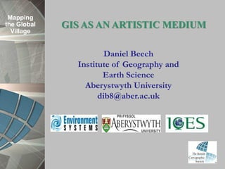
- 1. Mapping the Global GIS AS AN ARTISTIC MEDIUM Village Daniel Beech Institute of Geography and Earth Science Aberystwyth University dib8@aber.ac.uk
- 2. Mapping the Global CONTENT Village • WHAT IS ART? • THE POTENTIAL OF A CREATIVE GIS • EXAMPLES OF ART/SCIENCE ENGAGEMENT • CURRENT RESEARCH • CONCLUSIONS
- 3. Mapping the Global Village PHD thesis: The Potential of Volcanic Landscape Visualisation: Performing the Gap Between the Known and the Unknown
- 4. What is Art? Mapping the Global Village •“Art is … an arrangement of conditions intended to be capable of affording an aesthetic experience” (Davies, 2005). •Art is often ambiguous in content and visceral in form: it is not informational, but is instead a means of stimulating emotional as well as intellectual responses.
- 5. Mapping E.g. The Sublime the Global Village Edmund Burke • Sublime is the feeling of wonder and horror when confronted with the vastness and awefulness of nature. Immanuel Kant • The sublime is a pleasure felt in the powers of the human imagination, as it seeks to make sense of the formlessness and boundlessness of nature. More specific concepts •William Wordsworth – Romanticism and the Sublime •Barbara Claire Freeman – Feminine Sublime • David Nye – Technological Sublime
- 6. Mapping GIS and the Art/Science Binary the Global Village •Geographers such as Dan Sui have challenged C. P. Snow’s famous notion of the “Two Cultures,” Science & Art, using GIS as an example. • In terms of content, GIS creates new ways of visualising objects, processes, ideas and behaviours that are capable of mobilising specific emotions, as well as a creative intellectual discourse. • As a medium, GIS merges quantitative, locative information with an embodied process of visual literacy: we learn to present data for the eye and the hand to make sense of an navigate.
- 7. Mapping Why are Artists Interested in GIS? the Global Village •GIS encourages synergy and an interdisciplinarity. • GIS can generate unlimited visualisations of a place, region or planet, allowing for an experimental artistic process to emerge. • Interactivity allows for more user-orientated artworks to be created and re-made.
- 8. A Creative GIS? Mapping the Global Village • Creative GIS has focused on the overlaying and combining/correlating of variables, as well as the interfacing and interpolation of GIS modelling packages. • GIS software exemplifying this process includes: TerraView - handles vector and raster data in geo-relational databases. Capaware - creates artistic architecture for graphical visualization. Chameleon – imagines new cityscapes that recreate virtual environments.
- 9. Mapping David Endelman, LINE DROPS (1997) the Global Village • “As part of my art, I want to share with others what I see and experience as a cartographer. In addition, I am curious about how others view the world in which they live. Therefore, I want my art to be accessible and interactive. GIS as an art form is relevant to me as an artist because it is a tool of our time that produces a sense of our time and place”.
- 10. Mapping David Endelman, LINE DROPS (1997) the Global •Lines depict underground piping in Huntington Beach, California. Village • The image “displays a landscape of the unseen” (Endelman, 1999) through visual data and geological modelling software (GIS). • Line thickness can be enhanced and manipulated through Arc/Info. • The image is vague and abstract, illustrating a disconnect between GIS and reality. • Human connotations are illustrated through the portrayal of the hidden and the unknown.
- 11. Mapping Christian Nold, BIO MAPPING (2004) the Global Village • “Bio Mapping … explores new ways that we as individuals can make use of the information we can gather about our own bodies. Instead of security technologies that are designed to control our behaviour, this project envisages new tools that allows people to selectively share and interpret their own bio data”. • “… allows the wearer to record their Galvanic Skin Response (GSR), which is a simple indicator of emotional arousal in conjunction with their geographical location. This can be used to plot a map that highlights point of high and low arousal. By sharing this data we can construct maps that visualise where we as a community feel stressed and excited”.
- 12. Mapping Christian Nold, BIO MAPPING (2004) the Global Village •GIS has enabled artists and cartographers to allow people to map themselves and their biofunctions. • Data used is based upon the human body and its senses; the virtual environment is shaped by the arrangement and motion of the being. • The data is biological and emotional, creating new relations between individual and technology • The process of mapping also highlights otherwise unconscious emotional states.
- 13. Mapping Petra Gemeinboeck, Imagined the Global Village Geographies 02: Urban Fiction (2012) • “Petra Gemeinboeck… is particularly interested in the intersections between physical and virtual spaces… IG 02: Urban Fiction combines user demographic data and user geographical data (GIS) with the movements of the user (participants) within the landscape”. • The sense of unpredictability questions the extent to which the artwork is bounded, hinting at the limitless spread of the Kantian sublime.
- 14. Mapping Petra Gemeinboeck, Imagined the Global Village Geographies 02: Urban Fiction (2012) • “Urban Fiction” emphasises the role played by networking in the contemporary uses of Smartphones. • There is an awareness of location and motion, highlighting the themes of fluidity and mobility in current GIS-based artwork. • The urban becomes reconfigured through the artwork’s participatory usage, creating unpredictability in landscapes formation. • Gemeinboeck acknowledges the role played by territory but the work effectively portrays landscape as individually sculpted.
- 15. Mapping Brian Brush, TERRITORIES AMMAN the Global (2009) Village • “The resulting texture is a simulation or expression of the projective mental space that is invisible, yet pervasive in the connected experience between people, culture, activity, and the city.” • “These assemblages represent an expression of proximal influence by nearby human activity and certain territorial patterns emerge.”
- 16. Mapping Brian Brush, TERRITORIES AMMAN the Global (2009) Village • GIS manipulation can create a sublime digital texture that places social-spatial characteristics in a virtual positions that produces coloured assemblages. • Essentially, the view of Amman is the same but GIS binaries breed representational variance and diversity. Spatial dimensions are permeated and aesthetics are visually enhanced.
- 17. Mapping Marko Peljhan, MAKROLAB (1997- the Global 2007) Village • “It is a project that will research isolation strategies: how to isolate oneself from society to reflect and see this society better. …in an isolated and insulated environment with completely open possibilities of communication and monitoring of social events, but physically isolated, can provide a much faster, further and more efficient 'call' for social evolution.” • “This strategy is temporary. It's a come and go strategy. It is not something that you do once and then you are isolated …you must have the means and the possibility to transfer the result of this reflection back into society, whatever that result is.”
- 18. Mapping Marko Peljhan, MAKROLAB (1997- the Global 2007) Village • The MAKROLAB uses GIS in order to gather and map data in remote and almost inhospitable environments. • The initiative holistically encompasses art, science and culture through the creation of a dynamic virtual space. • The mobile laboratory overturns the top-down gaze of GIS practitioners, and encourages the communication of findings between indigenous communities across Alaska and Scandinavia, as well as ‘marginal’ communities in Scotland.
- 19. Mapping The Changing Palette of Art the Global Village • Art is important to society for reasons beyond simply inspiration and entertainment; art extends into sociological and technological debates. • Locative art tackles the use of GIS in nation-building and surveillance, focussing on the freedom and representation of the individual within the wider community and national level society. • The human becomes intertwined with both technology and its products; artists use GIS to create bodily, humanistic experiences. • Artists are actively changing imagined and lived spaces; this creates a platform for interaction.
- 20. Mapping Visualising the Cleveland Volcano the Global Village • Research draws on art/GIS genre to note how representations of this extreme landscape have a series of aesthetic dimensions. • GIS data sources for Cleveland include the United States Geological Survey (USGS) and the Alaska Volcanic Observatory (AVO). • GIS software includes Google Earth, Global Mapper and ARC-GIS.
- 21. Mapping Visualising the Cleveland Volcano the Global Village • Visualisations enhance particular ideas, such as the ‘top-down’ gaze. Viewers gain a position of power, illustrating mastery. • The image is bounded, hiding the external setting and hints of the region’s complex geopolitical past. • The mobility of the viewer gives them an additional feeling of mastery. This is a multifaceted and wholly embodied gaze; prevalent through the active exploration of the landscape.
- 22. Mapping Visualising the Cleveland Volcano the Global • The top image echoes Burke’s sublime, Village adding aesthetic spectacle and drama to the volcanic setting. • The symmetrical topography of Cleveland draws the eye to the centre of the image, actively involving the viewer and drawing emotional attention to data that was previously quantitative in form. • The second image draws on the gothic; the volcano is a distant, unknown element. • The iconographic fog and mist manifests metaphorical undertones that hint at a foreboding horror.
- 23. Mapping Emerging Questions the Global Village Does GIS lend itself to particular aesthetic concerns such as the sublime? To what extent are artistic uses of GIS a matter of simply adopting another tool? Can artists influence future developments in GIS software? How can the GIS community further engage the arts community?
- 24. THANK YOU Mapping the Global Village Please don’t hesitate to contact me regarding my work at dib8@aber.ac.uk
- 25. REFERENCES Mapping • Burke, E. (1844), Of the Sublime and Beautiful, New York: Harper and Bros. the Global • Davies, S. (2005), ‘Definitions of Art’, in Berys Gaut and Dominic Mciver Village Lopez (eds.), The Routledge Companion to Aesthetics, 2nd edition, London: Routledge, pp. 227–40. • Endelman, D. (1997), Line Drops, Computer Geoscience as Art exhibition, The Bakersfield Museum of Art in Bakersfield, California, U.S.A. • Eschner, S. (1998), "Computer Geoscience as Art.“, Bakersfield: Bakersfield Museum of Art. • Kant, I. (1911), Critique of Aesthetic Judgment, in J.C. Meredith, Oxford: Oxford University Press. • www.2012.foss4g.org, Foss4g, Accessed 14/05/2012. • www.aber.ac.uk, Aberystwyth University, Accessed 20/05/2012. • www.archiplangineering.com, Arch I-Plan Art, Accessed 20/05/2012. • www.artscatalyst.org, Arts Catalyst England, Accessed 20/05/2012. • www.avo.alaska.edu, Alaska Volcanic Observatory, Accessed 14/05/2012. • www.biomapping.net, Christian Nold, Accessed 14/05/2012. • www.carlson-gis.com, Carlson GIS, Accessed 14/05/2012. • www.capaware.org, Capaware Software, Accessed 20/05/2012. • www.cyber-swift.com, Cyber Swift, Accessed 14/05/2012. • www.earth.google.com, Google Earth, Accessed 20/05/2012.
- 26. REFERENCES Mapping •www.emotionalcartography.net/bio mapping emotion in social spaces- cities, the Global Emotional Cartography by Christian Nold, Accessed 20/05/2012. Village • www.envsys.co.uk, Environment Systems, Accessed 14/05/2012. • www.esri.com/software/arcgis, ESRI, Accessed 14/05/2012. • www.geography.tamu.edu/profile/DSui, Dan Sui profile, Accessed 14/05/2012. • www.gis.com/content/what-gis, Accessed 14/05/2012. • www.gistec.com, GIS Technology, Accessed 14/05/2012. • www.gisuser.com, GIS user, Accessed 20/05/2012. • www.globalmapper.com, Global Mapper, Accessed 14/05/2012. • www.impossiblegeographies.net, Accessed 20/05/2012. • www.josephinebosma.com, Josephine Bosma, Accessed 14/05/2012. • www.martacowordpress.com, Martaco World Press, Accessed 14/05/2012. • www.monoskop.org/Marko_Peljhan, Accessed 14/05/2012. • www.oup.com/us/catalog/philosophy, OUP, Accessed 14/05/2012. • www.plato.stanford.edu/kantaesthetics, Plato, Accessed 14/05/2012. • www.proceedings.esri.com, The Fine Art of Cartography, Accessed 14/05/2012. • www.scientificamerican.com, C. P. Snow, Accessed 14/05/2012. • www.seismopolite.com/, Seismopolite, Accessed 14/05/2012. • www.terrawareproducts.com, Terraware, Accessed 14/04/2012. • www.uenca.org/groundwater, UENCA, Accessed 20/05/2012. • www.usgs.gov, US Geological Survey, Accessed 14/05/2012. • www.victorianweb.org/philosophy, Accessed 20/05/2012.