Bhubaneswar an ideal capital city
•
45 j'aime•14,887 vues

BHUBANESWAR -an ideal capital city designed to reduce the gap between rich & poor.

Recommandé
Contenu connexe
Tendances
Tendances (20)
En vedette
En vedette (11)
Similaire à Bhubaneswar an ideal capital city
Similaire à Bhubaneswar an ideal capital city (20)
Plus de Rajesh Kolli
Plus de Rajesh Kolli (15)
Dernier
Dernier (20)
Bhubaneswar an ideal capital city
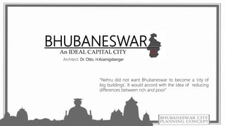
- 1. BHUBANESWAR An IDEAL CAPITAL CITY “Nehru did not want Bhubaneswar to become a ‘city of big buildings’. It would accord with the idea of reducing differences between rich and poor.” Architect: Dr. Otto. H.Koenigsberger
- 2. BHUBANESWAR • Bhubaneswar (20°15'N latitude and 85°50'E longitude), is an area covering 91.9414 sq.km. • The place has evidently derived its name from its principal deity Tri-Bhubaneswar or Bhubaneswar. • Has two distinct divisions, viz., the Old Town and the New Capital. • The following stages have affected the structure of the city: a) The Temple Town (Upto 1948) b) The “New Capital” (1948 – 56) c) Growth of Institutions (1956 – 76) d) Developments in Organised Sector (1976 Onwards) e) The Present Bhubaneswar BMC – Bhubaneswar Municipal Corporation BDPA – Bhubaneswar Development Plan Area
- 3. OLD TOWN • The Old Town is characterized by mixed land-use which is a usual phenomenon with all ancient towns and cities of India. It contains splendid specimens of Kalinga architecture spanning some twenty-five centuries of history, depicting the grace, the joy and the rhythm of life in all its wondrous variety. • Bhubaneswar known as the “Temple Town” (Upto 1948), has a unique position by virtue of the ability to seamlessly integrate its rich cultural heritage with a strong regional economic base. • Founded during the Kalinga empire over 3,000 years ago, Bhubaneswar today boasts of a cluster of magnificent temples, constituting a complete record of Odisha temple architecture from its early beginnings to its culmination. • The old city is featured by conglomeration of temples, monuments, mandaps, heritage ponds etc. Initially, the old city had 1000 temples and at present, the total temples are limited to 320. Old temple town It covers an area of 510 ha comprises of 4 villages • Kapil prasad, • Bhubaneswar, • Goutam Nagar and • Rajarani.
- 4. Why capital is shifted from Cuttack to Bhubaneswar ?• The question of a new capital for Odisha was linked with the Odias' movement for a separate province. Though Cuttack, the headquarters of Odisha Division was the centre of all cultural and political activities, it was found to be insufficient and congested for a provincial capital because of its location between the Mahanadi and Kathjodi rivers. • In 1933, the Odisha Administrative Committee recommended the retention of the provincial capital of Cuttack. After the creation of the separate province, for various reasons, the question of an alternative capital site was raised. CUTTAK CITY PLAN
- 5. • In 1936, a team of experts, appointed by the Central Public Works Department, which was headed by an engineer, named F T Jones suggested Rangailunda, a place near Berhampur town to be the site for the capital. • The post-war reconstruction committee proposed Bhubaneswar as the ideal site for capital because of its history, availability of space and geographical propinquity to Cuttack. The Public Works Department aslo reported in favour of Bhubaneswar on 14 April 1945 : ".... expansion of Cuttack ...... does not (appear) very promising ..... and it appears that going to Bhubaneswar for further expansion may be the best solution." Why capital is shifted from Cuttack to Bhubaneswar ?
- 6. NEW CAPITAL • On 13th April 1948, Bhubaneswar got back its status when the foundation stone of the present capital township was laid by Pandit Jawaharlal Nehru, after a gap of 1600 Years. The present old temple town was formed and was confined to an area of 956 Ha. • Later on Bhubaneswar was born as the new capital of Orissa in close proximity of the old temple town, the Master Plan for the new township was prepared by the famous architect Dr. Otto. H.Koenigsberger in 1948 to shape the city in serving as an administrative centre for the state, on the basis of the concept of NEIGHBORHOOD UNIT PLANNING • The site for the New Capital was selected after careful consideration. • It has the advantage of lying on the border between the fertile delta land and the hilly forest areas of Orissa.It has the natural advantage with regard to drainage. • The ground slopes from west to east and is divided into two parts intersected by the railway line. • The western part is high land with laterite soil that permits the growth of forest and the eastern part is low with alluvial soil suitable for agriculture. • The velocity of wind is maximum in summer.
- 7. • Koenigsberger’s design laid the city out in a linear pattern with a central artery forming a main spine to which neighborhood units were attached. It was designed for the population 40,000. • Neighborhood units had all the major amenities. Each unit was to house a population for 5,000-6,000. • It had a clear social agenda in accordance to Nehru’s Policies: neither cast nor socio-economic were to exist and gender equality and education were to be stressed. • By 1961, the population reached 40,000. The plan was revised by Julius Vaz to accommodate eleven neighborhood units instead of four units. • Nehru did not want Bhubaneswar to become a “city of big buildings” . It would accord with the idea of reducing differences between rich and poor.
- 8. PLANNING PRINCIPLES • Design of the New Capital is based on the system of neighborhood units which means a group of houses, large enough to afford the major amenities of urban life like schools, dispensaries, shopping- centres, entertainment, public libraries, etc. but at the same time small enough to keep all these amenities in short distances, so that the main advantage of rural life can be preserved. • To avoid boredom and uniformity the neighborhood units are individually with the object of giving it a distinct character. • In contrast to the Old Town, the land under different uses are segregated from each other so that the foul smell, smoke or dust of industry does not affect the residential areas nor the crown and of a commercial area affect the silence and solemnity of an administrative or educational area. • An area of 231 acres has been allotted for an Industrial Estate
- 9. A ’Planned Capital City ‘ need to have • A unique local identity and sense of place. • Clean natural environment, including water and air. • Regular blocks divided in to uniform plots. • Straight streets intersecting at right angles. • Rectilinear plots according to predetermined units of measurement [symmetrical layout/Grid Planning]. • Administrative and Government offices planned to be in one unit of space. • ‘Capital Complex’ consisting of Secretariat ,Legislative Assembly ,High court ,Raj Bhavan, MLA Quarters , Ministers Quarters etc. • Commercial complex. • Open, accessible, and well-kept public spaces and parks. • Hospitals , schools , Open grounds for meetings etc. • Green Belts and water bodies to be Eco friendly.
- 10. 1. footpaths, 2. parkways, 3. cycle paths, 4. Arterial Road (200ft. wide with 10ft. Wide foot-paths) 5. Major Unit Road (150ft. Wide) 6. Major Housing Street (100ft. Wide) 7. Minor Housing street (40ft. Wide) for seven groups of users for seven different functions. • The overall widths of land earmarked for roads and streets were not determined by traffic alone but also by requirements for storm water drainage services like overhead electric lines, telephone, water and the need of adequate light and air to the adjoining houses. • The overall width of land allotted for road purposes was, therefore, dependent on the height of houses on both sides. Koenigsberger suggested seven types of roads –
- 11. • The capital town was planned in 1948 and was built between 1948 and 1961 at a respectful distance from the temple town with no conscious steps taken to preserve the individual identities of each. • The city grew fast and the intervening areas were filled up quickly. Toady the “New Capital” presents a sharp contrast with distinct areas earmarked for residential, commercial, institutional and such other uses. FIRST CAPITAL CITY PLAN
- 12. • During 1956-76 major administrative activities like secretariat, heads of departments and similar government offices came up in Bhubaneswar. The salubrious climate, availability of suitable land attracted a number of various state level and regional institutions. Growth of institutions (1956 – 76)
- 13. • Constitution of the Bhubaneswar Regional Improvement Trust (BRIT) in 1976 and subsequently the Bhubaneswar Development Authority (BDA) in 1983 and the role of institutional finance for mass housing in the organized sector appears to be landmark in this phase of city’s growth. The schemes like Housing Board Colonies, BRIT Colonies, etc.. • In all such cases economy of space and cost had influenced the structure as well as their immediate environment. Shortage of Government land and economy of scale contributed to construction of multistoried flats Developments in Organized Sector (1976 Onwards)
- 15. The City Today • The city which was planned originally for 40,000 people with an area of 1684 Ha of is now accommodating about 7 lakhs people with an area of about 135 sq km. • The shape of the present city has assumed nearly a rectangular froms which shows the signs of development of the town on a vast unutilized undulating plateau. • The city has extended in seven different directions during the last few decades by engulfing the fringe villages. • This extension has got varied length and dimensions from the core of the original which has been supposed to lie at the temple area.
- 16. “Bhubaneswar today is a model of livability evident by the city’s stable growth rate in the recent decades. It is one of the few cities that has been able to successfully capitalize upon its assets- be it the tangible and intangible heritage (natural, built and people) or its strategic location- into economic drivers that have shaped the city’s growth in the recent decades.” REFERENCE: • Bhubaneswar_ From a Temple Town to a Capital City - Ravi Kalia • One Idea, Many Plans_ An American City Design Concept in Independent India - Sanjeev Vidyarthi • http://www.odisha.gov.in/forest_environment/pdf/Chap_3.pdf