Danis xlink2011
•Télécharger en tant que KEY, PDF•
0 j'aime•306 vues

The document discusses two biodiversity information networks - SCAR-MarBIN and ANTABIF - that provide free and open access to Antarctic biodiversity data. They follow a general philosophy of building an electronic ecosystem that exposes biodiversity data and metadata in multiple contexts through community collaboration and standardization. The networks have developed web portals, taxonomic and geospatial databases, field guides, and tools that follow open standards to facilitate data sharing and discovery. Projects aim to georeference genetic data and develop a Southern Ocean biogeography atlas.

Recommandé
Contenu connexe
En vedette
En vedette (12)
Similaire à Danis xlink2011
Similaire à Danis xlink2011 (20)
Plus de Bruno Danis
Plus de Bruno Danis (20)
Dernier
Dernier (20)
Danis xlink2011
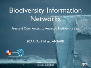
- 1. Biodiversity Information Networks Free and Open Access to Antarctic Biodiversity data SCAR-MarBIN and ANTABIF www.scarmarbin.be www.biodiversity.aq
- 2. SCAR-MarBIN & ANTABIF • www.scarmarbin.be: marine biodiversity information network • www.biodiversity.aq: biodiversity information facility • Core funding: BELSPO.be (until June 2012) • International Polar Year 2007/08 • Census of Antarctic Marine Life • Ocean Biogeographic Information System • Global Biodiversity Information Network
- 3. General philosophy • Build an electronic ecosystem • Offer free and open access to data and technology • Expose all the (biodiversity) data and metadata, in multiple contexts • Remain community-driven, and collaborative • Adopt strong standardization • Work for science, conservation, management
- 4. Who’s in?
- 5. Who *wants* to be in?
- 6. [results]: webportal (s) taxonomy, biogeography vizualisation open access 860,458 visitors 7,465,974 hits >50,000,000 dld records ANTABIF coming up
- 7. [results]: webportal (s) Terrestrial Marine Biodiversity Biodiversity Webrepository Field Guides Metadata catalogue Blog
- 8. [results]: taxonomic data • The first RAMS all taxa • Board of 60+ editors all species • Feeds WoRMS, CoL and EoL valid species • 17,098 taxa (RAMS) • Building a dynamic RAS • 24,248 taxa (RAS) 0 3,750 7,500 11,250 15,000
- 9. [results]: geospatial data 1,288,441 records 196 datasets 119 geodatasets 5,235 taxa Feeds OBIS, GBIF Downloadable WebGIS Webservices
- 10. ANTABIF:100% Open Source ANTABIF technological ecosystems: Language: Ruby Nuts and bolts Design patterns: MVC-ORM Framework: Rails(ActiveRecord) and YUI Search engine: Full text (Elasticsearch-Lucene) Database: PostGresql GIS server: Geoserver Spatial database: PostGIS Mapping client: OpenLayers Web services: RESTish (all resources) Protocoles: DIF, dwcore, dwc archive, Tapir…etc GBIF tools : HIT,IPT OS: FreeBSD Hosting: BBPF (ULB/VUB joint IT Center) Metadata systems: GCMD (mirrored)
- 11. Antarctic Field Guides afg.biodiversity.aq afg.scarmarbin.be • Identification aid • Best available pictures • Descriptions • Dynamically built from various sources
- 18. Projects... coming up Georeferenced genetic data: CAML barcoding Polar Macroscope working group: BiPolar analyses Southern Ocean Biogeography Atlas: interactive Atlas GBIF-NPT: Nodes Portal Toolkit
- 19. Available tools • AFG, other ID tools • Repositories • Metadata catalogues • Scratchpads • DarwinCore • GBIF informatics suite: IPT/HIT/NPT
- 20. DarwingCore • Body of Standards (TDWG) • Facilitate sharing of biodiversity data • Discovery, retrieval, integration • Core and extension • Participatory process
- 21. NPT: data on biodiversity webportals HIT: harvest data from multiple sources IPT: publishing the data
- 22. How do we X-link? • exporting the design models: standards and protocols, tools, data flows, promotion • help SCAR programs wherever needed (and to the best extent we can do this realistically...) • dynamic antarctic2100/data atlas??
Notes de l'éditeur
- \n
- \n
- \n
- \n
- \n
- \n
- \n
- \n
- \n
- \n
- \n
- \n
- \n
- \n
- \n
- \n
- \n
- \n
- \n
- \n
- \n
- \n